Hikes in Topanga State Park
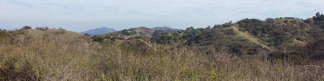
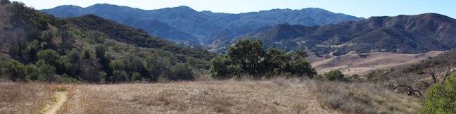
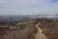
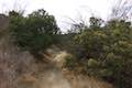
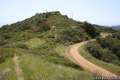
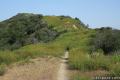
Topanga State Park preserves over 11,500 acres of the Santa Monica Mountains in a beautiful area north of the Pacific Palisades, east of Topanga Canyon, and south of Reseda (location map). The park is situated entirely within the Los Angeles city limits and is considered “the world’s largest wildland within the boundaries of a major city.” You certainly won’t feel like you’re in a city when you hike through Topanga State Park. Enjoy ocean views from chaparral-covered ridges or relax in shaded oak groves.
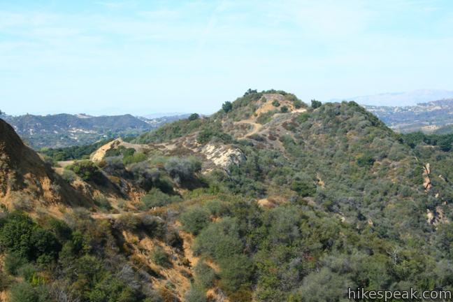
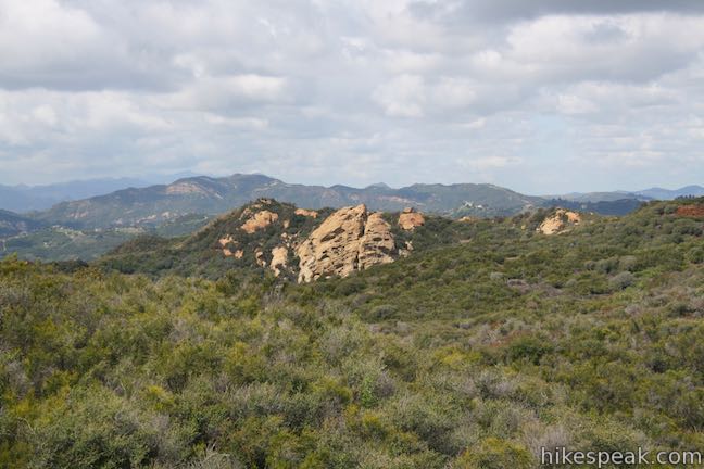
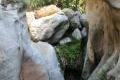
Numerous trailheads for Topanga State Park can be found along the park edges. For those who want to drive into the park, Trippet Ranch is the main trailhead, offering hikes to Eagle Rock, a summit of Swiss-cheese-like sandstone and Parker Mesa Overlook, a bluff with breathtaking views over the Pacific Ocean. To see another sandstone creation, head to Skull Rock. For a short outing with soothing ocean views, hike Los Liones Trail. During the rainy season, fleeting Santa Ynez Falls is a fun target too.
Topanga State Park has one campground, an 8-site trail camp called Musch Camp, located about one mile mile from Trippet Ranch.
Directions to Tripet Ranch: Take Topanga Canyon Road inland from Pacific Coast Highway for 4.6 miles to Entrada Road (or from the 101 Freeway, drive 7.7 miles south on Topanga Canyon Road to Entrada Road). Turn east on Entrada Road and drive up the mountain for one mile, following signs for Topanga State Park. A $10 day-use fee is required to park a vehicle at Trippet Ranch, which is open from . Free parking is available along the road outside the park.
Trailhead address: 20829 Entrada Road, Topanga Canyon, CA 90290
Trailhead coordinates: 34.0933, -118.5874 (34° 05′ 35.87″N 118° 35′ 14.64″W)
Surrounding Parks
Topanga State Park is just one piece of a patchwork of parks in the Santa Monica Mountains. Several other parks, like Temescal Gateway Park and Will Rogers State Historic Park, border Topanga State Park, further expanding the hiking possibilities! Trails in and around Topanga State Park are shown on the interactive map below.
Topanga State Park Hikes
These hikes are listed roughly from west to east and north to south. Sort the list alphabetically or by distance to pick the trail for you. The listed hikes link to write-ups with complete descriptions and directions as well as GPS maps, elevation profiles, and lots of photos – everything you need to get out and explore these trails!
| Trail | Description | Distance | Location |
|---|---|---|---|
 245 245 | Eagle Rock from Trippet Ranch This loop takes Musch Trail and Eagle Springs Fire Road to visit an exceptional sandstone summit in Topanga State Park. | 4.5 miles 800 feet | 34.0933, -118.5874 |
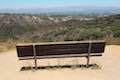
 250 250 | Parker Mesa Overlook from Trippet Ranch This out and back hike from Topanga State Park's main trailhead leads to a bluff with immense ocean views. | 6.7 miles 375 feet | 34.0933, -118.5874 |
 255 255 | Parker Mesa Overlook from Paseo Miramar This steep out and back hike rewards the effort with Pacific Ocean views en route to an overlook perched above Santa Monica Bay. | 5.7 - 7.8 miles 900 - 1,250 feet | 34.0508, -118.5571 |
 260 260 | Los Liones Trail This out and back hike visits a lust canyon with ocean views and can be used to reach Parker Mesa Overlook. | 2.6 miles 550 feet | 34.04727, -118.56007 |
 265 265 | Eagle Rock from Santa Ynez Canyon This out and back hike crosses a shaded canyon, climbing a ridge to summit a sandstone prominence in Topanga State Park. | 7.4 miles 1,400 feet | 34.0782, -118.56745 |
 270 270 | Santa Ynez Falls This out and back hike follows a shaded creek to a gorge containing a short waterfall. | 2.5 miles 250 feet | 34.0782, -118.56745 |
 272 272 | Winnetka Ridge Trail This ridge top hike ventures into the Santa Monica Mountains from the end of Winnetka Avenue in Woodland Hills. | 1.5 miles 200 feet | 34.14985, -118.57168 |
 273 273 | Corbin Canyon This partial loop offers an easy stroll along the bottom of a canyon on the north side of the Santa Monica Mountains near Tarzana and Woodland Hills. | 2.05 miles 150 feet | 34.1567, -118.56495 |
 285 285 | Temescal Peak This pair of out and back hikes ascend Temescal Ridge to a summit with sweeping views over Topanga State Park. | 5.8 - 7.6 miles 575 - 1,200 feet | 34.07863, -118.55997 |
 290 290 | Skull Rock This out and back hike descends Temescal Ridge to a head-shaped formation with great views over Santa Monica Bay. | 1.5 miles 225 feet | 34.07631, -118.5462 |
 293 293 | Hub Junction from Reseda Boulevard This hike from the edge of the San Fernando Valley goes through Topanga State Park to a scenic junction at the crossroads of the Eastern Santa Monica Mountains. Extend the trek to 6.85 miles round trip by summiting Temescal Peak or to 7.95 miles round trip by taking a loop to Eagle Rock. | 5.3 - 5.45 miles 400 - 460 feet | 34.13133, -118.55313 |
 295 295 | Caballero Canyon Trail This out and back hike ascends a canyon to views over the San Fernando Valley. | 3.4 miles 625 feet | 34.14273, -118.54088 |
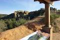
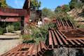 315 315 | Rustic Canyon's Murphy Ranch from Will Rogers State Historic Park This adventure visits the former ruins of a commune built by Nazi sympathizers in a canyon in Topanga State Park east of Will Rogers. | 4 - 5 miles 225 - 950 feet | 34.0546, -118.5109 |
 320 320 | Rustic Canyon's Murphy Ranch from Sullivan Ridge This loop drops from Sullivan Ridge into Rustic Canyon, where hikers could visit abandoned buildings once occupied by Nazi sympathizers. | 3.85 miles 325 feet | 34.061, -118.5037 |
 325 325 | Sullivan Ridge This out and back hike follows a scenic 6.3-mile long ridge on the east side of Topanga State Park | 7.5 - 14.3 miles 1,200 - 1,350 feet | 34.061, -118.5037 |
Or view Los Angeles trails and campgrounds in a larger map