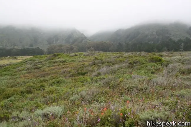
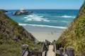
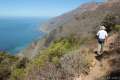
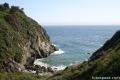
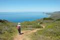
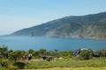
Along the bluffs of the Big Sur Coast protected by Los Padres National Forest is a scenic and easy ocean-view hike. Jade Cove and Plaskett Rock Point are just south of Plaskett Creek Campground on the west side of Highway One. Visited together, they form a 1.5-mile hike.
This hike has two trailheads. Both are unmarked a somewhat difficult to spot. From Plaskett Creek Campground drive a quarter mile south and scan the west side of the road for the Plaskett Rock Point trailhead. A second trail, another quarter mile to the south, leads straight to Jade Cove. A scenic path along the coastal bluff connects these parallel tracks.
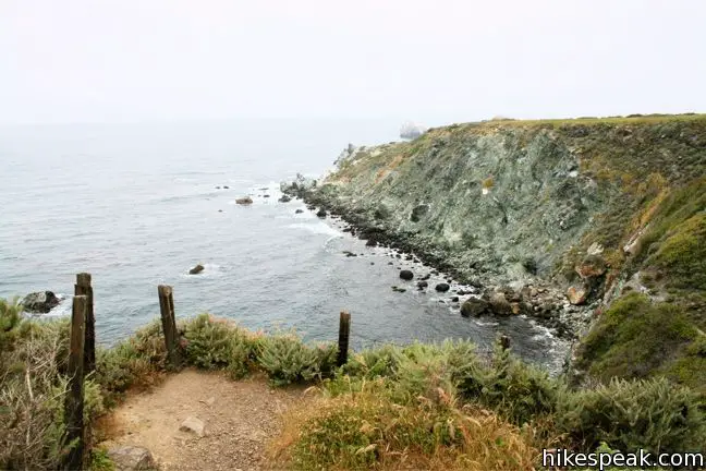
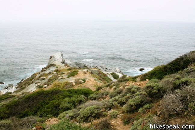
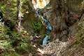
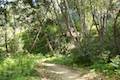
The upper trail splits not far from the road. The main track continues to Plaskett Rock Point, while a smaller path breaks off to the left and cuts across the grassland toward the top of Jade Cove, half a mile from the start. The lower trail, takes a direct line from Highway One, intersects the bluff trail, and descends the steep 0.1 mile path to Jade Cove.
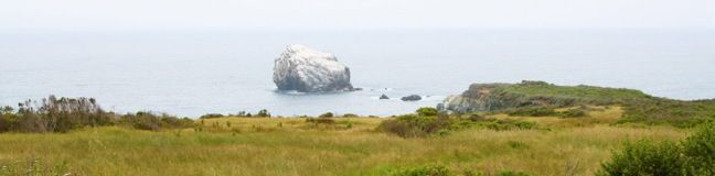
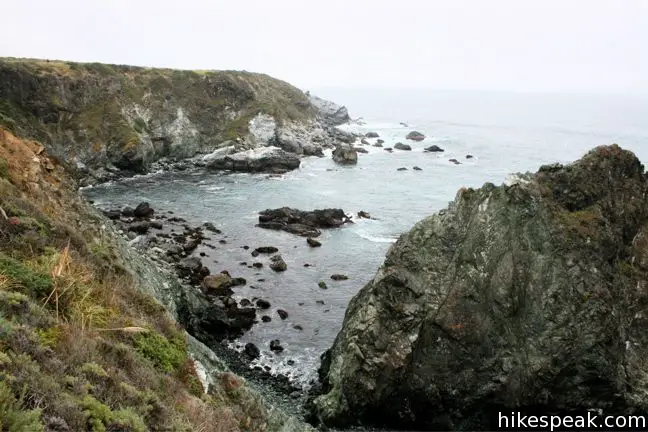
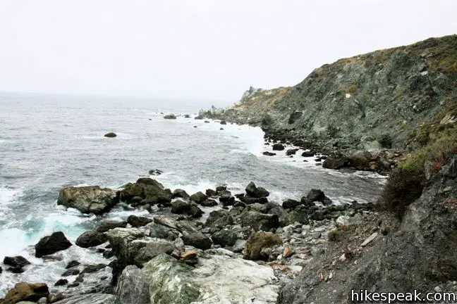
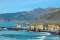
The cove does not yield much in the way of views, and is more popular with rock enthusiasts pursuing the jade found along the coast (which is why you will see “excavating prohibited” signs in this area).
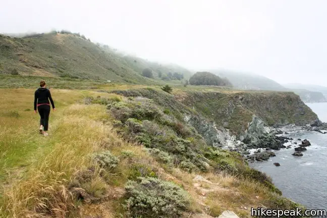
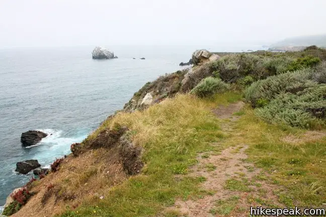
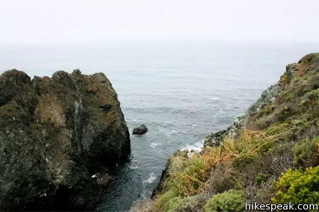
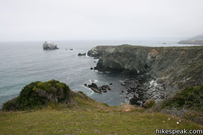
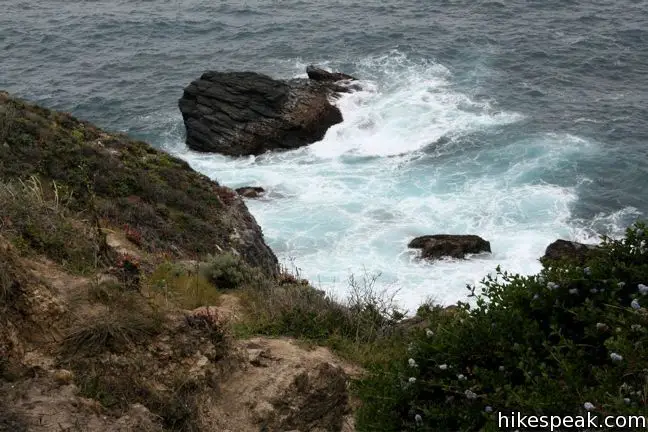
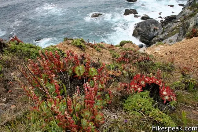
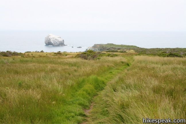
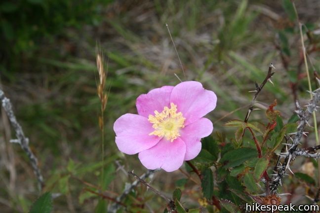
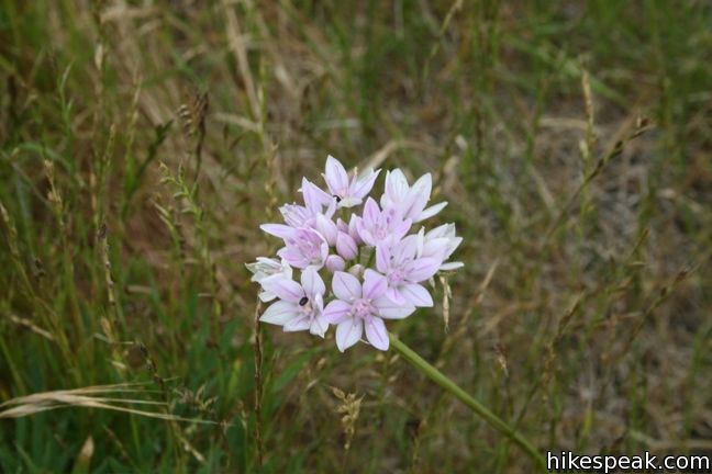
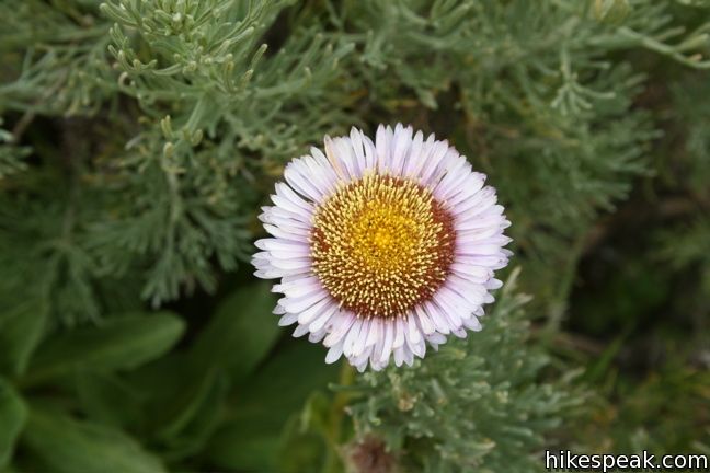
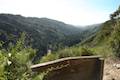
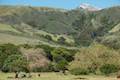
The trail above the cove meanders north along the bluff through coastal grasses spotted with wildflowers. Below barking elephant seals can be heard over the sound of waves crashing on the rocky shore. Halfway to the end of Plaskett Rock Point, the trail becomes overgrown and less easy going, so you may turn around before reaching the end.
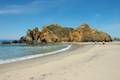
Excluding the steep track down to the cove (which requires the use of a rope at the bottom) the hike on the bluffs over Jade Cove is soft and level. Park at either trailhead and explore the area. This is a good family hike for those staying at the nearby Plaskett Creek Campground. Just north of Plaskett Rock Point is Sand Dollar Beach, which can be reached via a short trail that starts just north of the campground.
Directions to the Trailhead
- From the south, drive up Highway One, 15 miles north of Ragged Point Inn (or 38 miles north of Cambria).
- Park on the west side of Highway One.
- From the north, drive 22.3 miles south from Julia Pfeiffer Burns State Park (home of McWay Falls), or 30.4 miles south of Nepenthe Restaurant in Big Sur.
- Plaskett Creek Campground is just north of the trailheads and has several signs along the road.
Trailhead Location
Trailhead address: Cabrillo Highway & Plaskett Ridge Road (Highway One), Los Padres National Forest, Big Sur, CA 93920
Trailhead coordinates: 35.91705, -121.46905 (35° 55′ 01.4″N 121° 28′ 08.6″W)
View Big Sur in a larger map
Or view a regional map of surrounding Central Coast trails and campgrounds.


 | Sand Dollar Beach This short hike to Big Sur's longest beach passes two scenic overlooks on the way to the sand for a hike of 0.5 miles (or more) round trip. |
 | Pacific Valley Bluff Trail This short out and back hike extends from Highway One to an ocean bluff with fantastic views of the Big Sur Coast. |
 | Salmon Creek Falls This short hike visits a fine 120-foot waterfall near the start of Salmon Creek Trail. |
 | Buckeye Trail This hike of 6.5 miles or more reaches incredibly ocean vistas and trail camps in the Silver Peak Wilderness. Connect Cruickshank Trail and Buckeye Trail for an excellent shuttle hike of 8.25 miles or more. |
 | Cruickshank Trail This hike into Silver Peak Wilderness starts with bold ocean views and crosses redwood groves to reach Upper Cruickshank Camp at a junction with Buckeye Trail, 5 miles round trip from Highway One. |
 | Hare Creek Trail, Limekiln Trail, and Falls Trail This 2.65-mile hike in Limekiln State Park explores a trio of trails along lovely streams in redwood-lined canyons, reaching Limekiln Falls and historic lime kilns. |
 | McWay Falls This 0.6-mile hike looks out on a stunning Big Sur waterfall that pours 80 feet right on to the beach. |
 | Canyon Falls This 0.9-mile hike heads inland up McWay Creek past a picnic area in a redwood grove to a lovely little waterfall. |
 | Partington Cove This 1.5 mile hike visits a cove and a secluded beach along the scenic Big Sur coast. The cove is accessed through a tunnel. |
 | Pfeiffer Beach This short walk reaches an absolutely stunning beach that's a classic feature of the Big Sur landscape. |
 | Big Sur River Gorge This half-mile off-trail hike ventures up the Big Sur River on a water-wading boulder-hopping adventure to a crystal clear pool that's a gorgeous Big Sur swimming hole. |
 | Pfeiffer Falls and Valley View This 2.4-mile hike is like two hikes in one, reaching a waterfall in a canyon of redwoods and a vista point overlooking the Big Sur River Valley. |
 | Nature Trail - River Path Loop This easy 0.55-mile loop explores woodlands along the Big Sur River and a redwood grove that includes the unique and impressive Proboscis Tree. The loop can be combined with the trail to Pfeiffer Falls and Valley View for a 3-mile trek. |
 | Ridge Trail - Panorama Trail - Bluff Trail Loop This 8.7-mile loop in Andrew Molera State Park crosses a coastal ridge, bluff, and beach that are packed with amazing Big Sur views. |
 | More Central Coast Hikes Explore other destinations along the California coast between Ventura and Monterey, including trails in Los Padres National Forest. |
 | Bluff Trail in Montaña de Oro State Park This hike of around three miles tours tide pools, beaches, and impressive cliffs along a picturesque coastline. |
 | Point Buchon Trail This 1 1/3 to 6.8-mile hike explores the beautiful coastline south of Montaña de Oro State Park. |
 | Plaskett Creek Campground This 45-site campground in Los Padres National Forest is positioned across Highway One from Sand Dollar Beach and Plaskett Rock Point on the coast of Big Sur. |
 | Kirk Creek Campground This outstanding 33-site campground in Los Padres National Forest has enormous ocean views from a bluff along the Big Sur coast. |
 | Limekiln State Park Campground This small Big Sur campground at the bottom of Limekiln Canyon has sites along a creek through a redwood grove and near the ocean, with access to trails up Limekiln Canyon. |
 | Pfieffer Big Sur State Park Campground This large campground in the heart of Big Sur is spread out through oak and redwood groves along the Big Sur River. |
 | Andrew Molera State Park Trail Camp This trail camp is easy to reach (just a short walk in) with campsites in a meadow along the Big Sur River near Molera Beach. |
- Jade Cove on hikinginbigsur.com (opens in a new tab)
- Jade Cove in Top Trails: California Central Coast by Brian Milne (opens in a new tab)
- Sand Dollar Beach on hikinginbigsur.com (opens in a new tab)
- The national forest webpage for Plaskett Creek Campground (opens in a new tab)
- Plaskett Creek Campground on recreation.gov (opens in a new tab)
- The official website for Los Padres National Forest (opens in a new tab)
Common Questions about Jade Cove and Plaskett Rock Point in Los Padres National Forest (Big Sur)
- Is the trail open?
- Yes. You should expect to find that Jade Cove and Plaskett Rock Point Trail is open. There are no recent reports of trail closures. If you discover that the trail is closed, please help your fellow hikers by reporting a closure.
- Is this trail free to access?
- Yes, Jade Cove and Plaskett Rock Point Trail is free to access. No entrance fee, pass, or permit is required. If you discover that access rules have changed, please provide feedback on your experience.
- How much time does this hike take?
- It takes approximately 45 minutes to hike Jade Cove and Plaskett Rock Point Trail. Individual hiking times vary. Add extra time for breaks and taking in the views.
- How long is this hike?
- The hike to Jade Cove and Plaskett Rock Point Trail is a 1.5 mile loop with 150 feet of elevation change.
- Are dogs allowed on this trail?
- Yes, dogs are allowed on Jade Cove and Plaskett Rock Point Trail. The trail is open to hikers, dogs.
- Is Jade Cove and Plaskett Rock Point Trail good for kids?
- Yes, this hike is likely suitable for children. It is relatively short (1.5 miles) with manageable elevation gain.
- Are there ocean views on this hike?
- Yes, Jade Cove and Plaskett Rock Point Trail offers views of the ocean.
- Is this a good hike for wildflowers?
- Yes, Jade Cove and Plaskett Rock Point Trail is known for its seasonal wildflower displays.
- Where is the trailhead located?
- The trailhead for Jade Cove and Plaskett Rock Point Trail is located in Big Sur, CA.
Trailhead Address:
Cabrillo Highway
Big Sur, CA 93290
Trailhead Coordinates:
35.91705, -121.46905 - What are the driving directions to the start of the hike?
To get to the trailhead: From the south, drive up Highway One, 15 miles north of Ragged Point Inn (or 38 miles north of Cambria). Park on the west side of Highway One.
From the north, drive 22.3 miles south from Julia Pfeiffer Burns State Park (home of McWay Falls), or 30.4 miles south of Nepenthe Restaurant in Big Sur. Plaskett Creek Campground is just north of the trailheads and has several signs along the road.
View custom Google Maps directions from your current location.
- Are there other trails near Jade Cove and Plaskett Rock Point Trail?
- Yes, you can find other nearby hikes using the Hikespeak Hike Finder Map.

Go the extra miles...
Submit a rating of this hike to go with your comment. Contribute to the average trail rating.