
The trails to Pfeiffer Falls and Valley View are a perfect fit for hikers who like to multi-task. The versatile hike in Pfeiffer Big Sur State Park has a bit of everything. See impressive redwood trees in a shaded canyon, examine colorful wildflowers on a sunny ridge, admire a charming waterfall, and gaze out from a vista point that looks all the way down the Big Sur River Valley to the Pacific Ocean. The trail splits into two branches, with one going to Pfeiffer Falls and the other going to Valley View, so you get double the destinations on this 2.4-mile round trip hike with 550 feet of elevation gain. Who doesn’t like a two-for-one deal?
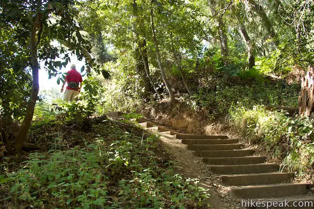
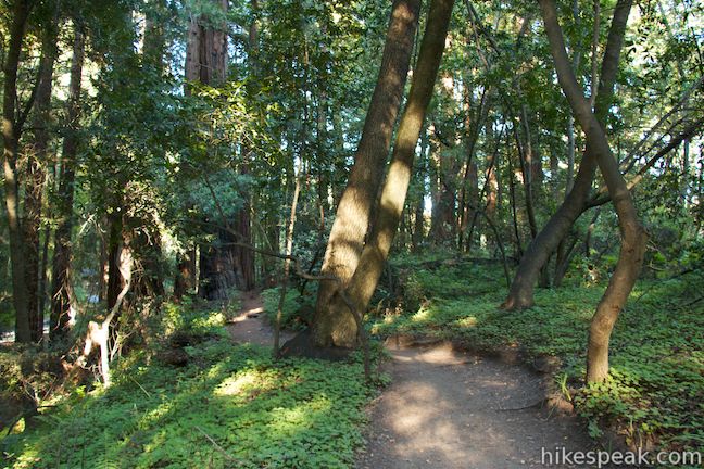
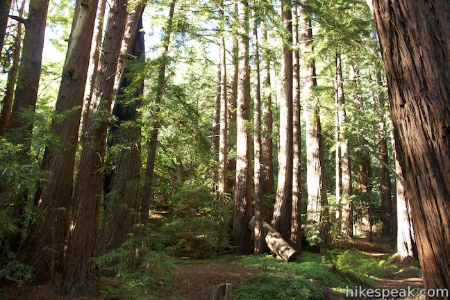
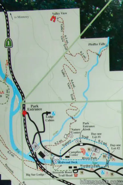
The hike begins from a trailhead by the Big Sur Lodge near the entrance to Pfeiffer Big Sur State Park. You can reach the start from day use parking lots inside the park by taking a short walk on River Path or Nature Trail (see the map below). Walk across the road from the lodge to get underway toward Pfeiffer Falls and Valley View. Walk up a paved walkway for a short stretch, making the first right turn at a sign for Pfeiffer Falls and Valley View. Go up this dirt trail on steps between redwood trees. A fern-lined stream in the gully to the left provides pleasant company as the hike gets underway.
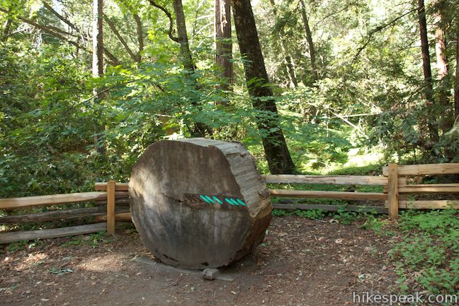
After passing cabins on the left (that can be booked through the Big Sur Lodge), you will come to a road. Cross it and bear right, following another sign for Pfeiffer Falls and Valley View. You’ll be drawn to a large tree cookie next to an information panel on the left side of the trail. Rings in the tree have been marked with historic events to help you visualize how long these massive trees can live. This mighty redwood started growing well before Columbus came to the Americas.
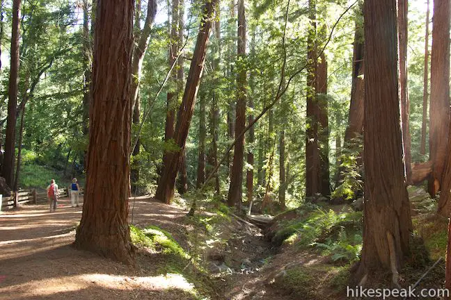
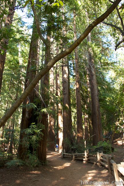
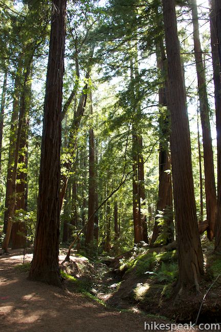
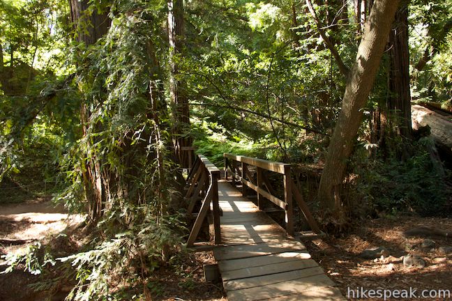
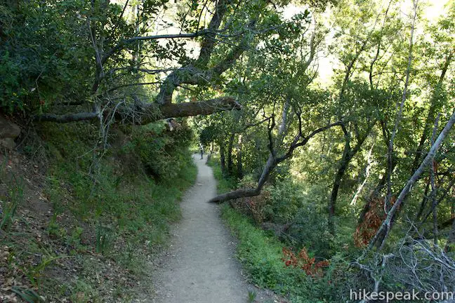
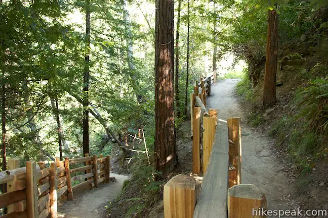
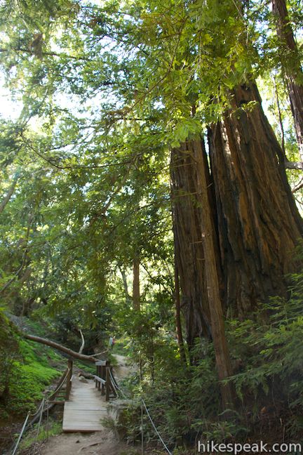
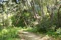
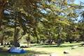
After 0.2 miles of preamble, the trail enters a grove of beautiful redwood trees. On a sunny day, pools of light fall through the canopy and brighten the broad rust-colored trunks. Pfeiffer Redwood Creek runs along the left side of the trail, lined by redwood sorrel and ferns. When you come to a wooden footbridge on the left, cross it to continue toward Pfeiffer Falls and Valley View. Before the bridge is a junction is a junction with a trail completed around 2016 that proceeds up the right side of the creek to Pfeiffer Falls (the former Pfeiffer Falls Trail along this route was closed after a 2008 wildfire).
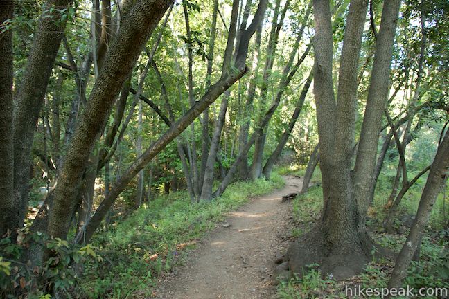
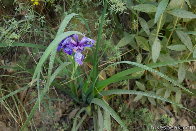
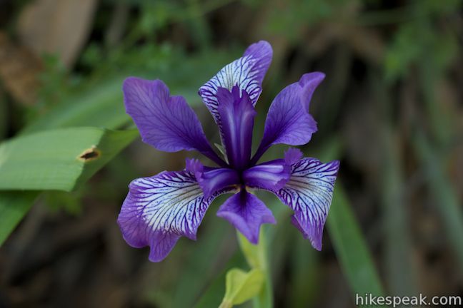
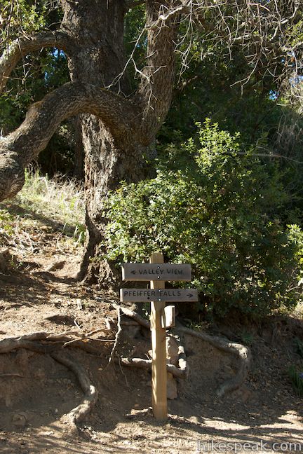
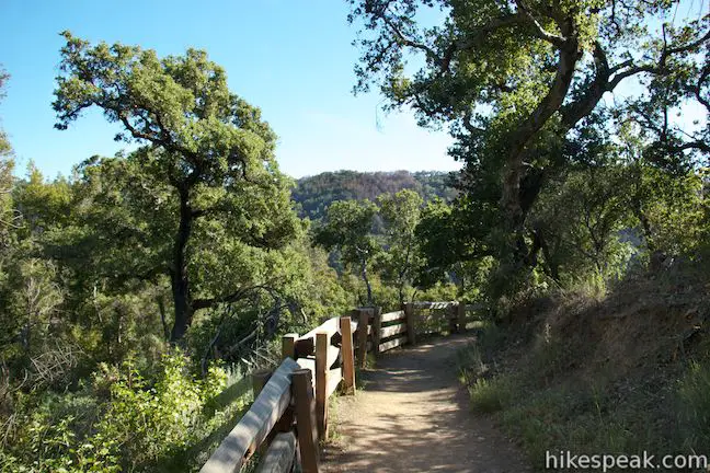
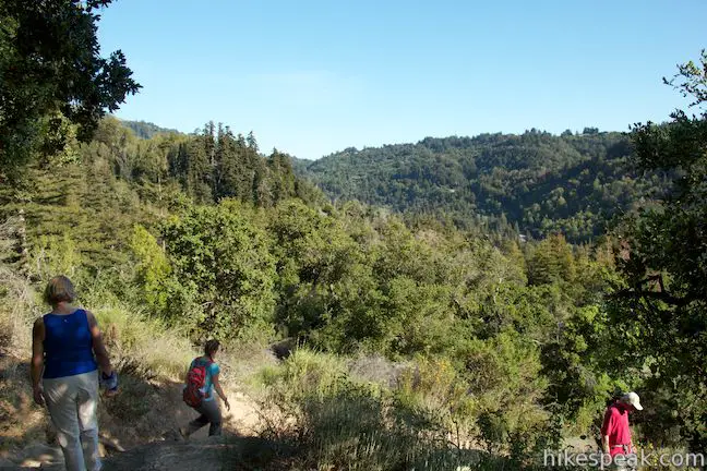
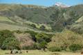
After the bridge, the trail starts to climb and the vegetation changes rapidly. Leave the redwood-covered canyon floor for a ridge with green leafy trees, pines, and brush. In the springtime, wild irises add pops of purple along the side of the trail. The ridge levels out to a false flat where a bench on the right provides a view over the bottom of the canyon. Continue up the trail, which gets steeper again before reaching the split between Valley View Trail and Pfeiffer Falls Trail, 0.65 miles from the start. A wooden sign marks your options. To the right is the trail to the waterfall, 0.2 miles long, dropping across the canyon to reach Pfeiffer Falls. The trail to the left continues 0.35 miles up the ridge to Valley View, gaining the final 175 feet.
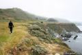
To get the climb out of the way, turn left toward Valley View. The trail proceeds along the spine of a ridge that hangs out like an island from the bigger ridgeline in the mountains above. Big oaks shade the trail, and their roots serve as helpful steps over some steep passages. Other areas have eroded ruts with no tree roots for traction, adding a little challenge to the ascent.
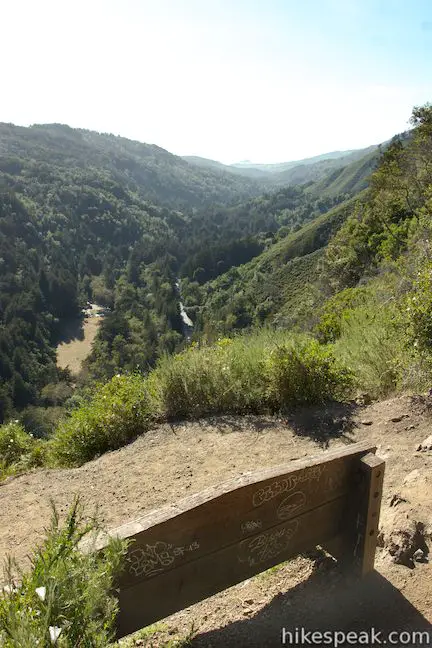
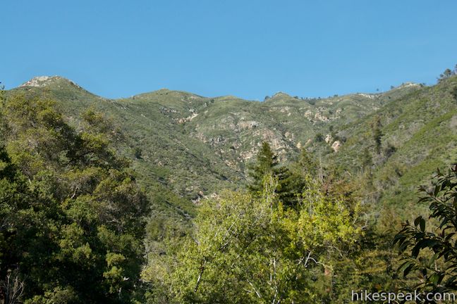
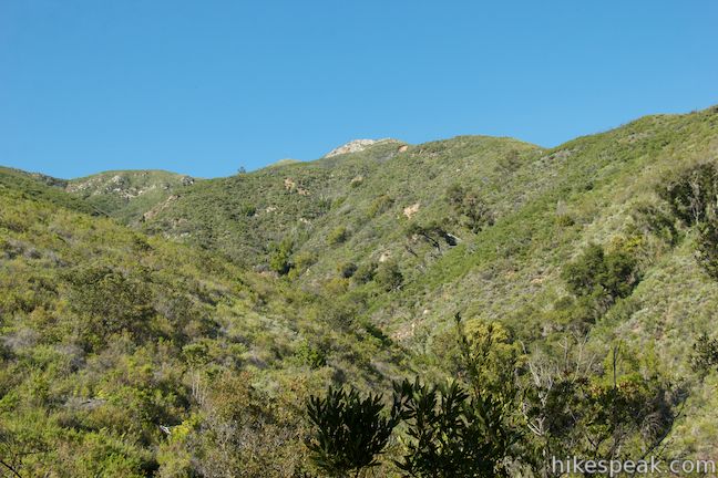
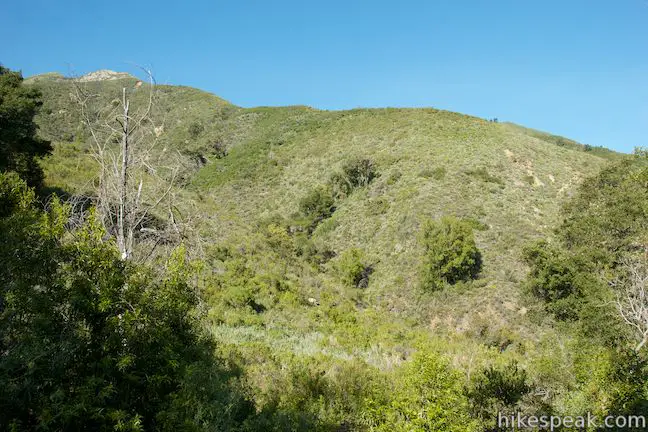
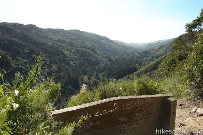
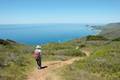
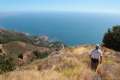
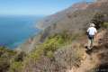
When you spot a bench on the left side of the trail, you might think you’ve made it, but this isn’t Valley View. Instead it’s not-a-valley-view, with tree branches obscuring the perspective of the valley below. Keep going up the trail, which levels out and passes through the oaks huddled around the top of the ridge. Enjoy occasional windows through the trees looking up into the steep mountains on the right side of the trail, exposing the high, remote wilds of Big Sur. Just before the end, it seems like the trail might go right into a steep mountainside. Don’t worry, you don’t have to climb any farther. The trail curves to the left and immediately terminates by the bench at Valley View.
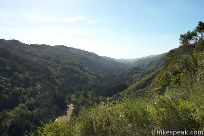
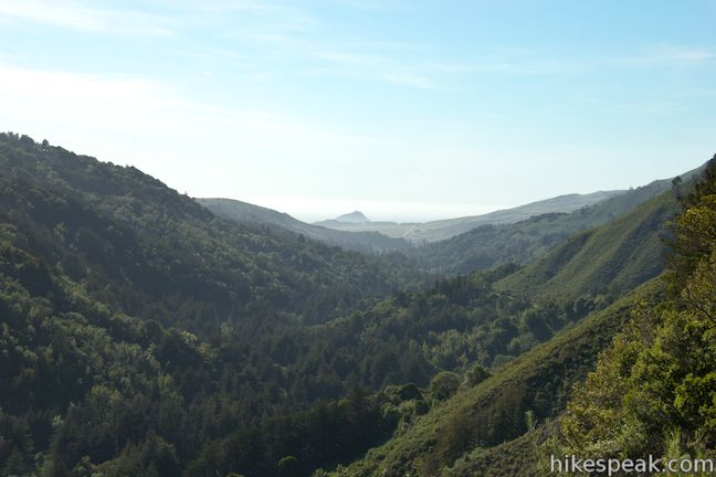
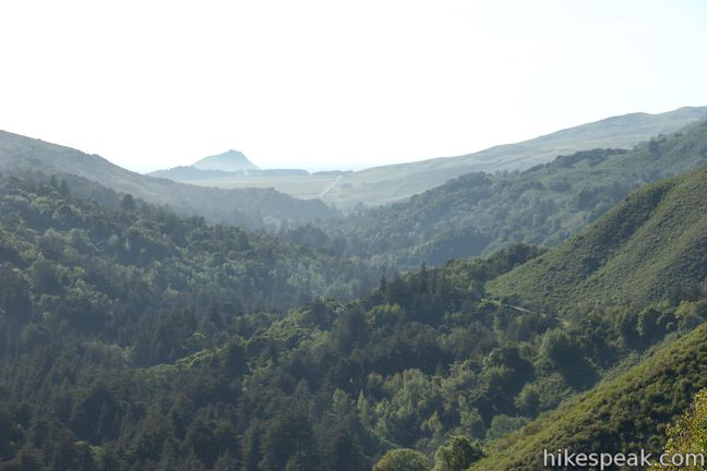
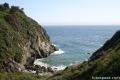
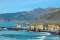
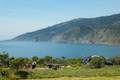
There’s no confusing this view, which looks northwest down the verdant Big Sur River Valley toward the protected wilds of Andrew Molera State Park. A piece of the Pacific Ocean should be visible beyond the bottom of the valley. Looking down, you can follow the line of Highway One as it runs up this storied valley. It’s a big view over Big Sur and you’ve earned it with your effort; have a seat and take it in.
This is the end of the line, so turn around and hike back down to the junction with Pfeiffer Falls Trail. As you descend the ridge, you’ll discover nice little views out over the valley that you probably missed on the hike up.
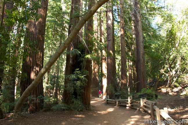
Upon returning to the junction, you will have hiked 1.35 miles. Proceed onto Pfeiffer Falls Trail, which heads downhill to a sharp switchback into the canyon. Walk through massive redwood trees and cross a couple wooden bridges to the junction with the trail coming up from the junction lower down the canyon. Trail construction that commenced in 2016 should provide an easier route to Pfeiffer Falls, also allowing visitors to convert this part of the hike into a loop.
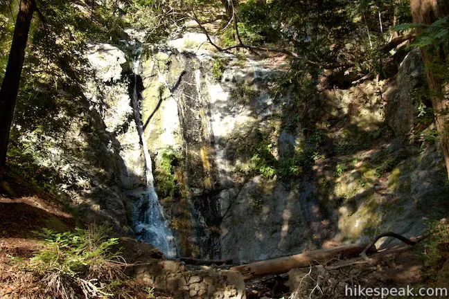
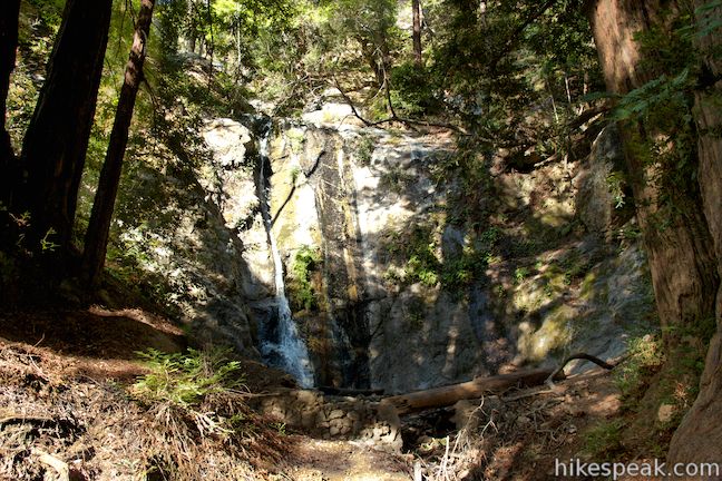
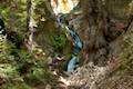
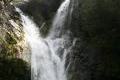
Bear left past the junction and head uphill a short distance to a viewpoint below the falls. Pfeiffer Falls is a short waterfall, about sixty feet tall, sliding down a rock face past moss and maidenhair ferns. Shown here, the waterfall is just a few ribbons of water, but it becomes more flush during the winter rainy season. Pfieffer Falls may not be as impressive as other Big Sur waterfalls, like McWay Falls, but it is charming never-the-less. Listen to the sound of the waterfall and look up at the surrounding skyscraping redwoods, enjoying a bit of Big Sur bliss.
As long as the trail down the canyon along Pfeiffer Redwood Creek is open, you can return that way. Otherwise, hike back up to Valley View Trail the way you came down. Going that way, you will return to Valley View Trail have hiked 1.75 miles. Turn left and take the unified trail down the ridge and back through the redwood grove to the trailhead by the Big Sur Lodge.
Update: Pfieffer Falls Trail and Valley View Trail has reopened following a closure due to damage from winter storms and impacts from the 2016 Soberanes Fire. Visit the Pfeiffer Big Sur State Park webpage for current information.
Dogs and bikes are not allowed on Pfeiffer Falls Trail and Valley View Trail. You can park in the Big Sur Lodge parking lot as a patron for no fee or pass through the park entrance station and pay a $10 day use fee or a $35 to $50 per night fee to camp in Pfieffer Big Sur State Park (all prices as of 2021). For more fun in Pfeiffer Big Sur State Park, you can also check out Big Sur River Gorge. No permit is required to hike to Pfeiffer Falls and Valley View, so get out and enjoy!
Directions to the Trailhead
- From the south, drive up Highway One to the Pfeiffer Big Sur State Park entrance, located on the right (east) side of the road, 11 miles north of Julia Pfeiffer Burns State Park and 2.9 miles north of Nepenth Restaurant.
- There are signs for the lodge and the state park at the intersection with Pfeiffer Big Sur Road.
- Drive up the road through an intersection for the lodge and cabin sites to reach the entry station for Pfeiffer Big Sur State Park.
- You will drive past the trailhead on the way to the entrance gate.
- Enter and park in either of the first two day use lots on the right.
- Walk back toward the lodge on either River Path or Nature Trail, which can be used to form a short loop hike of their own, to reach the start of the trail to Pfeiffer Falls and Valley View, just past the Proboscis Redwood Grove.
- From the north, drive 4.4 miles south of Andrew Molera State Park and 0.7 miles past Fernwood Resort to reach the park entrance.
- Turn left onto Pfeiffer Big Sur Road, following signs for the lodge and the state park.
- Drive up the road through an intersection for the lodge and cabin sites to the entry station for Pfeiffer Big Sur State Park.
- Proceed to either of the first two day use lots on the right.
- Walk back toward the lodge on either River Path or Nature Trail to reach the start of the trail to Pfeiffer Falls and Valley View, just past the Proboscis Redwood Grove.
Trailhead Location
Trailhead address: 47225 Highway 1, Big Sur, CA 93920
Trailhead coordinates: 36.25066, -121.7858 (36° 15′ 02.38″N 121° 47′ 08.89″W)
View Pfeiffer Big Sur State Park in a larger map
Or view a regional map of surrounding Central Coast trails and campgrounds.


 | Nature Trail - River Path Loop This easy 0.55-mile loop explores woodlands along the Big Sur River and a redwood grove that includes the unique and impressive Proboscis Tree. The loop can be combined with the trail to Pfeiffer Falls and Valley View for a 3-mile trek. |
 | Big Sur River Gorge This half-mile off-trail hike ventures up the Big Sur River on a water-wading boulder-hopping adventure to a crystal clear pool that's a gorgeous Big Sur swimming hole. |
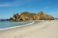 | Pfeiffer Beach This short walk reaches an absolutely stunning beach that's a classic feature of the Big Sur landscape. |
 | Ridge Trail - Panorama Trail - Bluff Trail Loop This 8.7-mile loop in Andrew Molera State Park crosses a coastal ridge, bluff, and beach that are packed with amazing Big Sur views. |
 | McWay Falls This 0.6-mile hike looks out on a stunning Big Sur waterfall that pours 80 feet right on to the beach. |
 | Canyon Falls This 0.9-mile hike heads inland up McWay Creek past a picnic area in a redwood grove to a lovely little waterfall. |
 | Partington Cove This 1.5 mile hike visits a cove and a secluded beach along the scenic Big Sur coast. The cove is accessed through a tunnel. |
 | Hare Creek Trail, Limekiln Trail, and Falls Trail This 2.65-mile hike in Limekiln State Park explores a trio of trails along lovely streams in redwood-lined canyons, reaching Limekiln Falls and historic lime kilns. |
 | Sand Dollar Beach This stunning hike of half a mile or more reaches two scenic overlooks as it descends to a long beach on the Big Sur coast. |
 | Jade Cove and Plaskett Rock Point This 1.5-mile hike along an ocean bluff visits a prominent peninsula and a small cove. |
 | Pacific Valley Bluff Trail This short out and back hike extends from Highway One to an ocean bluff with fantastic views of the Big Sur Coast. |
 | Salmon Creek Falls This short hike visits a fine 120-foot waterfall near the start of Salmon Creek Trail. |
 | Buckeye Trail This hike of 6.5 miles or more reaches incredibly ocean vistas and trail camps in the Silver Peak Wilderness. Connect Cruickshank Trail and Buckeye Trail for an excellent shuttle hike of 8.25 miles or more. |
 | Cruickshank Trail This hike into Silver Peak Wilderness starts with bold ocean views and crosses redwood groves to reach Upper Cruickshank Camp at a junction with Buckeye Trail, 5 miles round trip from Highway One. |
 | More Central Coast Hikes Explore other destinations along the California coast between Ventura and Monterey, including trails in Los Padres National Forest. |
 | Pfieffer Big Sur State Park Campground This large campground in the heart of Big Sur is spread out through oak and redwood groves along the Big Sur River. |
 | Andrew Molera State Park Trail Camp This trail camp is easy to reach (just a short walk in) with campsites in a meadow along the Big Sur River near Molera Beach. |
 | Limekiln State Park Campground This small Big Sur campground at the bottom of Limekiln Canyon has sites along a creek through a redwood grove and near the ocean, with access to trails up Limekiln Canyon. |
 | Kirk Creek Campground This outstanding 33-site campground in Los Padres National Forest has enormous ocean views from a bluff along the Big Sur coast. |
 | Plaskett Creek Campground This 45-site campground in Los Padres National Forest is positioned across Highway One from Sand Dollar Beach and Plaskett Rock Point on the coast of Big Sur. |
Pfeiffer Falls and Valley View on californiathroughmylens.com
Pfeiffer Falls and Valley View on redwoodhikes.com
Pfeiffer Falls and Valley View on hikinginbigsur.com
Pfeiffer Falls and Valley View on modernhiker.com
Pfeiffer Falls and Valley View on outdoorproject.com
Pfeiffer Falls on world-of-waterfalls.com
Pfeiffer Big Sur State Park on Wikipedia.org
Common Questions about Pfeiffer Falls and Valley View in Pfeiffer Big Sur State Park
- Is the trail open?
- Yes. You should expect to find that Pfeiffer Falls And Valley View is open. There are no recent reports of trail closures. If you discover that the trail is closed, please help your fellow hikers by reporting a closure.
- Do I need a permit for this hike?
- Yes. State Park Entrance Fee.
- How much time does this hike take?
- It takes approximately 1 hour 15 minutes to hike Pfeiffer Falls And Valley View. Individual hiking times vary. Add extra time for breaks and taking in the views.
- How long is this hike?
- The hike to Pfeiffer Falls And Valley View is a 2.4 mile out and back with 550 feet of elevation change.
- Are dogs allowed on this trail?
- No, dogs are likely not allowed on Pfeiffer Falls And Valley View. The trail is primarily open to hikers.
- Will I see a waterfall on this hike?
- Yes, Pfeiffer Falls And Valley View features a waterfall.
- Are there redwood trees on this hike?
- Yes, Pfeiffer Falls And Valley View passes through a grove of redwood trees.
- Where is the trailhead located?
- The trailhead for Pfeiffer Falls And Valley View is located in Big Sur, CA.
Trailhead Address:
47225 Highway 1
Big Sur, CA 93920
Trailhead Coordinates:
36.25066, -121.7858 - What are the driving directions to the start of the hike?
To get to the trailhead: From the south, drive up Highway One to the Pfeiffer Big Sur State Park entrance, located on the right (east) side of the road, 11 miles north of Julia Pfeiffer Burns State Park and 2.9 miles north of Nepenth Restaurant. There are signs for the lodge and the state park at the intersection with Pfeiffer Big Sur Road. Drive up the road through an intersection for the lodge and cabin sites to reach the entry station for Pfeiffer Big Sur State Park. You will drive past the trailhead on the way to the entrance gate. Enter and park in either of the first two day use lots on the right. Walk back toward the lodge on either River Path or Nature Trail, which can be used to form a short loop hike of their own, to reach the start of the trail to Pfeiffer Falls and Valley View, just past the Proboscis Redwood Grove.
From the north, drive 4.4 miles south of Andrew Molera State Park and 0.7 miles past Fernwood Resort to reach the park entrance. Turn left onto Pfeiffer Big Sur Road, following signs for the lodge and the state park. Drive up the road through an intersection for the lodge and cabin sites to the entry station for Pfeiffer Big Sur State Park. Proceed to either of the first two day use lots on the right. Walk back toward the lodge on either River Path or Nature Trail to reach the start of the trail to Pfeiffer Falls and Valley View, just past the Proboscis Redwood Grove.
View custom Google Maps directions from your current location.
- Are there other trails near Pfeiffer Falls And Valley View?
- Yes, you can find other nearby hikes using the Hikespeak Hike Finder Map.

This trail and the park have been closed since July 2016. It is not expected to re-open until mid/late 2017
The Pfeiffer Falls trail closed but Valley View opens.
It’s now open