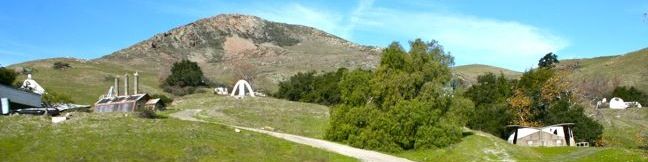
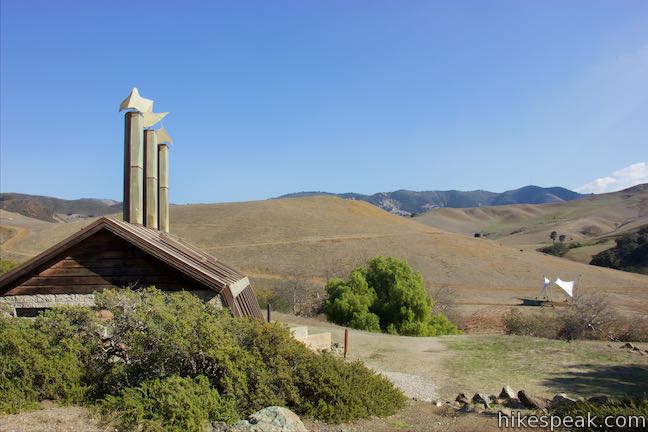
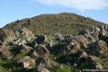
The Poly Canyon Design Village is a hamlet of unique and varied structures built over the decades by architecture students at California Polytechnic State University. Design Village is located on a quiet grassy hillside contoured by babbling creeks shaded by coast live oaks. The village is a short distance from the Cal Poly campus and creates a pleasant and interesting destination for a 2.5-mile hike with 300 feet of elevation gain.
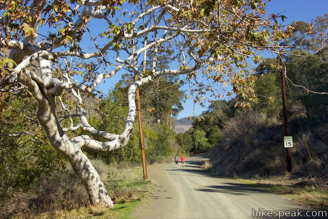
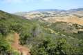
This hike begins from the northeast corner of the Cal Poly campus in San Luis Obispo. Start up Poly Canyon Road, a dirt service road that provides a gradual ascent. The first half-mile is almost completely level, allowing your legs to warm up as you leave the dorms of Cal Poly for a riparian forest at the base of the Santa Lucia Mountains.
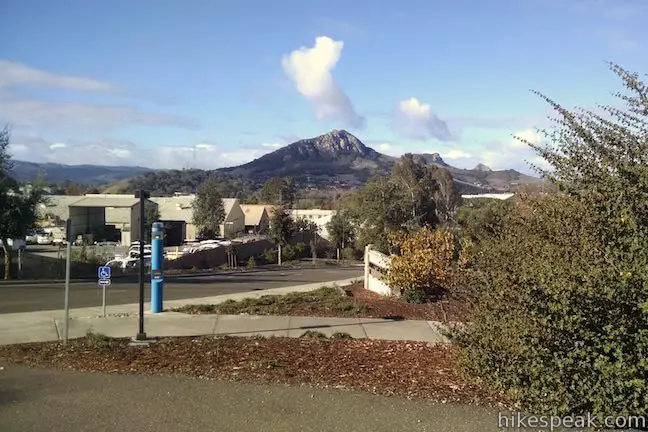
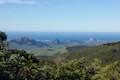
After 0.45 miles, continue straight through an intersection with a gated road heading up the ridge to the right. Just ahead, wooden steps descend the bank to the left through a eucalyptuses grove. A creek crossing here leadd to a narrow single track along the steep bank on the other side of Brizziolari Creek. A variation of this hike is to trek up the canyon on this slim path paralleling Poly Canyon Road. There are great views of Bishop Peak and neighboring Morros at the start of the hike.
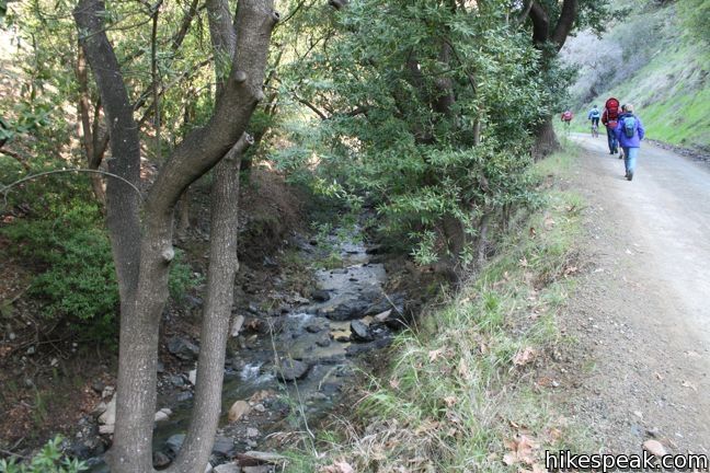
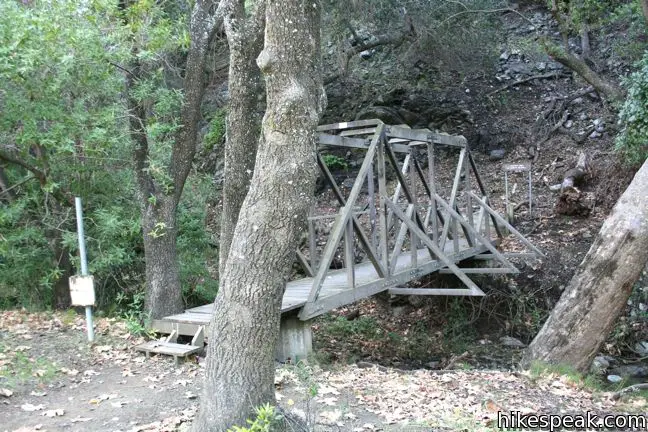
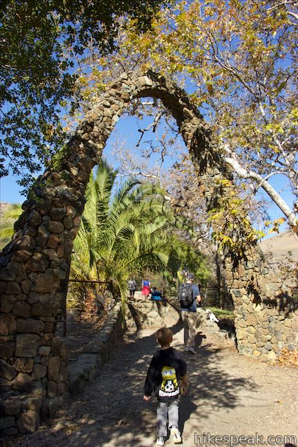
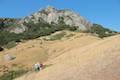
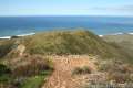
The wide dirt road continues northeast up the canyon alongside Brizziolari Creek, gradually gaining 100 feet of elevation. The road comes to a picnic area on the left, followed by the return of the footpath from the other side of the creek. Brizziolari Creek passes beneath Poly Canyon Road just before a wooden bridge on the right that connects to East Canyon Trail. This is the turning point for another hike, which climbs to an overlook on Yucca Ridge. To reach the Design Village, continue a short distance farther to a turnoff on the right beneath an impossible-to-miss stone arch, 3/4 of a mile from the start.
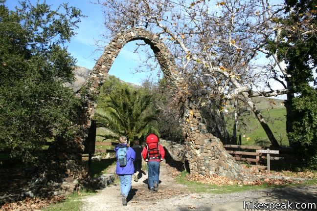
Pass below the elegant arch and continue up a trail lined by short stone walls. Cross a concrete bridge and arrive at the base of the hill of student constructions. From here, there is dirt road through the village, along with several interconnecting paths, allowing you to visit each structure via a contorted loop or another course of your choosing. Getting lost would be difficult, so relax and explore.
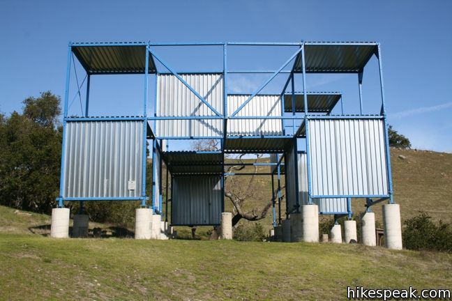
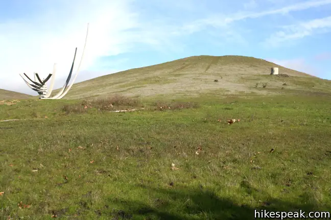
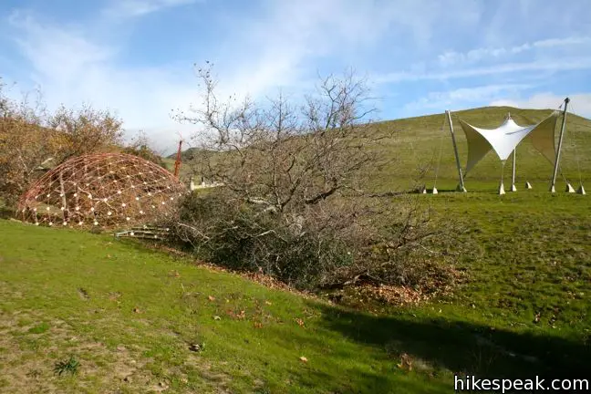
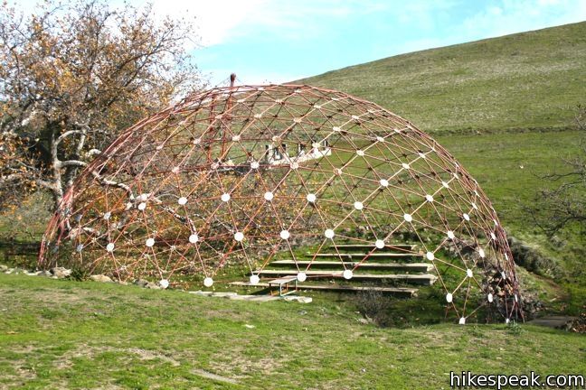
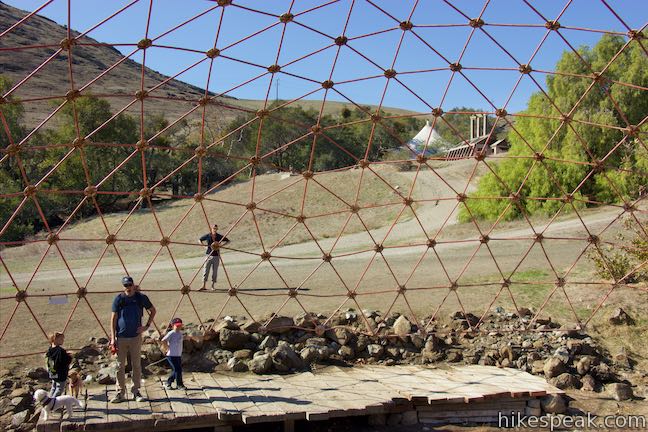
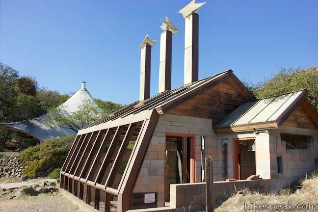
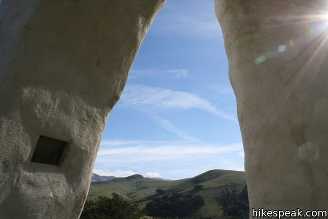
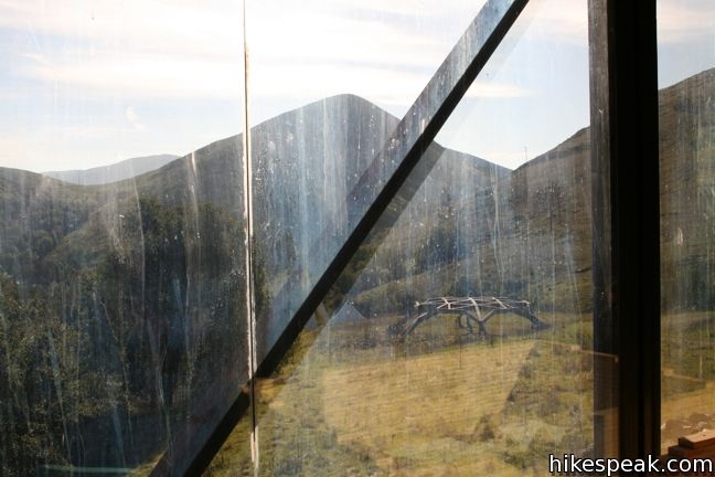
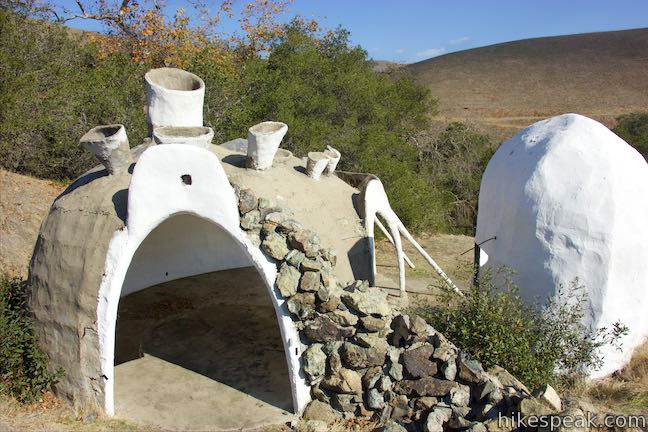
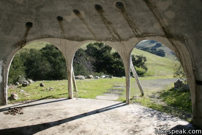
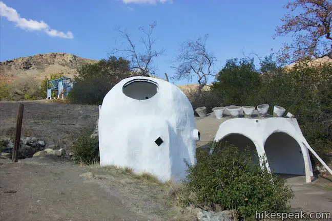
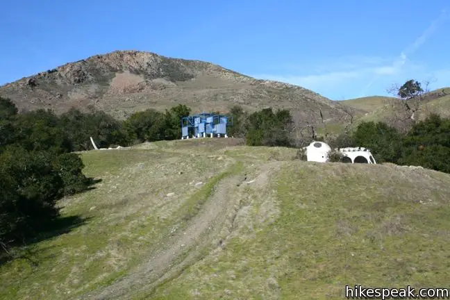
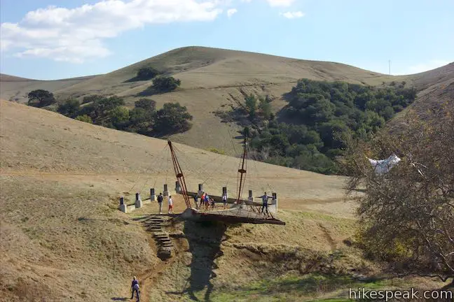
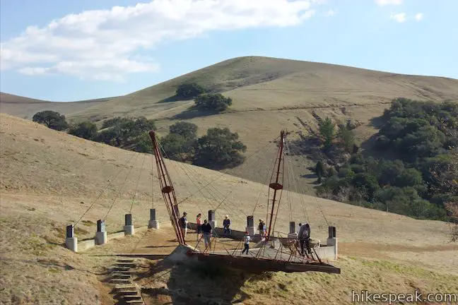
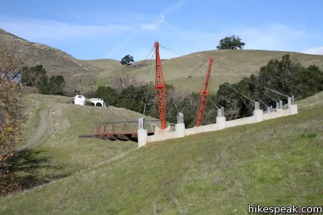
Since the 1970s, Cal Poly College of Architecture and Environmental Design students have used Poly Canyon as an outdoor test room to experiment with new constructions. Highlights of the village include: Shell House, Bridge house, Stick House, and Underground House (which may have been designed by Dr. Seuss). The Design Village is still used by the university and the installations will change over time.
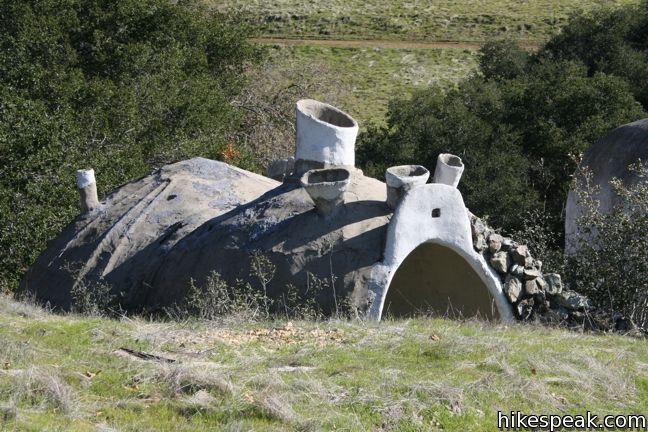
The houses and structures are architecturally experimental, abstract, and unique. Each one offers a different experience. Many of the constructions seem designed to integrate with the environment, including an amphitheater built along the creek beneath an open geodesic dome. Several of the old houses are dilapidated, showing signs of vandalism, but the small diverse village is still an interesting place to visit.
Once you’ve taken it all in, hike back down across the bridge and under the arch to Poly Canyon Road. Return the way you came for an easy 2.5 to 2.75-mile hike (depending on how much of the village you explore). Dogs are welcome. Bikes are allowed on Poly Canyon Road but not within the village. On weekends, access to the trail is free and no permit is required. On school days, an entrance fee and a permit are required to get on campus.
Directions to the Trailhead
- From Highway 101 (exit 203D from the south and exit 204 from the north), exit on to Grand Ave and head north for 1/3 of a mile to the Cal Poly campus.
- On weekdays stop at the visitor station and purchase a parking pass.
- On weekends, continue straight ahead for another 0.4 miles to the end of the road.
- Turn right on Perimeter Road and drive another 0.2 miles to Village Drive.
- Turn right and pull into the H4 parking lot on the left.
- From the lot, walk up to the intersection with Klamath Road and continue north for another 0.1 miles on Village Road.
- Take the slight right on to Poly Canyon Road to begin the hike.
- There is a gate at the bottom of the dirt road.
Trailhead Location
Trailhead address: Poly Canyon Road & Village Drive, California Polytechnic State University, San Luis Obispo, CA 93405
Trailhead coordinates: 35.30445, -120.65845 (35° 18′ 16″N 120° 39′ 30.4″W)
You may also view a regional map of surrounding Central Coast trails and campgrounds.


 | Stenner Creek Trail to The Eucs This 3.7-mile hike goes up Stenner Creek Canyon past a small waterfall and views of Bishop Peak to a collection of freeride bike trails called The Eucs. |
 | Stenner Creek Trail – Red Dog Trail – Poly Canyon Road Loop This 4.25-mile loop goes beyond the Eucs to explore grass-covered slopes at the base of the Santa Lucia Mountains. |
 | Cuesta Ridge Botanical Area This 6-mile round trip hike crosses a ridge in the Santa Lucia Mountains above Poly Canyon with panoramic views over San Luis Obispo, ascending to a grove of Sargent cypress in a botanical area in Los Padres National Forest. |
 | East Cuesta Ridge This wide dirt road offers an 8.4-mile hike to the top of Mount Lowe or a longer trek to the top of Lopez Canyon Trail, offering ocean views over San Luis Obispo and inland views over an evergreen wilderness. |
 | Reservoir Canyon This 5.35-mile hike ascends 1,350 feet past a waterfall and a collection of junk sculptures to a treeless summit overlooking San Luis Obispo. |
 | Bishop Peak This 3.5-mile hike ascends 950 feet to highest summit in the Nine Sisters, offering excellent views of San Luis Obispo and the surrounding Morros. |
 | Felsman Loop Trail This 2.7-mile loop crosses oak, sagebrush, and grass-covered slopes around the base of Bishop Peak, providing excellent views of that notable rocky summit and its San Luis Obispo surroundings. |
 | Cerro San Luis This 4-mile hike summits one of the Nine Sisters just west of downtown San Luis Obispo, delivering panoramic views. |
 | Cerro San Luis from Laguna Lake Park This 5.7-mile hike reaches the summit from a nearby park, enjoying even more San Luis Obispo views. |
 | "M" Trail This extensions off the trail up Cerro San Luis makes its own 1.9-mile round trip hike to the large white "M" installed halfway up the east side of the mountain. |
 | Lemon Grove Trail This 2.2-mile loop visits a historical lemon grove on the eastern slopes of Cerro San Luis. |
 | Lemon Grove & "M" Trails Loop This 2.4-mile hike uses all of the "M" Trail and part of Lemon Grove Loop Trail for a scenic circuit on the east side of Cerro San Luis. |
 | South Hills Ridge Trail This 1.5-mile round trip hike ascends 425 feet to the highest point in a cluster of hills near downtown San Luis Obispo, offering fine views over the city and surroundings. |
 | More hikes in San Luis Obispo Explore other trails around San Luis Obispo including Morro Bay State Park and Montaña de Oro State Park. |
Common Questions about Poly Canyon Design Village in San Luis Obispo
- Is the trail open?
- Yes. You should expect to find that Poly Canyon to Poly Canyon Design Village is open. There are no recent reports of trail closures. If you discover that the trail is closed, please help your fellow hikers by reporting a closure.
- Do I need a permit for this hike?
- Yes. Campus Entrance Fee.
- How much time does this hike take?
- It takes approximately 1 hour 15 minutes to hike Poly Canyon to Poly Canyon Design Village. Individual hiking times vary. Add extra time for breaks and taking in the views.
- How long is this hike?
- The hike to Poly Canyon to Poly Canyon Design Village is a 2.5 mile out and back with 300 feet of elevation change.
- Are dogs allowed on this trail?
- Yes, dogs are allowed on Poly Canyon to Poly Canyon Design Village. The trail is open to hikers, bikes (only on Poly Canyon Road), dogs.
- What mountain range is this trail in?
- Poly Canyon to Poly Canyon Design Village is located in the Santa Lucia Mountains.
- Where is the trailhead located?
- The trailhead for Poly Canyon to Poly Canyon Design Village is located in San Luis Obispo, CA.
Trailhead Address:
Poly Canyon Road
San Luis Obispo, CA 93405
Trailhead Coordinates:
35.30445, -120.65845 - What are the driving directions to the start of the hike?
To get to the trailhead: From Highway 101 (exit 203D from the south and exit 204 from the north), exit on to Grand Ave and head north for 1/3 of a mile to the Cal Poly campus. On weekdays stop at the visitor station and purchase a parking pass. On weekends, continue straight ahead for another 0.4 miles to the end of the road. Turn right on Perimeter Road and drive another 0.2 miles to Village Drive. Turn right and pull into the H4 parking lot on the left. From the lot, walk up to the intersection with Klamath Road and continue north for another 0.1 miles on Village Road. Take the slight right on to Poly Canyon Road to begin the hike. There is a gate at the bottom of the dirt road.
View custom Google Maps directions from your current location.
- Are there other trails near Poly Canyon to Poly Canyon Design Village?
- Yes, you can find other nearby hikes using the Hikespeak Hike Finder Map.

Cool – I’ll have to check this one out if I’m ever in the area.
[…] and chaparral, following a creek path on its north side. Towards the end of the road is the Design Village, a space where architecture students go out to build experimental structures. Each spring the space […]
When will you be having design village. Is this event open to students from other campus locations.
The trail is open to everyone! You can visit 7 days a week. On the weekends, you don’t have to pay a parking fee.
[…] breakfast. But at the meal I met a nice lady who visited the area every year. She recommended The Architectural Graveyard at California Polytechnic State University, then Hoagies restaurant for dinner. We really didn’t […]
Can you take dogs?
yes. Enjoy your hike.
I would like to visit during winter break if at all possible. Where is the best place to park? I understand that there is no parking fee, but I would definitely not like to get a ticket and would otherwise like to know the best place to park to be closest to the Design Village. Would this be around Village Rd. or elsewhere? Thanks.
[…] about the “tarantula math” concept, I saw my first desert tarantula while on a bike ride near Poly Canyon. To my dismay, this one was not in an argyle sweater and tortoise shell glasses like I had […]
Are horses allowed on poly canyon trail