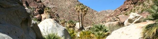
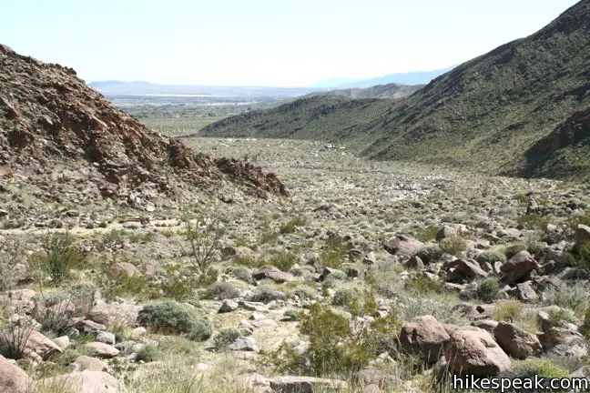
Borrego Palm Canyon is a wide trench descending west to east down the San Ysidro Mountains just west of Borrego Springs. The creation of Anza-Borrego Desert State Park began in the 1930s with the protection of this palm-filled canyon. The popularity of the trail exploring Borrego Palm Canyon has endured, even as the park has expanded to protect a thousand square miles of southeastern California. This 3.25-mile loop ascends 450 feet to a shady oasis in an alluring desert canyon.
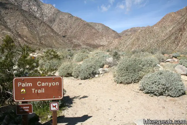
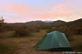
Borrego Palm Canyon Trail is located just north of the park visitor center, making it a convenient place to begin your exploration of the Anza-Borrego Desert. To reach the trailhead, drive through Borrego Palm Canyon Campground, the largest developed campground in the park, where an eight-dollar day use fee is charged. This is the only area in the park that requires such a fee.
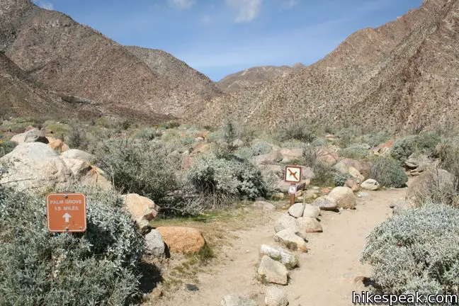
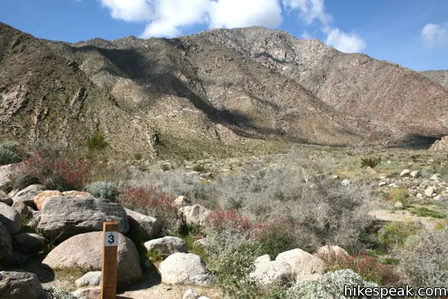
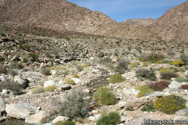
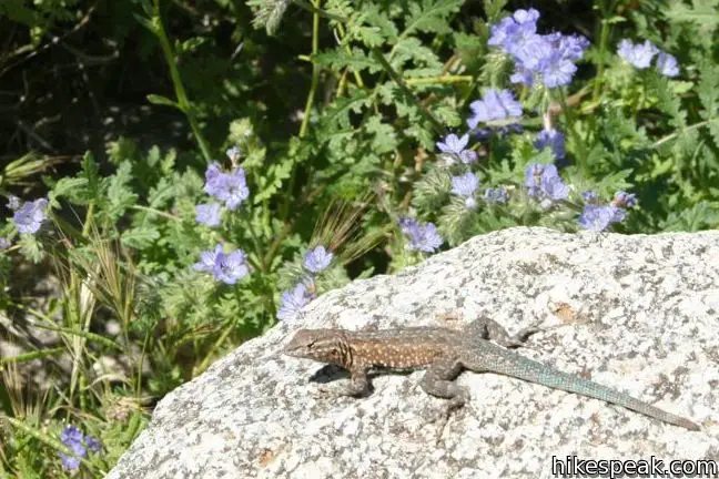
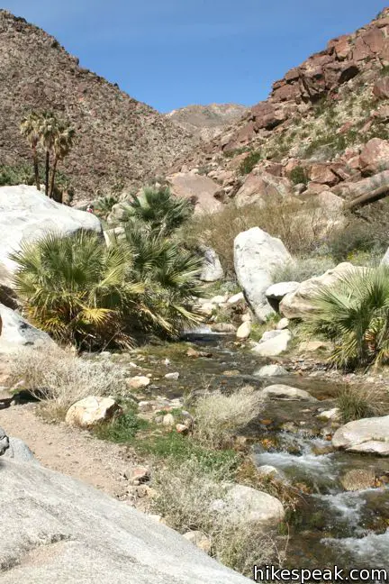
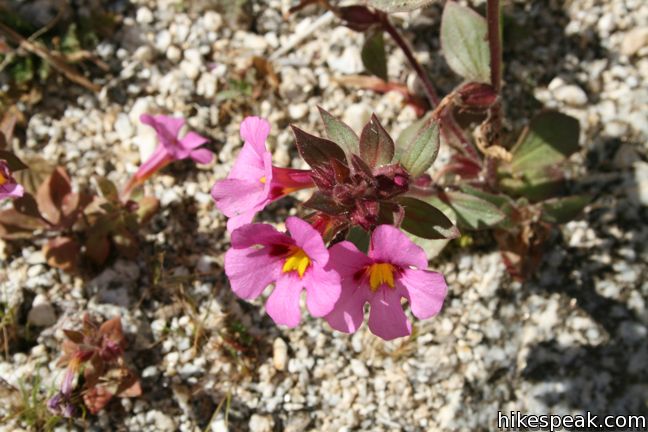
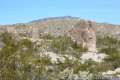
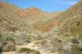
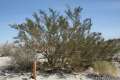
Pick up an informative pamphlet and begin hiking west up the wash outside Borrego Palm Canyon. Numbered markers coincide with entries in the trail guide that tell the story of the canyon as you hike. The trail passes through a variety of cacti and other desert vegetation.
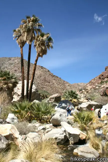
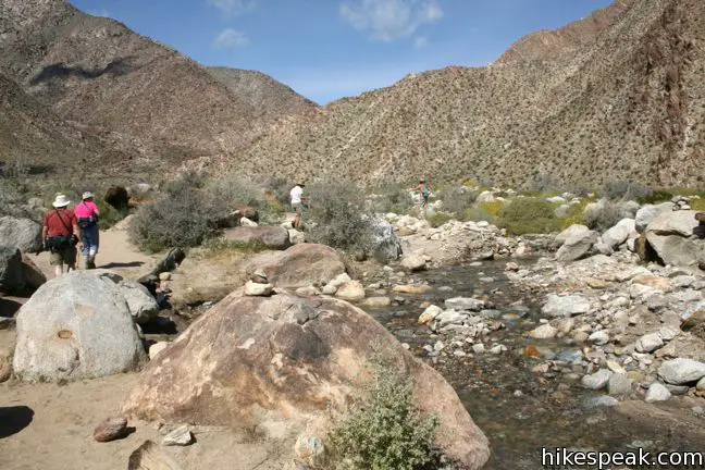
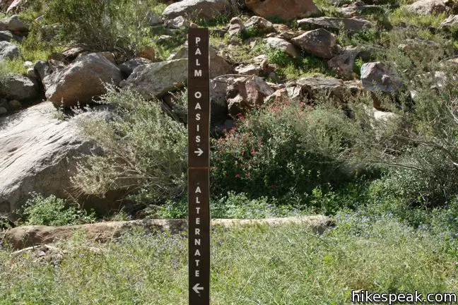
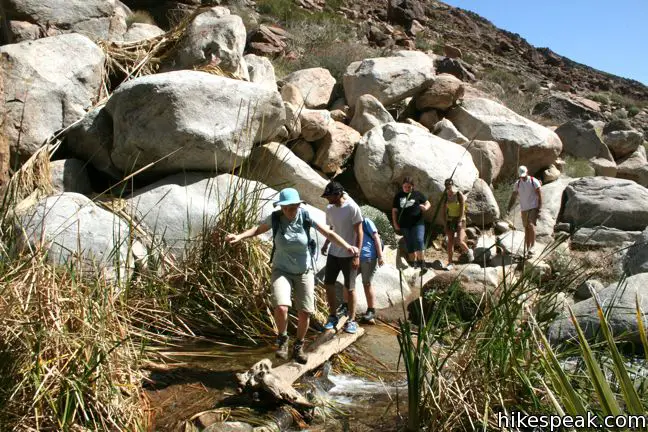
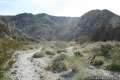
In the early spring, a surprisingly active stream flows out of Borrego Palm Canyon. Follow the trail back and forth over the creek bed a few times to arrive at a marked junction one mile (and 300 vertical feet) from the start. To the left, an alternate trail heads back to the campground. Hike this way on the return to add an extra quarter-mile to the trek, along with wider views and varied scenery.
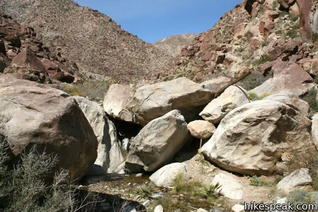
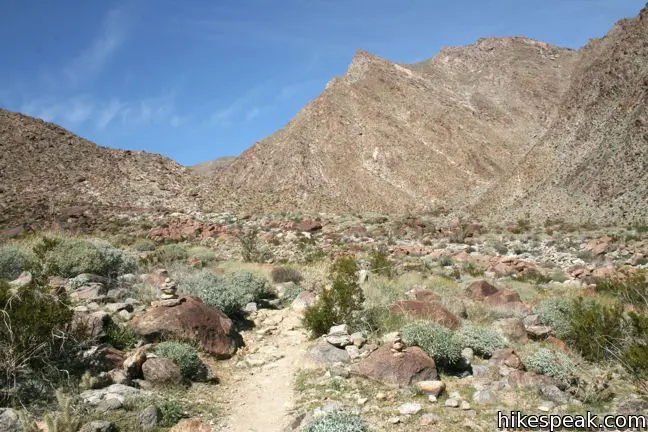
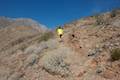
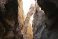
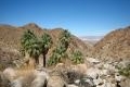
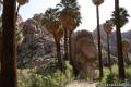
Turn right, continuing up the canyon toward the oasis. Downed palm trunks scattered around the mouth of the canyon are evidence of damage from a flash flood that tore through Borrego Palm Canyon in 2004. As the trail becomes slightly more rugged, amble over and around rocks to reach a small cluster of palms, 1/3 of a mile from the junction. Press on to the grand oasis of California fan palms just ahead.
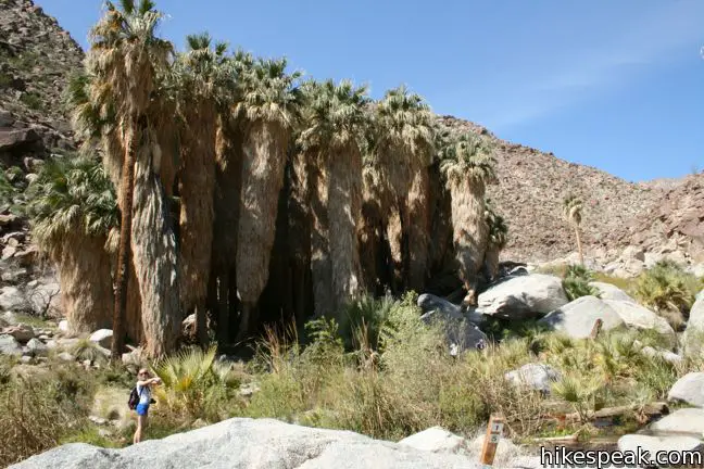
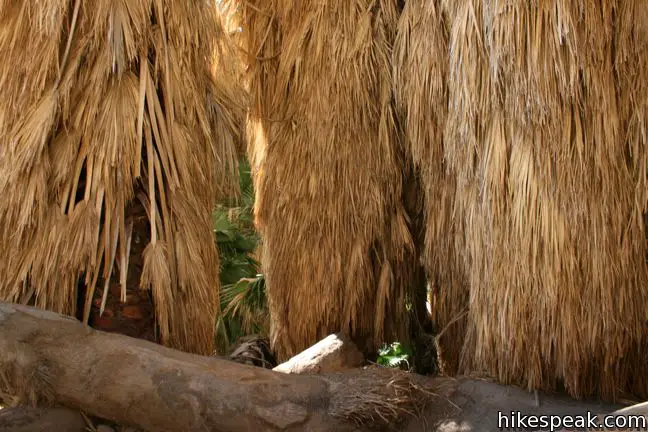
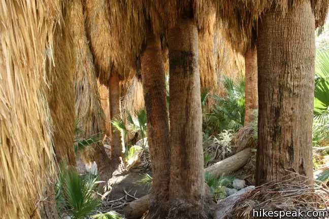
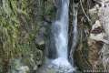
Relax in the shade of one of the largest palm oases in California. A far less traveled track continues up Borrego Palm Canyon toward seasonal waterfalls and an ascent trail to Indianhead Mountain.
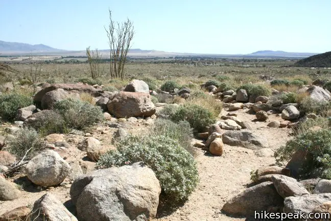
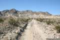
On your way back down the canyon, continue straight through the junction to return via the alternate trail. This single track climbs 90 feet up and over an alluvial fan south of the canyon itself, providing new views on the way back to the trailhead. This 1.25-mile track sees less foot traffic than the main trail up the canyon, passing through thriving cacti, ocotillo, and other desert brush.
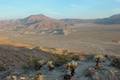
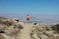
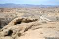
If you finish with this hike and still have energy, another trail departs from Borrego Palm Canyon Campground for you to check out. Panoramic Overlook Trail is a 1-mile round trip hike ascending to a scenic spot on the ridge south of Borrego Palm Canyon.
Dogs and bikes are allowed in the campground but not on the hiking trails. A $10 day use fee is charged to enter Borrego Palm Canyon Campground (price as of 2017), but no permit is required for either hike, so get out and enjoy!
Directions to the Trailhead
- From Christmas Circle in Borrego Springs, drive 1.5 miles west on Palm Canyon Drive to an unmarked service road just past Route S22, and 0.2 miles before the park visitor center.
- Turn north and drive one mile to the entrance of Borrego Palm Canyon Campground.
- Pass through the entrance station and drive to the trailhead at the west end of the campground.
Trailhead Location
Trailhead address: Borrego Palm Canyon Campground, Anza-Borrego Desert State Park, Borrego Springs, CA 92004
Trailhead coordinates: 33.2702, -116.4182 (33° 16′ 12″N 116° 25′ 05″W)
View Anza-Borrego Desert State Park in a larger map
Or view a regional map of surrounding California Desert trails and campgrounds.


 | Panoramic Overlook Trail The 1-mile round trip hike ascends a ridge on the south side of Borrego Palm Canyon to sweeping views of the San Ysidro Mountains and Borrego Valley. |
 | Hellhole Canyon Trail to Maidenhair Falls This 5.5-mile hike visits a 20-foot waterfall in a canyon near Borrego Springs, making it the perfect place to cool off on a hot day in the California Desert. |
 | Kenyon Overlook Trail This 1.15-mile loop sets out from Yaqui Pass to reach an incredible viewpoint across Mescal Bajada. |
 | Culp Valley Loop This 2.2-mile loop visits Culp Valley Overlook and Pena Springs, delivering views of the San Ysidro Mountains and Borrego Valley along the way. |
 | Calcite Mine Trail This 4.25-mile trek climbs 600 feet to a historic mine site, exploring exciting narrows along the way. |
 | The Slot This short hike descends through a narrow canyon beneath a natural rock span that is among the most photographed landmarks in Anza-Borrego Desert State Park. |
 | Narrows Earth Trail This 0.5-mile self-guided hike explores the geology of the park. |
 | Morteros Trail This 0.6-mile hike visits a village of boulders once occupied by Kumeyaay Indians who left behind Morteros, grinding bowls carved into the rock. |
 | Pictograph Trail This 1.8-mile hike visits rock paintings drawn by Kumeyaay Indians who lived in the Anza-Borrego Desert thousands of years ago. |
 | Rainbow Canyon Trail This 2.2-mile adventure follows an undeveloped trail up a colorful canyon full of vibrant rock formations and desert plants. |
 | Elephant Trees Trail This easy one-mile loop offers a lesson in desert botany including the rare elephant tree. |
 | Wind Caves Trail This 1.25-mile round trip hike climbs 250 feet to a sandstone formation that begs to be explored. |
 | Hikes in the California Desert Explore more trails in Death Valley National Park, Joshua Tree National Park, Anza-Borrego Desert State Park, and Mojave National Preserve. |
 | Fortynine Palms Oasis in Joshua Tree National Park The 3-mile round trip hike visits a cool desert oasis. |
 | Lost Palms Oasis in Joshua Tree National Park This 7.2-mile hike visits a desert oasis nestled between mountains in the southeast corner of the park. |
 | Anza-Borrego Desert Campgrounds There are four developed campgrounds, eight primitive campgrounds, and extensive roadside camping to accommodate your visit to California's largest state park. |
 | Anza-Borrego Desert State Park Wildflowers The desert bloom brings bursts of color to barrel cactus, beavertail cactus, ocotillo, and more. |
Common Questions about Borrego Palm Canyon Trail in Anza-Borrego Desert State Park
- Is the trail open?
- Yes. You should expect to find that Borrego Palm Canyon Trail is open. There are no recent reports of trail closures. If you discover that the trail is closed, please help your fellow hikers by reporting a closure.
- Do I need a permit for this hike?
- Yes. State Park Entrance Fee.
- How much time does this hike take?
- It takes approximately 1 hour 30 minutes to hike Borrego Palm Canyon Trail. Individual hiking times vary. Add extra time for breaks and taking in the views.
- How long is this hike?
- The hike to Borrego Palm Canyon Trail is a 3.25 mile loop with 450 feet of elevation change.
- Are dogs allowed on this trail?
- No, dogs are likely not allowed on Borrego Palm Canyon Trail. The trail is primarily open to hikers.
- Where is the trailhead located?
- The trailhead for Borrego Palm Canyon Trail is located in Borrego Springs, CA.
Trailhead Address:
Borrego Palm Canyon Campground
Borrego Springs, CA 92004
Trailhead Coordinates:
33.2702, -116.4182 - What are the driving directions to the start of the hike?
To get to the trailhead: From Christmas Circle in Borrego Springs, drive 1.5 miles west on Palm Canyon Drive to an unmarked service road just past Route S22, and 0.2 miles before the park visitor center. Turn north and drive one mile to the entrance of Borrego Palm Canyon Campground. Pass through the entrance station and drive to the trailhead at the west end of the campground.
View custom Google Maps directions from your current location.
- Are there other trails near Borrego Palm Canyon Trail?
- Yes, you can find other nearby hikes using the Hikespeak Hike Finder Map.

15 Comments on Borrego Palm Canyon Trail in Anza-Borrego Desert State Park
What hikers are saying:
✨ Generated summary of user commentsThis is a fantastic, adventurous journey through stunning rocky scenery and lush stream crossings. The canyon feels significantly warmer than expected, making extra water essential for a safe trip. Christopher recommends wearing durable clothing for boulder scrambling and shoes that can handle getting wet. Be prepared for ankle-deep water crossings and a day-use fee regardless of where you park.
“This was a fantastic, adventurous hike with stunning rocky scenery.” Jump to comment ↓
[…] We did a hike up the Borrego Palm Canyon Trail, […]
My 4.5 star rating is based on hiking past the marked official trail, going about 2 miles farther up the canyon. This was a fantastic, adventurous hike with stunning rocky scenery. There was lots of boulder scrambling and stream-crossings. Not a particularly easy trail, definitely good to go with strong knees, shoes with good tread that you don’t mind getting wet, pants you don’t mind snagging/ripping, and long-sleeve shirt.
I left early in the AM and returned in the afternoon, only saw 3 other groups of hikers. If you do go past the trail’s end, remember to tread lightly, avoiding the delicate plants as much as possible in this delicate environment.
[…] Hiking In The Park: Located within the campground, the Borrego Palm Canyon trail is one of our favorites. At just over 3 miles round-trip, it leads through a beautiful landscape of […]
[…] Hike Speak […]
You mention a flash flood over a decade ago in the Canyon but wasn’t there a fire there too
[…] didn’t explore beyond the palm oasis. For more info and photos of this hike, check out hikespeak.com […]
Water enough to wade in?
[…] and enjoyed a beautiful open-sky desert sunrise on the way to the trailhead. We were headed to Palm Canyon Trail, and were told we had to arrive before the parking lot even opened to get a parking spot. That was […]
I went to hike Palm Canyon today and found out it is closed. I wish the website would have mentioned that before the 2 hour drive to get there. It may be closed for awhile and wish there’s a way to let hikers know.
Thanks for the update. Unfortunately, it looks like the trail was closed on 2/15 due to unsafe conditions. I’ll try to gather more information…
Does anyone know if this trail is open now?
My wife and I hiked this trail on March 12, 2019 to see the super bloom. Parts of the trail criss-crossed the stream, which made it dicey a couple of times. It was probably ankle deep. We did not make it to the top, though. Do not park at the Visitor Center, it is probably 1 1/2 miles from the Visitor Center to the trail head. Go to the camp ground, if you can and start your hike from there.
Great hike. The canyon is much warmer than the air temperature would indicate, so, as others have said, bring plenty of water. Also, you can’t save $10 by parking at the visitor center, they charge the ‘day use’ fee there, too.
I went up and down palm canyon in the early 1950’s. Are there still gold fish In stream ? And is the bottle house still at the top? We always had a great time camping at the camp grounds below as Boy Scouts. We rode bikes on the unlit streets ran off the roads many times, and went on a few snipe hunts. Lots of great memories.
Snipe Hunts they are fun!!?