Wind Caves Trail
in Anza-Borrego Desert State Park
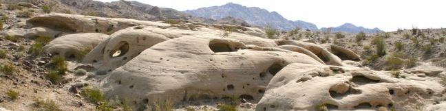
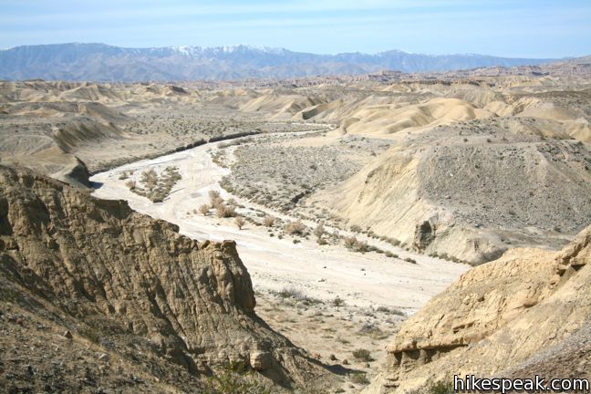
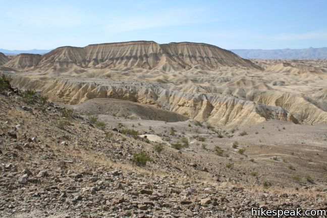
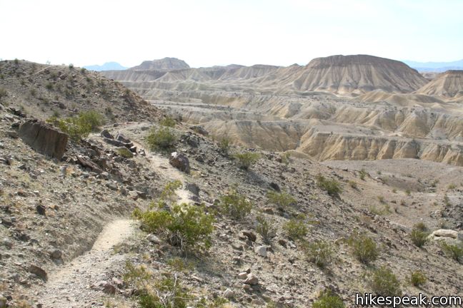
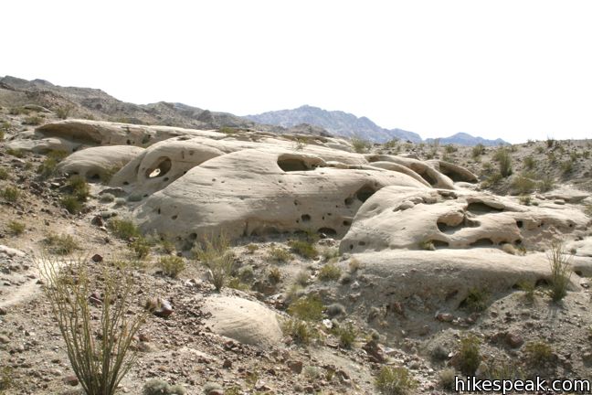
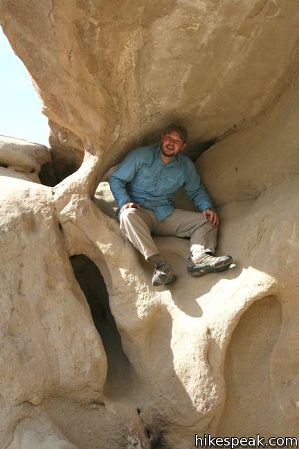
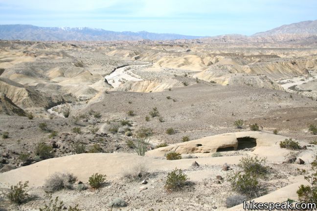
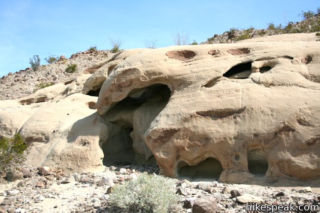
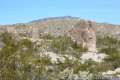
A short hike to a fascinating destination overlooking the Carrizo Badlands begins on the far east side of Anza-Borrego Desert State Park. This 1.25-mile round trip hike climbs 250 feet to a sandstone formation with wind-eroded pockets that insist on being explored.
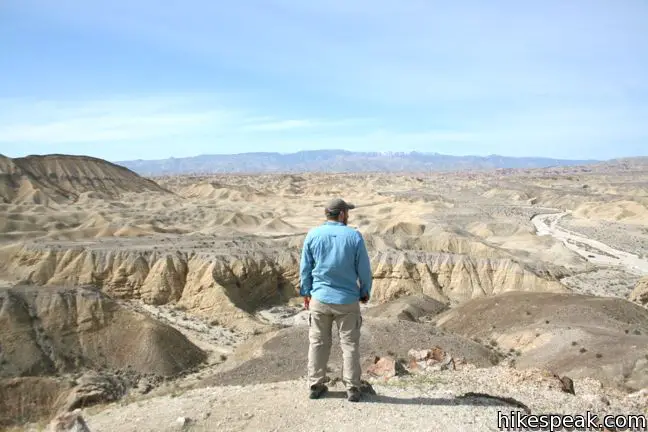
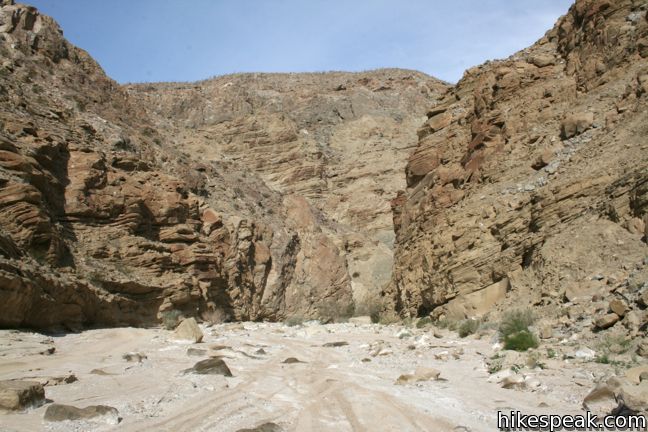
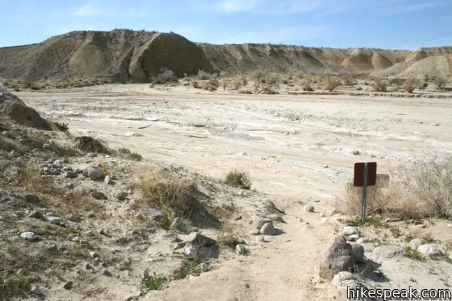
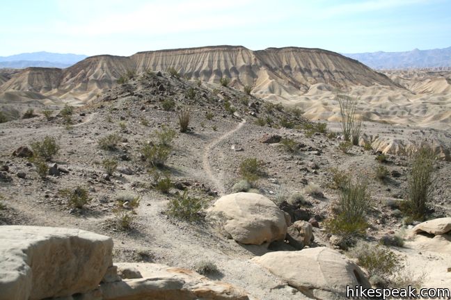
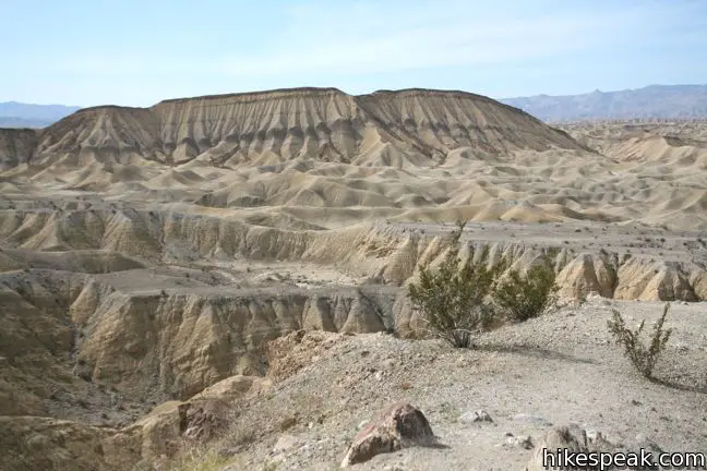
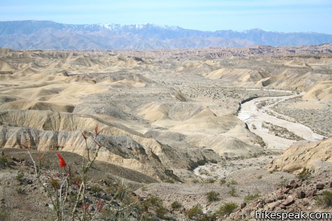
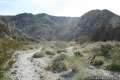
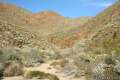
The hike begins with a quick ascent up the east side of Split Mountain Wash. Climb a series of rocky steps. With each gain, the view to the west and south expands over the sprawling badlands. This would be a scenic trail even if exciting wind caves weren’t waiting half a mile up the ridge.
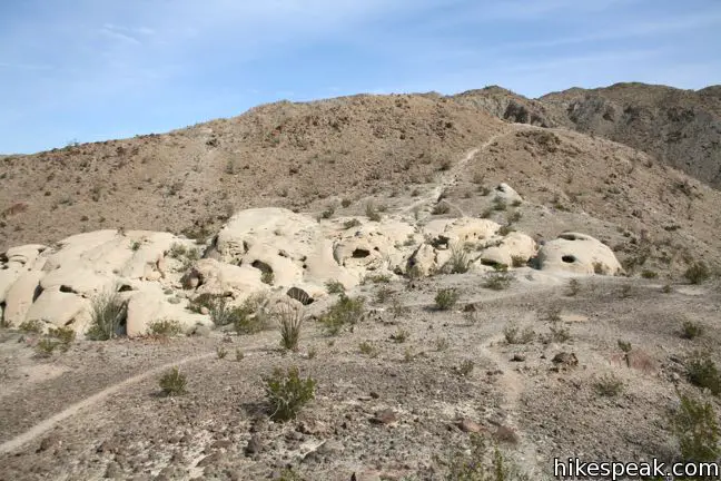
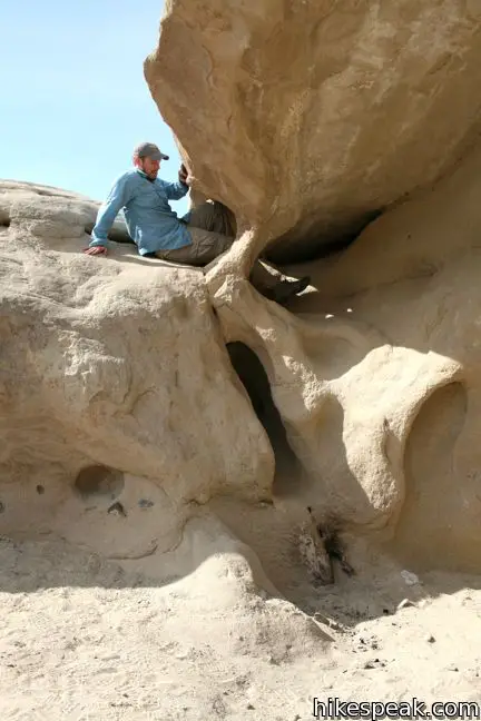
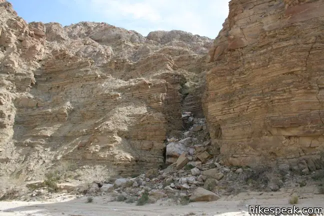
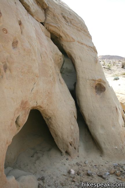
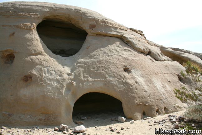
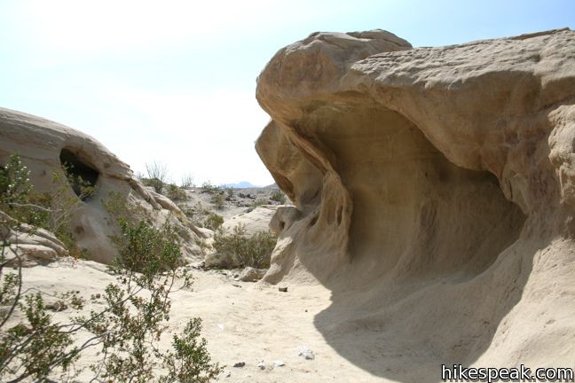
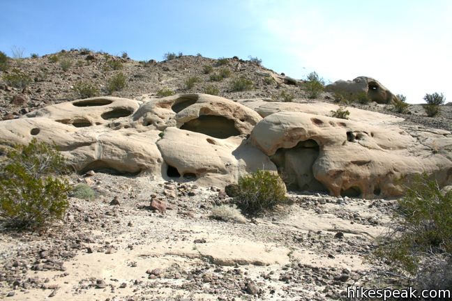
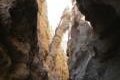
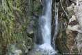
A few single tracks split off up the undulating mountainside. They all end up at the same place, but try to stick to the most worn trail. After one last rise, the wind caves come into view. The pocketed sandstone is full of interesting alcoves, caves and tunnels. Crawl through, climb over, and investigate.
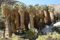
A spur trail heads northeast farther up Fish Creek Mountain, and another heads south a short distance to a small knoll with sweeping views over the wash and badlands. Below the wind caves to the west, a less-used single track descends to a small collection of sandstone caves. This track reunites with the main trail not far above the wash. Descend via this route to add a nice loop to the hike.
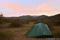
The wind caves are a wonderful destination for a short hike, and getting to Wind Caves Trail is an adventure of its own. Follow the directions below, and enjoy the impressive drive. Dogs are not permitted. No fee or permit is required, so get out and enjoy.
Directions to the Trailhead
- From Christmas Circle in Borrego Springs, drive 11.5 miles southwest on Borrego Springs Road.
- Turn left on Route 78 East and drive 6.6 miles to the desert hamlet of Ocotillo Wells in Ocotillo Wells State Vehicular Recreation Area.
- Turn south on Split Mountain Road.
- About 8 miles from Route 78, and 2 1/4 miles past the Elephant Tree Trail Area, the pavement comes to and end.
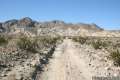
- Turn right on a dirt road up the center of a sandy wash.
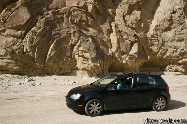
- Road conditions may vary, but the route is typically not entirely suitable for low clearance vehicles.
- After 1.4 miles, cross the turnoff for Fish Creek Campground, and continue up the road.
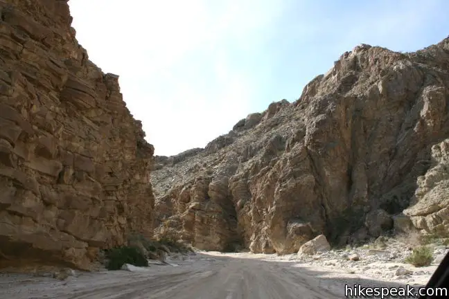
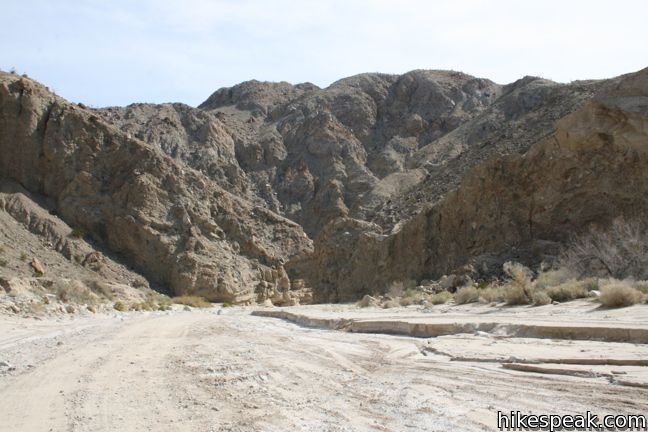
- The canyon narrows and steep stone walls rise up around the road, adding gravity to the trip up the split between Fish Creek Mountain and Vallecito Mountain.
- Drive another 2.75 to the trailhead, located on the left, on the inside of a curve in the road just after it exits the mountains.
- A sign for Wind Caves Trail is positioned at the trailhead.
Trailhead Location
Trailhead address: Fish Creek Wash, Anza-Borrego Desert State Park, Borrego Springs, CA 92004
Trailhead coordinates: 32.9933, -116.1184 (32° 59′ 35.9″N 116° 07′ 06.2″W)
You may also view a regional map of surrounding California Desert trails and campgrounds.


 | Elephant Trees Trail This easy one-mile loop offers a lesson in desert botany including the rare elephant tree. |
 | The Slot This short hike descends through a narrow canyon beneath a natural rock span that is among the most photographed landmarks in Anza-Borrego Desert State Park. |
 | Narrows Earth Trail This 0.5-mile self-guided hike explores the geology of the park. |
 | Calcite Mine Trail This 4.25-mile trek climbs 600 feet to a historic mine site, exploring exciting narrows along the way. |
 | Borrego Palm Canyon Trail This 3.25-mile loop visits a popular palm tree oasis in a canyon west of Borrego Springs. |
 | Hellhole Canyon Trail to Maidenhair Falls This 5.5-mile hike visits a 20-foot waterfall in a canyon near Borrego Springs, making it the perfect place to cool off on a hot day in the California Desert. |
 | Pictograph Trail This 1.8-mile hike visits rock paintings drawn by Kumeyaay Indians who lived in the Anza-Borrego Desert thousands of years ago. |
 | Morteros Trail This 0.6-mile hike visits a village of boulders once occupied by Kumeyaay Indians who left behind Morteros, grinding bowls carved into the rock. |
 | Rainbow Canyon Trail This 2.2-mile adventure follows an undeveloped trail up a colorful canyon full of vibrant rock formations and desert plants. |
 | Hikes in the California Desert Explore more trails in Death Valley National Park, Joshua Tree National Park, Anza-Borrego Desert State Park, and Mojave National Preserve. |
 | Gaviota Wind Caves near Santa Barbara This 2.5-mile hike just off the 101 Freeway visits an interesting formation of wind-carved caves with great ocean views. |
 | Anza-Borrego Desert Campgrounds Four developed campgrounds, eight primitive campgrounds, and extensive roadside camping accommodate your visit to California's largest state park. |
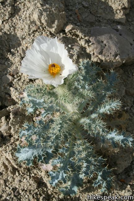
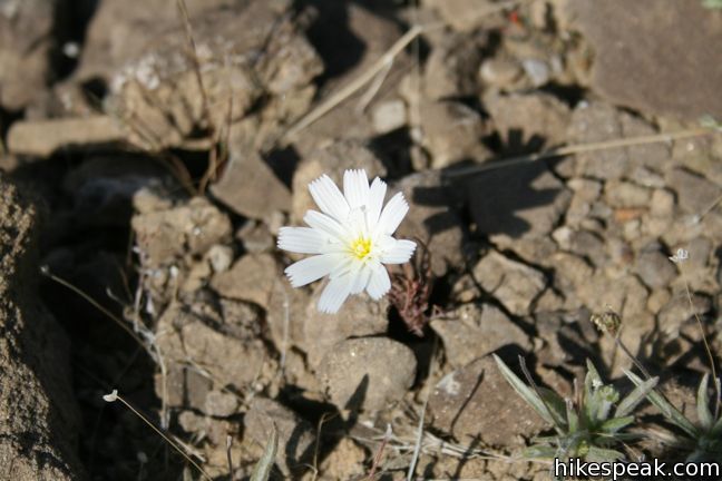
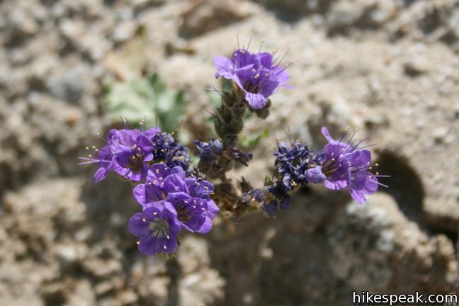
 | Anza-Borrego Desert State Park Wildflowers The desert bloom brings bursts of color to barrel cactus, beavertail cactus, ocotillo, and more. |
Common Questions about Wind Caves Trail in Anza-Borrego Desert State Park
- Is the trail open?
- Yes. You should expect to find that Wind Caves Trail is open. There are no recent reports of trail closures. If you discover that the trail is closed, please help your fellow hikers by reporting a closure.
- Is this trail free to access?
- Yes, Wind Caves Trail is free to access. No entrance fee, pass, or permit is required. If you discover that access rules have changed, please provide feedback on your experience.
- How much time does this hike take?
- It takes approximately 45 minutes to hike Wind Caves Trail. Individual hiking times vary. Add extra time for breaks and taking in the views.
- How long is this hike?
- The hike to Wind Caves Trail is a 1.25 mile out and back with 250 feet of elevation change.
- Are dogs allowed on this trail?
- No, dogs are likely not allowed on Wind Caves Trail. The trail is primarily open to hikers.
- Is Wind Caves Trail good for kids?
- Yes, this hike is likely suitable for children. It is relatively short (1.25 miles) with manageable elevation gain.
- Are there caves on this hike?
- Yes, Wind Caves Trail features caves to explore.
- Where is the trailhead located?
- The trailhead for Wind Caves Trail is located in Borrego Springs, CA.
Trailhead Address:
Fish Creek Wash
Borrego Springs, CA 92004
Trailhead Coordinates:
32.9933, -116.1184 - What are the driving directions to the start of the hike?
To get to the trailhead: From Christmas Circle in Borrego Springs, drive 11.5 miles southwest on Borrego Springs Road. Turn left on Route 78 East and drive 6.6 miles to the desert hamlet of Ocotillo Wells in Ocotillo Wells State Vehicular Recreation Area. Turn south on Split Mountain Road. About 8 miles from Route 78, and 2 1/4 miles past the Elephant Tree Trail Area, the pavement comes to and end. Turn right on a dirt road up the center of a sandy wash. Road conditions may vary, but the route is typically not entirely suitable for low clearance vehicles. After 1.4 miles, cross the turnoff for Fish Creek Campground, and continue up the road. The canyon narrows and steep stone walls rise up around the road, adding gravity to the trip up the split between Fish Creek Mountain and Vallecito Mountain. Drive another 2.75 to the trailhead, located on the left, on the inside of a curve in the road just after it exits the mountains. A sign for Wind Caves Trail is positioned at the trailhead.
View custom Google Maps directions from your current location.
- Are there other trails near Wind Caves Trail?
- Yes, you can find other nearby hikes using the Hikespeak Hike Finder Map.

12 Comments on Wind Caves Trail in Anza-Borrego Desert State Park
What hikers are saying:
✨ Generated summary of user commentsHikers find the journey to the caves as visually rewarding as the destination itself, admiring the unique rock formations along the route. High clearance vehicles are recommended for the rocky and sandy road conditions to avoid getting stuck. Jessica highlights that families can expect a memorable experience with plenty to see before even reaching the trailhead.
4×4 is necessary on the dirt road. I was worried my 2wd pickup would get stuck.
Can I bring my dog here? and do I need a pass? Does it cost anything to enter?
Hi-
Dogs are not allowed. There’s no cost to visit this area of Anza-Borrego Desert State Park. Have a good time!
It looks like you either have a VW Rabbit, or took a picture of someone out there in one.
Is a car like that even able to make it to the wind caves?
The condition of the road in the canyon can change. I’ve driven up to Fish Creek Campground a couple times in a VW hatchback. Once with no clearance issues and the other time scraping through some sand. I was able to drive most of the way up the canyon to Wind Caves Trail until bigger rocks in the road prevented me from driving all the way there. High clearance vehicles would definitely be recommended.
[…] a year and a half ago, we explored the Wind Caves. Being in a place like this, where there are large amounts of rock carved by little more than the […]
I loved your photos of Wind Caves. We are planning a March 2016 trip. Any more recent reports of the drive out to that trailhead? Thanks.
Just wanted to say thank you for the post! Took the family out to the caves yesterday and we had such a good time. We went out in a Honda Pilot, but only had to use our four wheel drive twice, closer to the trail head. So much to see on the way in!
I heard there is something going on at the wind caves over Halloween is that true
What about for a person with autism. How safe is the trail?
[…] explore Fish Creek Wash, an easy trail with access to some of the regions best hikes – like the Wind Caves Trail – or simply stop and climb some rocks for stunning views of the desert […]
We drove out to the trailhead on 2/20/23 in a 4wd Rav4 SUV. The road was rocky but passable, slow going. We’re not off-roaders but most of the vehicles were off-road capable (BTW, it’s not an off-roading area & only street legal vehicles are allowed on the road.) Very interesting rock formations along the road. We followed the tracks of other vehicles.
The Slot Trail is easier to access and has dramatic rock formations.