Pictograph Trail
in Anza-Borrego Desert State Park
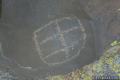
Pictograph Trail provides a 1.8-mile out and back hike to an elephant-sized canvas, otherwise known as a boulder, that was used by Kumeyaay Indian painters who lived in the Anza-Borrego Desert over two thousand years ago.
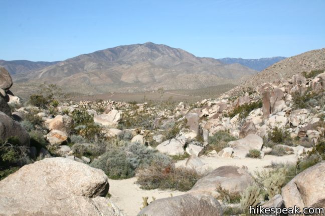
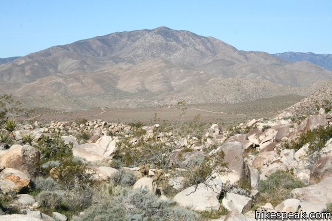
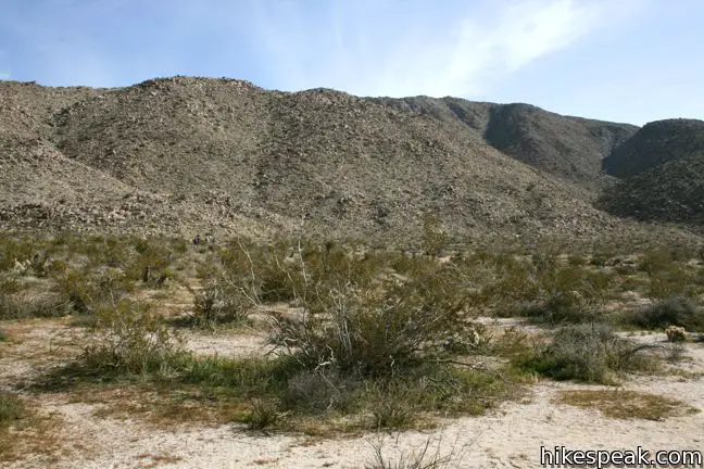
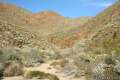
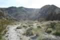
From the trailhead, hike east up a shallow draw in the ridgeline, gaining 190 feet over 0.55 miles. Behind you, there is a grand view over Little Blair Valley and Granite Mountain to the west.
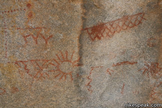
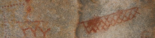
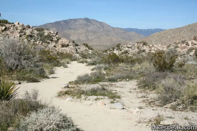
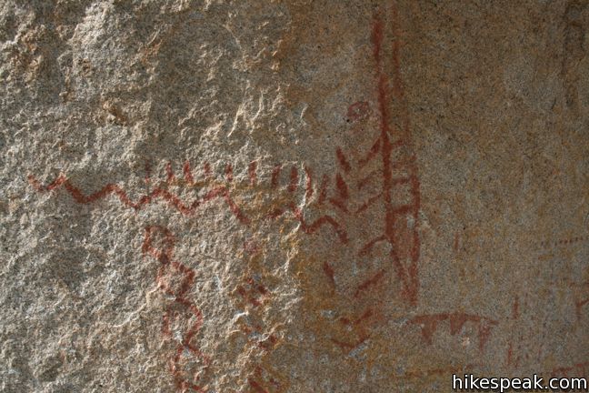
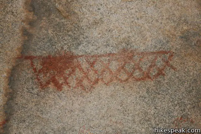
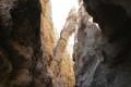
The trail curves slightly to the right along the edge of a small elevated valley, arriving at a large isolated boulder. On the north face, there is a collection of red symbols painted on the rock. The meaning of the pictograph is not completely known. Invent your own story, or simply stand and wonder what life was like in the Anza-Borrego Desert two thousand years ago.
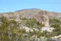
These days, it is less than a mile walk back to your automobile at the trailhead. To extend the hike, continue half a mile past the pictograph up to a knob-like rise in the ridge to the east. Backpackers may also set out northward on an off trail ascent of Whale Peak, the 5,350-foot mountain towering over the pictograph. To learn more about Native American life in the Anza-Borrego Desert, hike the nearby Morteros Trail. And of course, please keep the pictograph free of graffiti.
Directions to the Trailhead
- From Christmas Circle in Borrego Springs, drive 5 miles southwest on Borrego Springs Road.
- Turn right on Route S3 (Yaqui Pass Road) and drive 7 miles south over the ridge to Tamarisk Grove.
- Turn right on Route 78, heading west for another seven miles to Route S2.
- Turn left and drive six miles southeast to Blair Valley.
- Turn left off the pavement and head east through Blair Valley Campground.
- From here, it is 3.7 miles over well-maintained dirt roads to the trailhead.
- There are campsites along the road, as well as a few side roads, so stick to the main channel.
- Drive 2.7 miles around the north edge of Blair Valley to a T-junction.
- Turn left, following the sign for Morteros and Pictograph Trail.
- The trailhead is 2.3 miles ahead at road's end.
Trailhead Location
Trailhead address: Blair Valley, Anza-Borrego Desert State Park, Julian, CA 92036
Trailhead coordinates: 33.01965, -116.3598 (33° 01′ 10.7″N 116° 21′ 35″W)
View Anza-Borrego Desert State Park in a larger map
Or view a regional map of surrounding California Desert trails and campgrounds.


 | Morteros Trail This 0.6-mile hike visits a village of boulders once occupied by Kumeyaay Indians who left behind Morteros, grinding bowls carved into the rock. |
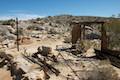 | Marshal South Home Trail This 1.3-mile hike ascends to the ruins of an adobe cabin on Ghost Mountain (Yaquitepec) with great views above Blair Valley. |
 | Rainbow Canyon Trail This 2.2-mile adventure follows an undeveloped trail up a colorful canyon full of vibrant rock formations and desert plants. |
 | Narrows Earth Trail This 0.5-mile self-guided hike explores the geology of the park. |
 | The Slot This short hike descends through a narrow canyon beneath a natural rock span that is among the most photographed landmarks in Anza-Borrego Desert State Park. |
 | Hikes in the California Desert Explore more trails in Death Valley National Park, Joshua Tree National Park, Anza-Borrego Desert State Park, and Mojave National Preserve. |
 | North Lava Bed Wash in Mojave National Preserve This quarter-mile path visits ancient petroglyphs engraved in volcanic rock. |
 | Barker Dam in Joshua Tree National Park This level 1.5-mile loop visits a foreign-looking reservoir and petroglyphs engravings within the Wonderland of Rocks. |
 | Anza-Borrego Desert Campgrounds Four developed campgrounds, eight primitive campgrounds, and extensive roadside camping accommodate your visit to California's largest state park. |
 | Anza-Borrego Desert State Park Wildflowers The desert bloom brings bursts of color to barrel cactus, beavertail cactus, ocotillo, and more. |
Common Questions about Pictograph Trail in Anza-Borrego Desert State Park
- Is the trail open?
- Yes. You should expect to find that Pictograph Trail is open. There are no recent reports of trail closures. If you discover that the trail is closed, please help your fellow hikers by reporting a closure.
- Is this trail free to access?
- Yes, Pictograph Trail is free to access. No entrance fee, pass, or permit is required. If you discover that access rules have changed, please provide feedback on your experience.
- How much time does this hike take?
- It takes approximately 45 minutes to hike Pictograph Trail. Individual hiking times vary. Add extra time for breaks and taking in the views.
- How long is this hike?
- The hike to Pictograph Trail is a 1.8 mile out and back with 190 feet of elevation change.
- Are dogs allowed on this trail?
- No, dogs are likely not allowed on Pictograph Trail. The trail is primarily open to hikers.
- Is Pictograph Trail good for kids?
- Yes, this hike is likely suitable for children. It is relatively short (1.8 miles) with manageable elevation gain.
- Where is the trailhead located?
- The trailhead for Pictograph Trail is located in Julian, CA.
Trailhead Address:
Anza-Borrego Desert State Park
Julian, CA 92036
Trailhead Coordinates:
33.01965, -116.3598 - What are the driving directions to the start of the hike?
To get to the trailhead: From Christmas Circle in Borrego Springs, drive 5 miles southwest on Borrego Springs Road. Turn right on Route S3 (Yaqui Pass Road) and drive 7 miles south over the ridge to Tamarisk Grove. Turn right on Route 78, heading west for another seven miles to Route S2. Turn left and drive six miles southeast to Blair Valley. Turn left off the pavement and head east through Blair Valley Campground. From here, it is 3.7 miles over well-maintained dirt roads to the trailhead. There are campsites along the road, as well as a few side roads, so stick to the main channel. Drive 2.7 miles around the north edge of Blair Valley to a T-junction. Turn left, following the sign for Morteros and Pictograph Trail. The trailhead is 2.3 miles ahead at road's end.
View custom Google Maps directions from your current location.
- Are there other trails near Pictograph Trail?
- Yes, you can find other nearby hikes using the Hikespeak Hike Finder Map.

I did this hike yesterday. The pictographs are worth the hike out. Too bad there is not much known about them, as a little knowledge would make them so much more interesting.