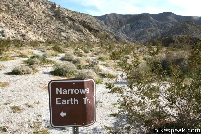
Narrows Earth Trail
in Anza-Borrego Desert State Park
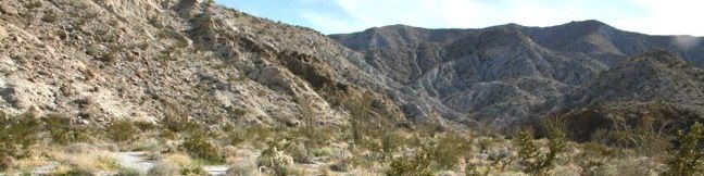
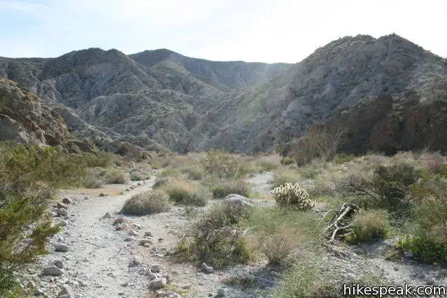
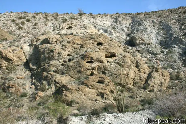
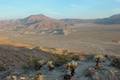
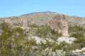
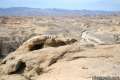
What Elephant Trees Trail is to desert botany, Narrows Earth Trail is to desert geology. The pamphlet available at the start of this half-mile loop describes the geological features present in Anza-Borrego Desert State Park. The desert is a great place to learn about geology. Sparse vegetation exposes the earth’s rock skeleton, bringing the secrets of the land’s formation to bear.
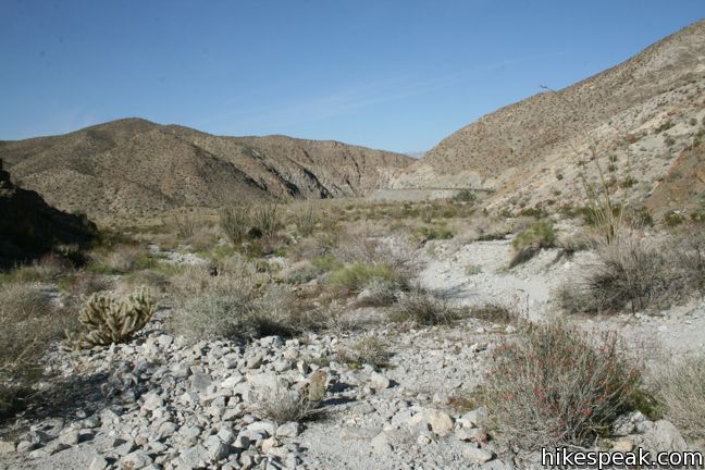
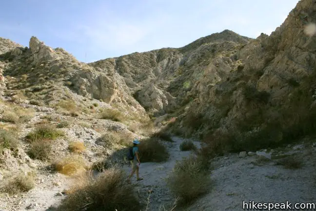
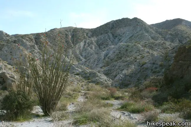
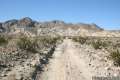
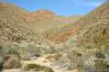
Begin hiking around the loop, up the east edge of Powder Dump Wash. At the top of this small sandy wash cut into the Vallecito Mountains, the trail turns around and backtracks along the west wall toward the trailhead. The hike does not go through any narrows. Instead, this is an “earth” trail just south of a gap between Yaqui Ridge and the Vallecito Mountains that is called the narrows. Route 78 passes through this gap, but Narrows Earth Trail does not.
Entries in the pamphlet coincide with seven markers along the trail, describing the variety of rocks visible in the park. Fault lines and other erosive powers that sculpt the landscape are also explained.
Narrows Earth Trail is a concise outdoor classroom, and the best trek in Anza-Borrego Desert State Park for a lesson in the different rocks that compose the park’s impressive landscapes. Knowledge gained on this short self-guided hike will help you to identify similar features throughout the park. When you know what to look for, desert geology is quite fascinating.
To explore one of the other self-guided nature trail in Anza-Borrego Desert State Park, check out Yaqui Well Trail, Elephant Trees Trail, or Cactus Loop Trail.
Directions to the Trailhead
- From Christmas Circle in Borrego Springs, drive 11.5 miles southwest on Borrego Springs Road.
- Turn right on Route 78 west and drive 4 miles through a dramatic gap between Yaqui Ridge and the Vallecito Mountains.
- Pull off the road into the trailhead parking area on the south (left) side of the road near mile marker 81.5, just south of Quartz Vein Wash.
Trailhead Location
Trailhead address: Route 78, Anza-Borrego Desert State Park, Borrego Springs, CA 92004
Trailhead coordinates: 33.13072, -116.30155 (33° 07′ 50.6″N 116° 18′ 05.6″W)
You may also view a regional map of surrounding California Desert trails and campgrounds.
 | Yaqui Well Trail This 1.6-mile out and back hike on a self-guided nature trail explores area botany and history, crossing a wash to reach a rare desert water source. |
 | The Slot This short hike descends through a narrow canyon beneath a natural rock span that is among the most photographed landmarks in Anza-Borrego Desert State Park. |
 | Kenyon Overlook Trail This 1.15-mile loop sets out from Yaqui Pass to reach an incredible viewpoint across Mescal Bajada. |
 | Calcite Mine Trail This 4.25-mile trek climbs 600 feet to a historic mine site, exploring exciting narrows along the way. |
 | Borrego Palm Canyon Trail This 3.25-mile loop visits a popular palm tree oasis in a canyon west of Borrego Springs. |
 | Hellhole Canyon Trail to Maidenhair Falls This 5.5-mile hike visits a 20-foot waterfall in a canyon near Borrego Springs, making it the perfect place to cool off on a hot day in the California Desert. |
 | Pictograph Trail This 1.8-mile hike visits rock paintings drawn by Kumeyaay Indians who lived in the Anza-Borrego Desert thousands of years ago. |
 | Morteros Trail This 0.6-mile hike visits a village of boulders once occupied by Kumeyaay Indians who left behind Morteros, grinding bowls carved into the rock. |
 | Rainbow Canyon Trail This 2.2-mile adventure follows an undeveloped trail up a colorful canyon full of vibrant rock formations and desert plants. |
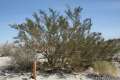 | Elephant Trees Trail This easy one-mile loop offers a lesson in desert botany including the rare elephant tree. |
 | Wind Caves Trail This 1.25-mile round trip hike climbs 250 feet to a sandstone formation that begs to be explored. |
 | Hikes in the California Desert Explore more trails in Death Valley National Park, Joshua Tree National Park, Anza-Borrego Desert State Park, and Mojave National Preserve. |
 | Anza-Borrego Desert Campgrounds Four developed campgrounds, eight primitive campgrounds, and extensive roadside camping accommodate your visit to California's largest state park. |
 | Anza-Borrego Desert State Park Wildflowers The desert bloom brings bursts of color to barrel cactus, beavertail cactus, ocotillo, and more. |
Common Questions about Narrows Earth Trail in Anza-Borrego Desert State Park
- Is the trail open?
- Yes. You should expect to find that Narrows Earth Trail is open. There are no recent reports of trail closures. If you discover that the trail is closed, please help your fellow hikers by reporting a closure.
- Is this trail free to access?
- Yes, Narrows Earth Trail is free to access. No entrance fee, pass, or permit is required. If you discover that access rules have changed, please provide feedback on your experience.
- How much time does this hike take?
- It takes approximately 15 minutes to hike Narrows Earth Trail. Individual hiking times vary. Add extra time for breaks and taking in the views.
- How long is this hike?
- The hike to Narrows Earth Trail is a 0.5 mile loop with 50 feet of elevation change.
- Are dogs allowed on this trail?
- No, dogs are likely not allowed on Narrows Earth Trail. The trail is primarily open to hikers.
- Is Narrows Earth Trail good for kids?
- Yes, this hike is likely suitable for children. It is relatively short (0.5 miles) with manageable elevation gain.
- Where is the trailhead located?
- The trailhead for Narrows Earth Trail is located in Borrego Springs, CA.
Trailhead Address:
Route 78
Borrego Springs, CA 92004
Trailhead Coordinates:
33.13072, -116.30155 - What are the driving directions to the start of the hike?
To get to the trailhead: From Christmas Circle in Borrego Springs, drive 11.5 miles southwest on Borrego Springs Road. Turn right on Route 78 west and drive 4 miles through a dramatic gap between Yaqui Ridge and the Vallecito Mountains. Pull off the road into the trailhead parking area on the south (left) side of the road near mile marker 81.5, just south of Quartz Vein Wash.
View custom Google Maps directions from your current location.
- Are there other trails near Narrows Earth Trail?
- Yes, you can find other nearby hikes using the Hikespeak Hike Finder Map.

Go the extra miles...
Submit a rating of this hike to go with your comment. Contribute to the average trail rating.