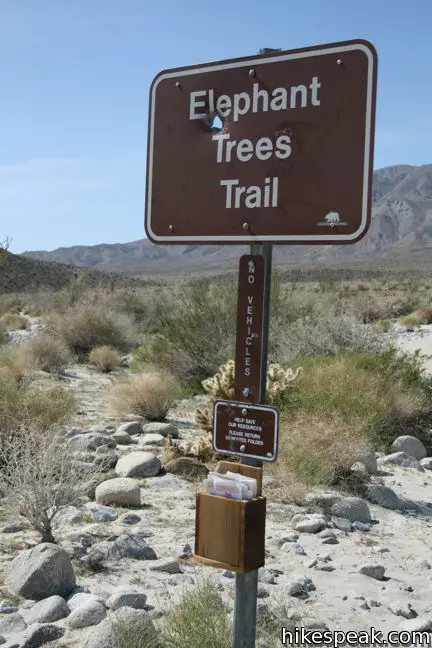
Elephant Trees Trail
in Anza-Borrego Desert State Park
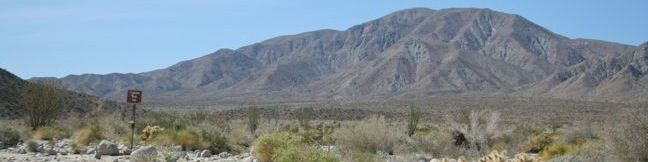
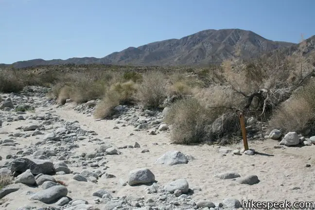
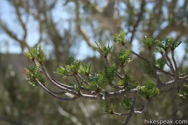
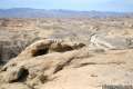
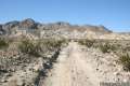
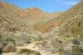
The elephant tree is likely the most unique plant in the entire Anza-Borrego Desert, and only one such tree stands along this one-mile nature trail. Pick up a pamphlet at the start of this self-guided loop, and enjoy a brief lesson on elephant trees and other more common vegetation. This is a great trail for those interested in learning about plant life in the Anza-Borrego Desert.

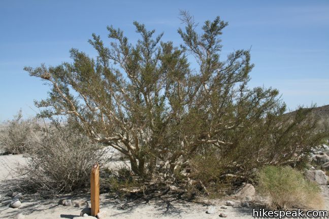
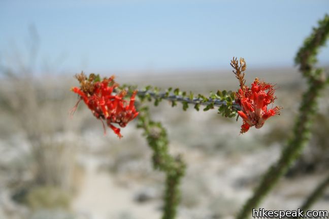
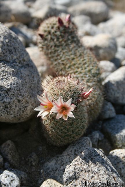
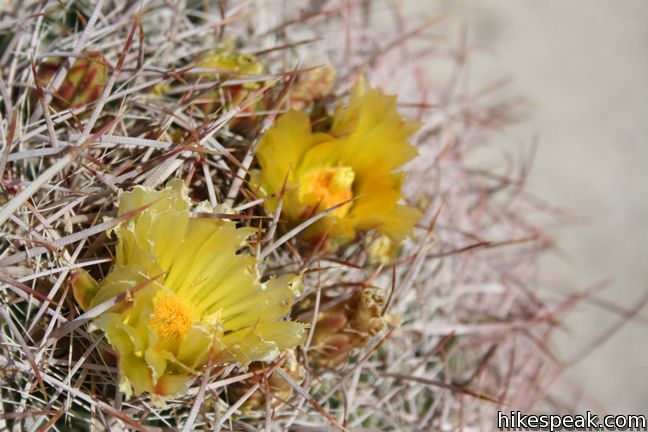
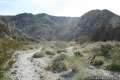
Did you know ocotillo can live to be 200 years old? Did you know desert lavender changes its leaves with the season? Discover even more about desert plants from readings in the pamphlet that coincide with numbered markers along the way. This easy trail circles a level wash with a diversity of desert cacti, brush and trees. Half way around the loop, the botany lesson comes to a climax as you arrive at a sole elephant tree. This rare trunky tree with small green leaves grows natively in the Anza-Borrego Desert and areas of Mexico. Scientists first recorded elephant trees at this location in 1937, when over a hundred were growing along Alma Wash.
This easy-to-follow trail only has 50 feet of elevation change. Relax and pay close attention to the sample of desert botany that is present throughout Anza-Borrego Desert State Park. To explore one of the other self-guided nature trail in Anza-Borrego Desert State Park, check out Yaqui Well Trail, Cactus Loop Trail, or Narrows Earth Trail.
Directions to the Trailhead
- From Christmas Circle in Borrego Springs, drive 11.5 miles southwest on Borrego Springs Road.
- Turn left on Route 78 East and drive 6.6 miles to Ocotillo Wells in Ocotillo Wells State Vehicular Recreation Area.
- Turn south on Split Mountain Road and drive 5.8 miles to an information panel for the elephant trees.
- Turn right and drive one mile up a dirt road to the trailhead.
- The road is rather rocky and low clearance vehicles will have to stop a quarter mile from the trailhead.
Trailhead Location
Trailhead address: Split Mountain Road, Anza-Borrego Desert State Park, Borrego Springs, CA 92004
Trailhead coordinates: 33.068153, -116.1168 (33° 04′ 05.35″N 116° 07′ 00.47″W)
View Anza-Borrego Desert State Park in a larger map
Or view a regional map of surrounding California Desert trails and campgrounds.


 | Wind Caves Trail This 1.25-mile round trip hike climbs 250 feet to a sandstone formation near Elephant Tree Trail that begs to be explored. |
 | The Slot This short hike descends through a narrow canyon beneath a natural rock span that is among the most photographed landmarks in Anza-Borrego Desert State Park. |
 | Narrows Earth Trail This 0.5-mile self-guided hike explores the geology of the park. |
 | Yaqui Well Trail This 1.6-mile out and back hike on a self-guided nature trail explores area botany and history, crossing a wash to reach a rare desert water source. |
 | Borrego Palm Canyon Trail This 3.25-mile loop visits a popular palm tree oasis in a canyon west of Borrego Springs. |
 | Hellhole Canyon Trail to Maidenhair Falls This 5.5-mile hike visits a 20-foot waterfall in a canyon near Borrego Springs, making it the perfect place to cool off on a hot day in the California Desert. |
 | Pictograph Trail This 1.8-mile hike visits rock paintings drawn by Kumeyaay Indians who lived in the Anza-Borrego Desert thousands of years ago. |
 | Morteros Trail This 0.6-mile hike visits a village of boulders once occupied by Kumeyaay Indians who left behind Morteros, grinding bowls carved into the rock. |
 | Calcite Mine Trail This 4.25-mile trek climbs 600 feet to a historic mine site, exploring exciting narrows along the way. |
 | Rainbow Canyon Trail This 2.2-mile adventure follows an undeveloped trail up a colorful canyon full of vibrant rock formations and desert plants. |
 | Hikes in the California Desert Explore more trails in Death Valley National Park, Joshua Tree National Park, Anza-Borrego Desert State Park, and Mojave National Preserve. |
 | Anza-Borrego Desert Campgrounds Four developed campgrounds, eight primitive campgrounds, and extensive roadside camping accommodate your visit to California's largest state park. |
 | Anza-Borrego Desert State Park Wildflowers The desert bloom brings bursts of color to barrel cactus, beavertail cactus, ocotillo, and more. |
- Elephant Trees Trail in Best Easy Day Hikes Anza-Borrego by Bill Cunningham (opens in a new tab)
- Elephant Trees Trail in California's Desert Parks by John McKinney (opens in a new tab)
- Elephant Trees Trail on naturalbornhikres.com (opens in a new tab)
- The official website for Anza-Borrego Desert State Park (opens in a new tab)
Common Questions about Elephant Trees Trail in Anza-Borrego Desert State Park
- Is the trail open?
- Yes. You should expect to find that Elephant Trees Trail is open. There are no recent reports of trail closures. If you discover that the trail is closed, please help your fellow hikers by reporting a closure.
- Is this trail free to access?
- Yes, Elephant Trees Trail is free to access. No entrance fee, pass, or permit is required. If you discover that access rules have changed, please provide feedback on your experience.
- How much time does this hike take?
- It takes approximately 30 minutes to hike Elephant Trees Trail. Individual hiking times vary. Add extra time for breaks and taking in the views.
- How long is this hike?
- The hike to Elephant Trees Trail is a 1 mile loop with 50 feet of elevation change.
- Are dogs allowed on this trail?
- No, dogs are likely not allowed on Elephant Trees Trail. The trail is primarily open to hikers.
- Is Elephant Trees Trail good for kids?
- Yes, this hike is likely suitable for children. It is relatively short (1 miles) with manageable elevation gain.
- Where is the trailhead located?
- The trailhead for Elephant Trees Trail is located in Borrego Springs, CA.
Trailhead Address:
Split Mountain Road
Borrego Springs, CA 92004
Trailhead Coordinates:
33.068153, -116.1168 - What are the driving directions to the start of the hike?
To get to the trailhead: From Christmas Circle in Borrego Springs, drive 11.5 miles southwest on Borrego Springs Road. Turn left on Route 78 East and drive 6.6 miles to Ocotillo Wells in Ocotillo Wells State Vehicular Recreation Area. Turn south on Split Mountain Road and drive 5.8 miles to an information panel for the elephant trees. Turn right and drive one mile up a dirt road to the trailhead. The road is rather rocky and low clearance vehicles will have to stop a quarter mile from the trailhead.
View custom Google Maps directions from your current location.
- Are there other trails near Elephant Trees Trail?
- Yes, you can find other nearby hikes using the Hikespeak Hike Finder Map.

Found the trailhead very easily. There was only one trailguide in the box. No map in the trailguide. Found the first 6 markers, but could not find any of the others and lost the trail. Never got to the Elephant Tree and was very disappointed. Be sure to print the map out from the computer before going on the hike. It might give you a better chance of staying on the trail and seeing the tree.
Exit off Split Mountain Road and trailhead were easy to find. Two very faded and weathered brochures were in the map box of the trailhead. Found the first seven markers easily, but the the wash area was washed out. We wandered around for awhile then went back to the start and began again going backwards around the trail… This proved to work as we were able to find the remainder of the markers and the Elephant Tree. Very enjoyable walk as well as imnformative.
A lot of foot traffic frequents this trail. Trail is marked fairly well with rocks and wood markers. I had no problems locating the elephant tree.