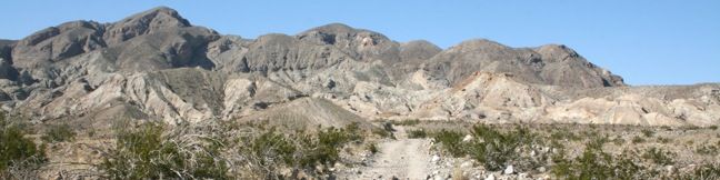
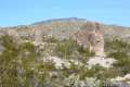
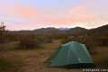
For a brief period at the start of America’s involvement in World War Two, this area was heavily mined for its high-grade calcite, a mineral then used to make bomb sights. This approximately 4-mile long expedition follows an old mining road into the Santa Rosa Mountains, crossing a narrow ravine with slot canyons that hikers may explore to add variety and excitement to this trek in Anza-Borrego Desert State Park.
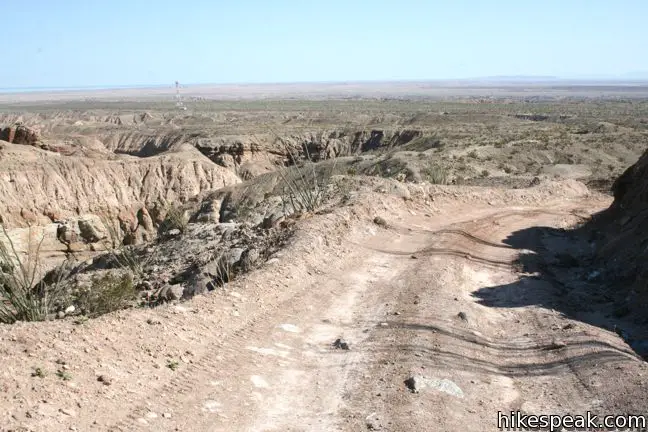
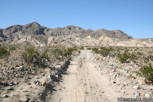
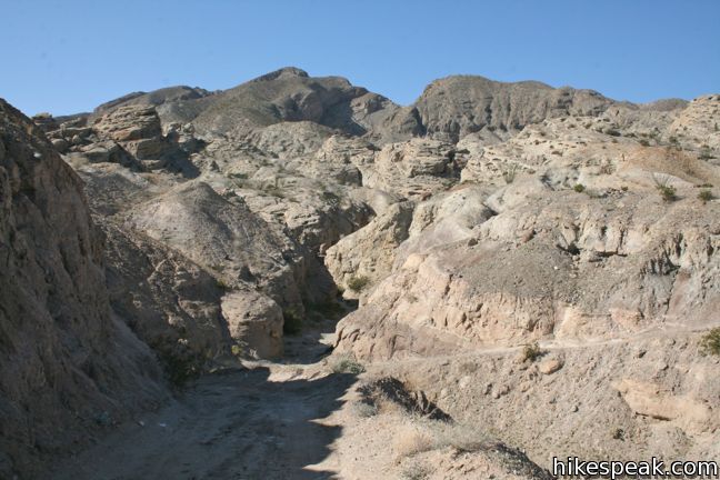
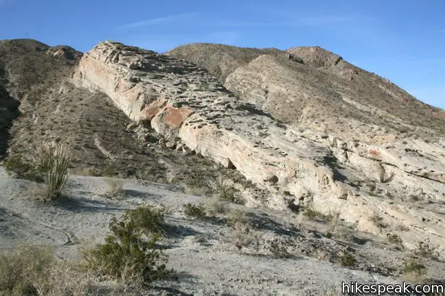
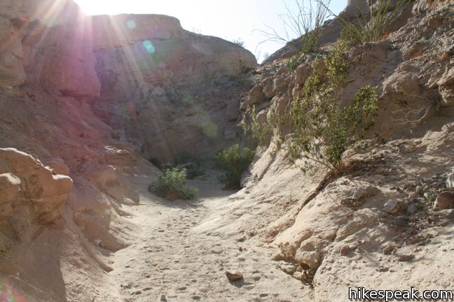
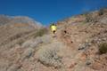
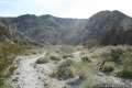
From the not-entirely-well-marked trailhead on route S22 east of Borrego Springs, begin down Calcite Mine Road, which immediately drops seventy-five feet into Palm Wash. Continue up the dirt road across desert badlands toward a mine built into Pyramid Peak. You are hiking up a 4X4 road so look out for occasional vehicle traffic.
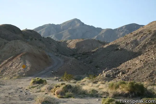
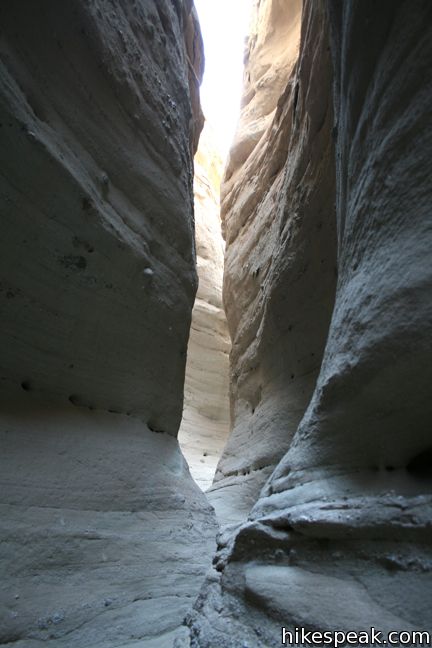
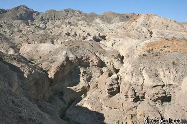
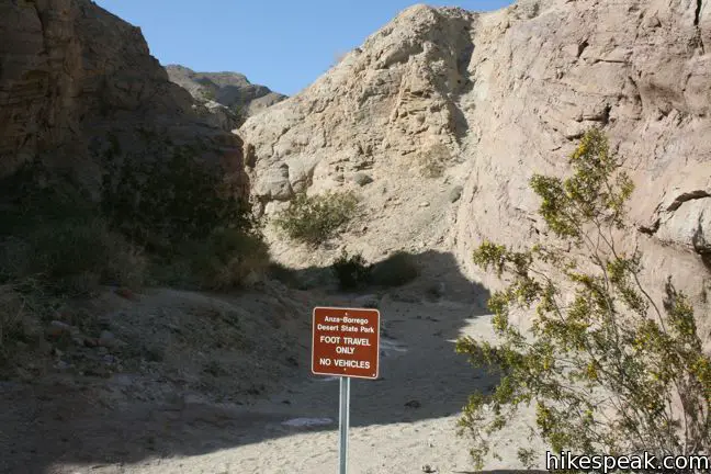
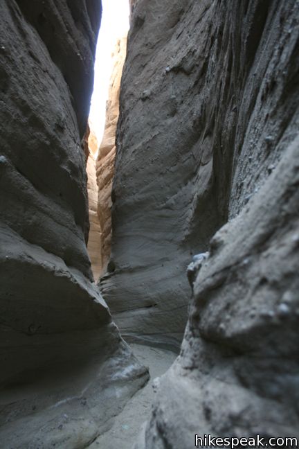
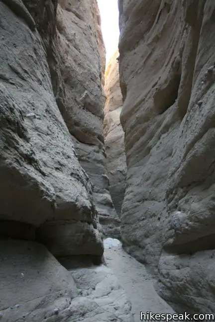
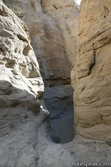
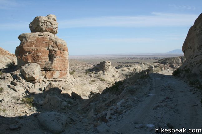
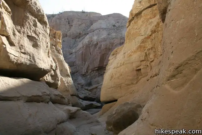
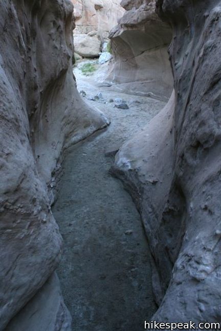
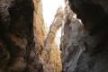
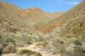
The road dips into a ravine 1.4 miles from the start, and half a mile from Calcite Mine. Above and below the road are narrows open only to hikers. To venture up the ravine to the mine site, leave the road and turn left. After a few hundred feet, the ravine narrows to just a few feet wide. Weave your way through winding water-swept sandstone, climbing a few pour-overs that obstruct the path.
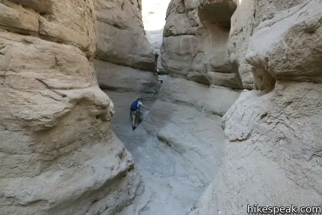
The trench eventually widens and arrives at a ten-foot dry falls. Retreat a few hundred yards and look for a steep track ascending through a gap on the east wall of the canyon.
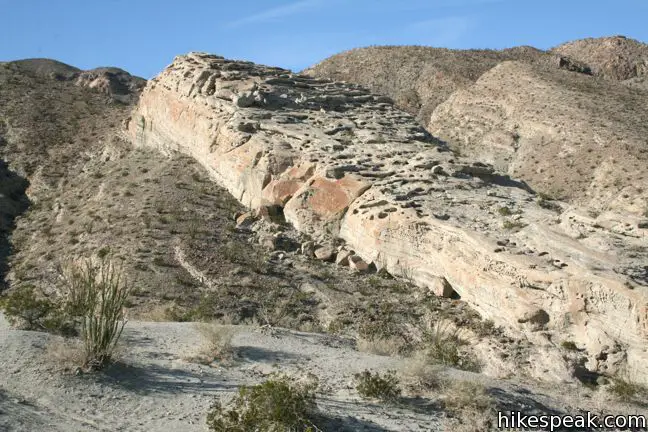
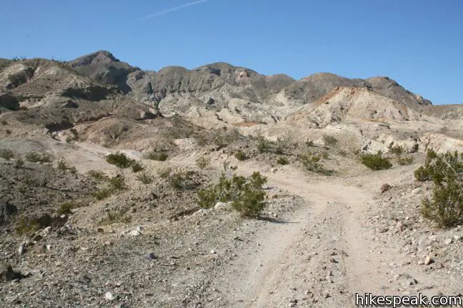
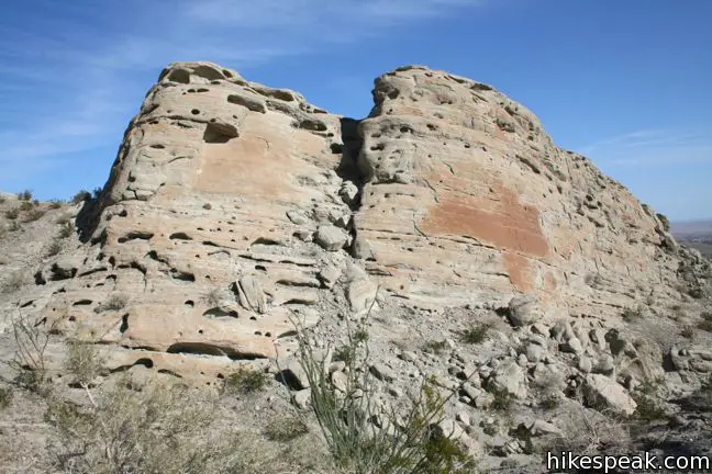
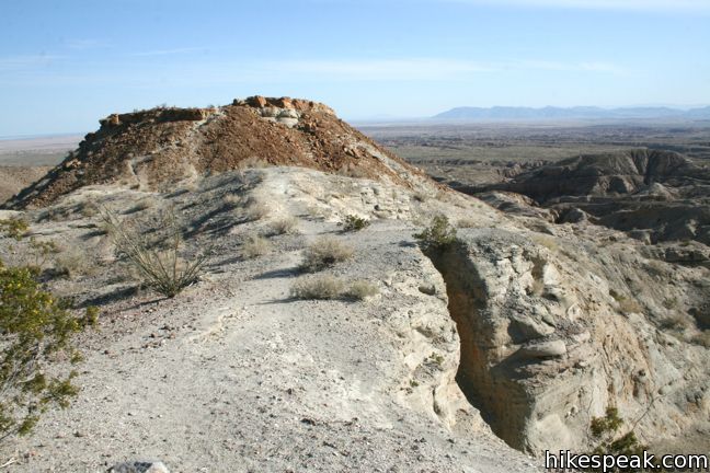
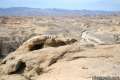
Climb to the rim and turn right, marching east on a faint and sometimes invisible footpath. Worry not, the mine is near. Hike over a low ridge and across the top of a small depression to reach the mine. You will pass to the left of a tall porous rock formation before stepping down to a large turnaround area at the top of the road.
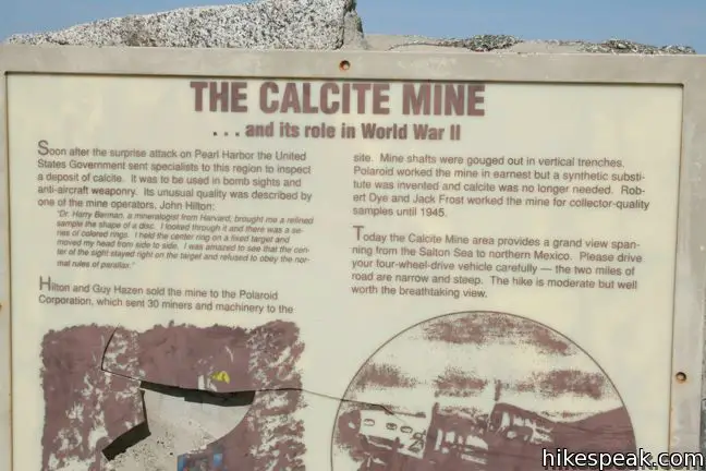
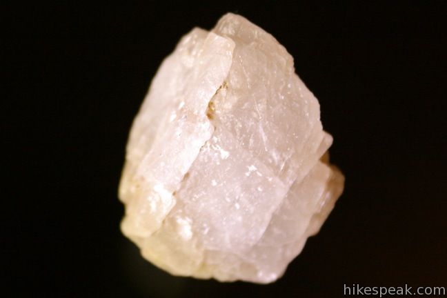
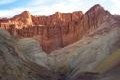
This is the mine site, though there is no rusting equipment to identify the location. Look below your feet and you are sure to spot a few pieces of calcite glistening on the ground. Calcite Mine played a brief but important role in U.S. history. After the attack on Pearl Harbor, military specialists pinpointed this rich deposit of optical-grade calcite, an essential material in the manufacturing of precision bomb sights and anti-aircraft weaponry. The discovery led to vigorous trench mining, which came to an end as quickly as it began when a synthetic substitute was created that held the same optical qualities as calcite and was less expensive to produce.

Footpaths leave Calcite Mine in several directions. Take the opportunity to explore.
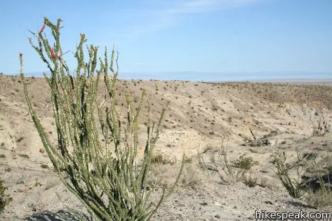
A track descending southeast to a rocky mound offers nice view over the vast badlands. The Salton Sea is visible to the east, a full 1,300 feet below Calcite Mine at 226 feet below sea level. North of Calcite Mine is the aptly named Locomotive Rock, a long prominent formation with jagged steps that stands out from the landscape and is identifiable from the trailhead.
A rugged jeep trail drops into the canyon below Locomotive Rock, allowing even greater exploration.
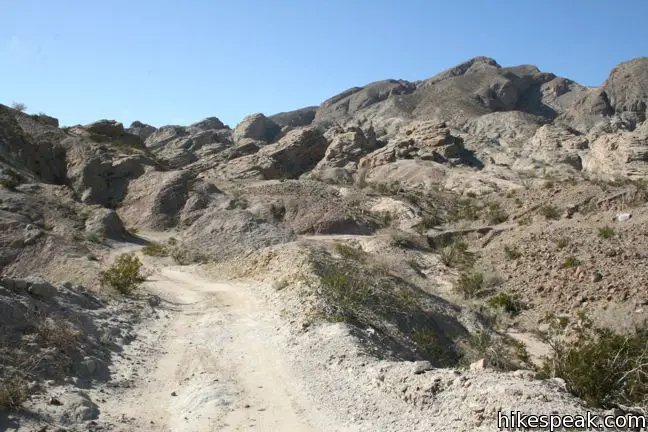
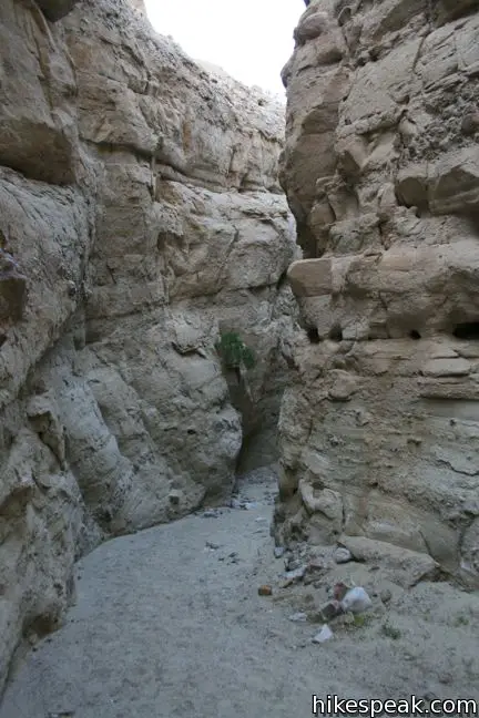
When you are ready to head out, hike half a mile back down the road to the ravine where you first went off-road to explore the narrows. Now turn left to head downhill through a lower slot.
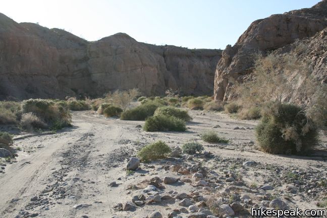
After 0.45 miles of fun, the narrows join a larger branch of the canyon. Turn right and stride down to the top of another 4X4 road.
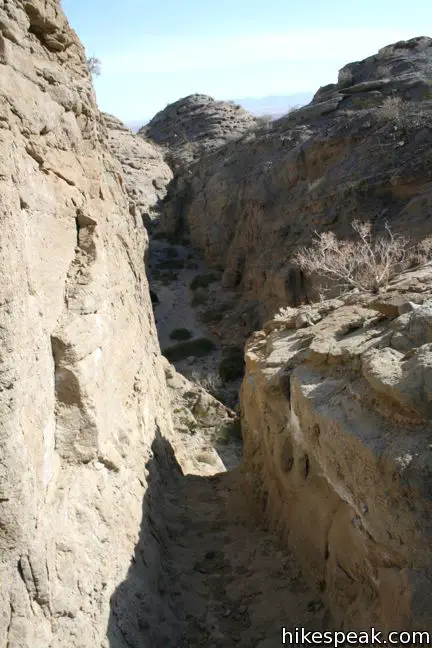
About a quarter mile down the wash, turn right up a steep jeep road. The road is faint, but it is very important not to miss this turn.
If you continue down the wash, it will angle progressively farther to the east, away from the trailhead, resulting in a frustrating unplanned extension of several miles. It is quite easy to lose your sense of direction in these winding desert channels, which is why it is important to hike with a reliable map, and useful to carry a GPS device. Assuming you don’t mistakenly continue down the wash (man, that would be frustrating…), hike out of the wash up the jeep trail connecting to Calcite Mine Road. Turn left and return to the trailhead, less than a mile away.
This figure-eight-shaped loop visits enthralling narrows and a mine site important to the history of the Anza-Borrego Desert.
Calcite Mine is 1.9 miles from Route S22 over the mine road, and a little farther through the narrows. Plan to hike at least a quarter mile around the mine site on this varied 4.25-mile trek with 600 feet of elevation between the low and high points.
No fee or permit is required to visit Calcite Mine and the adjacent narrows in Anza-Borrego Desert State Park, so get out enjoy.
Directions to the Trailhead
- From Christmas Circle in Borrego Springs, drive east for 4.3 miles on Palm Canyon Drive.
- The road bends north, becoming Pegleg Road.
- After 2.4 miles, the road turns east onto Borrego Salton Seaway (Route S22).
- Drive another 12.4 miles to the trailhead.
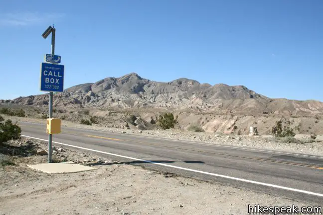
- A large turnout is on the north side of the road near mile marker 38.
- Calcite Mine Trail begins 0.2 miles to the east (marker 38.2).
- Directly across from the trailhead is a smaller turnout on the south side of the road near emergency call box 382.
- Park in either spot, and walk to the display panel at the start of Calcite Mine Road, which describes the history of Calcite Mine.
Trailhead Location
Trailhead address: Borrego Salton Seaway & Calcite Road, Anza-Borrego Desert State Park, Borrego Springs, CA 92004
Trailhead coordinates: 33.2811, -116.0964 (33° 16′ 52″N 116° 05′ 47″W)
View Anza-Borrego Desert State Park in a larger map
Or view a regional map of surrounding California Desert trails and campgrounds.


 | Borrego Palm Canyon Trail This 3.25-mile loop visits a popular palm tree oasis in a canyon west of Borrego Springs. |
 | Panoramic Overlook Trail The 1-mile round trip hike ascends a ridge on the south side of Borrego Palm Canyon to sweeping views of the San Ysidro Mountains and Borrego Valley. |
 | Hellhole Canyon Trail to Maidenhair Falls This 5.5-mile hike visits a 20-foot waterfall in a canyon near Borrego Springs, making it the perfect place to cool off on a hot day in the California Desert. |
 | The Slot This short hike descends through a narrow canyon beneath a natural rock span that is among the most photographed landmarks in Anza-Borrego Desert State Park. |
 | Narrows Earth Trail This 0.5-mile self-guided hike explores the geology of the park. |
 | Elephant Trees Trail This easy one-mile loop offers a lesson in desert botany including the rare elephant tree. |
 | Wind Caves Trail This 1.25-mile round trip hike climbs 250 feet to a sandstone formation that begs to be explored. |
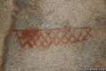 | Pictograph Trail This 1.8-mile hike visits rock paintings drawn by Kumeyaay Indians who lived in the Anza-Borrego Desert thousands of years ago. |
 | Morteros Trail This 0.6-mile hike visits a village of boulders once occupied by Kumeyaay Indians who left behind Morteros, grinding bowls carved into the rock. |
 | Rainbow Canyon Trail This 2.2-mile adventure follows an undeveloped trail up a colorful canyon full of vibrant rock formations and desert plants. |
 | Hikes in the California Desert Explore more trails in Death Valley National Park, Joshua Tree National Park, Anza-Borrego Desert State Park, and Mojave National Preserve. |
 | Golden Canyon - Gower Gulch Loop in Death Valley National Park This 4-mile loop travels up canyons and across badlands in a stunning region of the park near Furnace Creek. |
 | Contact Mine in Joshua Tree National Park This 3.9-mile hike ascends 700 feet up a wash, a canyon, and an old road to a mountainside mine site that offers a glimpse into the mining history of Joshua Tree. |
 | New York Peak in Mojave National Preserve This 7 to 9-mile round trip hike travels an old mining road before summiting the highest point of the New York Range in the northeast corner of the preserve. |
 | Anza-Borrego Desert Campgrounds Four developed campgrounds, eight primitive campgrounds, and extensive roadside camping accommodate your visit to California's largest state park. |
 | Anza-Borrego Desert State Park Wildflowers The desert bloom brings bursts of color to barrel cactus, beavertail cactus, ocotillo, and more. |
- Calcite Mine Trail on sandiegoreader.com (opens in a new tab)
- Calcite Mine Trail on modernhiker.com (opens in a new tab)
- Calcite Mine Trail on sandiegouniontribune.com (opens in a new tab)
- Calcite Mine Trail on calipidder.com (opens in a new tab)
- The official website for Anza-Borrego Desert State Park (opens in a new tab)
Common Questions about Calcite Mine Trail and Narrows in Anza-Borrego Desert State Park
- Is the trail open?
- Yes. You should expect to find that Calcite Mine Trail and Narrows is open. There are no recent reports of trail closures. If you discover that the trail is closed, please help your fellow hikers by reporting a closure.
- Is this trail free to access?
- Yes, Calcite Mine Trail and Narrows is free to access. No entrance fee, pass, or permit is required. If you discover that access rules have changed, please provide feedback on your experience.
- How much time does this hike take?
- It takes approximately 2 hours to hike Calcite Mine Trail and Narrows. Individual hiking times vary. Add extra time for breaks and taking in the views.
- How long is this hike?
- The hike to Calcite Mine Trail and Narrows is a 4 mile loop with 600 feet of elevation change.
- Are dogs allowed on this trail?
- No, dogs are likely not allowed on Calcite Mine Trail and Narrows. The trail is primarily open to hikers.
- Where is the trailhead located?
- The trailhead for Calcite Mine Trail and Narrows is located in Borrego Springs, CA.
Trailhead Address:
Borrego Salton Seaway
Borrego Springs, CA 92004
Trailhead Coordinates:
33.2811, -116.0964 - What are the driving directions to the start of the hike?
To get to the trailhead: From Christmas Circle in Borrego Springs, drive east for 4.3 miles on Palm Canyon Drive. The road bends north, becoming Pegleg Road. After 2.4 miles, the road turns east onto Borrego Salton Seaway (Route S22). Drive another 12.4 miles to the trailhead. A large turnout is on the north side of the road near mile marker 38. Calcite Mine Trail begins 0.2 miles to the east (marker 38.2). Directly across from the trailhead is a smaller turnout on the south side of the road near emergency call box 382. Park in either spot, and walk to the display panel at the start of Calcite Mine Road, which describes the history of Calcite Mine.
View custom Google Maps directions from your current location.
- Are there other trails near Calcite Mine Trail and Narrows?
- Yes, you can find other nearby hikes using the Hikespeak Hike Finder Map.

8 Comments on Calcite Mine Trail and Narrows in Anza-Borrego Desert State Park
What hikers are saying:
✨ Generated summary of user commentsHikers find this trail to be a blast for families, offering a challenging yet rewarding experience filled with side slot canyons to explore. Reaching the summit reveals impressive vistas that make the effort worthwhile. Visitors should watch for occasional jeep traffic sharing the road while navigating the terrain.
“Lots of little side slot canyons to explore.” Jump to comment ↓
“If you make it to the top of the trail, the vistas are something to behold!” Jump to comment ↓
I enjoy this trip report and the pics. Looks like a place of solitude – did you see any 4×4 trucks while on your hike?
I saw a couple trucks on the road (on a friday), but it is a great hiking route and the narrows are closed to trucks.
We just did this hike with a 5 and 7 year old and had a blast. We saw a group of jeeps coming out on the road as we hiked in. It was a lot of fun, pretty challenging. Lots of little side slot canyons to explore. If you make it to the top of the trail, the vistas are something to behold!
I just wanted to thank you for the fabulous guide. We took the trail just a couple of days ago and had a great time — your instructions were very clear!
Do you have the GPX file of this trail I can import? Thanks.
Hi. That’s not available at the moment, but potentially in the future.
[…] More reading about this hike: Hikespeak […]
[…] Anza Borrego Desert State Park, Calcite Mine Trail- Borrego Springs, Ca […]