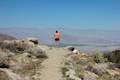
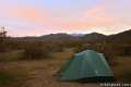
Hellhole Canyon is backed up against the San Ysidro Mountains just southwest of the Anza-Borrego Desert State Park Visitor Center in Borrego Springs. The ominously named canyon is home to Maidenhair Falls, a seasonal 20-foot waterfall that makes a refreshing hiking destination on a hot day in the California desert. If you are visiting the park in early spring, or any time rains bring water to Hellhole Canyon, Maidenhair Falls should be on your itinerary. The trail to the mouth of the canyon is wide and well maintained, but when the canyon narrows, rock scrambling becomes mandatory and there is only a faint path to follow to the top of this 5.5-mile round trip hike with 1,000 feet of elevation gain.
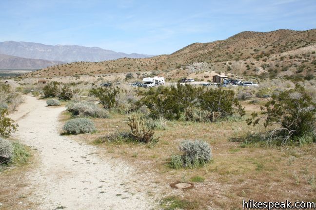
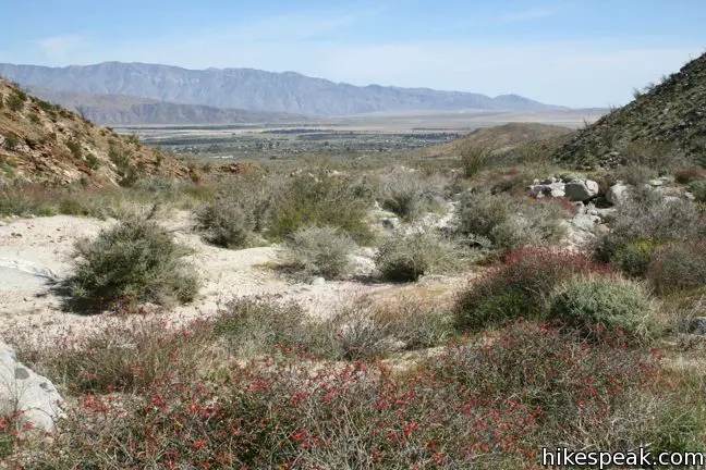
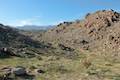
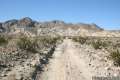
Starting from the same trailhead as the California Riding and Hiking Trail, head west toward Hellhole Canyon. Three canyons are visible from the start of the trail. Hellhole Canyon is furthest to the left, and conveniently that’s exactly where the trail will take you.
A quarter mile from the start, go straight through a junction with California Riding and Hiking Trail, which heads up into the mountains to the left. A single track coming in from the right connects to the visitor center, which is a more distant starting point for this hike.
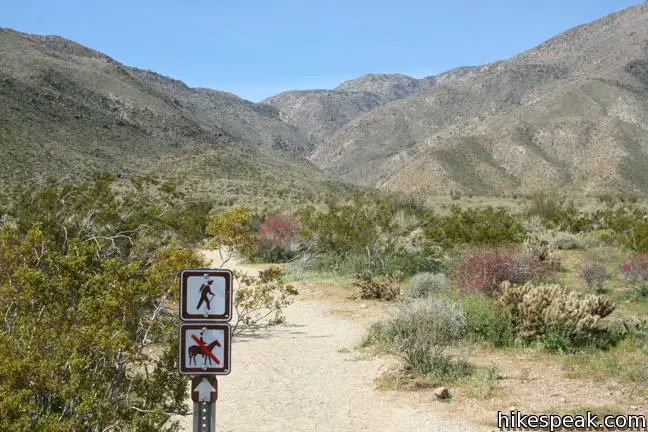
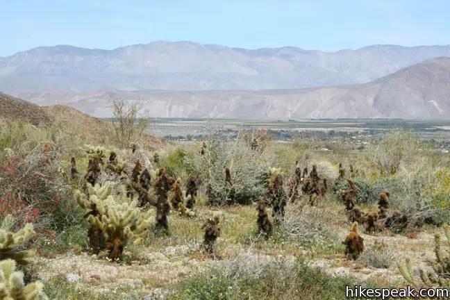
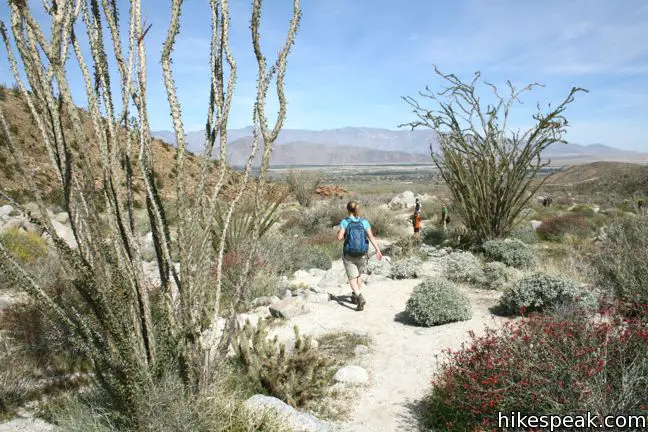
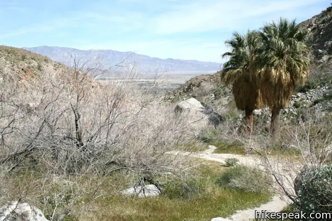
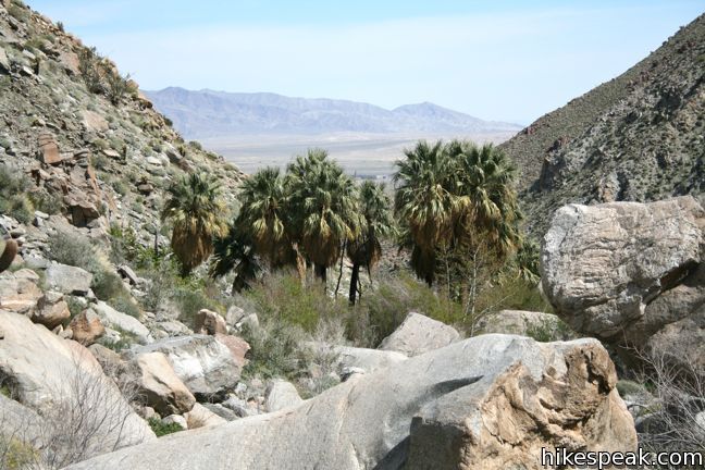
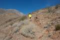
Progress up the wide alluvial fan outside Hellhole Canyon, passing between ocotillo, creosote bush, and other desert brush. A mile and a half from the start, the trail enters the canyon. An old track splits to the right heading closer to the creek bed past an old mountain lion warning sign. The more traveled trail continues along the south wall, eventually dropping across the creek bed to reunite with the other path and continue up canyon. If at least a trickle of water is flowing down the sand, the waterfall ahead should be full of life.
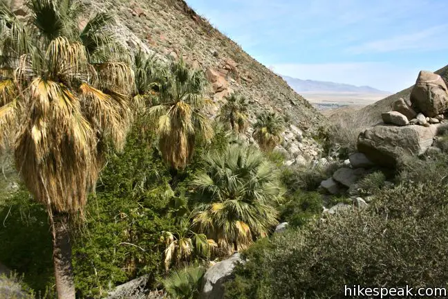
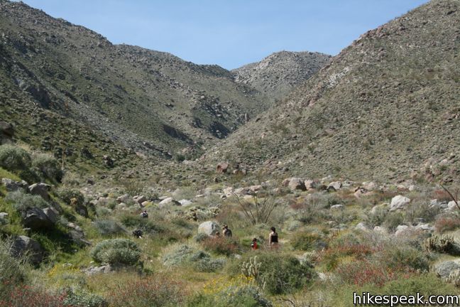
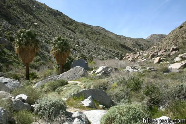
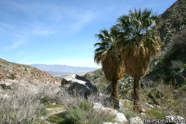
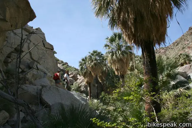
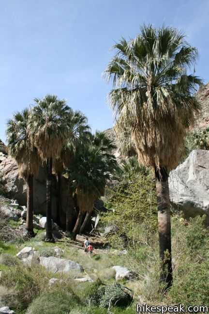
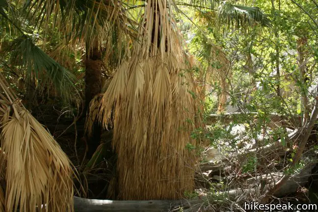
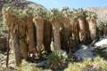
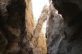
The trail becomes less defined as the canyon walls close, requiring you to scramble over rocks and dance around vegetation. Pass a small cluster of palms at around mile 2.15 and press on to a larger oasis 1/3 of a mile up the canyon. Many hikers turn back here, trading in the relief of the falls for the shade of the palms. With that, the trail grows even fainter.
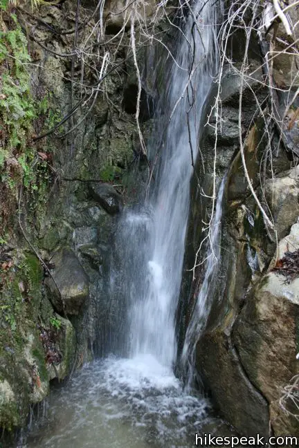
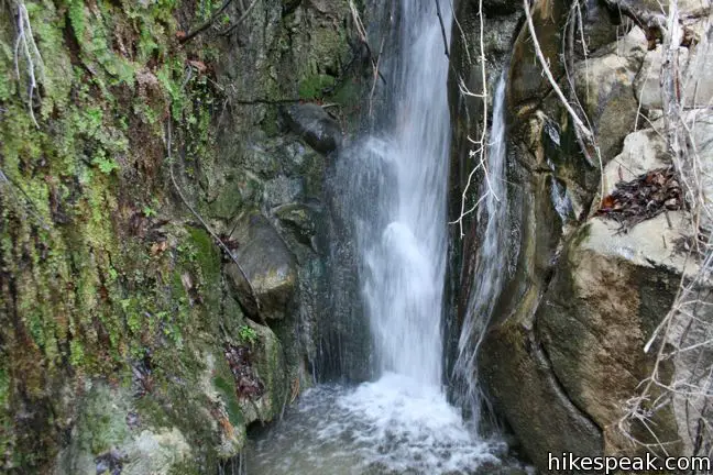
Make your way up along the creek, following traces of trails toward a common destination. Sycamores and cottonwoods are as thick as thieves, huddled along the bottom of this thin riparian zone. A slight 10-foot waterfall just below Maidenhair Falls might be confused with the desired cascade. Do not stop here! Continue a few hundred feet up a rocky slope to reach the more impressive Maidenhair Falls.
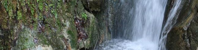
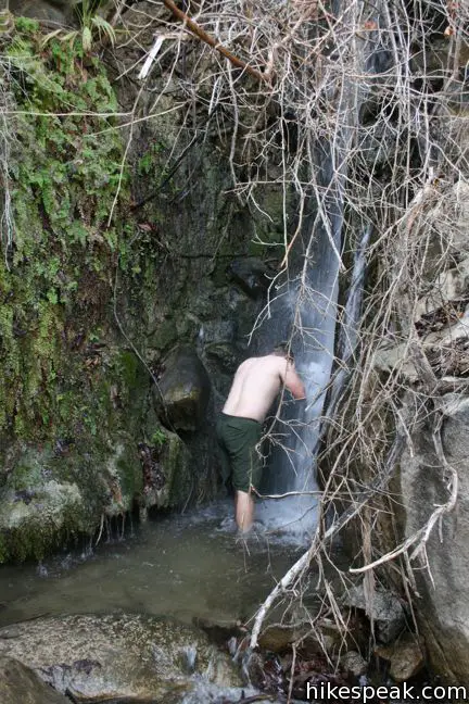
The sound of tumbling water leads to a twenty-foot waterfall in the center of the canyon. Maidenhair ferns adorn the moss-covered rocks around the falls, giving the waterfall its name. Thankfully it is not called Hellhole Falls, as that title would be ill-suited for such a serene seasonal cascade. Maidenhair Falls is approximately 2.75 from the trailhead (the exact distance can vary depending on your route up the canyon). After an arduous climb, step into the calf-deep pool and shower yourself below the falls. The cool waters will leave you feeling refreshed and re-energized for the entire hike down the canyon.
Maidenhair Falls is an excellent hiking destination in the Anza-Borrego Desert. If it is hotter than a hellhole in Borrego Springs, head up the trail to Maidenhair Falls for an exhilarating cold shower. No fee or permit is required to hike to Maidenhair Falls in Anza-Borrego Desert State Park, so get out and enjoy!
Directions to the Trailhead
- From Christmas Circle in Borrego Springs, drive 1.3 miles west on Palm Canyon Road.
- Turn left on Montezuma Valley Road (Route S22), which is 0.4 miles before the park visitor center.
- Drive 0.8 miles south and turn right into the large dirt parking area at the trailhead (just before the road heads up the mountain).
- There is a bathroom at the far end of the lot away from the start of the trail.
Trailhead Location
Trailhead address: Montezuma Valley Road (Route S22), Anza-Borrego Desert State Park, Borrego Springs, CA 92004
Trailhead coordinates: 33.248037, -116.40594 (33° 14′ 52.93″N 116° 24′ 21.38″W)
View Anza-Borrego Desert State Park in a larger map
Or view a regional map of surrounding California Desert trails and campgrounds.


 | Tubb Canyon Trail This 1.5-mile hike follows a footpath across Tubb Canyon to Big Spring in a desert canyon below Pinyon Ridge. |
 | Culp Valley Loop This 2.2-mile loop visits Culp Valley Overlook and Pena Springs, delivering views of the San Ysidro Mountains and Borrego Valley along the way. |
 | Borrego Palm Canyon Trail This 3.25-mile loop visits a popular palm tree oasis in a canyon west of Borrego Springs. |
 | Panoramic Overlook Trail The 1-mile round trip hike ascends a ridge on the south side of Borrego Palm Canyon to sweeping views of the San Ysidro Mountains and Borrego Valley. |
 | Kenyon Overlook Trail This 1.15-mile loop sets out from Yaqui Pass to reach an incredible viewpoint across Mescal Bajada. |
 | Calcite Mine Trail This 4.25-mile trek climbs 600 feet to a historic mine site, exploring exciting narrows along the way. |
 | The Slot This short hike descends through a narrow canyon beneath a natural rock span that is among the most photographed landmarks in Anza-Borrego Desert State Park. |
 | Hikes in the California Desert Explore more trails in Death Valley National Park, Joshua Tree National Park, Anza-Borrego Desert State Park, and Mojave National Preserve. |
 | Anza-Borrego Desert Campgrounds There are four developed campgrounds, eight primitive campgrounds, and extensive roadside camping to accommodate your visit to California's largest state park. |
 | Anza-Borrego Desert State Park Wildflowers The desert bloom brings bursts of color to barrel cactus, beavertail cactus, ocotillo, and more. |
- An article on Maindenhair Falls by Jerry Schad in the San Diego Reader (opens in a new tab)
- Hellhole Canyon Trail to Maindenhair Falls on modernhiker.com (opens in a new tab)
- Hellhole Canyon Trail to Maindenhair Falls on calipidder.com (opens in a new tab)
- Hellhole Canyon Trail to Maindenhair Falls on hikemasters.com (opens in a new tab)
- The official website for Anza-Borrego Desert State Park (opens in a new tab)
Common Questions about Hellhole Canyon Trail to Maidenhair Falls in Anza-Borrego Desert State Park
- Is the trail open?
- Yes. You should expect to find that Hellhole Canyon Trail is open. There are no recent reports of trail closures. If you discover that the trail is closed, please help your fellow hikers by reporting a closure.
- Is this trail free to access?
- Yes, Hellhole Canyon Trail is free to access. No entrance fee, pass, or permit is required. If you discover that access rules have changed, please provide feedback on your experience.
- How much time does this hike take?
- It takes approximately 3 hours to hike Hellhole Canyon Trail. Individual hiking times vary. Add extra time for breaks and taking in the views.
- How long is this hike?
- The hike to Hellhole Canyon Trail is a 5.5 mile out and back with 1000 feet of elevation change.
- Are dogs allowed on this trail?
- No, dogs are likely not allowed on Hellhole Canyon Trail. The trail is primarily open to hikers.
- Where is the trailhead located?
- The trailhead for Hellhole Canyon Trail is located in Borrego Springs, CA.
Trailhead Address:
Montezuma Valley Road
Borrego Springs, CA 92004
Trailhead Coordinates:
33.248037, -116.40594 - What are the driving directions to the start of the hike?
To get to the trailhead: From Christmas Circle in Borrego Springs, drive 1.3 miles west on Palm Canyon Road. Turn left on Montezuma Valley Road (Route S22), which is 0.4 miles before the park visitor center. Drive 0.8 miles south and turn right into the large dirt parking area at the trailhead (just before the road heads up the mountain). There is a bathroom at the far end of the lot away from the start of the trail.
View custom Google Maps directions from your current location.
- Are there other trails near Hellhole Canyon Trail?
- Yes, you can find other nearby hikes using the Hikespeak Hike Finder Map.

23 Comments on Hellhole Canyon Trail to Maidenhair Falls in Anza-Borrego Desert State Park
What hikers are saying:
✨ Generated summary of user commentsThis trail offers a beautiful and quiet adventure that rewards persistence with hidden waterfalls and lush ferns. Because the path becomes confusing near the palms, Karen warns that once you enter the boulder-filled canyon, you are committed to finishing the trek. Visitors must prepare for intense heat by carrying extra water, wearing sun protection, and starting as early as 8 a.m. to avoid the midday sun. Dogs are strictly prohibited in this area, which is also known mountain lion territory.
Going to hike this on Friday! Can’t wait!
heading over to the park in a week and can’t decide between the this and Borrego Palm Canyon. Which do you prefer?
Both hikes are fun. Hellhole Canyon is a bit more of an adventure so I would lean that way if you could only do one hike. It is pretty dry out in the Anza-Borrego Desert this year. Check at the visitor center when you arrive to make sure there is water in Maidenhair Falls.
excellent, thanks!
wondering if anyone has hiked Hellhole Canyon in the past week or so? Just want to know if there was water at Maidenhair Falls?
Thanks
Tessesa: did you end up going? was there water?
[…] For more information on the Anza-Borrego Desert State Park, go here – https://www.parks.ca.gov/?page_id=638 – and for more information on the Hellhole Canyon trail to Maidenhair Falls, go here – https://www.hikespeak.com/trails/hellhole-canyon-trail-maidenhair-falls-anza-borrego-desert/. […]
I was considering hiking from the Culp Valley campground to Maidenhair Falls. Ever done that? Not sure how far that is, but I was going to have someone pick me up at the trailhead so I don’t have to hike back up to the campground.
Haven’t hike all the way down from Culp Valley, but sounds fun!
Did you end up doing the hike from Culp Valley to Maindenhair Falls? I was thinking about doing the same thing this upcoming weekend.
We did it. It was fun, but very challenging. Once you start to descend through the huge boulder-filled canyon, you are committed to going the whole way, no matter how tired you get. If you do it, make sure you are well prepared. And you are in mountain lion territory, too.
We hiked Hellhole Canyon on April 8, 2014, it was a 101 degrees that day. We started early in the a.m. There was only a little bit of water trickling and a small pool, but the maidenhair fern was lush and lovely. The situation w/ water was the same when we hiked it in Nov. 2013. Have been there in the past when the fall was gushing. Trail gets lost when you get to the palms and standing water, but there is maidenhair up there!
[…] quand même eu le temps de faire une jolie randonnée d’environ 9Km. Nous avons remonté Hellhole Canyon jusqu’à Maindenhair Falls. C’est un itinéraire facile, bien qu’il faille un peu grimper à la fin du parcours. […]
Do you think this is safe for hiking with a toddler in a back carrier? Any mums do this before?
Almost died doing this hike. couldn’t even make it to the palms. another group turned back before us. Make sure u carry more water then u think u need. Temp was 93. guess at 28 I’m no longer in shape. I would not recommend toddler.
Is there actual water falling from the waterfalls this time of month?
Some waterfalls we went to don’t have any…
Small amount of water at the fall as of Feb 3 2018. Definitely enough to fill up water bottles and relax.
Can our dog accompany on this trip?
No. Dogs are not allowed.
Anyone been out there recently? Any water?
Update for Saturday, April 13, 2019: water still flowing at the falls.
Our group hiked Hellhole to Maidenhair fall on 2/16/20. Weather stated 54 degree when I checked at 6am. By the time we started hiking at 8:30am, it felt like 75 degree – hot! Luckily, there were some shades. Landscape is beautiful n quiet. Getting to the waterfall was confusing, the trail isn’t clear, we had to double back a few times, but finally found the hidden waterfall. Small but very cool. Good to know that no matter which trails you take, they lead to the palm trees and back. A great location to hike.
You need to bring enough water and maybe a bottle of electrolyte. Good hiking shoes cuz some of the rocks are slippery. A sun hat, sunblock, and extra socks in case you decide to get wet – only if the fall still have water. Go early!
Going Friday!