Barker Dam
in Joshua Tree National Park
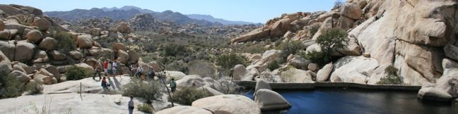
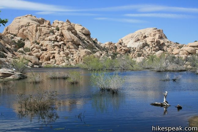
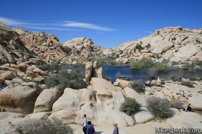
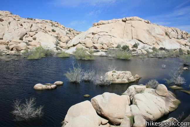
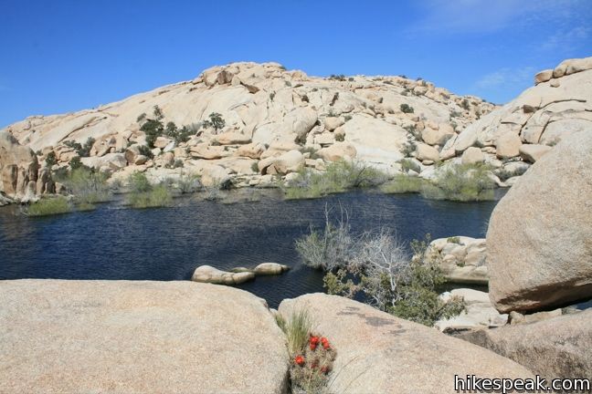
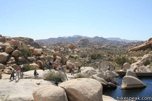
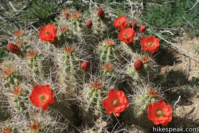
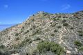
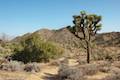
Barker Dam Loop visits a small foreign-looking reservoir within the Wonderland of Rocks in Joshua Tree National Park. Hikers of all abilities will enjoy this level 1.5-mile hike. The water can all but disappear during the dry season, so make a point to visit this trail in the winter and spring.
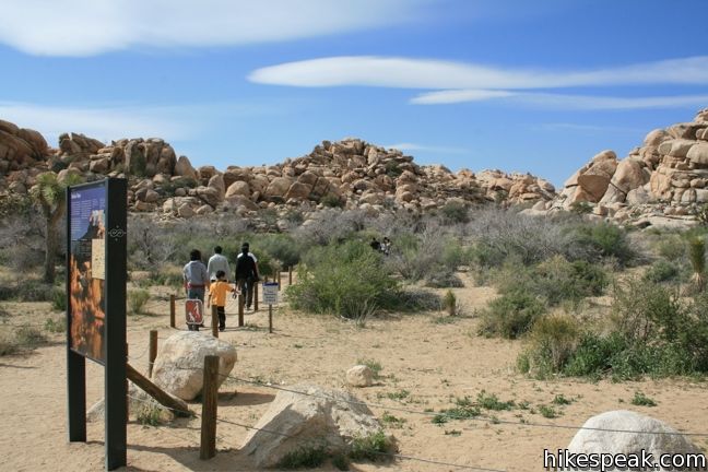
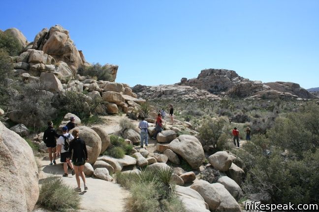
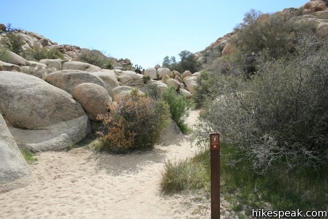
The well-marked loop is easy to follow and easy to hike. From the parking lot, take the trail heading northwest toward Barker Dam. There are two well-marked trails leaving from this trailhead, so be sure do not take the other trail heading northeast toward Wall Street Mill.
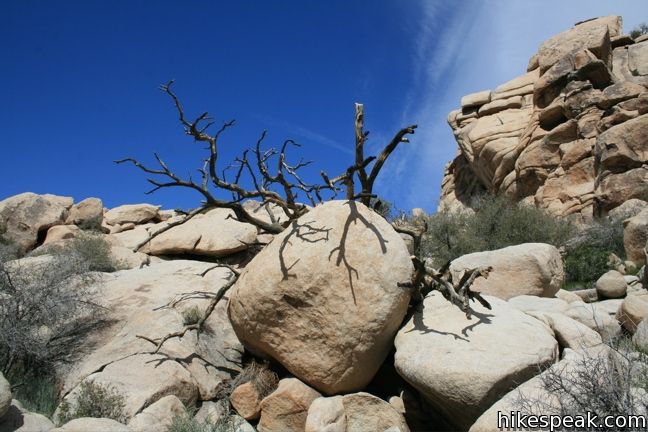
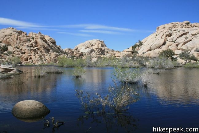
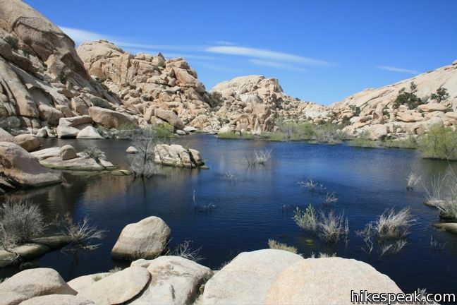
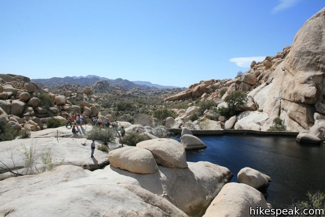
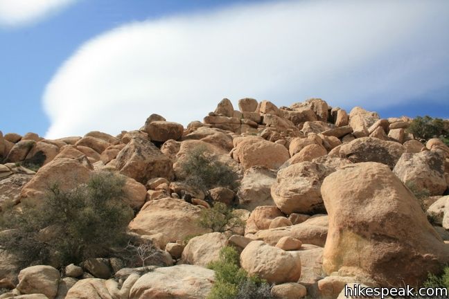
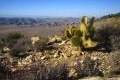
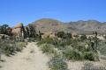
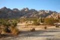
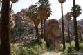
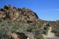
Tall mounds of boulders rise on either side, and then suddenly, the trail emerges along the shore of a small blue lake. The stagnant waters look out of place in this desert landscape, but the site is quite calm and worthy of a relaxing break from trekking in the desert.
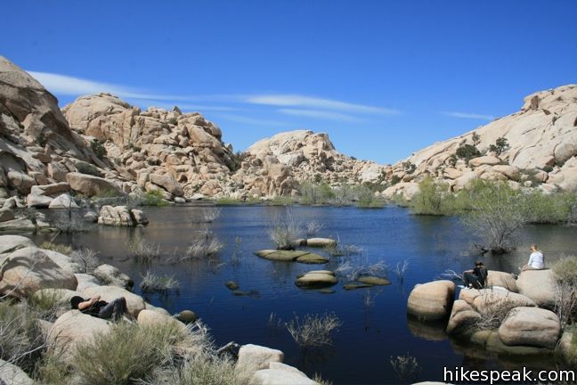
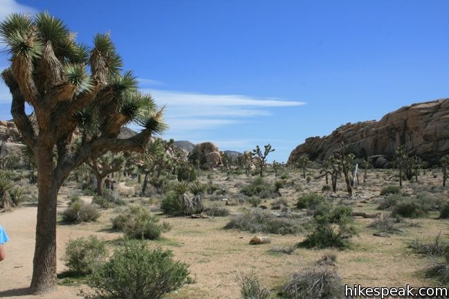
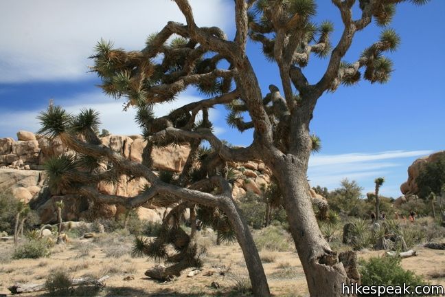
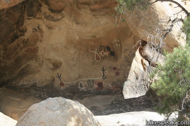
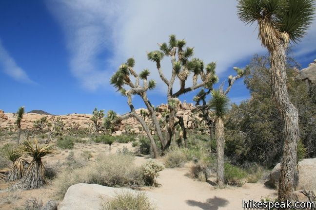
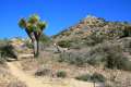
Turn left and follow the shoreline toward the dam itself. Barker Dam was build over a century ago by ranchers eager to save up some of the desert’s most vital resource, water. The trail turns west, leaves the lake and enters a flat piece of desert that is home to several tall Joshua trees. Follow the sandy track as it loops back toward the start. A marked turnoff visits a rock covered in vivid petroglyphs. These Native America drawings had their colors enhanced by a film crew working on an old Hollywood movie, which explains why they look too colorful to be real. Beyond the petroglyphs, continue along the trail. When it comes to a T, make a right to return to the parking lot. This 1.5-hike only has 50 feet of elevation change, making it a suitable excursion for anyone visiting Joshua Tree National Park.
Directions to the Trailhead
- The turnoff for Barker Dam is located on Park Boulevard 12 miles west of the intersection with Pinto Basin Road (in the heart of Joshua Tree National Park near many other park attractions).
- From the well-marked turnoff, drive north for 1.5 miles to the large parking area for Barker Dam.
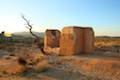
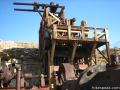
- This trailhead is located near the west end of an unpaved road that crosses through Joshua Tree from Desert Queen Mine (a fun drive for anyone not adverse to getting their vehicle a little dusty).
Trailhead Location
Trailhead address: Park Boulevard (Loop Road), Joshua Tree National Park, CA 92277
Trailhead coordinates: 34.0251, -116.1420 (34° 01′ 30.4″N 116° 08′ 31.2″W)
View Joshua Tree National Park in a larger map
Or view a regional map of surrounding California Desert trails and campgrounds.
 | Wall Street Mill This level 1.55 to 2.15-mile hike visits a well-reserved gold mill, exploring the mining history of Joshua Tree National Park. |
 | Wonderland Wash This level 2.1-mile hike travels past the ruins of Wonderland Ranch up a use trail into the Wonderland of Rocks. |
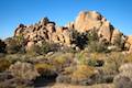 | Hidden Valley This one mile loop circles the interior of a small valley surrounded by tall rocks that serves as an excellent bouldering arena. |
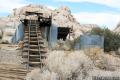
 | Desert Queen Mine This 1.6-mile hike follows a level trail to an overlook before crossing a canyon to visits the ruins of one the most profitable gold mines in the California desert. |
 | Ryan Mountain This 3-mile hike offers summit views from the center of Joshua Tree National Park. |
 | Ryan Ranch This 0.8 or 1.2-mile round trip hike visits the ruins of an old adobe homestead beneath Ryan Mountain. |
 | Lucky Boy Vista This level 2.5-mile hike visits a modest overlook at the site of an old mine. |
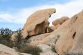
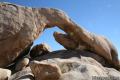 | Arch Rock This short hike leads to a natural arch in the granite formations by White Tank Campground. |
 | Inspiration Peak This 1.2-mile hike leaves the crowds at Keys View for even grander views at a 5,550-foot summit that looks out on the Coachella Valley, the Salton Sea, Mount San Jacinto, and much of Joshua Tree National Park. |
 | Lost Horse Mine This 4-mile hike visits a well-preserved mine and mill. |
 | Fortynine Palms Oasis The 3-mile round trip hike visits a cool desert oasis. |
 | Indian Cove The 101-site campground is home to a 0.6-mile interpretive trail and endless bouldering and rock climbing opportunities. |
 | Lost Palms Oasis This 7.2-mile hike visits a desert oasis nestled between mountains in the southeast corner of the park. |
 | Mastodon Peak This 2.6-mile loop visits a 3,400-foot summit with panoramic views of southeastern Joshua Tree. |
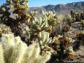 | Cholla Cactus Garden This quarter-mile loop allows visitors to stroll through an intense concentration of cholla cacti. |
 | Warren Peak This 5.5-mile hike summits a peak with impressive views over the west side of Joshua Tree. |
 | High View Nature Trail This 1 1/3-mile loop climbs a ridge on the west side of the park that offers views of San Gorgonio Mountain and Yucca Valley, along with an introduction to desert plants. |
 | Hikes in the California Desert Explore more trails in Death Valley National Park, Joshua Tree National Park, Anza-Borrego Desert State Park, and Mojave National Preserve. |
 | Joshua Tree Campgrounds Nine campgrounds with 500 total sites are spread throughout the park to facilitate your visit. |
 | Joshua Tree Wildflowers The desert in bloom is something any outdoor enthusiast in California should see. |
Common Questions about Barker Dam in Joshua Tree National Park
- Is the trail open?
- Yes. You should expect to find that Barker Dam Loop is open. There are no recent reports of trail closures. If you discover that the trail is closed, please help your fellow hikers by reporting a closure.
- Do I need a permit for this hike?
- Yes. National Park Entrance Fee.
- How much time does this hike take?
- It takes approximately 45 minutes to hike Barker Dam Loop. Individual hiking times vary. Add extra time for breaks and taking in the views.
- How long is this hike?
- The hike to Barker Dam Loop is a 1.5 mile loop with 50 feet of elevation change.
- Are dogs allowed on this trail?
- No, dogs are likely not allowed on Barker Dam Loop. The trail is primarily open to hikers.
- Is Barker Dam Loop good for kids?
- Yes, this hike is likely suitable for children. It is relatively short (1.5 miles) with manageable elevation gain.
- Where is the trailhead located?
- The trailhead for Barker Dam Loop is located in Joshua Tree National Park, CA.
Trailhead Address:
Park Boulevard
Joshua Tree National Park, CA 92277
Trailhead Coordinates:
34.0251, -116.1420 - What are the driving directions to the start of the hike?
To get to the trailhead: The turnoff for Barker Dam is located on Park Boulevard 12 miles west of the intersection with Pinto Basin Road (in the heart of Joshua Tree National Park near many other park attractions). From the well-marked turnoff, drive north for 1.5 miles to the large parking area for Barker Dam. This trailhead is located near the west end of an unpaved road that crosses through Joshua Tree from Desert Queen Mine (a fun drive for anyone not adverse to getting their vehicle a little dusty).
View custom Google Maps directions from your current location.
- Are there other trails near Barker Dam Loop?
- Yes, you can find other nearby hikes using the Hikespeak Hike Finder Map.

16 Comments on Barker Dam in Joshua Tree National Park
What hikers are saying:
✨ Generated summary of user commentsThis trail offers a glimpse into the desert's natural wonders, though water levels in the reservoir vary significantly by season. David warns that swimming is strictly prohibited to protect the ecological preserve, and pets are not allowed on the path.
“I find the desert and all discovered beauty which this holds for all us, simply amazing!!” Jump to comment ↓
Is it safe to swim in the lake waters?
It is illegal. Barker Dam water is part of an ecological preserve. Likewise, pets are not allowed on trails in the national parks.
Has anyone been here recently? I’m wondering how the water is and if its safe to swim here…. Thanks!!
As of 1/14/2015 there is very little water in the lake, despite several decent rains in the area this winter.
Went there 4/8/2015. It’s definitely dry for the most part! The CA drought is showing. The water left equates to a tiny pond…and was hard to tell there was water until you are right up next to the dam, looking down.
went 4/3/2016 all dry :/ I think we will try again in the winter
[…] Barker Dam Trail – This was a nice little loop and kind of cool to see water in the desert. It’s always interesting to see how the foliage changes in each of the different areas as well! Overall, pretty crowded trail and I would recommend skipping if your torn between where to spend your time. […]
Has anyone been to the dam just recently? The comments are dated and I’m looking for current info about the trail. 1-4-17. Thank you.
I went recently with my fam for the first time and we left late (around 2:30 pm) from the riverside area. We were afraid to go so late but we took our chances anyway. My mom was with us so we were also afraid the trail was going to be difficult for her. It wasn’t at all. It was really nice. There was water in the dam and I remember overhearing regulars that it had more water than they’ve ever seen. Including a tiny stream of water, they classified it as a river compared to J tree standards. We completed the hike in about an hour including return time. We didn’t really stop to look around though. Next time we’ll leave earlier to explore even more. Also, there is a parking charge of $25. They do have the option though to get a ticket for $40 for the whole year. I think we’ll do that next time because it is really pretty. By the way, we didn’t use the restrooms because the smell was horrendous. Even from a distance! I can only imagine how bad it gets in the summer. Horrible!
[…] The trail to Barker Dam is filled with rock formations. Literally towering above the well-worn path, crowding in on both sides along the trail. Weaving your way through passages, it’s tempting not to go astray, to take a climb up some of those piles. It tends to bring out the kid in you. […]
I was there on 5/29/17
A beautiful day in the park the dam was at least 1/2 full of brackish water. I wonder if anyone knows what the 2 ring concrete structures below the dam were ?
Bathtub?
Will you run into the petroglyphs on that one rock on the main trail? If not, how do you locate it? Thank you!
Has anyone been to Barker Dam in 2021? Is there water in the reservoir? Thanks.
Hi Andrea, did you end up visiting the Dam? Would you be able to let us know if there was still water for those of us still wondering in 2021?
We were there Mid April 2021 and the reservoir was dry.
Joshua Tree is a great place to live and have fun having lived in the area for over 15 years, I find the desert and all discovered beauty which this holds for all us, simply amazing!! Would be a retraction in discovering life´s wonders not to visit this natural wonder.