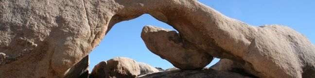
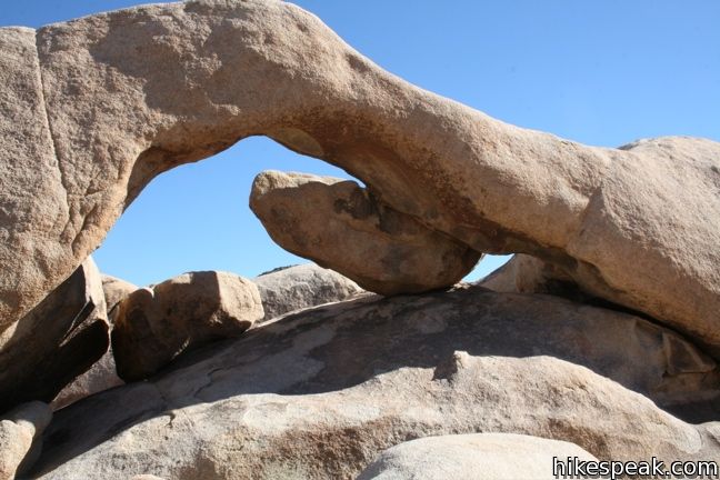
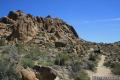
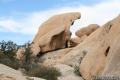
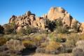
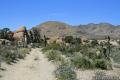
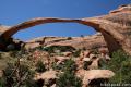
Arch Rock
in Joshua Tree National Park
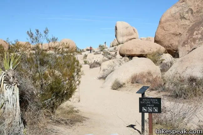
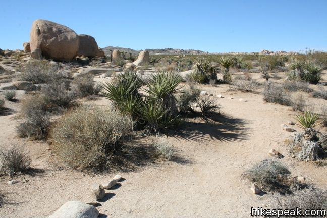
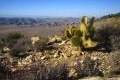
Want to see a natural arch in Joshua Tree National Park? Take a short hike to Arch Rock within the granite formations surrounding White Tank Campground. An easy and enjoyable 0.3-mile loop leaving the campground is a must-do stroll for anyone staying at White Tank Campground. Other park visitors can now enjoy a 1.3-mile lollipop loop hike that begins from a trailhead along Pinto Basin Road.
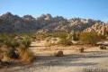
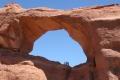
Arch Rock from Twin Tanks Trailhead
To reach the new trailhead, take Pinto Basin Road 2.2 miles south of Park Boulevard or half a mile northwest of White Tank Campground to the Twin Tanks Day Use Area on the west side of the road. Set out south from the Twin Tanks.
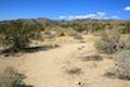
After 0.15 miles of cross desert hiking, make a left on California Riding and Hiking Trail, cross Pinto Basin Road, and then make a right off of California Riding and Hiking Trail to continue hiking gradually downhill toward White Tank Campground. At 0.55 miles from the trailhead, come to a T-junction at the start of a 0.2-mile loop to Arch Rock.
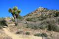
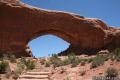
Arch Rock from White Tank Campground
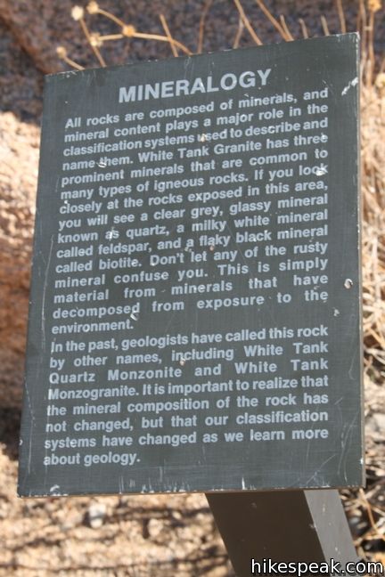
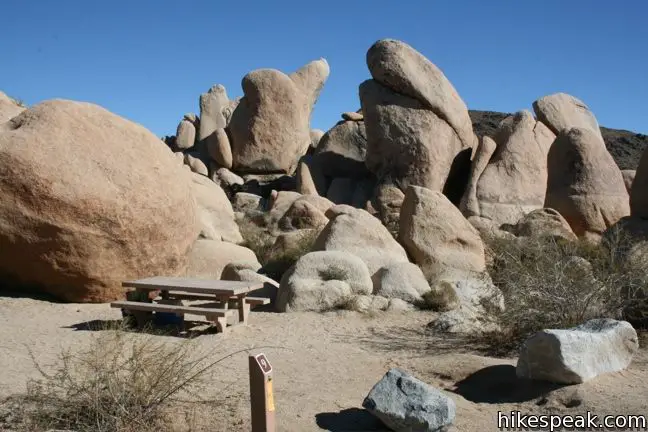
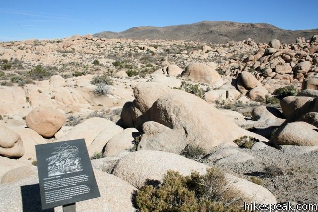
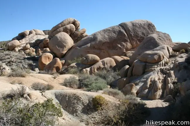
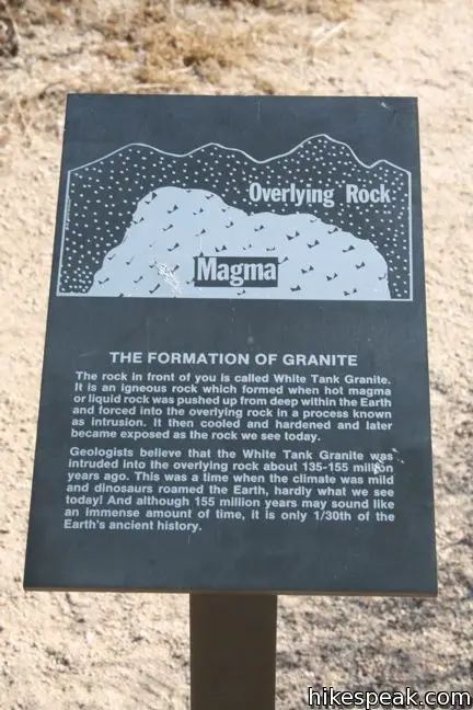
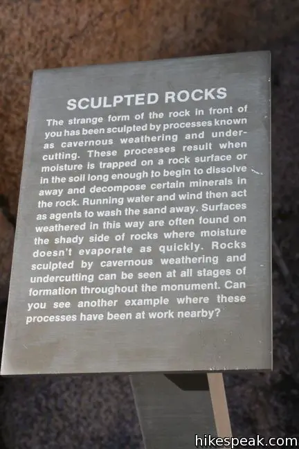
Campers will find a trail to Arch Rock from within White Tank Campground. Driving into the campground, take the left split in the road. A path to Arch Rock begins alongside campsite nine. The arch is an eighth of a mile up the trail and easy to spot. Take your time getting to Arch Rock and read the placards along the trail that describe the geological history that contributed to the creation of the arch.
Day use parking may be available near site fifteen at the end of the loop. However, with the creation of the trail from the Twin Tanks Day Use Area, the campgrounds day use parking may no longer be available (and was limited to begin with).
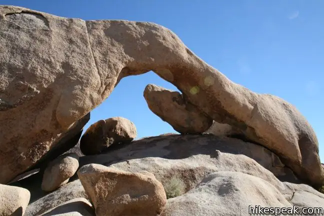
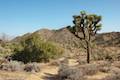
Arch Rock Loop
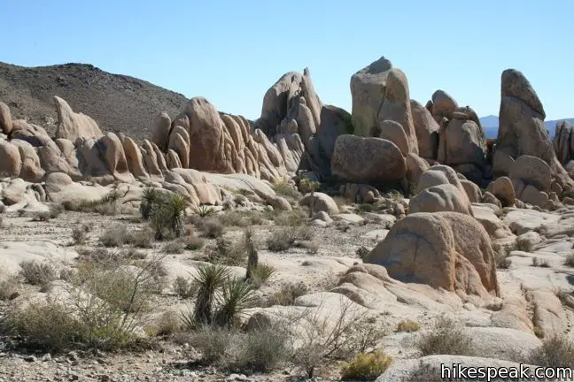
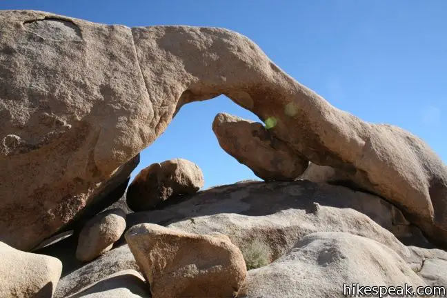
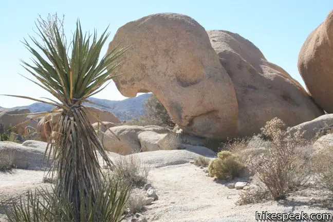
The single-track trail provides a side-view of Arch Rock, and a few steps off trail puts hikers right below the rock span. Climb right up and touch it if you like. Arch Rock is about 30-feet across and shaped somewhat like a brontosaurus. Though certainly not in the same league as the spans in Arches National Park, Arch Rock is still a fascinating formation.
The trail circling back the junction with trail from Twin Tanks or with the edge White Tank Campground (depending on where you began).
This is easy and family-friendly hike makes a nice outing. Arches are always cool to see, so go check it out. Joshua Tree National Park has an entrance fee, but no permit is required to hike to Arch Rock.
Directions to the Trailhead
Twin Tanks Trailhead:
- From the intersection with Park Boulevard and Pinto Basin Road (4.5 miles south of the north entrance), head southwest on Pinto Basin Road for 2.2 miles to Twin Tanks Day Use Area, on the right.
- The trail begins from the south end of the parking area.
- Coming from the other direction, the trailhead is half a mile past White Tank Campground.
White Tank Campground:
- From the intersection with Park Boulevard and Pinto Basin Road (4.5 miles south of the north entrance), head southwest on Pinto Basin Road for 2.7 miles to White Tank Campground.
- Enter the campground and proceed to the trailhead near site #9.
- Coming from the other direction, White Tank Campground is 27 mile up Pinto Basin Road from the Cottonwood Visitor Center.
Trailhead Location
Trailhead address: Twin Tanks Backcountry Registration Board, Pinto Basin Road, Joshua Tree National Park, CA 92277
Trailhead coordinates: 33.9899, -116.02275 (33° 59′ 23.6″N 116° 01′ 22″W)
Campground address: White Tank Campground, Pinto Basin Road, Joshua Tree National Park, CA 92277
Campground coordinates: 33.9852, -116.01655 (33° 59′ 06.7″N 116° 00′ 59.6″W)
You may also view a regional map of surrounding California Desert trails and campgrounds.


 | Crown Prince Lookout This easy 3.25-mile round trip hike crosses a desert plateau to a pair of overlook near the site of an World War II era observation post. |
 | Contact Mine This 3.9-mile hike ascends 700 feet up a wash, a canyon, and an old road to a mountainside mine site that offers a glimpse into the mining history of Joshua Tree. |
 | Cholla Cactus Garden This quarter-mile loop allows visitors to stroll through an intense concentration of cholla cacti. |
 | Mastodon Peak This 2.6-mile loop visits a 3,400-foot summit with panoramic views of southeastern Joshua Tree. |
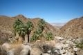
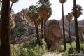 | Lost Palms Oasis This 7.2-mile hike visits a desert oasis nestled between mountains in the southeast corner of the park. |
 | Bajada Trail This level 0.3-mile nature trail loop explores the plants living on a desert bajada. |
 | Fortynine Palms Oasis The 3-mile round trip hike visits a cool desert oasis. |
 | Desert Queen Mine This 1.6-mile hike follows a level trail to an overlook before crossing a canyon to visits the ruins of one the most profitable gold mines in the California desert. |
 | Ryan Mountain This 3-mile hike offers summit views from the center of Joshua Tree National Park. |
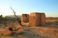 | Ryan Ranch This 0.8 or 1.2-mile round trip hike visits the ruins of an old adobe homestead beneath Ryan Mountain. |
 | Wonderland Wash This level 2.1-mile hike travels past the ruins of Wonderland Ranch up a use trail into the Wonderland of Rocks. |
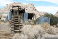 | Wall Street Mill This level 1.55 to 2.15-mile hike visits a well-reserved gold mill, exploring the mining history of Joshua Tree National Park. |
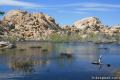 | Barker Dam This level 1.5-mile loop visits a small foreign-looking reservoir within the Wonderland of Rocks. |
 | Hidden Valley This one mile loop circles the interior of a small valley surrounded by tall rocks that serves as an excellent bouldering arena. |
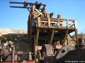 | Lost Horse Mine This 4-mile hike visits a well-preserved mine and mill. |
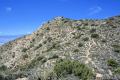 | Inspiration Peak This 1.2-mile hike leaves the crowds at Keys View for even grander views at a 5,550-foot summit that looks out on the Coachella Valley, the Salton Sea, Mount San Jacinto, and much of Joshua Tree National Park. |
 | Lucky Boy Vista This level 2.5-mile hike visits a modest overlook at the site of an old mine. |
 | Indian Cove The 101-site campground is home to a 0.6-mile interpretive trail and endless bouldering and rock climbing opportunities. |
 | Warren Peak This 5.5-mile hike summits a peak with impressive views over the west side of Joshua Tree. |
 | High View Nature Trail This 1 1/3-mile loop climbs a ridge on the west side of the park that offers views of San Gorgonio Mountain and Yucca Valley, along with an introduction to desert plants. |
 | Hikes in the California Desert Explore more trails in Death Valley National Park, Joshua Tree National Park, Anza-Borrego Desert State Park, and Mojave National Preserve. |
 | Landscape Arch in Arches National Park This level 2.5-mile hike visits the longest natural arch in the world along with two other enjoyable arches. |
 | Skyline Arch in Arches National Park This short 0.4-mile hike ends below a wide arch near the top of a sandstone fin. |
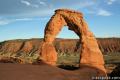 | Delicate Arch in Arches National Park This 3-mile hike visits this most iconic arch in the world, a beautiful span that should not be missed. |
 | Double Arch in Arches National Park This 0.8-mile hike visits a pair of connected arches in the Windows region of Arches National Park. |
 | Window Arches in Arches National Park This one-mile loop presents three arches in close proximity, the North and South Windows and Turret Arch. |
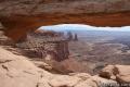 | Mesa Arch in Canyonlands National Park This 0.7-mile loop visits a picturesque arch spanning across the mesa's edge. |
 | Grandstaff Trail to Morning Glory Bridge in Moab, Utah This 4.65-mile round trip hike travels through a scenic canyon to a 243-foot long natural bridge. |
 | Joshua Tree Campgrounds Nine campgrounds with 500 total sites are spread throughout the park to facilitate your visit. |
 | Joshua Tree Wildflowers The desert in bloom is something any outdoor enthusiast in California should see. |
Common Questions about Arch Rock in Joshua Tree National Park
- Is the trail open?
- Yes. You should expect to find that Arch Rock Trail is open. There are no recent reports of trail closures. If you discover that the trail is closed, please help your fellow hikers by reporting a closure.
- Do I need a permit for this hike?
- Yes. National Park Entrance Fee.
- How much time does this hike take?
- It takes approximately 30 minutes to hike Arch Rock Trail. Individual hiking times vary. Add extra time for breaks and taking in the views.
- How long is this hike?
- The hike to Arch Rock Trail is a 1.3 mile lollipop loop with 100 feet of elevation change.
- Are dogs allowed on this trail?
- No, dogs are likely not allowed on Arch Rock Trail. The trail is primarily open to hikers.
- Is Arch Rock Trail good for kids?
- Yes, this hike is likely suitable for children. It is relatively short (1.3 miles) with manageable elevation gain.
- Where is the trailhead located?
- The trailhead for Arch Rock Trail is located in Joshua Tree National Park, CA.
Trailhead Address:
Pinto Basin Road
Joshua Tree National Park, CA 92277
Trailhead Coordinates:
33.9899, -116.02275 - What are the driving directions to the start of the hike?
To get to the trailhead: Twin Tanks Trailhead: From the intersection with Park Boulevard and Pinto Basin Road (4.5 miles south of the north entrance), head southwest on Pinto Basin Road for 2.2 miles to Twin Tanks Day Use Area, on the right. The trail begins from the south end of the parking area. Coming from the other direction, the trailhead is half a mile past White Tank Campground.
White Tank Campground: From the intersection with Park Boulevard and Pinto Basin Road (4.5 miles south of the north entrance), head southwest on Pinto Basin Road for 2.7 miles to White Tank Campground. Enter the campground and proceed to the trailhead near site #9. Coming from the other direction, White Tank Campground is 27 mile up Pinto Basin Road from the Cottonwood Visitor Center.
View custom Google Maps directions from your current location.
- Are there other trails near Arch Rock Trail?
- Yes, you can find other nearby hikes using the Hikespeak Hike Finder Map.

14 Comments on Arch Rock in Joshua Tree National Park
What hikers are saying:
✨ Generated summary of user commentsHikers find this trail to be a magnificent venue for photography, especially when capturing the unique leg and hip joint shape of the formation. While the path is level, reaching the arch itself requires flexibility to navigate crevices and sandy, slippery rock surfaces. Hannah warns that the trailhead is now located at the Twin Tanks Parking Area, and those not staying at the campground should avoid parking in White Tank. Adventurous explorers can also seek out an easy slot canyon located just southeast of the main attraction.
“Great venue for awesome pictures.” Jump to comment ↓
There is another fun way in through an easy slot canyon just southeast of the arch for those who want a little more adventure and exploring.
Thanks for the info and maps! Very useful! You mentioned a day use parking area around Campground #15. If you are not camping in White Tank Campgrounds, where would you recommend parking if taking photos of Arch Rock at night? Thanks!
Hi Ken,
There is space for a few cars to park (near site #15). These spaces are not reserved for campers so if you are staying elsewhere, you can drive in, park there and then hike to the Arch. Daytime is fine. Have fun!
Hello! The trailhead for Arch Rock is now at the Twin Tanks Parking Area. Hikers should not park in White Tank Campground for this trail, though campers are still able to access the Arch Rock from the campground.
Subject: Arch Rock in Joshua Tree National Park
Hi Hikespeak
We will be arriving in May from Canada and were wondering which park entrance to use and if it is possible for someone with a cane to walk to the Arch Rock.
The north entrance will be the closest, but you can reach Arch Rock from any of the three main entrances. The trail is short, level, and even. The tricky part for someone with a cane will be getting from the trail up next to Arch Rock itself, but depending in their fitness level/assistance, this hike seems doable.
[…] vegetable kingdom,” wrote Captain John C. Fremont in 1844. Known as the park’s namesake, the Joshua trees are a species of yucca growing only in the high desert, mainly the Mojave. There are […]
Thanks to Seth Smigelski for this hikespeak.com creation.
We finally found the arc rock site today after missing it prior years. The trail goes west of Camp site # 9 and has black slate markers on posts. Trail goes up and around big rock just north and west of #9 campsite. Trail has stepped rocks and trail rock markers until you reach the arc rock sign post, the fourth such post marker. You will be looking east northeast and you will see the arc shaped rock with a gap in it. It is on top of the formation. It is a long rock somewhat shaped like a leg and hip joint. There are two smaller rocks seated in the hole in the arch. You can climb in the rock crevices from the marker post up several rocks and crevices to get right up on the ARC Rock. You can also approach the arc rock from the west side looking east south east. it is an awesome sight. Great venue for awesome pictures. You can easily climb up carefully and sit in the arc and climb on top of the arc if you are nimble. Not recommended if you are not flexible and nimble. You need to have the use of your arms, legs and hands. Shoes with good soles and ankle support are highly recommended. The surface of the rocks is quite sandy and slippery in spots. Being thin will be an advantage to get through the crevices that will lead you up the formation to the hole in the rock under the arc. If you have a bad back or knees maybe just have a look best you can without trying to climb up into the crevices. Not a good spot to take a fall or slip into a crevice. Be careful and enjoy the view. Sit back and just inhale the beauty of the spot and the unusual placement of the rock fragments. Sunset and Night shots of the rock opening are awesome as someone posted on line as viewed March 15th, 2014. Worth the trip just to see it with your own eyes and 360 degrees of access. Took about 3 -4 hours round trip from Palm Desert without stopping to view other rock formations, via Jucca Valley and Joshua Tree in the west gate. You can get to the Arc Rock through the north gate via 29 Palms as well which is possibly a bit quicker but not as scenic in so far as rock formations is concerned. Recommend you allow 4 -6 hours to make a return trip just for Arc Rock. The White Tank Campsite has many awesome rock formations and several trails to explore. It is easy to see why people camp there. It is magnificent. Did I mention that a camera would be very nice to have to capture and keep the scenery. If I was young again, man o man?! Nature…such a wonder.
Where can I find heart rock?
Heart rock shape location please n how to find it,thku
[…] Millenia of whipping winds and rushing water have served to sculpt some incredible designs throughout these deserts. One of the most miraculous, the 30-foot-tall Arch Rock, is easily accessible thanks to a 0.5-mile out-and-back trail starting from White Tank Campground. […]
[…] The rocks surrounding Arch Rock Nature Trail were the perfect size for our kids (ages 6, 9 and 11) to have an incredible time climbing and exploring on without giving me too much of a heart attack. We love this Amazing Rock Paradise! […]
[…] Arch Rock Loop trail within the park, close to several other important points in the park. Here are exact directions to get to Arch Rock from a variety of starting […]
[…] Arch Rock Nature Trail is a great option for anyone who wants an easy and family-friendly hike. […]