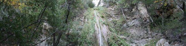
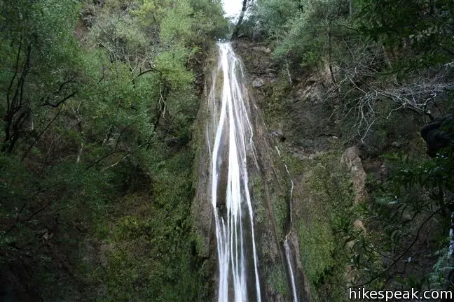
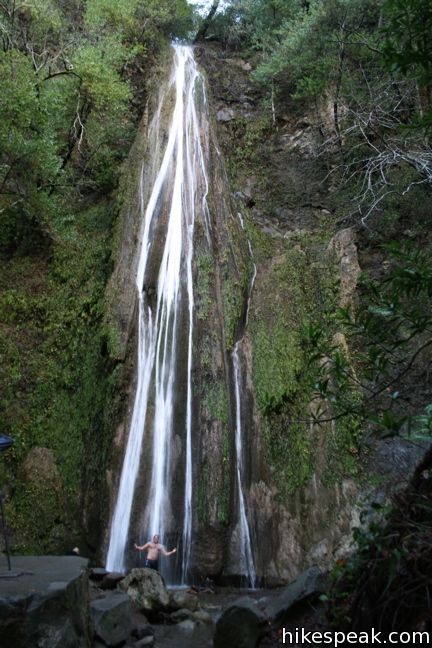
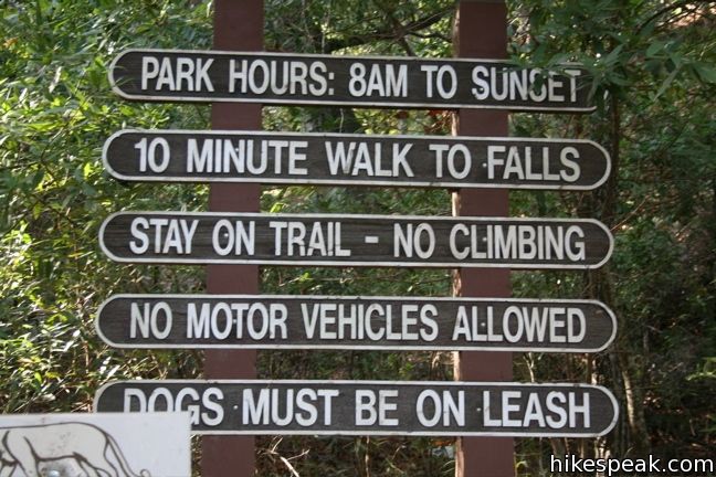
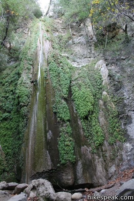
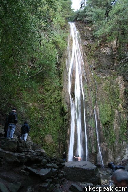
Nojoqui Falls Parks is located just off Highway 101 north of the Gaviota Tunnel between Santa Barbara and Buellton. In addition to picnic tables and playing fields, the park offers a short hike to an eighty-foot waterfall. This two-thirds of a mile round trip trail ascends 175 feet up a shaded canyon to the enchanting Nojoqui Falls.
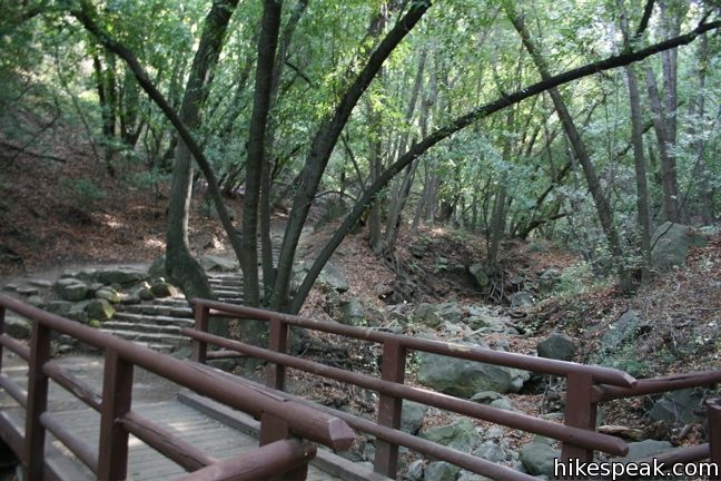
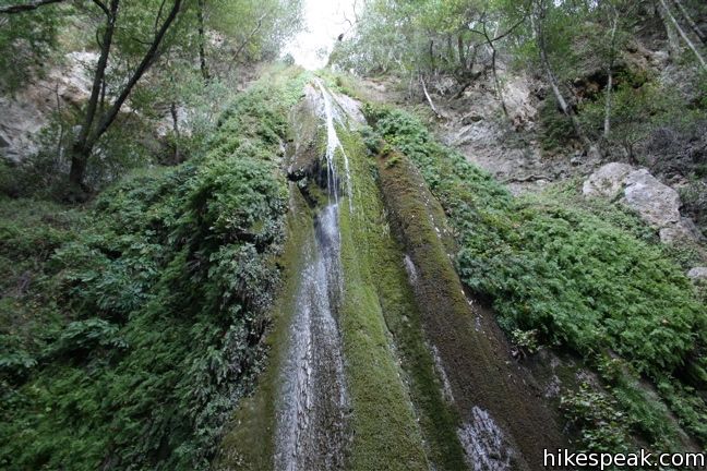
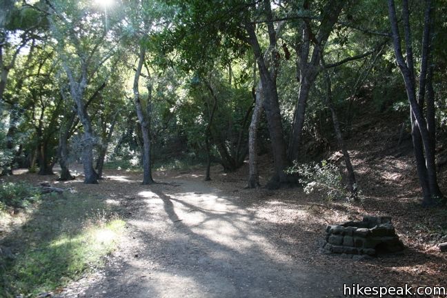
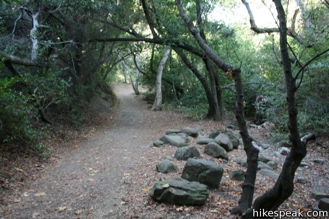
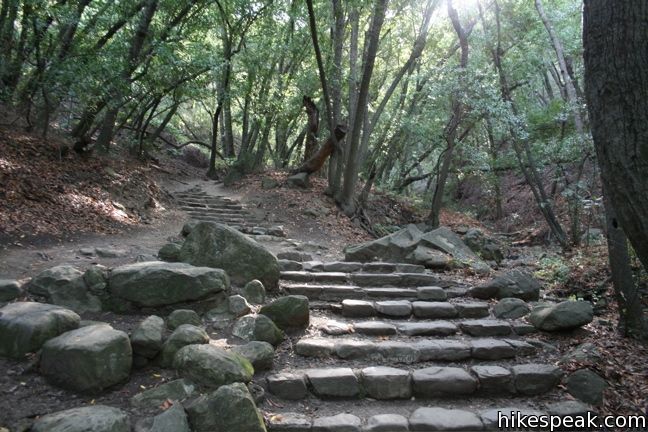
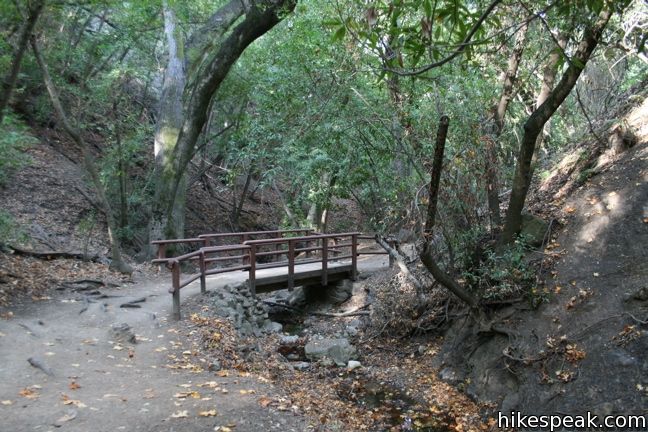
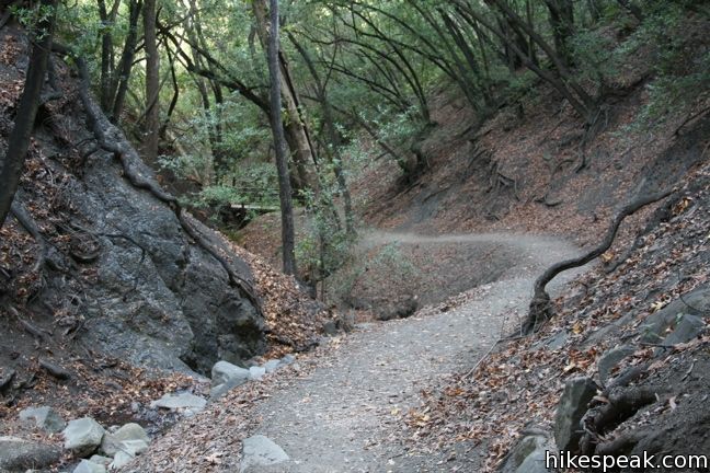
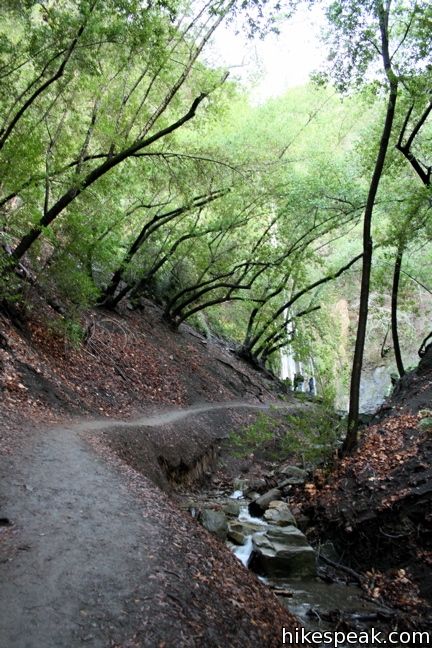
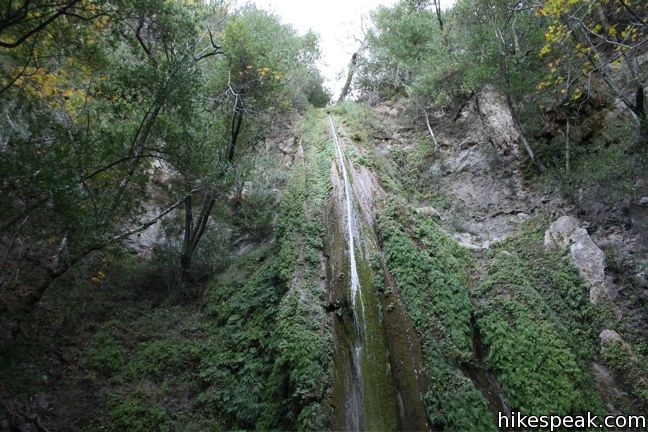
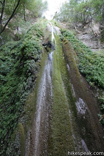
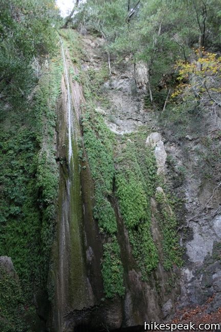
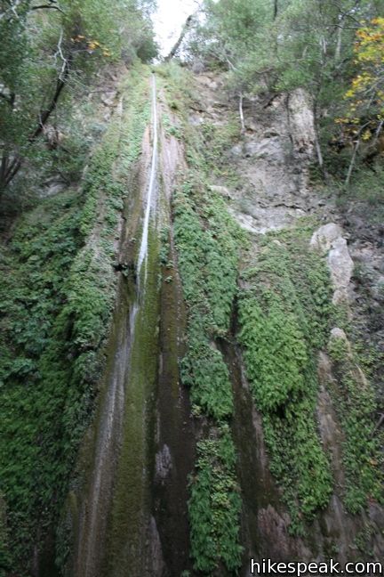
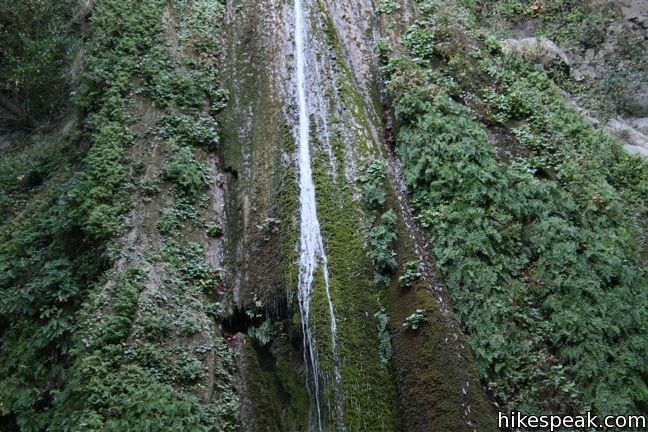
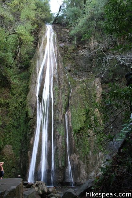
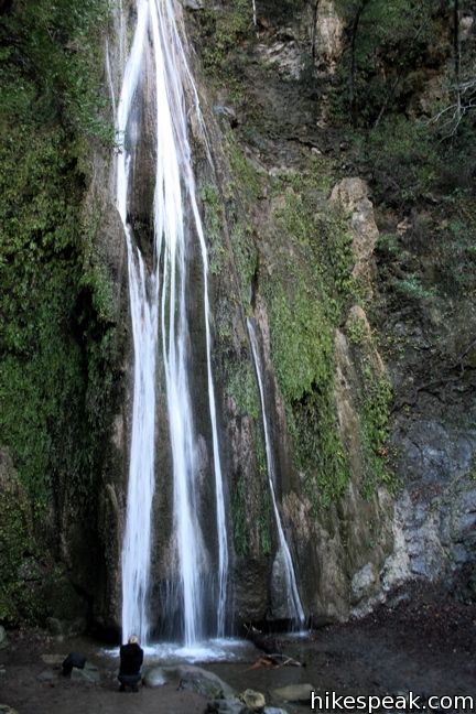
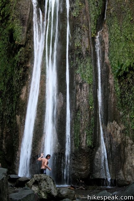
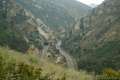
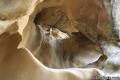
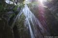
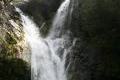
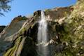
There are no junctions on the way to Nojoqui Falls. Just stick to the wide trail as it passes through an old forest of oaks and laurels. Halfway up, the trail enters the canyon below the falls, crossing a wooden bridge and climbing stone steps on the left bank of the creek. The trail crisscrosses the canyon and arrives at a stone viewing platform at the base of the falls. Overhead, Nojoqui Falls cascades down an 80-foot wall of fern-lined sandstone. This year-round attraction peaks in early spring when the falls are fullest, but Nojoqui Falls remains picturesque in the autumn when the waterfall is reduced to a slender ribbon of water flowing down a lush green tapestry. After heavy rains, Nojoqui Falls expands from a trickle to a torrent, becoming a truly powerful sight.
Unfortunately, the Chumash word Nojoqui is pronounced na-hoo-ee and not no-joke-ee, which would have been more humorous to their English speaking successors. Regardless of the name, the waterfall is a beautiful sight, certainly worthy of the short hike (no joking). After enjoying the falls, simply return the way you came. The entire hike takes about 20 minutes. While this is not enough time to work up a sweat, visiting the falls is a nice activity for anyone driving on the 101 and looking for a quick break. Those spending more time in Nojoqui Falls Park can make use of the picnic tables, BBQ pits, and ball fields. The park is free to the public and dogs are welcome on leash.
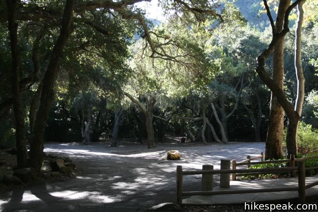
To get to the trailhead: From Santa Barbara, take Highway 101 north. Drive 5.4 miles past the Gaviota Rest Area and turn right on La Lata Place, following signs for Nojoqui Park. Take La Lata Place for one mile and make the first left on Alisal Road. After 0.8 miles, turn right into Nojoqui Falls Park. Follow the road through the park to the left and toward the mountains. Restrooms are located in front of the cul-de-sac at the trailhead. The park is free to the public and dogs are welcome on leash.
To get to Nojoqui Falls Park from the north, from the city of Buellton, take Highway 101 south for 4.7 miles and turn left following signs for Nojoqui Park onto La Lata Place. Make the first left on to Alisal Road and proceed to the park as described above.
Trailhead address: 3200 South Alisal Road, Nojoqui Falls Park, Gaviota, CA 93117
Trailhead coordinates: 34.530632, -120.176306 (34° 31′ 50.27″N 120° 10′ 34.70″W)
You may also view a regional map of surrounding Central Coast trails and campgrounds.

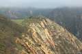 | Gaviota Pass Overlook Loop This 6.5-mile loop tours scenic ridges in Gaviota State Park to arrive at a soaring overlook above the Gaviota Tunnel. |
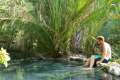 | Gaviota Hot Springs This short hike visits a warm hot springs along the trail to Gaviota Peak in Gaviota State Park. |
 | Gaviota Peak This 6.5-mile loop mounts a 2,458-foot summit two miles from the Pacific and then descends Trespass Trail to explore the wilds of the Santa Ynez Mountains. |
 | Tunnel View and Trespass Trails Loop This 2.6-mile loop steals a view over Highway 101 and the Gaviota Tunnel. |
 | Gaviota Wind Caves This 2.5-mile hike just off Highway 101 visits wind-carved caves in Gaviota State Park with great ocean views. |
 | Tequepis Trail This invigorating 8.4-mile round trip hike offers views of Lake Cachuma as it climbs the Santa Ynez mountains to views of Santa Barbara and the Pacific. |
 | More Central Coast Hikes Explore other destinations along the California coast between Ventura and Monterey, including trails in Los Padres National Forest. |
 | Rose Valley Falls in the Los Padres National Forest This 1-mile round trip trail leads to the lower tier of a lovely two-tier 300-foot waterfall. |
 | Salmon Creek Falls This short hike visits a fine 120-foot waterfall near the start of Salmon Creek Trail. |
 | McWay Falls This 0.6-mile hike looks out on a stunning Big Sur waterfall that pours 80 feet right on to the beach. |
 | Fish Canyon Falls in the San Gabriel Mountains This 4.8-mile round trip hike leaves from an active rock quarry and progresses up a beautiful canyon to a mesmerizing multi-tiered waterfall. |
 | Escondido Falls in the Santa Monica Mountains This 3.8-mile out and back hike visits a 200-foot waterfall that is split into two tiers. The upper tier is 150 feet tall and stunning after a rainstorm. |
 | Lower Yosemite Fall in Yosemite National Park This 1.2-mile hike delivers visitors to the base of the tallest waterfall in North America. The experience is not to be missed. |
Nice pictures, good to see the waterfall flowing so well.
Wondering if anyone knows what conditions are like around mid-August
Nojoqui Falls in Santa Barbara County?
I just did this short hike and the falls were totally dry. It’s still a pretty hike. I’ll be back again in early spring to catch the falls flowing!
saving this now – planning for a spring hike.
[…] Hikespeak also has a detailed write-up here. […]
How is the water there? Still any flowing or is it dry?
Trail is closed due to rockslide right near falls from heavy rainstorm in Dec. Temp fencing and warning signs didn’t seem to discourage many hikers though.
This trail is still closed as of this week.
Does anyone know if this trail will be open by the 27th? Or if it is open now?
Can someone tell me if the trail is open now?
I would also like to know if the trail in open… If not we’ll just have to climb!
I am wondering if the trail is opened and if there is any water falling.
The trail is still closed as of July 4th, 2015 weekend.
I am also wondering if the trail is open and if there is any water falling.
Thanks.
The Trail is still Closed as of August 29, 2015
I’m wondering if the trial has open or not?
Trail is still closed as of 12/26/2015. Ranger told us there have been two landslides, and a boulder is blocking the trail, so it is closed indefinately.
Is the trail open yet? Does it have water?
Hi all. We went to the falls yesterday. There is nothing more than what I would call a trickle. The landslide happened just in front of the falls. There is a posted sign warning to go no further, but a footpath has been created by people ignoring the sign and fence that traverses the (mostly) dry creek bed.
Is the trail open? I’ve been wanting to take my daughter there. Last year, after it closed, I heard that there was a fracas involving the police and the on-ranger. Maybe there needs to be a change of personnel in charge of this park?
Well, on March 3 the waterfall was dry. We had some pretty good rain yesterday (all day). Does anyone know if there is a waterfall? I am planning on going there this afternoon with my daughter.
Is the waterfall open and is there any water coming down? Has anyone been there recently 6/12/16? Thank you in advance.
Are dogs allowed on the hiking trails?
Dogs are allowed on the hiking trail. Also the trail is still closed right before the falls but as others have stated there is a path simply walking around the close barrier. Only a few drops coming down the falls.
What does the name Nojoqui mean?
Careful here. My moms car was broken into on November 18, 2016. If anyone was there on that day please let me know. Someone smashed out her window and stole her purse and everything in it. Very weird that everyone said they didn’t hear anything. Doesn’t seem to be a safe place.
Too bad I didn’t read your post sooner. We were there Dec. 30, 2016, a couple of days ago, and the same thing happend to us. I wish they had signs posted as we were the SIXTH break-in in two weeks.
[…] Solvang there is an easy trail to a beautiful waterfall, Nojoqui Falls. We were so excited about seeing this because we love going on family hikes. Plus it was a trail […]
Thank you guys for giving a heads up about the break-ins. I’m glad I read this. I really wanna see this spot but now I know to uber there or something.
Can you hike clear up to the falls yet, or is the trail still closed just before the falls?
The top 200 feet remains closed indefinitely. Too much debris still falling which makes it unsafe.
[…] due to a hold off on the expected rain, we pulled off the 101 north of Santa Barbara to walk the Nojoqui Falls Park Trail. It’s a pretty area to drive to and walk to see the Falls. We hadn’t done the research […]
Any water in the falls today June 8, 2019?
Just wondering if there’s any update on the waterfall, hiking conditions recently. Thanks in advance
There was water this weekend. More of a beautiful trickle then a thundering falls. The signs that are up all around the falls are soooo ugly. It would be nice if the message was blended better into the surrounding. They also need a falls viewing area with a sign for photo ops. It’s a great walk for kids. Short and sweet. If you like a more peaceful walk either come really early or skip this one.
Is the trail open now (July 2020)?
We are planning to hike the Nojoqui trail on November 22 – Sunday before Thanksgiving. Please let me know if it will be open and available for 6 to 8 people?Also, Are there bathrooms and,are there ballfield and or picnic tables available also?
Visited the falls this past May 30th, 2021 and there was a little bit of water flowing on the falls. The hike is pretty short. I think we hiked it in about 15 minutes and that included making short stops along the way for pictures. Its still a really nice hike and has pretty scenery. Uneven paths and a slight incline on the way up with uneven stairways. Saw a few seniors waiting down at the bottom while other hikers continued the hike. So if you have seniors with you or you have any kind of physical limitations, you might want to re-think this hike.