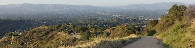
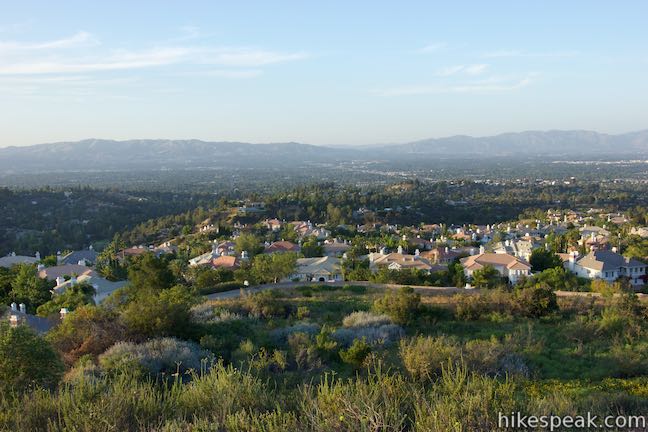
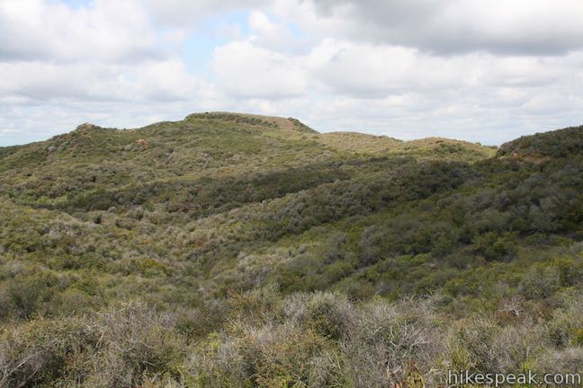
Hub Junction and Temescal Peak from Reseda Boulevard in the Santa Monica Mountains
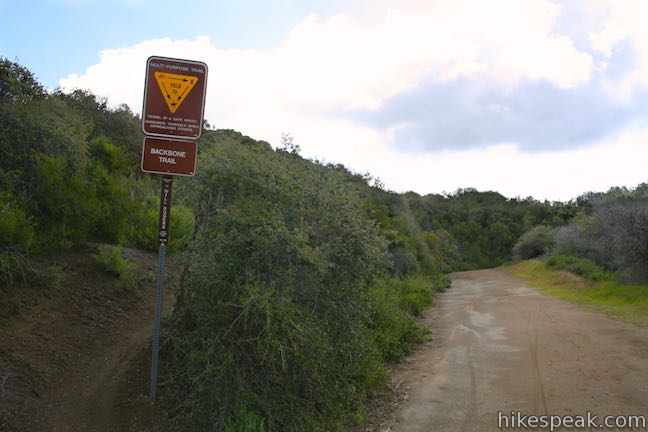
Reseda Boulevard gives hikers in the San Fernando Valley easy access to Topanga State Park and other areas of the Santa Monica Mountains. From the top of Reseda Boulevard, it is just 0.2 miles up to an unpaved stretch of Mulholland Drive (called Dirt Mulholland) that runs east and west across the range, connecting to lots of other trails, including nearby Temescal Ridge Trail. Enjoy nice mountain views from Temescal Ridge Trail on a southbound trek to Hub Junction, dubbed the crossroads of the Eastern Santa Monica Mountains, which is both an intersection of trails and a scenic destination.
Hub Junction provides a good turnaround point for a 5.3 to 5.45-mile hike with 400 to 460 feet of elevation change (the extra length comes if you use Bent Arrow Trail to add a little loop to the hike).
From Hub Junction, consider hiking another 1.4 miles round trip to the top of Temescal Peak (6.85 miles total with another 125 feet of elevation change) or stray west on Eagle Springs Loop, a 2.5-mile circuit to the more impressive summit of Eagle Rock (7.95 miles total).
Whether Hub Junction is the destination or a waypoint on a grander hike, setting out from Reseda Boulevard offers quick immersion into a picturesque part of the Santa Monica Mountains.
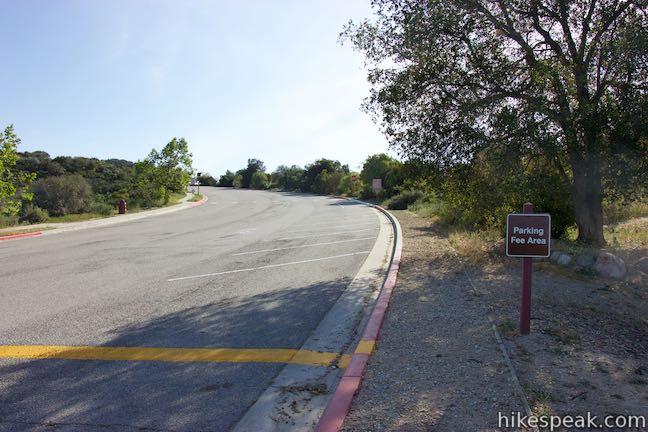
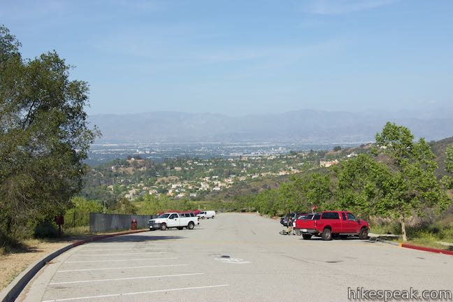
Reseda Boulevard runs right up a ridge from the San Fernando Valley into the Santa Monica Mountains. Before getting underway, you must choose between two parking areas at the top of Reseda Boulevard. Pull-in spaces line both sides of the road for the last 0.4 miles. Half of that parking is free, but a $5 vehicle fee is charged to park along the last 0.2 miles of the road in Marvin Braude Mulholland Gateway Park. A painted line in the road separates the paid parking from the free parking. Do you want to pay for the convenience? If you don’t, you’ll just walk a bit farther. A scenic path along the west side of the road helps make the extra walk enjoyable.
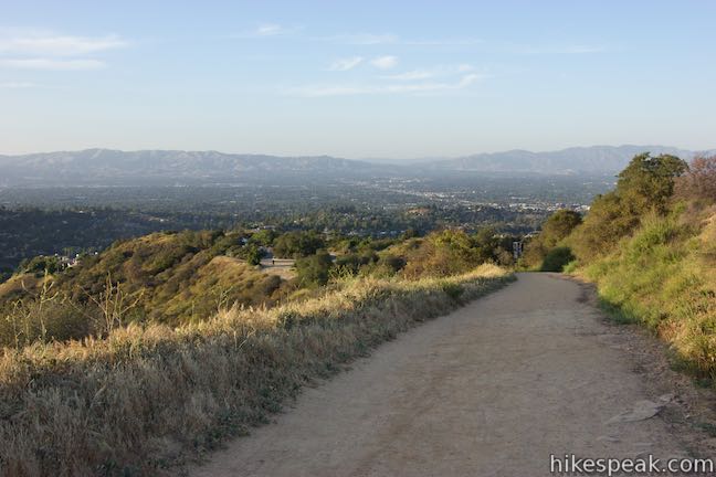
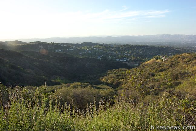
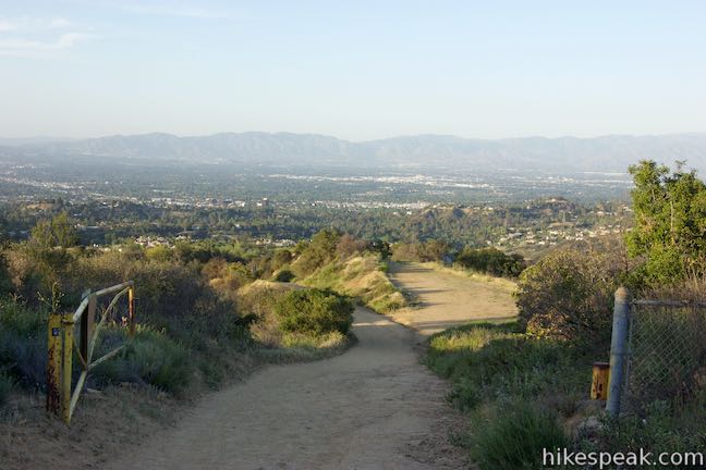
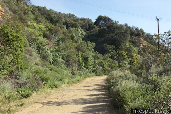
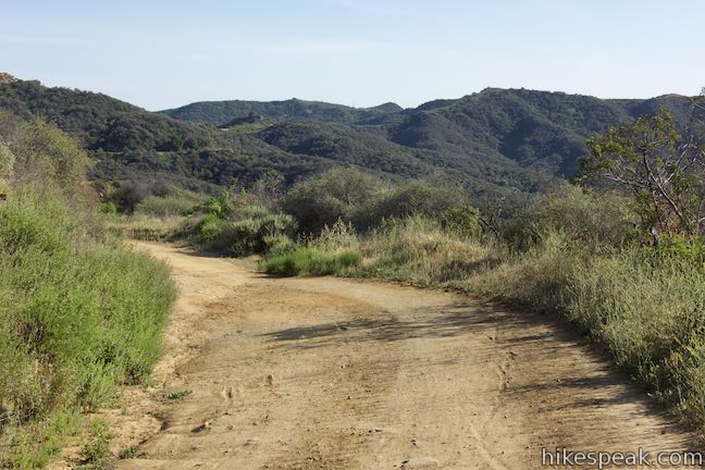
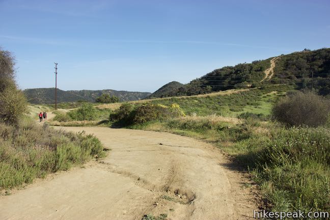
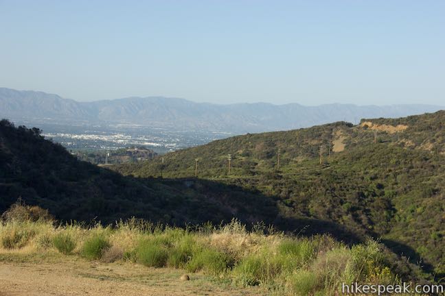
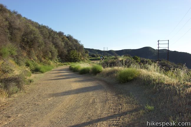
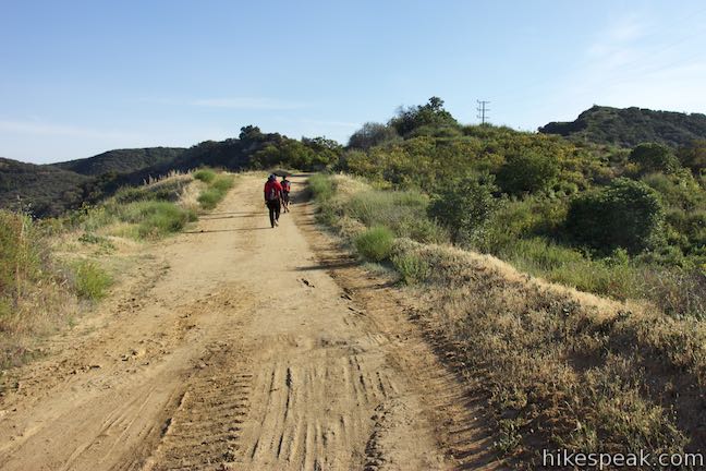
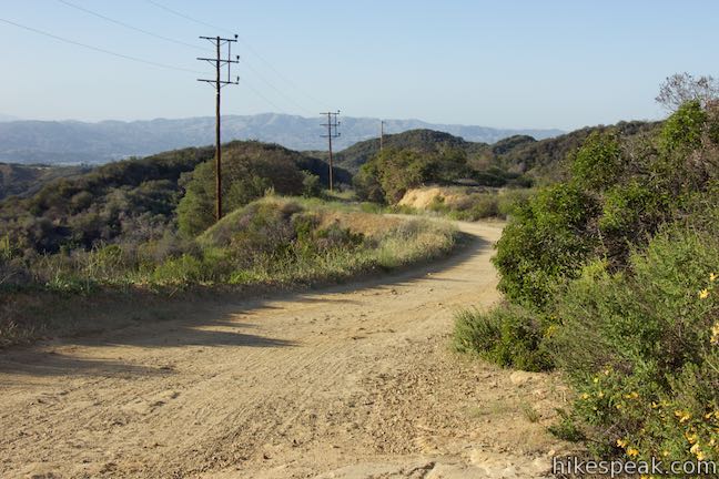
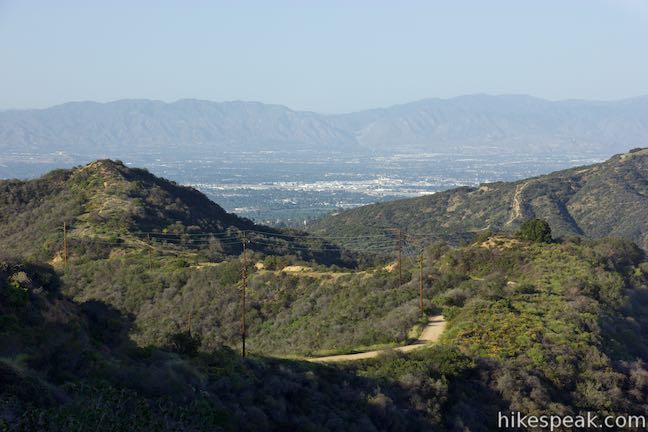
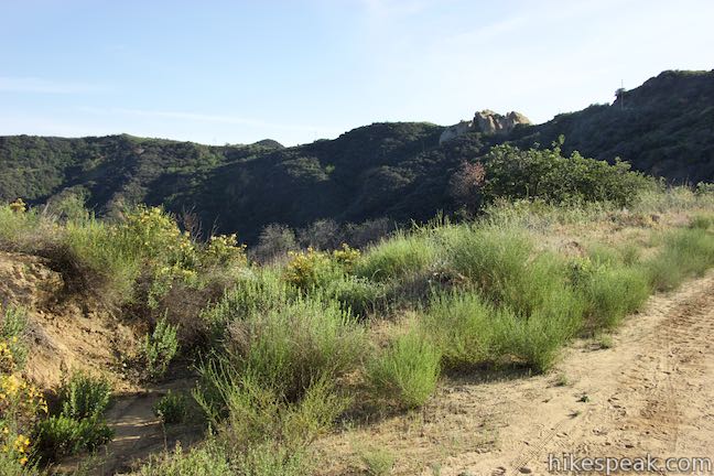
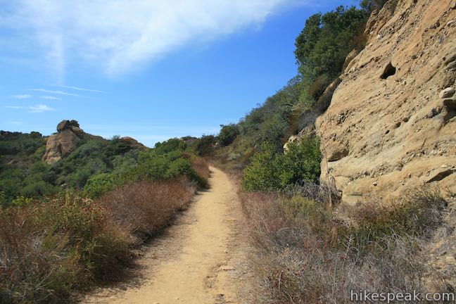
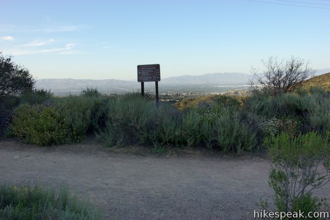
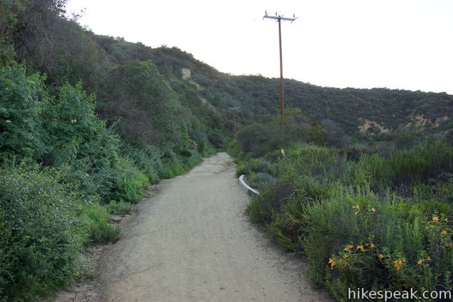
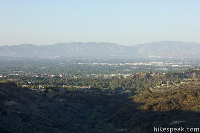
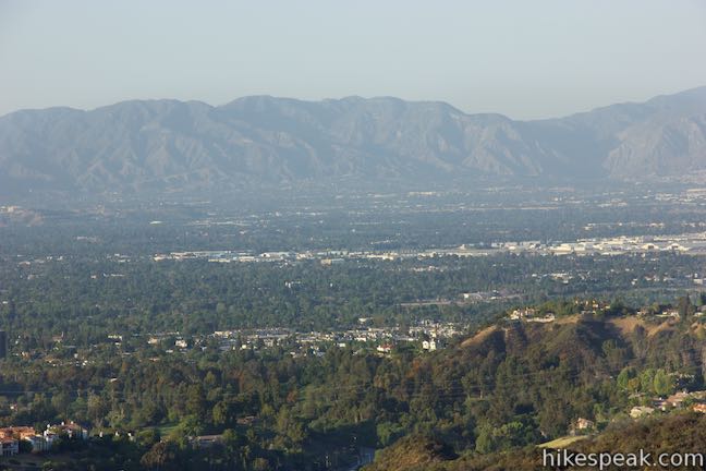
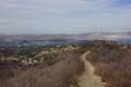
Where the road ends, the hike truly begins. Go through a paved loop at the top of the road and start up a wide dirt road that maintains the same course as Reseda Boulevard. Look over your shoulder as you hike. Reseda Boulevard Trail (sometimes called Fire Road Twenty-nine) offers broad views back across the San Fernando Valley toward the Santa Susana Mountains and the west end of the San Gabriel Mountains.
After just 300 feet, a single-track trail called Reseda Spur Trail breaks off to the right and goes up to Mulholland Drive west of the top of Reseda Boulevard. Reseda Spur Trail can be taken as a shortcut on the way to Temescal Ridge Trail.
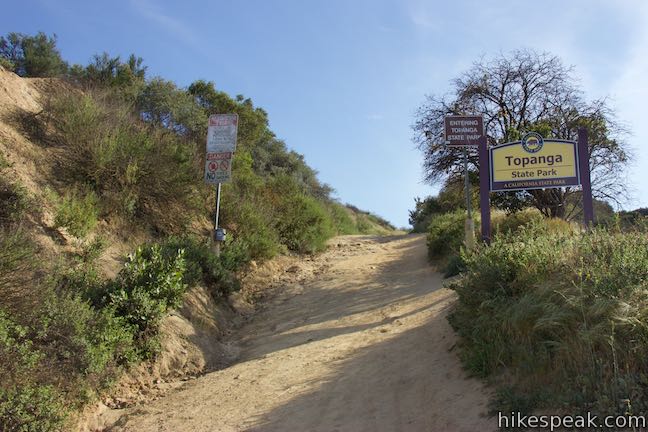
Reseda Boulevard Trail passes a sign at the boundary of Topanga State Park, halfway up to a T-junction with Mulholland Drive, which Reseda Boulevard Trail reaches after just 0.2 miles.
Hub Junction lies farther to the south and there are actually a couple good routes to get there:
- The most obvious path is to turn right, hike to Temescal Ridge Trail and take that to Hub Junction, reaching it 2.65 miles from the start
- An alternative is to turn left on Mulholland Drive, descend to Bent Arrow Trail and take that single track up to Temescal Ridge Trail to get to Hub Junction, 2.8 miles from the start
Both routes to Hub Junction are enjoyable, so why choose? Hike in one way and out the other. The directions below save Bent Arrow Trail for the hike back as a way to add a small loop to the middle of the hike.
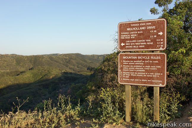
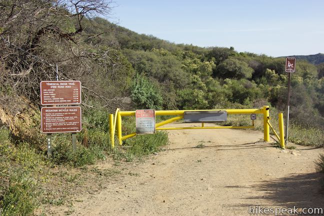
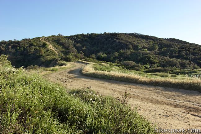
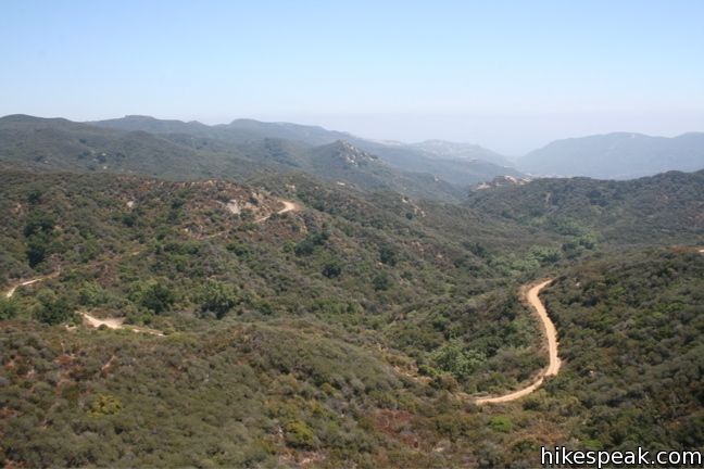
At the top of Reseda Boulevard Trail, which might be the steepest trail on this hike, turn right on a nearly 8-mile long unpaved stretch of Mulholland Drive known as Dirt Mulholland. Proceed 0.3 miles up the wide dirt road, passing the top of Reseda Spur Trail halfway to the major junction with the north end of Temescal Ridge Trail. Large signs mark the intersection, so you should not miss it.
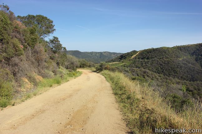
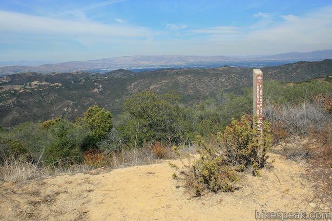
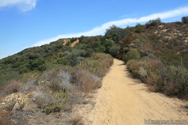
Temescal Ridge Trail heads south, going all the way to the Pacific Palisades where it ends in Temescal Gateway Park. The whole trail is 7.9 miles long, but you will only have to hike another 2.15 miles to get to Hub Junction.
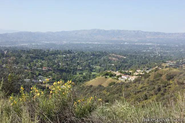
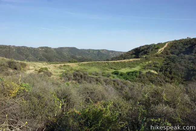
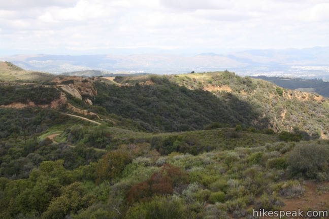
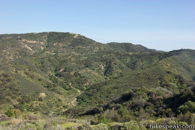
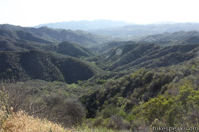
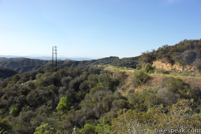
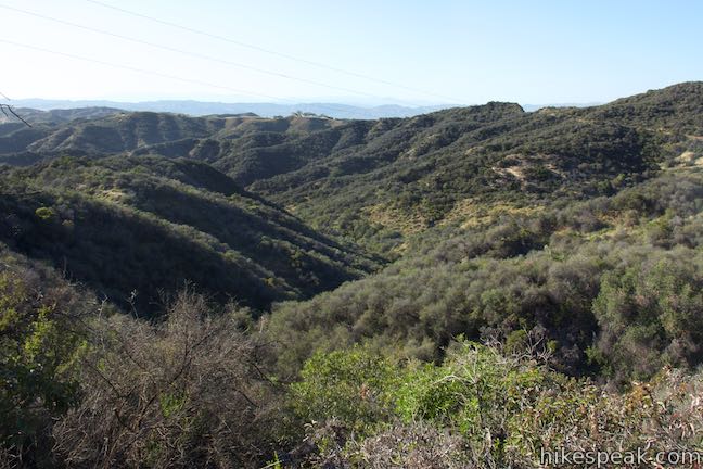
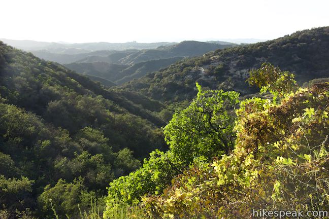
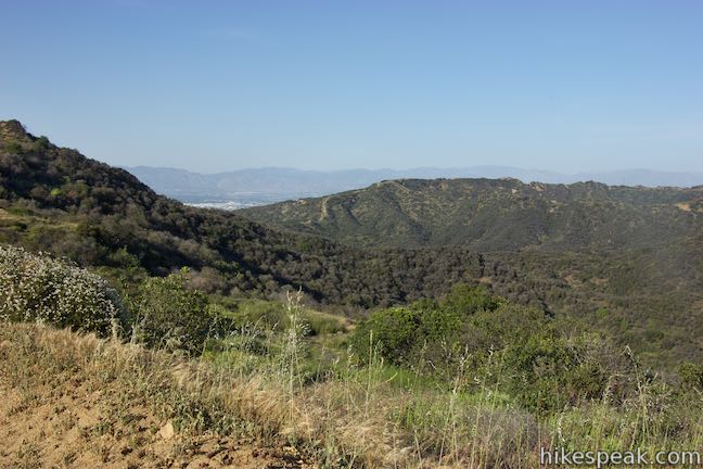
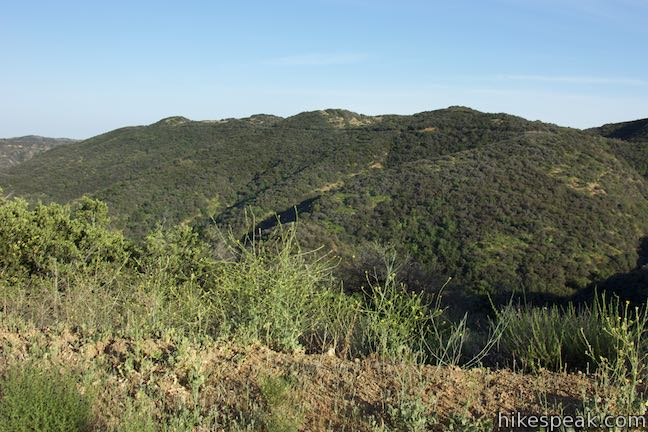
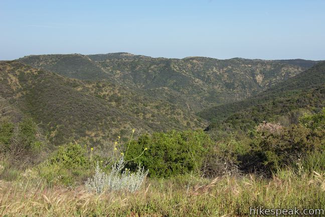
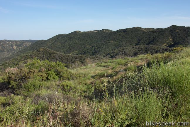
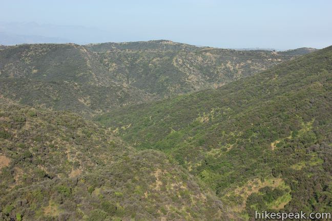
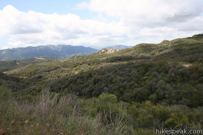
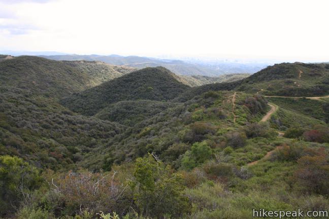
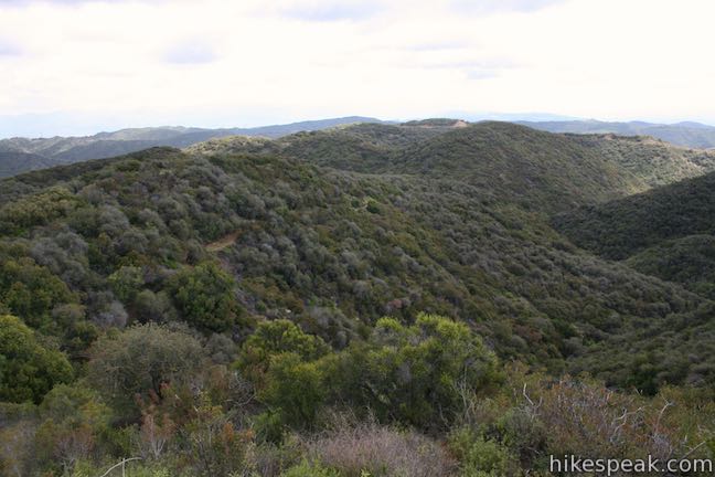
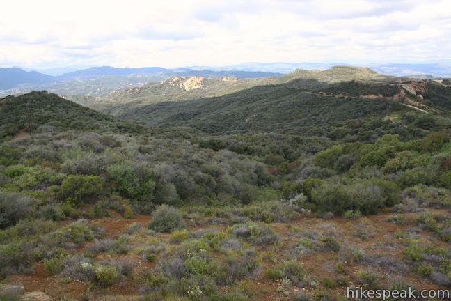
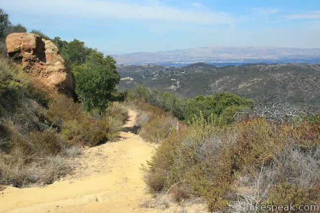
The ridge on Temescal Ridge Trail becomes more pronounces as you go. Initial views to the west overlook a large round drainage carved by streams feeding into Garapito Creek. Below that, Topanga Canyon is surrounded by more mountains and ridges in the Santa Monica Mountains.
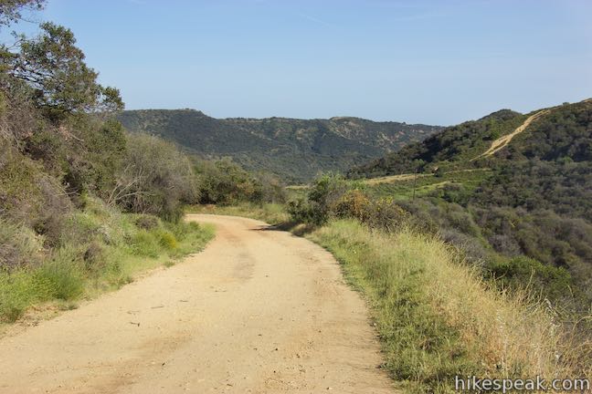
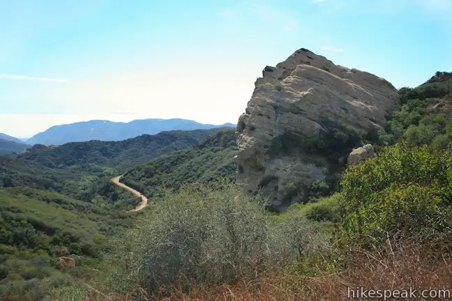
Initially, Temescal Ridge Trail heads downhill, making its way toward a long saddle on the ridge. As it crosses the saddle, Temescal Ridge Trail meets Garapito Canyon Trail on the right, which crosses the canyon between here and Eagle Rock. Just past this junction, another single track parts to the left. This is Bent Arrow Trail, which folds down the other side of the ridge to connect to Mulholland Drive east of Reseda Boulevard. This is the lowest point on Temescal Ridge Trail for this hike and it is another 1.55 miles from Bent Arrow Trail to Hub Junction with 375 feet of elevation change.
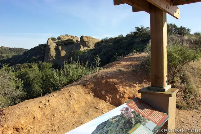
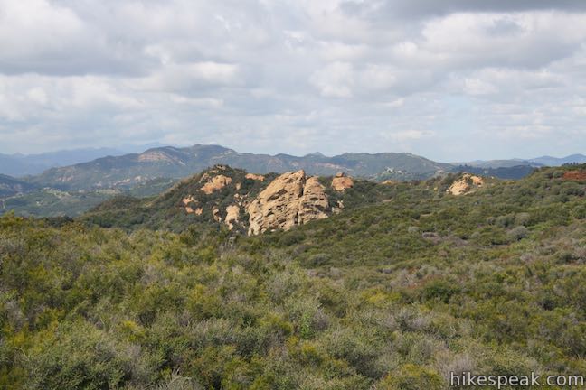
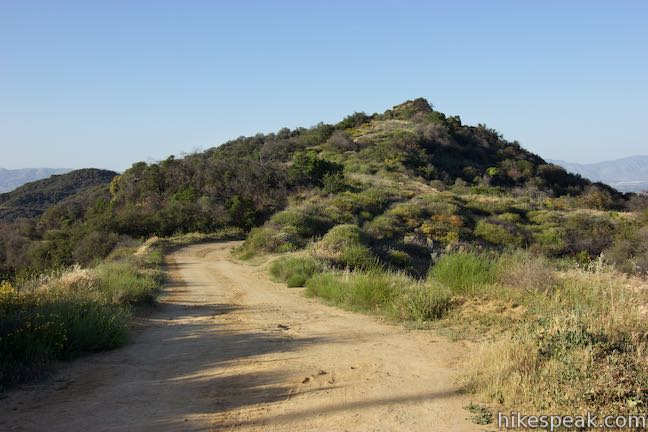
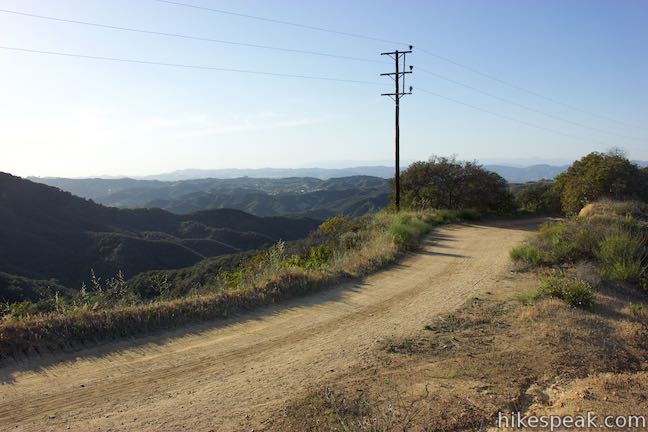
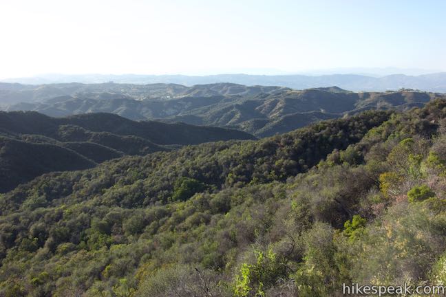
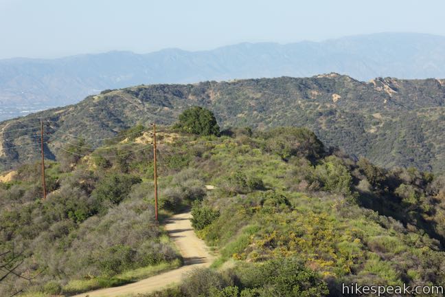
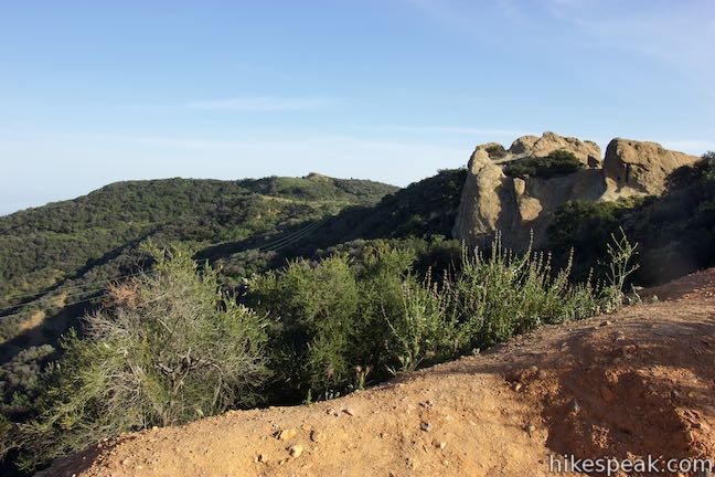
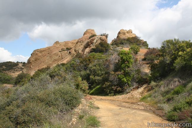
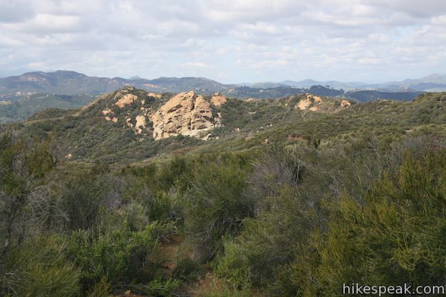
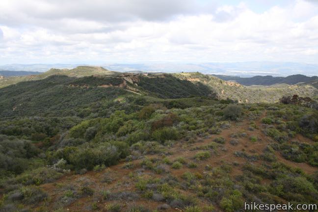
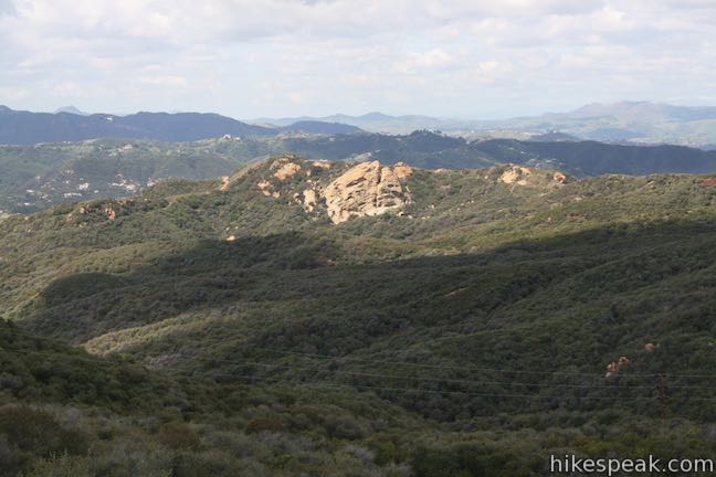
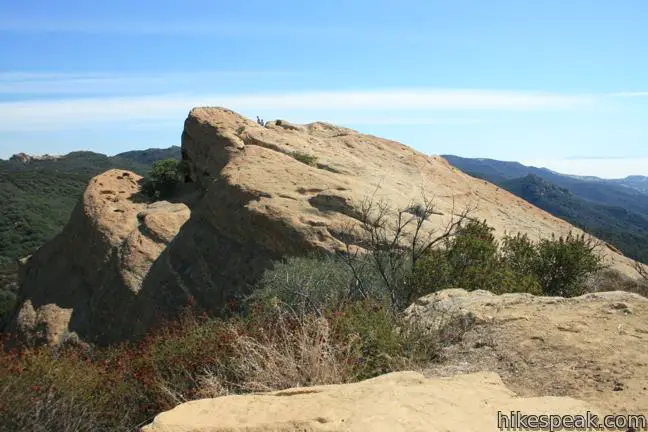
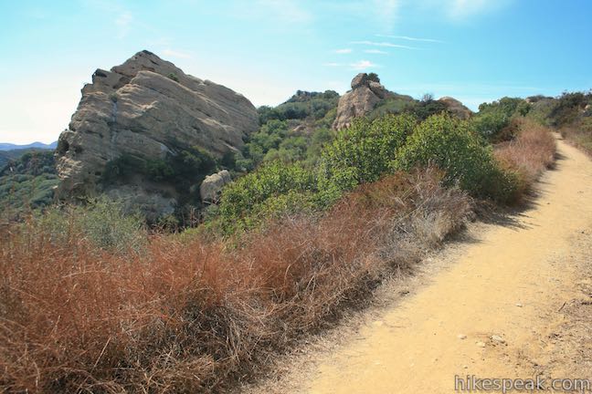
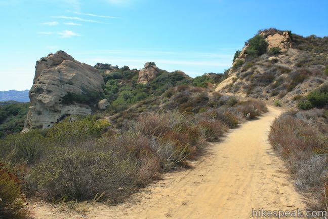
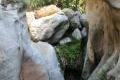
Temescal Ridge Trail ventures deeper into the mountains where sights of of the San Fernando Valley become more fleeting. Steep canyons drop away on both side of Temescal Ridge, backed by more ridges in Topanga State Park. Proceed up the road, which overlaps a line of utility poles. When you see the Cathedral Rocks, a crown of sandstone jutting from the ridge, you’ll know you’re getting close to Hub Junction.
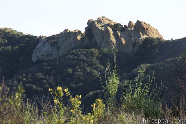
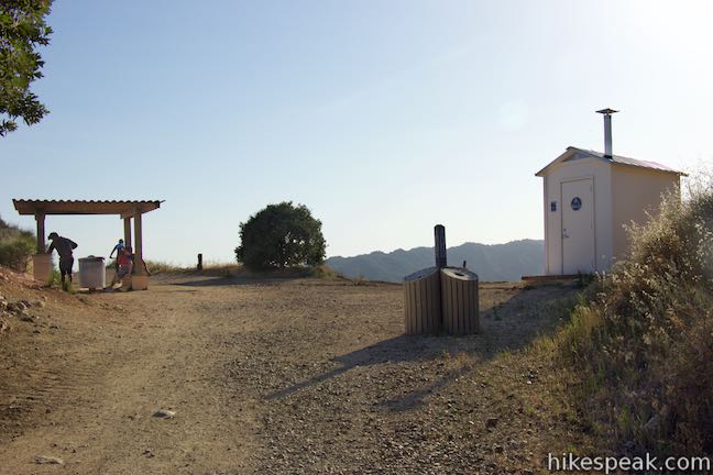
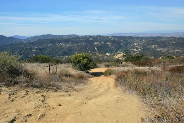
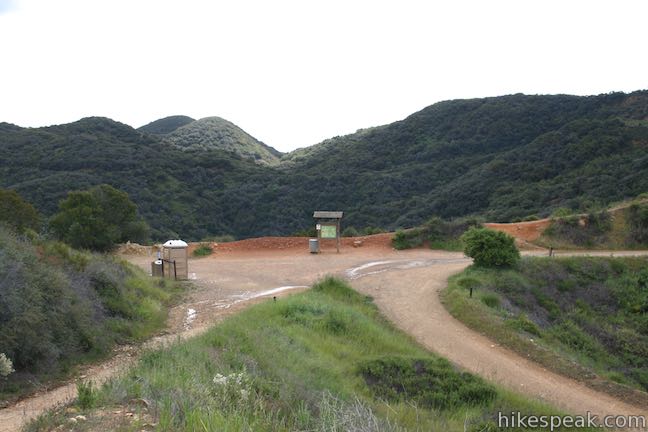
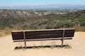
Make a last ascent to come up to Hub Junction, where a pavilion provides a bit of shade and information panels about the park and mountains. The panel compares Cathedral Rocks to:
A slice of layer cake tipped over on its side.
That’s a tasty way to look at a 21 to 42-million year old conglomerate sandstone formation atop the ridge to the south. You have come to a scenic crossroads. Will you turn back or hike even farther?
Temescal Peak
The most obvious extension from Hub Junction is to continue south to Temescal Peak, the high point on Temescal Ridge, which is 0.7 miles away.
To bag the summit, continue up Temescal Ridge Trail, passing just below the Cathedral Rocks. To the west, Eagle Rock stands out above the rest of Topanga State Park. As the trail ascends toward the summit, pass Rogers Road Trail on the left, which descends to Will Rogers State Park.
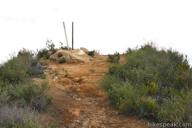
After passing below the small summit of Temescal Peak (and half a from Hub Junction), take the marked single track ascending to the left, which is a section of the Backbone Trail that crosses Temescal Peak and descends to Rodgers Road en route to Will Rogers State Park. Leave this track after just a tenth of a mile, and bust up a footpath on the left that rise to the top in another tenth of a mile. Two poles and a USGS survey marker denote the 2,126-foot summit, which is only about 70 vertical feet above Temescal Ridge Trail. While the views from the top aren’t much different than those on the trail below, the not-so-prominent summit provides an excellent 360-degree view over Topanga State Park and more of the Santa Monica Mountains.
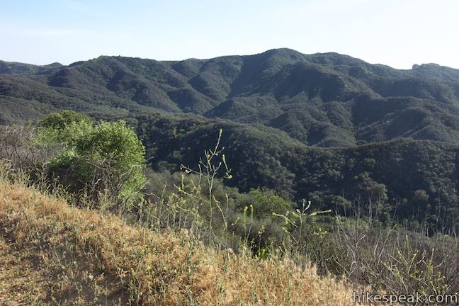
To the east, a majestic series of rolling ridges lead to San Vicente Mountain. To the north, you’ll spot the Cathedral Rocks, Hub Junction, and a big spread of the San Fernando Valley. More beautiful mountains lie to the northwest, including the alluring nearby outcropping of Eagle Rock. To the south is a long view down Temescal Ridge toward Santa Monica Bay. Leaving the summit, you can return to Hub Junction the way you came.
Eagle Springs Loop to Eagle Rock
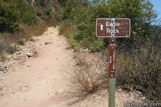
A second good extension uses a pair of dirt roads heading west from Hub Junction to Eagle Rock. This is a loop so either Eagle Springs Fire Road or Eagle Rock Fire Road (also a section of the Backbone Trail) can be used to start the 2.5-mike loop to Eagle Rock.
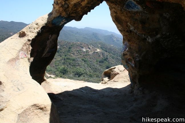
To hike Eagle Springs Loop in a clockwise direction turn west down Eagle Springs Fire Road and take it for 1.3 miles, dropping into an canyon and up to Eagle Junction where it meets the other end of Eagle Rock Fire Road. Turn right up this rough dirt road and ascend toward a ledge of pocketed sandstone called Eagle Rock. Gain close to 300 feet over the next half mile to come up along the backside of the 1,957-foot summit of Eagle Rock. The road continues past the summit to return to Hub Junction, so take the path to the right up to the pothole-filled pinnacle. Climb to the top and get panoramic views over Santa Monica Bay, the San Fernando Valley, and all the mountains in between. Explore interesting crevices and alcoves, including a small arch, or just relax and enjoy the lofty perch.
Leaving Eagle Rock, hike another 0.7 miles east on Eagle Rock Fire Road back to Hub Junction. Junctions with Cheney Trail and Garapito Canyon Trail come in quick succession on the left, but stick with the main road. Before dropping back to Hub Junction, Eagle Rock Fire Road has grand views over the Santa Monica Mountains.
Hiking back from Hub Junction
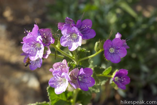
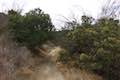
When you are ready to return to Reseda Boulevard, either reverse the route down Temescal Ridge Trail to Mulholland Drive to Reseda Boulevard or bend the route to include Bent Arrow Trail. Hike 1.55 miles north from Hub Junction down to the saddle at the junction with Bent Arrow Trail. Turn right on Bent Arrow Trail, which quickly leaves the ridge and drops down a string of switchbacks. There are lovely views down the upper reaches of Rustic Canyon to the south. The single track bottoms out and turns slightly uphill along the side of the ridge. In the spring, this is an excellent place to spot wildflowers like large-flowered phacelia.
Bent Arrow Trail ends after 0.45 miles, coming to a T-junction with Mulholland Drive. To the north, look down over Caballero Canyon toward the San Fernando Valley (the top of Caballero Canyon Trail is to the right). Reseda Boulevard follows the ridge on the west side of Caballero Canyon, so to reach it, turn left on Mulholland Drive. It’s an uphill journey on Dirt Mulholland for the next 0.6 miles to return to Reseda Boulevard Trail. Turn right to descend the last 0.2 miles back to the trailhead.
There is a bathroom at the top of Reseda Boulevard in Marvin Braude Mulholland Gateway Park and a port-o-potty at Hub Junction. A $5 fee is charged to park a vehicle in Marvin Braude Mulholland Gateway Park (as of 2015), but there is no fee to park below the line on Reseda Boulevard. Watch out for the photo enforced stop sign where the parking transitions. The free parking can fill up first on weekends.
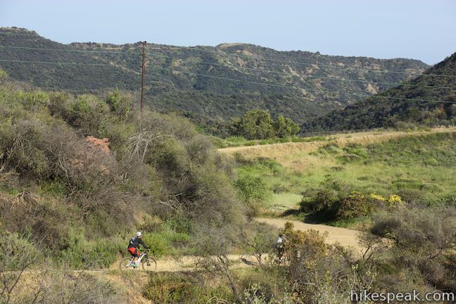
Bikes are allowed on the wide dirt trails (Reseda Boulevard, Mulholland Drive, Temescal Ridge, Eagle Springs, and Eagle Rock) but are not allowed on single-tracks like the Backbone Trail and Bent Arrow Trail. Dogs can go up the start of Reseda Boulevard Trail to Mulholland Drive, but dogs are not allowed on Temescal Ridge Trail and other parts of Topanga State Park.
To approach Temescal Peak from the other direction, consider hiking up Temescal Ridge Trail from the Pacific Palisades. No permit is required to hike to Hub Junction or other points in Topanga State Park, so get out and enjoy!
Directions to the Trailhead
- From the meeting between the 101 Freeway and the 405 Freeway, drive west on the 101 Freeway for 4 miles to exit 23 for Reseda Boulevard.
- At the bottom of the offramp, turn left and head south.
- Pass the start of Caballero Canyon Trail after 2.2 miles and drive another mile up to the edge of the paid parking.
- The hike begins from the top of Reseda Boulevard.
Trailhead Location
Trailhead address: 3600 Reseda Boulevard, Tarzana, CA 91356
Trailhead coordinates: 34.13133, -118.55313 (34° 07′ 52.78″N 118° 33′ 11.26″W)
You may also view a regional map of surrounding Los Angeles trails and campgrounds.

Eagle Springs Loop


Bent Arrow Trail![]()
![]()
![]()
![]()
![]()
![]()
![]()
![]()
![]()
![]()
![]()
![]()
![]()
![]()
 | Temescal Peak from the Pacific Palisades This 5.8 to 7.6-mile hike ascends Temescal Ridge to a summit with sweeping views over Topanga State Park and the Santa Monica Mountains. |
 | Caballero Canyon Trail This 3.4-mile round trip hike ascends a canyon on the north side of the Santa Monica Mountains with views over the San Fernando Valley. |
 | Vanalden Cave This 0.6-mile round trip hike visits a unique sandstone cave that you can stand inside and above. The hike can be extended to 1.55 miles round trip to visit a nearby vista point with a panoramic perspective of the Santa Monica Mountains. |
 | Corbin Canyon This 2.05-mile hike offers an easy stroll along the bottom of a canyon on the north side of the Santa Monica Mountains near Tarzana and Woodland Hills. |
 | Winnetka Ridge Trail This 1.5-mile hike ventures up a ridge into the Santa Monica Mountains from the end of Winnetka Avenue in Woodland Hills. |
 | Skull Rock This 1.5-mile hike descends Temescal Ridge to a head-shaped formation with great views over Santa Monica Bay. |
 | Eagle Rock from Trippet Ranch This 4.5-mile loop takes Musch Trail and Eagle Springs Fire Road to visit an exceptional sandstone summit in Topanga State Park. |
 | Eagle Rock from Santa Ynez Canyon This 7.4-mile hike takes the long route from a canyon in the Pacific Palisades up to the panoramic sandstone summit. |
 | Santa Ynez Falls This 2.5-mile follows a shaded creek to a gorge containing a short waterfall. |
 | Temescal Canyon This 2.6-mile loop offers a variety of scenery and decent exercise, despite its relative brevity. |
 | More trails in the Santa Monica Mountains Explore other destinations in the range. |
Common Questions about Hub Junction and Temescal Peak from Reseda Boulevard in the Santa Monica Mountains
- Is the trail open?
- Yes. You should expect to find that Reseda Boulevard to Hub Junction is open. There are no recent reports of trail closures. If you discover that the trail is closed, please help your fellow hikers by reporting a closure.
- Do I need a permit for this hike?
- Yes. Free and paid parking.
- How much time does this hike take?
- It takes approximately 2 hours 30 minutes to hike Reseda Boulevard to Hub Junction. Individual hiking times vary. Add extra time for breaks and taking in the views.
- How long is this hike?
- The hike to Reseda Boulevard to Hub Junction is 5.3 - 7.95 miles (out and back) with 400 feet of elevation change.
- Are dogs allowed on this trail?
- No, dogs are likely not allowed on Reseda Boulevard to Hub Junction. The trail is primarily open to hikers, bikes (fire roads only).
- Does this trail go to a summit?
- Yes, Reseda Boulevard to Hub Junction reaches a summit with panoramic views.
- What mountain range is this trail in?
- Reseda Boulevard to Hub Junction is located in the Santa Monica Mountains.
- Where is the trailhead located?
- The trailhead for Reseda Boulevard to Hub Junction is located in Tarzana, CA.
Trailhead Address:
3600 Reseda Boulevard
Tarzana, CA 91356
Trailhead Coordinates:
34.13133, -118.55313 - What are the driving directions to the start of the hike?
To get to the trailhead: From the meeting between the 101 Freeway and the 405 Freeway, drive west on the 101 Freeway for 4 miles to exit 23 for Reseda Boulevard. At the bottom of the offramp, turn left and head south. Pass the start of Caballero Canyon Trail after 2.2 miles and drive another mile up to the edge of the paid parking. The hike begins from the top of Reseda Boulevard.
View custom Google Maps directions from your current location.
- Are there other trails near Reseda Boulevard to Hub Junction?
- Yes, you can find other nearby hikes using the Hikespeak Hike Finder Map.

By looking at the pictures this looks like a great hike but one thing: Someone needs to form a volunteer group like Friends of Topanga State Park and work on graffiti removal on Eagle Rock. I have added this hike to trails I want to hike
[…] http://www.hikespeak.com/trails/reseda-boulevard-hub-junction/ […]
Rode it on MTb last night 5/18/2020 Seems like someone dumbed down several rocky sections there, there was one near middle lookout point (by the tree) it was a rock garden with a gradient that I always enjoyed clearing and the whole section before the bridge (the staircase).. Now it seems like ppl will not have problem riding it even on a road bike.. I always tried to ride it uphill as much as possible and thought one day to clear it all, now it’s much more smoother.. I cant imagine why someone would destroy natural features..