Sydney Street Trail to Murray Hill (Unnamed Hill)
in San Luis Obispo
If the hike at your own risk sign at the start of Sydney Trail doesn’t intimidate you, maybe the 1,275-foot climb over 1.4 miles (one-way) will. This is a steep hike up a rocky road. The destination is a stone seating area at the top of Murray Hill (also known as Unnamed Hill), a 1,715-foot summit in the Santa Lucia Foothills with panoramic views over San Luis Obispo, more commonly reached from the north via Reservoir Canyon Trail. This rugged hike is accented with climbs over cattle gates, ensuring that you get a little upper body workout on this rigorous trek.
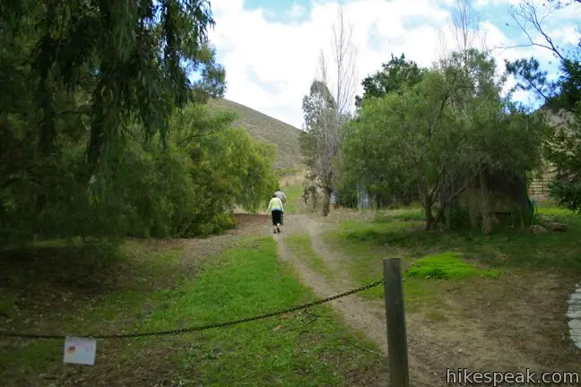
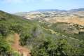
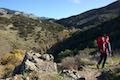
Park at the top of Sydney Street, one mile southeast of downtown San Luis Obispo and continue straight up a private paved road on foot. After a tenth of a mile, when the pavement ends, proceed up a dirt road, passing a warning sign for hikers about rattlesnakes and bulls (you will be hiking on the edge of an active ranch). Begin hiking up a small wooded canyon carved into the steep grass-covered hillside. It will not take long for you to understand why mountain bikers in San Luis Obispo call this trail the “hill of pain.” Sydney Street Trail would make one hell of a fat tire conquest, certainly qualifying as an HC climb in the Tour de France.
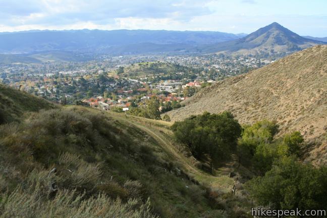
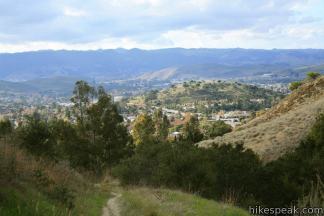
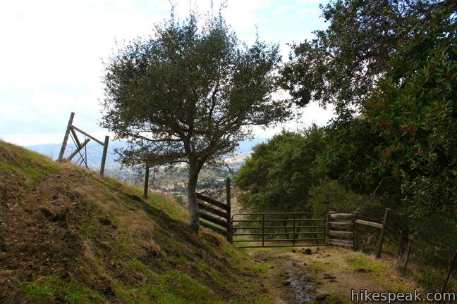
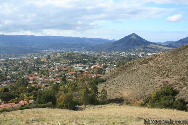
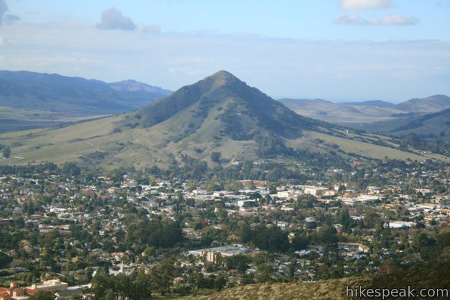
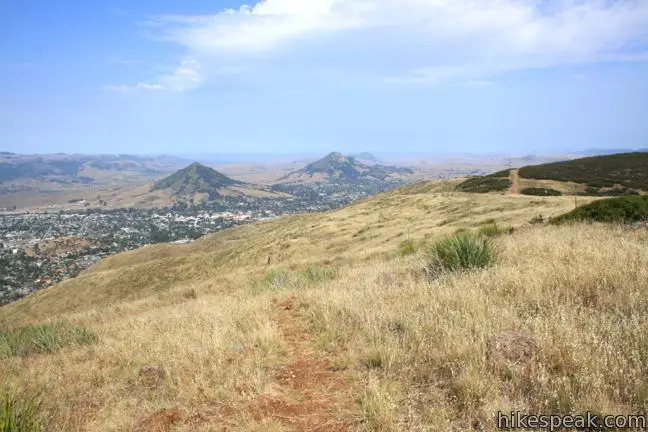
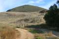
A quarter mile from the start, you will hit the first gate across the trail. Climb to the other side and continue uphill, quickly reaching another gate. Here the trail swings to the right and out of the canyon for an overview of San Luis Obispo. Swing back to the left, returning to the canyon over a third cattle gate. After climbing close to 400 feet in less than half a mile, pause to catch your breath and admire the view across the city toward Cerro San Luis and Bishop Peak.
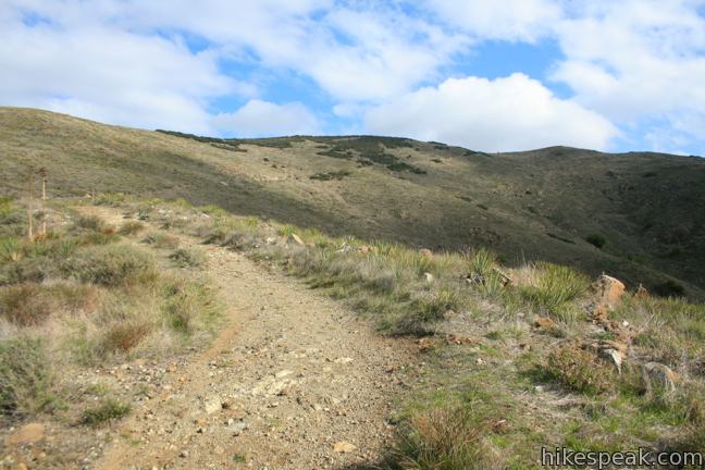
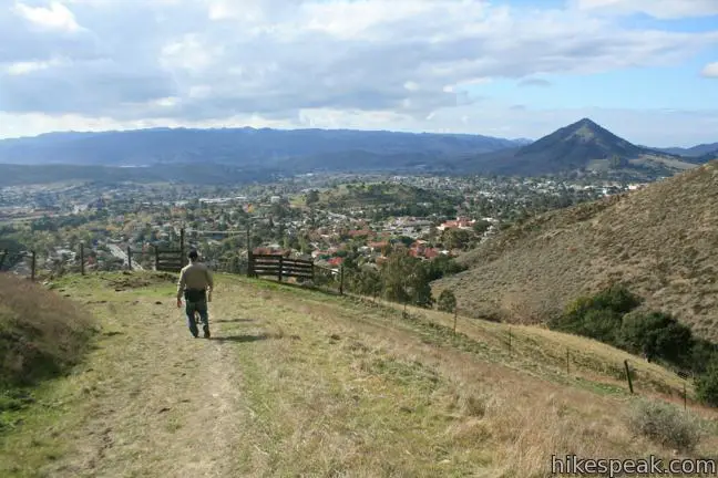
A tenth of a mile above the third and final gate, the trail switches to the right and climbs out of the canyon, gaining more elevation toward a landing that protrudes from the northwest-to-southeast running ridge that dominates Murray Hill. Look over your shoulder as you pass below a row of power lines. Can you still spot your vehicle on Sydney Street, 700 feet below?
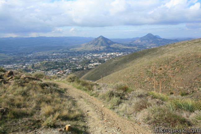
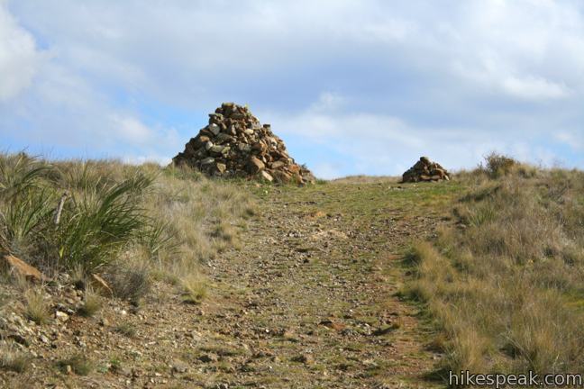
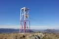
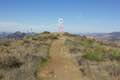
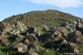
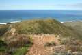
The rocky road angles northeast and then east for the summit, climbing another half mile (with 500 feet of elevation gain) to a junction marked by a pair of large boulder piles. To the left, Ridge Trail heads along the ridge down to a junction with Summit Trail by an old tower that houses a bell. Turn right to reach the summit. After an easy tenth of a mile, come to an unmarked junction with Reservoir Canyon Trail on the left. Don’t turn left, and don’t go straight. Instead, split the difference on a path up to the stone seating area at the top of Murray Hill.
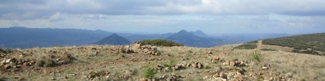
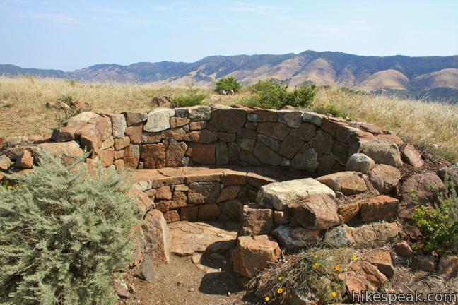
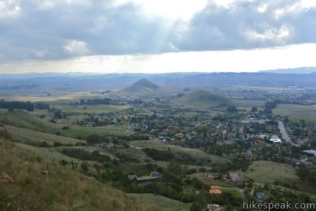
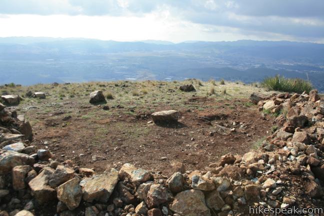
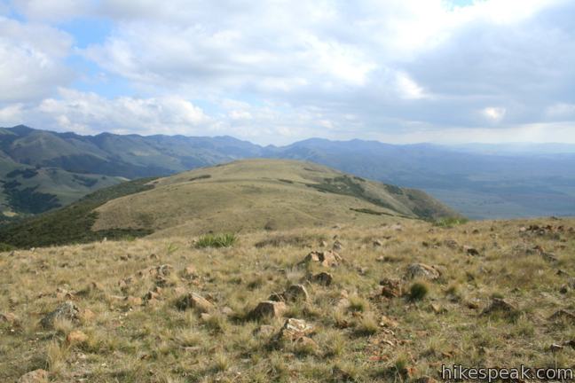
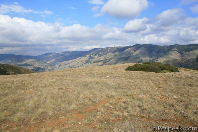
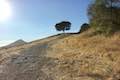
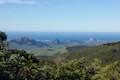
The summit is built up with a garden of fledgling trees and impressive horseshoe-shaped stone bench ideal for resting your legs and taking in the view over Edna Valley. Farther to the south, one can see the Pismo Dunes and Point Sal. There are three windows of ocean views in all, Pismo Beach to the south, Whalers Island in San Luis Bay to the southwest, and Moro Bay to the west. The panorama does not stop there as Murray Hill looks east toward the Santa Lucia Mountains, north over Reservoir Canyon toward Cuesta Grade, and west onto the Irish Hills and several jagged Morros, including the prominently displayed Cerro San Luis and Bishop Peak. It is quite a sight!
While many locals aren’t sure what to call this summit (unlike the other prominences around), it can be called Murray Hill, taking its name from Judge Walter Murray who resided in San Luis Obispo in the 1800s. Murray took part in the California gold rush after fighting in the Mexican-American War and wrote for the San Luis Obispo Tribune.
When your legs have recovered from the ascent and your eyes have recovered from the beauty, head back the way you came. The descent is brisk but the trail is still quite rugged. No fee or permit is required to hike to Murray Hill. As with all hikes, but especially on this one, your safety is your responsibility, so do take “the hike at your own risk” sign to heart.
Directions to the Trailhead
- Take Highway 101 to exit 203 in downtown San Luis Obispo.
- Drive half a mile southeast on California Street and turn right on San Luis Drive.
- After a third of a mile, continue southeast on Johnson Street.
- Drive 0.8 miles and turn left on Sydney Street (one block after Bishop).
- Go a quarter mile up Sydney Street and park along the side of the road at the top of the street.
Trailhead Location
Trailhead address: 1800 Sydney Street, San Luis Obispo, CA 93401
Trailhead coordinates: 35.27307, -120.641322 (35° 16′ 23.05″N 120° 38′ 28.75″W)
View Murray Hill in a larger map
Or view a regional map of surrounding Central Coast trails and campgrounds.


 | Reservoir Canyon Trail This 5.35-mile hike ascends 1,350 feet past a waterfall and a collection of junk sculptures to a treeless summit overlooking San Luis Obispo. |
 | Reservoir Canyon Summit Trail This 4.1-mile hike ascends to a point on the northwest end of the ridge above Reservoir Canyon, presenting panoramic views over San Luis Obispo from the base of an old tower with a bell that can be rung with a thrown pebble. |
 | Reservoir Canyon Trail - Summit Trail Loop This 5.6-mile loop ventures up Reservoir Canyon Trail to the summit viewpoint, crosses Ridge Trail to the bell tower, and descends Summit Trail back into Reservoir Canyon. |
 | Creek Bypass Trail Loop This 1-mile hike takes the beginnings of Summit Trail and Reservoir Canyon Trail and connect them with a short trail boasting big canyon views. |
 | Terrace Hill This 0.55-mile hike tours a flattened mountaintop in the city of San Luis Obispo that hosts panoramic views of the surroundings. |
 | Islay Hill This 1.8-mile round trip hike climbs 550 feet to the top of San Luis Obispo's easternmost Morro. |
 | South Hills Ridge Trail This 1.5-mile round trip hike ascends 425 feet to the highest point in a cluster of hills near downtown San Luis Obispo, offering fine views over the city and surroundings. |
 | Cerro San Luis from Laguna Lake Park This 5.7-mile hike reaches the summit from a nearby park. |
 | Bishop Peak This 3.5-mile hike ascends 950 feet to highest summit in the Nine Sisters, offering excellent views of San Luis Obispo and the surrounding Morros. |
 | Poly Canyon Design Village This 2.5-mile hike visits an experimental architectural village designed by Cal Poly students at the base of the Santa Lucia Mountains. |
 | Cuesta Ridge Botanical Area This 6-mile round trip hike crosses a ridge in the Santa Lucia Mountains with panoramic views over San Luis Obispo, ascending to a grove of Sargent cypress in a botanical area in Los Padres National Forest. |
 | East Cuesta Ridge This wide dirt road offers an 8.4-mile hike to the top of Mount Lowe or a longer trek to the top of Lopez Canyon Trail, offering ocean views over San Luis Obispo and inland views over an evergreen wilderness. |
 | More hikes in San Luis Obispo Explore other trails around San Luis Obispo including Morro Bay State Park and Montaña de Oro State Park. |
Common Questions about Sydney Street Trail to Murray Hill (Unnamed Hill) in San Luis Obispo
- Is the trail open?
- Yes. You should expect to find that Sydney Street Trail to Murray Hill is open. There are no recent reports of trail closures. If you discover that the trail is closed, please help your fellow hikers by reporting a closure.
- Is this trail free to access?
- Yes, Sydney Street Trail to Murray Hill is free to access. No entrance fee, pass, or permit is required. If you discover that access rules have changed, please provide feedback on your experience.
- How much time does this hike take?
- It takes approximately 2 hours to hike Sydney Street Trail to Murray Hill. Individual hiking times vary. Add extra time for breaks and taking in the views.
- How long is this hike?
- The hike to Sydney Street Trail to Murray Hill is a 2.8 mile out and back with 1275 feet of elevation change.
- Are dogs allowed on this trail?
- Yes, dogs are allowed on Sydney Street Trail to Murray Hill. The trail is open to hikers, bikes, dogs.
- Does this trail go to a summit?
- Yes, Sydney Street Trail to Murray Hill reaches a summit with panoramic views.
- Where is the trailhead located?
- The trailhead for Sydney Street Trail to Murray Hill is located in San Luis Obispo, CA.
Trailhead Address:
1800 Sydney Street
San Luis Obispo, CA 93401
Trailhead Coordinates:
35.27307, -120.641322 - What are the driving directions to the start of the hike?
To get to the trailhead: Take Highway 101 to exit 203 in downtown San Luis Obispo. Drive half a mile southeast on California Street and turn right on San Luis Drive. After a third of a mile, continue southeast on Johnson Street. Drive 0.8 miles and turn left on Sydney Street (one block after Bishop). Go a quarter mile up Sydney Street and park along the side of the road at the top of the street.
View custom Google Maps directions from your current location.
- Are there other trails near Sydney Street Trail to Murray Hill?
- Yes, you can find other nearby hikes using the Hikespeak Hike Finder Map.

the hill you refer to as Murray is not named by any authority, I have this on official record from Neil Havlik, the natural resources manager for the City of San Luis Obispo http://www.blm.gov/ca/st/en/info/rac/cpnmac/members/neil_havlik.html
some people even call it High School ridge
We tried to hike but there are signs at the trailhead prohibiting entrance. A huge ‘No Trespassing’ sign and a private property sign. We respected them and found a different trail in SLO.
Ignore the sign. I’m 26, a local, and grew up just around the corner. When I’m on the trail I always see 2-5 people hiking. I have never seen the owner stop someone. Historically I think it’s an old PGE access easement
The trail is private. I’ve been asked to return to my car as it’s on private property. I always try to respect owners and land rights, so I might suggest taking this hike off your site. Also, this whole hillside isn’t bike-friendly. Hikers only, as the trails are too narrow and it’s unsafe.