Hikes in Malibu Creek State Park
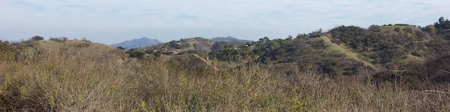
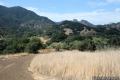
With some of the most picturesque landscapes in all of the Santa Monica Mountains, Malibu Creek State Park is an excellent place to hike. Many miles of hiking trails explore the over 8,000 acres protected by Malibu Creek State Park.
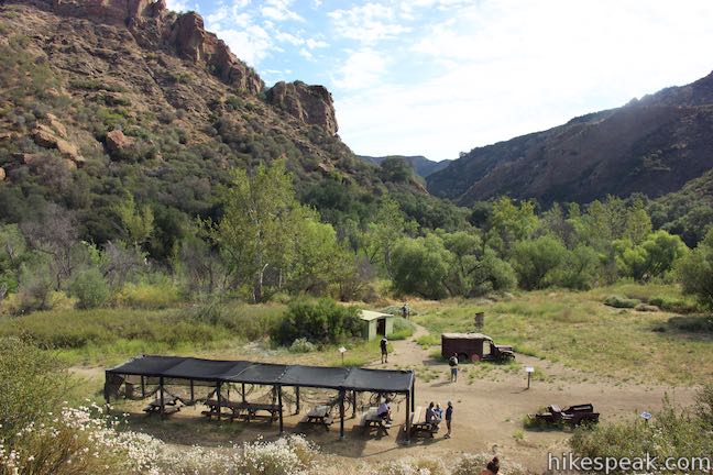
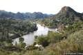
Before it was a state park, movie studios operated filming ranches on this land, using the cinematic scenery for over a hundred projects, including Planet of the Apes and M*A*S*H. The well preserved and restored MASH site is a popular hiking destination. Rock Pool is an equally popular target for hikers, particularly on warm summer days.
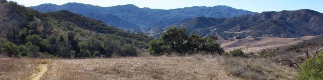
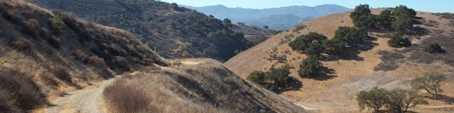
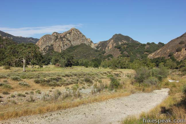
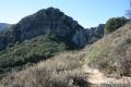
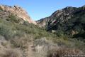
Malibu Creek State Park is located in Agoura Hills, Calabasas, and Malibu, about 27 miles from downtown Los Angeles. The park preserves much of the Malibu Creek Watershed, the largest watershed in the Santa Monica Mountains. Malibu Creek State Park is a few miles inland from the Pacific coast, with a ridge of 2,000-foot tall mountains along the south side of the park. Mesa Peak Motorway, a segment of the Backbone Trail, crosses this ridge. On the north side of these mountains is a legendary park landform, the Goat Buttes. These bold volcanic rock formations make dramatic backdrops for many Malibu Creek State Park trails.
Want to spend the night? Malibu Creek State Park has one campground with 63 sites that can be reserved in advance. Learn more about the Malibu Creek State Park Campground.
Malibu Creek State Park has one park entrance with a large parking lot. A vehicle fee is charged for this area of the park, which offers convenient trail access. Hikers can also set out from other spots with free roadside parking.
Directions to Malibu Creek State Park
The entrance to Malibu Creek State Park is located on the west side of Las Virgenes/Malibu Canyon Road between Highway 101 and Pacific Coast Highway.
Coming from the end of Interstate 10 in Santa Monica, take PCH west for 13 miles. Turn right to head inland on Malibu Canyon Road, which becomes Las Vigenes Canyon Road. Drive 6.1 miles from PCH and turn left into the park entrance.
Coming from Highway 101, take exit 32 for Las Virgenes Canyon Road and travel south for 3.5 miles to the park entrance, which is on the right just after Las Vigenes Canyon Road crosses Mulholland Highway.
Park Address:
Malibu Creek State Park
1925 Las Virgenes Road
Calabasas, CA 91301
Surrounding Parks
Malibu Creek State Park has great neighbors, belonging to a patchwork of parks that make up the Santa Monica Mountains National Recreation Area. Paramount Ranch, Solstice Canyon, and Corral Canyon are highlights among the nearby places to visit.
Malibu Creek State Park Hikes
These hikes are listed roughly from west to east and north to south. Sort the list alphabetically or by distance to pick the trail for you. The listed hikes link to write-ups with complete descriptions and directions as well as GPS maps, elevation profiles, and lots of photos – everything you need to get out and explore these trails!
| Trail | Description | Distance | Location |
|---|---|---|---|
 175 175 | Lake Vista Trail This out and back hike crosses the west end of Malibu Creek State Park and climbs to a scenic view over Malibu Lake. | 4.1 miles 350 feet | 34.1052, -118.7318 |
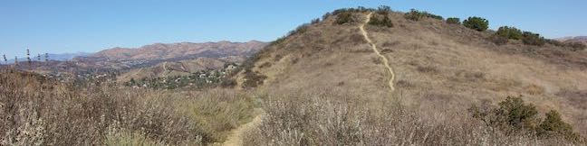
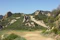
 178 178 | Phantom Trail This hike goes up and over a panoramic ridge on the north side of Malibu Creek State Park. | 4.8 miles 1,175 feet | 34.10625, -118.7323 |
 180 180 | Cistern, Lookout, and Cage Creek Trails This team of trails make a scenic descent to Century Lake for a short loop or longer hikes in Malibu Creek State Park. | 2.05 - 3.6 miles 425 feet | 34.1052, -118.7318 |
 185 185 | M*A*S*H Set This hike visits the site where the exteriors of the television show MASH were filmed, a 4.75-mile trek from the park entrance. | 3.6 - 5.7 miles 200 - 425 feet | 34.0964, -118.71673 |
 187 187 | Lost Cabin Trail This 1.5-mile round trip extension to the MASH set hike dead-ends in a mountain canyon at the site of a now nonexistent cabin. | 5.1 - 7.2 miles 190 feet | 34.0964, -118.71673 |
 195 195 | Talepop Loop This lollipop loop crosses a scenic mountain between Liberty Canyon and Las Virgenes Canyon in Malibu Creek State Park. | 4.75 miles 500 feet | 34.10353, -118.7137 |
 199 199 | Grassland Trail to Crags Road and Rock Pool This easy hike enters Malibu Creek State Park on South Grassland Trail, then forms a loop around Crags Road to visit Rock Pool. | 3 miles 125 feet | 34.10345, -118.7140 |
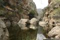 202 202 | Malibu Creek Traverse This adventure hike explores the C-shaped gorge between Rock Pool and Century Lake in Malibu Creek State Park. | 4 miles 200 feet | 34.097733, -118.72929 |
 204 204 | McAuley Peak This hike up the Backbone Trail leads to to a cool rock formation on a panoramic summit honoring a trailblazing conservationist. | 6.15 miles 1,530 feet | 34.07994, -118.7038 |
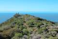 205 205 | Mesa Peak from Malibu Canyon Road (Piuma Trailhead) This out and back hike ascends the Backbone Trail from Malibu Creek State Park to a subtle summit with substantial ocean views. | 6.5 miles 1,375 feet | 34.07994, -118.7038 |
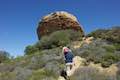
 1257 1257 | Mesa Peak from Corral Canyon Road This out and back hike travels along a ridge adorned with sandstone outcroppings to approach a peak with ocean views over Malibu. Shorten the outing by stopping at a prominent boulder on a crest above Mesa Peak. | 5.35 - 7 miles 465 feet | 34.079, -118.75556 |
Or view Los Angeles trails and campgrounds in a larger map
Woolsey Fire Update: Malibu Creek State Park has reopened following the November 2018 Woolsey Fire. The state park quickly reopened the Tapia Traihead after the fire. The main area of the park, although badly damaged, reopened in late December 2018. Structures within the park were destroyed. Check the Malibu Creek State Park website for current visitor information.