Pacific Valley Bluff Trail Big Sur hike Los Padres National Forest Ocean view bluff hike
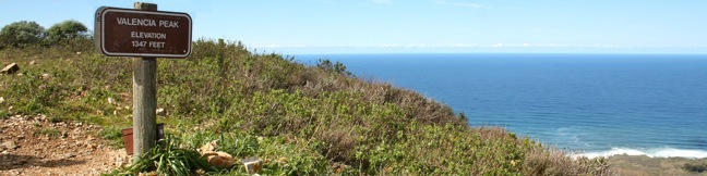
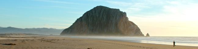
This short, level hike in Big Sur's Los Padres National Forest ventures to the end of a grassy point topped by a crown of spiked boulders. The bluff offers fantastic views of the coves and rocky sea stacks up and down the rugged coastline of Big Sur. The trailhead is conveniently located along Highway One, and at 1.1 miles round trip with 50 feet of elevation change, the views far outweigh... Read more.
My Hikes: Completed hikeA green icon of shows a picture of a landscape with a check mark in the upper right corner, signifying that this is a hike you would like to put on your completed list.OK! Add to trails I've hiked
My Hikes: Want to hikeA green icon of shows a picture of a landscape with a heart in the upper right corner, signifying that this is a hike you would like to put on your to-do list.OK! Add to trails I want to hike
TagsA green icon depicting a tags represents a list of words and phrases that this content is tagged with Tagged with · Big Sur · Free Trails · Los Padres National Forest · Ocean Views
Hike DistanceA green icon of a hiker used to label information about the length of the hike Distance: 1.1 miles · Elevation change: 50 feet
By: Published: Last updated: April 16, 2017
Carpinteria Salt Marsh Nature Park estuary hike
Since so much of the coastline of Southern California has been developed upon, it comes as a relief to find a 230-acre estuary that has been set aside and preserved as a vital ecosystem for shorebirds. Carpinteria Salt Marsh Nature Park offers a level 1.2-mile round trip hike through part of El Estuaro past several observation areas and benches. While this might not appear to be the most... Read more.
My Hikes: Completed hikeA green icon of shows a picture of a landscape with a check mark in the upper right corner, signifying that this is a hike you would like to put on your completed list.OK! Add to trails I've hiked
My Hikes: Want to hikeA green icon of shows a picture of a landscape with a heart in the upper right corner, signifying that this is a hike you would like to put on your to-do list.OK! Add to trails I want to hike
TagsA green icon depicting a tags represents a list of words and phrases that this content is tagged with Tagged with · Carpinteria · Carpinteria Salt Marsh Nature Park · Free Trails · Nature Trails
Hike DistanceA green icon of a hiker used to label information about the length of the hike Distance: 1.2 miles · Elevation change: 10 feet
By: Published: Last updated: February 12, 2018
Hazard Peak Loop Hazard Peak Trail East Boundary Barranca Trail Islay Creek Trail Montaña de Oro State Park hike
The hike up and down Hazard Peak Trail delivers a heavy dose of ocean views. While it could be argued that this 6-mile round trip hike is the finest trek to the summit of Hazard Peak, you may wish to consider elongating that hike to a 9.2-mile loop that returns to the coast via Islay Creek Trail in the adjacent Islay Creek Canyon. Sacrificing a second helping of ocean views, the loop... Read more.
My Hikes: Completed hikeA green icon of shows a picture of a landscape with a check mark in the upper right corner, signifying that this is a hike you would like to put on your completed list.OK! Add to trails I've hiked
My Hikes: Want to hikeA green icon of shows a picture of a landscape with a heart in the upper right corner, signifying that this is a hike you would like to put on your to-do list.OK! Add to trails I want to hike
TagsA green icon depicting a tags represents a list of words and phrases that this content is tagged with Tagged with · California State Parks · Free Trails · Irish Hills · Los Osos · Ocean Views · Summits · Montaña de Oro State Park
Hike DistanceA green icon of a hiker used to label information about the length of the hike Distance: 9.2 miles · Elevation change: 1000 feet
By: Published: Last updated: May 13, 2025
Hazard Peak Trail Montaña de Oro State Park summit hike
Montaña de Oro State Park is packed with so many picturesque places that it can be difficult to settle on just one day hike. However, if you are looking for broad, unobstructed view over Morro Bay, you should feel compelled to set out for the top of Hazard Peak. Looking north from this coastal 1,076-foot summit, you won't see anything even half as tall as Hazard Peak for about 15 miles,... Read more.
My Hikes: Completed hikeA green icon of shows a picture of a landscape with a check mark in the upper right corner, signifying that this is a hike you would like to put on your completed list.OK! Add to trails I've hiked
My Hikes: Want to hikeA green icon of shows a picture of a landscape with a heart in the upper right corner, signifying that this is a hike you would like to put on your to-do list.OK! Add to trails I want to hike
TagsA green icon depicting a tags represents a list of words and phrases that this content is tagged with Tagged with · California State Parks · Free Trails · Irish Hills · Los Osos · Ocean Views · Summits · Montaña de Oro State Park
Hike DistanceA green icon of a hiker used to label information about the length of the hike Distance: 6 miles · Elevation change: 950 feet
By: Published: Last updated: May 20, 2017
Islay Creek Trail Montaña de Oro State Park hike
Montaña de Oro State Park has a couple lengthy level hikes. If you desire ocean views, you can't do any better than the Bluff Trail. If you would rather hike up a canyon flanked by thousand foot peaks along a creek that even has a small waterfall, the fitting trail is Islay Creek Trail. The rolling 3-mile long dirt road has 300-feet of easy elevation change. Just before the trail ends at... Read more.
My Hikes: Completed hikeA green icon of shows a picture of a landscape with a check mark in the upper right corner, signifying that this is a hike you would like to put on your completed list.OK! Add to trails I've hiked
My Hikes: Want to hikeA green icon of shows a picture of a landscape with a heart in the upper right corner, signifying that this is a hike you would like to put on your to-do list.OK! Add to trails I want to hike
TagsA green icon depicting a tags represents a list of words and phrases that this content is tagged with Tagged with · California State Parks · Free Trails · Irish Hills · Los Osos · Ocean Views · Montaña de Oro State Park
Hike DistanceA green icon of a hiker used to label information about the length of the hike Distance: 6 miles · Elevation change: 300 feet
By: Published: Last updated: May 11, 2017
Valencia Peak Trail Montaña de Oro State Park hike
At 1,347 feet, Valencia Peak is one of the highest summit in Montaña de Oro State Park and may provide the best panorama of the park's stunning shoreline and inviting inland peaks. The views are epic and the hike is 4.5-miles round trip with 1,275 feet of elevation. An older version of Valencia Peak Trail was 0.4 miles shorter each way, and the new route uses more switchbacks to ease the... Read more.
My Hikes: Completed hikeA green icon of shows a picture of a landscape with a check mark in the upper right corner, signifying that this is a hike you would like to put on your completed list.OK! Add to trails I've hiked
My Hikes: Want to hikeA green icon of shows a picture of a landscape with a heart in the upper right corner, signifying that this is a hike you would like to put on your to-do list.OK! Add to trails I want to hike
TagsA green icon depicting a tags represents a list of words and phrases that this content is tagged with Tagged with · California State Parks · Free Trails · Irish Hills · Los Osos · Ocean Views · Summits · Montaña de Oro State Park
Hike DistanceA green icon of a hiker used to label information about the length of the hike Distance: 4.5 miles · Elevation change: 1275 feet
By: Published: Last updated: January 24, 2018
Morro Strand Trail Morro Strand State Beach Morro Rock Cloisters Park Cloisters Wetlands San Luis Obispo Morro Bay California beach hike stroll walk sand lagoon central coast
Morro Rock is an iconic landmark on California's Central Coast. Located north of San Luis Obispo, the 578-foot tall mass of volcanic rock rises above of the Pacific Ocean, separating the inviting sands of Morro Strand State Beach from the blue waters of Morro Bay Harbor. Starting from a protected coastal wetland along Highway One in Morro Bay, this easy beach hike crosses sand dunes into... Read more.
My Hikes: Completed hikeA green icon of shows a picture of a landscape with a check mark in the upper right corner, signifying that this is a hike you would like to put on your completed list.OK! Add to trails I've hiked
My Hikes: Want to hikeA green icon of shows a picture of a landscape with a heart in the upper right corner, signifying that this is a hike you would like to put on your to-do list.OK! Add to trails I want to hike
TagsA green icon depicting a tags represents a list of words and phrases that this content is tagged with Tagged with · Free Trails · Morro Bay · Morros · Ocean Views
Hike DistanceA green icon of a hiker used to label information about the length of the hike Distance: 3.5 miles · Elevation change: 25 feet
By: Published: Last updated: January 16, 2018
Carpinteria Bluffs Trail to Carpinteria Seal Sanctuary Overlook in Carpinteria Bluffs Nature Preserve
You could call a hike easy if it was less a mile long and almost completely level. You could call a hike easy to reach if the trailhead was right at the end of a freeway offramp. You could call a hike easy to enjoy if it offered lovely coastal views and almost guaranteed wildlife viewing. Introducing the easy-to-reach, easy-to-enjoy, and all around easy hike from Carpinteria Bluffs Nature... Read more.
My Hikes: Completed hikeA green icon of shows a picture of a landscape with a check mark in the upper right corner, signifying that this is a hike you would like to put on your completed list.OK! Add to trails I've hiked
My Hikes: Want to hikeA green icon of shows a picture of a landscape with a heart in the upper right corner, signifying that this is a hike you would like to put on your to-do list.OK! Add to trails I want to hike
TagsA green icon depicting a tags represents a list of words and phrases that this content is tagged with Tagged with · Carpinteria · Carpinteria Bluffs Nature Preserve · Carpinteria Seal Sanctuary · Elephant Seals · Free Trails · Ocean Views
Hike DistanceA green icon of a hiker used to label information about the length of the hike Distance: 2 miles · Elevation change: 100 feet
By: Published: Last updated: February 12, 2018
Gaviota Pass Overlook hike Gaviota State Park Trails Lompoc California
Gaviota State Park preserves 2,787 oceanfront acres in the rugged and beautiful Santa Ynez Mountains west of Santa Barbara. If the park was not sliced down the middle by Highway 101, it would surely be one of the most popular state parks on the Central Coast. The presence of the freeway certainly cuts down on crowds, enabling hikers to enjoy the largely untainted scenery in relative... Read more.
My Hikes: Completed hikeA green icon of shows a picture of a landscape with a check mark in the upper right corner, signifying that this is a hike you would like to put on your completed list.OK! Add to trails I've hiked
My Hikes: Want to hikeA green icon of shows a picture of a landscape with a heart in the upper right corner, signifying that this is a hike you would like to put on your to-do list.OK! Add to trails I want to hike
TagsA green icon depicting a tags represents a list of words and phrases that this content is tagged with Tagged with · California State Parks · Free Trails · Gaviota State Park · Goleta · Las Cruces · Ocean Views · Santa Ynez Mountains
Hike DistanceA green icon of a hiker used to label information about the length of the hike Distance: 6.5 miles · Elevation change: 650 feet
By: Published: Last updated: April 24, 2017
Jesusita Trail to Inspiration Point hike Santa Barbara California
Located in the Santa Ynez Mountains, 1,800-feet above Santa Barbara, Inspiration Point provides panoramic views over The American Riviera. It is a moderate 7.55 to 7.95-mile round trip trek from San Roque Road up Jesusita Trail to Inspiration Point, gradually checking off 1,400 feet of elevation gain. Those who prefer a shorter alternative, can hike from Tunnel Road and take a 3.75-mile... Read more.
My Hikes: Completed hikeA green icon of shows a picture of a landscape with a check mark in the upper right corner, signifying that this is a hike you would like to put on your completed list.OK! Add to trails I've hiked
My Hikes: Want to hikeA green icon of shows a picture of a landscape with a heart in the upper right corner, signifying that this is a hike you would like to put on your to-do list.OK! Add to trails I want to hike
TagsA green icon depicting a tags represents a list of words and phrases that this content is tagged with Tagged with · Creeks · Free Trails · Ocean Views · Santa Ynez Mountains
Hike DistanceA green icon of a hiker used to label information about the length of the hike Distance: 7.55 miles · Elevation change: 1800 feet
By: Published: Last updated: January 9, 2018