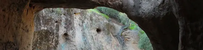
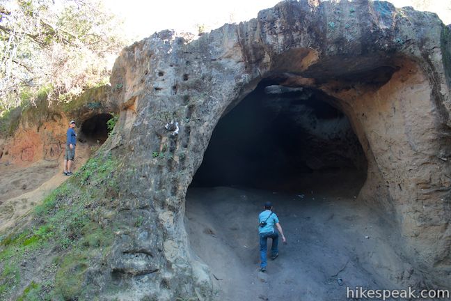
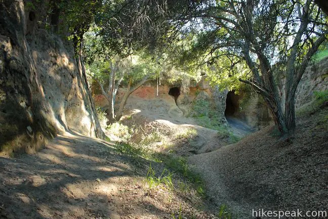
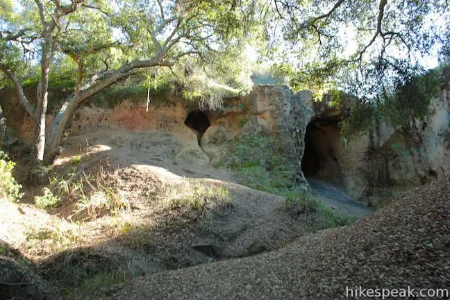
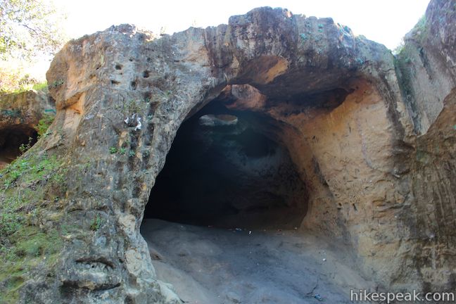
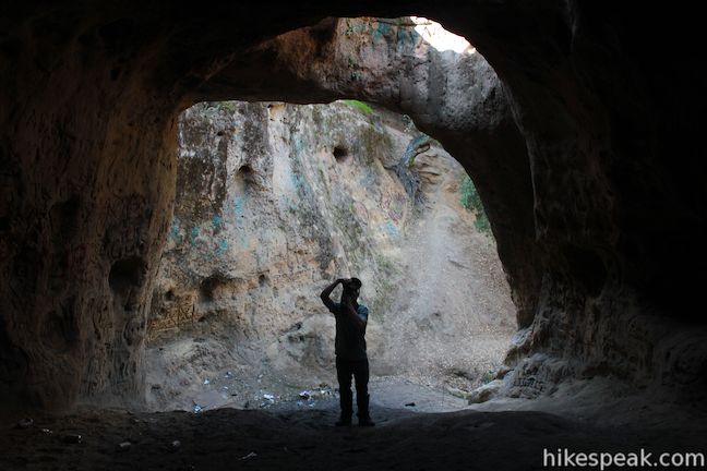
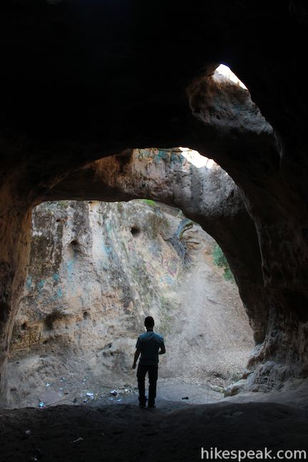
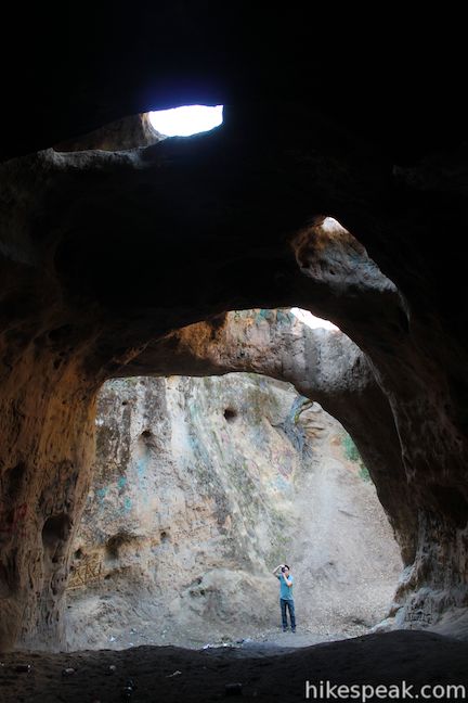
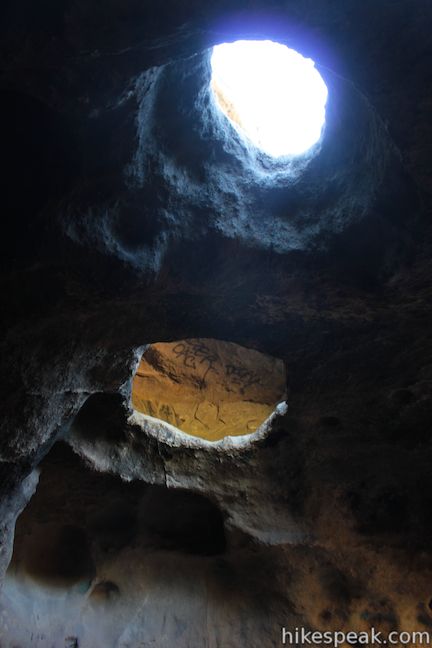
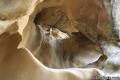
Vanalden Cave near Tarzana is one of the most unusual sandstone formations in the Santa Monica Mountains and is quite easy to hike to. Vanalden Cave is a sandstone den about 25 feet tall, 25 feet wide, and 50 feet deep. The roof of the cave is only a few feet thick with a few holes that, like skylights, illuminate cave walls covered with curious carvings and graffiti.
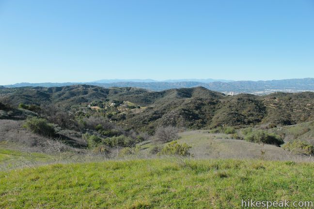
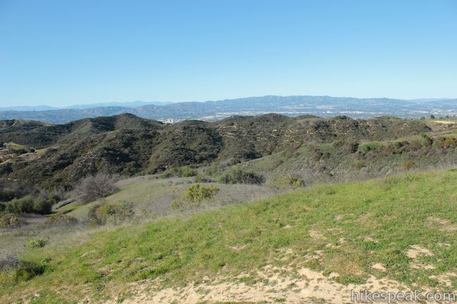
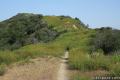
Hike 0.6 miles round trip to Vanalden Cave for a short excursion with 100 feet of elevation change or extend the hike to 1.55 miles round trip with 350 feet of elevation change to reach a nearby vista point on Vanalden Trail that provides a panoramic amphitheater-like view of the Santa Monica Mountains.
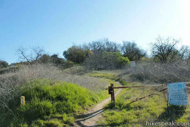
The short hike to Vanalden Cave has a few unmarked junctions along the way, so know the directions before you go.
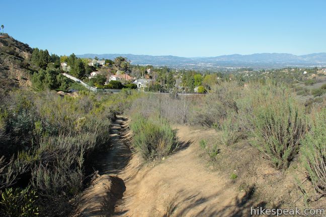
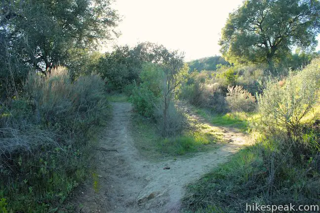
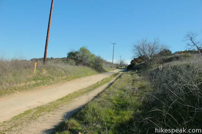
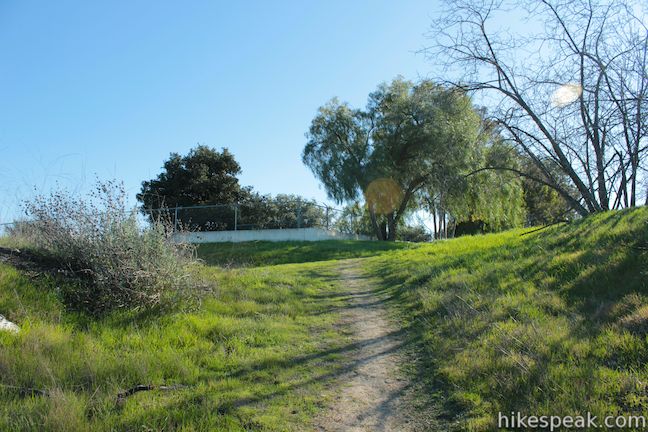
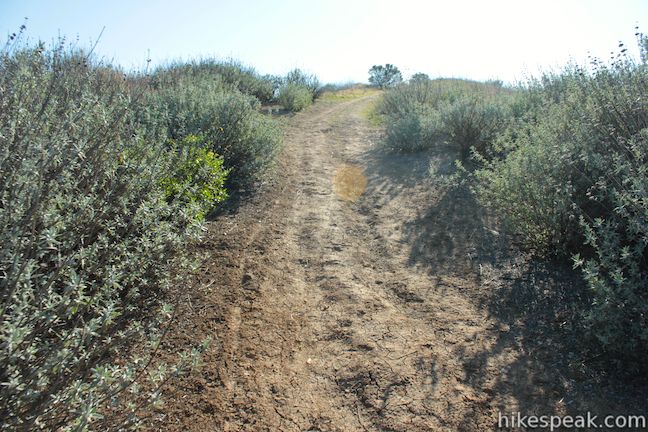
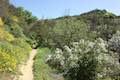
Start up Vanalden Trail, a dirt trail beginning from the south end of Vanalden Avenue in Tarzana. Reach a split in the trail after 0.15 miles. Vanalden Trail continues up the mountainside to the right (this is the route to the vista point that you can visit after the cave). To get to Vanalden Cave, turn left at the split.
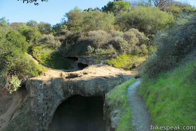
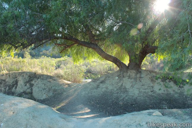
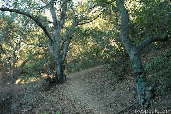
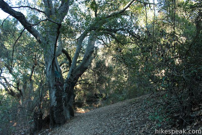
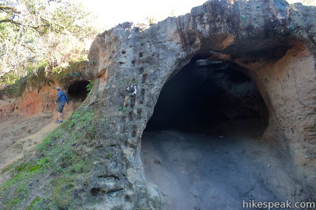
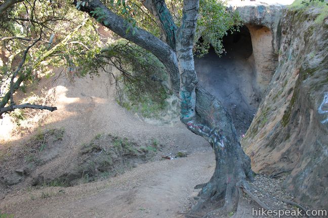
The dirt track enters an oak grove and descends to a large oak at another trail split, 0.05 miles from Vanaladen Trail. A trail breaking off to the right heads to the top of Vanalden Cave. Straight past the tree, you can drop into a ravine and turn right to hike up to the mouth of Vanalden Cave. A steep path alongside the cave allows you to connect the upper and lower trails to explore all sides of Vanalden Cave.
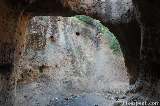
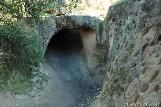
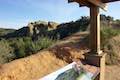
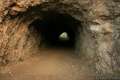
By either route, it is only a few hundred feet from the oak tree to Vanalden Cave. The mouth of the cave is shaped like an arch. The interior looks black as a midnight sky, until you step inside and see that holes in the ceiling of the cave let in ample light for you to poke around and explore.
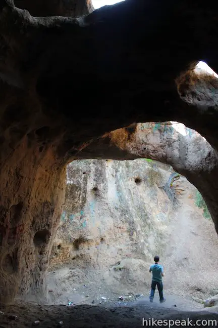
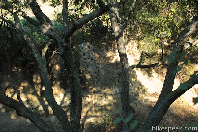
Unlike most caves, Vanalden Cave is only covered on top by a few feet of rock. A path along the edge of a ledge extends to the top of Vanalden Cave where you can look down through the holes into the shadows below. You can crawl through a window on the side of Vanalden Cave too.
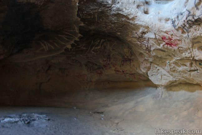
The soft sandstone walls of Vanalden Cave have been cut into or spray-painted over on almost every surface of the cave. Numerous strange and humorous faces are carved into the rock. Sadly, a lot of liter is spread on the ground around Vanalden Cave too, detracting a bit from this awesome natural feature.
After checking out Vanalden Cave from all sides, you can hike back the way you came (0.6 miles round trip) or continue up Vanalden Trail to a panoramic view of the Santa Monica Mountains (1.55 miles total round trip).
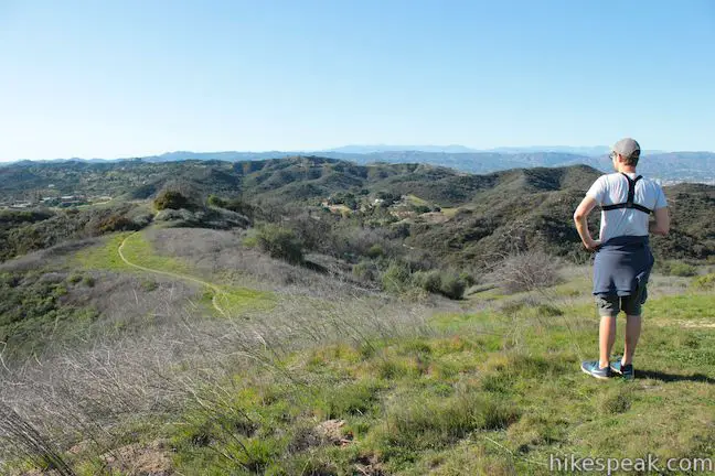
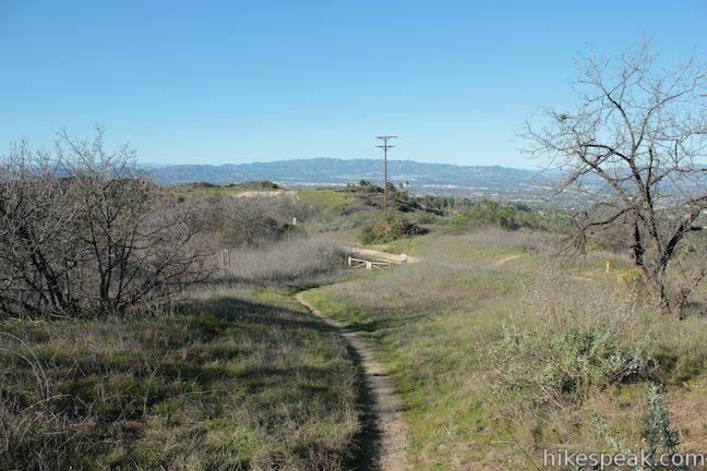
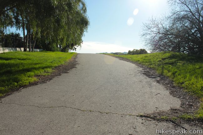
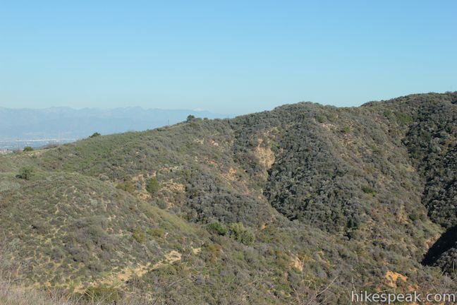
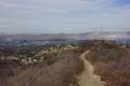
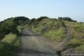
Backtrack down past the oak tree and out to the original trail split. This time, take the main fork and continue up Vanalden Trail. Just above the split, stay to the left past a path that breaks off to the right. Vanalden Trail comes to a junction with an unpaved section of Mulholland Drive after 1/8 of a mile. You could turn right or left here and hike deep into the Santa Monica Mountains, but for a great nearby view you should continue straight across Mulholland Drive up Vanalden Trail.
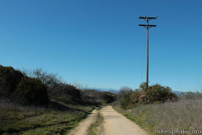
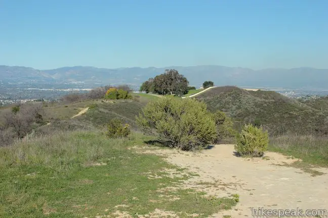
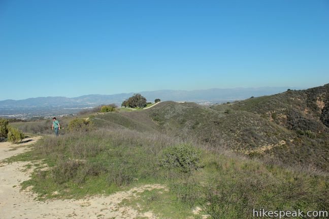
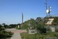
The dirt single track bends to the left, heading south up a hill for 0.05 miles. When you meet a paved LADWP Service Road, turn right and follow the road past Corbin Tank, walking 0.07 miles to the end of the pavement where a dirt single track continues toward the now evident vista point.
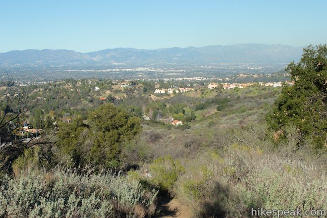
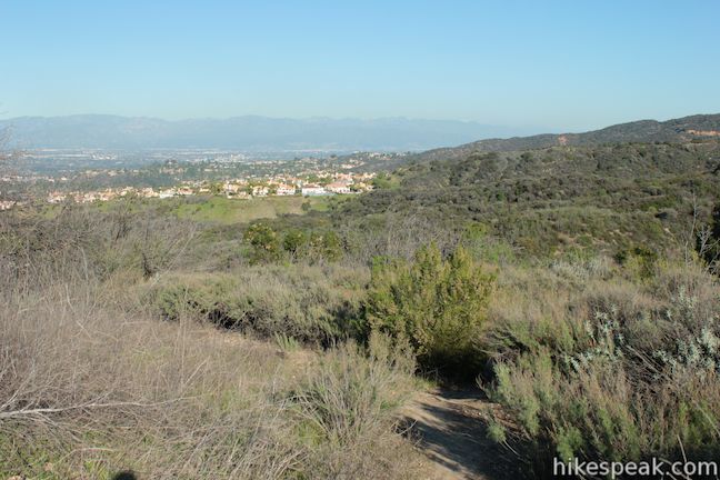
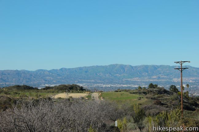
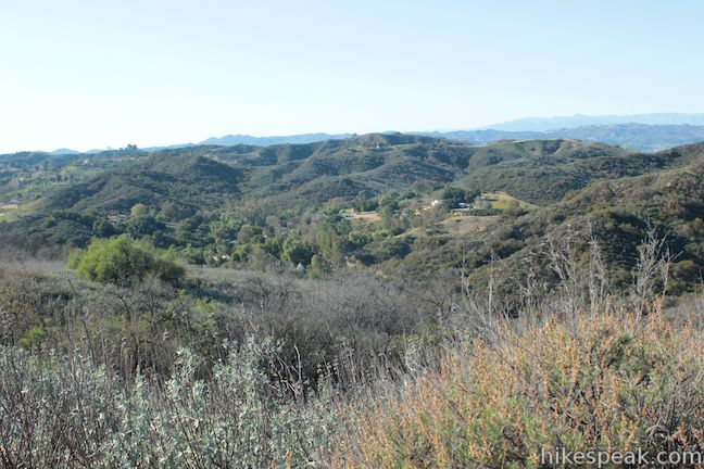
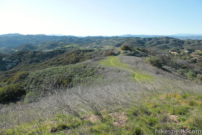
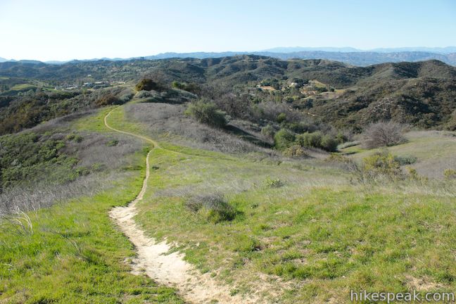
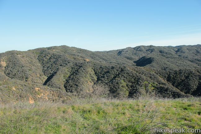
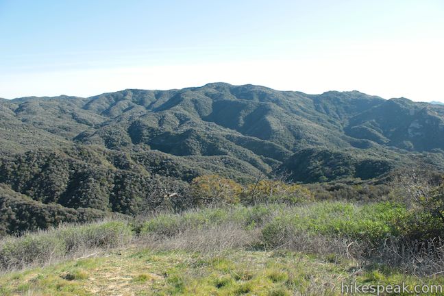
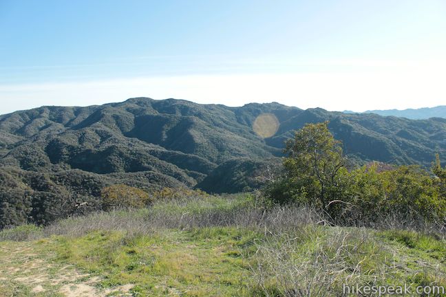
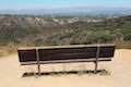
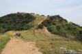
It’s just under a quarter mile from the pavement to the vista point. Stay left through one last obvious junction, passing a path that cuts off the small vista summit and continues down Vanalden Trail. The viewpoint does not seem to have a name so let’s call it Vanalden Vista.
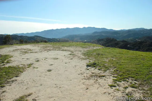
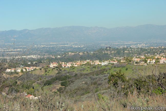
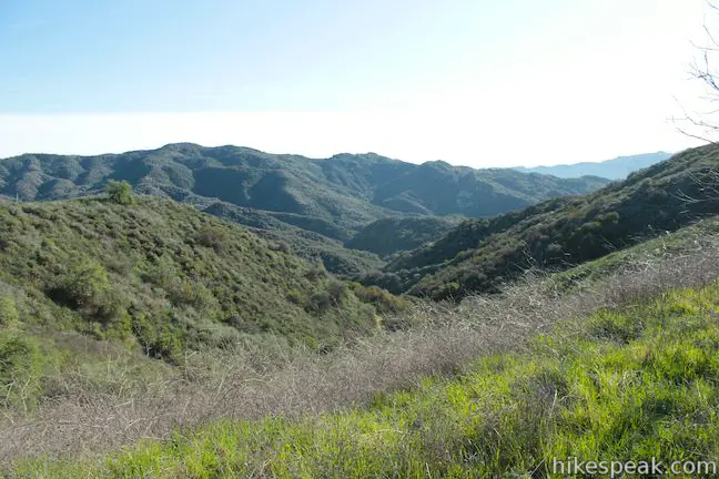
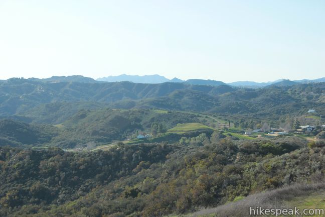
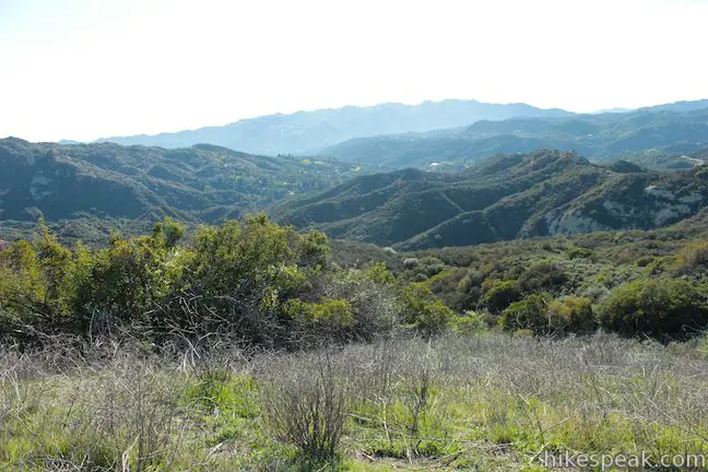
Vanalden Vista presents a pretty astonishing perspective of the Santa Monica Mountains. Canyons below Vanalden Vista roll out to the east, south, and west, followed by mountains that appear in the shape of a ring from this vantage. The vista point presents an amphitheater-like panorama of the Santa Monica Mountains that is truly sweeping.
Vanalden Trail turns west and drops from the vista point to Santa Maria Road in Topanga. If you are mountain biking, or in the mood for a longer hike, you could descend to Santa Maria Road and then loop back up to Mulholland Drive west of Vanalden Trail in Marvin Braude Mulholland Gateway Park. Even without that longer venture, the short extension from Vanalden Cave to Vanalden Vista is well worth the effort.
Take it all in and return the way you came for a 1.55 mile round trip hike to Vanalden Cave and Vanalden Vista. Dogs and mountain bikes are permitted on Vanalden Trail. No fee or permit is required to hike to Vanalden Cave, so get out and enjoy!
To get to the trailhead: Take the 101 Freeway to exit 24 for Tampa Avenue (5 miles west of Interstate 405). Turn south at the bottom of the ramp and drive one block down Tampa Avenue to Ventura Boulevard. Turn left on Ventura Boulevard, drive three blocks, and turn right at the first traffic light onto Vanalden Avenue. Drive three miles south to the end of Vanalden Avenue where the trail begins. Free street parking is available from 6 a.m. to 9 p.m.
Trailhead address: 3630 Vanalden Avenue, Tarzana, CA 91356
Trailhead coordinates: 34.134666, -118.563017 (34° 08′ 04.79″N 118° 33′ 46.86″W)
View Santa Monica Mountains in a larger map
Or view a regional map of surrounding Los Angeles trails and campgrounds.


 | Hub Junction from Reseda Boulevard This 5.3 to 5.45-mile hike from the edge of the San Fernando Valley goes through Topanga State Park to a scenic junction at the crossroads of the Eastern Santa Monica Mountains. Extend the trek to 6.85 miles round trip by summiting Temescal Peak or to 7.95 miles round trip by taking a loop to Eagle Rock. |
 | Caballero Canyon Trail This 3.4-mile round trip hike ascends a canyon on the north side of the Santa Monica Mountains with views over the San Fernando Valley. |
 | Corbin Canyon This 2.05-mile hike offers an easy stroll along the bottom of a canyon on the north side of the Santa Monica Mountains near Tarzana and Woodland Hills. |
 | Winnetka Ridge Trail This 1.5-mile hike ventures up a ridge into the Santa Monica Mountains from the end of Winnetka Avenue in Woodland Hills. |
 | Viewridge Trail This 3-mile hike in Summit Valley Edmund D. Edelman Park travels down a canyon on Viewridge Trail (also known Santa Maria Canyon Trail) to Summer Hill Ranch Road where there are sweeping views over Topanga and the Santa Monica Mountains from Canyon Overlook. |
 | Westridge Trail to San Vicente Mountain This 7.4-mile hike travels a scenic ridge between a Brentwood neighborhood and a summit that was once used as a Nike Missile site. |
 | Mulholland Drive to San Vicente Mountain This 2-mile hike approaches the peak from the east and offers views to the north and south en route to the old Nike Missile site. |
 | Upper Canyonback Trail This 3 mile hike descends Canyonback Ridge from Mulholland Drive to the Mountain Gate Country Club Estates. |
 | Sullivan Canyon This 8.5-mile round trip hike follows a wide trail up the center of a sycamore-filled canyon. |
 | Sullivan Ridge A prominent lone-standing Live Oak along Sullivan Ridge makes a natural turnaround point and a 7.5 to 8.3 mile round trip hike. |
 | Murphy Ranch This 3.85-mile loop descending from Sullivan Ridge Fire Road into Rustic Canyon, where hikers can visit abandoned buildings that had unusual occupants. |
 | More trails in the Santa Monica Mountains Explore other destinations in the range. |
 | Cave of Munits and Castle Peak This action-packed 2.1-mile loop has two great attractions, crossing an impressive cave to climb to a rocky peak with views over the San Fernando Valley. |
 | The Grotto This 3-mile out and back hike visits a talus cave in the Santa Monica Mountains National Recreation Area. |
 | Chumash Painted Cave This very short trail looks in on Native American rock art in the Santa Ynez Mountains. |
 | Gaviota Wind Caves This 2.5-mile hike just off the 101 Freeway visits wind-carved caves in Gaviota State Park with great ocean views. |
 | Bronson Cave This short easy hike visits a man-made cave recognizable as the Batcave from the 1960s Batman TV series and hundreds of other locations on TV and film. |

Be Careful!!
The last 200 feet before the cave is RIDDLED with poison oak.
I am really not clear on the directions which can be subjective. What I’d really like instead of the coordinates to the trailhead, does anyone have the coordinates to the cave itself?
The cave is here: 34.131711,-118.562506
Garbage and broken beer bottles everywhere! Someone was setting up a DJ mixing table in the cave when we got there so we didn’t get to explore much.
That’s pretty much what you can expect from urban hiking. People don’t go there for nature or solitude. They go there to do things that aren’t acceptable elsewhere.
I didn’t got to see the caves. it’s hard to find. they need to post sign for it… And see like 4 big snake so got scared and left
[…] Vanalden Cave | Tarzana […]
[…] So… if you go to this cave, don’t use the Alltrails map. Instead, use the one on Hikespeak. And read the description on where to go and how to get there, because it’s helpful[…]
Was looking forward to seeing the cave but it was impossible to find. No signs posted. Left vey disappointed.
Just went there this weekend it was very hard to find, After a little exploration we were able to find it. The directions here were very helpful.
I tried going to the cave from the trail on Mullholland. About 250 ft from the cave, the thin trail was collapsed with old mud – too dangerous for me to navigate so I turned around
love this hike
I’ve been going there since 1975 before vanalden went that far. It ended at the golf course & we were able to navigate there without the benifit of gps. Stop your whining that there are no signs. Now it’s an easy hike & easy to find but definitely watch out for the poison oak. It got me good once. Bring a trash bag & help keep the area free from trash. Take only memories & leave only foot prints