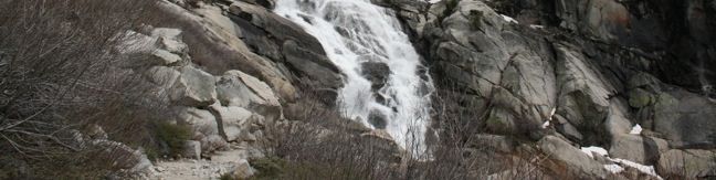
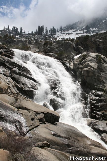
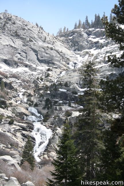
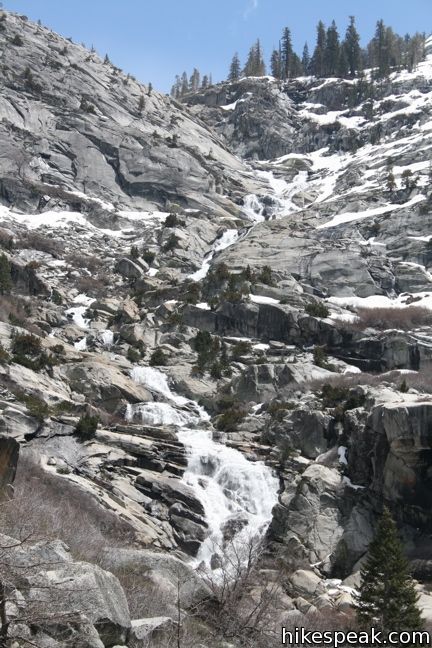
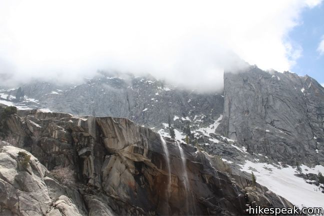
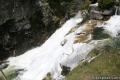
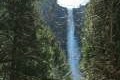
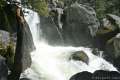
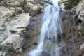
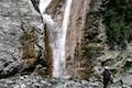
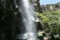
Measuring 1,200 feet long, Tokopah Falls is the tallest waterfall in Sequoia National Park. Unlike the famous free-falling waterfalls in that other national park to the north, Tokopah Falls features a long series of steep picturesque cascades. The 4.2-mile round trip hike to the waterfall is fairly gradual, gaining 630 feet up a trail that should be enjoyable for hikers of all abilities. To make things simple, there are no junctions to worry about along the way to the waterfall where the trail dead ends.
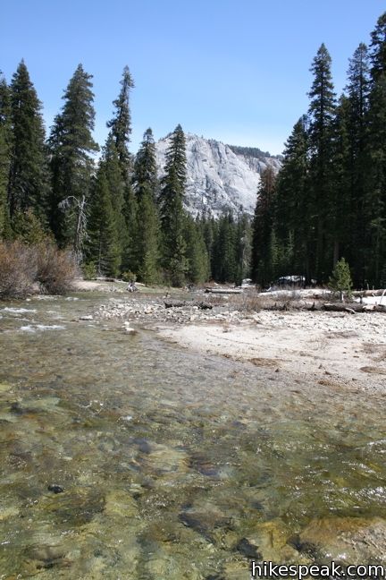
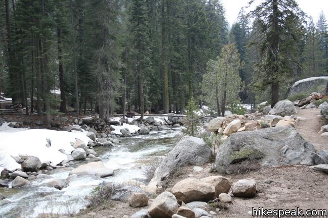
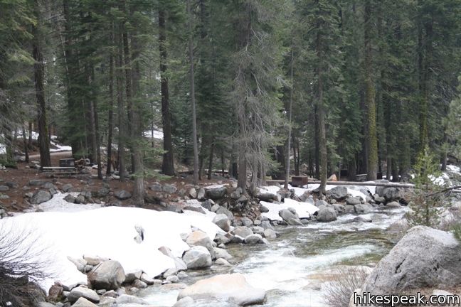
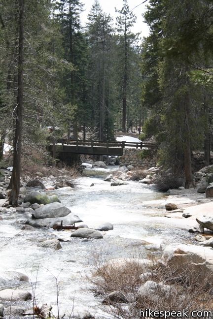
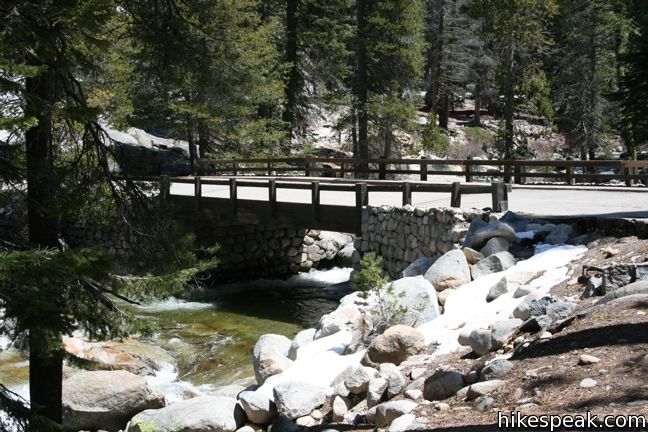
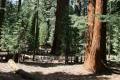
Start near Lodgepole Visitor Center and General Store, driving (or walking) a short distance up Lodgepole Road to a trailhead parking area within Lodgepole Campground. Proceed from there on foot, following the road into the campground, with the Marble Fork of the Kaweah River on your left. Bear left at a split and cross a bridge over the river. On the other side, turn right up the start of Tokopah Falls Trail.
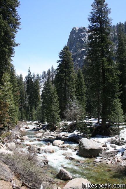
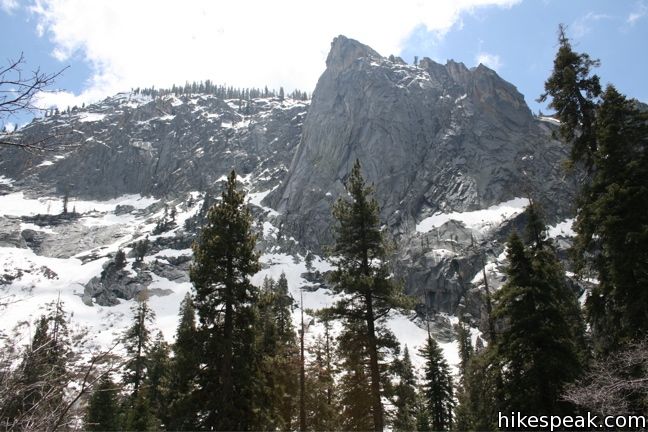
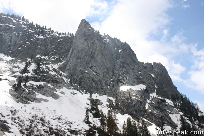
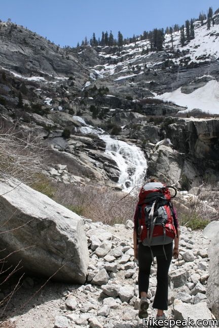
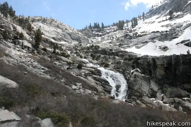
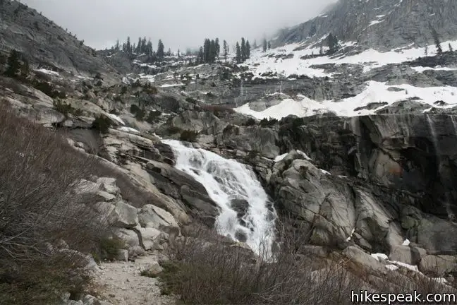
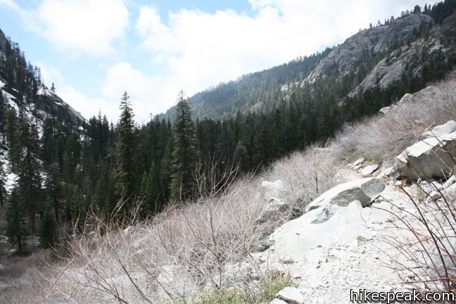
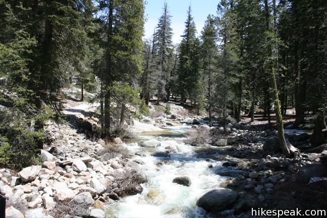
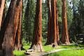
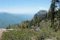
The trail to Tokopah Falls heads east along the north bank of the Marble Fork of the Kaweah River. The single track wanders beneath tall pines and passes several small forest meadows. After a few creek crossings and two bridges, exit the forest and gain the first clear view of the waterfall. To the south, an impressive peak named the Watchtower rises 1,600 feet above Tokopah Valley, making the landscape even more dramatic.
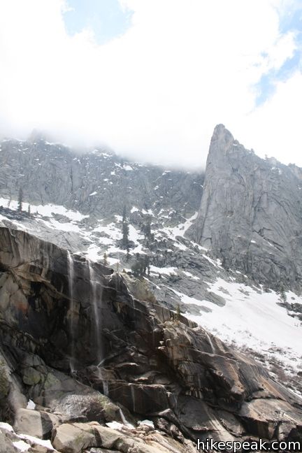
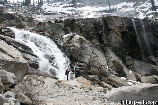
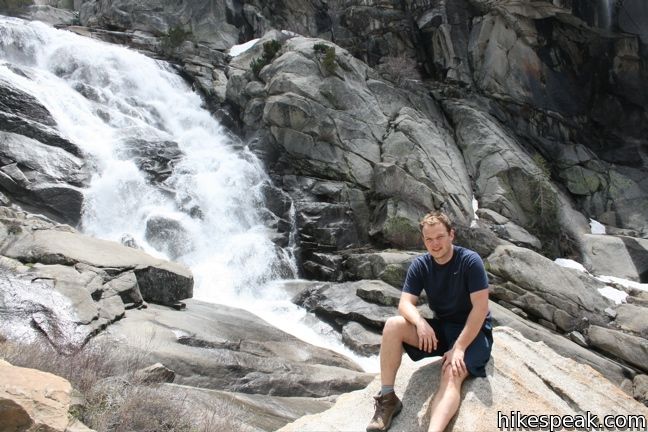
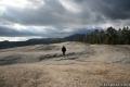
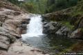
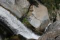
Tokopah is long and elegant. To get to it, cross a rocky moraine over the last half mile of the U-shaped canyon. The trail remains gradual and passable as it maneuvers between large boulders, ending at the base of the impressive falls. Take pictures, take a break, and return the way you came.
The Marble Fork sports another waterfall farther down the mountain from Tokopah. The 8-mile round trip hike to the thunderous Marble Falls shows how this branch of the river got its name.
Sequoia National Park has an entrance fee, but no permit is required to hike to Tokopah Falls. Dogs and mountain bikes are prohibited. The trail to the waterfall is best during the spring snow melt, so get out and enjoy!
Directions to the Trailhead
- Take Generals Highway to the turnoff for the Lodgepole Visitor Center (4.5 miles north of the Giant Forest Museum) and drive east toward Lodgepole Campground.
- Park in the large lot near the nature center and bathrooms and cross a bridge to the north side of the river where the trail begins.
Trailhead Location
Trailhead address: Lodgepole Road, Sequoia National Park, CA 93262
Trailhead coordinates: 36.6048, -118.7249 (36° 36′ 17.3″N 118° 43′ 29.6″W)
View Sequoia National Park in a larger map
Or view a regional map of surrounding Sierra Nevada trails and campgrounds.
 | Marble Falls This 8-mile hike takes a flower-lined path up a mountain canyon to a powerful waterfall. |
 | General Sherman Tree This one-mile hike visits the world's biggest tree, a 275-foot tall Giant Sequoia that is 36.5 feet across at the base. |
 | Congress Loop This easy paved two mile loop visits the fourth and fifth tallest Sequoias in the world (among others). |
 | Big Trees Trail This 1.4-mile stroll explores giant sequoias around Round Meadow on a paved nature trail that is easy, educational, and beautiful. |
 | Sunset Rock This 2-mile hike visits a large granite dome with great views to the west, possibly the best place to end your day in the Giant Forest. |
 | Beetle Rock This short walk from the Giant Forest Museum to Beetle Rock visits a granite dome with great views and stunning sunsets. |
 | Crescent Meadow This level 1.6-mile loop visits a Sequoia you can stand inside (Chimney Tree) and another that someone used to live in (Tharp's Log). |
 | Sugar Pine Trail and Bobcat Point Trail Loop This short but diverse 1.5-mile loop peaks at Bobcat Point, which presents a fierce perspective of Moro Rock and a massive canyon. |
 | Hanging Rock Trail This short 0.35-mile hike passes views of Moro Rock en route to a balancing boulder on a canyon rim at the edge of the Giant Forest. |
 | Moro Rock This 0.6 mile hike sports panoramic views and should be considered a mandatory hike for first time visitors to Sequoia National Park. |
 | Paradise Creek This short stroll leaves Buckeye Flat Campground to visit the perfect swimming hole for a hot summer day in the Sierra. |
 | Panther Creek This 6-mile hike follows the Middle Fork Trail to a 100 foot waterfall that drops into the Middle Fork of Kaweah River. |
 | More trails in the Sierra Nevada Mountains Explore other destinations in Sequoia National Park and the rest of the range. |
 | Lower Yosemite Fall in Yosemite National Park This electrifying 1.2-mile hike delivers visitors to the base of the tallest waterfall in North America. |
 | Bridalveil Fall in Yosemite National Park This easy paved half-mile trail visits the base of a 620-foot single-drop waterfall on the south side of Yosemite Valley. |
 | Chilnualna Falls in Yosemite National Park This 8-mile round trip hike ascends 2,200 feet past a raucous string of cascades to the top of a waterfall alongside Wawona Dome. |
 | Tangerine Falls in the Los Padres This 2.5-mile hike visits a beautiful waterfall on the edge of Los Padres National Forest near Santa Barbara. |
 | Rose Valley Falls in the Los Padres This 1-mile round trip trail leads to the lower tier of a lovely two-tier 300-foot waterfall. |
 | San Antonio Falls in the San Gabriel Mountains This 1.4-mile hike visits a multi-tier waterfall along the trail to Mount Baldy. |
 | Sturtevant Falls in the San Gabriel Mountains This 3.3-mile hike visits a 60-foot waterfall and a lush cottage-lined canyon. |
 | Fish Canyon Falls in the San Gabriel Mountains This 4.8-mile round trip hike leaves from an active rock quarry and progresses up a beautiful canyon to a mesmerizing multi-tiered waterfall. |
 | Sequoia and Kings Canyon National Parks Campgrounds There are 14 campgrounds with over 1,000 total sites spread throughout the park to facilitate your visit. |
Tokopah Falls in Best Short Hikes in California's South Sierra by Karen and Terry Whitehill
Tokopah Falls in Sequoia and Kings Canyon National Parks: Your Complete Hiking Guide by Mike White
Tokopah Falls in Top Trails: Sequoia and Kings Canyon by Mike White
Tokopah Falls on summitpost.org
Common Questions about Tokopah Falls in Sequoia National Park
- Is the trail open?
- Yes. You should expect to find that Tokopah Falls Trail is open. There are no recent reports of trail closures. If you discover that the trail is closed, please help your fellow hikers by reporting a closure.
- Do I need a permit for this hike?
- Yes. National Park Entrance Fee.
- How much time does this hike take?
- It takes approximately 2 hours 15 minutes to hike Tokopah Falls Trail. Individual hiking times vary. Add extra time for breaks and taking in the views.
- How long is this hike?
- The hike to Tokopah Falls Trail is a 4.2 mile out and back with 630 feet of elevation change.
- Are dogs allowed on this trail?
- No, dogs are likely not allowed on Tokopah Falls Trail. The trail is primarily open to hikers.
- Will I see a waterfall on this hike?
- Yes, Tokopah Falls Trail features a waterfall.
- Where is the trailhead located?
- The trailhead for Tokopah Falls Trail is located in Sequoia National Park, CA.
Trailhead Address:
Lodgepole Road
Sequoia National Park, CA 93262
Trailhead Coordinates:
36.6048, -118.7249 - What are the driving directions to the start of the hike?
To get to the trailhead: Take Generals Highway to the turnoff for the Lodgepole Visitor Center (4.5 miles north of the Giant Forest Museum) and drive east toward Lodgepole Campground. Park in the large lot near the nature center and bathrooms and cross a bridge to the north side of the river where the trail begins.
View custom Google Maps directions from your current location.
- Are there other trails near Tokopah Falls Trail?
- Yes, you can find other nearby hikes using the Hikespeak Hike Finder Map.

Hello, we are going to sequioa for a few day and taking my kids. Will this trail be good for a 5 year old?
Hi – This trail should be suitable for young kids. Just keep an eye on them near the river.
Thanks for posting this great description! We will have a baby in a stroller designed for hiking. Do you think we’ll be able to make it to the falls, or is there a bit of scrambling over rocks toward the end?
Hi Rosie,
Your stroller should we great for most of the trails in the Giant Forest. The end of this trail does require you to cross a bunch of boulders. You should be able to do 90% of the trail with ease. The waterfall is looking great right now. Enjoy the hike!
Coming out to yosemite and sequoia in a few weeks. Have the hikes mapped out for yosemite but looking for some good hikes in sequoia and kings. Staying at the john muir lodge 2 nights . What are the best hikes/ things to do to get a feel for the 2 parks? thanks
I’ve heard that Tokopah Falls has gotten pretty dry this summer, so this might not be the best hike for your trip. From the Muir Lodge you can easily visit the Grant Grove and Inspiration Point. I’d recommend starting there.
I had anticipated taking the trip to Tokopah Falls since last winter, but not until the end of August 2013 did I have the time. I enjoy hiking near water and experiencing the beauty and power of waterfalls and was looking forward to this one. Unfortunately there was no water in the Marble Fork of the Kaweah River that you follow to get to the falls or over the falls themselves. I’m not certain if this is common place this time of year, or just an aberration caused by the drought we are having in California. The lack of water only brings your attention to the grandeur of Tokopah Valley, which was created by glaciers cutting and shaping the granite formations that become the sides of the valley. The trail is very well traveled and maintained. There are cement and rock steps over the granite to help in your 500 foot climb up the trail, and wooden bridges are in place to help you cross the many forks of Horse Creek. There is a couple to meadows along the way and a bear with cub were spotted along with a small heard of deer. Unfortunately they slipped into the concealment before pictures could be taken. This type of activity is easier documented earlier in the day. This is a very active bear area because of the Lodgepole camp grounds and they are use to humans and are non aggressive. Even though we share the same trail, it is not wise to get too close or feed them, they are wild. The goose berries were getting ripe and there were patches all along the trail. The trail has been shaded by furs and lodgepole pines up to Horse Creek, but soon it opens up into the beauty that is Tokopah Falls. When it looks as though the trail is about to end because of the rock formations, you will make out the trail continues between, under, and over the boulders so we can pass through getting closer to the base of the falls. To the south, your right as you are facing the falls, you we see and be in awe of the Watchtower. It is a granite rock formation that was too hard for the glacier to break down. As you journey on the trail, the appearance of the Watchtower changes. The views of the Watchtower are worth the hike themselves, and are nothing short of magnificent. Return to Lodgepole camp ground along the same trail. For us more seasoned adventurers, the man made steps and the rock steps can take a toll on the knees. Mine were a might sore after the hike in Tokopah Valley.
Is the hike to Tokopah Falls in Sequoiah worth it or is it too dry because of the drought? (May 3,2014)
ALWAYS worth it!
Did this hike 7/3/16. Still awesome!!!
Did this hike today. It was beautiful!
I am headed to the Sequoias next weekend – Hiking 4/01-4/02 – Will this be open?
We hiked to Tokopah Falls 3/25/16 There as still snow on the ground but that made the trail easy to follow. Took about 1 1/2 hrs to reach the falls but worth it. The weather was good but I would recommend long sleeve shirt or sweat shirt that you can take off if needed. Also a good pair of comfortable shoes and bottle of water. This was an easy trail but you will get winded at times. Oh and most important don’t forget you camera.
Is the waterfall always running or does it dry up in the summer? We are hoping to go sometime in July 2016.
Did this trail on April 1. Still large drifts throughout. They block what looks like an otherwise easy trail. Bridges drifted over leaving a small ledge to get across. Lots of crusted over spots with holes underneath. Spent lots of time up to my knees in snow. Interesting hike and memorable but if you want an easy hike or have little kids I would wait until later in the spring. Our 11 year old son did just fine.
Are there any safe places along the trail for the kids to take a dip in the water?
What month is the best month to see the full affect of the Tokopah waterfall ? We just went this weekend , no water ?
Does the falls still have water
The diverse topography and unusual rock formations make this one of the best hikes in either of the three! This is a “don’t miss” for sure!
Husband and I enjoyed the hike with a group of people. It made for an amazing view on our anniversary.