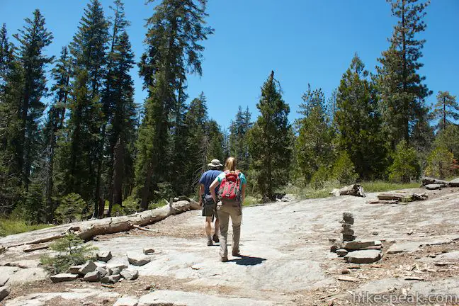
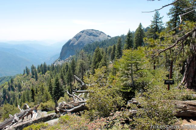
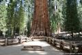
Isn’t it comforting to know that even in the Giant Forest, the most visited area of Sequoia National Park, you can still find a wonderful trail where you might not bump into another hiker? Starting from the busy parking area at Crescent Meadow, Sugar Pine Trail heads away from that beautiful sequoia-lined meadow to seek out other interesting natural features away from the big trees. The loop passes grinding holes carved into the rock by Native Americans and serves up sweeping views from the rim of a profound canyon carved by the Middle Fork of the Kaweah River. The best views of this moderate 1.5-mile loop with 250 feet of elevation change come from Bobcat Point, which has a fierce perspective of Moro Rock, just a mile away.
Sugar Pine Trail is a dirt and rock single track that runs 1.5 miles between the parking lots at Moro Rock and Crescent Meadow. For a longer hike, you could start from Moro Rock and hike a 3.3-mile lollipop loop on Sugar Pine and Bobcat Point Trails. However, the Moro Rock Parking Area is small and usually crowded, so it is preferable to start from Crescent Meadow and explore an action packed 1.5-mile loop.
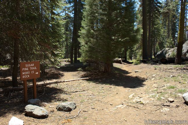
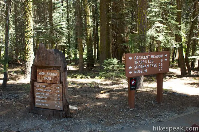
From the Crescent Meadow Parking Area, set out south down Sugar Pine Trail, located to the right of High Sierra Trail, which will be your return route. Sugar Pine Trail comes to a marked junction after a few hundred feet. Turn right, following signs for Moro Rock. The path to the left can be used by those who start from Moro Rock and wish to loop past the Crescent Meadow Parking Area.
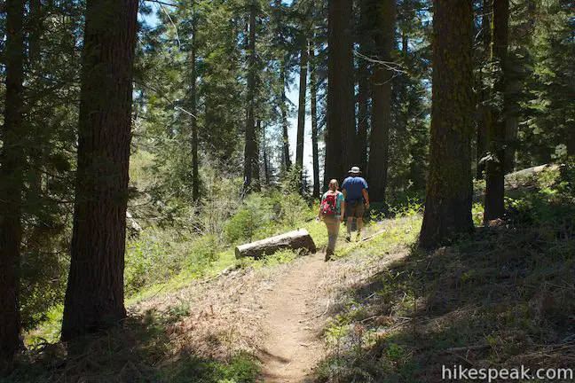
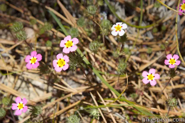
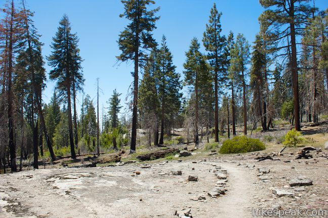
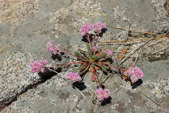
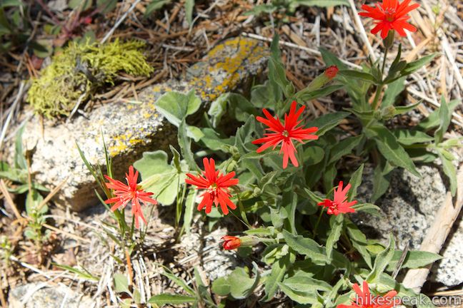
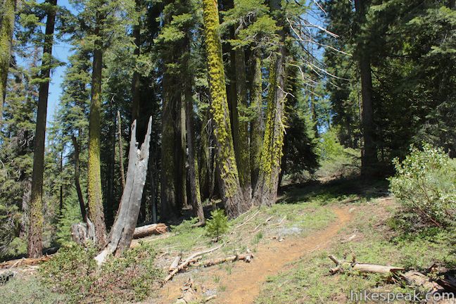
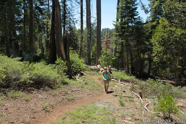
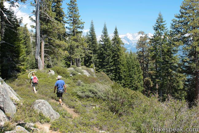
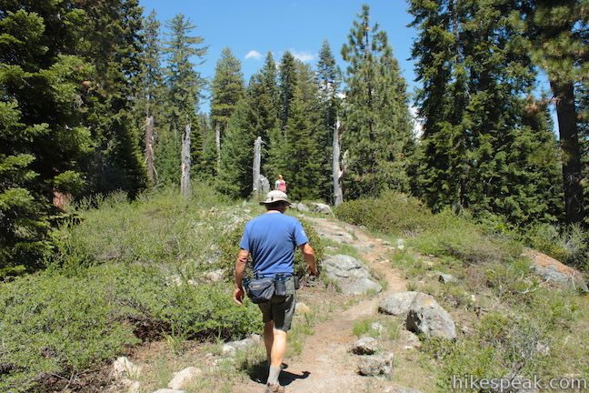
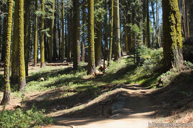
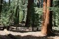
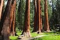
Continuing gradually downhill, you will pass through a forest of sugar pines. There aren’t any giant sequoias along this loop, but the small-by-comparison sugar pines do have one oversized feature. Their pinecones are enormous! Keep an eye on the ground and you will spot pinecones that are over a foot long. Wildfire has charred some of the pines along the trail and smaller plants are flourishing in the reviving forest. You can spot sun-loving mustang clover, pussypaws, and California Indian pink blooming along the forest floor in the late spring and early summer.
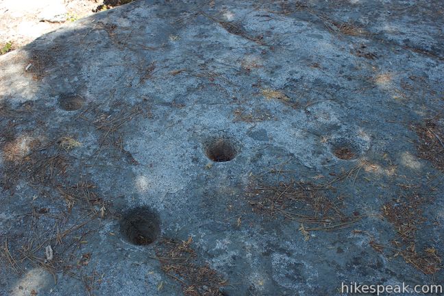
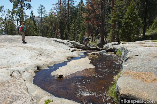
After 0.3 miles of hiking, you will come to a marked junction with a spur trail on the left to “Indian Mortars” on a landing of exposed granite bedrock along Crescent Creek. Walk a few hundred feet this way to find morteros, or mortars, bowl-shaped holes carved into the rock. Native Americans used the morteros to grind local nuts and seeds into meal.
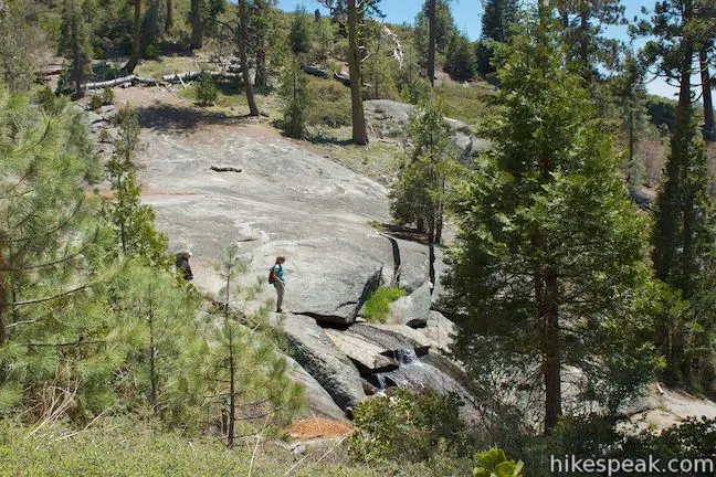
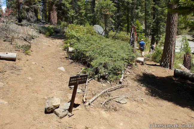
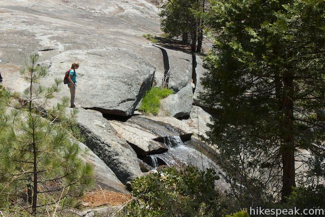
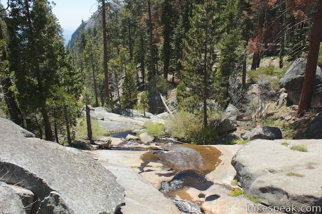
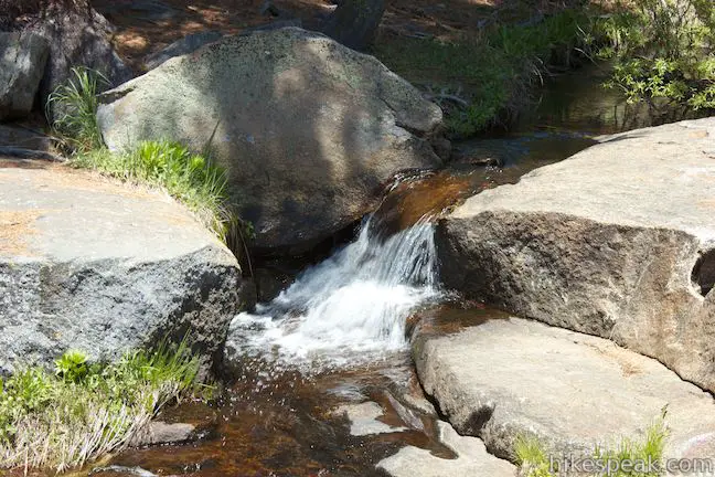
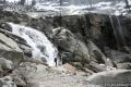
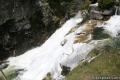
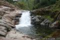
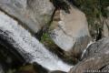
Backtrack to Sugar Pine Trail and continue down the single track as it follows Crescent Creek downstream. At 0.6 miles, you will come to a marked junction with Bobcat Point Trail. Sugar Pine Trail continues to the right for 0.9 miles to Moro Rock, but make a sharp left turn toward Bobcat Point and walk down to a crossing of Crescent Creek. The charming flow slices down a slab of granite through pools and small cascades. This is the low point of the loop at 6,500 feet. Linger a bit by the water before beginning the ascent to Bobcat Point.
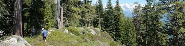
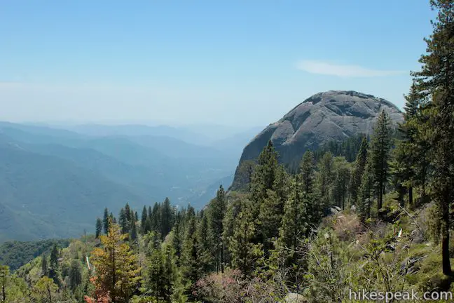
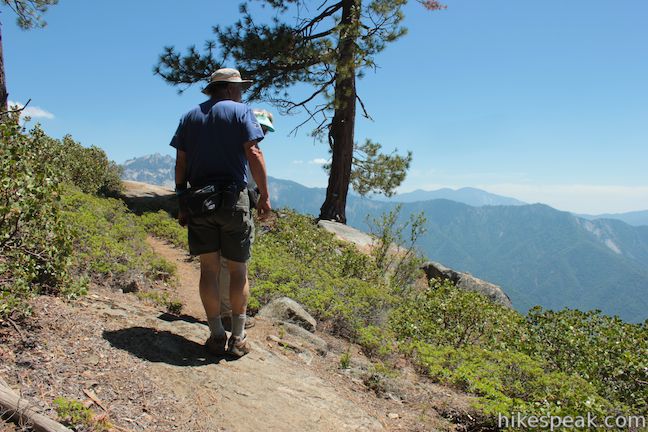
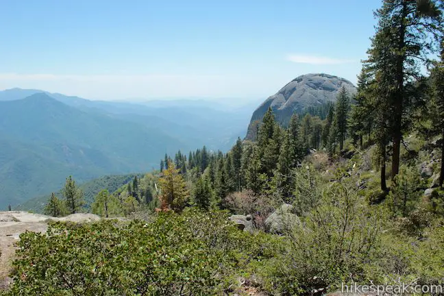
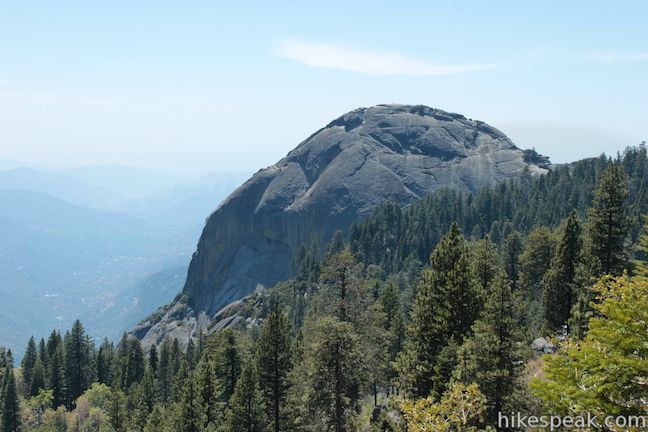
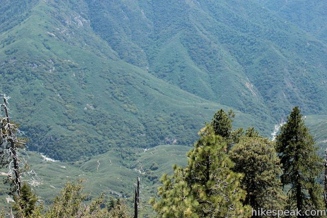
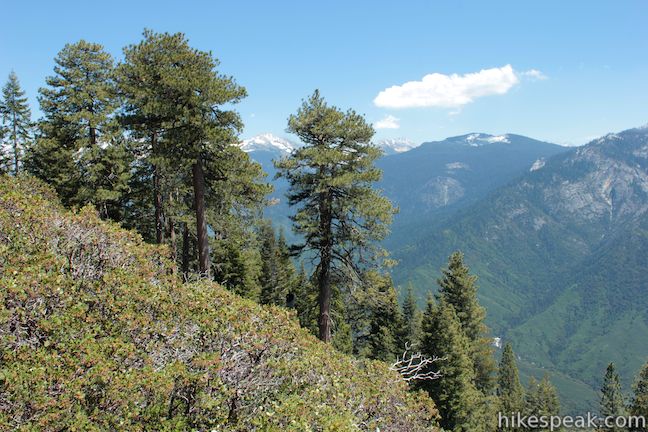
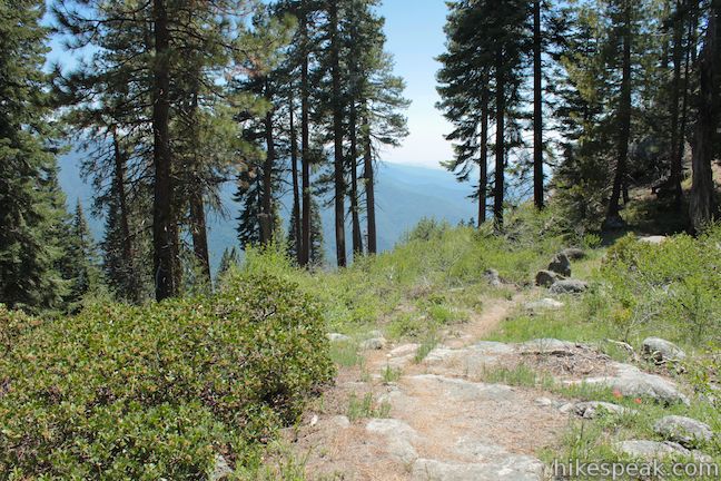
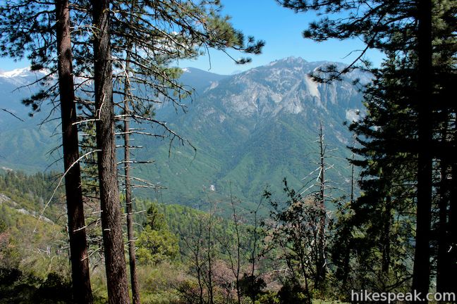
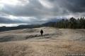
The trail climbs 150 feet in a quarter mile to reach Bobcat Point, which is identified with a small sign and excellent views across the grand canyon formed around the Middle Fork of the Kaweah River. The spired tops of Castle Rocks are visible to the south on the other side of the canyon, and some 3,000 feet below, Middle Fork Trail can be seen weaving along the roaring river. The highlight of Bobcat Point is the view to the west, where the granite dome called Moro Rock rises above the rim of the canyon.
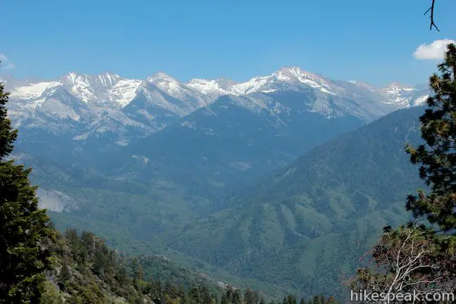
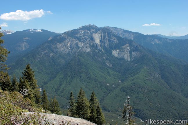
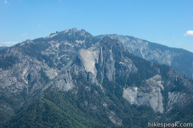
Bobcat Point Trail continues east from the point across a ridge above the rim of the canyon where it should pass a location called Kaweah Vista that looks east toward the peaks on the Great Western Divide towering above the Middle Fork Kaweah River. Unlike Bobcat Point, Kaweah Vista is not marked with a sign or easy to find. In fact, different guide maps put the vista in different places along the trail. What or where Kaweah Vista is can be disputed, but you will certainly need to be more aggressive and attentive to find the eastward views along this trail.
Shortly after Bobcat Point, as the trail crosses a rise in the ridge and you will pass the first Kaweah Vista. Looking above the treetops, you can spot snowcapped summits to the east. It’s not really what you would call a vista, but it’s an enjoyable view, especially if you hop up on one of the short boulders along the trail for a little boost.
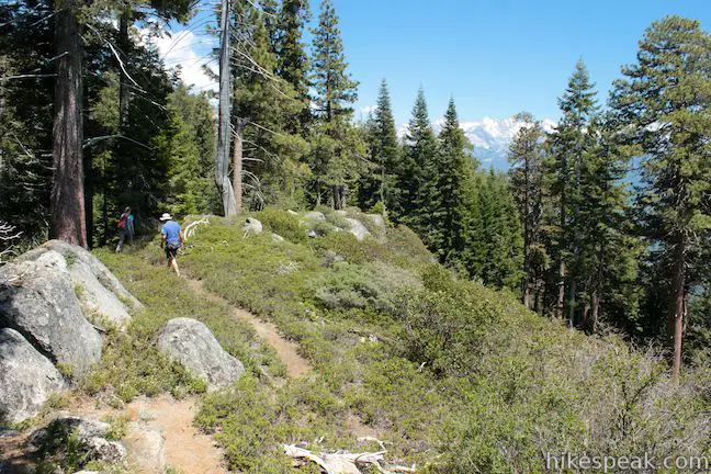
Bobcat Point Trail slinks across a dip in the ridge before climbing again to the highest spot on the loop. Here you get almost a Kaweah Vista, seeing the open canyon through a few rows of trees just below the trail. If Bobcat Point Trail had been built along the base of these trees you would surely have a great Kaweah Vista. At this spot, 0.3 miles past Bobcat Point and 1.2 miles from the start, the trail turns left and heads north toward High Sierra Trail, leaving the views behind.
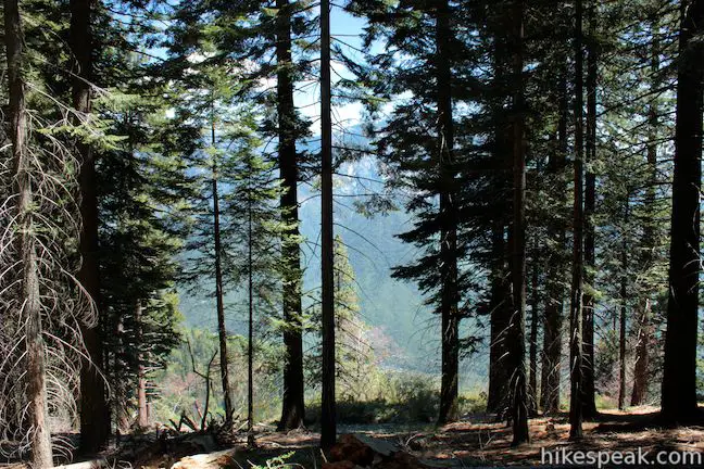
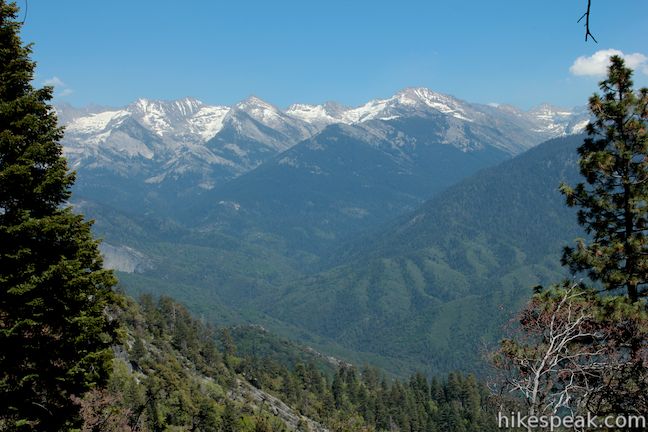
It is well worth straying off trail here just a little bit to find better views, as long as you take it upon yourself to find your way back to the trail. Ease down a slope covered in pine needles to the edge of the trees where you’ll find a footpath worn in by like-minded view seekers. Below the line of sugar pines there are open views south across the chasm toward Castle Rocks and east toward the jagged line of snowcapped peaks on the Great Western Divide. This is the best Kaweah Vista. It’s just unfortunate that it’s not on the trail itself.
Make your way back to Bobcat Point Trail, which switchbacks down the opposite side of the ridge, heading north to a junction with High Sierra Trail, 1 1/3 miles from the start of the loop. If you turned right, you could hike 60 miles on High Sierra Trail all the way to Mount Whitney. To continue with the loop, however, turn left and hike a short distance back to the trailhead.
After a hundred feet you will come to a junction with Crescent Meadow Trail. Turn left again for a direct hike back to the parking lot, or turn right to venture around the beautiful meadow lined by sequoias.
You will cross the top of Crescent Creek a few hundred feet farther down High Sierra Trail. A path on the left side of the creek connects back to Sugar Pine Trail (at the first junction you come to on the hike). Stick with High Sierra Trail across two wooden footbridges to return to the Crescent Meadow Parking Area, closing out the loop after 1.5 miles of scenic and peaceful hiking.
The basic directions of the Sugar Pine and Bobcat Point Trails Loop are:
- Start down Sugar Pine Trail from the Crescent Meadow Parking Area (0 miles)
- Stay to the right on Sugar Pine Trail through an early junction (0.05 miles)
- Take the short spur to the left to explore the Indian Mortars. (0.30 miles)
- Continue down Sugar Pine Trail (0.30 miles)
- Make a sharp left turn onto Bobcat Point Trail (0.60 miles)
- Cross and explore Crescent Creek (0.65 miles)
- Appreciate Bobcat Point (0.90 miles)
- Pass the off-trail Kaweah Vista (1.20 miles)
- Turn left on High Sierra Trail (1.33 miles)
- Turn left past Crescent Meadow Trail to stay on High Sierra Trail (1.35 miles)
- Return to the Crescent Meadow Parking Area (1.50 miles)
Dogs and mountain bikes are prohibited on trails in Sequoia National Park. A park entrance fee is taken to reach the trailhead, but no permit is required to hike the Sugar Pine and Bobcat Point Trails Loop, so get out and enjoy!
Directions to the Trailhead
- Take Generals Highway to Crescent Meadow Road, which is just south of the Giant Forest Museum.
- Drive east past the turnoff for Moro Rock (A short and amazing hike).
- After three miles, the road ends at the Crescent Meadow Parking Area.
- Along the way, travelers can drive beneath Tunnel Log, a Sequoia that fell over the road.
Trailhead Location
Trailhead address: Crescent Meadow Road, Sequoia National Park, CA 93262
Trailhead coordinates: 36.5548, -118.7490 (36° 33′ 17.2″N 118° 44′ 56.4″W)
View Sugar Pine and Bobcat Point Trails Loop in a larger map
Or view a regional map of surrounding Sierra Nevada trails and campgrounds.


 | Crescent Meadow This level 1.6-mile loop visits a Sequoia you can stand inside (Chimney Tree) and another that someone used to live in (Tharp's Log). |
 | Moro Rock This 0.6 mile hike sports panoramic views and should be considered a mandatory hike for first time visitors to Sequoia National Park. |
 | Hanging Rock Trail This short 0.35-mile hike passes views of Moro Rock en route to a balancing boulder on a canyon rim at the edge of the Giant Forest. |
 | General Sherman Tree This one-mile hike visits the world's biggest tree, a 275-foot tall Giant Sequoia that is 36.5 feet across at the base. |
 | Congress Loop This easy paved two mile loop visits the fourth and fifth tallest Sequoias in the world (among others). |
 | Big Trees Trail This 1.6-mile stroll explores giant sequoias around Round Meadow on a paved nature trail that is easy, educational, and beautiful. |
 | Sunset Rock This 2-mile hike visits a large granite dome with great views to the west, possibly the best place to end your day in the Giant Forest. |
 | Tokopah Falls This 4.2-mile hike reaches the base of the tallest waterfall in Sequoia National Park. |
 | Marble Falls This 8-mile hike takes a flower-lined path up a mountain canyon to a powerful waterfall. |
 | Paradise Creek This short stroll leaves Buckeye Flat Campground to visit the perfect swimming hole for a hot summer day in the Sierra. |
 | Panther Creek This 6-mile hike follows the Middle Fork Trail to a 100 foot waterfall that drops into the Middle Fork of Kaweah River. |
 | More trails in the Sierra Nevada Mountains Explore other destinations in Sequoia National Park and the rest of the range. |
 | Sequoia and Kings Canyon National Parks Campgrounds There are 14 campgrounds with over 1,000 total sites spread throughout the park to facilitate your visit. |
Common Questions about Sugar Pine and Bobcat Point Trails Loop in Sequoia National Park
- Is the trail open?
- Yes. You should expect to find that Sugar Pine and Bobcat Point Trails Loop is open. There are no recent reports of trail closures. If you discover that the trail is closed, please help your fellow hikers by reporting a closure.
- Do I need a permit for this hike?
- Yes. National Park Entrance Fee.
- How much time does this hike take?
- It takes approximately 45 minutes to hike Sugar Pine and Bobcat Point Trails Loop. Individual hiking times vary. Add extra time for breaks and taking in the views.
- How long is this hike?
- The hike to Sugar Pine and Bobcat Point Trails Loop is a 1.5 mile loop with 250 feet of elevation change.
- Are dogs allowed on this trail?
- No, dogs are likely not allowed on Sugar Pine and Bobcat Point Trails Loop. The trail is primarily open to hikers.
- Is Sugar Pine and Bobcat Point Trails Loop good for kids?
- Yes, this hike is likely suitable for children. It is relatively short (1.5 miles) with manageable elevation gain.
- Where is the trailhead located?
- The trailhead for Sugar Pine and Bobcat Point Trails Loop is located in Sequoia National Park, CA.
Trailhead Address:
Crescent Meadow Road
Sequoia National Park, CA 93262
Trailhead Coordinates:
36.5548, -118.749 - What are the driving directions to the start of the hike?
To get to the trailhead: Take Generals Highway to Crescent Meadow Road, which is just south of the Giant Forest Museum. Drive east past the turnoff for Moro Rock (A short and amazing hike). After three miles, the road ends at the Crescent Meadow Parking Area. Along the way, travelers can drive beneath Tunnel Log, a Sequoia that fell over the road.
View custom Google Maps directions from your current location.
- Are there other trails near Sugar Pine and Bobcat Point Trails Loop?
- Yes, you can find other nearby hikes using the Hikespeak Hike Finder Map.

Started Sugar Pine Trail at the Crescent Meadow parking lot heading toward Moro Rock. The first part of the trail you pass through an area that looks like it has been through a fire. There are a number of downed tress, but allot of new growth that is five to ten feet tall. The trail traverses over and through massive granite rocks and slabs. This might be part of the foundation of Moro Rock . You travel down the trail .5 mile and then cross over Crescent Creek and commence on an upward climb to Bobcat Point. There are wonderful views of Moro Rock through the trees along the trail. Once you reach Bobcat Point the area opens up and you have magnificent views of Moro Rock and the Middle Fork of Kaweah River. After checking out the views you recommence your upward climb and meet up with the High Sierra Trail. You turn left and return to Crescent Meadows parking lot. If you were to turn right onto the High Sierra trail, you could also see Eagle View, another wonderful spot to see splendid view of the area. It might be recommend to take this hike in the winter when the heat induced haze and smog are greatly reduced.