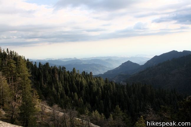
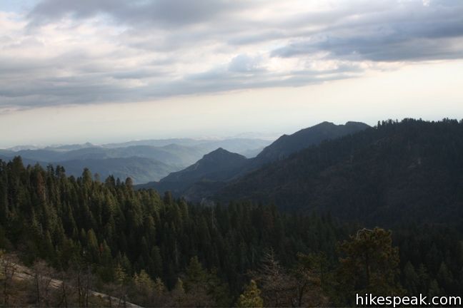
Sunset Rock offers fine westerly views across Sequoia National Park. After walking amongst the giant sequoias or hiking more serious trails in the Sierra, a stroll out to Sunset Rock may be the best way to end the day.
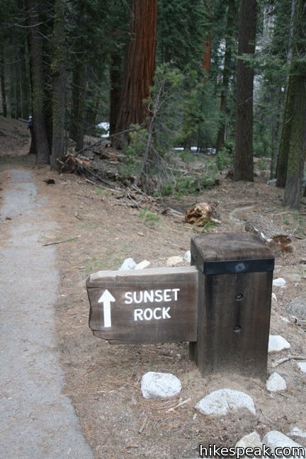
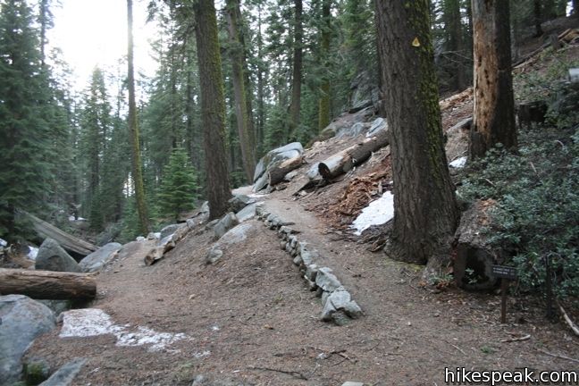
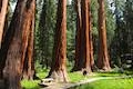
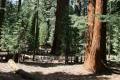
Across the road from the Giant Forest Museum, start down a paved trail that descends to a wooden bridge over Little Deer Creek. Cross the footpath that follows the stream and take the dirt path rising up the bank in front of you. If you turned right here, you would reach Big Trees Trail, an easy, beautiful, and educational trail through the giant sequoias along Round Meadow.
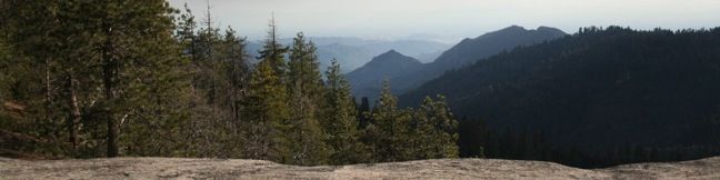
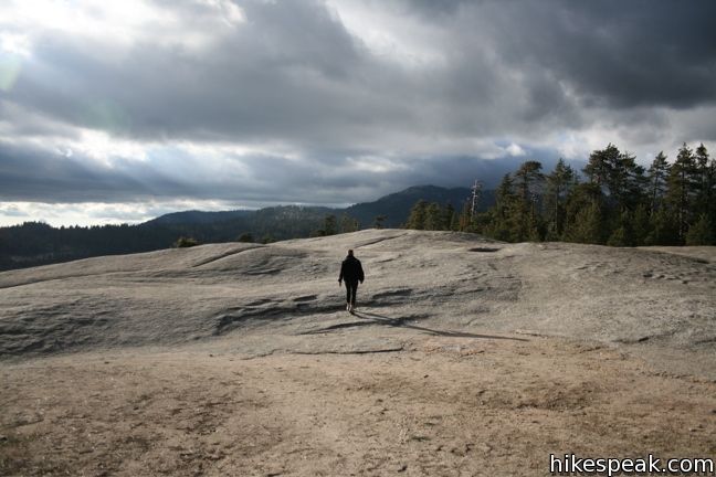
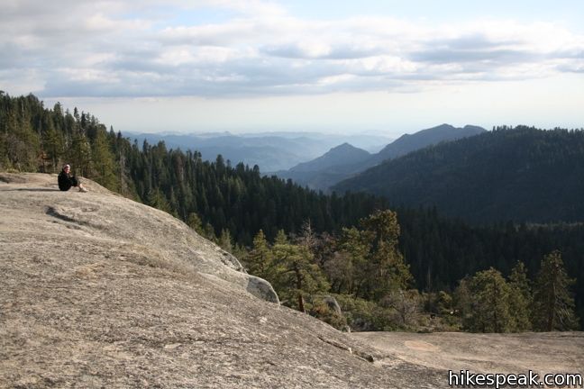
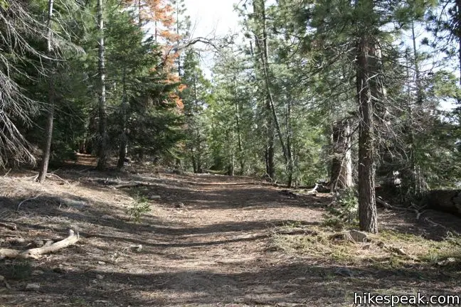
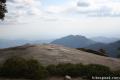
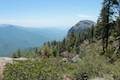
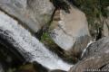
Proceed straight on Sunset Rock Trail. After a mile on the easy forest trail, step out of the trees onto a large granite dome. This rock clearing sports views down Deep Canyon, which has been picturesquely carved by the Marble Fork of the Kaweah River. Below and somewhere out of sight is Marble Falls, but there is plenty to see from Sunset Rock. If you arrive at the prescribed time of day, have a seat and watch the sun go to rest over the ridge of pines to the west. You are in for a treat!
It may be a good idea to have a flashlight on hand for the hike back. This easy 2-mile round trip trail can be completed by hikers of all abilities. For a similar view with an even shorter (or no) hike, visit Beetle Rock on the other side of the Giant Forest Museum parking lot.
Directions to the Trailhead
- Park in the lot across the Generals Highway from the Giant Forest Museum.
- The trail starts near the north end of the parking lot.
Trailhead Location
Trailhead address: Generals Highway (California 198), Sequoia National Park, CA 93262
Trailhead coordinates: 36.5657, -118.7724 (36° 33′ 56.5″N 118° 46′ 20.6″W)
You may also view a regional map of surrounding Sierra Nevada trails and campgrounds.


 | Big Trees Trail This 1.4-mile stroll explores giant sequoias around Round Meadow on a paved nature trail that is easy, educational, and beautiful. |
 | Beetle Rock This short walk from the Giant Forest Museum to Beetle Rock visits a granite dome with great views and stunning sunsets. |
 | Hanging Rock Trail This short 0.35-mile hike passes views of Moro Rock en route to a balancing boulder on a canyon rim at the edge of the Giant Forest. |
 | Moro Rock This 0.6 mile hike sports panoramic views and should be considered a mandatory hike for first time visitors to Sequoia National Park. |
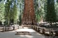 | General Sherman Tree This one-mile hike visits the world's biggest tree, a 275-foot tall Giant Sequoia that is 36.5 feet across at the base. |
 | Congress Loop This easy paved two mile loop visits the fourth and fifth tallest Sequoias in the world (among others). |
 | Crescent Meadow This level 1.6-mile loop visits a Sequoia you can stand inside (Chimney Tree) and another that someone used to live in (Tharp's Log). |
 | Sugar Pine Trail and Bobcat Point Trail Loop This short but diverse 1.5-mile loop peaks at Bobcat Point, which presents a fierce perspective of Moro Rock and a massive canyon. |
 | Tokopah Falls This 4.2-mile hike reaches the base of the tallest waterfall in Sequoia National Park. |
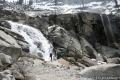
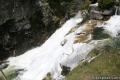 | Marble Falls This 8-mile hike takes a flower-lined path up a mountain canyon to a powerful waterfall. |
 | Paradise Creek This short stroll leaves Buckeye Flat Campground to visit the perfect swimming hole for a hot summer day in the Sierra. |
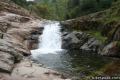
 | Panther Creek This 6-mile hike follows the Middle Fork Trail to a 100 foot waterfall that drops into the Middle Fork of Kaweah River. |
 | More trails in the Sierra Nevada Mountains Explore other destinations in Sequoia National Park and the rest of the range. |
 | Sequoia and Kings Canyon National Parks Campgrounds There are 14 campgrounds with over 1,000 total sites spread throughout the park to facilitate your visit. |
Common Questions about Sunset Rock in Sequoia National Park
- Is the trail open?
- Yes. You should expect to find that Sunset Rock Trail is open. There are no recent reports of trail closures. If you discover that the trail is closed, please help your fellow hikers by reporting a closure.
- Do I need a permit for this hike?
- Yes. National Park Entrance Fee.
- How much time does this hike take?
- It takes approximately 45 minutes to hike Sunset Rock Trail. Individual hiking times vary. Add extra time for breaks and taking in the views.
- How long is this hike?
- The hike to Sunset Rock Trail is a 2 mile out and back with 50 feet of elevation change.
- Are dogs allowed on this trail?
- No, dogs are likely not allowed on Sunset Rock Trail. The trail is primarily open to hikers.
- Is Sunset Rock Trail good for kids?
- Yes, this hike is likely suitable for children. It is relatively short (2 miles) with manageable elevation gain.
- Where is the trailhead located?
- The trailhead for Sunset Rock Trail is located in Sequoia National Park, CA.
Trailhead Address:
Generals Highway
Sequoia National Park, CA 93262
Trailhead Coordinates:
36.5657, -118.7724 - What are the driving directions to the start of the hike?
To get to the trailhead: Park in the lot across the Generals Highway from the Giant Forest Museum. The trail starts near the north end of the parking lot.
View custom Google Maps directions from your current location.
- Are there other trails near Sunset Rock Trail?
- Yes, you can find other nearby hikes using the Hikespeak Hike Finder Map.

[…] a black bear and lots of adorable golden-mantled ground squirrels. Then we drove and hiked to Sunset Rock for incredible views of the sun setting over the mountains. On our way back out of Three Rivers, […]
Thank you so much for the detailed hiking and backcountry camping options. I have some great ideas for my next camping trips. This is a great resource!