General Grant Tree Trail
in Kings Canyon National Park
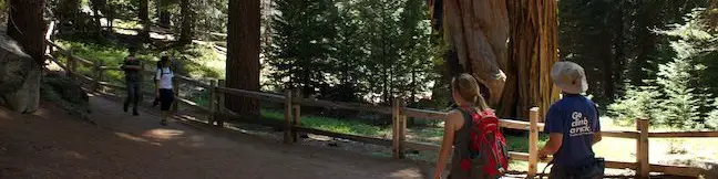
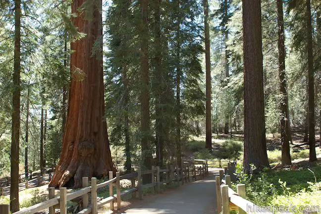
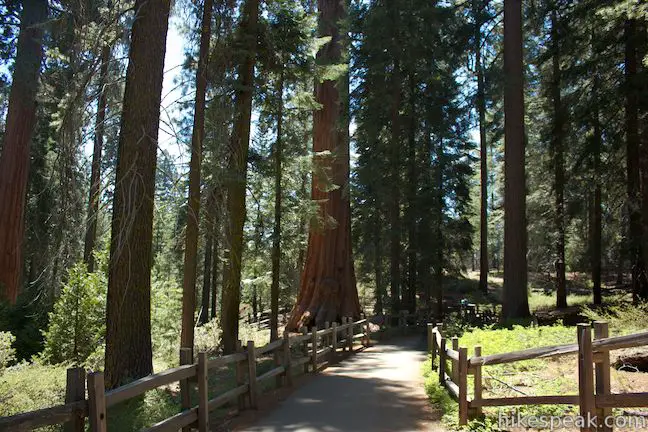
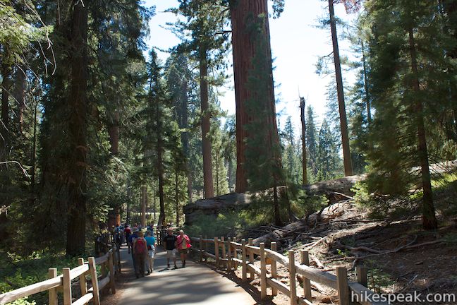
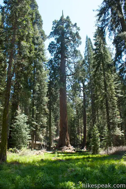
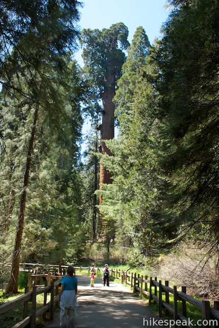
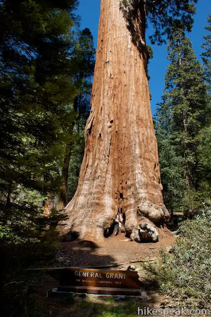
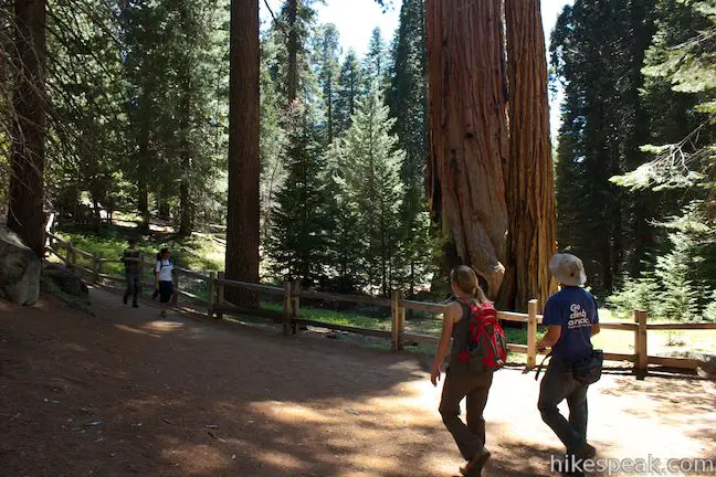
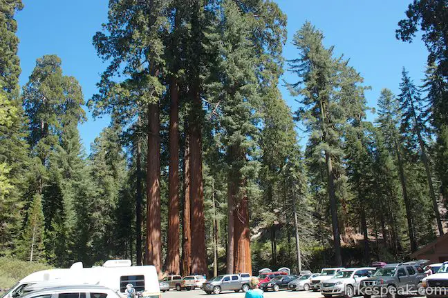
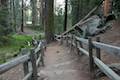
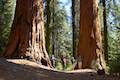
The Grant Grove is one of the top draws in Kings Canyon National Park, containing the park’s most important sequoia, the General Grant Tree. The Grant Grove is one of the world’s premier sequoia habitats with several of the world’s largest trees. It is the oldest section of Kings Canyon National Park, first protected as General Grant National Park in 1890. A paved 0.8-mile loop explores the grove of giant sequoias around the General Grant Tree and you can extend your hike in this area by checking out North Boundary Trail, North Grove Trail, and Dead Giant Loop Trail, or by following the trail between Grant Grove and Grant Village. Expect General Grant Tree Trail (the loop through the heart of the Grant Grove) to be filled with other hikers, informative panels, and astonishing trees.
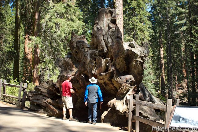
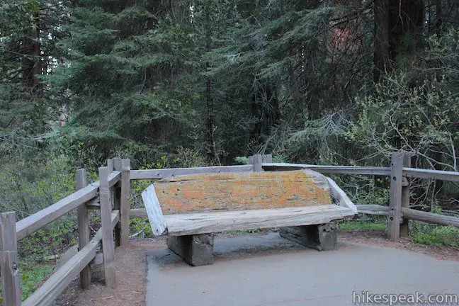
For $1.50 (as of 2013), you can purchase a handy trail guide at the trailhead that was put together by the Sequoia Natural History Association and includes 15 entries that correspond with numbered markers along the trail. Even without the pamphlet, you will have no trouble making your way to the General Grant Tree, and the panels along the trail provide an adequate amount of information for those who prefer not to read too much while they hike. There is a fallen giant sequoia along the trail called the Fallen Goliath that you can walk through to connect the upper and lower sides of the loop. It is so fun to walk through the tree, why not do it twice and convert the short loop into a figure 8?
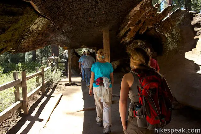
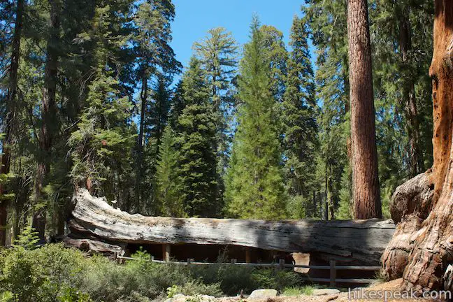
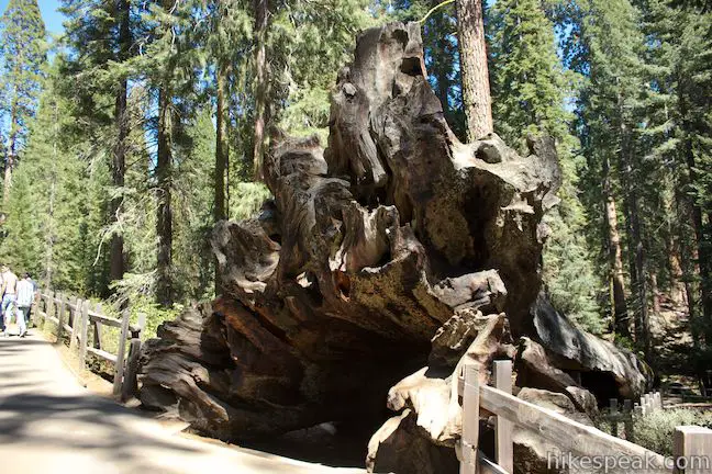
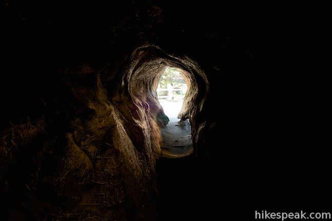
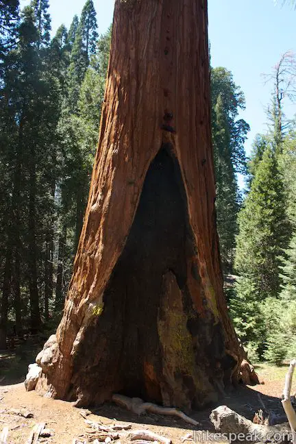
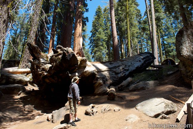
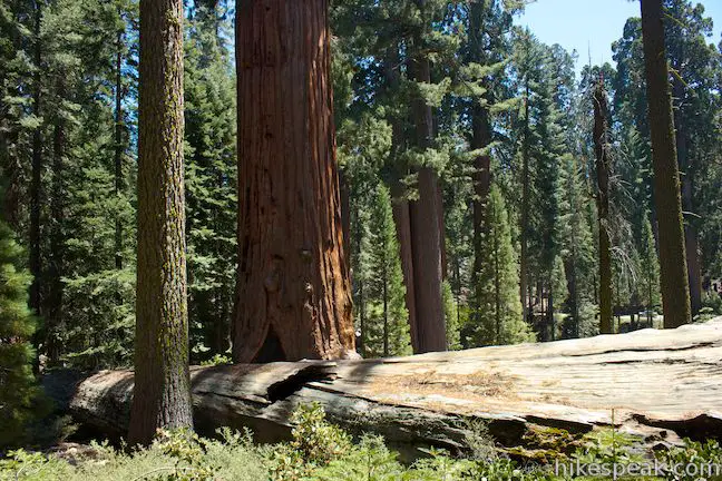
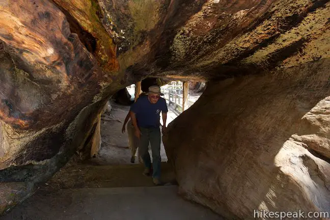
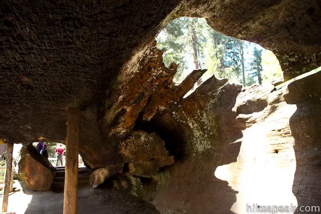
The General Grant Tree Trail splits immediately at the trailhead to start the loop. Take the trail heading uphill to the left, which will curve to the right around the Lincoln Tree, named after President Abraham Lincoln, who relied on General Grant during the Civil War. After just a tenth of a mile, you will reach the upturned roots of the Fallen Monarch. The tree was hallowed by wildfires so that when it fell, it became a tunnel that you can walk through. Turn right and hike down through the Fallen Monarch. In the past, this tree was used as a temporary housing for a pair of loggers, the Gamlin brothers. It was also used as a hotel and saloon, and later as stables for the U.S. Cavalry.
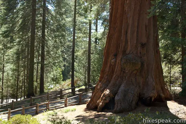
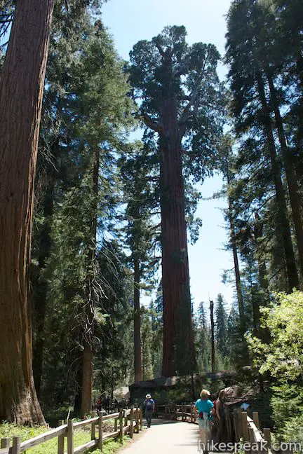
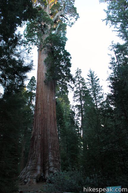
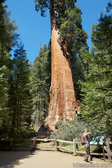
After a couple hundred feet, you will step through the wooden tunnel at the bottom of the Fallen Monarch and reach the lower end of the paved loop. Turn left and proceed toward the General Grant Tree. After passing other big sequoias, the trail will curve to the right and you will pass Photo Point. Here there is a good view through the forest toward the General Grant Tree. Because sequoias are so tall, once you get up close, it is hard to capture them from top to bottom (or crown to base) all in one photo. Snap some shots and admire the grandeur of the General Grant Tree. As a point of reference, the lowest branch of the enormous tree is 129 feet off the ground.
A tenth of a mile from the Fallen Monarch, you will come to a junction. The trail to the right heads to the Michigan Log and connects to the trail between Grant Village and the Grant Grove Parking Area. To reach the General Grant Tree, turn left. You will quickly pass the Tennessee Tree, one of many trees named after states in the Grant Grove.
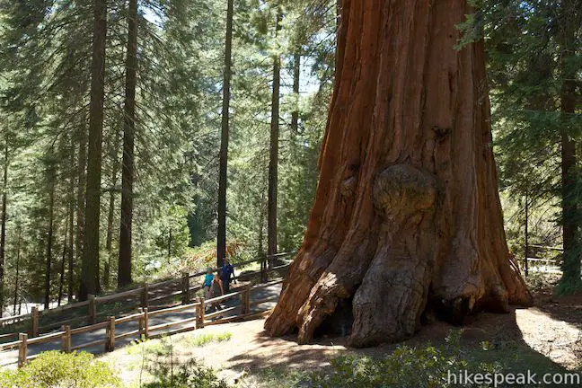
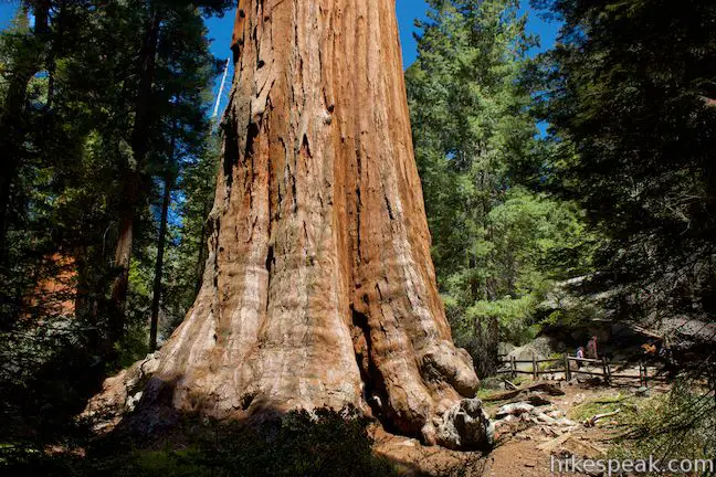
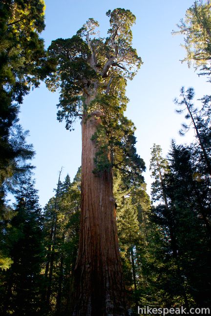
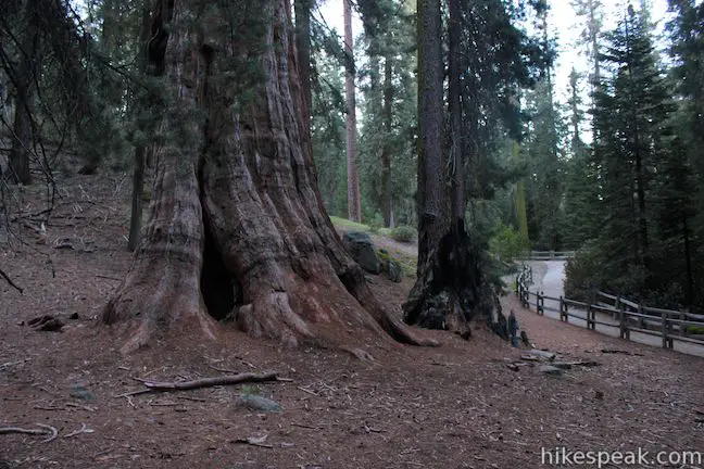
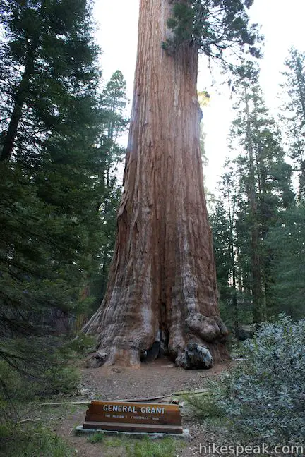
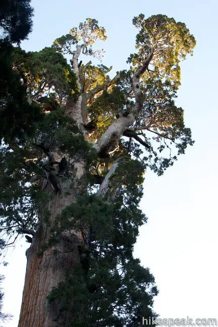
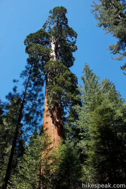
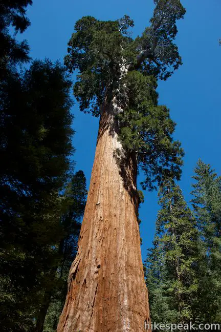
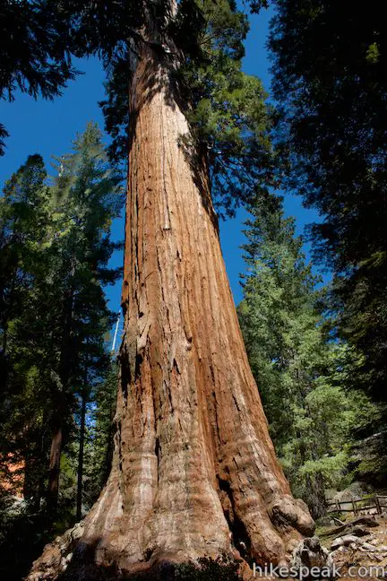
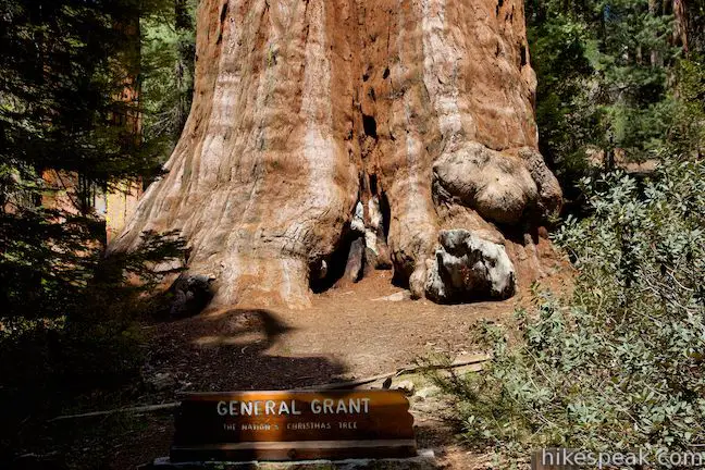
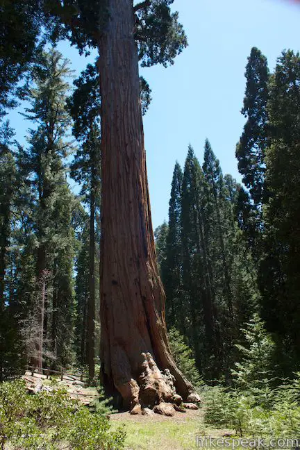
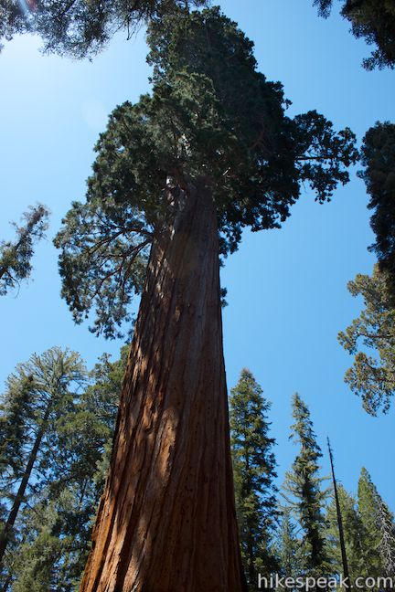
The next split in the trail is for the loop around the General Grant Tree. Walk all the way around the awesome tree to truly get a sense of its presence. Informative panels are on the left (west) side of the tree and views of a large fire scar are on the east side. The General Grant Tree has a volume estimated at 46,608 cubic feet, weighs over 1,250 tons, is 267 feet tall (the height of a 24-story building), and has a diameter at base height of 29 feet. The General Grant Tree is young by sequoia standards at around 1,700 years old and is still growing thicker. The General Grant Tree is the world’s third largest tree (General Sherman Tree is the largest) with the broadest base diameter of any sequoia at 40.3 feet.
The General Grant Tree is a significant tree for all of America. In addition be being “The Nation’s Christmas Tree,” The General Grant Tree is a national shrine in memory of the men and women of the Armed Forces who have served and fought and died to keep America free. The General Grant Tree is America’s only living shrine. The tree is of course named after Ulysses S. Grant, the victorious Civil War General and America’s 18th president.
On the east side of the General Grant Tree, a path goes up to the Vermont Log, a big fallen sequoia that broke into pieces (unlike the Fallen Monarch). If you hike the North Boundary Trail Loop, you will actually step through higher sections of the same fallen sequoia.
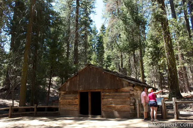
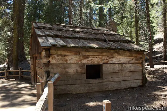
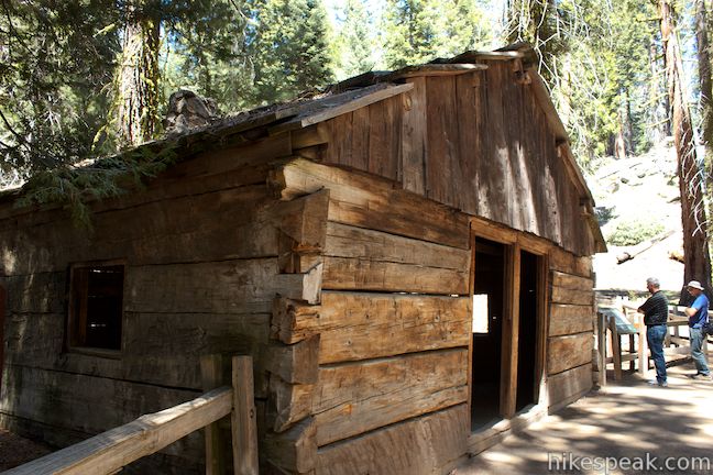
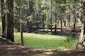
On the north side of General Grant Tree, the trail continues up to the Gamlin Cabin. The cabin is over 140 years old and has been reconstructed and relocated three times. The cabin is nicely restored and in a great location near the General Grant Tree. A sign outside the cabin explains that:
This cabin was built in 1872 by Israel Gamlin, who with his brother Thomas filed a timber claim to 160 acres within the Grant Grove. They quartered here until 1878 while grazing cattle in the mountains. After General Grant National Park was established in 1890, the cabin was used as a storehouse by the U.S. Cavalry who patrolled the park until 1913. Later it became the quarters of the first park ranger stationed here.
There is a junction at the Gamlin Cabin. If you turn right, you can take a dirt trail up to the North Boundary Trail Loop. Even if you do not hike the full loop, you could walk a short distance to North Grant View for a look down over the cabin toward the General Grant Tree.
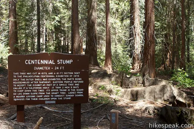
To continue the General Grant Tree Trail, turn left at the Gamlin Cabin and stay on the paved walkway. It is 0.15 miles back to the Fallen Monarch. Along the way, you will pass the Lightening Tree, Centennial Stump, and the Oregon and California Trees. The Centennial Stump has a diameter of 24 feet and an interesting history, as a sign along the trail explains:
This tree was cut in 1875, and a 16-foot section was sent to the Philadelphia Centennial Exhibition of 1876. Only the outer shell was exhibited, the parts being reassembled after shipment. Eastern people refused to accept the exhibit as part of a single tree and called it a “California Hoax.” It took two men nine days to chop down the tree. Its upper trunk is the scarred log down slope from the Grant Tree. Ladies from a nearby logging camp used to conduct Sunday school services for their children upon the stump.
While the “California Hoax” was a sad finish for the 1,800-year old tree, it would only be 14 more years before the grove received permanent federal preservation as a national park.
The California Tree will come next on the south (left) side of the trail, and while the Lighting Tree may not have actually been struck by lightning, the California Tree definitely was in 1967. When a bolt of lighting hit it, the top of the tree shattered and went up in flames. For the safety of park visitors, the tree was extinguished, a procedure that required a forester to climb up into the tree with a hose.
When you get back to the Fallen Monarch, turn left and walk back down through the tree again for double the fun. At the other end, turn right this time and hike 0.05 miles down to the trailhead. You will pass the Robert E. Lee Tree, named after General Grant’s Civil War adversary.
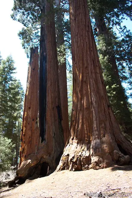
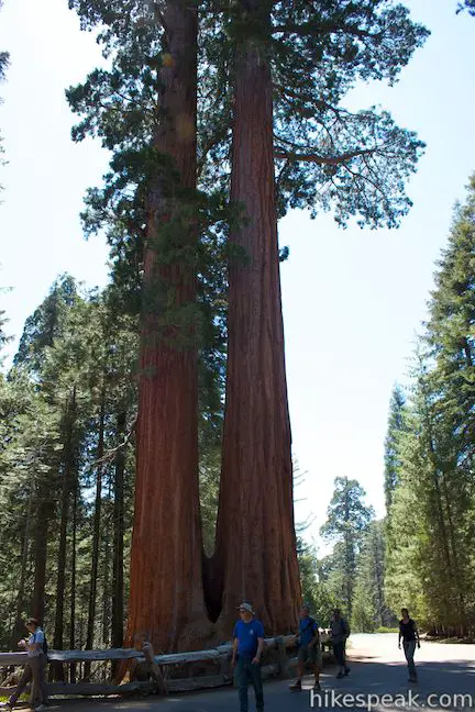
Across from the trailhead, you will spot a cozy pair of sequoias named the Twin Sisters that joined together at their bases. Double trees like these can be found in most sequoia groves. The trees are so big that when they started growing they were at least ten feet apart and only teamed up after decades or centuries of growth. At the far end of the large parking area, you’ll spot another cluster of fused together trees named the Happy Family. Hopefully you and your family will be happy after hiking the General Grant Tree Trail.
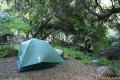
Please help to preserve the Grant Grove by not walking on or marring any trees. This is a very crowded and noisy trail, so arrive in the early morning if you would like to experience some fleeting tranquility in the gorgeous grove. It is quite a sight when the first rays of sunlight strike the top of the General Grant Tree before spreading down to illuminate the rest of the grove. Dogs and mountain bikes are prohibited on trails in Kings Canyon National Park. A national park entrance fee is required to visit the park, but you will not need a permit to hike through the Grant Grove, so get out and enjoy!
Directions to the Trailhead
- From Fresno, drive east on Route 180.
- After some 50 miles, you will reach the Big Stump Entrance Station for Kings Canyon National Park.
- Proceed 1.7 miles to a three-way intersection.
- To the right, Route 198 heads south toward Sequoia National Park.
- Turn left to stay on Route 180 and drive another 1.6 miles north to an intersection with Grant Tree Road.
- Make a left turn down Grant Tree Road, which is 0.2 miles after Grant Village, which is on the right.
- After turning left on Grant Tree Road, you will pass the entrance to Azalea Campground on the left.
- Proceed 0.75 miles down to the Grant Grove Parking Area, which you will find below a right bend at the bottom of the road.
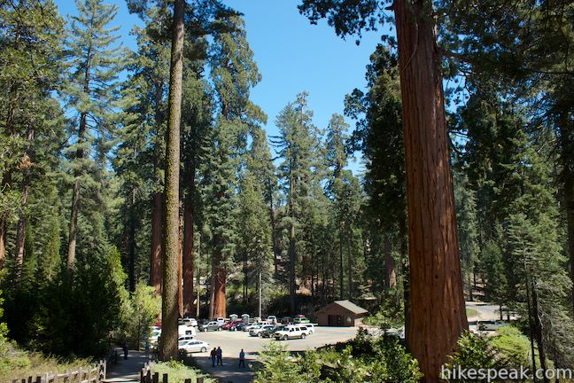
- General Grant Tree Trail begins from the northwest side of the lot near the Twin Sisters.
Trailhead Location
Trailhead address: Grant Tree Road, Kings Canyon National Park, CA 93628
Trailhead coordinates: 36.747, -118.973128 (36° 44′ 49.2″N 118° 58′ 23.26″W)
You may also view Kings Canyon National Park in a larger map
Or view a regional map of surrounding Sierra Nevada trails and campgrounds.


 | North Boundary Trail This 3.55-mile hike starts on the trail between Grant Grove and Grant Village and passes the General Grant Tree to reach a 2.75-mile loop through the pine forest north of the Grant Grove. |
 | North Grove Trail This 2-mile loop explores a quiet grove of sequoias near the crowded Grant Grove and can combine with Dead Giant Loop Trail for 3.25-mile hike. |
 | Dead Giant Loop Trail This 2.25-mile loop passes a small meadow and a large dead sequoia to reach Sequoia Lake Overlook and can combine with nearby North Grove Trail for 3.25-mile hike. |
 | Grant Village to Grant Grove Trail This mile-long trail connects the visitor center at Grant Village with the parking lot at Grant Grove, passing through Azalea Campground to reach giant sequoias, including the General Grant Tree. |
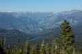 | Panoramic Point This 0.5-mile round trip hike reaches an exception overlook with views into Kings Canyon. |
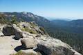 | Buena Vista Peak This 2-mile round trip hike ascends 420 feet to a granite summit with 360-degree views over the Redwood Mountain Sequoia Grove and Kings Canyon. |
 | Hart Tree and Fallen Goliath Loop This 8.3-mile loop on Hart Tree Trail and Redwood Creek Trail passes tranquil streams and interesting sequoias in the Redwood Mountain Grove in Kings Canyon National Park. |
 | Grizzly Falls This 0.1-mile round trip stroll at Grizzly Falls Picnic Area in Sequoia National Forest reaches the base of an 80-foot waterfall along the Generals Highway near the Cedar Grove Area of Kings Canyon National Park. |
 | Roaring River Falls This paved 0.3-mile round trip hike reaches a thundering little waterfall on a tributary of the Kings River in Kings Canyon National Park. |
 | Kanawyer Loop Trail This 5-mile loop is scenic and easy, exploring east from the backcountry gateway at Road's End along both sides of the South Fork Kings River in Kings Canyon. |
 | More trails in the Sierra Nevada Mountains Explore other destinations in Kings Canyon National Park and the rest of the range. |
 | Sequoia and Kings Canyon National Parks Campgrounds There are 14 campgrounds with over 1,000 total sites spread throughout the parks to facilitate your visit. |
- General Grant Tree Trail in Kings Canyon National Park: A Complete Hiker's Guide by Mike White (opens in a new tab)
- General Grant Tree Trail on americansouthwest.net (opens in a new tab)
- General Grant Tree Trail on kevingong.com (opens in a new tab)
- A shorter Grant Grove Hike on redwoodhikes.com (opens in a new tab)
- The General Grant Grove on wikipedia.org (opens in a new tab)
- Grant Grove Area Trails on nps.gov (opens in a new tab)
- The official website for Kings Canyon National Park (opens in a new tab)
Common Questions about General Grant Tree Trail in Kings Canyon National Park
- Is the trail open?
- Yes. You should expect to find that General Grant Tree Trail is open. There are no recent reports of trail closures. If you discover that the trail is closed, please help your fellow hikers by reporting a closure.
- Do I need a permit for this hike?
- Yes. National Park Entrance Fee.
- How much time does this hike take?
- It takes approximately 15 minutes to hike General Grant Tree Trail. Individual hiking times vary. Add extra time for breaks and taking in the views.
- How long is this hike?
- The hike to General Grant Tree Trail is a 0.8 mile loop with 50 feet of elevation change.
- Are dogs allowed on this trail?
- No, dogs are likely not allowed on General Grant Tree Trail. The trail is primarily open to hikers.
- Is General Grant Tree Trail good for kids?
- Yes, this hike is likely suitable for children. It is relatively short (0.8 miles) with manageable elevation gain.
- Are there sequoia trees on this hike?
- Yes, General Grant Tree Trail visits a grove of giant sequoias.
- Where is the trailhead located?
- The trailhead for General Grant Tree Trail is located in Kings Canyon National Park, CA.
Trailhead Address:
Grant Tree Road
Kings Canyon National Park, CA 93628
Trailhead Coordinates:
36.747, -118.973128 - What are the driving directions to the start of the hike?
To get to the trailhead: From Fresno, drive east on Route 180. After some 50 miles, you will reach the Big Stump Entrance Station for Kings Canyon National Park. Proceed 1.7 miles to a three-way intersection. To the right, Route 198 heads south toward Sequoia National Park. Turn left to stay on Route 180 and drive another 1.6 miles north to an intersection with Grant Tree Road. Make a left turn down Grant Tree Road, which is 0.2 miles after Grant Village, which is on the right. After turning left on Grant Tree Road, you will pass the entrance to Azalea Campground on the left. Proceed 0.75 miles down to the Grant Grove Parking Area, which you will find below a right bend at the bottom of the road. General Grant Tree Trail begins from the northwest side of the lot near the Twin Sisters.
View custom Google Maps directions from your current location.
- Are there other trails near General Grant Tree Trail?
- Yes, you can find other nearby hikes using the Hikespeak Hike Finder Map.

5 Comments on General Grant Tree Trail in Kings Canyon National Park
What hikers are saying:
✨ Generated summary of user commentsHikers visit this trail to behold the scale of the General Grant tree and explore the surrounding grove. The area offers a chance to observe the natural lifecycle of the forest, including Sequoias that have died in recent years. Visitors regularly coordinate their trips to include other nearby giants like the General Sherman tree, though Cindy recommends accounting for drive times when staying in Three Rivers.
Was there ever a N.Y. Tree in Grants grove?
Can you ride bicycle on the hiking trails?
we are planning a trip to the forest very soon and want to see the Grant as well as the Sherman trees. How close are they? We are staying in 3 Rivers and wondered about drive time.
Hi. We’re to be hiking around Sequoia National PARK and Kings Canyon areas in May. For study reasons, we’d particularly like to see Sequoias that have died in recent years, can anyone recommend where we might see them?
Full Virtual Hike of the General Grant Tree Trail in 4K UHD:
https://youtu.be/nEZyNM5ypOA
Perfect for trip planning or treadmill training!