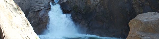
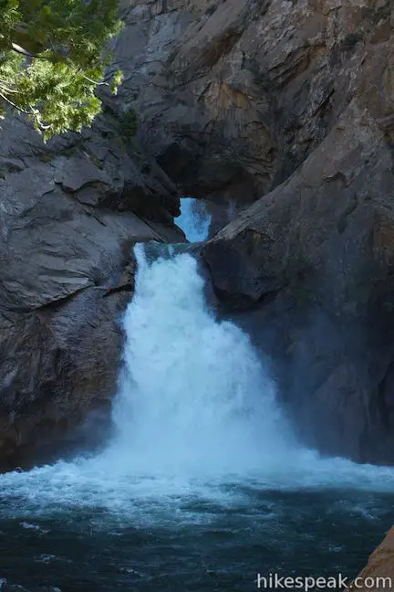
Roaring River Falls
in Kings Canyon National Park
Of course it is Yosemite Valley that rules the Sierra when it comes to waterfalls, but Kings Canyon has some regal waterfalls of its own, like Roaring River Falls. Located just off Generals Highway in the Cedar Grove Area of Kings Canyon National Park, the short but violent waterfall can be reached on a paved 0.3-mile round trip hike. Roaring River Falls makes a quick, rewarding outing and a worthwhile stop for anyone driving into Kings Canyon.
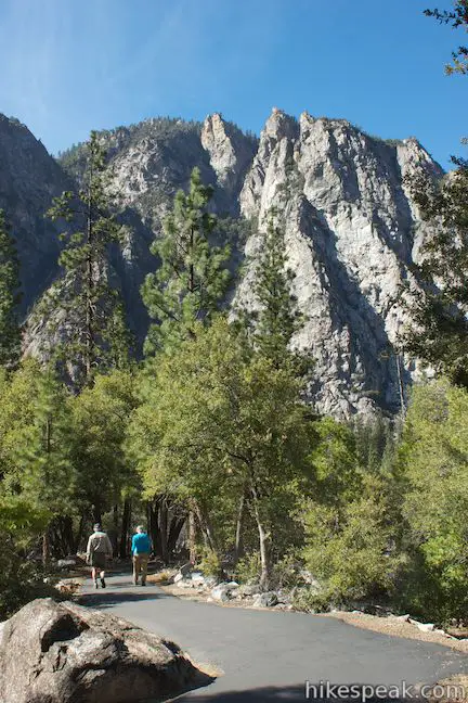
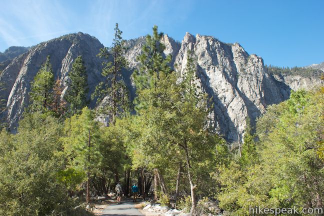
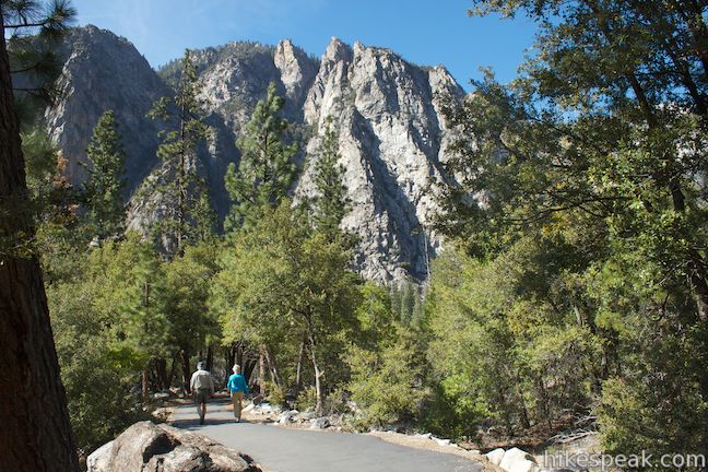
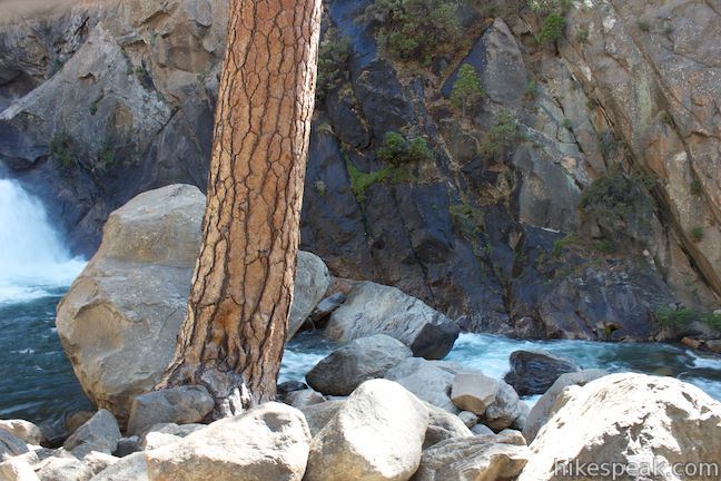
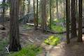
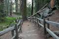
Hike south along a wide paved trail from a turnout along Generals Highway (Route 180), the only road into Kings Canyon. After an eighth of a mile, you will come to a junction in the wheelchair-friendly trail. River Trail ventures to the left, following the South Fork Kings River east up the canyon toward Zumwalt Meadow, Kanawyer Loop Trail, Bubbs Creek, and the backcountry of the Sierra. For this short hike, stay to the right on a trail to the base of Roaring River Falls, which reveals itself through the trees.
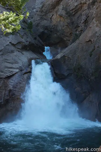
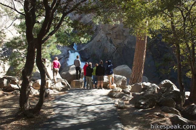
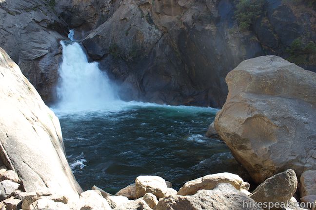
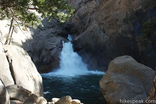
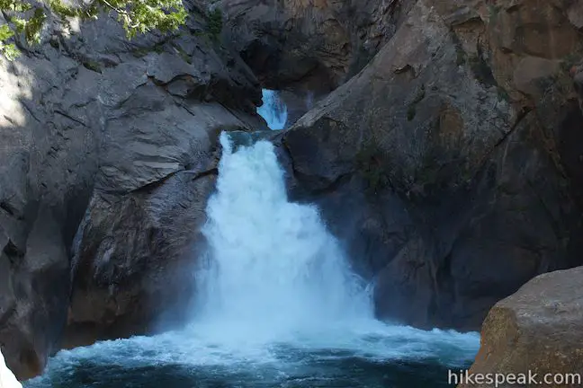
Like nearby Grizzly Falls, Roaring River Falls tumbles down a tributary of the Kings River. The water pushes violently through a rocky gap and drops about twenty feet into a swirling blue pool before streaking down a river of white water to join the Kings River (the pool can turn an emerald green color under the late summer sun when the waterfall is less violent).
Step to the right side of the overlook to get a better view of a second tier of Roaring River Falls that is just above the lower tier of the waterfall.
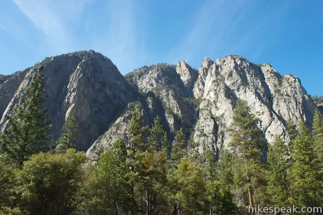
Once you’ve felt the mist and heard the roar of Roaring River Falls, turn around and head back down the trail. On the hike back, you will have nice views of North Mountain and the jagged cliffs on the opposite side of Kings Canyon. The mountain towers over the treetops, rising over 3,500 feet above the canyon floor.
The road to Roaring River Falls closes in the winter and may not open until late April, so check ahead before you visit. Dogs and mountain bikes are prohibited on trails in Kings Canyon National Park. A national park entrance fee is required to visit the park, but you will not need a permit to hike to Roaring River Falls, so get out and enjoy!
Directions to the Trailhead
- From Fresno, drive east on Route 180.
- After some 50 miles, you will reach the Big Stump Entrance Station for Kings Canyon National Park.
- Proceed 1.7 miles to a three-way intersection.
- To the right, Route 198 heads south toward Sequoia National Park.
- Turn left to stay on Route 180.
- From here, it is another 33.3 miles to the Roaring River Falls Trailhead, located on the right (south) side of the road.
- Along the way you will exit Kings Canyon National Park and cross through Sequoia National Forest before reentering Kings Canyon.
- The trailhead is 7.3 miles past the Grizzly Falls Picnic Area, 4.75 miles past the boundary between Sequoia National Forest and Kings Canyon National Park, and 2.5 miles before Road's End at the end of Generals Highway (where Kanawyer Loop Trail begins).
- The Roaring River Falls Trailhead comes 4 miles after an intersection where Cedar Grove Road splits off to the left.
- Stay to the right, following Generals Highway across the river.
Trailhead Location
Trailhead address: Generals Highway (California 180), Kings Canyon National Park, CA 93633
Trailhead coordinates: 36.783747, -118.622121 (36° 47′ 01.48″N 118° 37′ 19.63″W)
You may also view a regional map of surrounding Sierra Nevada trails and campgrounds.


 | Kanawyer Loop Trail This 5-mile loop is scenic and easy, exploring east from the backcountry gateway at Road's End along both sides of the South Fork Kings River in Kings Canyon. |
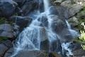 | Grizzly Falls This 0.1-mile round trip stroll at Grizzly Falls Picnic Area in Sequoia National Forest reaches the base of an 80-foot waterfall along the Generals Highway near the Cedar Grove Area of Kings Canyon National Park. |
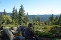
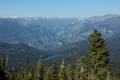 | Panoramic Point This 0.5-mile round trip hike reaches an exception overlook with views into Kings Canyon. |
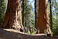
 | General Grant Tree Trail This 0-8 mile loop in the Grant Grove passes through a Fallen Monarch to reach the General Grant Tree, one of the world's largest sequoias. |
 | North Boundary Trail This 3.55-mile hike starts on the trail between Grant Grove and Grant Village and passes the General Grant Tree to reach a 2.75-mile loop through the pine forest north of the Grant Grove. |
 | North Grove Trail This 2-mile loop explores a quiet grove of sequoias near the crowded Grant Grove and can combine with Dead Giant Loop Trail for 3.25-mile hike. |
 | Dead Giant Loop Trail This 2.25-mile loop passes a small meadow and a large dead sequoia to reach Sequoia Lake Overlook and can combine with nearby North Grove Trail for 3.25-mile hike. |
 | Grant Village to Grant Grove Trail This mile-long trail connects the visitor center at Grant Village with the parking lot at Grant Grove, passing through Azalea Campground to reach giant sequoias, including the General Grant Tree. |
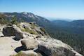 | Buena Vista Peak This 2-mile round trip hike ascends 420 feet to a granite summit with 360-degree views over the Redwood Mountain Sequoia Grove and Kings Canyon. |
 | Hart Tree and Fallen Goliath Loop This 8.3-mile loop on Hart Tree Trail and Redwood Creek Trail passes tranquil streams and interesting sequoias in the Redwood Mountain Grove in Kings Canyon National Park. |
 | More trails in the Sierra Nevada Mountains Explore other destinations in Kings Canyon National Park and the rest of the range. |
 | Sequoia and Kings Canyon National Parks Campgrounds There are 14 campgrounds with over 1,000 total sites spread throughout the parks to facilitate your visit. |
- Roaring River Falls in Top Trails: Sequoia and Kings Canyon National Parks by Mike White (opens in a new tab)
- Roaring River Falls on americansouthwest.net (opens in a new tab)
- Roaring River Falls on world-of-waterfalls.com (opens in a new tab)
- The official website for Kings Canyon National Park (opens in a new tab)
Common Questions about Roaring River Falls in Kings Canyon National Park
- Is the trail open?
- Yes. You should expect to find that Roaring River Falls Trail is open. There are no recent reports of trail closures. If you discover that the trail is closed, please help your fellow hikers by reporting a closure.
- Do I need a permit for this hike?
- Yes. National Park Entrance Fee.
- How much time does this hike take?
- It takes approximately 15 minutes to hike Roaring River Falls Trail. Individual hiking times vary. Add extra time for breaks and taking in the views.
- How long is this hike?
- The hike to Roaring River Falls Trail is a 0.3 mile out and back with 25 feet of elevation change.
- Are dogs allowed on this trail?
- No, dogs are likely not allowed on Roaring River Falls Trail. The trail is primarily open to hikers.
- Is Roaring River Falls Trail good for kids?
- Yes, this hike is likely suitable for children. It is relatively short (0.3 miles) with manageable elevation gain.
- Will I see a waterfall on this hike?
- Yes, Roaring River Falls Trail features a waterfall.
- Where is the trailhead located?
- The trailhead for Roaring River Falls Trail is located in Kings Canyon National Park, CA.
Trailhead Address:
Generals Highway
Kings Canyon National Park, CA 93633
Trailhead Coordinates:
36.783747, -118.62212 - What are the driving directions to the start of the hike?
To get to the trailhead: From Fresno, drive east on Route 180. After some 50 miles, you will reach the Big Stump Entrance Station for Kings Canyon National Park. Proceed 1.7 miles to a three-way intersection. To the right, Route 198 heads south toward Sequoia National Park. Turn left to stay on Route 180. From here, it is another 33.3 miles to the Roaring River Falls Trailhead, located on the right (south) side of the road. Along the way you will exit Kings Canyon National Park and cross through Sequoia National Forest before reentering Kings Canyon. The trailhead is 7.3 miles past the Grizzly Falls Picnic Area, 4.75 miles past the boundary between Sequoia National Forest and Kings Canyon National Park, and 2.5 miles before Road's End at the end of Generals Highway (where Kanawyer Loop Trail begins). The Roaring River Falls Trailhead comes 4 miles after an intersection where Cedar Grove Road splits off to the left. Stay to the right, following Generals Highway across the river.
View custom Google Maps directions from your current location.
- Are there other trails near Roaring River Falls Trail?
- Yes, you can find other nearby hikes using the Hikespeak Hike Finder Map.

We love to camp, and are always looking for new sites. This year we went to Albion, beautiful place. I want to find out about camping here now, would it be 1st come, or reservations only? Also plenty of water?
It is technically incorrect to refer to roads inside a National Park by state highway numbers. These are federal roads, and not considered part of the state highway that they connect to at one or both ends.
[…] Roaring River Falls […]