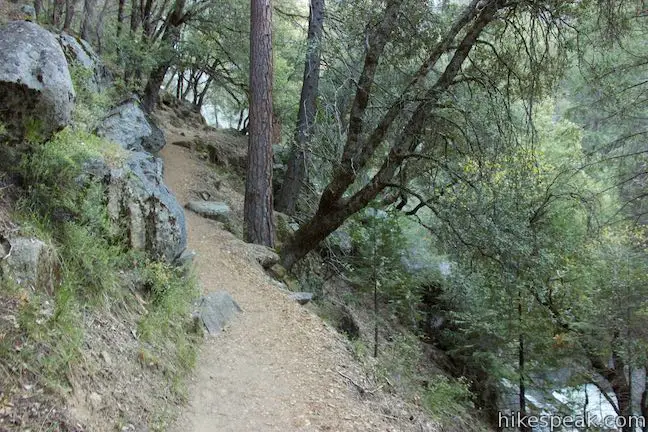
This less-traveled single track on the southern end of Yosemite National Park visits thundering cascades and one of the longest falls in the park outside Yosemite Valley. Chilnualna Falls Trail passes through charming forests on the way to Upper Chilnualna Falls where hikers can connect to other trails delving into the Yosemite backcountry. Chilnualna Falls Trail is rated as strenuous for its length more than its pitch. Beyond a steep section along cascades at the start of the trail, the single track is steady and surprisingly gradual, gaining 2,200 feet over 4 miles.
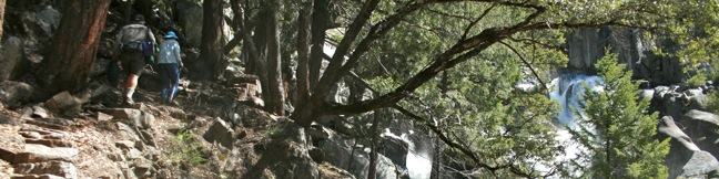
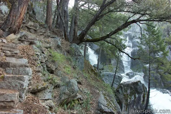
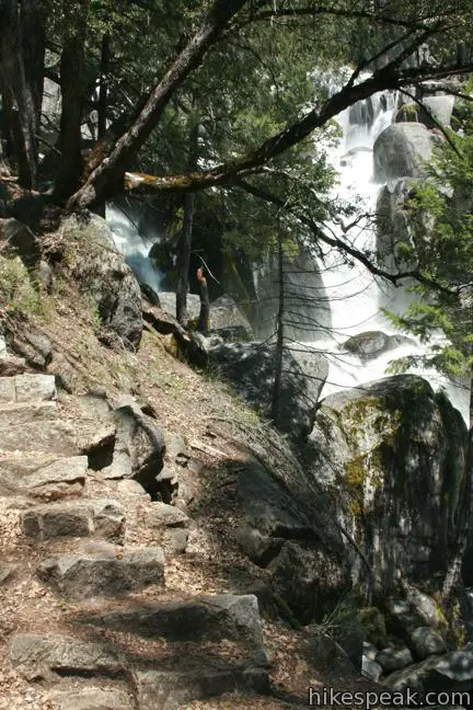
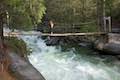
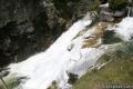
If an 8-mile round trip hike is more than you are looking for, do not pass up the opportunity to see the cascades that parallel the start of the trail. Hike to the top of the stone steps along this daunting stretch of Chilnualna Creek, and then return to the trailhead for a highly enjoyable half-mile hike.
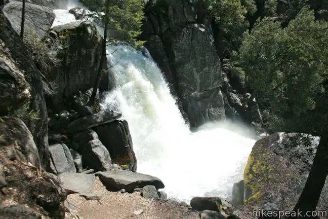
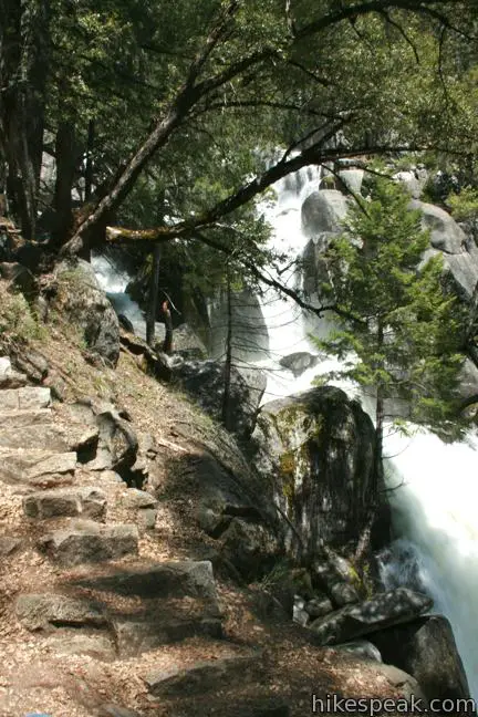
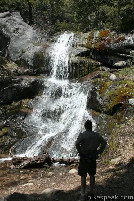
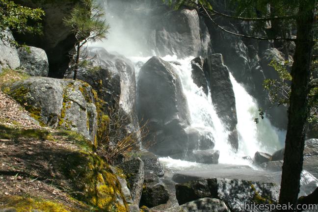
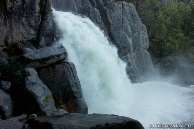
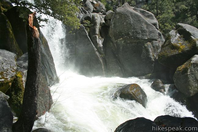
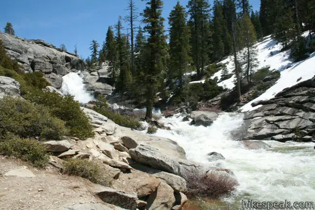
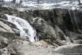
Begin from a parking area off Chilnualna Falls Road in the Wawona Area of Yosemite National Park and walk a short distance east on the road to the marked start of Chilnualna Falls Trail. A stock trail angles to the left. Be glad you aren’t a horse and take the single track toward a sensational string of cascades. In no time at all, you will be standing alongside a raucous chain of pour-overs in Chilnualna Creek. The water absolutely thunder in the spring when snow melt swells the banks.
Chilnualna Falls Trail separates from the creek to reach the upper waterfall, so absorb the cascade, and any mist that hits you, before moving on.
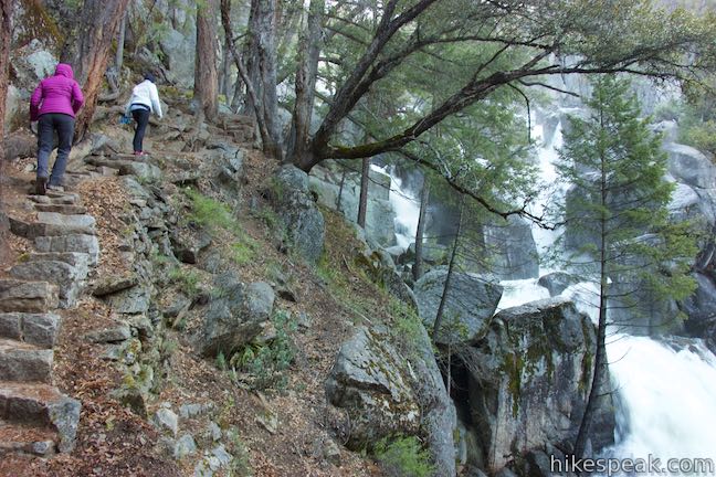
A switchback of stone steps leads to a reunion with the stock trail, 0.4 miles from the start. If you turned left here, you could hike 0.6 miles back to the start for a 1-mile loop. However, if you’re ready to head back, it is far more scenic to return down Chilnualna Falls Trail past the cascades. To continue up the trail, head to the right at this junction (there are not further junctions until you reach the waterfall).
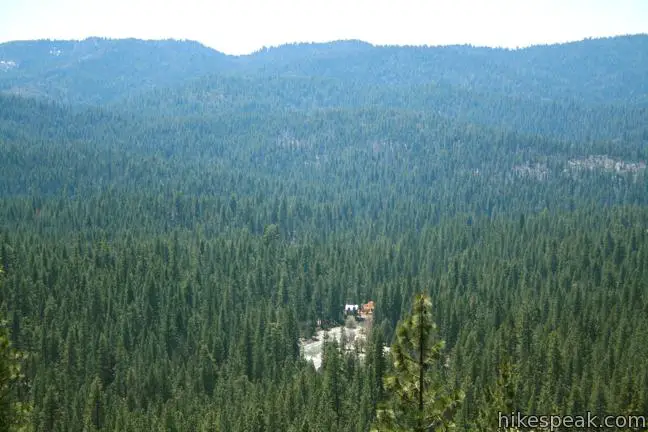
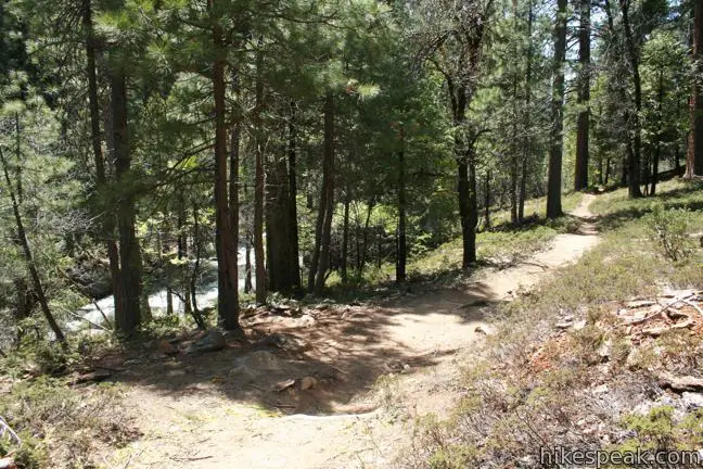
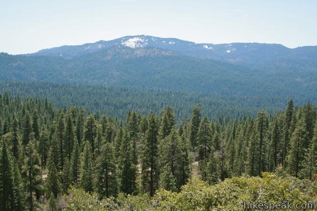
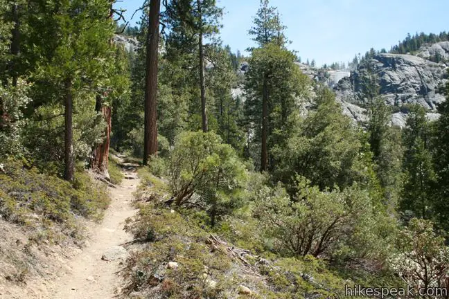
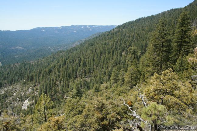
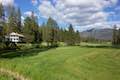
Through the trees to the left, a view appears over the pine-covered basin containing Wawona. Two-thirds of a mile from the junction, logs bridge a seasonal creek crossing. About two tenths of a mile farther, Chilnualna Creek comes into view. The trail runs parallel to this frothy channel for another 0.15 miles. Footpaths heading down to the rapids offer a short detour. The main trail moves away from the creek, avoiding it for the rest of the climb to the falls.
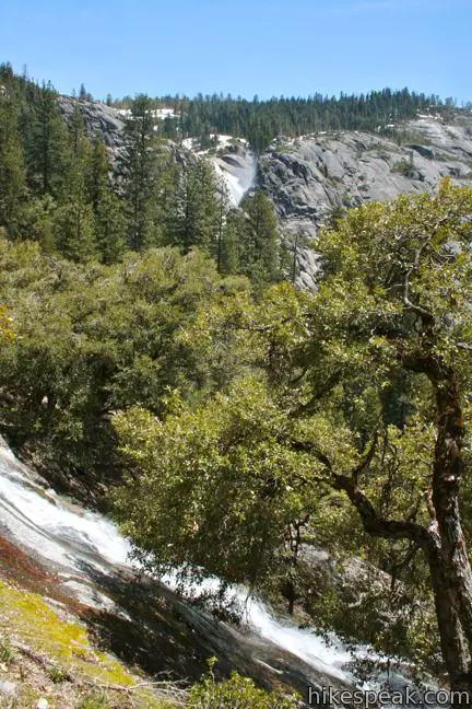
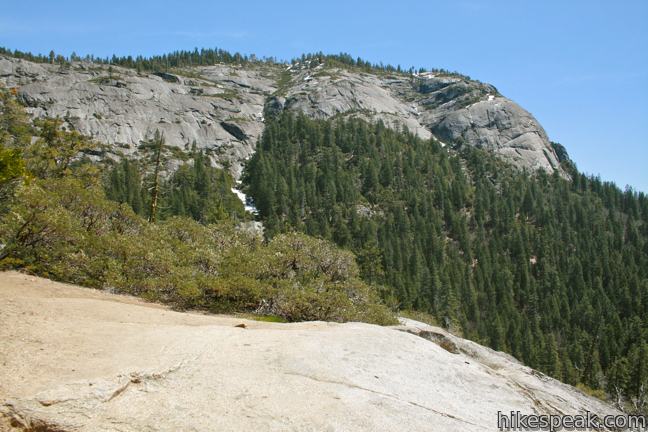
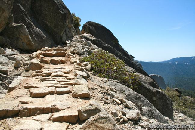
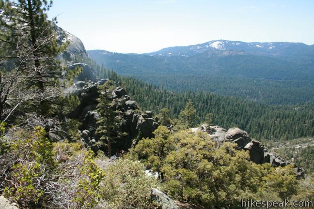
After crossing two more seasonal tricklers, march up a flight of stone steps to an area of exposed granite with grand views down the canyon carved by Chilnualna Creek. Across the creek is Wawona Dome, a 6,899-foot cap with steep rock walls that reverberate the sounds of tumbling water.
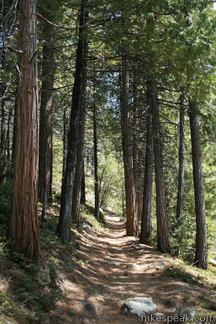
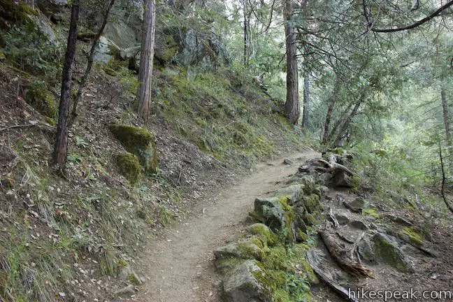
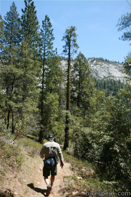
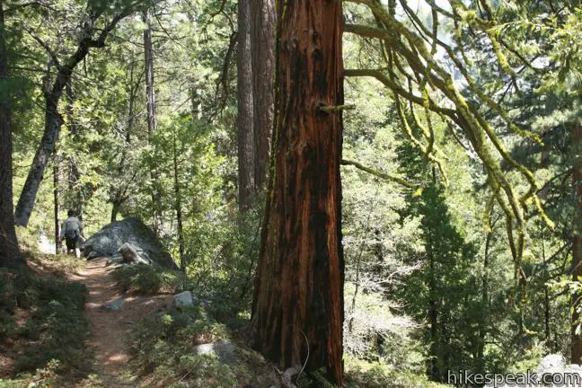
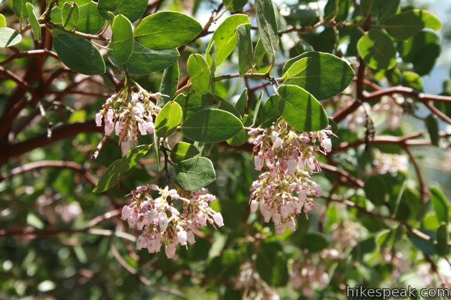
Chilnualna Falls Trail continues in and out of shade, traveling through a pine forest decorated by ruby-trunked manzanita trees. Some wildfire damage may be evident, but whether you are hiking over dirt, rocks, or a soft bed of pine needles, the environment is seductively sylvan.
Half a mile past the open granite area, and 2.75 miles from the trailhead, you will start to hear and see Upper Chilnualna Falls. Tall pines around the trail and a rock trench sheltering the waterfall obscure any clear view of the falls.
The volume of the waterfall increases as you hike, along with your frustration that an unobstructed view is not available. Each time you near what might be a clean shot of the falls, the teasing trail turns up a switchback away from the creek.
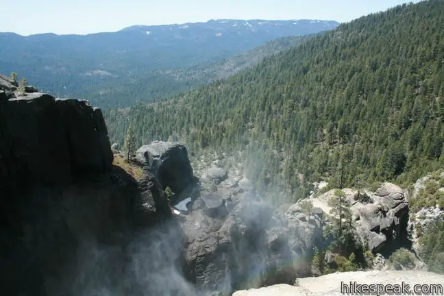
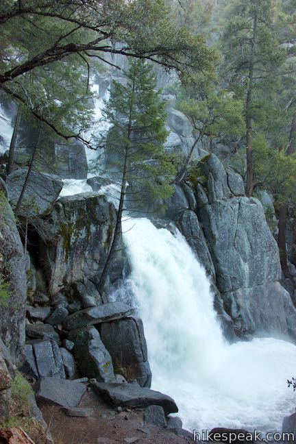
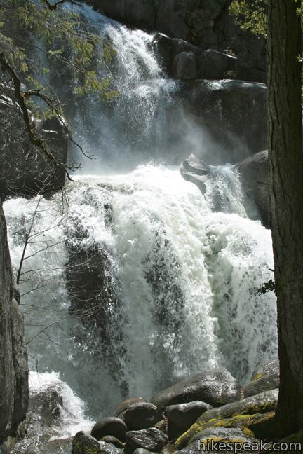
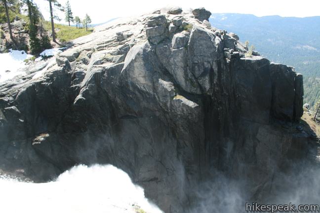
The best view of Chilnualna Falls comes three-quarters of a mile from the top. A sizable seasonable stream pours over the trail from left to right, providing its own waterfall that is undeniably pleasant if not as impressive. This liquid conduit clears the forest below, providing the broadest window of Chilnualna Falls.
Chilnualna Falls dumps off the rim of the canyon and channel north down a jagged trench under the direction of a bold rock that obscures a head-on view. Another quarter mile up the trail, dense trees obscure an almost perfect perspective of the waterfall. After a few final switchbacks, the trail straightens out and crosses rock steps on an outcropping north of the falls. Even from the top of the Chilnualna Falls, you do not get a full view of the chute because of the way it angles off the cliff. However, you are rewarded with a panorama of the valley below.
Above Chilnualna Falls, the trail switches past smaller cascades, coming to a trail junction that allows backpackers to trek farther. Alder Creek, Bishop Creek, Bridalveil Creek, and Westfall Meadow can be reached en route to Glacier Point Road to the north. Buena Vista Lake, Crescent Lake, Johnson Lake, and Buck Camp can be reached by hiking east. A wilderness permit is required for all overnight adventures into the Yosemite backcountry.
For day hikers, take a moment to look over the waterfall (without getting too close to the edge) and return the way you came. On the way down, you will notice more views of Chilnualna Falls than you saw on the way up (unless you looked over your shoulder a lot). The trail is enjoyable in reverse, as you stride back to the cascade and down to the trailhead.
This hike to Chilnualna Falls should be considered moderate for its steepness and strenuous for its length. The trail crosses south facing slopes and is one of the first to be free of snow in the spring. It is a pleasant hike that time of year when the waterfalls are full. The trail passes in and out of shade and can become quite hot in the summer. Carry lots of water and avoid hiking at mid-day. This long gradual trail offers a peaceful escape from the crowds in Yosemite Valley. An entrance fee is required to access Chilnualna Falls Trail in Yosemite National Park. Bathrooms and food storage lockers (bear boxes) are provided at the trailhead. Be bear safe and have a great hike!
Directions to the Trailhead
- From Wawona Road (Highway 41), 28 miles south of Yosemite Valley and 4.8 miles north of the south entrance to Yosemite National Park (just north of Wawona Hotel and Golf Course), head east on Chilnualna Falls Road.
- Drive 1.7, passing Redwoods in Yosemite Lodge, and pull into the large parking area that slopes down to the right.
- (If you cross a bridge over Chilnualna Creek, you have gone too far and will soon arrive at a trailhead for Wawona Swinging Bridge.)
Trailhead Location
Trailhead address: Chilnualna Falls Road, Yosemite National Park, CA 95389
Trailhead coordinates: 37.54839, -119.63369 (37° 32′ 54.2″N 119° 38′ 01.28″W)
View Wawona Area Hikes in a larger map
Or view a regional map of surrounding Sierra Nevada trails and campgrounds.


 | Wawona Swinging Bridge This 0.8 or 1.4-mile hike leads to a suspension bridge spanning a charming stretch of the South Fork Merced River in the Wawona Area of Yosemite National Park. |
 | Wawona Meadow Loop Trail This gentle 3.9-mile loop passes through forest encircling a verdant, mostly-natural meadow near Wawona Hotel at the south end of Yosemite National Park. |
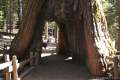 | Mariposa Grove of Giant Sequoias This 1.6-mile hike (or longer) visits the biggest trees in Yosemite. |
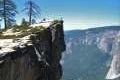 | Taft Point Trail This 2-mile round trip hike visits an overlook on the south wall of Yosemite Valley with fascinating rock fissures carved into the exposed granite. |
 | Panorama Trail This nearly 10-mile long one-way hike travels from Glacier Point down to Yosemite Valley in the most scenic way possible. |
 | More trails in the Sierra Nevada Mountains Explore other destinations in Yosemite National Park and the rest of the range. |
 | Tokopah Falls This 4.2-mile hike reaches the base of the tallest waterfall in Sequoia National Park. |
 | Marble Falls This 8-mile hike takes a flower-lined path up a mountain canyon to a powerful waterfall. |
 | Yosemite National Park Campgrounds There are 13 campgrounds with over 1,600 total sites spread throughout the park to facilitate your visit. |
Common Questions about Chilnualna Falls Trail in Yosemite National Park
- Is the trail open?
- Yes. You should expect to find that Chilnualna Falls Trail is open. There are no recent reports of trail closures. If you discover that the trail is closed, please help your fellow hikers by reporting a closure.
- Do I need a permit for this hike?
- Yes. National Park Entrance Fee.
- How much time does this hike take?
- It takes approximately 4 hours 45 minutes to hike Chilnualna Falls Trail. Individual hiking times vary. Add extra time for breaks and taking in the views.
- How long is this hike?
- The hike to Chilnualna Falls Trail is a 8 mile out and back with 2200 feet of elevation change.
- Are dogs allowed on this trail?
- No, dogs are likely not allowed on Chilnualna Falls Trail. The trail is primarily open to hikers.
- Is Chilnualna Falls Trail a difficult hike?
- This hike should be considered strenuous. Hikers should be prepared for a workout covering 8 miles and 2200 feet of climbing.
- Will I see a waterfall on this hike?
- Yes, Chilnualna Falls Trail features a waterfall.
- Where is the trailhead located?
- The trailhead for Chilnualna Falls Trail is located in Yosemite National Park, CA.
Trailhead Address:
Chilnualna Falls Road
Yosemite National Park, CA 95389
Trailhead Coordinates:
37.54839, -119.63369 - What are the driving directions to the start of the hike?
To get to the trailhead: From Wawona Road (Highway 41), 28 miles south of Yosemite Valley and 4.8 miles north of the south entrance to Yosemite National Park (just north of Wawona Hotel and Golf Course), head east on Chilnualna Falls Road. Drive 1.7, passing Redwoods in Yosemite Lodge, and pull into the large parking area that slopes down to the right. (If you cross a bridge over Chilnualna Creek, you have gone too far and will soon arrive at a trailhead for Wawona Swinging Bridge.)
View custom Google Maps directions from your current location.
- Are there other trails near Chilnualna Falls Trail?
- Yes, you can find other nearby hikes using the Hikespeak Hike Finder Map.

I have hiked all over Chilnualna Falls and whats so cool is our vacation rental homes are very close to the area. I will give a 10% discount to all hikers that stay with us
what is the price for one night? we may do our 5 hour drive on june 30 and start hiking early on july 1.