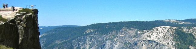
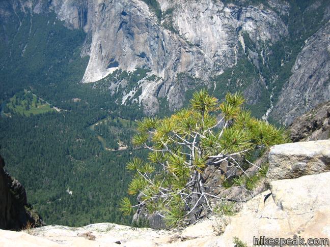
The panoramic view from Taft Point and the rock fissures nearby provide a rewarding 2-mile hike. The dirt single track descends just 250 feet to an outcropping on the south wall of Yosemite Valley that overlooks El Capitan and Yosemite Falls.
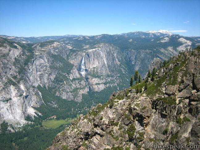
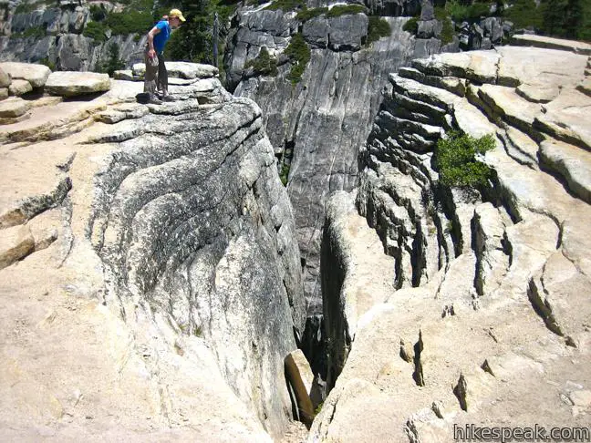
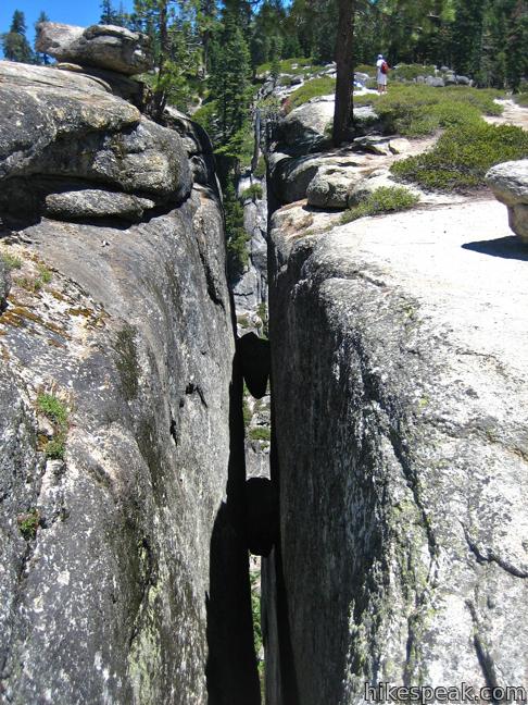
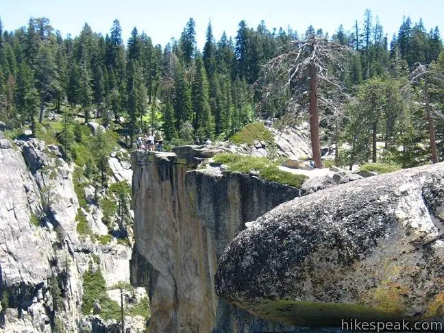
From the trailhead, turn left and begin a peaceful walk through a big pine forest bordering a high elevation meadow. Swing down across exposed granite to the edge of Yosemite Valley. Impressive fissures cut into the cliffs leading out to the point. Without getting too close, look down into these vertical chasms that drop what looks like a thousand feet into a trench coursing down into Yosemite Valley.
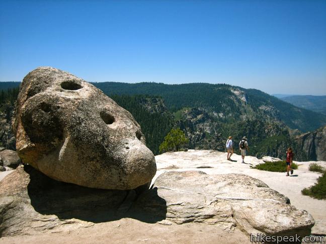
A railing welded into the rock marks the lookout on Taft Point. The point is named after William Howard Taft, the 27th president of the United States who visited the park in 1909. Perhaps the president was looking for views similar to nearby Glacier Point without all the crowds. This is what you will find today.
The road to the trailhead, Glacier Point Road, closes in the winter, so check road conditions if you are planning to hit the trail before Memorial Day. Taft Point Trail is an excellent summertime hike.

Directions to the Trailhead
- From Highway 41, ten miles south of Yosemite Valley and seventeen miles from the south entrance, turn east onto Glacier Point Road.
- Drive thirteen miles to the well-marked trailhead, located two miles from the end of the road at Glacier Point.
- The trailhead is shared by Sentinel Dome Trail, which heads northeast.
- Taft Point Trail heads west to the canyon's edge.
Trailhead Location
Trailhead address: Glacier Point Road, Yosemite National Park, CA 95389
Trailhead coordinates: 37.712354, -119.586448 (37° 42′ 44.47″N 119° 35′ 11.21″W)
View Yosemite National Park in a larger map
Or view a regional map of surrounding Sierra Nevada trails and campgrounds.


 | Panorama Trail This nearly 10-mile long one-way hike travels from Glacier Point down to Yosemite Valley in the most scenic way possible. |
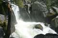
 | Bridalveil Fall Trail This easy paved half-mile trail visits the base of a 620-foot single-drop waterfall on the south side of Yosemite Valley. |
 | Lower Yosemite Fall Trail This 1.2-mile hike delivers visitors to the base of the tallest waterfall in North America. The experience is not to be missed. |
 | Chilnualna Falls Trail This 8-mile round trip hike ascends 2,200 feet past a raucous string of cascades to the top of a waterfall alongside Wawona Dome. |
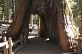 | Mariposa Grove of Giant Sequoias This 1.6-mile hike (or longer) visits the biggest trees in Yosemite. |
 | More trails in the Sierra Nevada Mountains Explore other destinations in Yosemite National Park and the rest of the range. |
 | Otto's Trail in Colorado National Monument This 0.75-mile round trip hike visits an overlook near the Pipe Organs with an excellent view of Independence Monument and Monument Canyon. |
 | Window Rock Trail in Colorado National Monument This 1/3-mile round trip hike ends at a distinct point on the wall of Monument Canyon where a natural window appears just below the top of the cliff. |
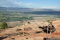
 | Grand View Point in Canyonlands National Park This 2-mile hike travels along the mesa's edge from Grand View Overlook to the southernmost point on the Island in the Sky. |
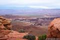
 | White Rim Overlook in Canyonlands National Park This gradual 1.8-mile hike visits the end of a peninsula in the Island in the Sky with 300-degree views of the canyons below. |
 | Yosemite National Park Campgrounds Thirteen campgrounds with over 1,600 total sites are spread throughout the park to facilitate your visit. |
Common Questions about Taft Point in Yosemite National Park
- Is the trail open?
- Yes. You should expect to find that Taft Point Trail is open. There are no recent reports of trail closures. If you discover that the trail is closed, please help your fellow hikers by reporting a closure.
- Do I need a permit for this hike?
- Yes. National Park Entrance Fee.
- How much time does this hike take?
- It takes approximately 1 hour to hike Taft Point Trail. Individual hiking times vary. Add extra time for breaks and taking in the views.
- How long is this hike?
- The hike to Taft Point Trail is a 2 mile out and back with 250 feet of elevation change.
- Are dogs allowed on this trail?
- No, dogs are likely not allowed on Taft Point Trail. The trail is primarily open to hikers.
- Is Taft Point Trail good for kids?
- Yes, this hike is likely suitable for children. It is relatively short (2 miles) with manageable elevation gain.
- Where is the trailhead located?
- The trailhead for Taft Point Trail is located in Yosemite National Park, CA.
Trailhead Address:
Glacier Point Road
Yosemite National Park, CA 95389
Trailhead Coordinates:
37.712354, -119.586448 - What are the driving directions to the start of the hike?
To get to the trailhead: From Highway 41, ten miles south of Yosemite Valley and seventeen miles from the south entrance, turn east onto Glacier Point Road. Drive thirteen miles to the well-marked trailhead, located two miles from the end of the road at Glacier Point. The trailhead is shared by Sentinel Dome Trail, which heads northeast. Taft Point Trail heads west to the canyon's edge.
View custom Google Maps directions from your current location.
- Are there other trails near Taft Point Trail?
- Yes, you can find other nearby hikes using the Hikespeak Hike Finder Map.

7 Comments on Taft Point in Yosemite National Park
What hikers are saying:
✨ Generated summary of user commentsThis trail excitements visitors drawn to its famous vistas and dramatic terrain. Hikers should remain mindful of seasonal conditions, as heavy snow can persist into the spring and obscure the path even after access roads open.
GPS coordinates seem to be wrong. These coordinates direct to a parking lot in the Valley on Wawona Road.
Thanks for catching that! The coordinates have been corrected.
I’d like to take my mother-in-law out to Taft Point but her knee is really bad and can really only walk on flat ground for any kind of distance. What is the elevation change like? Will she have to do any scrambling over rocks or descend/ascend any steep grades at all?
Love all the info. on Taft Point. Im doing a report and this totally helps me!!
Anyone know the current snow level at taft point/Sentinel dome parking?
On Mother’s Day Weekend the parking area was open but the trails were covered in snow. A storm after that re-closed Glacier Point Road, so there should still be plenty of snow on the trails.
My fiancé and I have been throwing places around to make our special day exactly that. Is it possible to have a small (very small) ceremony at Taft point or any of the other spots at Yosemite? Or any of the waterfall fronts are beautiful as well.