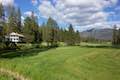
Swinging Bridge in Yosemite Valley seduces photographers with views of Yosemite Falls. This is not a hike to that bridge, which isn’t actually a swinging suspension bridge. This is a hike to Wawona Swinging Bridge, which has plenty of bounce in it’s step, spanning a boulder-framed chute in the South Fork Merced River. Wawona Swinging Bridge is located at the south end of Yosemite National Park, where it doubles as a swimming hole destination when temperatures are running high and the river is running low.
Trails lead to Wawona Swinging Bridge from two Wawona Area roads:
- Follow Swinging Bridge Trail from the end of Chilnualna Falls Road for a 1.4-mile round trip hike to the bridge with 70 feet of elevation change (hike 1)
- Start from Forest Drive and approach the opposite end of Wawona Swinging Bridge for a 0.8-mile round trip hike with 40 feet of elevation change (hike 2)
The wide trail from Forest Drive to Wawona Swinging Bridge is short and easy, but lacks some of the scenery featured along the slightly longer route along the north side of the river. It is also possible to combine these routes and their adjoining roads for a longer 4.8-mile walk through Wawona.
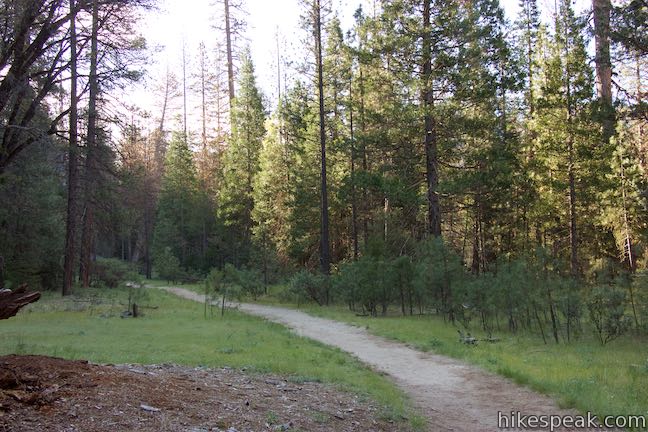
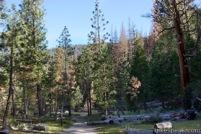
Hike 1: Wawona Swinging Bridge from Chilnualna Falls Road
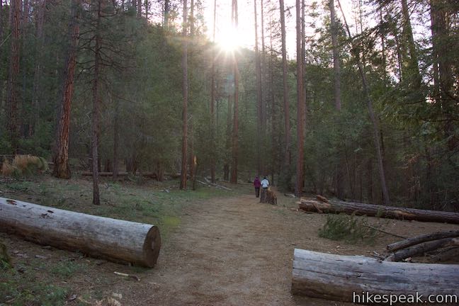
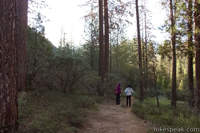
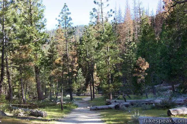
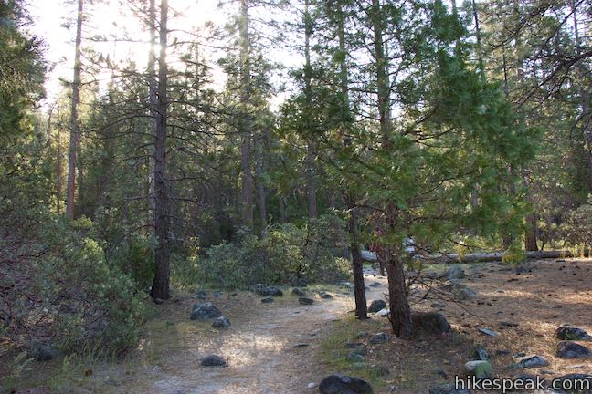
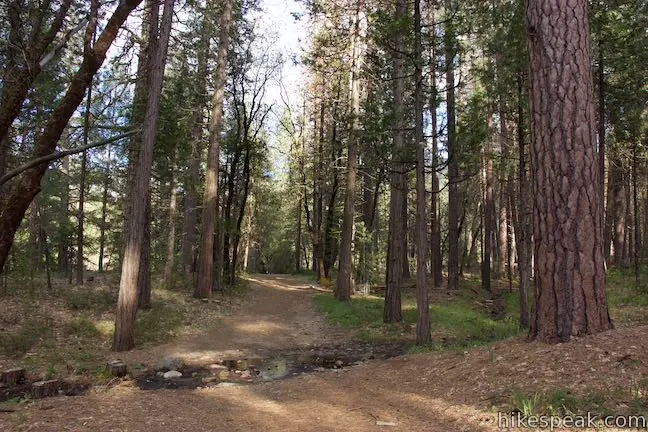
Set out from the very end of Chilnualna Falls Road, 0.4 miles beyond the trailhead parking for the excellent Chilnualna Falls Trail and about half a mile from accommodations at The Redwoods in Yosemite. From a dirt parking area at road’s end, begin down the trail next to a sign that reads “Swinging Bridge – .7 miles.”
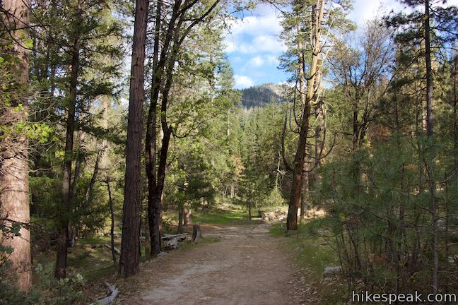
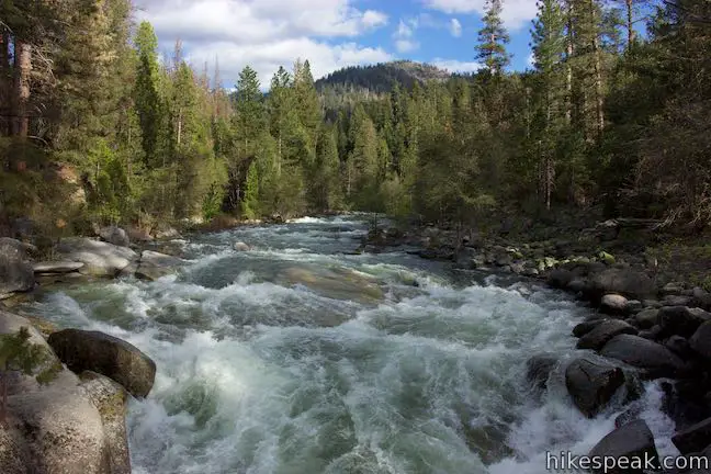
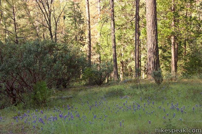
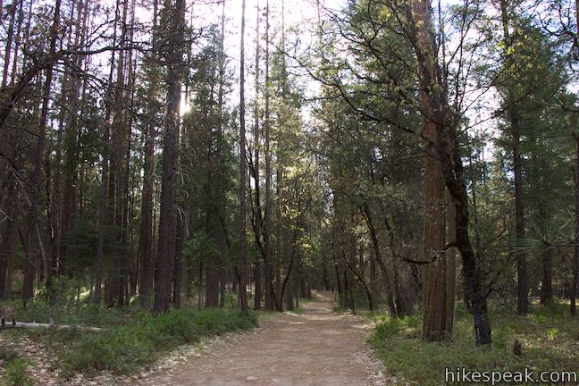
Swinging Bridge Trail is relatively flat, aiming slightly downhill through an airy pine forest. Gaps through the trees allow you to look up at the granite face of Wawona Dome, which rises to the left.
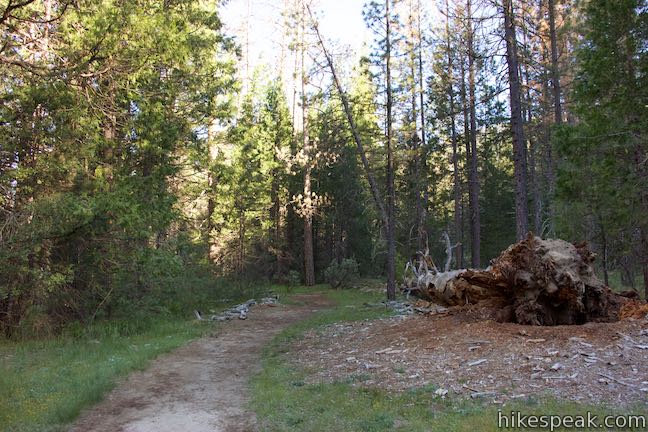
After about 300 yards, you may need to hop across a seasonal creek flowing across the trail. If water is present, that may be a sign that the South Fork Merced River is flowing strong.
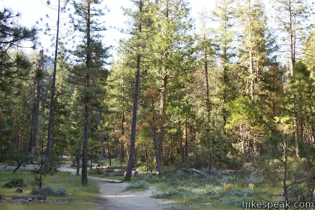
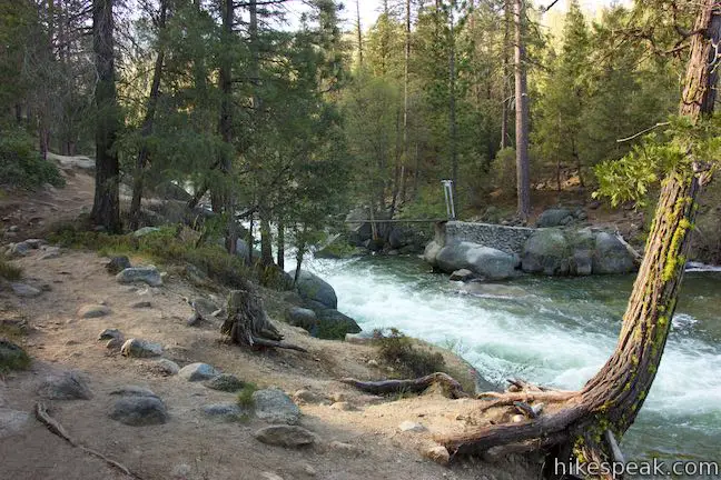
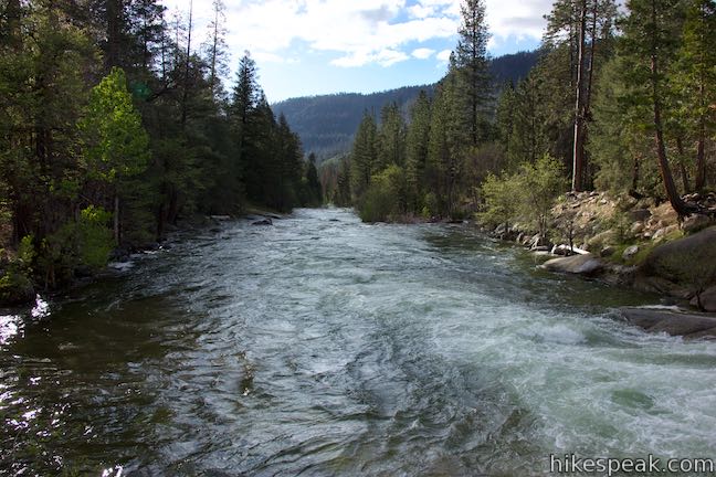
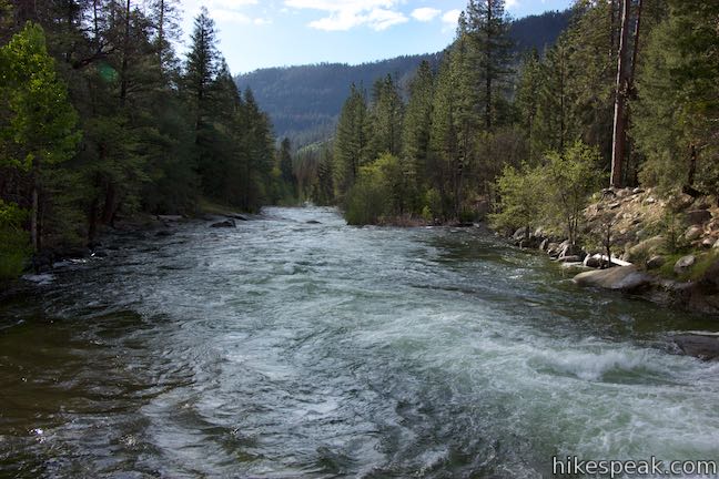
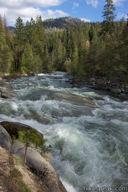
Proceed through the forest and come alongside the river with a tenth of a mile to go. Watch the water course over boulders as you proceed upstream and gain sight of Wawona Swinging Bridge. Boulders form a natural barricade around the north end of the bridge, so you’ll need to make a sweeping curve to the right to make your way down to Wawona Swinging Bridge.
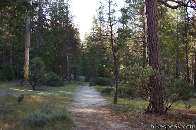
Hike 2: Wawona Swinging Bridge from Forest Drive
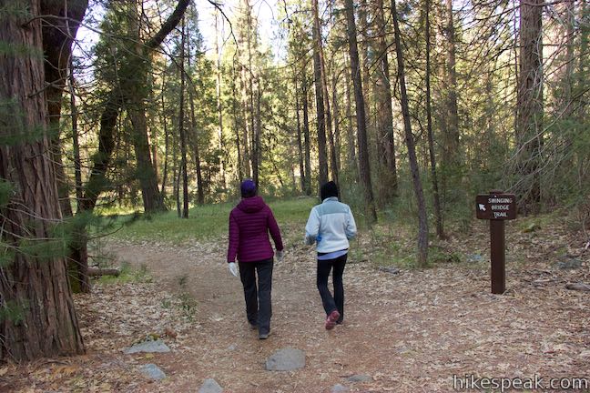
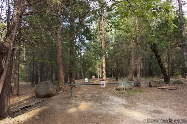
This wide trail to Wawona Swinging Bridge is even shorter and easier than the alternative to the north. Start from the end of Forest Drive, just past Camp Wawona, an Adventist retreat. This trailhead has a vault toilet and ample parking. Find a gate at the start of the trail and begin hiking, passing a “Swinging Bridge Area” sign.
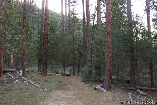
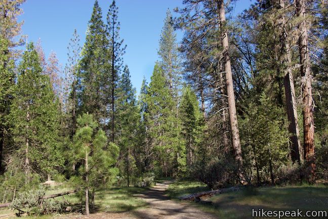
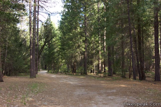
Ease through tall pines on a wide and level trail. Although you may hear the South Fork Merced River to the left, the water is not that visible, and neither is Wawona Dome.
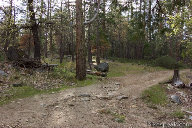
Ramble through the forest for a third of a mile to a point where the trail comes down a slope and arrives at a split. Ignore the double-track trail parting to the right and stay to the left to hug the river. Just beyond this junction, you will approach the riverbank and arrive at Wawona Swinging Bridge.
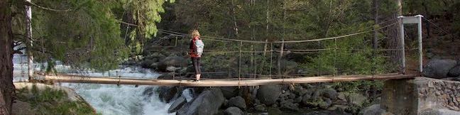
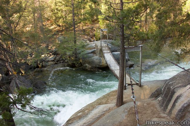
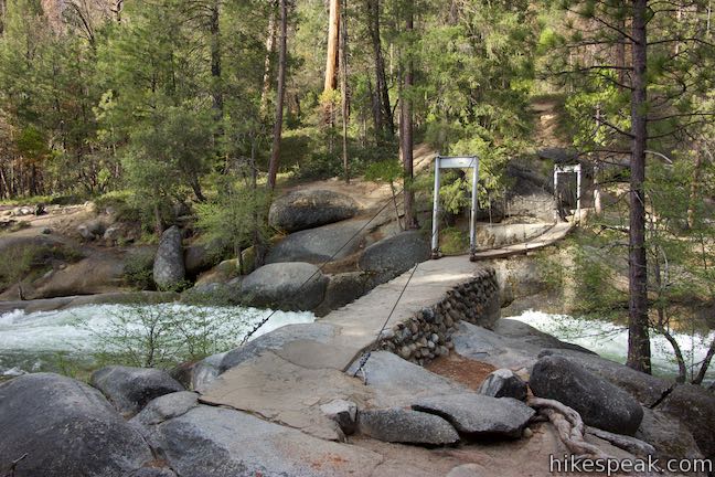
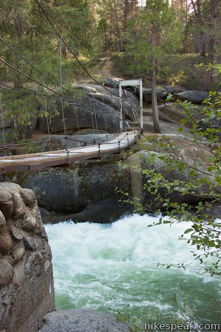
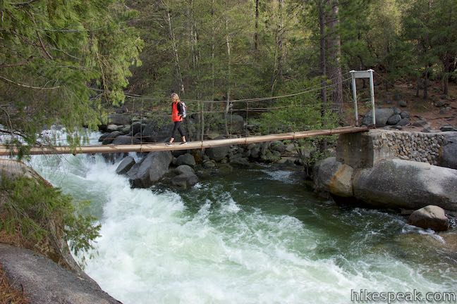
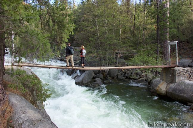
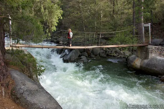
Wawona Swinging Bridge
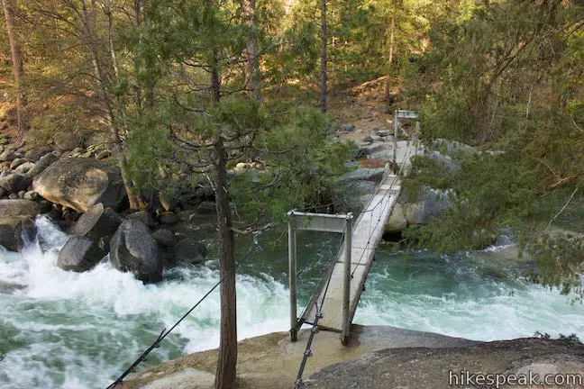
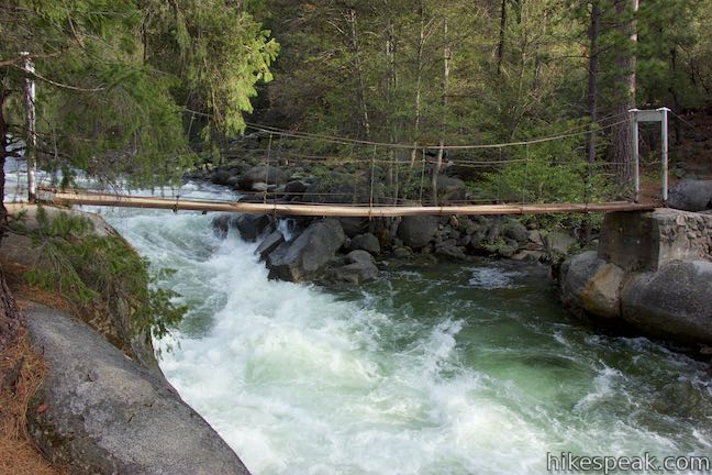
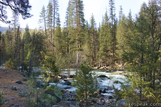
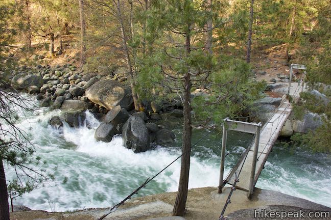
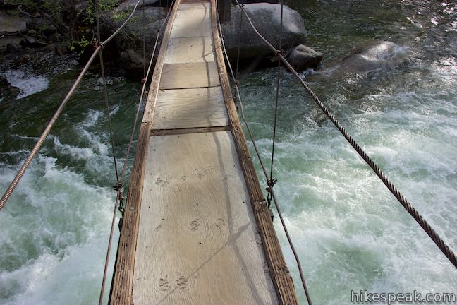
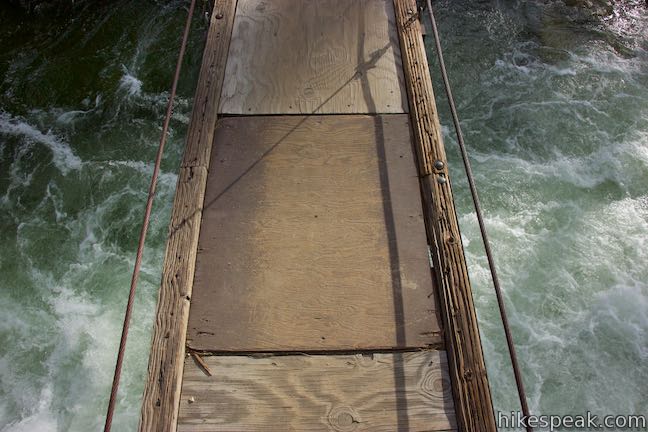
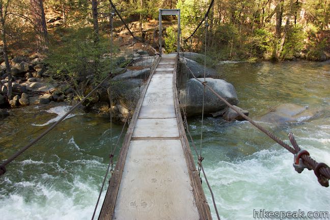
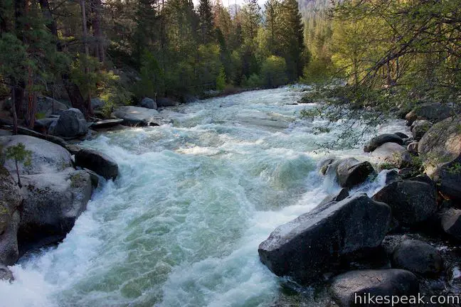
Wawona Swinging Bridge crosses a roughly 40-foot long span over the South Fork Merced River. The bridge has wooded planks to walk across and metal cables to grip as hand rails. As you venture out onto the bridge, you’ll notice that it is sturdy but shifting.
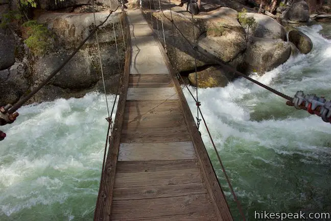
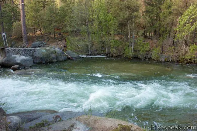
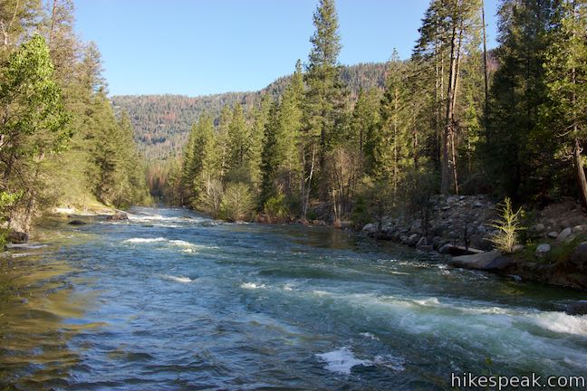
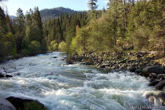
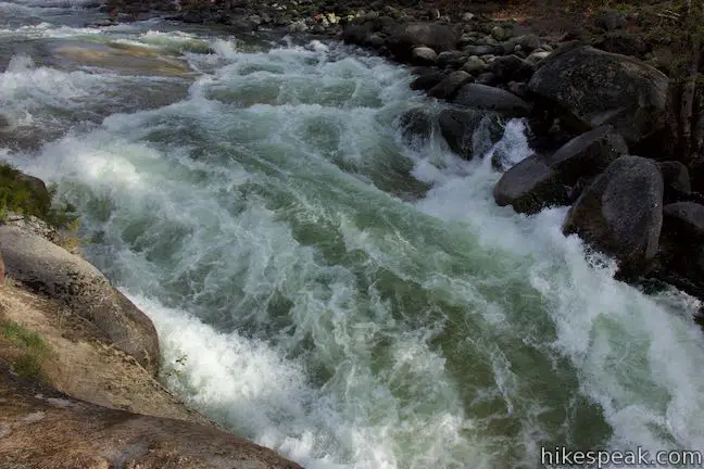
Wawona Swinging Bridge is attached to rock formations on each bank. These boulders pinch the river and make the water run more swift below the bridge. During periods of high snowmelt, the gushing river fills with frothy rapids. At drier times of the year, the river slows to create emerald pools wrapped by the pale boulders around Wawona Swinging Bridge.
Standing in the middle of Wawona Swinging Bridge offers scenic perspectives up and down the South Fork Merced River, with its conifer-lined banks. You can also watch the mesmerizing water run past the bridge below your feet.
Walk across the bridge and then cross back. Unless you’re trying to get to the other trailhead or hiking the loop, return which every way you came. Dogs and bikes are not permitted. Yosemite National Park has an entrance fee, but no permit is needed to hike to Wawona Swinging Bridge. The Forest Drive Trailhead has a vault toilet, but no food storage lockers (bear boxes). The trailhead at the end of Chilnualna Falls Road does not have bathrooms or food storage lockers, but you will find both at the nearby trailhead for Chilnualna Falls Trail.
Wawona Swinging Bridge Swimming Hole
If you see a waning sign about deadly river conditions when you start the hike, it would be incredibly foolish to enter the South Fork Merced River. Certain times of year may be safer to enter the river. The boulder-lined pools near Wawona Swinging Bridge are a know swimming hole destination. Enter the river at your own risk (and definitely not during a raging spring snowmelt). The seasonal warning sign reads:
Danger!!! This rive is deceptive – and unforgiving! Stay at least one body length from the water’s edge. Its current is more powerful than any swimmer. The cold water will tire you quickly. This river is full of traps, some that you cannot see. Successful water rescues are rare in Yosemite National Park.
Directions to the Trailhead
Chilnulana Falls Road Trailhead:
- Take Wawona Road (Highway 41) to the intersection with Chilnualna Falls Road, 28 miles south of Yosemite Valley and 4.8 miles north of the south entrance to Yosemite National Park.
- Head east on Chilnualna Falls Road through cabins for the Redwoods in Yosemite Lodge.
- After 1.7 miles, pass the parking area for Chilnualna Falls Trail on the right.
- Proceed another 0.4 miles up the road, which narrows to a single-track and drops to a bridge across Chilnulana Creek (appreciate views looking up and down the creek).
- On the other side, the road goes up a hill past more cabins.
- As the road flattens out, a tenth of a mile after the Chilnualna Creek Bridge, stay left at a split, following the sign for Swinging Bridge.
- Park in the lot at the end of the road where the trail begins.
Forest Drive Trailhead:
- Take Wawona Road (Highway 41) to the intersection with Forest Drive, which is just north of Wawona Hotel (Big Trees Lodge) about 28.2 miles south of Yosemite Valley and 4.6 miles from the south entrance to Yosemite National Park.
- Head east on Forest Drive for 1.8 miles to the large parking area at road's end.
Trailhead Location
Trailhead address: Chilnulana Falls Road Trailhead, Chilnualna Falls Road, Yosemite National Park, CA 95389
Trailhead coordinates: 37.54637, -119.63015 (37° 32′ 46.9″N 119° 37′ 48.5″W)
Trailhead address: Forest Drive Trailhead, Forest Drive, Yosemite National Park, CA 95389
Trailhead coordinates: 37.54333, -119.6284 (37° 32′ 36″N 119° 37′ 42.2″W)
View Wawona Area Hikes in a larger map
Or view a regional map of surrounding Sierra Nevada trails and campgrounds.
Hiking from Chilnualna Falls Road


Hiking from Forest Drive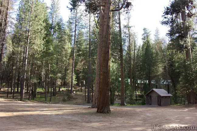

Wawona Swinging Bridge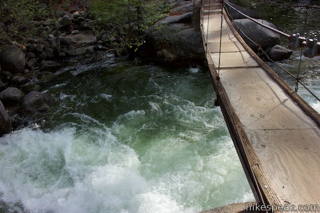


 | Chilnualna Falls Trail This 8-mile round trip hike ascends 2,200 feet past a raucous string of cascades to the top of a waterfall alongside Wawona Dome. |
 | Wawona Meadow Loop Trail This gentle 3.9-mile loop passes through forest encircling a verdant, mostly-natural meadow near Wawona Hotel at the south end of Yosemite National Park. |
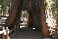 | Mariposa Grove of Giant Sequoias This 1.6-mile hike (or longer) visits the biggest trees in Yosemite. |
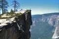 | Taft Point Trail This 2-mile round trip hike visits an overlook on the south wall of Yosemite Valley with fascinating rock fissures carved into the exposed granite. |
 | Panorama Trail This nearly 10-mile long one-way hike travels from Glacier Point down to Yosemite Valley in the most scenic way possible. |
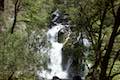 | Lewis Creek Trail to Corlieu Falls This 0.8-mile round trip hike travels down along a rushing creek to a viewing platform in front of an enthusiastic, cascading waterfall. |
 | Shadow of the Giants Trail This 1.1-mile nature trail visits giants sequoias and imparts wisdom about the great trees and their surroundings. |
 | Big Ed Tree Trail This 0.2-mile hike is quite short, but visits a tree that is quite big - part of the Nelder Grove of Giant Sequoias in Sierra National Forest. |
 | Bull Buck Tree Trail This 0.8-mile loop leaves from Nelder Grove Campground and leads to a single giant sequoia with an incredibly broad base. |
 | More trails in the Sierra Nevada Mountains Explore other destinations in Yosemite National Park and the rest of the range. |
 | Yosemite National Park Campgrounds Thirteen campgrounds with over 1,600 total sites are spread throughout the park to facilitate your visit. |
 | Nelder Grove Campground This 7-site campground offers cozy nights in a partially logged grove of giant sequoias in Sierra National Forest. |
- The official National Park Service webpage for Wawona Area Day Hikes (opens in a new tab)
- Wawona Swinging Bridge on yosemitehikes.com (opens in a new tab)
- Wawona Swinging Bridge on alltrails.com (opens in a new tab)
- Wawona Swinging Bridge on hikingproject.com (opens in a new tab)
- Wawona Swinging Bridge Loop on hikingproject.com (opens in a new tab)
- The official website of Yosemite National Park (opens in a new tab)
Common Questions about Wawona Swinging Bridge in Yosemite National Park
- Is the trail open?
- Yes. You should expect to find that Chilnualna Falls Road to Wawona Swinging Bridge is open. There are no recent reports of trail closures. If you discover that the trail is closed, please help your fellow hikers by reporting a closure.
- Do I need a permit for this hike?
- Yes. National Park Entrance Fee.
- How much time does this hike take?
- It takes approximately 15 minutes to hike Chilnualna Falls Road to Wawona Swinging Bridge. Individual hiking times vary. Add extra time for breaks and taking in the views.
- How long is this hike?
- The hike to Chilnualna Falls Road to Wawona Swinging Bridge is a 0.7 mile out and back with 70 feet of elevation change.
- Are dogs allowed on this trail?
- No, dogs are likely not allowed on Chilnualna Falls Road to Wawona Swinging Bridge. The trail is primarily open to hikers.
- Is Chilnualna Falls Road to Wawona Swinging Bridge good for kids?
- Yes, this hike is likely suitable for children. It is relatively short (0.7 miles) with manageable elevation gain.
- Is there swimming on this hike?
- Yes, Chilnualna Falls Road to Wawona Swinging Bridge includes a swimming hole.
- Where is the trailhead located?
- The trailhead for Chilnualna Falls Road to Wawona Swinging Bridge is located in Yosemite National Park, CA.
Trailhead Address:
Chilnualna Falls Road
Yosemite National Park, CA 95389
Trailhead Coordinates:
37.54637, -119.63015 - What are the driving directions to the start of the hike?
To get to the trailhead: Chilnulana Falls Road Trailhead: Take Wawona Road (Highway 41) to the intersection with Chilnualna Falls Road, 28 miles south of Yosemite Valley and 4.8 miles north of the south entrance to Yosemite National Park. Head east on Chilnualna Falls Road through cabins for the Redwoods in Yosemite Lodge. After 1.7 miles, pass the parking area for Chilnualna Falls Trail on the right. Proceed another 0.4 miles up the road, which narrows to a single-track and drops to a bridge across Chilnulana Creek (appreciate views looking up and down the creek). On the other side, the road goes up a hill past more cabins. As the road flattens out, a tenth of a mile after the Chilnualna Creek Bridge, stay left at a split, following the sign for Swinging Bridge. Park in the lot at the end of the road where the trail begins.
Forest Drive Trailhead: Take Wawona Road (Highway 41) to the intersection with Forest Drive, which is just north of Wawona Hotel (Big Trees Lodge) about 28.2 miles south of Yosemite Valley and 4.6 miles from the south entrance to Yosemite National Park. Head east on Forest Drive for 1.8 miles to the large parking area at road's end.
View custom Google Maps directions from your current location.
- Are there other trails near Chilnualna Falls Road to Wawona Swinging Bridge?
- Yes, you can find other nearby hikes using the Hikespeak Hike Finder Map.

Go the extra miles...
Submit a rating of this hike to go with your comment. Contribute to the average trail rating.