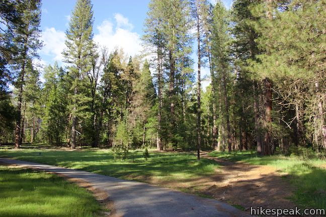
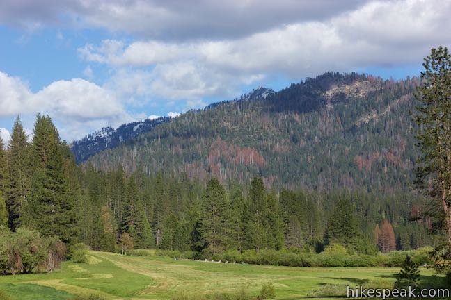
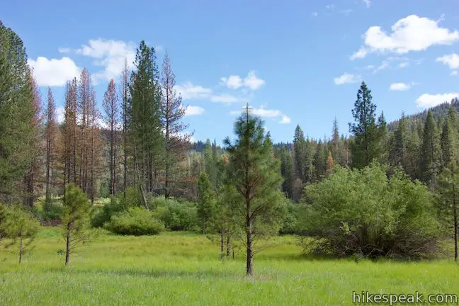
Wawona Meadow Loop Trail weaves through the forest surrounding a large meadow at the south end of Yosemite National Park, offering a relaxing hike that receives less attention than those in Yosemite Valley. Starting from trailheads on two sides of Wawona Hotel (Big Trees Lodge), Meadow Loop Trail follows an old road for 3.3 miles and can be connected by paths across the hotel ground for a 3.9-mile loop with 250 gentle feet of elevation change.
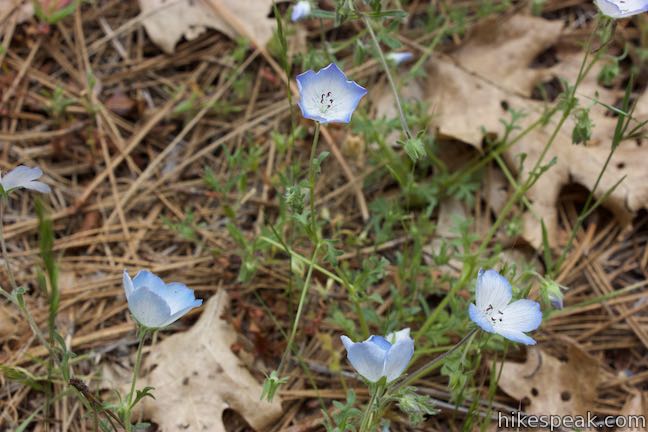
Signs along Wawona Meadow Loop Trail deliver information about Wawona Basin’s ecosystems and history. The mostly-shaded trail is extra enjoyable in early summer months when the verdant meadow pops with blooming wildflowers. While most trails in Yosemite National Park prohibit dogs, bikes, and horses, Wawona Meadow Loop Trail welcomes all three!
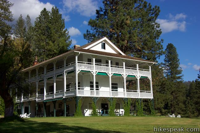
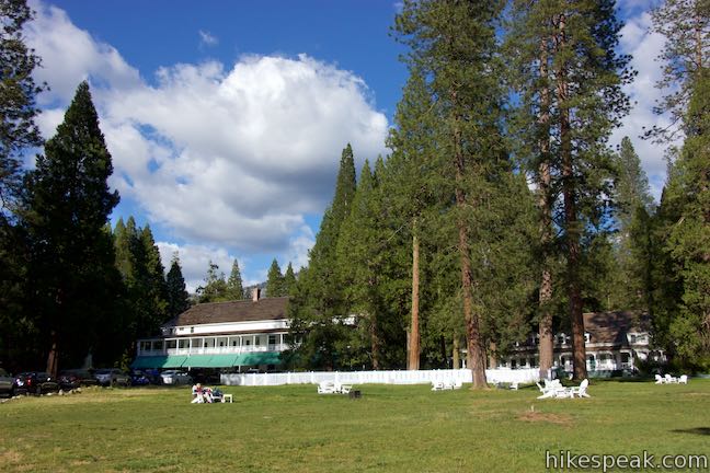
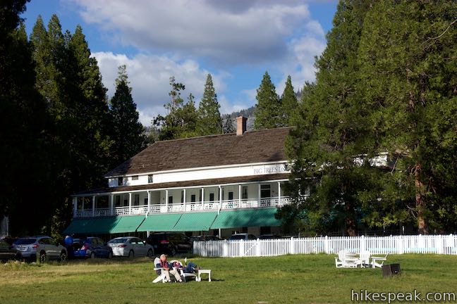
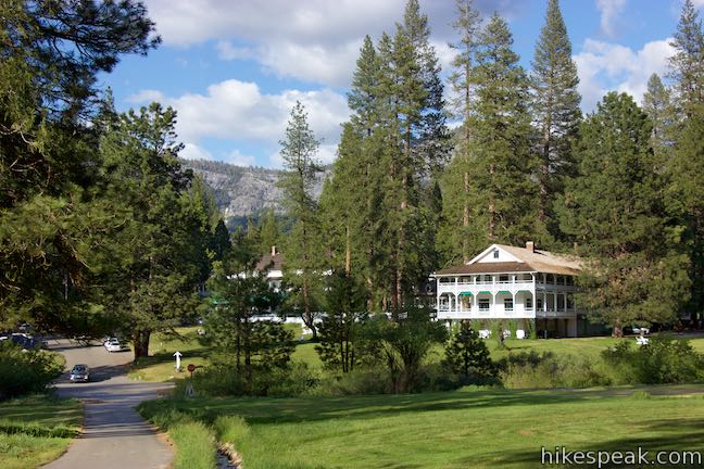
Counterclockwise seems to be the most popular direction on Wawona Meadow Loop Trail, but there’s no disadvantage to hiking in the other direction. Those staying at Wawona Hotel (Big Trees Lodge), can pick up the loop right from the hotel. For everyone else, a parking area along Wawona Road (Highway 41) is an equally convenient starting point.
As follows are directions that begin from the roadside trailhead east of the hotel, immediately cross through the least interesting part of the loop (the hotel grounds), and launch into the trail from the other trailhead just south of the hotel. (Hotel guests can just skip the first couple paragraph of the directions below to start from the hotel.)
The basic directions for Wawona Meadow Loop are:
- Instead of following the wide trail beyond the gate to the left of the kiosk, bear right (west) on a narrower trail (0 miles)
- Take the crosswalk over Wawona Road (0.08 miles)
- Bear right on a paved hotel road (0.2 miles)
- Walk in front of the golf shop for the Wawona Hotel (0.4 miles)
- Take a crosswalk back across Wawona Road (0.48 miles)
- Turn right on a path along the golf course (0.5 miles)
- Turn left onto Chowchilla Mountain Road, which is perpendicular to Wawona Road (0.55 miles)
- Turn left onto Meadow Loop Trail (0.6 miles)
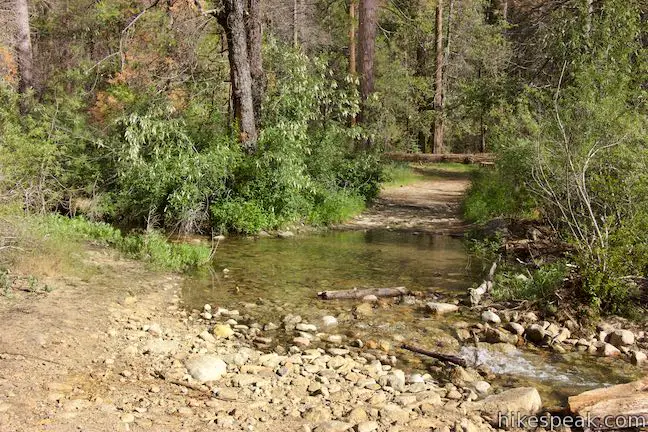
- Cross a creek at the south end of the meadow (2.1 miles)
- Stay to the left past a dirt road near another creek crossing (2.35 miles)
- Cross a third creek, which may be the biggest (2.5 miles)
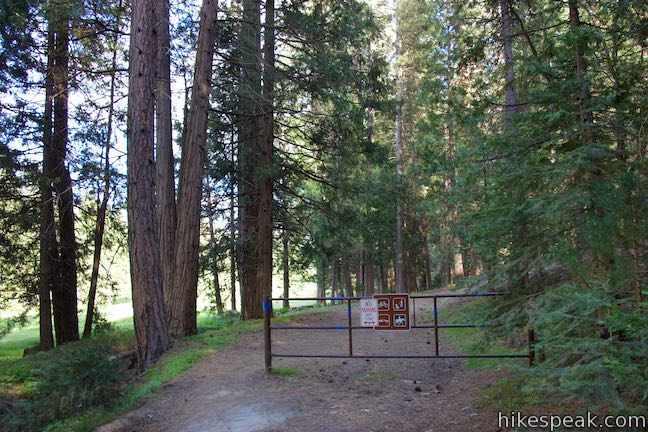
- Go through a gate to return to the trailhead parking area (3.9 miles)
Connecting Wawona Meadow Loop Trail
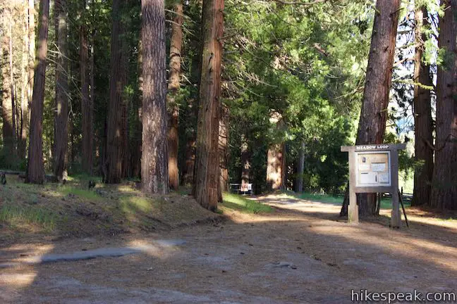
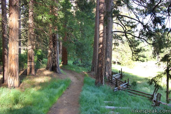
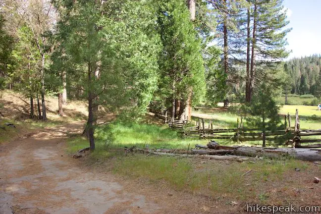
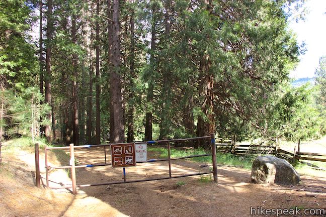
From a partially paved parking area just off the south side of Wawona Road (4.3 miles from the park’s south entrance), find a trail kiosk labeled “Meadow Loop” in front of a gate at the start of Meadow Loop Trail. While you could start off in this direction along the edge of the meadow, why not close out the loop with this scenic stretch instead? To get the hotel-crossing park of the loop out of the way first, take the less obvious trail to the right of the kiosk. Pick up a dirt trail heading west along a split-rail fence that protects the meadow. Visitors are asked to stay out of the meadow and not trample the wildflower-bearing grasses.
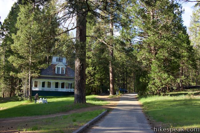
After less than a tenth of a mile, the trail leads to a crosswalk over Wawona Road. Safely make your way to the north side of the busy road and continue up a dirt trail. In another tenth of a mile, the trail joins a paved road into the hotel grounds. Bear right and continue heading northwest. As you walk up this road, another trail will part to the left. You can take this shortcut to trim a bit of distance off the hike. Otherwise, continue along the road and go through a curve to the left past some hotel cabins. Come to a larger building that houses Wawona Hotel’s golf shop and walk along the far side of this building. When you see a path dropping to the left to a crosswalk back over Wawona Road, take it.
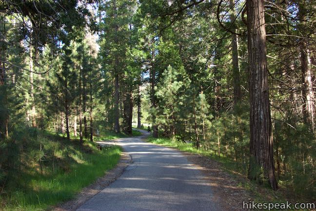
Leave the Wawona Hotel Golf Shop and cross back to the south side of Wawona Road. Pass through a bit of brush and come to the edge of the 9-hole golf course on Wawona Meadow. Don’t worry; most of the hike will be far away from the golf course. Bear right on a path along the golf course that quickly reaches Chowchilla Mountain Road, a paved road that intersects Wawona Road.
Turn left to take Chowchilla Mountain Road for 0.05 miles to the start of Meadow Loop Trail. You are walking on one of the oldest roads in Yosemite National Park, which began as a horse trail and developed into a stage road that connected Wawona with the mining town of Mariposa. The road was said to include bone-jarring drops and climbs on the way to verdant Wawona Basin. A panel along the road explains:
The Chowchilla Mountain Road began in 1856 as a simple toll trail providing access from Mariposa to Yosemite Valley. In 1870, Galen Clark and others expanded this trail to a stage road, enabling wheeled vehicles to reach Clark’s Station (Wawona). This road continues to receive limited use today.
In The Yosemite, John Muir described Galen Clark as the best mountaineer he had ever met and one of his kindest mountain friends.
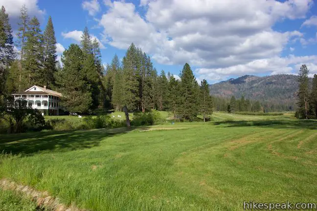
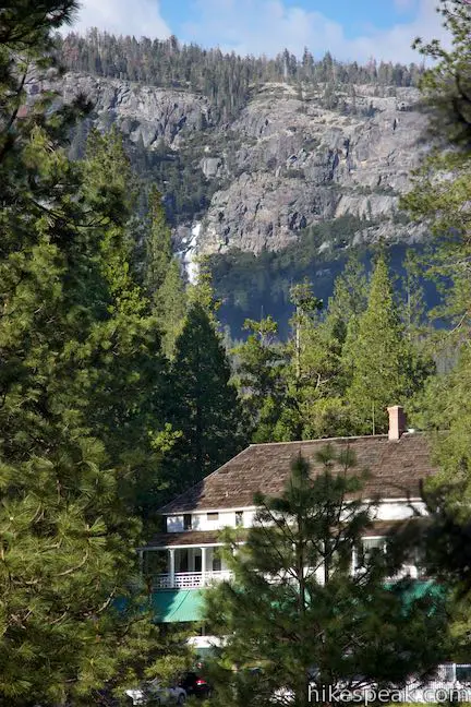
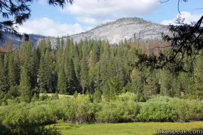
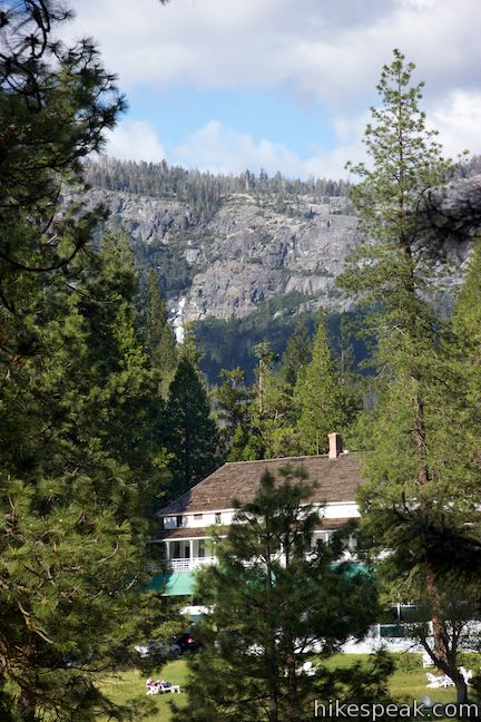
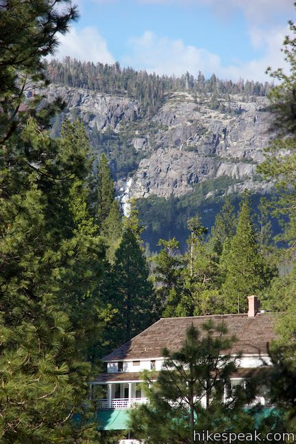
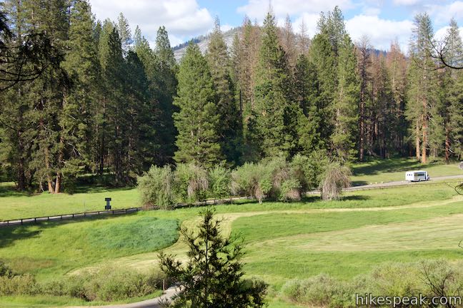
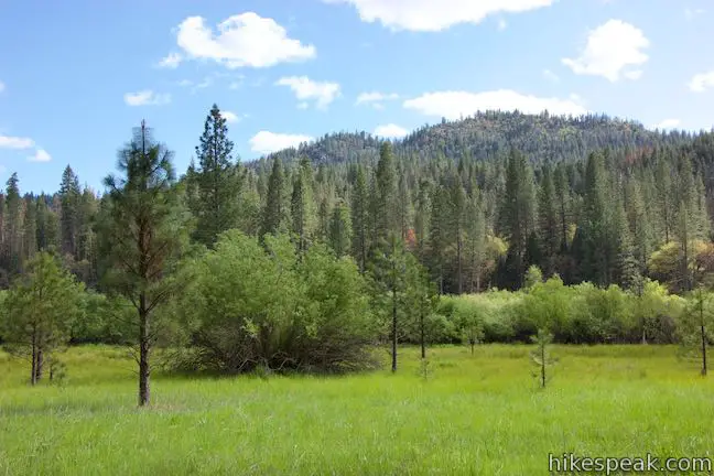
As you walk south on Chowchilla Mountain Road, look back for a grand perspective of Wawona Hotel. In the distance, the tumbling waters of Chilnualna Falls can also be seen. To the east is a long clear view up Wawona Meadow toward Mount Savage.
Hiking Wawona Meadow Loop Trail
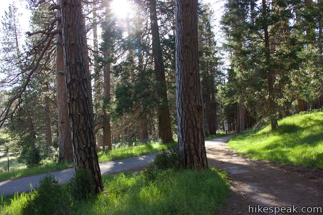
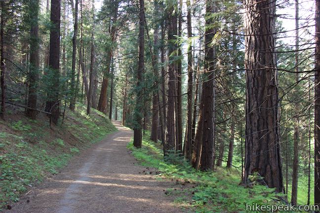
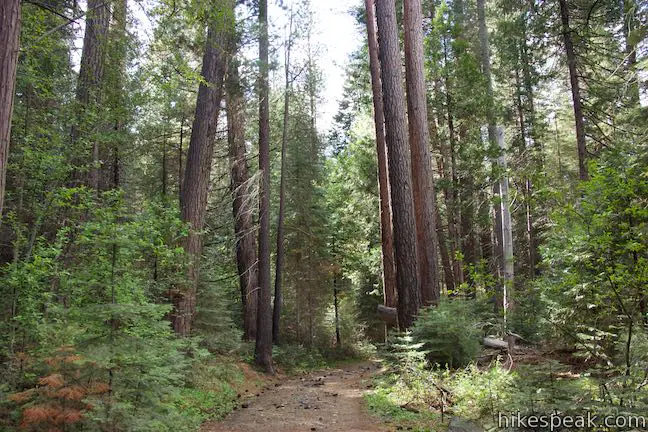
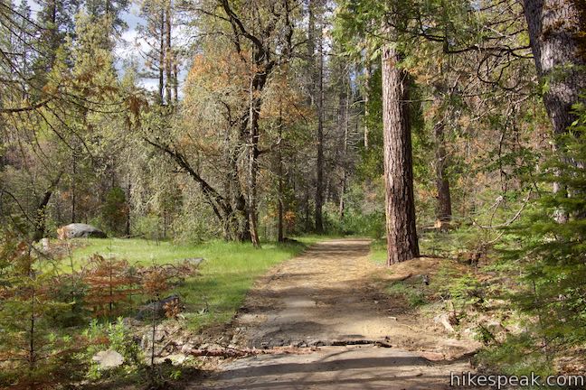
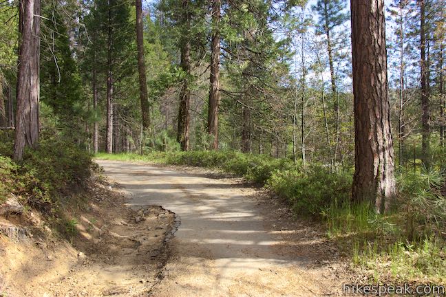
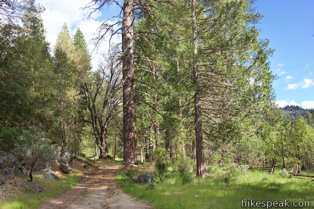
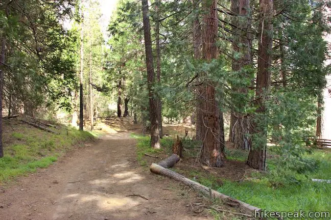
After putting in a 0.6-mile preamble, come to the kiosk and gate at the start of Meadow Loop Trail. Turn left to begin on the trail. Meadow Loop Trail is build on an old paved road, but much of the pavement is eroded and covered in dirt and tree debris. The kiosk has a trail map and passages that include this description of the trail:
Today’s trail follows the historic Meadow Loop Road, originally built in 1891. In addition to serving as a sightseeing road for visitors, it allowed for easy access to the orchard, pasture, and farmland that once comprised a large section of this meadow to the south. Enjoy your travels down Wawona’s memory lane.
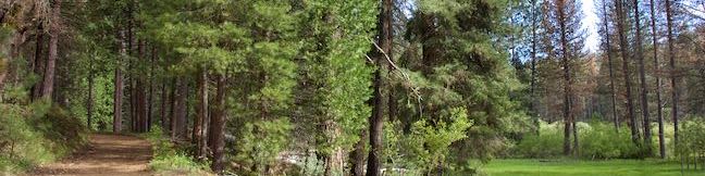
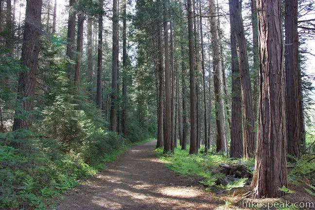
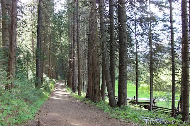
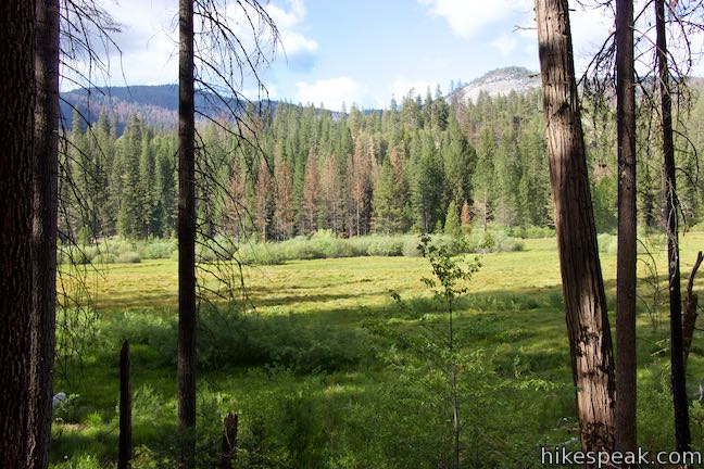
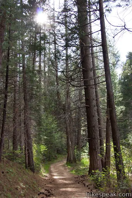
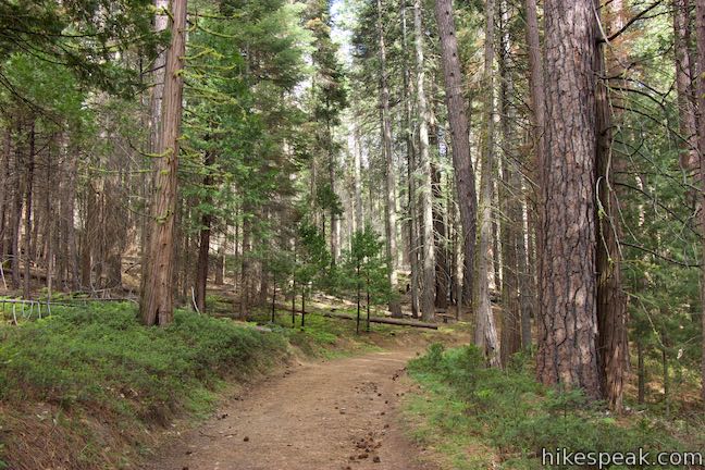
Follow the wide trail through a forest of tall ponderosa pines, accompanied by incense cedars and white firs. To your left, you’ll find views through the trees at the edge of the meadow looking across the golf course toward the Victorian hotel.
After 1/3 of a mile, come to the first of five informative panels along the trail. This one describes the plants that grow in Wawona Meadow, highlighting how they are adapted to conditions in the Sierra Nevada where wetlands are flooded in the spring by snowmelt but dry out later in the year.
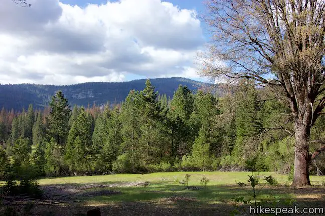
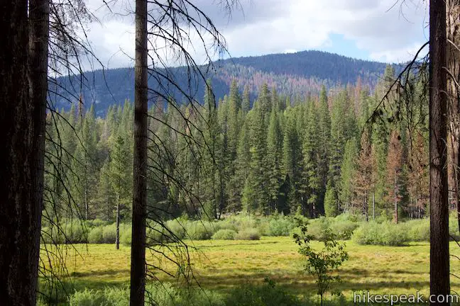
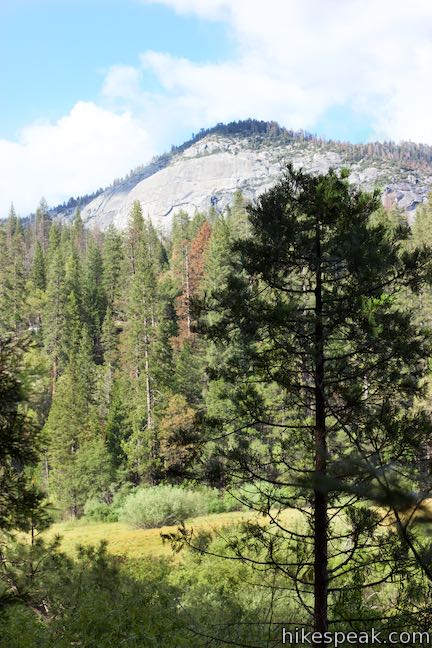
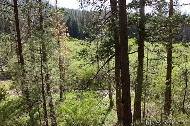
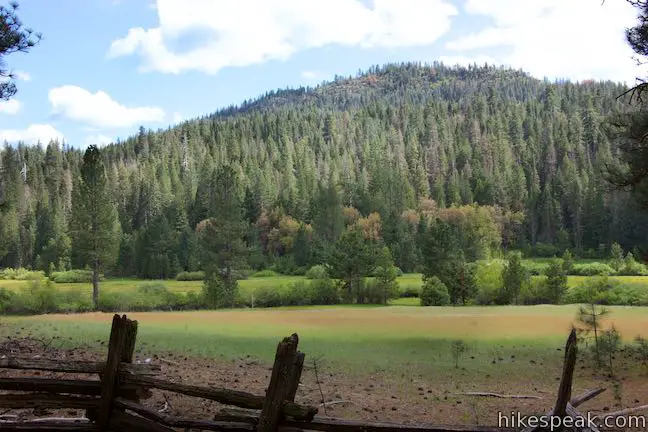
Continue heading southeast along the trail through the forest bordering Wawona Meadow. Enjoy periodic peeks across the meadow’s green grasses toward Wawona Dome, a mass of granite rising to the north.
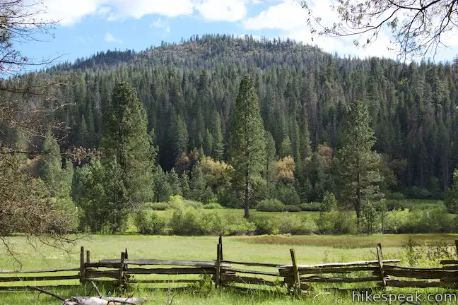
Old sections of split-rail fence border the meadow, and you’ll also pass an old cattle chute. These are hints at the “long and varied history” of Wawona Meadow, as outlined by the next panel along the loop:
In 1851, the Mariposa Battalion passed by here on their way into Yosemite Valley. Wawona, and the historic Wawona Hotel, quickly became a stopping place for visitors on their way to and from Yosemite Valley to the Mariposa Grove of Giant Sequoias. From the mid-1850s until the early 1930s, the purveyors of the Wawona Hotel used Wawona Meadow as a place to grow fruits and vegetables and graze horses, mules, cows, and pigs. For a short time there was a landing strip in this meadow to allow for air service into Wawona! In 1918, the Wawona Golf Course was constructed in the north end of the meadow. As recently as the 1970s, this meadow was used as a pasture for horses from the Wawona Stables.
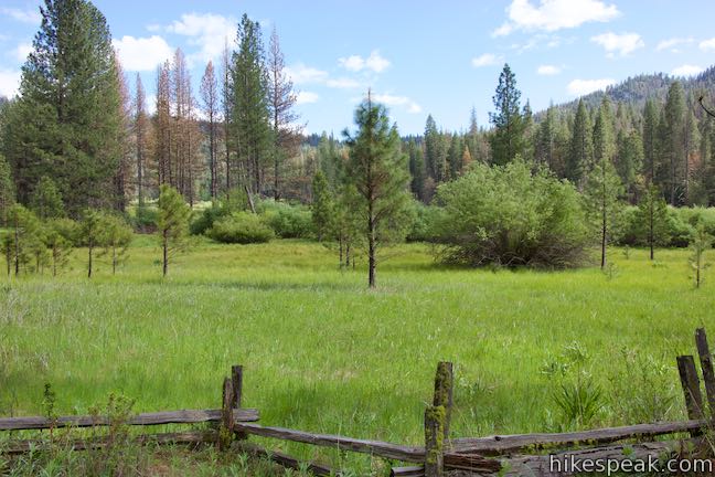
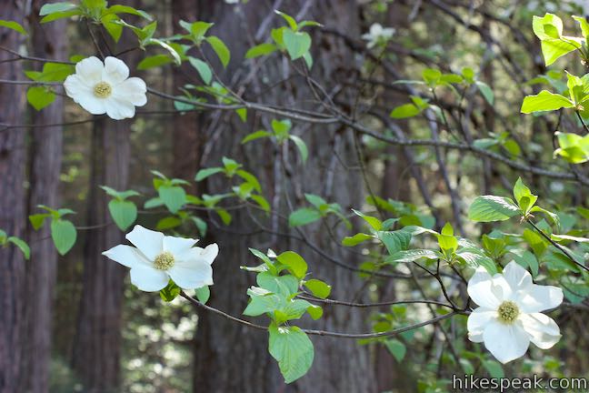
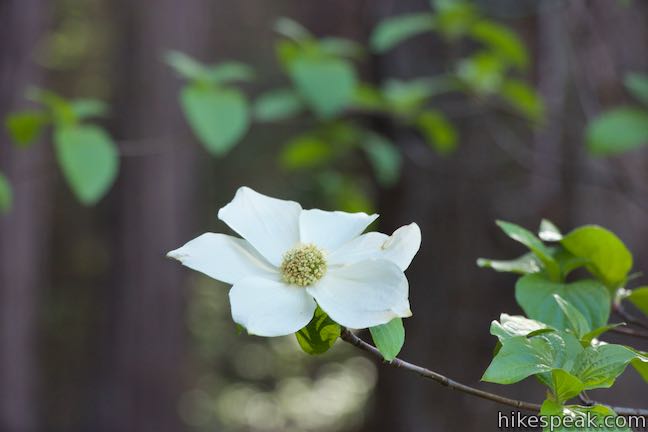
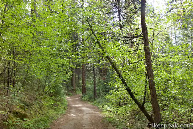
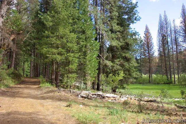
The Wawona Area did not become part of Yosemite National Park until 1932, so the meadow isn’t as natural as other areas of the park, but still has plenty of beauty. Enjoy a nice view from the meadow’s edge by the second nature trail panel, before dipping back into the forest. The next third of a mile offers lovely looks across the meadow through thin rows of trees. Black oaks and dogwoods join the conifers to enhance the forest.
Reach a third information panel describing restoration efforts undertaken by the National Park Service starting in 2010. Meadows in this region typically flood with snowmelt in the spring and slowly distribute that water into rivers. Ditches dug in Wawona Meadow in 1936 altered that behavior, diverting water to orchards and other agricultural and livestock uses for the area’s inhabitants. Changing the water patterns changed what plants prospered in the meadow, allowing non-native plants to take root. The ditches deepened and the erosion increased – until the park service took action and filled the ditches and replanted native flora.
Wawona Meadow Loop Trail rounds the south end of the meadow and crosses the first of three creeks that drain into the meadow, 1.5 miles from the trailhead on Chowchilla Mountain Road (and 2.1 miles from the start of the hike). Hike a quarter mile across the south end of the meadow to a junction by a second creek crossing. Stay to the left on Meadow Loop Trail past a wide dirt road parting to the right. Just ahead, the trail passes the third creek crossing, which appears to be the most active and can require some log and rock hopping during wet months.
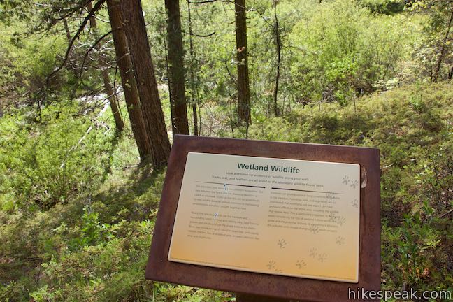
Having rounded the southeast end of the meadow, the trail now ventures northwest along the other side of the basin. Rise into a forest that offers broader views over the meadow. Pass a panel describing the animals that live in and around Wawona Meadow. The panel explains why the area surrounding the trail is a hot spot for animal viewing:
The transitional zone between two different ecosystems – like here between the forest and the Wawona Meadow is called an ecotone. Ecotones like this can be great places to view wildlife because animals common to overlapping environments are often brought together here.
Animals that live around Wawona Meadow include black bears, deer, coyotes, weasels, martens, foxes, bobcats, mice, chipmunks, and dozens of species of birds.
As you continue into the final 1.5 miles of the hike, you may pick up some vehicle noise from Wawona Road. The trail descends off a conifer-covered hill to return to the side of the meadow, where it slips past black oaks and willows. Look out over Wawona Meadow, which hosts verdant sledges and corn lilies in spring and summer months. Early summer brings blooming wildflowers to the area as well, like lupines, larkspur, and monkeyflower.
Come to the last info panel along the loop, which is titled, “A Good Place to Stop.” Don’t put your feet up yet, since the trail continues for another 0.55 miles. The panel explains that Native Americans lived in the Wawona Area for at least 5,000 years, and in the region at large for over 10,000 years:
American Indians were living along the South Fork of the Merced River, a few miles downstream from Wawona when pioneers arrived in 1851. Originally called Pallahchun (an American Indian word for “a good place to stop”), Wawona was later know as Clark’s Station, named for Galen Clark, pioneer and founder of the Wawona Hotel, who was appointing the first “Guardian” of the Yosemite Grant by the state of California.
Continue walking along the gently rolling trail, enjoying some of the best views across Wawona Meadow as you close out the hike. Cross through the gate to return to the kiosk by the parking area where the loop began.
Wawona Meadow Loop comes to a total of 3.9 miles with 250 feet of elevation change. Dogs, bikes, and horses are all allowed on Wawona Meadow Loop Trail. A fee is changed to enter Yosemite National Park, but no permit is required to hike around Wawona Meadow, so get out and enjoy!
Directions to the Trailhead
- From Yosemite Valley, take Wawona Road (Highway 41) south for 28.5 miles.
- About 0.4 miles past the Wawona Hotel, pull into the trailhead parking area on the right for Wawona Meadow Loop Trail.
- Coming from the south, cross through the entrance station by Mariposa Grove and drive 4.3 miles to the trailhead, which is on the left (before Wawona Hotel).
Trailhead Location
Trailhead address: Wawona Road (Highway 41), Yosemite National Park, CA 95389
Trailhead coordinates: 37.53441, -119.6499 (37° 32′ 03.9″N 119° 38′ 59.6″W)
View Wawona Area Hikes in a larger map
Or view a regional map of surrounding Sierra Nevada trails and campgrounds.


 | Wawona Swinging Bridge This 0.8 or 1.4-mile hike leads to a suspension bridge spanning a charming stretch of the South Fork Merced River in the Wawona Area of Yosemite National Park. |
 | Chilnualna Falls Trail This 8-mile round trip hike ascends 2,200 feet past a raucous string of cascades to the top of a waterfall alongside Wawona Dome. |
 | Mariposa Grove of Giant Sequoias This 1.6-mile hike (or longer) visits the biggest trees in Yosemite. |
 | Taft Point Trail This 2-mile round trip hike visits an overlook on the south wall of Yosemite Valley with fascinating rock fissures carved into the exposed granite. |
 | Panorama Trail This nearly 10-mile long one-way hike travels from Glacier Point down to Yosemite Valley in the most scenic way possible. |
 | Lewis Creek Trail to Corlieu Falls This 0.8-mile round trip hike travels down along a rushing creek to a viewing platform in front of an enthusiastic, cascading waterfall. |
 | Shadow of the Giants Trail This 1.1-mile nature trail visits giants sequoias and imparts wisdom about the great trees and their surroundings. |
 | Big Ed Tree Trail This 0.2-mile hike is quite short, but visits a tree that is quite big - part of the Nelder Grove of Giant Sequoias in Sierra National Forest. |
 | Bull Buck Tree Trail This 0.8-mile loop leaves from Nelder Grove Campground and leads to a single giant sequoia with an incredibly broad base. |
 | More trails in the Sierra Nevada Mountains Explore other destinations in Yosemite National Park and the rest of the range. |
 | Yosemite National Park Campgrounds Thirteen campgrounds with over 1,600 total sites are spread throughout the park to facilitate your visit. |
 | Nelder Grove Campground This 7-site campground offers cozy nights in a partially logged grove of giant sequoias in Sierra National Forest. |
- The official National Park Service webpage for Wawona Area Day Hikes (opens in a new tab)
- Wawona Meadow Loop Trail in 50 Best Short Hikes: Yosemite National Park and Vicinity by Elizabeth Wenk (opens in a new tab)
- Wawona Meadow Loop Trail on discoverthewest.blogspot.com (opens in a new tab)
- Wawona Meadow Loop Trail on yosemitehikes.com (opens in a new tab)
- Wawona Meadow Loop Trail on alltrails.com (opens in a new tab)
- Wawona Meadow Loop Trail on hikingproject.com (opens in a new tab)
- Wawona Meadow Loop Trail on goexplorenature.com (opens in a new tab)
- The official website of Yosemite National Park (opens in a new tab)
Common Questions about Wawona Meadow Loop Trail in Yosemite National Park
- Is the trail open?
- Yes. You should expect to find that Wawona Meadow Loop Trail is open. There are no recent reports of trail closures. If you discover that the trail is closed, please help your fellow hikers by reporting a closure.
- Do I need a permit for this hike?
- Yes. National Park Entrance Fee.
- How much time does this hike take?
- It takes approximately 1 hour 45 minutes to hike Wawona Meadow Loop Trail. Individual hiking times vary. Add extra time for breaks and taking in the views.
- How long is this hike?
- The hike to Wawona Meadow Loop Trail is a 3.9 mile loop with 250 feet of elevation change.
- Are dogs allowed on this trail?
- Yes, dogs are allowed on Wawona Meadow Loop Trail. The trail is open to hikers, dogs, bikes.
- Where is the trailhead located?
- The trailhead for Wawona Meadow Loop Trail is located in Yosemite National Park, CA.
Trailhead Address:
Wawona Road
Yosemite National Park, CA 95389
Trailhead Coordinates:
37.53441, -119.6499 - What are the driving directions to the start of the hike?
To get to the trailhead: From Yosemite Valley, take Wawona Road (Highway 41) south for 28.5 miles. About 0.4 miles past the Wawona Hotel, pull into the trailhead parking area on the right for Wawona Meadow Loop Trail. Coming from the south, cross through the entrance station by Mariposa Grove and drive 4.3 miles to the trailhead, which is on the left (before Wawona Hotel).
View custom Google Maps directions from your current location.
- Are there other trails near Wawona Meadow Loop Trail?
- Yes, you can find other nearby hikes using the Hikespeak Hike Finder Map.

Go the extra miles...
Submit a rating of this hike to go with your comment. Contribute to the average trail rating.