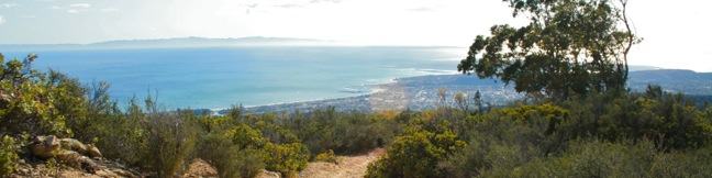
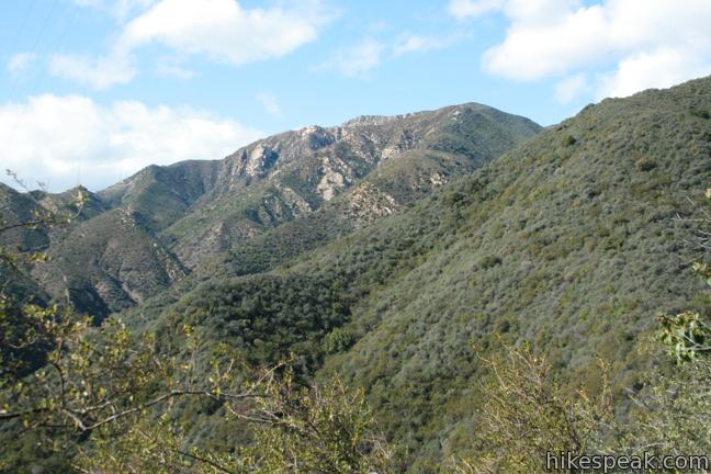
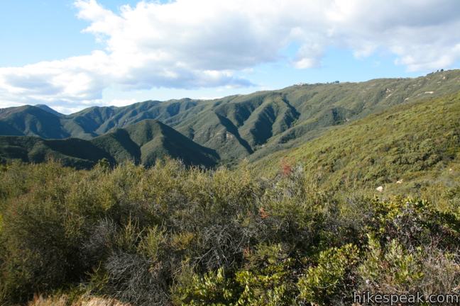
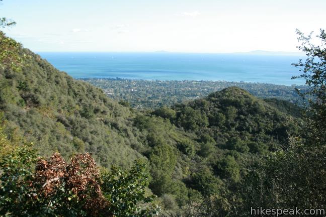
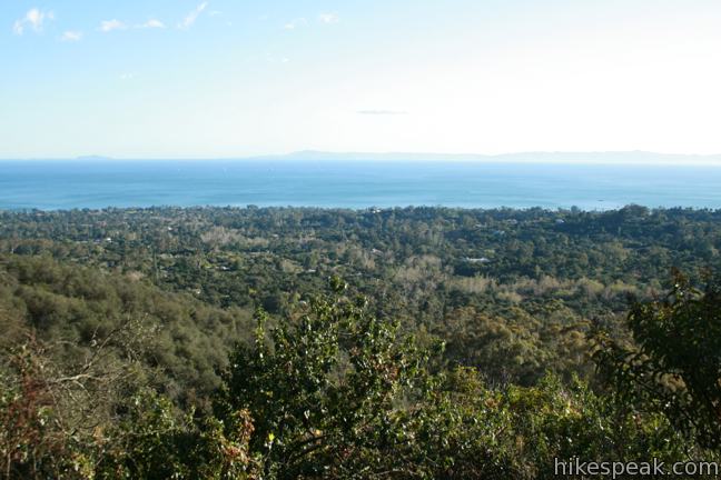
The Santa Ynez Mountains form a verdant backdrop behind Santa Barbara. One of the highest summits in the range is Montecito Peak, which offers sensational views over the coastal cities below and the Pacific Ocean beyond. The 3,214-foot peak can be reached via a demanding 7.1-mile round trip hike with 2,450 feet of elevation change. It is quite a trek, but the ever-expanding ocean views will keep you motivated along the way.
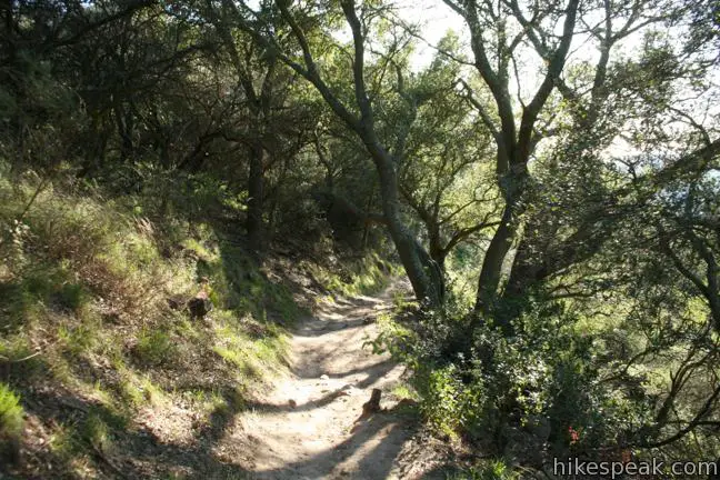
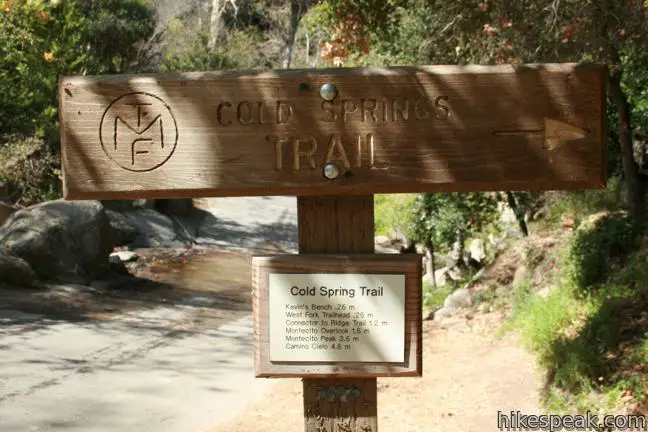
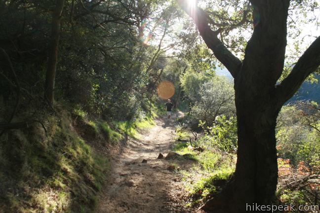
The hike begins at the bottom of Cold Springs Trail in a cozy canyon in a corner of Montecito, California. The heavily shaded trail enters Los Padres National Forest and follows the right bank of Cold Springs Creek.
After a quarter-mile, the trail passes a bench and a junction with West Fork Trail, which breaks off to the left across the creek toward destinations like Tangerine Falls. For Montecito Peak, continue straight up the trail, tackling a string of switchbacks up an oak-shaded slope.
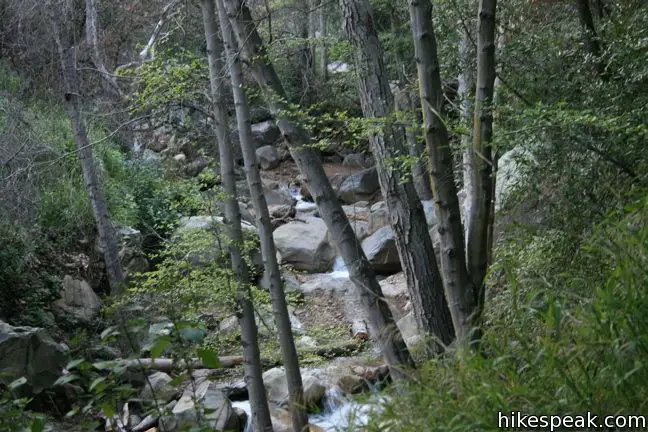
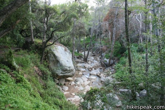
At 0.6 miles from the start, Cold Springs Trail has its first creek crossing. On the opposite bank, the trail turns sharply to the left past low-lying vinca before swinging back around to the right. After another 0.2 miles, the trail crosses the creek again (farther upstream), coming to a junction on the other side. Stay to the right to continue up Cold Springs Trail, angling east and then south, wrapping higher up the canyon wall past a couple seasonal (usually dry) streams.
The trail comes to another unmarked junction, 1.2 miles (and 700 vertical feet) from the start. Turn left here to hike up to Montecito Peak. The trail straight ahead continues along the side of the canyon and makes a quick descent to the trailhead. This is the second section of Cold Springs Loop, 0.3 miles shorter than the distance you’ve hiked so far. Take this route on the hike down to add a partial loop to the trek, cutting the total round trip distance to Montecito Peak from 7.4 miles down to 7.1 miles.
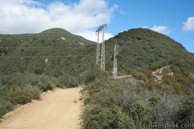
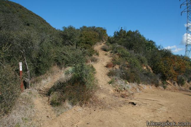
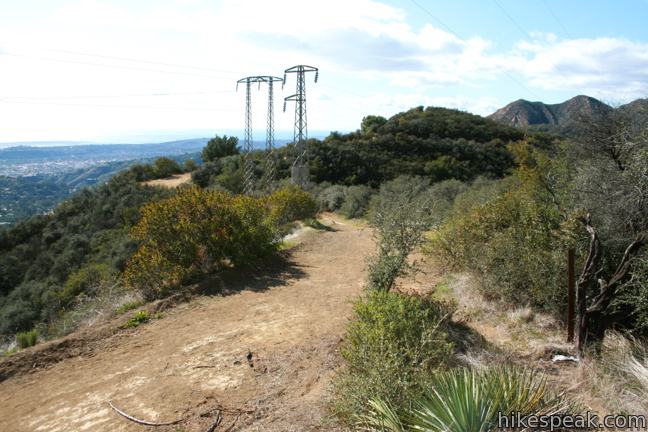
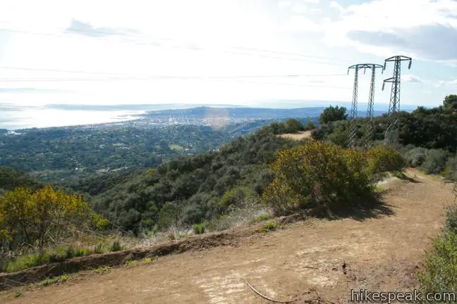
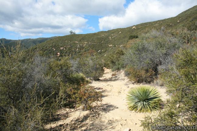
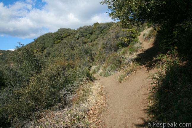
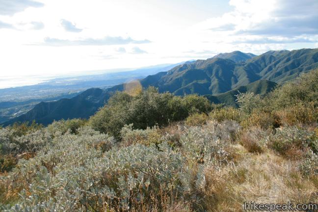
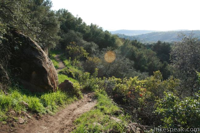
The trail above Cold Springs Loop travels uphill beneath the hike’s last shady canopy, reaching a dirt service road after another 0.35 miles. This spot offers a surprising view down the coast to the southeast. Turn left, crossing beneath a string of power lines. You will be on this wide dirt road for less than a tenth of a mile before turning left again up a dirt single track. From here, there are no more junctions to worry about until the turnoff just below the summit. There is also minimal shade from this point on as chaparral becomes the dominant vegetation.
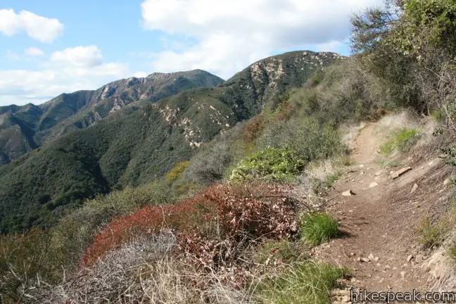
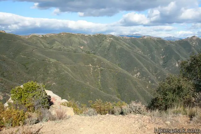
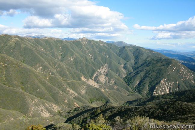
The trail angles up a ridge south of Montecito Peak, rounding up the east side of a knoll to come to a saddle on the ridge, two miles from the start of the hike. The trail switches to the west side of the ridge and continues to climb.
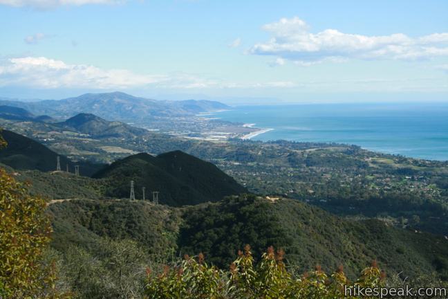
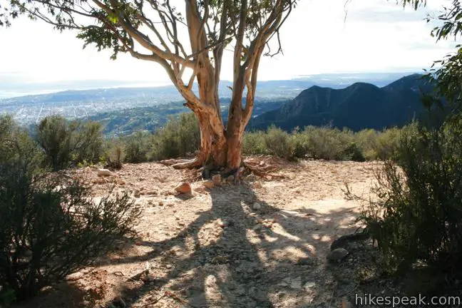
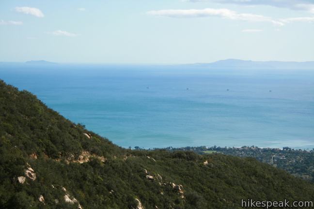
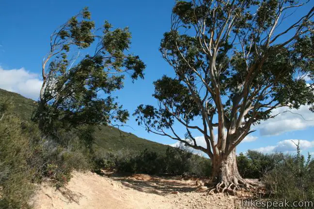
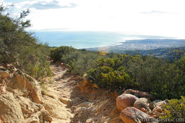
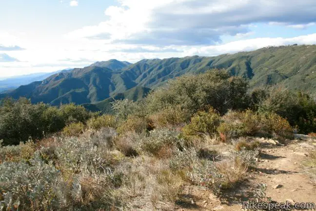
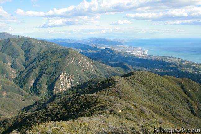
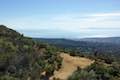
After almost another mile (spent looking down over Santa Barbara), the trail crosses an overlook marked by a pair of eucalyptus trees. Take a quick break in the elusive shade, cool off in the mountain breezes, and enjoy the ocean views. Many hikers turn around right here, 700 feet below the summit for a 5.3 of 5.6-mile hike with 1,725 feet of elevation gain.
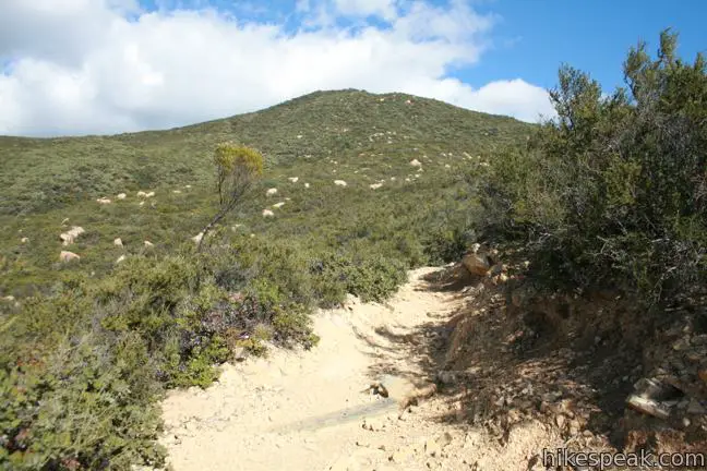
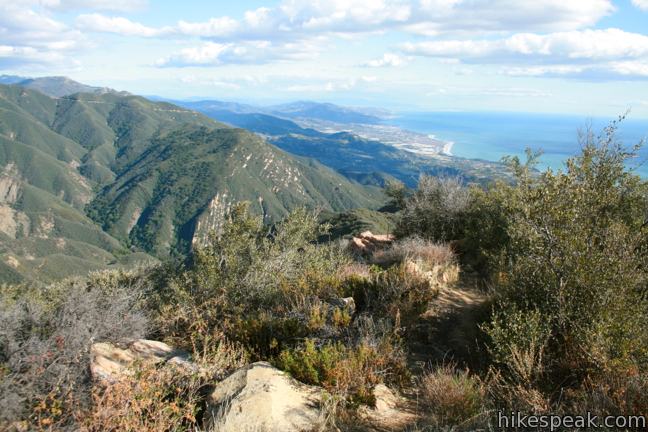
If you aren’t intimidated, continue another 0.9 to the top of Montecito Peak, a pyramid-shaped point northeast of the eucalyptus trees. Don’t be alarmed when the trail splits into two paths, as they quickly reunite. Two-thirds of a mile past the eucalyptus trees, the trail passes just below the west side of Montecito Peak. Look for a path breaking off to the right and take it. Hike up to a saddle at the north end of the summit and turn to face the short but steep march to the top. You will gain about 200 feet over the last 0.15 miles to reach the summit of Montecito Peak.
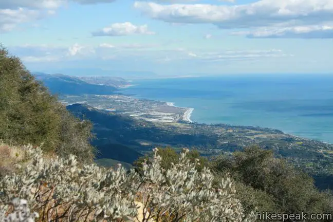
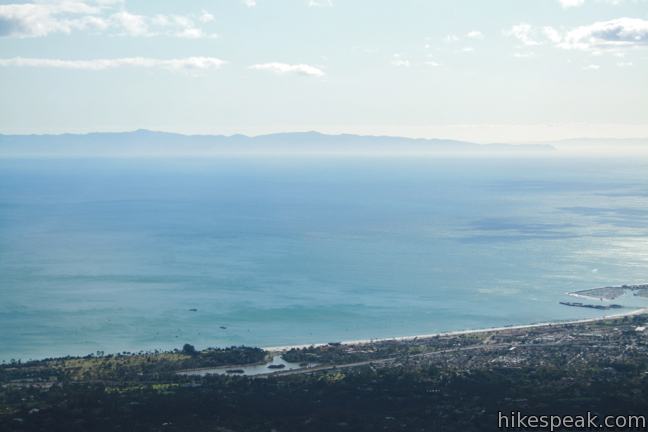
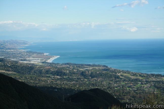
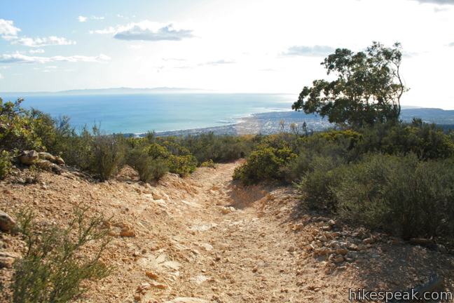
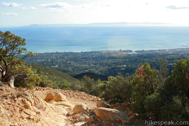
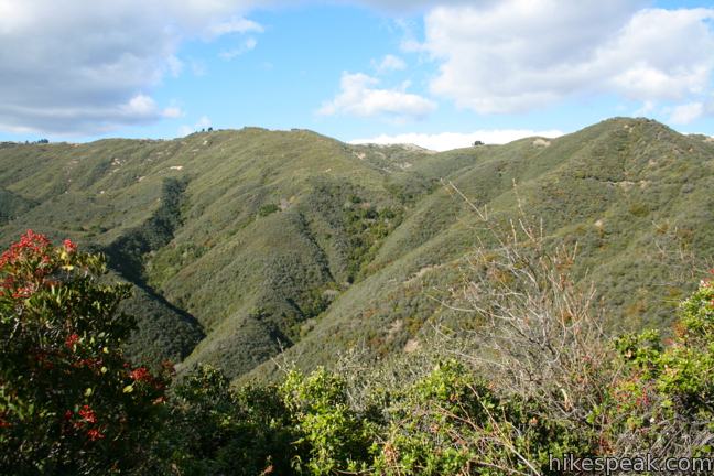
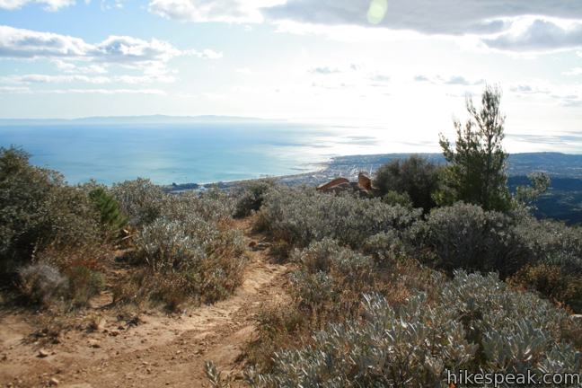
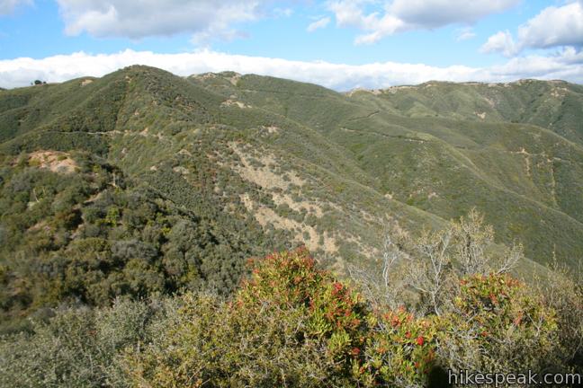
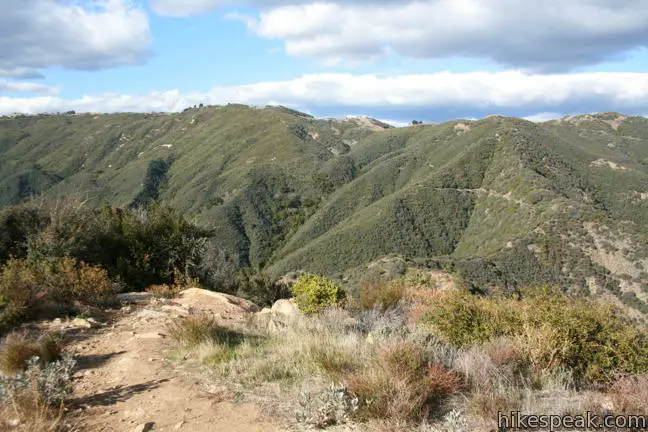
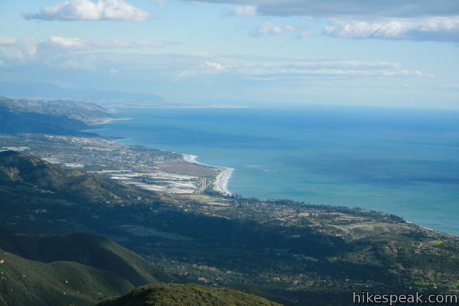
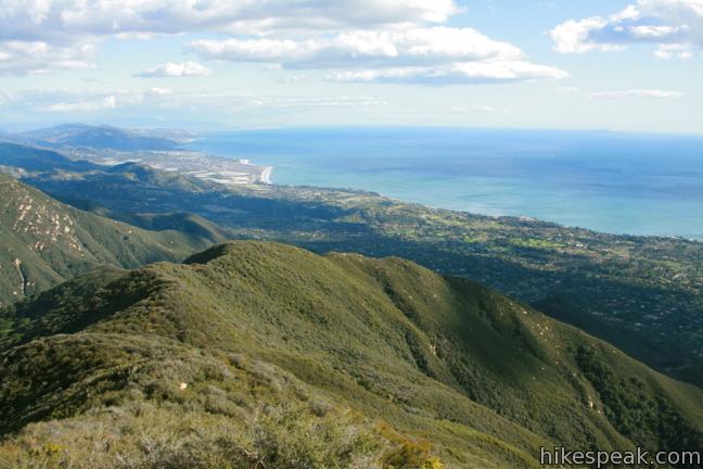
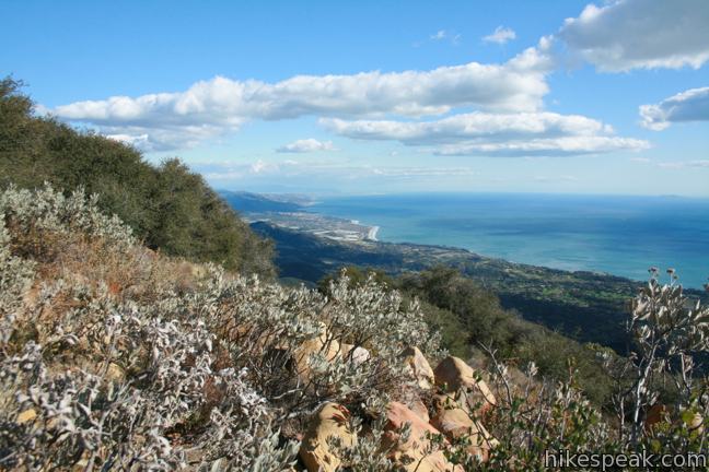
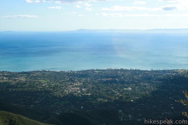
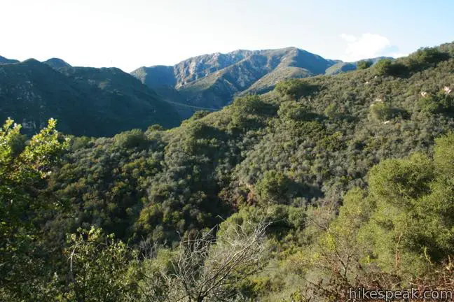
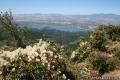
Stunning 360-degree views await at the summit. Santa Barbara is visible below to the southwest, while oil platforms and Channel Islands can be seen farther out over the Pacific Ocean. The coastal view extends a long distance to the southeast toward Ventura. There are also views to the east, north, and west over surrounding mountains and ridges in the Santa Ynez Range protected by Los Padres National Forest. There is a peak registry next to the jumble of boulders at the southwest end of the peak and a USGS marker above the eastern face.
Montecito Peak offers great views, worthy of the arduous hike. On the descent you may complete the Cold Springs Loop for a quicker route down. Start by hiking back the way you came, past the pair of eucalyptus trees and the Edison Service Road. When you reach the T-junction where you initially turned left heading uphill to the road, turn left again, this time continuing along the wall of the canyon. You will immediately pass a window out the mouth of Cold Springs Canyon toward the Pacific.
Stay straight (to the right) through a junction after less than a tenth of a mile, passing an alternative route up to the Edison Service Road. After another half mile, stay to the right again through two more junctions and descend the final 0.4 miles to the end of the trail, located about five feet from the start of Cold Springs Trail where the hike began.
Montecito Peak presents a challenging day hike with great coastal views. While this trail passes through Los Padres National Forest, no adventure pass is required to park at the trailhead. Dogs are welcome on leashes. No fee or permit is required to hike Cold Springs Trail to Montecito Peak, so get out and enjoy!
Directions to the Trailhead
- Take exit 94A off Highway 101 on Olive Mill Road in Montecito and drive toward the mountains.
- Continue up Olive Mill Road as it turns into Hot Springs Road.
- Two miles from the freeway, turn left on Mountain Drive.
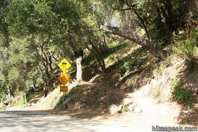
- Drive 1 mile to a point where Cold Springs Creek flows over the road.
- Park here and find the wooden sign marking the start of Cold Springs Trail (on the right side of the road, just before the creek).
Trailhead address: East Mountain Drive, Montecito, CA 93108
Trailhead coordinates: 34.456058, -119.6533 (34° 27′ 21.8″N 119° 39′ 11.9″W)
View Montecito Peak in a larger map
Or view a regional map of surrounding Central Coast trails and campgrounds.


 | Tangerine Falls This 2.5-mile hike visits a beautiful waterfall on the edge of Los Padres National Forest near Santa Barbara. |
 | McMenemy Overlook This 3.7-mile hike uses four trails to form a loop through the mountains behind Montecito, California. |
 | Ennisbrook Trail This easy 1.85-mile lollipop loop crosses charming stone bridges over San Ysidro Creek to explore a lush oak forest that is flooded by nasturtiums in the spring. |
 | Carpinteria Bluffs Trail to Carpinteria Seal Sanctuary Overlook This 1 to 2-mile hike goes from Carpinteria Bluffs Nature Preserve to a viewing area above a harbor seal rookery, offering beach access and beautiful oceanfront hiking. |
 | Inspiration Point from Tunnel Road This 3.75-mile round trip combines Tunnel Trail and Jesusita Trail to ascend Mission Canyon to a sweeping viewpoint that looks down over Santa Barbara and up into the Santa Ynez Mountains. |
 | Inspiration Point from San Roque Road This 7.55 to 7.95-mile round trip hike ascends 1,400 feet up the western side of Jesusita Trail to a panoramic perch in the Santa Ynez Mountains with great views over Santa Barbara. |
 | Knapp's Castle This easy 0.8-mile hike visits the scenic ruins of an estate home built atop the mountains behind Santa Barbara. |
 | Lizard's Mouth This half-mile hike visits a unique rock formation with amazing views over Santa Barbara and the Pacific. |
 | Gaviota Wind Caves This 2.5-mile hike just off Highway 101 visits wind-carved caves in Gaviota State Park with great ocean views. |
 | Tequepis Trail This invigorating 8.4-mile round trip hike offers views of Lake Cachuma as it climbs the Santa Ynez mountains to views of Santa Barbara and the Pacific. |
 | Nojoqui Falls This short 0.65-mile hike visits an 80-foot tall fern-lined waterfall. |
 | More Central Coast Hikes Explore other destinations along the California coast between Ventura and Monterey, including trails in Los Padres National Forest. |
Common Questions about Montecito Peak in Los Padres National Forest
- Is the trail open?
- Yes. You should expect to find that Cold Springs Trail to Montecito Peak is open. There are no recent reports of trail closures. If you discover that the trail is closed, please help your fellow hikers by reporting a closure.
- Is this trail free to access?
- Yes, Cold Springs Trail to Montecito Peak is free to access. No entrance fee, pass, or permit is required. If you discover that access rules have changed, please provide feedback on your experience.
- How much time does this hike take?
- It takes approximately 4 hours 30 minutes to hike Cold Springs Trail to Montecito Peak. Individual hiking times vary. Add extra time for breaks and taking in the views.
- How long is this hike?
- The hike to Cold Springs Trail to Montecito Peak is a 7.1 mile out and back with 2450 feet of elevation change.
- Are dogs allowed on this trail?
- Yes, dogs are allowed on Cold Springs Trail to Montecito Peak. The trail is open to hikers, dogs.
- Is Cold Springs Trail to Montecito Peak a difficult hike?
- This hike should be considered strenuous. Hikers should be prepared for a workout covering 7.1 miles and 2450 feet of climbing.
- Are there ocean views on this hike?
- Yes, Cold Springs Trail to Montecito Peak offers views of the ocean.
- Does this trail go to a summit?
- Yes, Cold Springs Trail to Montecito Peak reaches a summit with panoramic views.
- What mountain range is this trail in?
- Cold Springs Trail to Montecito Peak is located in the Santa Ynez Mountains.
- Where is the trailhead located?
- The trailhead for Cold Springs Trail to Montecito Peak is located in Montecito, CA.
Trailhead Address:
East Mountain Drive
Montecito, CA 93108
Trailhead Coordinates:
34.456058, -119.6533 - What are the driving directions to the start of the hike?
- To get to the trailhead: Take exit 94A off Highway 101 on Olive Mill Road in Montecito and drive toward the mountains. Continue up Olive Mill Road as it turns into Hot Springs Road. Two miles from the freeway, turn left on Mountain Drive. Drive 1 mile to a point where Cold Springs Creek flows over the road. Park here and find the wooden sign marking the start of Cold Springs Trail (on the right side of the road, just before the creek).
View custom Google Maps directions from your current location. - Are there other trails near Cold Springs Trail to Montecito Peak?
- Yes, you can find other nearby hikes using the Hikespeak Hike Finder Map.

[…] Start your hike at the Cold Springs Trail, and continue straight up when you reach the West Frog Trail junction, shortly after which you would have a few creek-crossings to do. Then, after a few more unmarked junctions and single tracks, you will be rewarded with an amazing 360 degree view at the very top. (details here) […]
Does anyone know if the trail to Montecito Peak is open and whether the trailhead is accessible at this time? I am not from the area and would like to know if the trail is still impacted by the fires and floods. Thanks.
Is the single eucalyptus tree still at the top of the west fork of Cold Spring Trail?