Griffith Observatory to the Hollywood Sign in Griffith Park
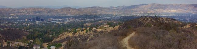
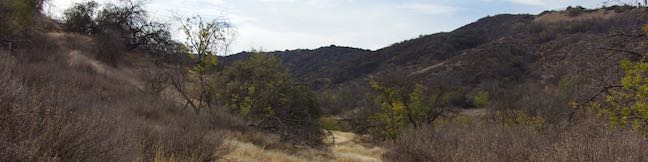
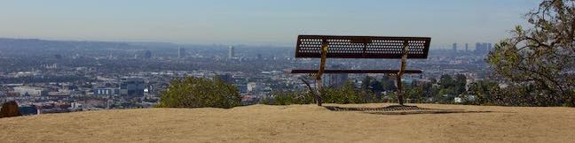
Are you trying to get from the Griffith Observatory to the Hollywood Sign? Perhaps Google Maps lead you to Griffith Observatory when you were trying to get driving directions to the Hollywood Sign or maybe you are just eager to hike between Griffith Park's two biggest landmarks. It is possible to walk from Griffith Observatory to the Hollywood Sign. ...Read more.
Distance: 8.8 miles · Elevation change: 575 feet
By: Published: January 9, 2017 Last updated: April 9, 2026
Heaps Peak Arboretum in the San Bernardino Mountains
Get to know the plants, animals, and natural history of Southern California at Heaps Peak Arboretum. Located near Lake Arrowhead, the arboretum is a developed piece of San Bernardino National Forest. Sequoia Trail is the main trail through Heaps Peak Arboretum, covering 3/4 of a mile with 90 feet of elevation change. The star of the trail is a planted grove of sequoiadendron giganteum, or what us non-Latin speakers call giant sequoias. ...Read more.
Distance: 0.75 miles · Elevation change: 90 feet
By: Published: December 23, 2016 Last updated: December 5, 2025
Winnetka Ridge Trail in the Santa Monica Mountains
If you like ridge top views without the effort of hiking all the way up a ridge, make your way to the end of Winnetka Avenue in Woodland Hills. From there, Winnetka Ridge Trail runs south along the spine of a ridge into the Santa Monica Mountains. The ridge stands above the west side of Corbin Canyon and delivers broad views over the San Fernando Valley. ...Read more.
Distance: 1.5 miles · Elevation change: 200 feet
By: Published: December 21, 2016 Last updated: December 5, 2025
Corbin Canyon Park in the Santa Monica Mountains
Corbin Canyon Park is a less visited pocket of Topange State Park in the Santa Monica Mountains. The 328-acre parcel stretches into the mountains from neighborhoods in Tarzana and Woodland Hills, presenting a small offering of trails that are isolated from longer routes through the Santa Monica Mountains. Corbin Canyon hosts trails for a pleasant and manageable 2. ...Read more.
Distance: 2.05 miles · Elevation change: 150 feet
By: Published: December 15, 2016 Last updated: December 5, 2025
Griffith Observatory via East Observatory Trail in Griffith Park
Griffith Observatory sits on a ridge between Vermont Canyon Road and Western Canyon Road on the slopes of Mount Hollywood in Griffith Park. Griffith Observatory is a true Los Angeles landmark that can be appreciated by arriving by trail instead of driving up the park roads. Take West Observatory Trail if you wish to hike to Griffith Observatory from Western Canyon or follow these directions to hike to Griffith Observatory from Vermont Canyon Road. ...Read more.
Distance: 1.5 miles · Elevation change: 380 feet
By: Published: December 5, 2016 Last updated: April 9, 2026
Tumalo Falls in Deschutes National Forest
Tumalo Falls is rightfully considered one of the must-see attractions in Bend, Oregon. The grandest waterfall on Tumalo Creek makes a nearly 100-foot drop from a cliff in Deschutes National Forest west of Bend. Admire the broad single-drop waterfall from a downstream viewpoint that is fifty yards from Tumalo Falls Day Use Area. Then take a half a mile round trip hike to an overlook at the brink of the falls for a close-up look at the first-class gusher. ...Read more.
Distance: 0.5 miles · Elevation change: 105 feet
By: Published: December 2, 2016 Last updated: April 16, 2026
Tumalo Falls Loop in Deschutes National Forest
Tumalo Falls is the tallest and most beautiful waterfall on Tumalo Creek near Bend, Oregon, but it isn't the creek's only waterfall. If you like seeing water tumble, go beyond the half-mile round trip hike to Tumalo Falls and explore a grander 7.4 miles loop that visits half dozen other named waterfalls and perhaps a dozen more unnamed smaller waterfalls and cascades. ...Read more.
Distance: 7.4 miles · Elevation change: 1100 feet
By: Published: December 2, 2016 Last updated: April 23, 2026
Deschutes River Trail to Benham Falls in Deschutes National Forest
Strolling down Deschutes River Trail toward Benham Falls, you might be skeptical that this calm river will hasten into rapids and cascades. The wall of volcanic rock on the far side of the river does offer an early clue that something dramatic could happen. The Deschutes River was rerouted by Lava Butte Lava Flow, causing it to tumble over a few waterfalls on its path north toward Bend. ...Read more.
Distance: 1.9 miles · Elevation change: 50 feet
By: Published: November 21, 2016 Last updated: April 16, 2026
Trail of the Molten Land in Newberry National Volcanic Monument
You'll be grateful to find pavement and not melting hot lava on Trail of the Molten Land. This impressive trail is built atop a barren landscape of dark volcanic rock, the Lava Butte Lava Flow in Newberry National Volcanic Monument, which is part of Deschutes National Forest. Panels along the trail provide information about how the lava flow began at Lava Butte, a cinder cone above the trail. ...Read more.
Distance: 1.25 miles · Elevation change: 135 feet
By: Published: November 18, 2016 Last updated: December 5, 2025
Trail of the Whispering Pines in Newberry National Volcanic Monument
Trail of the Whispering Pines is an interpretive botanical trail highlighting high desert plants in Newberry National Volcanic Monument. This short and level paved path covers just a quarter mile. Trail of the Whispering Pines can easily be explored as a 0.4-mile walk beginning and ending at Lava Lands Visitor Center. This short hike can be connected to Trail of the Molten Land, which is even more impressive, for a 1. ...Read more.
Distance: 0.4 miles · Elevation change: 5 feet
By: Published: November 18, 2016 Last updated: December 5, 2025