Temescal Canyon Loop in the Santa Monica Mountains
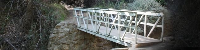
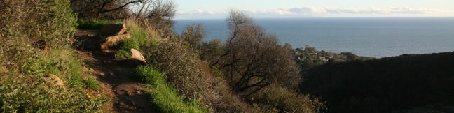
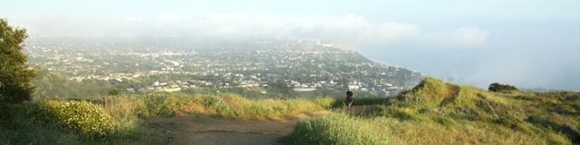
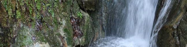
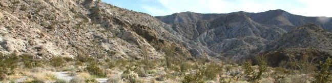
Temescal Canyon Loop offers a good workout along with ocean and canyon views. Temescal Gateway Park is situated just off Sunset Blvd in the Pacific Palisades, and this convenient urban location makes Temescal Canyon Loop a very popular hike. The basic dimensions of the loop is 2.6 miles with 860 feet of elevation gain, but the hike can be expanded to four miles or longer thanks to a variety of extensions. ...Read more.
Distance: 2.6 miles · Elevation change: 860 feet
By: Published: April 9, 2011 Last updated: April 8, 2026
Los Liones Trail in the Santa Monica Mountains
Los Liones Trail weaves up a lush canyon at the south end of Topanga State Park, just a mile from the Pacific Ocean. The ivy and chaparral-lined hike offers glimpses of Santa Monica Bay. After 1.3 miles and 550 feet of elevation gain, Los Liones Trail arrives at a clearing on a ridge at a bench that looks down on the Pacific Palisades, Santa Monica, and the ocean beyond. ...Read more.
Distance: 2.6 miles · Elevation change: 550 feet
By: Published: April 8, 2011 Last updated: December 5, 2025
Parker Mesa Overlook via East Topanga Fire Road and Los Liones Trail in the Santa Monica Mountains
Parker Mesa Overlook offers panoramic views of Santa Monica Bay and the Pacific Ocean. The coastline spans from Palos Verdes to Malibu, with nothing but blue in between. Parker Mesa Overlook is located on the west side of Topanga State Park, which holds the distinction of being the: World's largest wildland within the boundaries of a major city. This distinguishes it from Griffith Park, which is the: Largest municipal park and urban wilderness area in the United States. ...Read more.
Distance: 7.8 miles · Elevation change: 1300 feet
By: Published: April 8, 2011 Last updated: April 8, 2026
Hellhole Canyon Trail to Maidenhair Falls in Anza-Borrego Desert State Park
Hellhole Canyon is backed up against the San Ysidro Mountains just southwest of the Anza-Borrego Desert State Park Visitor Center in Borrego Springs. The ominously named canyon is home to Maidenhair Falls, a seasonal 20-foot waterfall that makes a refreshing hiking destination on a hot day in the California desert. If you are visiting the park in early spring, or any time rains bring water to Hellhole Canyon, Maidenhair Falls should be on your itinerary. ...Read more.
Distance: 5.5 miles · Elevation change: 1000 feet
By: Published: April 6, 2011 Last updated: April 9, 2026
Borrego Palm Canyon Trail in Anza-Borrego Desert State Park
Borrego Palm Canyon is a wide trench descending west to east down the San Ysidro Mountains just west of Borrego Springs. The creation of Anza-Borrego Desert State Park began in the 1930s with the protection of this palm-filled canyon. The popularity of the trail exploring Borrego Palm Canyon has endured, even as the park has expanded to protect a thousand square miles of southeastern California. ...Read more.
Distance: 3.25 miles · Elevation change: 450 feet
By: Published: April 5, 2011 Last updated: April 8, 2026
Rainbow Canyon Trail in Anza-Borrego Desert State Park
For an exciting 2.2-mile hike on an undeveloped trail through a colorful canyon, make your way to Rainbow Canyon, located south of Blair Valley in Anza-Borrego Desert State Park. A bit of scrambling is required on this hike, to climb several sloped dry falls within the canyon. This hike has 300 feet of elevation gain between the trailhead and the turnaround point, with plenty to see along the way. ...Read more.
Distance: 2.2 miles · Elevation change: 300 feet
By: Published: April 3, 2011 Last updated: April 7, 2026
Pictograph Trail in Anza-Borrego Desert State Park
Pictograph Trail provides a 1.8-mile out and back hike to an elephant-sized canvas, otherwise known as a boulder, that was used by Kumeyaay Indian painters who lived in the Anza-Borrego Desert over two thousand years ago. From the trailhead, hike east up a shallow draw in the ridgeline, gaining 190 feet over 0.55 miles. Behind you, there is a grand view over Little Blair Valley and Granite Mountain to the west. ...Read more.
Distance: 1.8 miles · Elevation change: 190 feet
By: Published: April 2, 2011 Last updated: April 9, 2026
Morteros Trail in Anza-Borrego Desert State Park
This short gradual 0.6-mile round trip hike ascends to an area of Anza-Borrego Desert State Park that was once inhabited by Kumeyaay Indians. The Kumeyaay left behind morteros, grinding bowls carved into large boulders along the trail. These Native Americans used the circular morteros over 2,000 years ago to grind local nuts and seeds into meal. From the well-marked trailhead above Blair Valley, begin hiking southwest toward a gap in the hillside. ...Read more.
Distance: 0.6 miles · Elevation change: 40 feet
By: Published: April 1, 2011 Last updated: April 9, 2026
Calcite Mine Trail and Narrows in Anza-Borrego Desert State Park
For a brief period at the start of America's involvement in World War Two, this area was heavily mined for its high-grade calcite, a mineral then used to make bomb sights. This approximately 4-mile long expedition follows an old mining road into the Santa Rosa Mountains, crossing a narrow ravine with slot canyons that hikers may explore to add variety and excitement to this trek in Anza-Borrego Desert State Park. ...Read more.
Distance: 4 miles · Elevation change: 600 feet
By: Published: March 31, 2011 Last updated: April 9, 2026
Narrows Earth Trail in Anza-Borrego Desert State Park
What Elephant Trees Trail is to desert botany, Narrows Earth Trail is to desert geology. The pamphlet available at the start of this half-mile loop describes the geological features present in Anza-Borrego Desert State Park. The desert is a great place to learn about geology. Sparse vegetation exposes the earth's rock skeleton, bringing the secrets of the land's formation to bear. ...Read more.
Distance: 0.5 miles · Elevation change: 50 feet
By: Published: March 29, 2011 Last updated: April 9, 2026