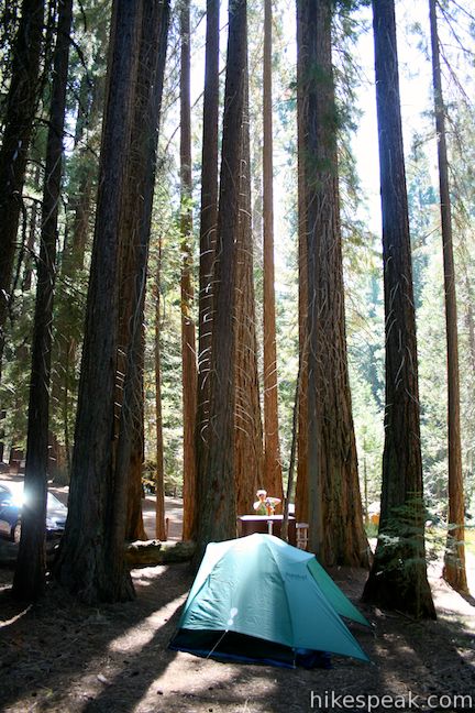
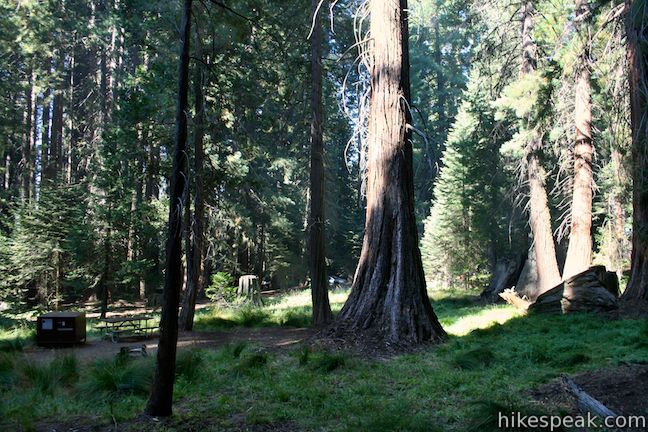
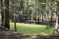
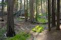
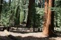
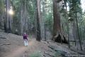
Sequoia National Park and Kings Canyon National Park are two large adjoining parks with many camping options. With so much to see, it is definitely worth spending multiple days in these two parks. The campgrounds are a great way to experience the parks after dark.
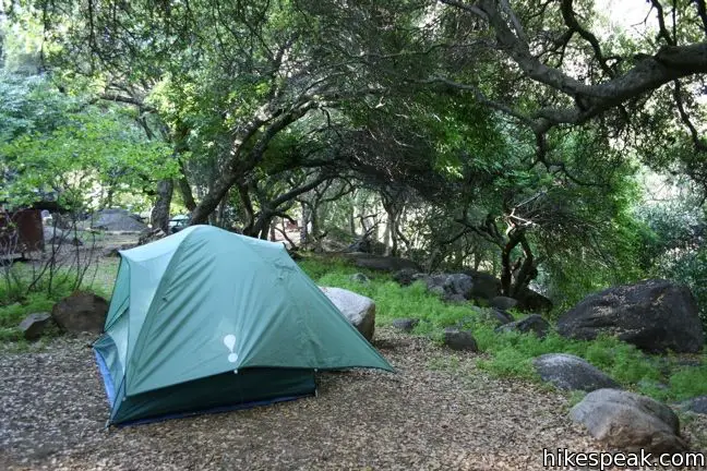
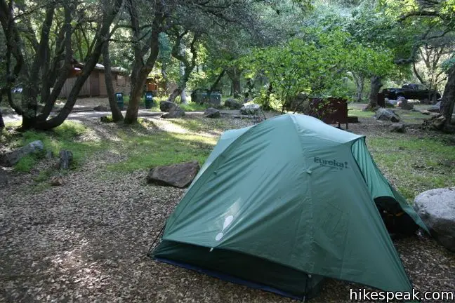
Located near the Giant Forest and Tokopah Falls, Lodgepole Campground is the largest campground in Sequoia National Park with 214 sites. Farther down the mountain south of the Giant Forest are two foothills campgrounds, Potwisha and Buckeye Flat. During cooler months, they are the best place to stay. Even farther south, the remote Mineral King region has two campgrounds of its own, Atwell Mill and Cold Springs Campground. The national parks are bordered by Sequoia National Forest, and you can find additional camping in the Hume Lake Ranger District.
Campgrounds in Sequoia and Kings Canyon National Parks
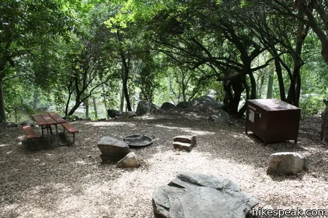
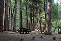
Moraine Campground | 120 sites | open May – October | first-come first-serve | $18 per night | potable water, picnic tables, fire rings, bear boxes, and flush toilets | showers nearby | elevation 4,600 feet
Canyon View Campground | 16 group sites | open late May to October | reservations accepted | $40 – $60 per night depending on group size | potable water, picnic tables, fire rings, bear boxes, and flush toilets | showers nearby | elevation 4,600 feet
Sentinel Campground | 82 sites | open late April to October | first-come first-serve | $18 per night | potable water, picnic tables, fire rings, bear boxes, and flush toilets | showers nearby | elevation 4,600 feet
Sheep Creek | 111 sites | open May to mid-November | first-come first-serve | $18 per night | potable water, picnic tables, fire rings, bear boxes, and flush toilets | showers nearby | elevation 4,600 feet
Sunset Campground | 157 sites | open late May to mid-September | first-come first-serve | $22 per night | potable water, picnic tables, fire rings, bear boxes, and flush toilets | showers nearby | elevation 6,500 feet
Crystal Springs Campground | 36 sites (plus 14 group sites) | open late May to mid-September | first-come first-serve | $18 per night | potable water, picnic tables, fire rings, bear boxes, and flush toilets | showers nearby | elevation 6,500 feet
Azelea Campground | 110 sites | open year-round | first-come first-serve | $18 per night | potable water, picnic tables, fire rings, bear boxes, and flush toilets | showers nearby | elevation 6,500 feet
Dorst Creek Campground | 36 sites (plus 14 group sites) | open June – Labor Day | reservations accepted | $22 per night | potable water, picnic tables, fire rings, bear boxes, flush toilets, and an RV disposal station | elevation 6,800 feet
Lodgepole Campground | 204 sites | open year-round | reservations accepted | $22 per night | potable water, picnic tables, fire rings, bear boxes, flush toilets, and an RV disposal station | elevation 6,700 feet
Potwisha Campground | 42 sites | open year-round | reservations accepted May – September | $22 per night | potable water, picnic tables, fire rings, bear boxes, flush toilets, and an RV disposal station | elevation 2,100 feet
Buckeye Flat Campground | 28 sites | open year round | reservations accepted May – September | $22 per night | potable water, picnic tables, fire rings, bear boxes, and flush toilets | elevation 2,800 feet
Atwell Mill Campground | 21 sites | open May – October | first-come first-serve | $12 per night | potable water, picnic tables, fire rings, bear boxes, and pit toilets | elevation 6,600 feet
Cold Springs Campground | 40 sites | open May – October | first-come first-serve | $12 per night | potable water, picnic tables, fire rings, bear boxes, and pit toilets | elevation 7,500 feet
South Fork Campground | 10 sites | open year round | first-come first-serve | $12 per night | no potable water, picnic tables, fire rings, bear boxes, and pit toilets | elevation 3,600 feet
For more information on all these campgrounds, visit the Sequoia and Kings Canyon National Parks Camping Page.
Use the map below to view the campgrounds and get directions:
Or view Sierra Nevada trails and campgrounds in a larger map
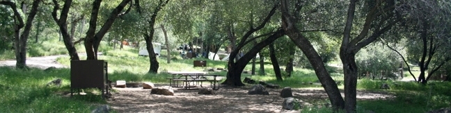
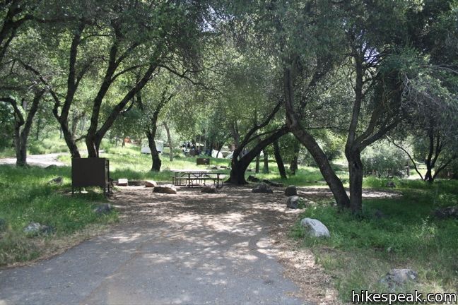
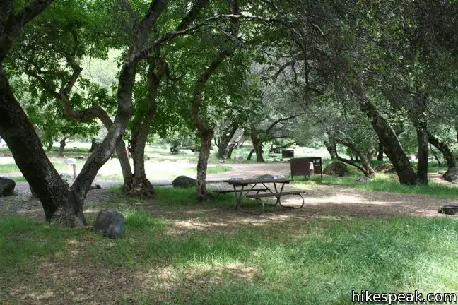
Foothills Campgrounds – Potwisha and Buckeye Flat: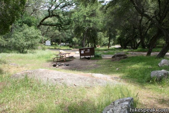


 | Hume Lake Ranger District Campgrounds There are fourteen campgrounds in the Hume Lake Ranger District of Sequoia National Forest and Giant Forest National Monument, including the 74-site Hume Lake Campground. |
 | Western Divide Ranger District Campgrounds There are ten campgrounds in Giant Sequoia National Monument within the Western Divide Ranger District of Sequoia National Forest, including the 32-site Quaking Aspen Campground. |
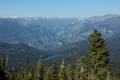
Trails in Kings Canyon National Parks
Trail | Description | Distance | Location |
|---|---|---|---|
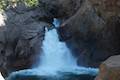 264 264 | Roaring River Falls This paved out and back hike reaches a thundering little waterfall on a tributary of the Kings River. | 0.3 miles 25 feet | 36.783747, -118.622121 |
 266 266 | Kanawyer Loop Trail This loop is scenic and easy, exploring east from the backcountry gateway at Road's End along both sides of the South Fork Kings River in Kings Canyon. | 5 miles 125 feet | 36.794663, -118.582941 |
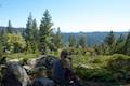
 270 270 | Panoramic Point This short out and back hike reaches an exception overlook with views into Kings Canyon. | 0.5 miles 100 feet | 36.753793, -118.946754 |
 280 280 | North Boundary Trail This lollipop loop hike starts on the trail between Grant Grove and Grant Village and passes the General Grant Tree to reach a 2.75-mile loop through the pine forest north of the Grant Grove. | 3.55 miles 375 feet | 36.746811, -118.972595 |
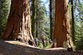
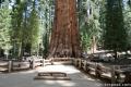
 284 284 | General Grant Tree Trail This loop in the Grant Grove passes through a Fallen Monarch to reach the General Grant Tree, one of the world's largest sequoias. | 0.8 miles 50 feet | 36.747, -118.973128 |
 286 286 | North Grove Trail This loop explores a quiet grove of sequoias near the crowded Grant Grove and can combine with Dead Giant Loop Trail for 3.25-mile hike. | 2 miles 350 feet | 36.747103, -118.974642 |
 288 288 | Dead Giant Loop Trail This loop passes a small meadow and a large dead sequoia to reach Sequoia Lake Overlook and can combine with nearby North Grove Trail for 3.25-mile hike. | 2.25 miles 300 feet | 36.747103, -118.974642 |
 290 290 | Grant Village to Grant Grove Trail This mile-long trail connects the visitor center at Grant Village with the parking lot at Grant Grove, passing through Azalea Campground to reach giant sequoias, including the General Grant Tree. | 2 miles 250 feet | 36.740049, -118.963588 |
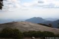
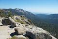 295 295 | Buena Vista Peak This out and back hike reaches a granite summit with 360-degree views over the Redwood Mountain Grove and Kings Canyon. | 2 miles 420 feet | 36.718234, -118.896935 |
 297 297 | Hart Tree and Fallen Goliath Loop This loop on Hart Tree Trail and Redwood Creek Trail passes tranquil streams and interesting sequoias in the Redwood Mountain Grove. | 8.3 miles 925 feet | 36.707444, -118.92093 |
Trails in Sequoia National Parks
Trail | Description | Distance | Location |
|---|---|---|---|
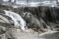 300 300 | Tokopah Falls This gradual out and back hike visits the tallest waterfall in Sequoia National Park. | 4.2 miles 630 feet | 36.6048, -118.7249 |
 310 310 | General Sherman Tree This paved out at back hike visits the world's biggest tree. | 1 mile 200 feet | 36.5848, -118.74984 |
 320 320 | Congress Loop This easy paved loop visits the fourth and fifth tallest Sequoias in the world (among others). | 2 miles 230 feet | 36.5848, -118.74984 |
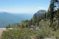
 330 330 | Sunset Rock This out and back hike visits a large granite dome with great views to the west. | 2 miles 50 feet | 36.5657, -118.7724 |
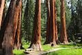 333 333 | Big Trees Trail This easy, educational, and beautiful loop explores the giant sequoias around Round Meadow. | 1.4 miles 50 feet | 36.564866, -118.773736 |
 340 340 | Beetle Rock This short walk from the Giant Forest Museum to Beetle Rock visits a granite dome with great views and stunning sunsets. | 0.25 miles 50 feet | 36.5647, -118.77425 |
 350 350 | Crescent Meadow This level loop visits a Sequoia you can stand inside (Chimney Tree) and another that someone used to live in (Tharp's Log). | 1.6 miles 150 feet | 36.5548, -118.7490 |
 353 353 | Sugar Pine and Bobcat Point Trails Loop This short but diverse loop peaks at Bobcat Point, which presents a fierce perspective of Moro Rock and a massive canyon. | 1.5 miles 250 feet | 36.5548, -118.7490 |
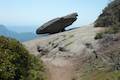 358 358 | Hanging Rock Trail This short out and back hike passes views of Moro Rock en route to a balancing boulder on a canyon rim at the edge of the Giant Forest. | 0.35 miles 100 feet | 36.549128, -118.768186 |
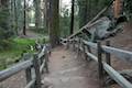
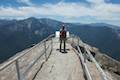 360 360 | Moro Rock This short out and back hike (with a lot of stairs) sports panoramic views and should be considered a mandatory hike for first time visitors to Sequoia National Park. | 0.6 miles 300 feet | 36.5469, -118.7656 |
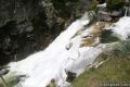 370 370 | Marble Falls This out and back hike takes a flower-lined path up a mountain canyon to a powerful waterfall. | 8 miles 2,150 feet | 36.51785, -118.80115 |
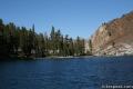
 380 380 | Paradise Creek This short stroll leaves Buckeye Flat Campground to visit the perfect swimming hole for a hot summer day in the Sierra. | 0.5 to 6 miles 75 feet | 36.52185, -118.76352 |
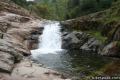
 390 390 | Panther Creek This out and back hike follows the Middle Fork Trail to a 100 foot waterfall into the Middle Fork of Kaweah River. | 6 miles (or farther) 600 feet | 36.52755, -118.7513 |
 420 420 | Hockett Trail This out and back hike descends through sequoias to East Fork Kaweah River and farther into the backcountry of Mineral King. | 3 to 5 miles (or farther) 600 feet | 36.46424, -118.6690 |
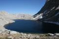
 440 440 | Monarch Lakes Trail This out and back hike visits a spectacular pair of lakes high above Mineral King Valley. | 9.4 miles 2,500 feet | 36.45305, -118.59665 |
 430 430 | Eagle Lake Trail The out and back hike climbs the west side of Mineral King Valley to a high-elevation lake. | 7.2 miles 2,200 feet | 36.4488, -118.5954 |
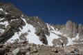 550 550 | Mount Pickering This 13,485-foot summit rises above Sky Blue Lake to offer sweeping views of the sierra. | 30 miles 3,500 feet | 36.527133, -118.290875 |
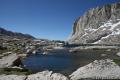 560 560 | Sky Blue Lake This hike extends beyond Lower Soldier Lake up Miter Basin to a deep blue lake surrounded by 14,000-foot peaks. | 26 miles 2,300 feet | 36.532788, -118.273494 |
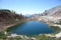
 570 570 | Primrose Lake This trek visits a lake off the side of Miter Basin near Sky Blue Lake and below Mount Pickering. | 28 miles 2,300 feet | 36.521144, -118.276173 |
 580 580 | Mount Langley This trek enters Sequoia from the east through Inyo National Forest to reach a 14,042-foot summit with towering views of the Sierra. | 22 miles 4,000 feet | 36.524419, -118.238826 |
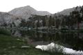 590 590 | Lower Soldier Lake This 19.2-mile loop crosses Cottonwood Pass and New Army Pass to visit a beautiful lake that is an ideal camping spot for backpackers heading higher and deeper into the Sierra. | 17.6 to 20.8 miles 1,500 to 2,300 feet | 36.503604, -118.269331 |
We are planning a camping trip to the Sequoia Nat’l Forest beginning July 6, 2012. What is the likelyhood of finding a first come first served spot on this particular weekend? We are tent camping and coming from Oregon. I would hate to drive all that way and not find a spot. I noticed that Princess Campground has a lot of availability. Is there a reason why? Should we steer clear of this campground?
Arriving early on a Friday you can usually pick from your choice of first-come first-serve sites. The park may be mire crowded thanks to 4th of July, but you should be OK. Arrive as early as you can.
We’re looking to go camping the same time as cara (from the post above) July 6th weekend. I’ve been doing a lot of research and looking for sites. You seem to really know the area so can you tell me is Dorst creek a good location? Also i know that they take reservations because they are all booked up but do you know if they also have a first come first serve site? Also can you tell me which site is the closest to the waterfalls and the natural water slide? If you could help me I would really appreciate it. =)
Hi –
I have not stayed at Dorst Creek. Potwisha and Buckeye Flat Campgrounds are the closest to Paradise Creek and Marble Falls. Good luck grabbing a campsite. Keep checking for online reservations in the weeks before your trip as someone may cancel their reservation. If Sequoia National Park fills up, you can also look at Giant Sequoia National Monument (farther to the south), stay at Quaking Aspen Campground, and visit the natural water slide.
thanks =)
Im coming up for Easter vacation, 14th-17th. I need to know if Buckeye Flats will be open. If not when will it be opening?
We are thinking of coming this weekend, May 16th and 17th. But it’s a five hour drive and we are wondering how early we’d need to arrive to get a campsite. Anywhere really. (Are there any that are bad?) What are the chances of us getting one with no reservations, as the sites that take the reservations are all booked. Thanks!
Hello! I’m planning on going camping at Sequoia in the summer. But I was wondering if you can help me find a perfect camping site. I want to be in a campground that’s in the wilderness, close to swimming areas, but not really close to others campsites, I don’t mind being in the same campsite but I don’t want to be in a campground where’s there like 40-100 campsites. And also wanted a campsite where the people are pretty spread out from your camping area. I don’t want them to be so close to our area. Can you give me some helpful suggestions of campgrounds?
I am planning to camp at sequoia and King Canyon on Friday July 3 through July 5 2015 but I cannot make reservation on that weekend. For first come first serve what time should I be there to get a spot on any campsite with flush toilets? Thank you!
Plan to camp in King’s Canyon/Sequoia National Parks in May… roughly from the 9-11th. I read that most of the campgrounds are first come first served. For that time of year, would I have any trouble getting a good site if I arrive early in the day… and what would be considered “early?” Thanks!