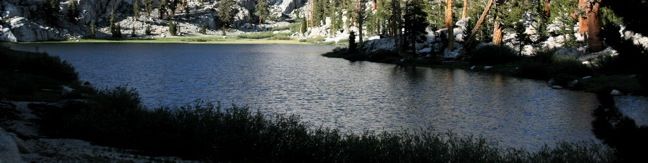
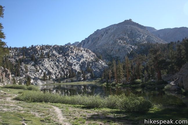
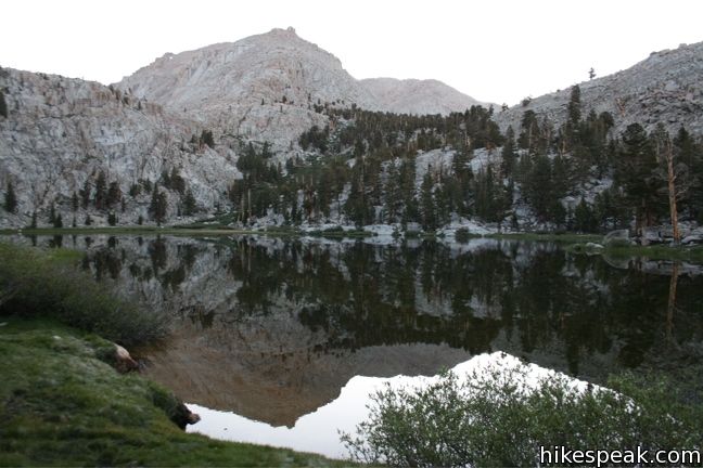
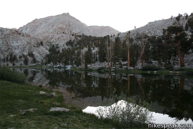
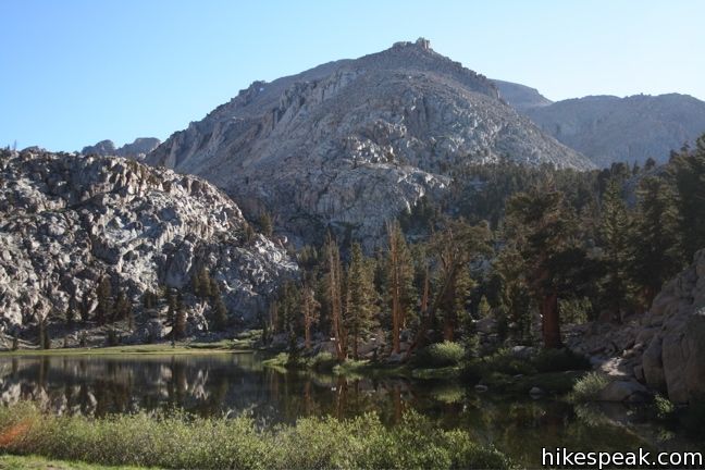
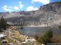
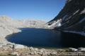
Lower Soldier Lake lies at 10,800 feet on the eastern edge of Sequoia National Park. This is a favored place for backpackers to bed down, and for good reason. A host of trails and off-trail targets make this a prime base camp. The nearest trailhead is Horseshoe Meadow in the Golden Trout Wilderness, which offers two routes to Lower Soldier Lake. About half a mile separates the start of the two trails so they can easily be combined to form a loop.
- Cottonwood Pass Trail to the Pacific Crest Trail (8.8 miles one-way)
- Cottonwood Lakes Trail to New Army Pass Trail (10.4 miles one-way)
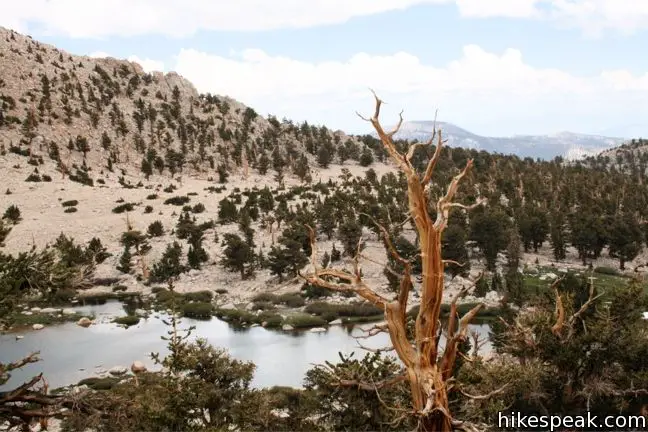
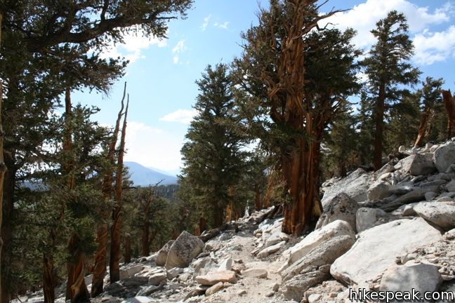
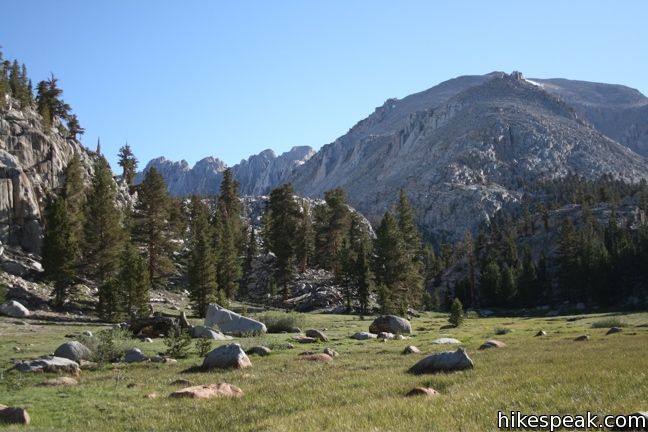
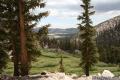
From Cottonwood Pass: The shorter trail also requires less elevation gain. Leave Horseshoe Meadow and hike 3.5 miles up the 1,200-foot climb to Cottonwood Pass. Turn right at the junction with the Pacific Crest Trail in the direction of Rock Creek. Pass Chicken Spring Lake, and continue northwest along the trail through a rugged alpine forest of ancient foxtail pines. These trees can grow north of two thousand years old, and the golden red trunks are an everlasting source of beauty along the trail.
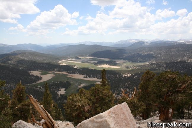
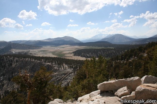
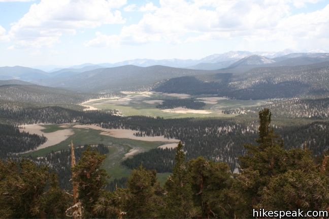
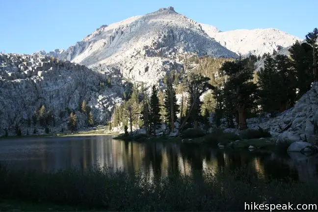
The Pacific Crest Trail switches up a rocky mound east of Chicken Spring Lake to a scenic spot that overlooks the lake in one direction and Big Whitney Meadow in the other.
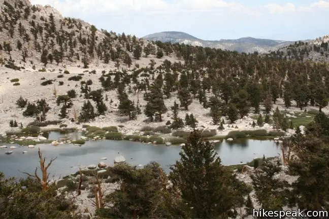
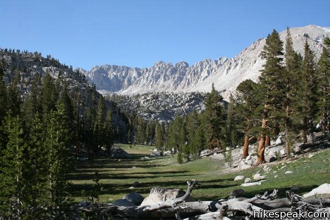
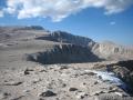
Moving on, the Pacific Crest Trail sets a course for Sequoia National Park, wrapping over slopes and around high meadows. The trail rises to a high point of 11,440 before descending to Siberian Outpost in Sequoia National Park.
At 3.6 miles from the pass (and 7.1 from the trailhead), turn right at the junction with the Siberian Pass Trail and continue 1.6 miles to the creek that flows from Lower Soldier Lake.
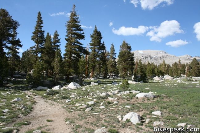
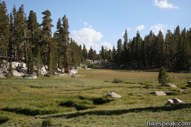
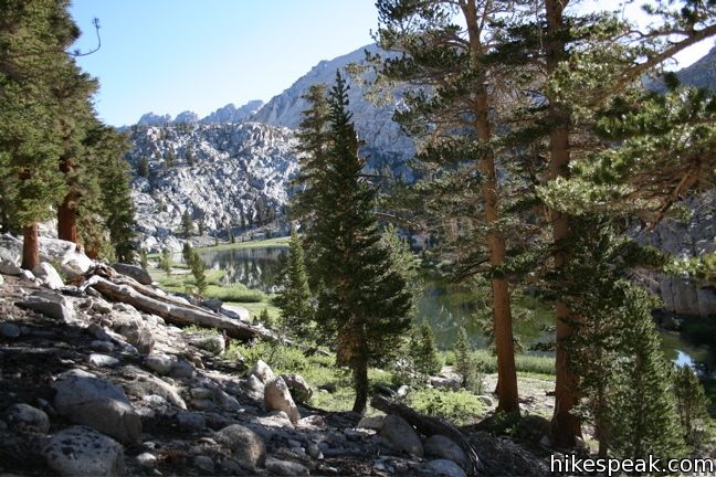
Along the way, you will pass through a mostly level forest of Lodgepole and Foxtail Pines, and cross a creek that parallels New Army Pass Trail. Go through this junction. When you come to a T-junction at a second creek, make a right and travel a tenth of a mile along the meadow’s edge to reach Lower Soldier Lake.
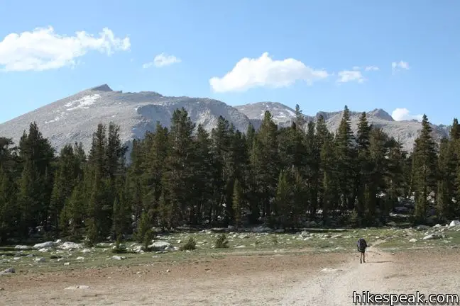
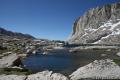
From Cottonwood Lakes: The Cottonwood Lakes – New Army Pass route to Lower Soldier Lake is a mile and a half longer with greater elevation and greater scenery. From Cottonwood Lakes trailhead at Horseshoe Meadow, take the main trail past Long Lake and High Lake to New Army Pass. This 7.5-mile stretch climbs to 12,300 feet (from 10,040), before descending off the back of the pass for 2.3 miles down to a junction with the Pacific Crest Trail. Turn right on PCT and hike the last mile to the junction 0.1 miles below Lower Soldier Lake. Turn right again to arrive at the lake.
As a loop: Those hiking out to Lower Soldier Lake as a loop may prefer to return via New Army Pass. The climb to the pass is gradual on the national park side. From the pass, returning hikers are treated to seven and a half miles of mostly downhill hiking past beautiful lakes, forests, and meadows.
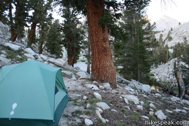
Camping at the lake: Remember to observe park regulations by tenting at least a hundred feet from the water. Campfires are prohibited. If Lower Soldier Lake seems crowded, there are other sites to camp at around the meadow and farther down Rock Creek. A permit is needed for all overnight excursions. Review Cottonwood Pass Trail or Cottonwood Lakes Trail for more information about permits and quotas.
Directions to the Trailhead
- From the city of Lone Pine on Route 395, turn west at the traffic light on Whitney Portal Road.
- After three miles, turn left on Horseshoe Meadow Road.
- Drive twenty miles up mountain switchbacks to road's end at Horseshoe Meadow.
- Cottonwood Pass trailhead is at the east end of the campground.
- Cottonwood Lakes trailhead is at the end of the paved road to the right.
- If you hike to Lower Soldier Lake as a loop, the two trailheads are half a mile apart and can be connected through the pack station trail or by passing through the campground and hillside that separate the trailheads.
Trailhead Location
Trailhead address: Horseshoe Meadows Road, Inyo National Forest, Lone Pine, CA 93545
Trailhead coordinates: 36.44834, -118.17065 (36° 26′ 54″N 118° 10′ 14.3″W)
View Eastern Sierra in a larger map
Or view a regional map of surrounding Sierra Nevada trails and campgrounds.


 | Lower Soldier Lake to New Army Pass This trail ascends from Lower Soldier Lake to New Army Pass at the top of Cottonwood Lakes Trail. |
 | Cottonwood Pass This 7-mile round trip trail ascends 1,200 feet to an 11,200-foot pass and a junction with the Pacific Crest Trail, with access to Golden Trout Wilderness and Sequoia National Park. |
 | Cottonwood Lakes This scenic trail through a lake-filled basin provides a 10-mile round trip day hike to Long Lake and a 7.5-miles one-way trek to New Army Pass on the border of Sequoia National Park near Mount Langley. |
 | Sky Blue Lake This hike extends beyond Lower Soldier Lake up Miter Basin to a deep blue lake surrounded by towering peaks. |
 | Primrose Lake This side trek visits a lake between Miter Basin and Mount Pickering en route to Sky Blue Lake. |
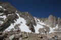 | Mount Pickering This 13,485-foot summit rises above Sky Blue Lake to offer sweeping views of the Sierra. |
 | Old Cottonwood Creek Trail This 8 to 9-mile day hike follows a secluded trail through mountain meadows to the South Fork Lakes and Cirque Lake. |
 | Mount Langley This 22-mile trek travels past Cottonwood Lakes Trail over New Army Pass to a 14,042-foot summit with towering views of the Sierra. |
| Old Cottonwood Creek Trail This 8 to 9-mile day hike follows a secluded trail through mountain meadows to the South Fork Lakes and Cirque Lake. |
 | More trails in the Sierra Nevada Mountains Explore other destinations in Sequoia National Park and the rest of the range. |
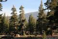 | Horseshoe Meadow Campgrounds This pair of campgrounds offer 40 sites and serve as a great base for the Cottonwood Pass and Cottonwood Lakes trails. |
- Lower Soldier Lake in Sequoia National Park: Your Complete Hiking Guide by Mike White (opens in a new tab)
- Trail and campground status page for the Mount Whitney Ranger District of Inyo National Forest (opens in a new tab)
- Inyo National Forest bear canister page (opens in a new tab)
- The official website for Inyo National Forest (opens in a new tab)
Common Questions about Lower Soldier Lake in Sequoia National Park
- Is the trail open?
- Yes. You should expect to find that Lower Soldier Lake Loop is open. There are no recent reports of trail closures. If you discover that the trail is closed, please help your fellow hikers by reporting a closure.
- Do I need a permit for this hike?
- Yes. National Forest Wilderness Permit and bear canister required for overnight trips.
- How much time does this hike take?
- It takes approximately 9 hours 30 minutes to hike Lower Soldier Lake Loop. Individual hiking times vary. Add extra time for breaks and taking in the views.
- How long is this hike?
- The hike to Lower Soldier Lake Loop is a 19.2 mile loop with 2350 feet of elevation change.
- Are dogs allowed on this trail?
- No, dogs are likely not allowed on Lower Soldier Lake Loop. The trail is primarily open to hikers.
- Is Lower Soldier Lake Loop a difficult hike?
- This hike should be considered strenuous. Hikers should be prepared for a workout covering 19.2 miles and 2350 feet of climbing.
- Is there a lake on this hike?
- Yes, Lower Soldier Lake Loop visits a lake.
- Where is the trailhead located?
- The trailhead for Lower Soldier Lake Loop is located in Lone Pine, CA.
Trailhead Address:
Horseshoe Meadows Road
Lone Pine, CA 93545
Trailhead Coordinates:
36.44834, -118.17065 - What are the driving directions to the start of the hike?
To get to the trailhead: From the city of Lone Pine on Route 395, turn west at the traffic light on Whitney Portal Road. After three miles, turn left on Horseshoe Meadow Road. Drive twenty miles up mountain switchbacks to road's end at Horseshoe Meadow. Cottonwood Pass trailhead is at the east end of the campground. Cottonwood Lakes trailhead is at the end of the paved road to the right. If you hike to Lower Soldier Lake as a loop, the two trailheads are half a mile apart and can be connected through the pack station trail or by passing through the campground and hillside that separate the trailheads.
View custom Google Maps directions from your current location.
- Are there other trails near Lower Soldier Lake Loop?
- Yes, you can find other nearby hikes using the Hikespeak Hike Finder Map.

[…] from the nearest trailhead. Those making the hike typically stay overnight in the area, and nearby Lower Soldier Lake offers great camping for backpackers. From Horseshoe Meadow in the Golden Trout Wilderness, one […]
If you had a choice to volunteer for a conservation research project in either Mulkey or Big Whitney Meadow, which one would you choose?
Thanks!
Hi-
I haven’t been to Mulkey Meadow. Big Whitney Meadow would be great. I don’t think you can go wrong!
[…] You’ll be hiking from Horseshoe Meadow campgrounds in the Sierras over Cottonwood Pass, and on to Lower Soldier Lake. It will be 5 chicks, 1 dude, and a whole lot of […]
[…] take Cottonwood Pass – both will get you to the same place). The camping area we wanted by Lower Soldier Lake was supposedly just on the other side of the pass, and we were ready to go (HA! Idiots.)! There […]
[…] take Cottonwood Pass – both will get you to the same place). The camping area we wanted by Lower Soldier Lake was supposedly just on the other side of the pass, and we were ready to go (HA! Idiots.)! There […]