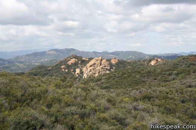
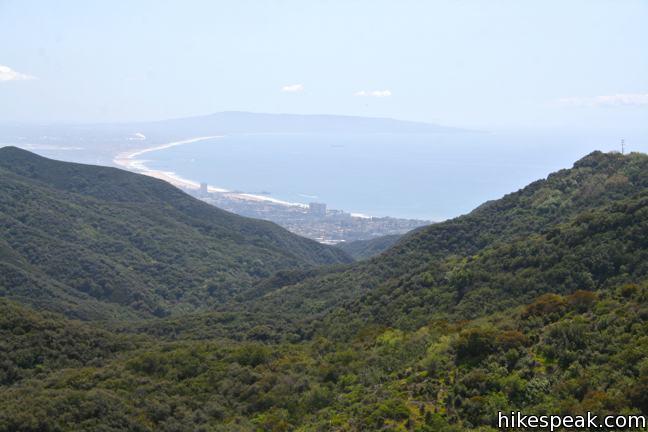
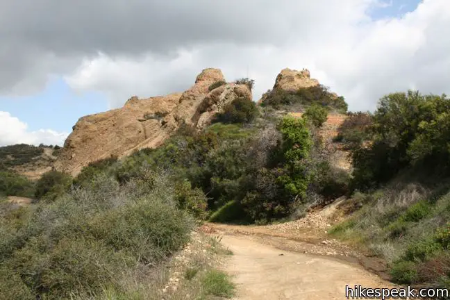
Temescal Peak in the Santa Monica Mountains from Pacific Palisades
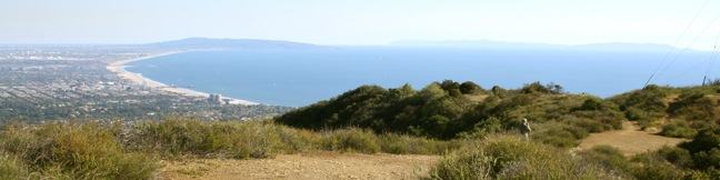
Temescal Peak rises over a wide region of the Santa Mountains triangulated between the Pacific Palisades, Topanga, and Calabasas. The peak sits on Temescal Ridge, which runs north to south between Santa Ynez Canyon and Temescal Canyon in Topanga State Park. Only seventy vertical feet separate the summit from Temescal Ridge Trail, a service road running down the ridge, making the final climb to the top a near effortless ascent. The not-so-prominent peak does manage to provide 360-degree views over the range, and is one of the highest points in the Santa Monica Mountains at 2,126 feet.
Temescal Peak can be reached from a number of trailheads, but this trail report will concentrate on two southern approaches from starting points off Palisades Drive. One route, beginning up Trailer Canyon Fire Road, offers a 7.6-mile round trip hike with 1,200 feet of elevation gain. An easier route starts up Palisades Highlands Access Trail for a 5.8-mile hike with 575 feet of elevation gain. Both options take Temescal Ridge Trail north to the summit. The truly ambitious could also begin hiking from the very bottom of Temescal Ridge Trail in Temescal Gateway Park for a 10.5 miles round trip hike with 1,750 feet of elevation gain. Additionally, hikers can get to Temescal Peak by passing through Hub Junction, extending hikes to Eagle Rock or exploring the north end of Temescal Ridge Trail on a trek to Temescal Peak from Reseda Boulevard.
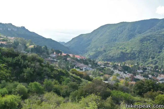
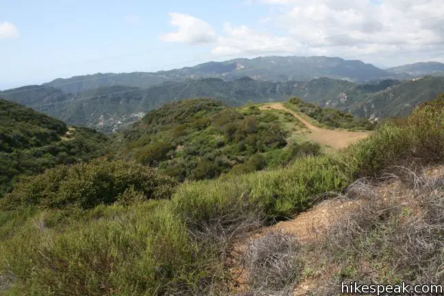
Temescal Peak from Palisades Highlands Access Trail
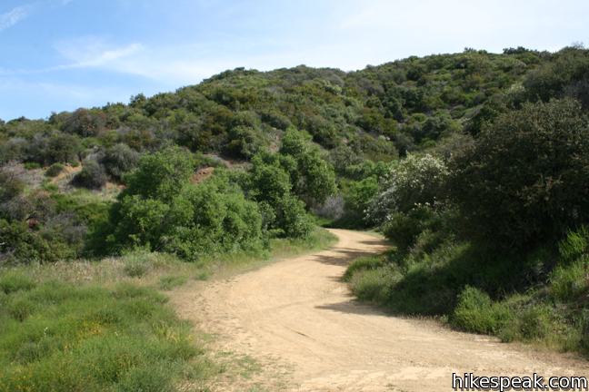
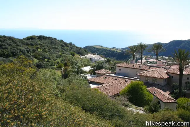
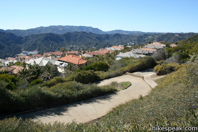
The short route begins up a concrete road built into a steep slope composed of drainage ditches and retainer walls. As you leave the affluent development above Palisades Drive, views over the Pacific Ocean and surrounding mountains expand. While this trail is farther south than Trailer Canyon Fire Road, it begins 625 feet higher up the ridge, making for an easier hike.
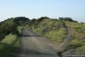
After just a quarter mile, the trail comes to a T-junction with Temescal Ridge Trail. Turn left toward Temescal Peak. To the right, the trail descends 275 feet to Skull Rock, a fun outcropping half a mile down the ridge, before continuing down to Temescal Gateway Park off Sunset Boulevard.
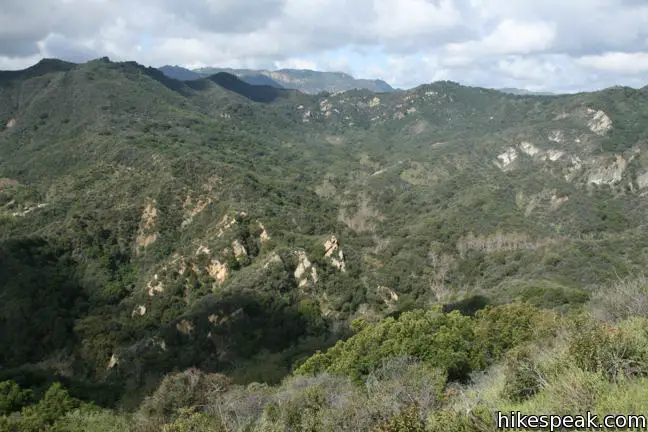
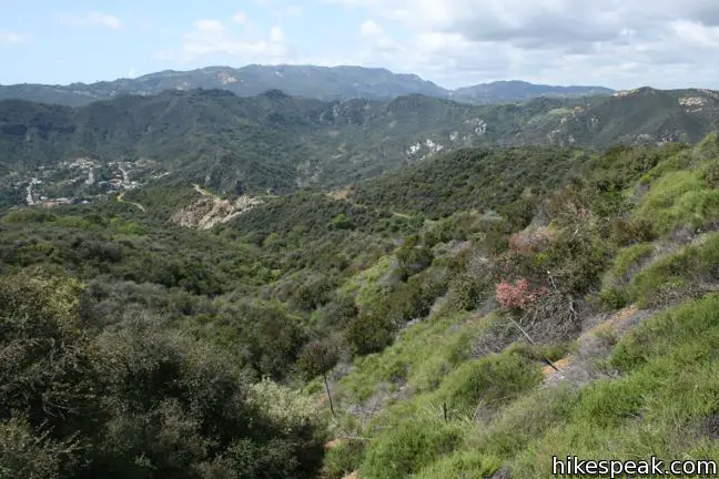
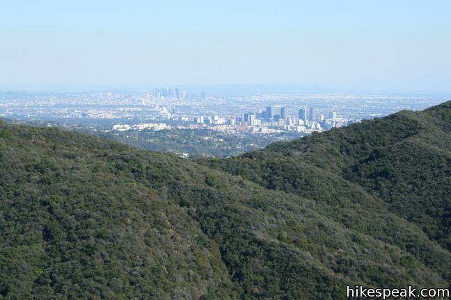
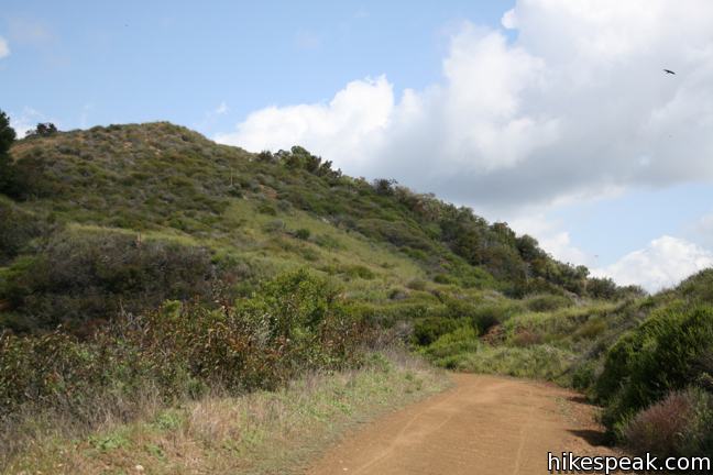
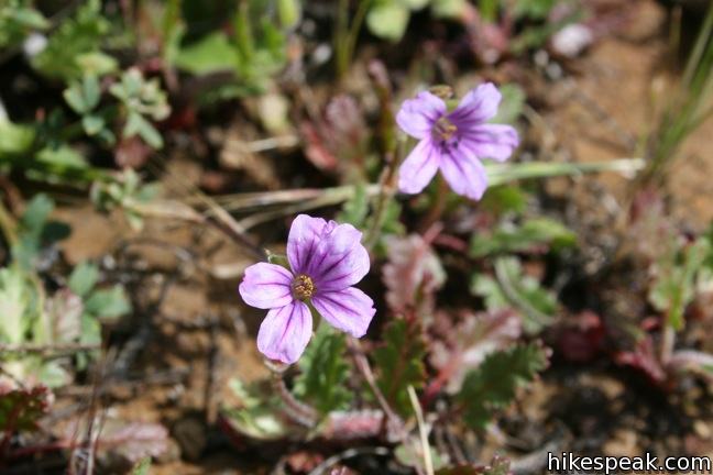
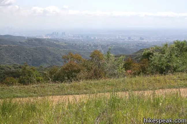
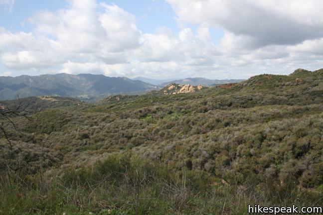
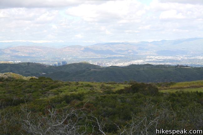
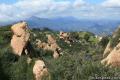
Temescal Ridge is covered in low grasses and sagebrush that enable sweeping views. To the south is a lovely perspective of Santa Monica Bay and the sprawling civilization of Los Angeles. To the east, over the ridges of the Santa Monica Mountains, rise the loftier San Gabriel Mountains.
A third of a mile north of the junction, the road passes through a section of trees and brush that provide some of the only shade on the hike. Less than a mile up the ridge, the road crosses the radio-towered summit of Green Peak at 1,966 feet, and drops down to a junction with Trailer Canyon Fire Road, 1.15 miles from the Palisades Highlands Access Trail. From here it is another mile and a half to Temescal Peak.
Temescal Peak from Trailer Canyon Fire Road
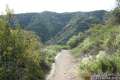
The more challenging route provides excellent views over Santa Ynez Canyon. Begin hiking up the dirt service road, which is well graded except for a few rocky sections, making it a popular mountain biking trail. About 0.3 miles up, the road passes a single out-of-place palm tree, juxtaposed against the indigenous chaparral. The palm stands alongside a small creek that carries rainwater off the ridge.
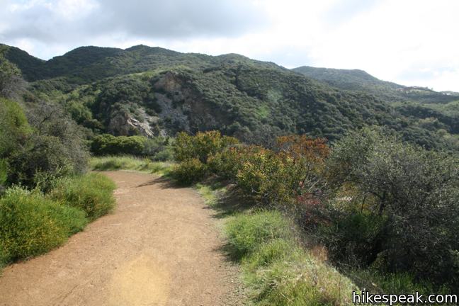
After half a mile, the road swings east, providing broad views over Santa Ynez Canyon and the surrounding mountains. Three-quarters of a mile from the start, the trail passes through a metal gate and enters Topanga State Park.
To the left, a small footpath ascends a clay gully and crosses a lush ridge up to Temescal Ridge Trail. After 2/3 of a mile, this steep track reaches a landing on Temescal Ridge just north of the top of Trailer Canyon Fire Road. No time or energy is saved by taking this route. The trail is rarely used and extremely overgrown, probably receiving more traffic from animals than humans. This is definitely the toughest way up, so wear long pants and prepare to bushwhack through brush if you decide to trek this way.
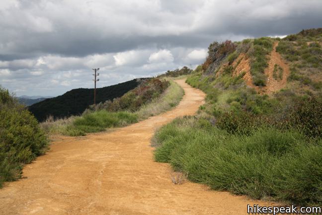
The more sensible option is to continue up Trailer Canyon Fire Road, which weaves progressively farther up the ridge, gaining 550 feet over 1.5 miles to reach Temescal Ridge. The views expand as you go, and the wide road provides easy travel. When you come to the end of the road, turn left and head north up Temescal Ridge Trail.
Reaching Temescal Peak
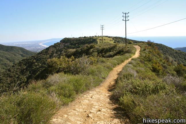
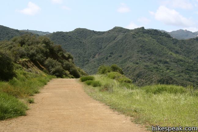
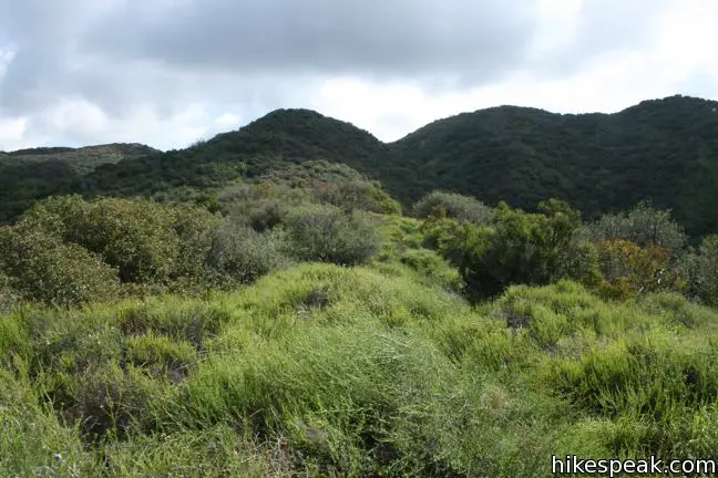
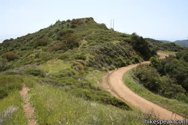
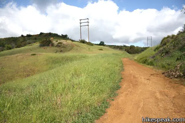
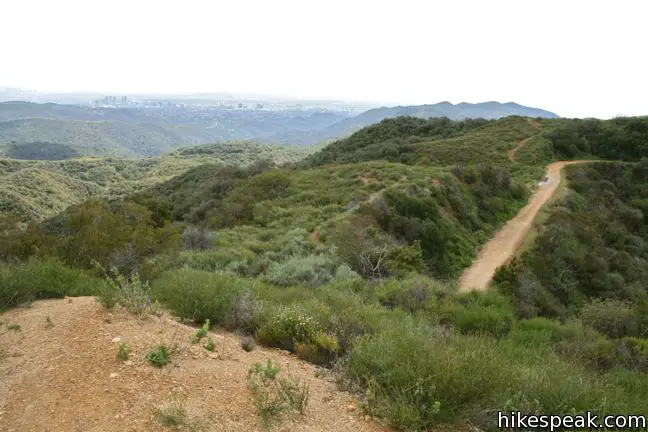
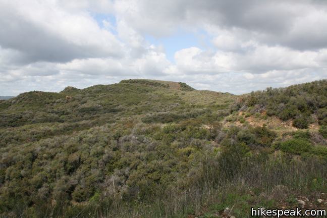
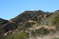
Follow the winding road up Temescal Ridge. The broad views are only slightly diminished by power lines sharing the ridge. In addition to the service road, a single track runs along the ridge parallel to the road. Similar to the hiking experience on the ridges to the east (Sullivan Ridge, Westridge, and Canyonback Ridge), the single track can be used to add fun variety to the hike for those keen to stray from the service road and explore more of the contours of Temescal Ridge. Temescal Peak happens to be the highest point on the ridge, but many of the other crests are only a hundred feet shorter. The single track crosses all of these undulations, offering extra exercise to those who venture off the road.
A gradual mile and a half from the top of Trailer Canyon Fire Road, Temescal Ridge Trail wraps around Temescal Peak and comes to a junction with the Backbone Trail, starting its westward journey from Will Rogers State Park to Point Mugu State Park. Prior to this, a footpath leaves the road and goes up the south side of the peak, but because the summit is only 70 feet above the road and not much taller than previous crests, it is easy to walk right past the turnoff.
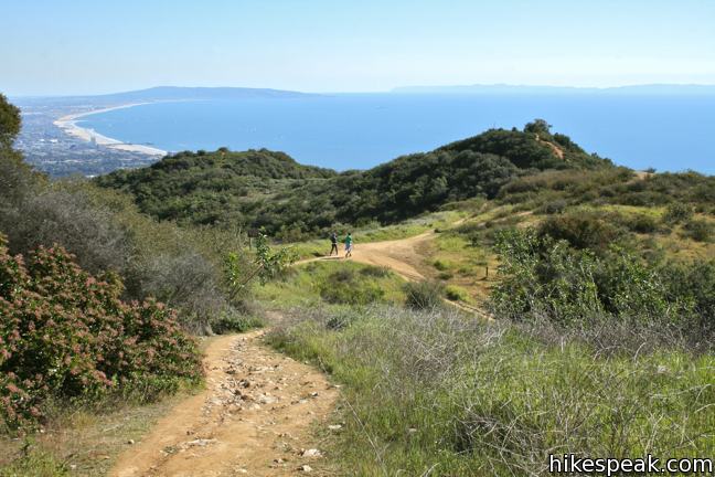
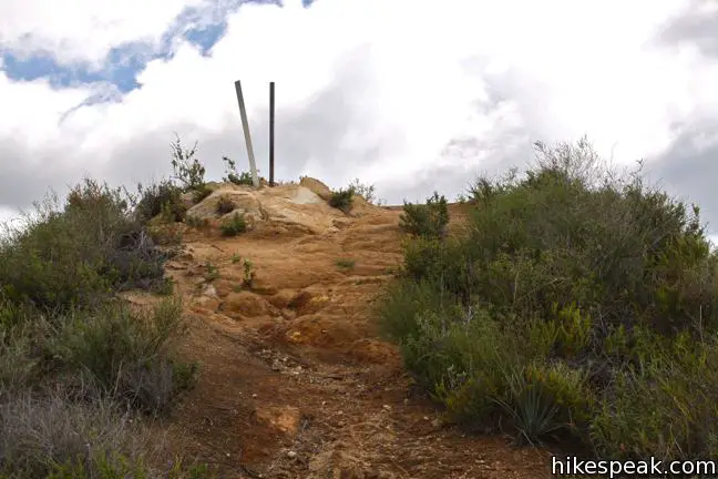
Backbone Trail provides the most obvious route to the top of Temescal Peak. Turn right up the singe track and backtrack around the crown of Temescal Peak. After just a tenth of a mile, break off to the left on one of the footpaths to the top of the peak, another tenth of a mile up. Two poles and a USGS survey marker sit at the summit. To the east, a majestic series of rolling ridges leads to San Vicente Mountain. To the north spreads San Fernando Valley. To the northwest are more beautiful mountains, including an alluring nearby outcropping, Eagle Rock. To the south is a long view down Temescal Ridge toward Santa Monica Bay. Take in the plentiful views before returning south or continuing north.
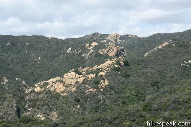
To extend the hike, drop back down to the Backbone Trail junction and turn right, taking Temescal Ridge Trail across a long saddle to Hub Junction, half a mile to the north. This major trail intersection allows hiking in new directions. One fine extension is a 2.5-mile loop to Eagle Rock, a scenic sandstone summit to the west. Alternately, those who hike up to Eagle Rock from Santa Ynez Canyon or Trippet Ranch may hike an additional 1.85 miles (one way) to summit Temescal Peak. Another way to reach the peak is to hike up to Hub Junction from the north from a trailhead at the top of Reseda Boulevard.
No matter how far you hike in Topanga State Park, you are sure to enjoy immense views over a truly scenic stretch of the Santa Monica Mountains. This trek up Temescal Ridge quickly transports hikers from city streets to mountain peaks for a refreshing immersion in nature. No fee or permit is required to hike to Temescal Peak. Mountain bikes are welcome, so get out and enjoy.
Directions to the Trailhead
Palisades Highlands Access Trail:
- From Sunset Boulevard, half a mile east of PCH, head north on Palisades Drive.
- After 3.3 miles, continue straight on Chastain Parkway for another half a mile.
- Turn right on Via Las Palmas, and drive two short blocks up to the trailhead parking on the left.
- The trail will be on the right.
Trailer Canyon Fire Road:
- From Sunset Boulevard, half a mile east of PCH, head north on Palisades Drive.
- After 2.4 miles.
- Turn left onto Vereda de la Montura, (the same turnoff for the trailhead for hikes in Santa Ynez Canyon to Santa Ynez Falls and Eagle Rock) and make an immediate right on Michael Lane.
- Drive half a mile to the trailhead, which will be on the left.
- Street parking is available on Michael Lane.
Trailhead Location
Trailhead address: Palisades Highlands Access Trail, Via Las Palmas, Pacific Palisades, CA 90272
Trailhead coordinates: 34.07631, -118.5462 (34° 04′ 34.7″N 118° 32′ 46.3″W)
Trailhead address: Trailer Canyon Fire Road Trailhead, 1803 Michael Lane, Pacific Palisades, CA 90272
Trailhead coordinates: 34.07863, -118.55997 (34° 04′ 43.06″N 118° 33′ 35.9″W)
View Santa Monica Mountains in a larger map
Or view a regional map of surrounding Los Angeles trails and campgrounds.
Trailer Canyon Fire Road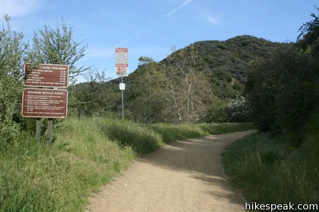


Palisades Highlands Access Trail
Temescal Ridge Trail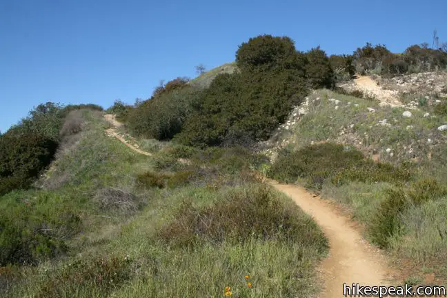


 | Skull Rock This 1.5-mile hike descends Temescal Ridge to a head-shaped formation with great views over Santa Monica Bay. |
 | Eagle Rock from Trippet Ranch This 4.5-mile loop takes Musch Trail and Eagle Springs Fire Road to visit an exceptional sandstone summit in Topanga State Park. |
 | Eagle Rock from Santa Ynez Canyon This 7.4-mile hike takes the long route from a canyon in the Pacific Palisades up to the panoramic sandstone summit. |
 | Santa Ynez Falls This 2.5-mile follows a shaded creek to a gorge containing a short waterfall. |
 | Temescal Canyon This 2.6-mile loop offers a variety of scenery and decent exercise, despite its relative brevity. |
 | Rivas Canyon This 2.1-mile (one way) trail crosses a lush secluded canyon connecting Temescal Gateway Park to Will Rogers State Park. |
 | Parker Mesa Overlook This steep out-and-back hike rewards the effort with excellent views of the Pacific Ocean. |
 | Los Liones Trail This hike visits a lust canyon with ocean views, a potential start of the hike to Parker Mesa Overlook. |
 | Hub Junction from Reseda Boulevard This 5.3 to 5.45-mile hike from the edge of the San Fernando Valley goes through Topanga State Park to a scenic junction at the crossroads of the Eastern Santa Monica Mountains. Extend the trek to 6.85 miles round trip by summiting Temescal Peak or to 7.95 miles round trip by taking a loop to Eagle Rock. |
 | More trails in the Santa Monica Mountains Explore other destinations in the range. |
 | Mandeville Canyon to San Vicente Mountain Loop This 5-mile hike incorporating a few trails, taking a DWP road up to Westridge to visit San Vicente Mountain, before crossing Mulholland Drive and Canyonback Ridge to return to Mandeville Canyon via Hollyhock Fire Road. |
 | Westridge Trail to San Vicente Mountain This 7.4-mile hike travels a scenic ridge between a Brentwood neighborhood and a summit that was once used as a Nike Missile site. |
 | Calabasas Peak This 3.6-mile hike travels an easy-to-follow fire road, climbing 900 feet to panoramic views of the Santa Monica Mountains and San Fernando Valley. |
 | Castro Crest from Latigo Canyon Road This 3.8-mile hike crosses a green canyon and climbs to a scenic saddle below Castro Peak. |
 | Saddle Peak from Stunt High Trail This 7.5-mile hike combines Stunt High Trail and a section of the Backbone Trail to visit the 6th tallest summit in the Santa Monica Mountains. |
Common Questions about Temescal Peak in the Santa Monica Mountains from Pacific Palisades
- Is the trail open?
- Yes. You should expect to find that Trailer Canyon Fire Road & Temescal Ridge Trail to Temescal Peak is open. There are no recent reports of trail closures. If you discover that the trail is closed, please help your fellow hikers by reporting a closure.
- Is this trail free to access?
- Yes, Trailer Canyon Fire Road & Temescal Ridge Trail to Temescal Peak is free to access. No entrance fee, pass, or permit is required. If you discover that access rules have changed, please provide feedback on your experience.
- How much time does this hike take?
- It takes approximately 2 hours 45 minutes to hike Trailer Canyon Fire Road & Temescal Ridge Trail to Temescal Peak. Individual hiking times vary. Add extra time for breaks and taking in the views.
- How long is this hike?
- The hike to Trailer Canyon Fire Road & Temescal Ridge Trail to Temescal Peak is 5.8 or 7.6 miles (out and back) with 575 or 1200 feet of elevation change.
- Are dogs allowed on this trail?
- No, dogs are likely not allowed on Trailer Canyon Fire Road & Temescal Ridge Trail to Temescal Peak. The trail is primarily open to hikers, bikes.
- Does this trail go to a summit?
- Yes, Trailer Canyon Fire Road & Temescal Ridge Trail to Temescal Peak reaches a summit with panoramic views.
- What mountain range is this trail in?
- Trailer Canyon Fire Road & Temescal Ridge Trail to Temescal Peak is located in the Santa Monica Mountains.
- Where is the trailhead located?
- The trailhead for Trailer Canyon Fire Road & Temescal Ridge Trail to Temescal Peak is located in Pacific Palisades, CA.
Trailhead Address:
Via Las Palmas
Pacific Palisades, CA 90272
Trailhead Coordinates:
34.07631, -118.5462 - What are the driving directions to the start of the hike?
To get to the trailhead: Palisades Highlands Access Trail: From Sunset Boulevard, half a mile east of PCH, head north on Palisades Drive. After 3.3 miles, continue straight on Chastain Parkway for another half a mile. Turn right on Via Las Palmas, and drive two short blocks up to the trailhead parking on the left. The trail will be on the right.
Trailer Canyon Fire Road: From Sunset Boulevard, half a mile east of PCH, head north on Palisades Drive. After 2.4 miles. Turn left onto Vereda de la Montura, (the same turnoff for the trailhead for hikes in Santa Ynez Canyon to Santa Ynez Falls and Eagle Rock) and make an immediate right on Michael Lane. Drive half a mile to the trailhead, which will be on the left. Street parking is available on Michael Lane.
View custom Google Maps directions from your current location.
- Are there other trails near Trailer Canyon Fire Road & Temescal Ridge Trail to Temescal Peak?
- Yes, you can find other nearby hikes using the Hikespeak Hike Finder Map.

[…] Photo blog: Temescal Ridge Trail in Topanga State Park, California […]
Can dogs go on the Fire Road and can they be off leash? Have you encountered any rattlesnakes on the Fire Road?
Dogs are not allowed on this hike. There are rattlesnakes in the Santa Monica Mountains, but I don’t recall spotting any on this hike
[…] un intento por pasar un rato agradable durante este fin de semana festivo, hice un viaje corto al Pico Temescal en Topanga State Park, desde Palisades Highlands. Como pensaba, las vistas a lo largo de lo que […]
[…] A good description of access and the hike is here: http://www.hikespeak.com/trails/temescal-peak/ […]
Will the trail be open Christmas Day?