
Nature just seems a bit wilder in Tasmania. On the slopes of Mount Wellington in Hobart’s Wellington Park, there’s an Octopus Tree that takes its name from thick tentacle-like roots that wrap around a boulder below the tree. It’s only a 0.3-kilometer walk to the tree from Shoobridge Bend on Pinnacles Road and the tree can be visited on a loop by incorporating Circle Track for an easy and enjoyable 1.1-kilometer (0.7-mile) hike that passes through a dense mossy forest.
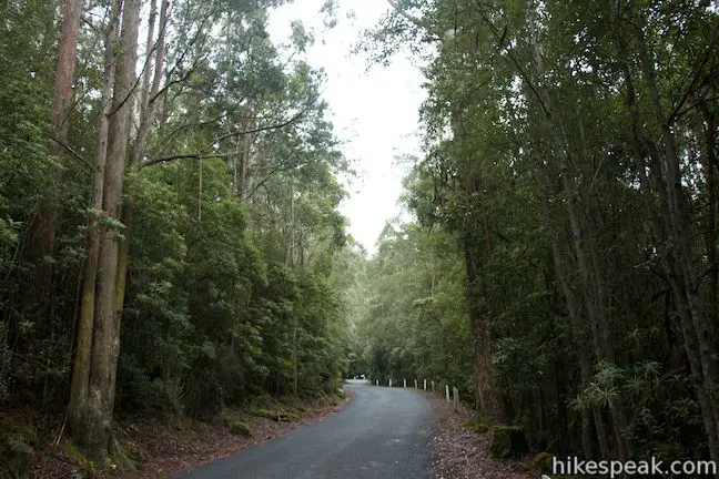
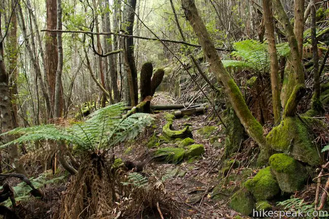
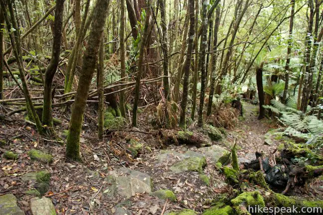
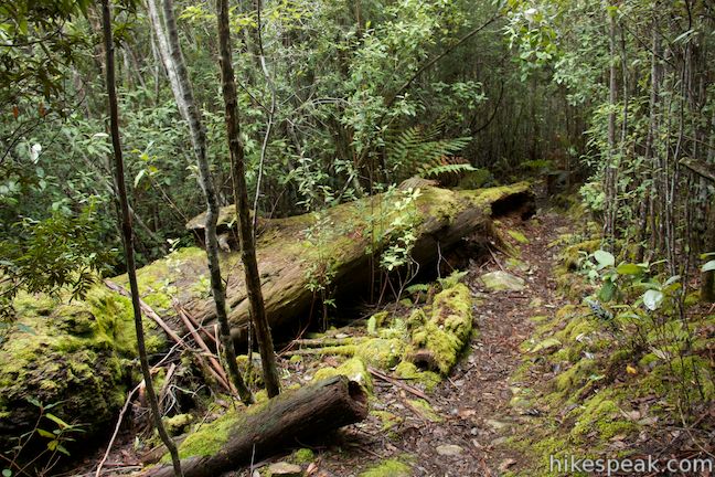
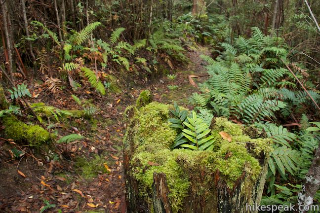
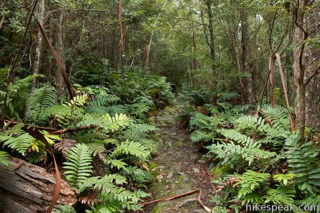
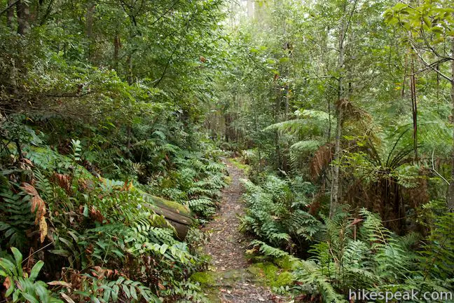
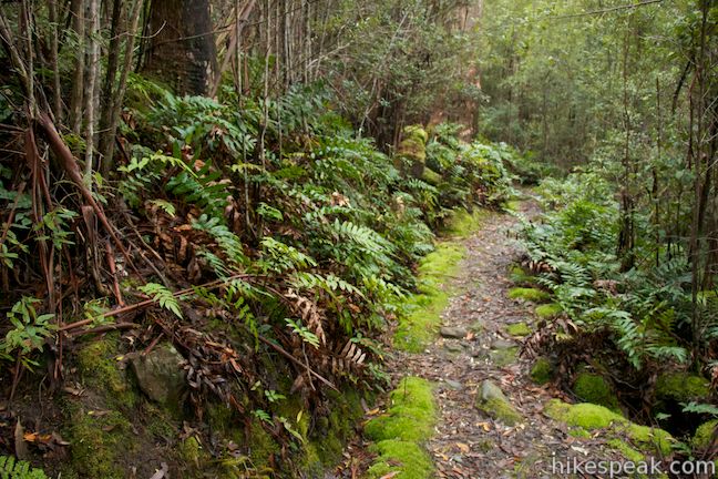
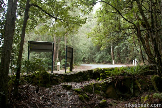
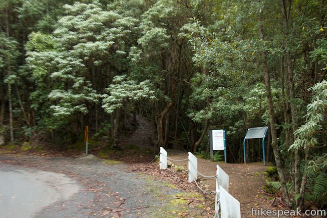
The loop begins from Shoobridge Bend, a pronounced horseshoe bend on Pinnacles Road, nine kilometers below the summit of Mount Wellington. The direct route to the Octopus Tree starts from the outside of this hard left bend in Pinnacles Road. There is a car park on the left just before the turn that is a convenient place to leave a vehicle. The start of Circle Track is farther down the road across from the car park. Walk a hundred meters down the road from the parking area and turn left down Circle Track, which is marked with a sign. Circle Track heads down the mountainside into a fern-covered forest full of fallen trees and rocks covered in vibrant green moss.
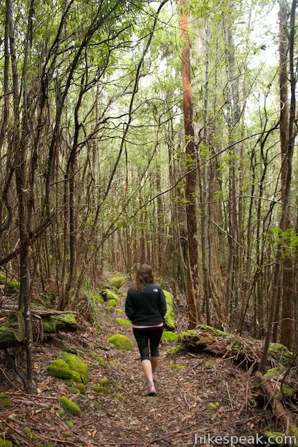
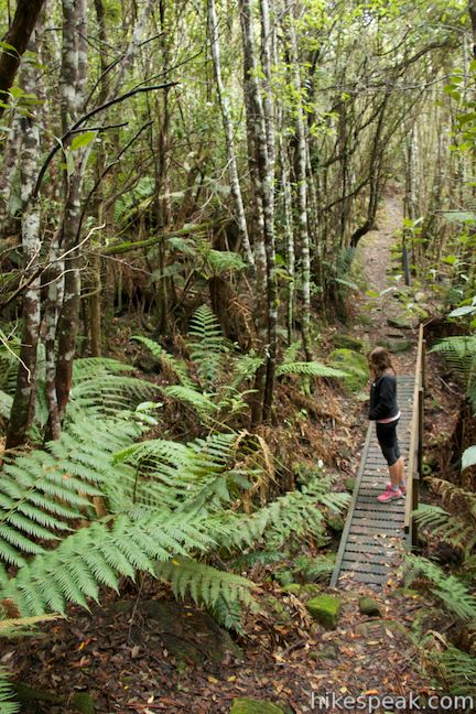
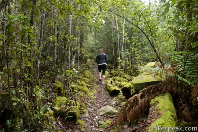
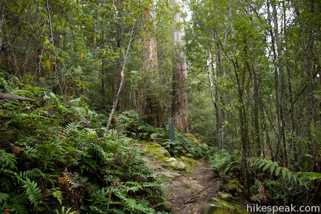
Circle Track progresses downhill for 200 meters to a wooden footbridge over a trickling stream. Turn uphill on the other side of the short bridge and pass a junction with Betts Vale Track, staying to the left to continue on Circle Track. The single-track trail makes a sharp left bend and ascends to a junction with Shoobridge Track, 0.5 kilometers into the hike. The return route to Pinnacles Road is to the left, but turn right first to venture off the loop to the impressive Octopus Tree.
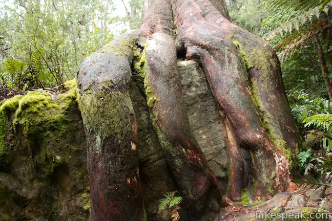
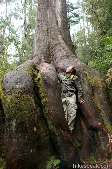
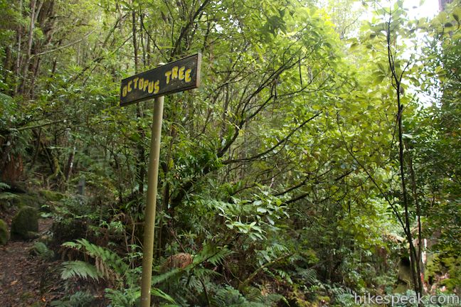
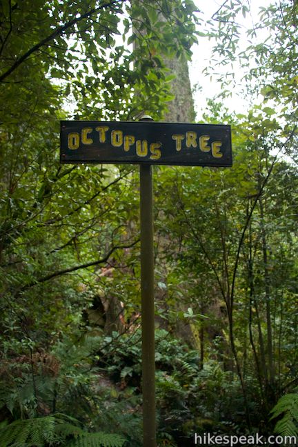
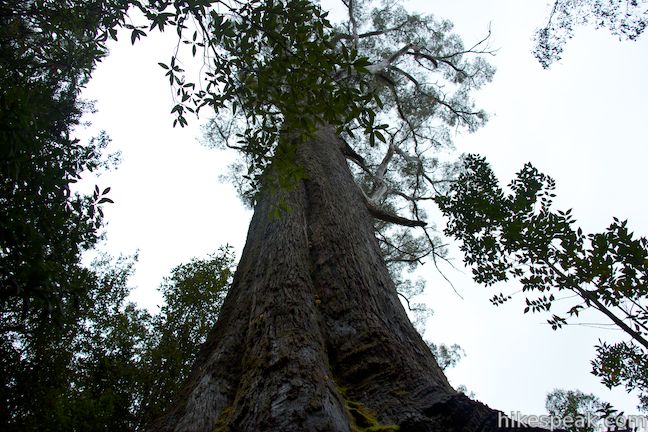
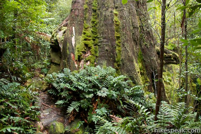
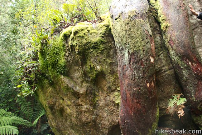
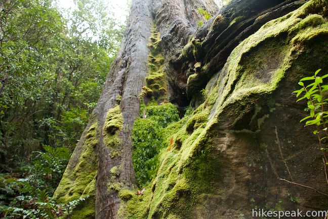
After less than a quarter of a kilometer of level hiking on Shoobridge Track, you will see a funky sign labeled Octopus Tree. Take the spur trail below the sign, which descends to the right toward a tall eucalyptus tree that stands atop a large boulder rising above the rest of the mountainside. The tree’s thick roots grow around the rock like the tentacles of an octopus. You can walk all the way around the base of the tree, but the left side is the one that most resembles an octopus. Four large finger-like roots extend from the trunk and clutch the boulder below like fingers around a ball. The octopus’s tentacles aren’t as obvious on the other side of the boulder, but there is an octopus’s garden of ferns, fungi, and moss clinging to the roots and rock on that side of the tree.
After checkout out the Octopus Tree, return to Shoobridge Track and turn left to walk back to the junction with Circle Track. Continue straight (which would have originally been a left turn) and Shoobridge Track takes you back to Pinnacles Road in another tenth of a mile. If you parked in the area between the two ends of the loop, your vehicle will be visible just down the road to the left.
Octopus Tree is an interesting attraction in Wellington Park, and the 1.1-kilometer (0.7-mile) loop on Circle Track to Octopus Tree is a good short walk to explore along the drive up Pinnacles Road (toward the Pinnacles Boardwalk at the summit). Bikes are not permitted on Circle Track and Shoobridge Track, but dogs are allowed on leashes. No fee or permit is required to hike to Octopus Tree in Wellington Park, so get out and enjoy!
Directions to the Trailhead
- From the central business district of Hobart, where Highway 1 and A3 merge, continue south on Davey Street (A6).
- After 2 kilometers, stay to the right to continue straight through an intersection with Sothern Outlet (A6) and proceed up Davey Street (B54).
- After another 900 meters, Davey Street becomes Huon Road and curves to the right.
- Drive another 6.3 kilometers up Heon Road and make a very sharp right turn up Pillinger Drive (C616) toward Mount Wellington.
- Pillinger Drive turns into Pinnacles Road.
- From the intersection, it is 2.6 kilometers up to the car park at Shoobridge Bend where the loop begins.
Trailhead Location
Trailhead address: Pinnacle Road, Wellington Park, TAS 7054, Australia
Trailhead coordinates: -42.908751, 147.24798 (42° 54′ 31.50″S 147° 14′ 52.72″E)
You may also view a regional map of surrounding Australian trails, campgrounds, and lodging.


 | Pinnacles Boardwalk & Summit Trig The 0.3-kilometer round trip walk on Pinnacles Boardwalk can easily be extended to a 0.75-kilometer walk on the top of Mount Wellington, checking out another short boardwalk and the trig station at the summit. |
 | Tasmans Arch & Devils Kitchen This 0.9-mile walk visits two impressive features on the coast of the Tasman Peninsula, a natural bridge and a chasm carved by the sea. |
 | Blowhole & Fossil Bay Lookout This short walk in Tasman National Park reaches a coastal vista point and a wave-carved tunnel through a rocky point that has the potential to spray up like a whale spout. |
 | Coal Mines Historic Site This 0.8-kilometer loop through the Convict Precinct explores the ruins of an old prison and coal mine that relied on convict laborers. |
 | Cape Raoul This 12 to 14-kilometer hike explores the pristine coastline at the southwest end of the Tasman Peninsula, reaching a cape with daunting 200-meter tall cliffs dropping to swirling seas. |
 | Russell Falls & Horseshoe Falls This hike in Mount Field National Park visits one of Tasmania's most famous and beautiful waterfalls and can be extended from 1.8 to 2.65 kilometers by venturing to the top of Russell Falls and nearby Horseshoe Falls. |
 | Liffey Falls This 2.2-kilometer walk passes the Upper Cascades on the Liffey River to reach the base of lovely Liffey Falls, one of Tasmania's finest waterfalls. |
 | Cataract Gorge This 3.4-kilometer loop combines Zig-Zag Track, Cataract Walk, and Bridge Walk to explore Cataract Gorge Reserve, an impressive natural area just outside the center of Launceston. |
 | Friendly Beaches This hike explores a long, pristine beach on the east coast of Tasmania north of the Freycinet Peninsula. |
 | Cape Tourville This 0.6-kilometer circuit provides big views along the east coast of Freycinet Peninsula, circling 100-meter tall bluffs to reach the Cape Tourville Lighthouse. |
 | Wineglass Bay and Hazards Beach Circuit This approximately 12-kilometer loop takes a rewarding route through Freycinet National Park, visiting pristine light sand beaches at Hazards Beach and the renowned Wineglass Bay. |
 | Apsley Waterhole & Lookout Track This 1.4-kilometer loop travels through a eucalyptus forest to a popular swimming hole on the Apsley River in Douglas-Apsley National Park. |
 | Saint Columba Falls This 1.2-kilometer round trip hike descends into a rainforest to the base of a powerful 90-meter tall waterfall. |
 | Mount William This 3.6-kilometer out and back hike tops a short summit that is the high point of Mount William National Park with panoramic views over the coastline at the northeast corner of Tasmania. |
 | More trails in Australia Explore other destinations in Victoria and Tasmania, Australia. |
Common Questions about Octopus Tree and Circle Track in Wellington Park
- Is the trail open?
- Yes. You should expect to find that Octopus Tree & Circle Track is open. There are no recent reports of trail closures. If you discover that the trail is closed, please help your fellow hikers by reporting a closure.
- Is this trail free to access?
- Yes, Octopus Tree & Circle Track is free to access. No entrance fee, pass, or permit is required. If you discover that access rules have changed, please provide feedback on your experience.
- How much time does this hike take?
- It takes approximately 15 minutes to hike Octopus Tree & Circle Track. Individual hiking times vary. Add extra time for breaks and taking in the views.
- How long is this hike?
- The hike to Octopus Tree & Circle Track is a 1.1 km / 0.7 mile loop with 50 meters / 165 feet of elevation change.
- Are dogs allowed on this trail?
- Yes, dogs are allowed on Octopus Tree & Circle Track. The trail is open to hikers, dogs.
- Is Octopus Tree & Circle Track good for kids?
- Yes, this hike is likely suitable for children. It is relatively short (0.7 miles) with manageable elevation gain.
- Where is the trailhead located?
- The trailhead for Octopus Tree & Circle Track is located in Wellington Park, Tasmania.
Trailhead Address:
Pinnacle Road
Wellington Park, Tasmania 7054
Trailhead Coordinates:
-42.908751, 147.24798 - What are the driving directions to the start of the hike?
To get to the trailhead: From the central business district of Hobart, where Highway 1 and A3 merge, continue south on Davey Street (A6). After 2 kilometers, stay to the right to continue straight through an intersection with Sothern Outlet (A6) and proceed up Davey Street (B54). After another 900 meters, Davey Street becomes Huon Road and curves to the right. Drive another 6.3 kilometers up Heon Road and make a very sharp right turn up Pillinger Drive (C616) toward Mount Wellington. Pillinger Drive turns into Pinnacles Road. From the intersection, it is 2.6 kilometers up to the car park at Shoobridge Bend where the loop begins.
View custom Google Maps directions from your current location.
- Are there other trails near Octopus Tree & Circle Track?
- Yes, you can find other nearby hikes using the Hikespeak Hike Finder Map.

Please note that in Australia, we do not use miles or feet any more. We use metres and Kilometres, NOT meters (instruments or gauges)and kilometers. (Please note the correct spelling). Thank you!
This website is written in American English and offers both metric and imperial measurements for hikes in Australia and New Zealand.
I’m 5ft 11 and everyone else I know is 5 foot something.
Circle Track is now only a half circle running from Shoobridge Track down to Betts Vale Track. It does not connect back to Pinnacle Road since about 2018. See Open Street Map for up to date track info.