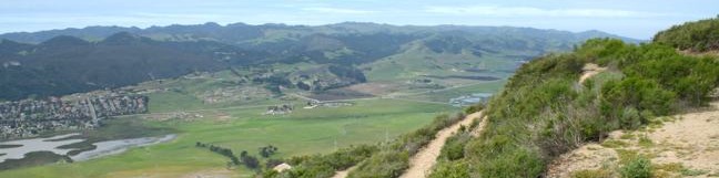
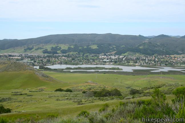
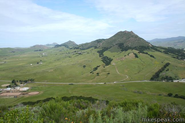
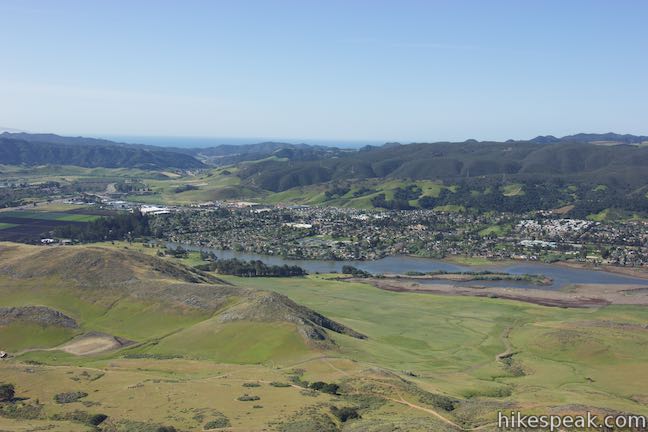
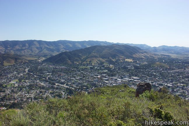
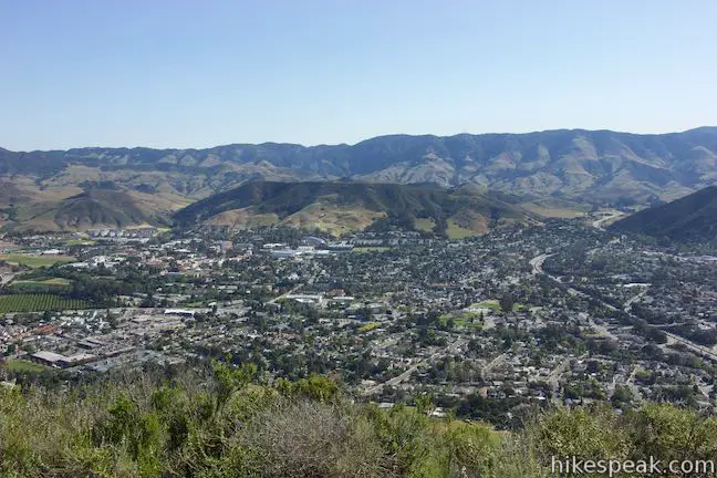
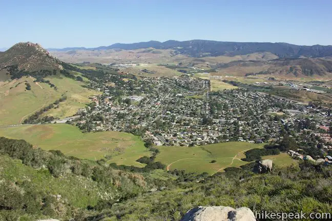
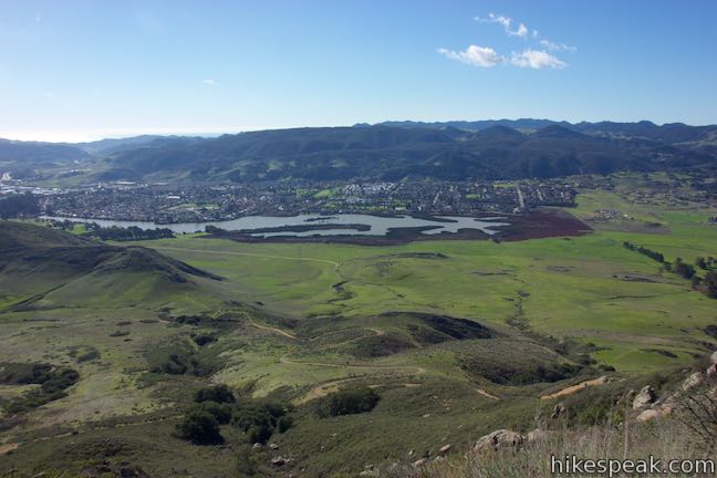
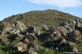
Located just west of downtown San Luis Obispo, the 1,292-foot Cerro San Luis (or San Luis Mountain) offers sweeping views over the city and surroundings. Cerro San Luis is a member of the Morros, or Nine Sisters, a chain of prominent volcanic peaks stretching east from Morro Bay. These beautiful peaks set the postcard-like backdrop for San Luis Obispo and are excellent places to hike.
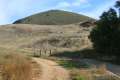
Several trails explore Cerro San Luis, and its proximity to downtown makes it quite popular with hikers. The main trail to the summit begins from the end of Marsh Street just before the on ramp to Highway 101, providing a four mile out and back hike with 1,100 feet of elevation change.
Variations: The hike up Cerro San Luis can be converted to a 5-mile round trip hike by using an alternate trail in one direction to loop back through other areas of the mountain. Lemon Grove Loop Trail overlaps the first half-mile of the hike and can be tacked on to the trek to extend the hike by 1.5 miles. Another alternative is to hike 5.7 miles round trip from Laguna Lake Park to the summit of Cerro San Luis.
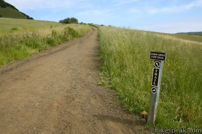
Just a tenth of a mile from the trailhead, stay to the left through a junction with Lemon Grove Loop Trail. Angle northwest up the skirt of the peak through a mixture of Prickly peak cactus and sage. After passing a restful park bench, make another left, half a mile from the start, to leave Lemon Grove Loop Trail on a track to the summit. Turn left again when you meet a path heading back toward Lemon Grove Loop Trail.
Cross the southern side of the mountain. Go through an oak grove and stay to the left through a junction with “M” Trail, which climbs up to the white “M” on the side of the mountain. The “M” represents Mission Prep School, the way the P on Yucca Ridge represents Cal Poly. Beyond the letter, “M” Trail descends toward Lemon Grove Loop Trail, opening up other loop options, like Lemon Grove and “M” Trails Loop.
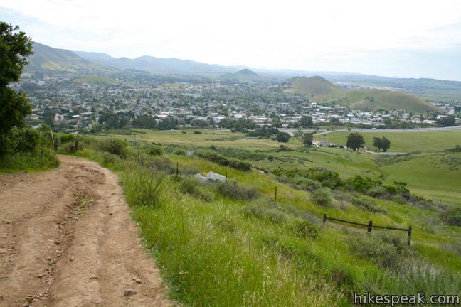
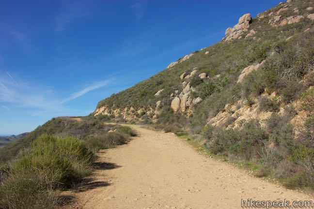
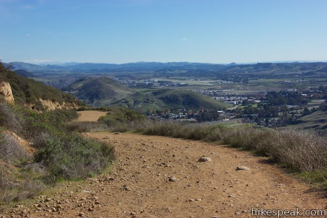
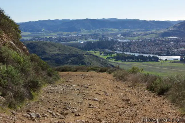
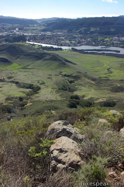
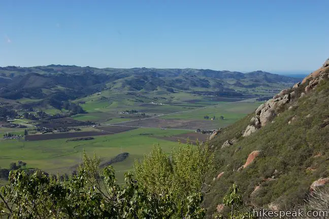
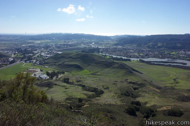
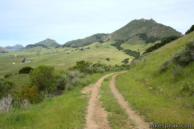
Stay on Cerro San Luis Trail past the “M” Trail. Continue west until you reach a wide dirt road, one mile from the start. This road was bulldozed by an angry Alex Madonna after the city denied his petition to build an alpine-themed convention center at the top of Cerro San Luis. To the left, the road descends to the stables behind Madonna Inn. Part of this trail is also used by hikers making the extended ascent from Laguna Lake Park.
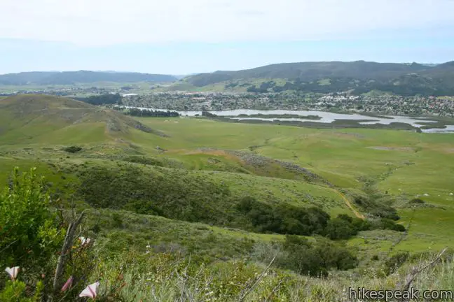
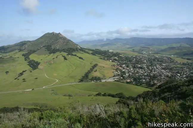
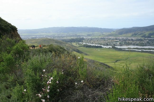
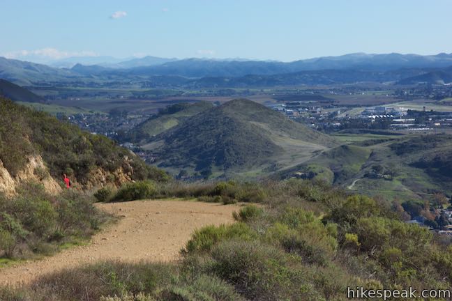
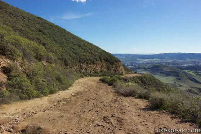
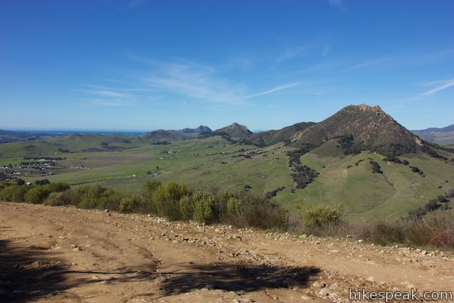
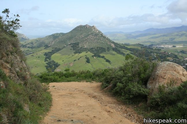
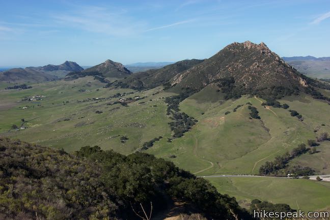
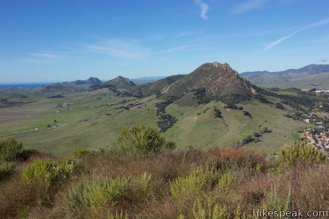
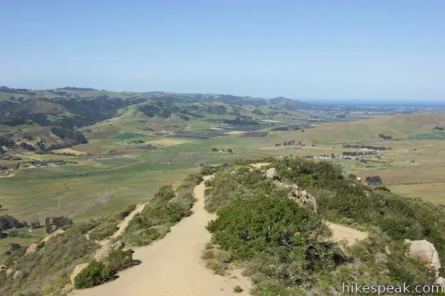
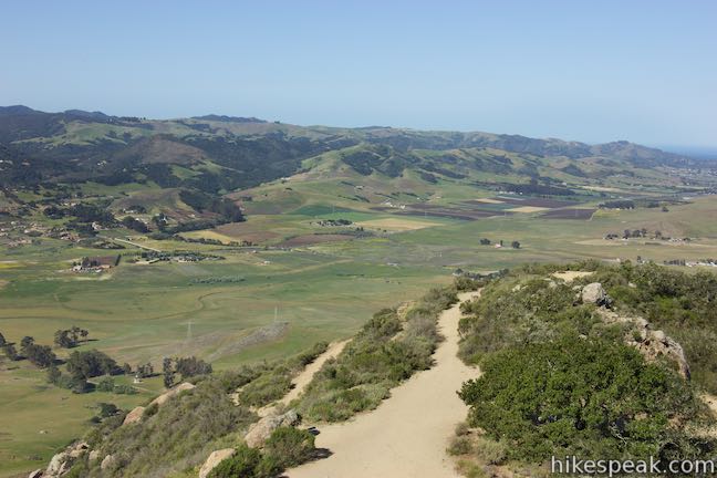
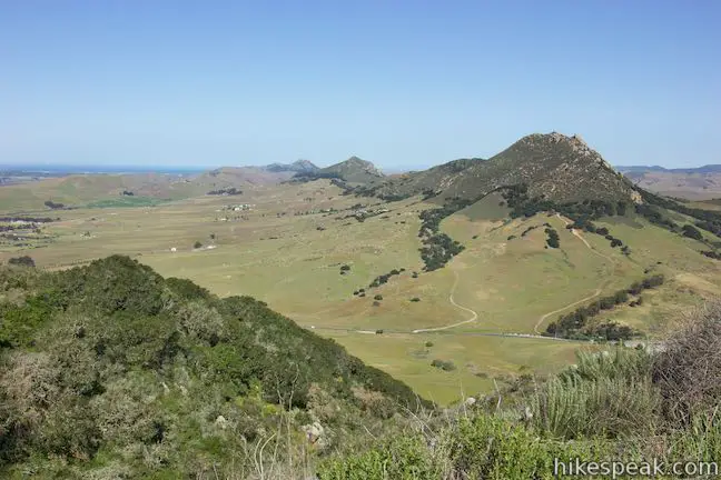
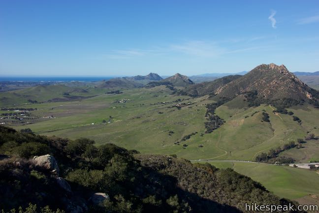
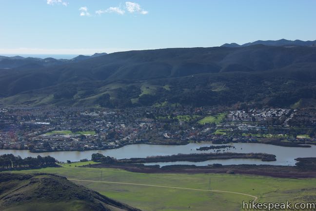
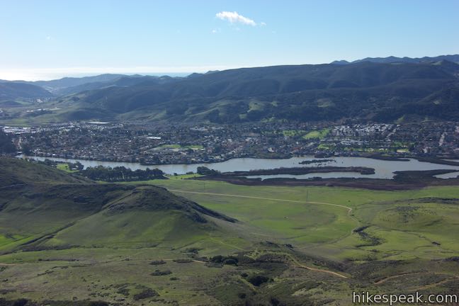
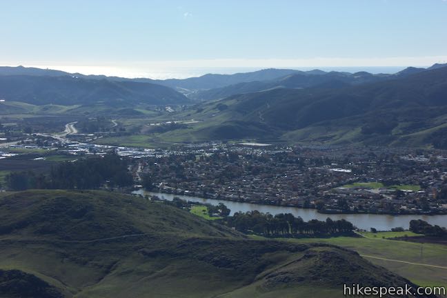
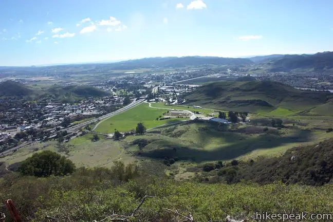
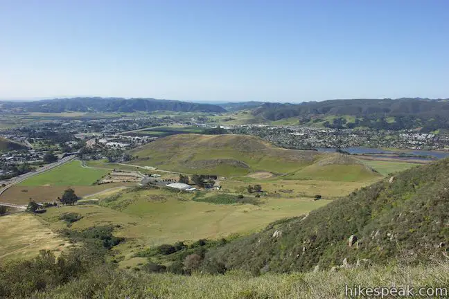
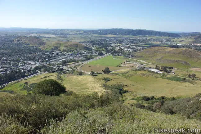
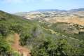
Turn right and hike the final mile up this broad trail to the summit. After 0.4 miles, the trail bends around the northwestern slope of the mountain to offer a fantastic view of Bishop Peak. Three other Morros, Chumash Peak, Cerro Romualdo, and Hollister Peak, can also be seen from this vantage point.
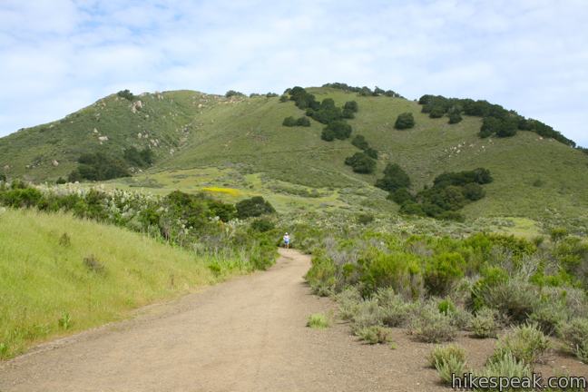
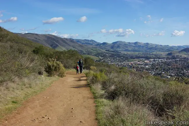
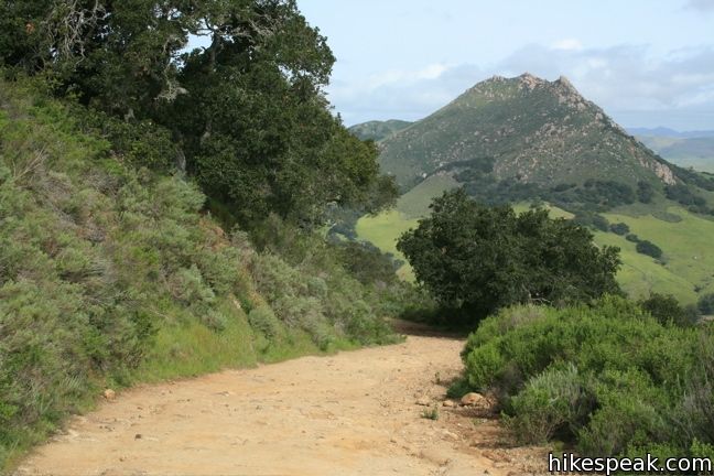
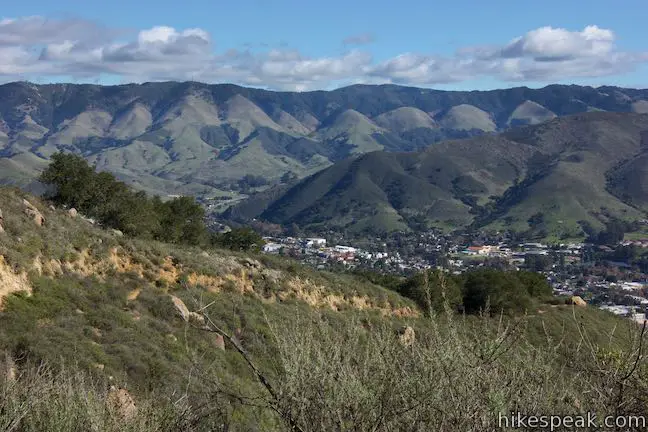
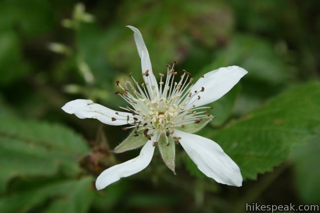
The trail swings up the north side of the mountain as the vegetation thickens. Coast live oaks provide occasional shade, while Indian paintbrush, morning glories, Lupines, monkeyflower, and other wildflowers add splashes of color along the trail in the spring.
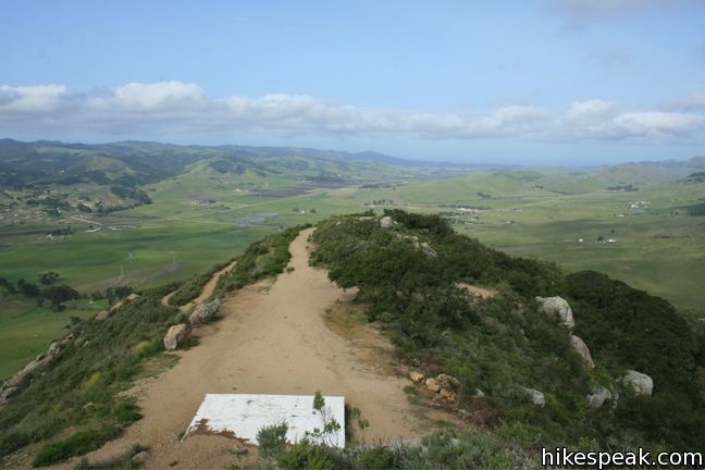
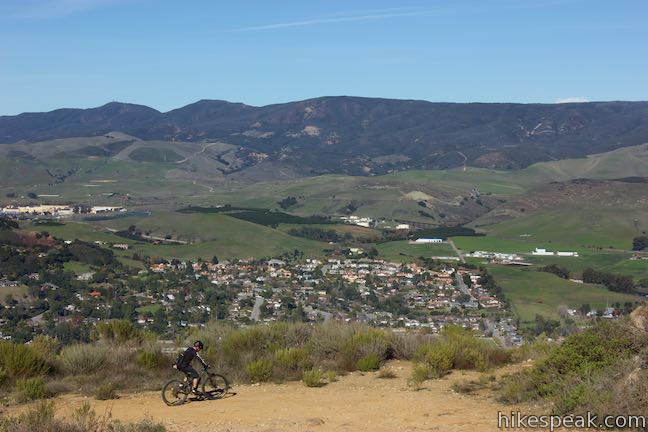
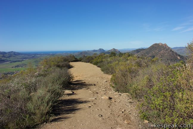
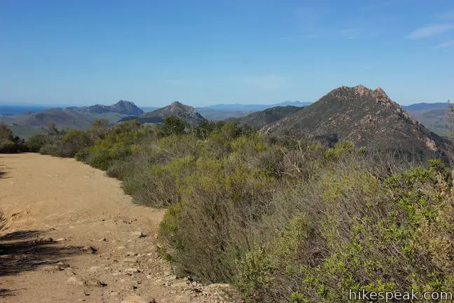
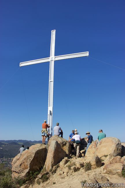
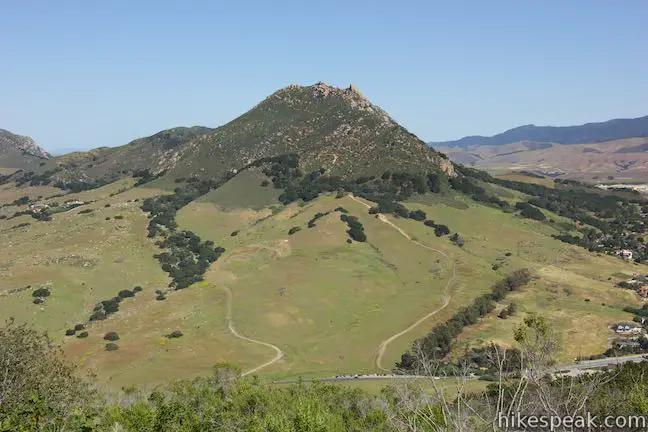
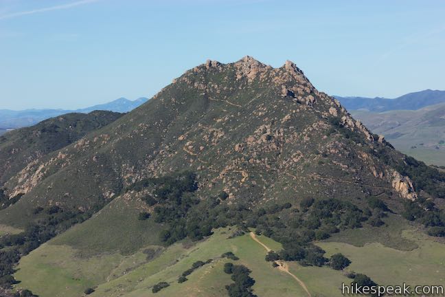
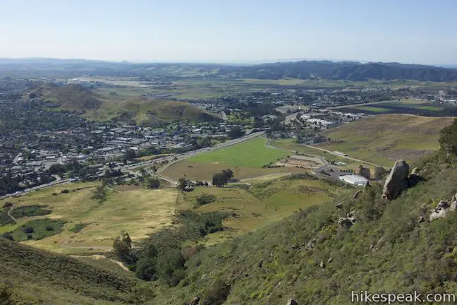
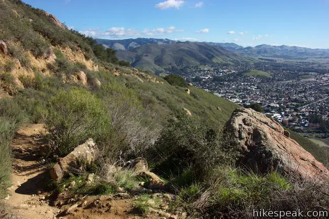
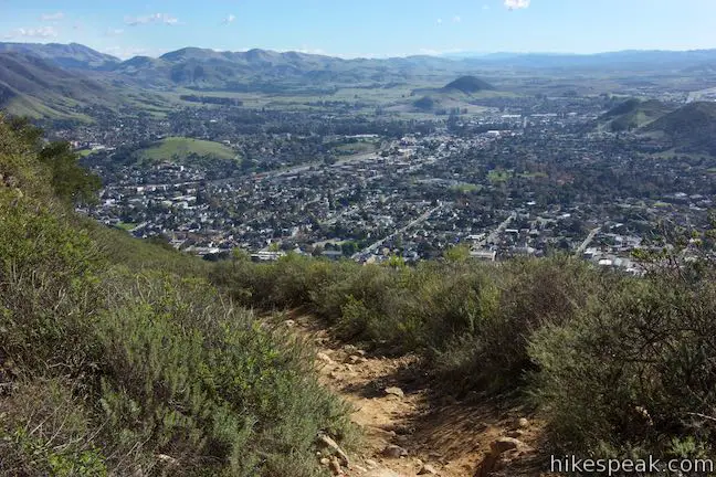
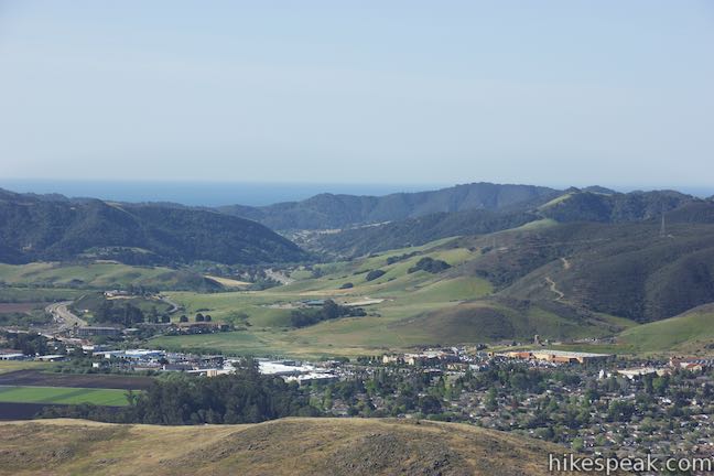
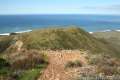
Cal Poly and the Santa Lucia Mountains fill the view as the trail switches up to a short loop circling the top of the peak. Turn right or left and make your way east to the summit. Amble up a pile of boulders and take in the 360-degree views from the top of Cerro San Luis.
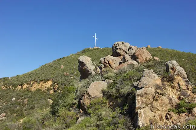
A white platform at the top of the road is used to hold special church services. Around Easter, a tall white cross stands atop the summit, and at Christmas there are lights in the shape of a tree. Neither construction interferes with the sweeping views over San Luis Obispo.
From the summit, head back the way you came or descend via the alternate trail (backside trail) to extend the hike from four to five miles.
Backside Trail
From the top of Cerro San Luis, make your way a tenth of a mile back along the southern side of the loop and locate a trail dropping off the mountain. Head down the trail for the 5-mile loop, making a left through a junction after a hundred feet. This wide track curls around Cerro San Luis in a counter-clockwise direction from south to east to north to west to eventually reconnect with the route you took up. This longer “backside” route is less crowded and offers different perspectives to enjoy.
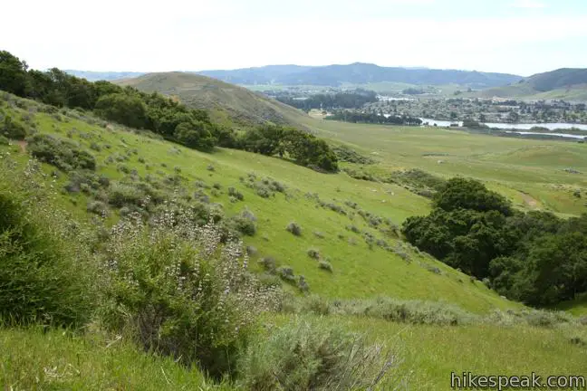
A short distance from the top of the trail, there is a nice perch looking south. Proceed another 0.2 miles and come to a overlook by a large bounder where there are views east over San Luis Obispo. The trail enters an oak forest from here and becomes rocky as it descends the mountainside. Meet a junction on the northeast side of the mountain, 3/4 of a mile from the top. Make a left to continue around the mountain. Alternatively, turn right to drop down into a pasture north of Lemon Grove Loop Trail. On the connector trail, bear right through unmarked to junctions to reach the Lemon Grove for a shorter route back to the trailhead. The backside trail continues another 1.25 miles around the skirt of the mountain, offering a close-up of Bishop Peak before angling uphill to meet the broad dirt trail on Cerro San Luis, directly across from the trail coming up from Marsh Street. Go straight across the road to travel one mile back to the trailhead, retracing the route at the start of the hike.
The trek to the summit of Cerro San Luis begins in a city-owned open space. The Madonna Family owns the mountain itself, but grants public access to hikers and mountain bikers. Dogs are welcome. No fee or permit is required to hike up Cerro San Luis, so get out and enjoy.
Directions to the Trailhead
- From downtown San Luis Obispo, take Higuera Street southeast to Marsh Street and turn right.
- Pass beneath Highway 101, and turn right on Fernandez Lane (the only road on the right before Marsh Street turns on to the 101 South).
- Turn right into the dirt parking area.
- The trail begins at the end of the lot.
Trailhead Location
Trailhead address: 1183 Fernandez Road, San Luis Obispo, CA 93405
Trailhead coordinates: 35.2749, -120.67237 (35° 16′ 29.6″N 120° 40′ 20.5″W)
View San Luis Obispo in a larger map
Or view a regional map of surrounding Central Coast trails and campgrounds.


Alternate Trail (Backside Trail)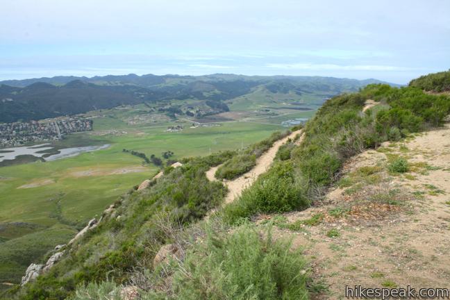


 | "M" Trail This extensions off the trail up Cerro San Luis makes its own 1.9-mile round trip hike to the large white "M" installed halfway up the east side of the mountain. |
 | Lemon Grove Loop Trail This 2.2-mile loop visits a historical lemon grove on the eastern slopes of Cerro San Luis. |
 | Lemon Grove & "M" Trails Loop This 2.4-mile hike uses all of the "M" Trail and part of Lemon Grove Loop Trail for a scenic circuit on the east side of Cerro San Luis. |
 | Cerro San Luis from Laguna Lake Park This 5.7-mile hike summits one of the Nine Sisters just west of downtown San Luis Obispo. |
 | Bishop Peak This 3.5-mile hike ascends 950 feet to highest summit in the Nine Sisters, offering excellent views of San Luis Obispo and the surrounding Morros. |
 | Felsman Loop Trail This 2.7-mile loop crosses oak, sagebrush, and grass-covered slopes around the base of Bishop Peak, providing excellent views of that notable rocky summit and its San Luis Obispo surroundings. |
 | Terrace Hill This 0.55-mile hike tours a flattened mountaintop in the city of San Luis Obispo that hosts panoramic views of the surroundings. |
 | South Hills Ridge Trail This 1.5-mile round trip hike ascends 425 feet to the highest point in a cluster of hills near downtown San Luis Obispo, offering fine views over the city and surroundings. |
 | Islay Hill This 1.8-mile round trip hike climbs 550 feet to the top of San Luis Obispo's easternmost Morro. |
 | Reservoir Canyon This 5.35-mile hike ascends 1,350 feet past a waterfall and a collection of junk sculptures to a treeless summit overlooking San Luis Obispo. |
 | Poly Canyon Design Village This 2.5-mile hike visits an experimental architectural village designed by Cal Poly students at the base of the Santa Lucia Mountains. |
 | More hikes in San Luis Obispo Explore other trails around San Luis Obispo including Morro Bay State Park and Montaña de Oro State Park. |
Common Questions about Cerro San Luis in San Luis Obispo
- Is the trail open?
- Yes. You should expect to find that Cerro San Luis Trail is open. There are no recent reports of trail closures. If you discover that the trail is closed, please help your fellow hikers by reporting a closure.
- Is this trail free to access?
- Yes, Cerro San Luis Trail is free to access. No entrance fee, pass, or permit is required. If you discover that access rules have changed, please provide feedback on your experience.
- How much time does this hike take?
- It takes approximately 2 hours 15 minutes to hike Cerro San Luis Trail. Individual hiking times vary. Add extra time for breaks and taking in the views.
- How long is this hike?
- The hike to Cerro San Luis Trail is a 4 mile out and back with 1100 feet of elevation change.
- Are dogs allowed on this trail?
- Yes, dogs are allowed on Cerro San Luis Trail. The trail is open to hikers, dogs, bikes.
- Does this trail go to a summit?
- Yes, Cerro San Luis Trail reaches a summit with panoramic views.
- Where is the trailhead located?
- The trailhead for Cerro San Luis Trail is located in San Luis Obispo, CA.
Trailhead Address:
1183 Fernandez Road
San Luis Obispo, CA 93405
Trailhead Coordinates:
35.2749, -120.67237 - What are the driving directions to the start of the hike?
To get to the trailhead: From downtown San Luis Obispo, take Higuera Street southeast to Marsh Street and turn right. Pass beneath Highway 101, and turn right on Fernandez Lane (the only road on the right before Marsh Street turns on to the 101 South). Turn right into the dirt parking area. The trail begins at the end of the lot.
View custom Google Maps directions from your current location.
- Are there other trails near Cerro San Luis Trail?
- Yes, you can find other nearby hikes using the Hikespeak Hike Finder Map.

[…] up with a brisk walk on any one of San Luis Obispo’s famed hiking trails like Felsman Loop or Cerro San Luis, followed by fresh coffee and beignets at local favorite eatery, Big Sky Café. Head back to the […]
[…] up with a brisk walk on any one of San Luis Obispo’s famed hiking trails like Felsman Loop or Cerro San Luis, followed by fresh coffee and beignets at local favorite eatery, Big Sky Café. Head back to the […]
[…] week Arleena and I revisited Cerro San Luis (or San Luis Mountain). Back in week 12, Arleena and I made a wrong turn on this trail that only […]
Love this hike – The Lemon Grove Loop is great if you just want a quick trail run, while the hike to the summit is a must if you’re looking for a ~2 hour hike with sweeping 360 views of the entire city of SLO. Big, wide trails that are shared with mountain bikers (who are few and far between and attach bells to their bikes to warn hikers). The hike can be strenuous if you head out mid-day – be sure to bring water and wear sunscreen, as the trail doesn’t see much tree cover. This is a great diversion from Bishop’s Peak, and is a hike I see myself repeating in the near future.
We hiked to the M then continued the narrow, rocky trail to the top. You feel much higher than 1200+ft when you get there. Views of SLO are spectacular! We took the main trail down from the top. It was wide, much shorter and less strenuous. Finished the hike with the Lemon Grove trail. More of a great walk than a hike.
[…] Madonna, the family who owns the land, its actual representation is for Mission High School. The Cerro San Luis Obispo, more commonly known as Madonna, hike can be accessed by multiple trails. Its most common entrance […]
[…] was a beautiful hike. Cerro San Luis has many different trails going different directions, so I know I’m going to do another hike there sometime in the […]
is there an easter sunrise service on Cero mountain this year ap 5 and what time ?
Will there be a Easter service on the Madonna Inn this year 2015
[…] Madonna is without a doubt one of the most undervalued hikes in all of Slo County. Depending on where you […]
There is no “Madonna Mountain” in San Luis Obispo, CA. This mountain has always been “San Luis Mountain” or more recently, “Cerro San Luis” if you prefer. The large “M” was placed on the mountain by students of the former (M)isson Central High School.
“Cerro San Luis” is absolutely referred to as Madonna Mountain, and it’s (M)ission College Prep, which still exists downtown.
Signed,
SLO resident
Mission High School was closed for many years, and reincarnated as Mission College Prep, which the poster above may not have realized. What is certain, though, is that locals abhor the use of “Madonna Mountain,” and prefer San Luis Mountain or Cerro San Luis.
Not all locals “abhor the use of ‘Madonna Mountain.'” I’m a local who has lived here all 32 years of my life, and I refer to it as Madonna Mountain.
Lol , my grandma went to school with Alex the M was there long before he built his hotel. You can always tell when someone is 1 st or 2 nd generation , they don’t know local history.
I noticed a locked gate on the trail on Tuesday. Is the Madonna family trying to block access to the summit? Is this allowed?
I would like to find a hike that will last no longer than 2 hours and have great views?