Valley of Fire State Park Campgrounds Camping Atlatl Rock Campground and Arch Rock Campground Valley of Fire Nevada
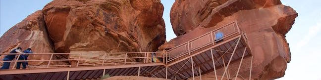
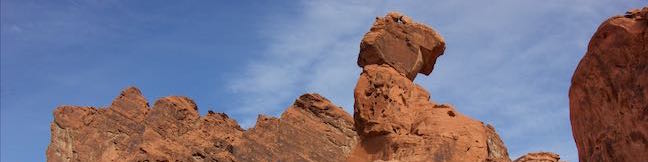
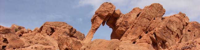
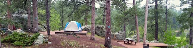
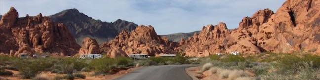
Camping in Valley of Fire State Park is a real pleasure with nicely established campsites wrapped by bold formations of red sandstone. Atlatl Rock Campground and nearby Arch Rock Campground, both located on the west side of the park offer great camping experiences for visitors to Valley of Fire State Park. General Camping Information Spring and fall are the ideal seasons to camp in Valley of Fire State Park. ...Read more.
TagsA green icon depicting a tags represents a list of words and phrases that this content is tagged with Tagged with · Nevada State Parks · Tent Camping
By: Published: Last updated: May 13, 2025
Atlatl Rock Trail Petroglyphs Hike Valley of Fire State Park Nevada
Valley of Fire State Park is an excellent place to see Native American rock art up close. Atlatl Rock sports a collection of petroglyphs on a boulder about fifty feet off the ground. A metal staircase has been installed on the side of the red sandstone formation to take visitors right up to a viewing area in front of the petroglyphs. Atlatl Rock is on a Scenic Loop Road on the west side of the park next to Atlatl Rock Campground and is a great, quick attraction in Valley of Fire State Park. ...Read more.
My Hikes: Completed hikeA green icon of shows a picture of a landscape with a check mark in the upper right corner, signifying that this is a hike you would like to put on your completed list.OK! Add to trails I've hiked
My Hikes: Want to hikeA green icon of shows a picture of a landscape with a heart in the upper right corner, signifying that this is a hike you would like to put on your to-do list.OK! Add to trails I want to hike
TagsA green icon depicting a tags represents a list of words and phrases that this content is tagged with Tagged with · Nevada State Parks · Overton · Petroglyphs
Hike DistanceA green icon of a hiker used to label information about the length of the hike Distance: 0.1 miles · Elevation change: 50 feet
By: Published: Last updated: November 9, 2018
Petrified Logs Loop Petrified Wood Trail Valley of Fire State Park Hike Nevada
Petrified wood is the fossil of a tree that has been turned to stone. Find out how this happens and see partially buried petrified logs in Valley of Fire State Park in Nevada. An easy 0.3-mile loop goes past several good examples of petrified logs, as well as informative panels detailing how the park's petrified logs came to be. Petrified Logs Loop is located on the southwest side of Valley of Fire State Park up a short gravel road from Valley of Fire Highway. ...Read more.
My Hikes: Completed hikeA green icon of shows a picture of a landscape with a check mark in the upper right corner, signifying that this is a hike you would like to put on your completed list.OK! Add to trails I've hiked
My Hikes: Want to hikeA green icon of shows a picture of a landscape with a heart in the upper right corner, signifying that this is a hike you would like to put on your to-do list.OK! Add to trails I want to hike
TagsA green icon depicting a tags represents a list of words and phrases that this content is tagged with Tagged with · Nevada State Parks · Overton · Petrified Logs
Hike DistanceA green icon of a hiker used to label information about the length of the hike Distance: 0.3 miles · Elevation change: 45 feet
By: Published: Last updated: May 13, 2025
Balancing Rock Trail Valley of Fire State Park Balancing Rock Hike Nevada Valley of Fire State Park Visitor Center Balanced Rock
This short hike begins next to the visitor center for Valley of Fire State Park. Hike just a quarter mile round trip to stand below a formation of red sandstone that seems to be standing quite precariously. The short trail is located near the start of White Domes Road and is an easy and convenient addition to any park visit. Facing the visitor center, turn to the left to spot the start of the trail. ...Read more.
My Hikes: Completed hikeA green icon of shows a picture of a landscape with a check mark in the upper right corner, signifying that this is a hike you would like to put on your completed list.OK! Add to trails I've hiked
My Hikes: Want to hikeA green icon of shows a picture of a landscape with a heart in the upper right corner, signifying that this is a hike you would like to put on your to-do list.OK! Add to trails I want to hike
TagsA green icon depicting a tags represents a list of words and phrases that this content is tagged with Tagged with · Nevada State Parks · Overton
Hike DistanceA green icon of a hiker used to label information about the length of the hike Distance: 0.25 miles · Elevation change: 10 feet
By: Published: Last updated: April 4, 2017
Elephant Rock Trail Valley of Fire State Park Elephant Rock Hike Nevada Valley of Fire State Park
Elephant Rock is a unique rock formation just off Valley of Fire Highway, next to the east entrance of Valley of Fire State Park. This is the sort of sandstone formation that can't be believed by people who haven't seen it. Is Elephant Rock an oddly shaped natural arch or perhaps a stone encased mastodon trunk? Get a close look at Elephant Rock on an easy 0. ...Read more.
My Hikes: Completed hikeA green icon of shows a picture of a landscape with a check mark in the upper right corner, signifying that this is a hike you would like to put on your completed list.OK! Add to trails I've hiked
My Hikes: Want to hikeA green icon of shows a picture of a landscape with a heart in the upper right corner, signifying that this is a hike you would like to put on your to-do list.OK! Add to trails I want to hike
TagsA green icon depicting a tags represents a list of words and phrases that this content is tagged with Tagged with · Arches · Nevada State Parks · Overton
Hike DistanceA green icon of a hiker used to label information about the length of the hike Distance: 0.3 miles · Elevation change: 50 feet
By: Published: Last updated: January 9, 2018
Multnomah-Wahkeena Loop Columbia River Gorge National Scenic Area Oregon Multnomah Falls Larch Mountain Trail Wahkeena Trail Hike Wahkeena Falls Fairy Falls Ecola Falls Weisendanger Falls Waterfalls
Multnomah Falls is the tallest waterfall in Oregon and not the sort of waterfall that leaves you asking for more. Still, the Columbia River Gorge has so many waterfalls to offer that you can pair scoping out Multnomah Falls from top to bottom with admiring a quintet of other waterfalls on an immensely beautiful hike. This loop combines Wahkeena Trail with Larch Mountain Trail and is 6. ...Read more.
My Hikes: Completed hikeA green icon of shows a picture of a landscape with a check mark in the upper right corner, signifying that this is a hike you would like to put on your completed list.OK! Add to trails I've hiked
My Hikes: Want to hikeA green icon of shows a picture of a landscape with a heart in the upper right corner, signifying that this is a hike you would like to put on your to-do list.OK! Add to trails I want to hike
TagsA green icon depicting a tags represents a list of words and phrases that this content is tagged with Tagged with · Cascade Range · Columbia River Gorge National Scenic Area · Free Trails · Waterfalls
Hike DistanceA green icon of a hiker used to label information about the length of the hike Distance: 6.05 miles · Elevation change: 1525 feet
By: Published: Last updated: May 13, 2025
Horsetail Falls Trail – Oneonta Trail Loop Hike to Ponytail Falls Middle Oneonta Falls Columbia River Gorge National Scenic Area Oregon
Do you have a need for waterfalls? Heading to the Columbia River Gorge is a good start (the area is stocked full of them). If you choose to hike Horsetail Falls Trail, you'll get a tall waterfall right at the trailhead. Half a mile up the trail, you'll find another waterfall that you can actually walk behind. Combine Horsetail Falls Trail and Oneonta Trail for a 2. ...Read more.
My Hikes: Completed hikeA green icon of shows a picture of a landscape with a check mark in the upper right corner, signifying that this is a hike you would like to put on your completed list.OK! Add to trails I've hiked
My Hikes: Want to hikeA green icon of shows a picture of a landscape with a heart in the upper right corner, signifying that this is a hike you would like to put on your to-do list.OK! Add to trails I want to hike
TagsA green icon depicting a tags represents a list of words and phrases that this content is tagged with Tagged with · Cascade Range · Columbia River Gorge National Scenic Area · Free Trails · Waterfalls
Hike DistanceA green icon of a hiker used to label information about the length of the hike Distance: 2.85 miles · Elevation change: 325 feet
By: Published: Last updated: August 31, 2023
Forest Park Hike to Pittock Mansion Wildwood Trail Upper Macleay Trail Portland Oregon
Pittock Mansion is a popular place to visit in Portland, perhaps less for the building itself than for its view over city and surrounding mountains. You can drive right up to Pittock Mansion and take a tour or hike up through Forest Park and immerse yourself in a temperate rainforest that's closer to the city than you might expect. Start from Cornell Road for a partial loop hike on Wildwood Trail and Upper Macleay Trail that is 2. ...Read more.
My Hikes: Completed hikeA green icon of shows a picture of a landscape with a check mark in the upper right corner, signifying that this is a hike you would like to put on your completed list.OK! Add to trails I've hiked
My Hikes: Want to hikeA green icon of shows a picture of a landscape with a heart in the upper right corner, signifying that this is a hike you would like to put on your to-do list.OK! Add to trails I want to hike
TagsA green icon depicting a tags represents a list of words and phrases that this content is tagged with Tagged with · Forest Park · Free Trails · Northwest Portland · Portland · Tualatin Mountains · West Hills of Portland
Hike DistanceA green icon of a hiker used to label information about the length of the hike Distance: 2.5 miles · Elevation change: 435 feet
By: Published: Last updated: July 24, 2025
Lower Oneonta Falls Adventure Oneonta Gorge Waterfall hike Columbia River Gorge National Scenic Area Oregon
Lower Oneonta Falls is an enchantress – a 100-foot ribbon of white water plunging down a steep wall of dark volcanic rock draped in moss and ferns. Getting to this waterfall demands an off-trail adventure up Oneonta Gorge that involves wading through crystal clear stretches of Oneonta Creek as it passes between the towering walls of this narrow gorge. ...Read more.
My Hikes: Completed hikeA green icon of shows a picture of a landscape with a check mark in the upper right corner, signifying that this is a hike you would like to put on your completed list.OK! Add to trails I've hiked
My Hikes: Want to hikeA green icon of shows a picture of a landscape with a heart in the upper right corner, signifying that this is a hike you would like to put on your to-do list.OK! Add to trails I want to hike
TagsA green icon depicting a tags represents a list of words and phrases that this content is tagged with Tagged with · Cascade Range · Closed · Columbia River Gorge National Scenic Area · Free Trails · Waterfalls
Hike DistanceA green icon of a hiker used to label information about the length of the hike Distance: 0.8 miles · Elevation change: 25 feet
By: Published: Last updated: December 7, 2018
Bismarck Lake Campground Black Hills National Forest South Dakota Camping
Bismarck Lake is a small, secluded 23-site campground in Black Hills National Forest, less than five miles east of Custer, South Dakota. While some sites offer obstructed views of the lake below, most sites are nestled back in the woods among ponderosa pines and large boulders. A lakeside boardwalk with benches and an elevated seated area leaves from the campground and offers greats spot for enjoying your morning tea or spotting wildlife. ...Read more.
TagsA green icon depicting a tags represents a list of words and phrases that this content is tagged with Tagged with · Black Hills · Custer · Tent Camping
By: Published: Last updated: June 29, 2025