Petrified Logs Loop
in Valley of Fire State Park
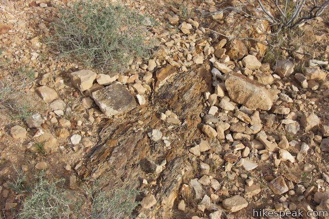
Petrified wood is the fossil of a tree that has been turned to stone. Find out how this happens and see partially buried petrified logs in Valley of Fire State Park in Nevada. An easy 0.3-mile loop goes past several good examples of petrified logs, as well as informative panels detailing how the park’s petrified logs came to be.
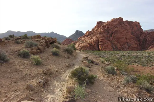
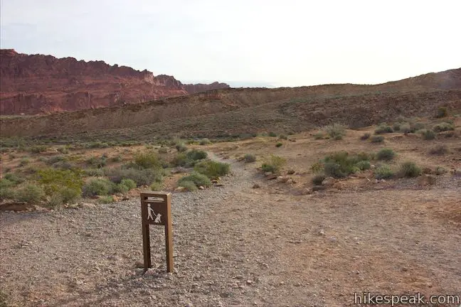
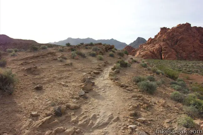
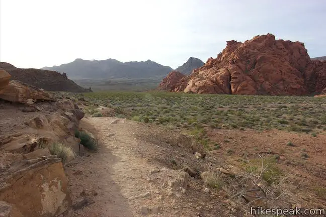
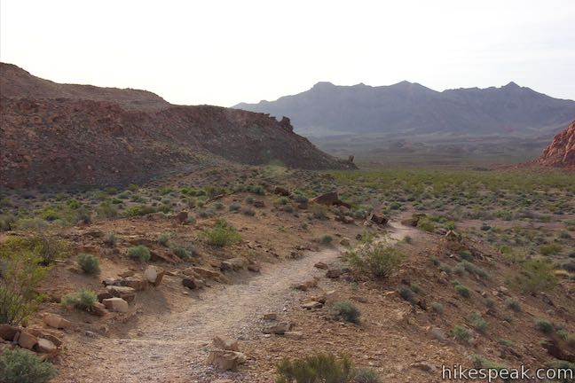
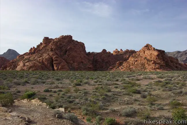
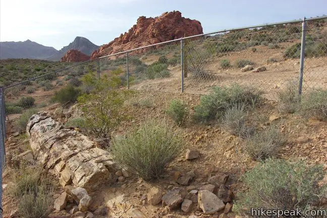
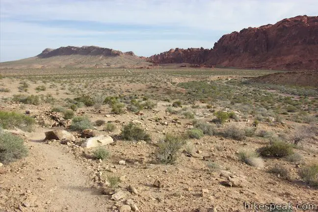
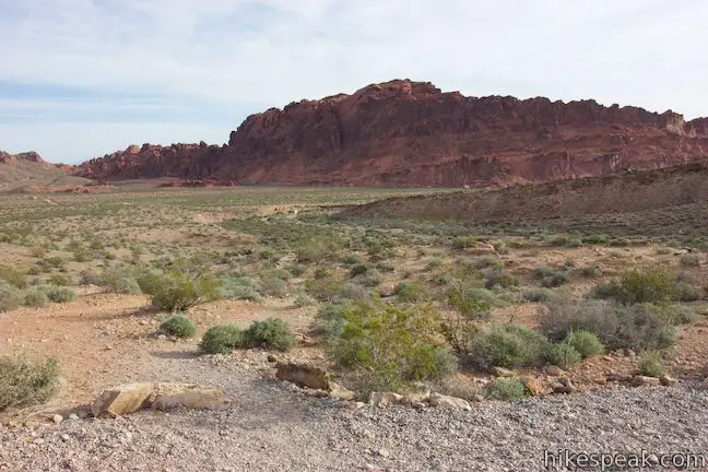
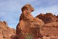
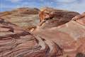
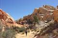
Petrified Logs Loop is located on the southwest side of Valley of Fire State Park up a short gravel road from Valley of Fire Highway. A few paths leave from the end of the gravel road to approach the petrified logs. The simplest way to go is to begin down the trail to the right, saving the two trails to the left to use at the end of the loop. Hike out on the trail to the right along the side of a low ridge. As you go, enjoy views south toward a bigger ridge of red sandstone. There are no logs to observe on this first part of the trail, so continue down the trail, curving to the left around the end of the ridge.
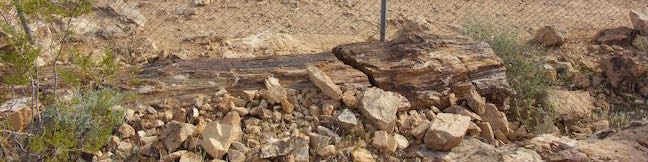
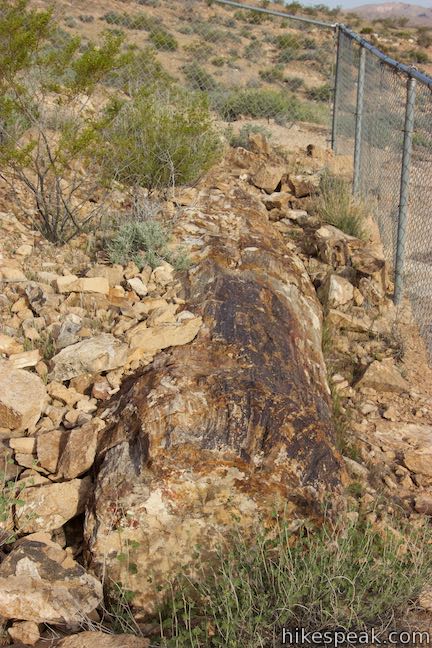
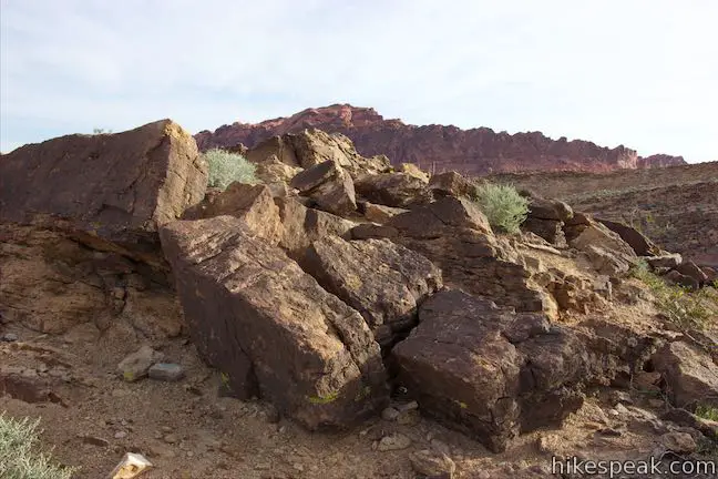
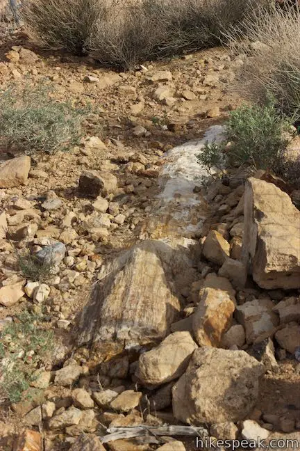
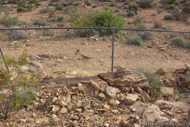
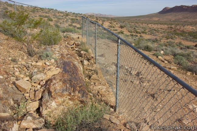
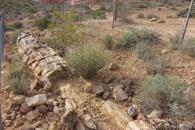
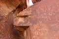
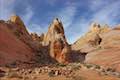
Come to the first fenced-in area containing a petrified log after a tenth of a mile. Walk along the side of the fence and discover a chunk of petrified wood. This sample log is the least exposed but definitely looks like a big log turned into stone.
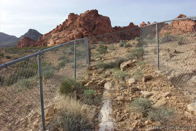
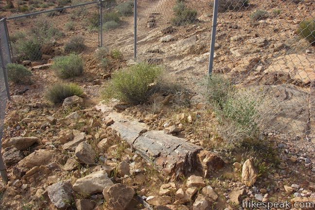
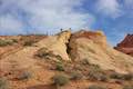
Hiking north up the trail, you will quickly arrive an area with two fenced-in rectangles protecting petrified logs. These are better examples of petrified wood with more of each log revealed above the desert floor.
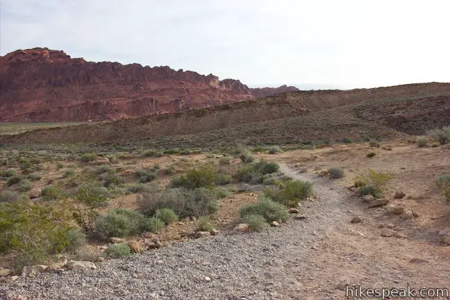
Keep hiking north to a final fenced-in petrified log. From here, the trail curves to the left and ascends a gradual slope back to the trailhead. The route seems to splinter (no pun intended) into a few paths, all of which head back to the parking area.
Valley of Fire State Park charges an entrance fee, but no permit is required to take the easy hike on Petrified Logs Loop. Leashed dogs are allowed. On park maps, the trailhead is shown as “Petrified Logs (west).” Another area of petrified logs is located east of the Visitor Center.
How did these logs become petrified?
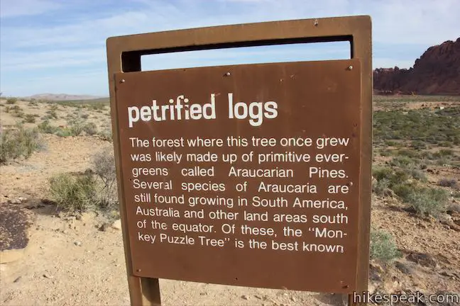
Panels along the trail explain that petrified forests are actually somewhat common in the west. To start the process, trees were carried from a forest miles away and deposited by floodwaters, buried beneath thousands of feet of silt, sand, and sea deposits. A panel describes how a log would then turned into stone:
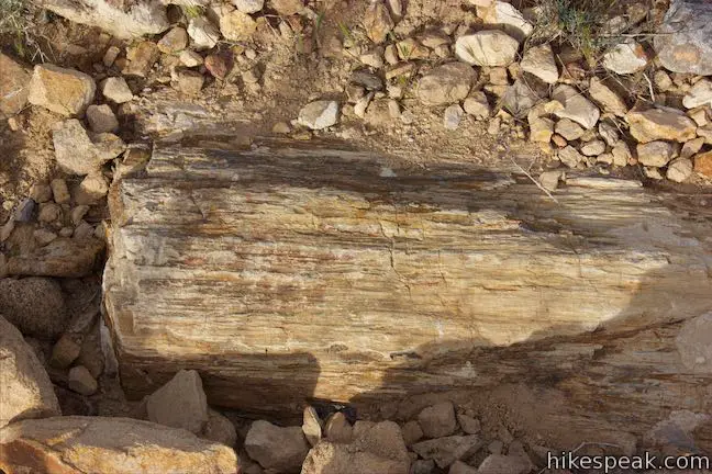
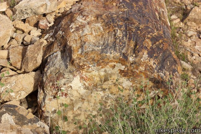
While this log was buried, ground water, carrying minerals in solution, worked its way into the microscopic air spaces in the woody tissues. Here the minerals were deposited, completely filling available space. The colors in the log are usually caused by oxides of iron and manganese.
The minerals completely replace the wood material, while retaining the trees original structure. The result is a rock that looks like a tree trunk, matching the size and dimension of the original log.
What do we know about the trees that became petrified logs?
The logs likely came from primitive evergreens called Araucarian pines that grew in the surrounding area 150 million years ago (give or take a few million years), during the great Age of Reptiles.
Directions to the Trailhead
- From Las Vegas, take Interstate 15 north for about 35 miles to exit 75 (signs for Valley of Fire State Park and Lake Mead National Recreation Area).
- At the end of the offramp, proceed southeast on Valley of Fire Highway.
- Go through the park's west entrance after 14.5 miles and drive an additional 1.8 miles to an intersection where Scenic Loop Road (Campground Road) parts to the left.
- Go the other direction at this intersection and turn right up a gravel trail, following the sign for Petrified Logs.
- Drive another 0.2 miles to the trailhead at the end of the road.
Trailhead Location
Trailhead address: Petrified Logs Road, Valley of Fire State Park, Overton, NV 89040
Trailhead coordinates: 36.42266, -114.5413 (36° 25′ 21.57″N 114° 32′ 28.68″W)
You may also view a regional map of surrounding Nevada trails and campgrounds.


 | Atlatl Rock Step right up to see Native American rock art on this 0.1-mile trail with stairs up a rock face to a collection of petroglyphs. |
 | Balancing Rock This 0.25-mile hike, which begins next to the Valley of Fire State Park Visitor Center, approaches a rock formation that appears to stand with a bit of magic. |
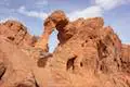 | Elephant Rock This 0.3-mile hike at the east entrance of Valley of Fire State Park leads to a sandstone formation resembling an elephant with a unique natural arch for a trunk. |
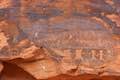 | Petroglyph Canyon Trail to Mouse's Tank This 0.75-mile hike travels down a sandy path lined with petroglyphs to a natural basin formed in the sandstone. |
 | Rainbow Vista This scenic hike of up to 1.5 miles explores multi-colored landscapes, crossing through sandstone formations to summit a short crest with tremendous 360-degree views and the option to continue to Fire Canyon Overlook. |
 | Fire Wave This 1.5-mile hike reaches a sensational striped creation where a slickrock depression is painted in waves of orange and beige. |
 | White Domes This 1.1-mile loop is impressive from start to finish as it explores colorful, intricate rock formations, passes and old film set, and slips through a narrow slot canyon. |
 | Hikes in Nevada Explore more trails in Nevada and the picturesque parks around Las Vegas. |
 | Atlatl Rock Campground and Arch Rock Campground Valley of Fire State Park has great places to camp surrounded by formations of red sandstone. |
Common Questions about Petrified Logs Loop in Valley of Fire State Park
- Is the trail open?
- Yes. You should expect to find that Petrified Logs Trail is open. There are no recent reports of trail closures. If you discover that the trail is closed, please help your fellow hikers by reporting a closure.
- Do I need a permit for this hike?
- Yes. State Park Entrance Fee.
- How much time does this hike take?
- It takes approximately 15 minutes to hike Petrified Logs Trail. Individual hiking times vary. Add extra time for breaks and taking in the views.
- How long is this hike?
- The hike to Petrified Logs Trail is a 0.3 mile loop with 45 feet of elevation change.
- Are dogs allowed on this trail?
- Yes, dogs are allowed on Petrified Logs Trail. The trail is open to hikers, dogs.
- Is Petrified Logs Trail good for kids?
- Yes, this hike is likely suitable for children. It is relatively short (0.3 miles) with manageable elevation gain.
- Where is the trailhead located?
- The trailhead for Petrified Logs Trail is located in Overton, Nevada.
Trailhead Address:
Valley of Fire State Park
Overton, Nevada 89040
Trailhead Coordinates:
36.42266, -114.5413 - What are the driving directions to the start of the hike?
To get to the trailhead: From Las Vegas, take Interstate 15 north for about 35 miles to exit 75 (signs for Valley of Fire State Park and Lake Mead National Recreation Area). At the end of the offramp, proceed southeast on Valley of Fire Highway. Go through the park's west entrance after 14.5 miles and drive an additional 1.8 miles to an intersection where Scenic Loop Road (Campground Road) parts to the left. Go the other direction at this intersection and turn right up a gravel trail, following the sign for Petrified Logs. Drive another 0.2 miles to the trailhead at the end of the road.
View custom Google Maps directions from your current location.
- Are there other trails near Petrified Logs Trail?
- Yes, you can find other nearby hikes using the Hikespeak Hike Finder Map.

Go the extra miles...
Submit a rating of this hike to go with your comment. Contribute to the average trail rating.