Fire Wave Trail
in Valley of Fire State Park
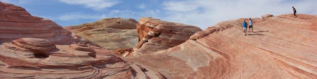
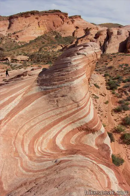
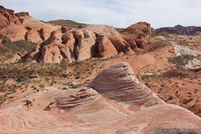
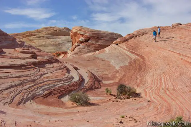
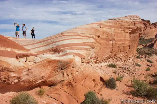
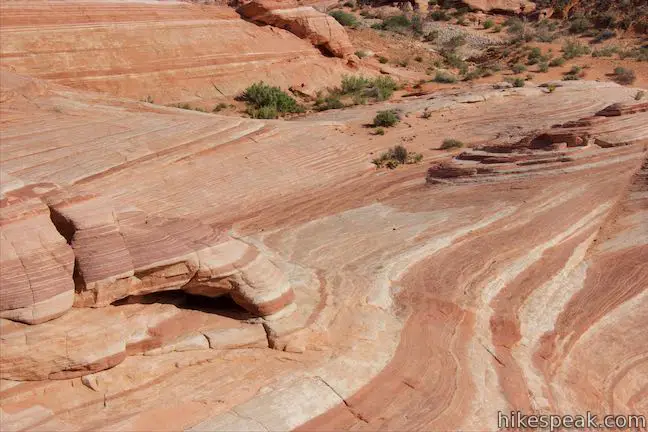
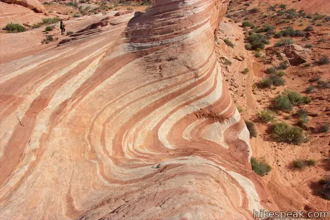
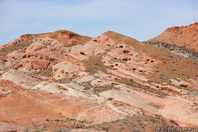
Stripes are something you don’t see too often in nature (unless you live near a bunch of zebras), and the stripes at Fire Wave really stand out. In this isolated area of Valley of Fire State Park in Nevada, the slickrock has interchanging streaks of beige and red-orange colored sandstone.
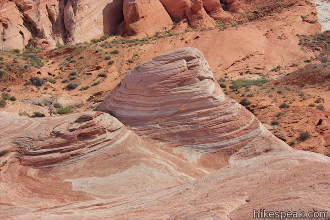
Fire Wave has a bowl-shaped depression with a couple rising points covered with wavy lines. If you weren’t allowed to walk right across Fire Wave, you might think the stripes were painted. See the magic for yourself on Fire Wave Trail, which is 1.5 miles round trip with 175 feet of elevation change.
Fire Wave Trail is a newer trail in Valley of Fire State Park that does not appear on some older park maps. Begin from Parking Lot #3, the final parking area on White Does Road before it ends by White Domes Trail. White Domes Road is one of the park’s excellent scenic drives.
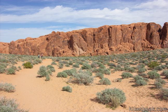
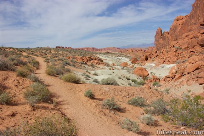
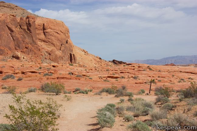
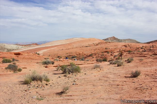
Walk across to the west side of White Does Road to the signed start Fire Wave Trail, which heads northeast down a sandy slope. The trail aims toward a long steep ridge of red sandstone.
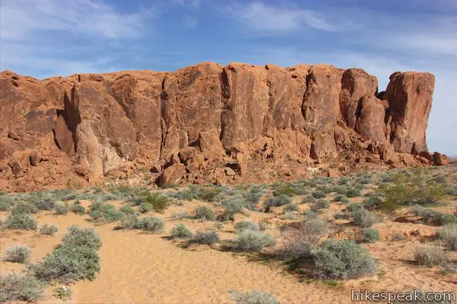
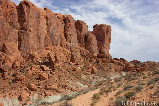
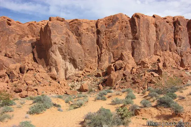
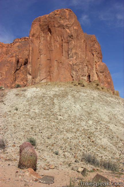
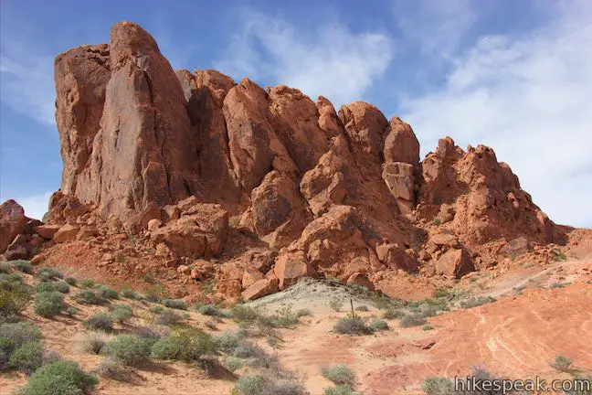
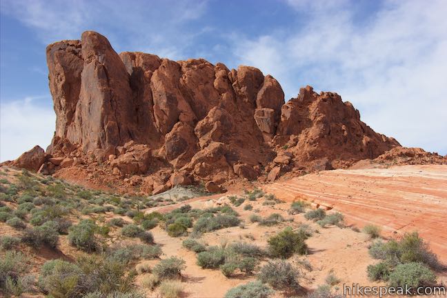
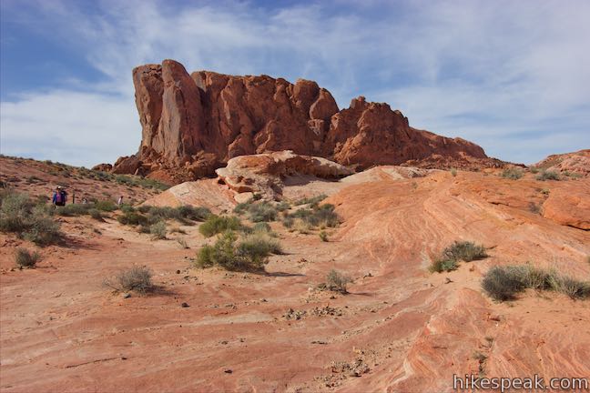
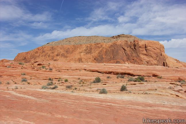
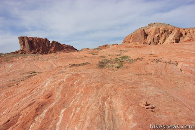
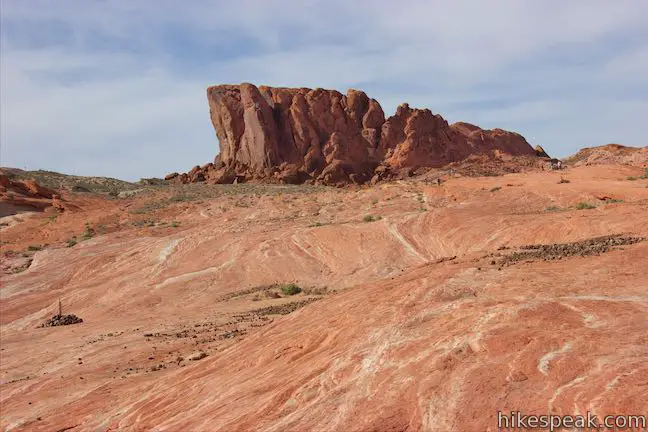
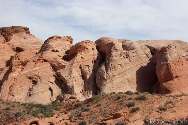
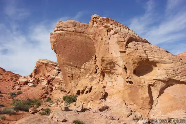
As you approach a depression in front of the cliffs, the trail curves to the right. Here the sand gets more packed and the traveling is easier. Hike south along the side of this tall formation, keeping a slope up to White Domes Road on your right. The trail curves to the left around the end of the formation, which has a tall block of stone called Gibraltar Rock that leans out from the rest of the ridge, rising to just over 2,170 feet.
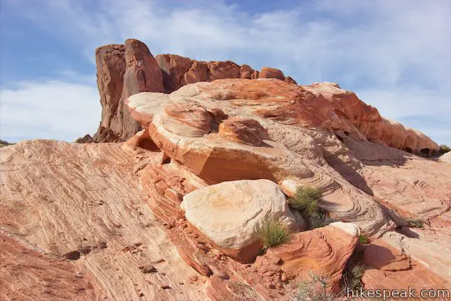
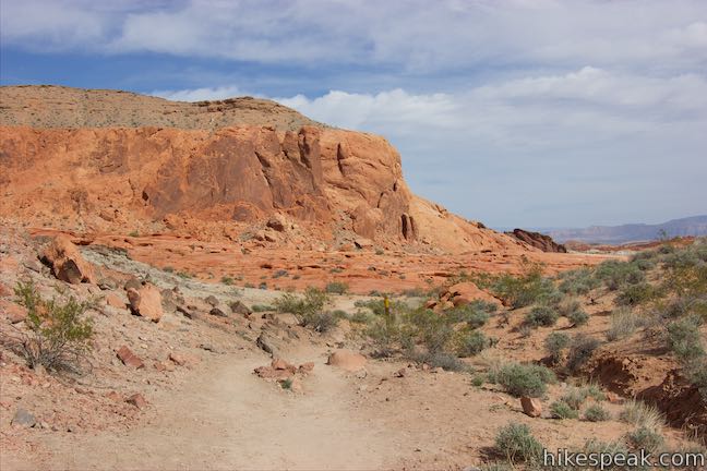
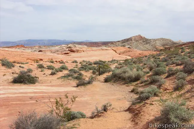
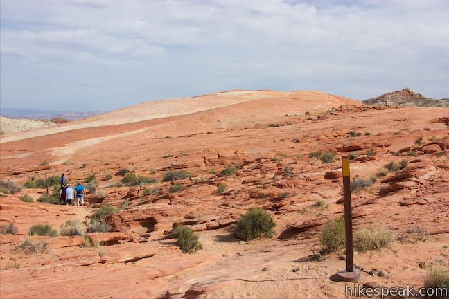
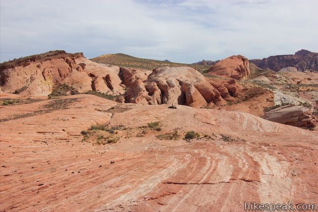
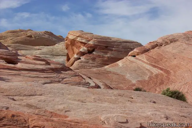
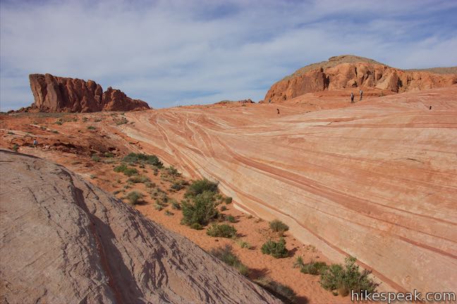
Drop through some small boulders and approach a slickrock formation running to the southeast. Subtle lines are visible in the rock that become much more prevalent when you reach Fire Wave. Follow markers and curve right alongside the striped slickrock, 0.35 miles from the start.
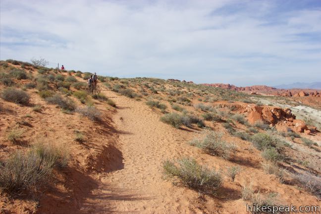
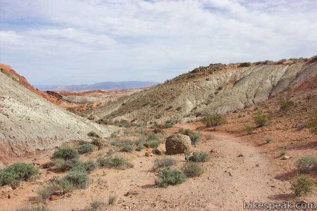
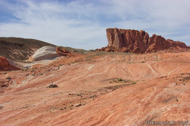
Descend along the side of the slickrock, eventually passing a small area of rounded knobs striped in vivid colors. This little formation offers an appetizer of the stripes to come. Look back up the trail toward the cliffs on the ridge you walked around.
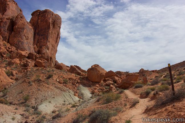
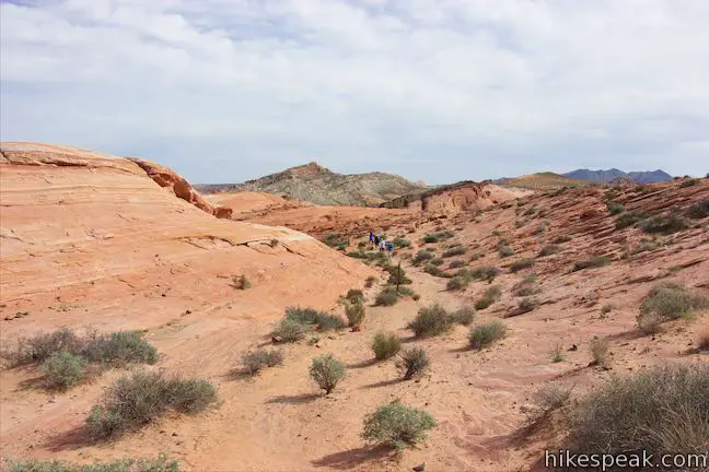
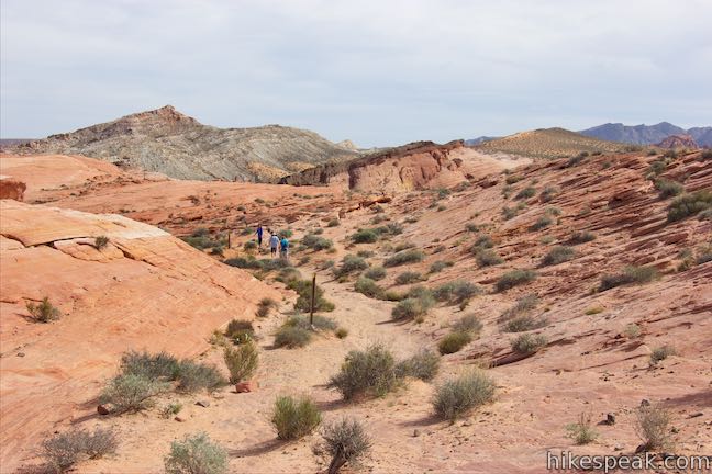
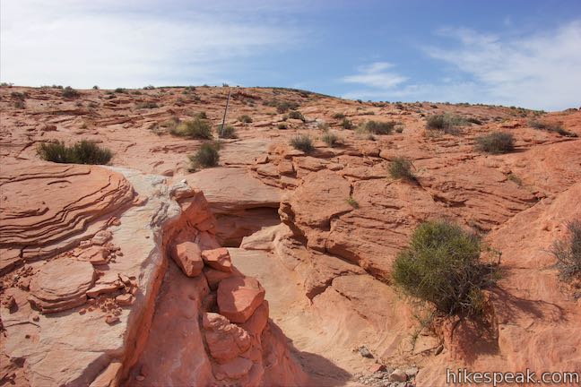
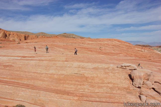
After half a mile of hiking (total), the trail makes a sudden left and goes across a cut eroded into the slickrock. Go a short distance down this tiny ravine to a trail marker pointing to the right. Follow it and begin hiking up a slope on the slickrock itself.
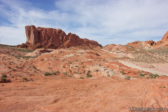
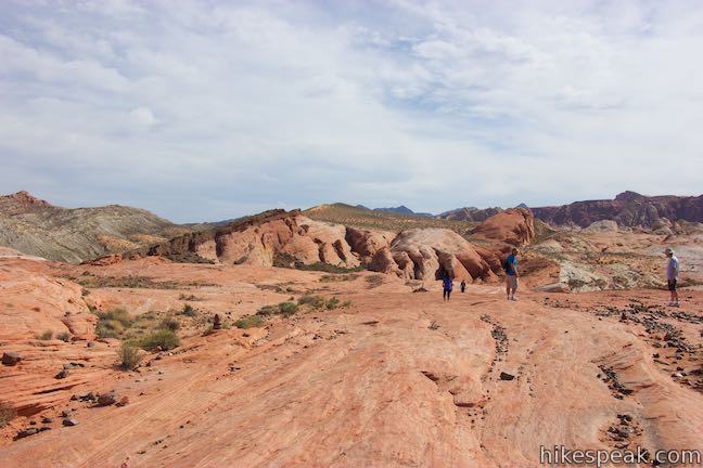
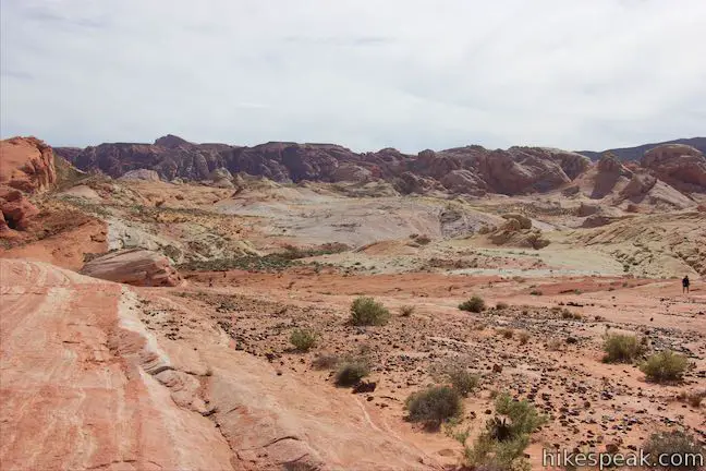
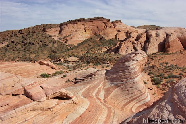
Go over a crest and hike along markers leading downhill to Fire Wave. For just a moment, you might start to wonder where Fire Wave is, and then you’ll see it, a carved-out area at the southwest end of the rock formation you are on.
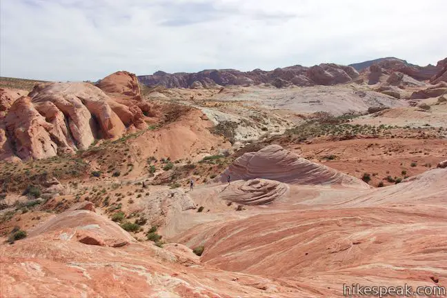
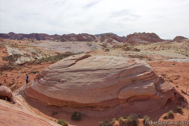
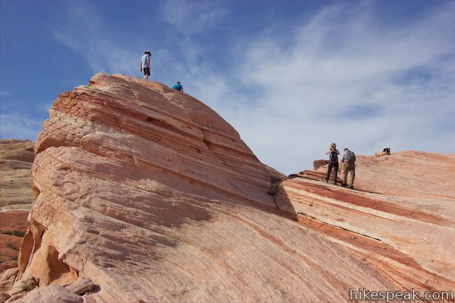
Walk down to the wave, reaching this incredible natural attraction, 0.75 miles from the start. Now explore the bowl covered in orange and white stripes.
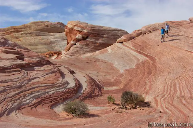
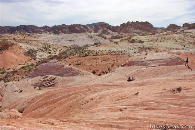
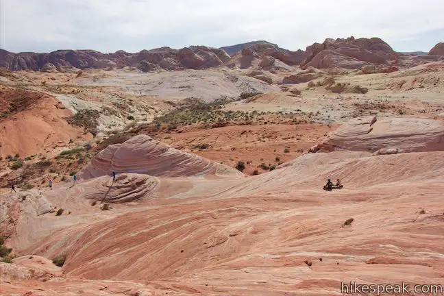
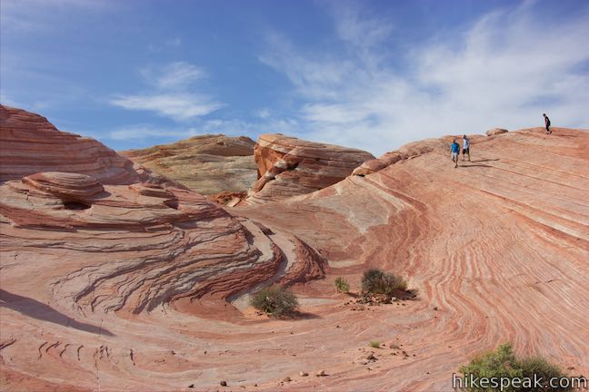
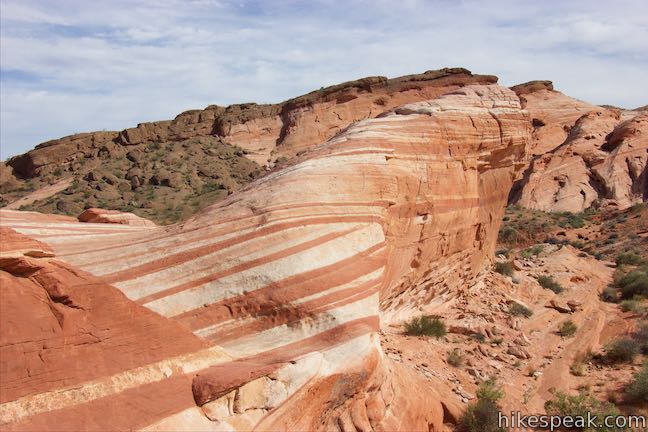
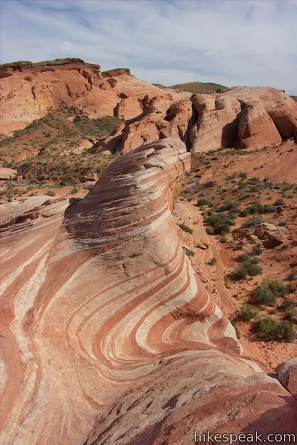
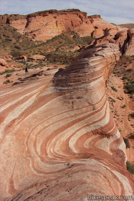
On the west side of Fire Wave, find an area where the rock drops away like it has been scooped out – showing some of the area’s best stripes. On the far side of the striped depression, a crest rises in the shape of a wave. Go up one of the rock islands in Fire Wave and take in your surroundings. You’ll certainly want to linger in this place of rare beauty.
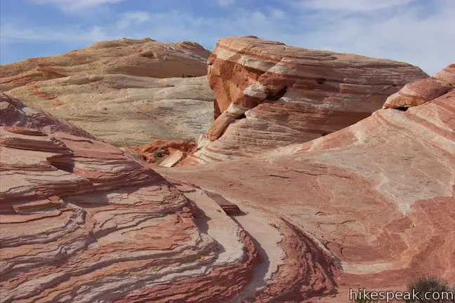
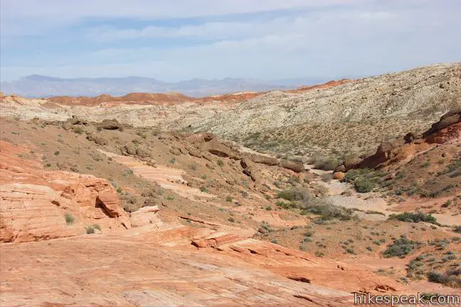
If you go down the south side of Fire Wave, you’ll hit the side of Kaolin Wash, which runs from west to east. Though not showing any waves, the rock formations on the other side of the wash are striped too. You can also look west toward the White Domes Area where the earth is colored in whites, pinks, and reds.
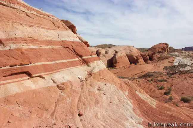
Fire Wave Trail closes between sunset and sunrise, so eventually you’ll have to hike back the way you came. Looking up the slope you took down to Fire Wave, you’ll see something puzzling in the slickrock. The stripes in the rock seem to overlap each other, adding another fascinating element of this far-out landscape.

Valley of Fire State Park charges an entrance fee but no permit is needed to hike Fire Wave Trail. Dogs are allowed on leashes. Stay on the well-marked trail to help preserve the surrounding landscapes. Should you need to immediately share a selfie from Fire Wave, the parking area at the start of the trail has good cell phone coverage.
Directions to the Trailhead
- From Las Vegas, take Interstate 15 north for about 35 miles to exit 75 (signs for Valley of Fire State Park and Lake Mead National Recreation Area).
- At the end of the offramp, go southeast on Valley of Fire Highway.
- Reach the park's west entrance after 14.5 miles.
- Drive another 3.5 miles and turn left, following a sign for the visitor center and Mouse's Tank.
- Go a tenth of a mile and bear left to stay on White Domes Road, bypassing the visitor center.
- Drive another 3.7 miles to Parking Lot #3, which is on the left across from the start of the trail (2.9 miles past Rainbow Vista Trailhead).
- Arriving from the east, from the intersection of Route 169 and 167 near Lake Mead, drive west on Valley of Fire Highway for two miles to the park's east entrance.
- Drive another 3.3 miles to the intersection by the start of White Domes Road, turn right and take this road for 4.8 miles to Parking Lot #3.
Trailhead Location
Trailhead address: White Domes Road (Mouse’s Tank Road), Valley of Fire State Park, Overton, NV 89040
Trailhead coordinates: 36.4882, -114.52875 (36° 29′ 17.51″N 114° 31′ 43.50″W)
You may also view a regional map of surrounding Nevada trails and campgrounds.


 | White Domes This 1.1-mile loop is impressive from start to finish as it explores colorful, intricate rock formations, passes and old film set, and slips through a narrow slot canyon. |
 | Rainbow Vista This hike of up to 1.5 miles goes up a sandstone mini-summit with tremendous 360-degree views over multi-colored landscapes and then continues on to Fire Canyon Overlook. |
 | Petroglyph Canyon Trail to Mouse's Tank This 0.75-mile hike travels down a sandy path lined with petroglyphs to a natural basin formed in the sandstone. |
 | Balancing Rock This 0.25-mile hike, which begins next to the Valley of Fire State Park Visitor Center, approaches a rock formation that appears to stand with a bit of magic. |
 | Elephant Rock This 0.3-mile hike at the east entrance of Valley of Fire State Park leads to a sandstone formation resembling an elephant with a unique natural arch for a trunk. |
 | Petrified Logs Loop This 0.3-mile hike gets close to petrified logs on the desert floor passing panels that explain how wood is petrified. |
 | Atlatl Rock Step right up to see Native American rock art on this 0.1-mile trail with stairs up a rock face to a collection of petroglyphs. |
 | Hikes in Nevada Explore more trails in Nevada and the picturesque parks around Las Vegas. |
 | Atlatl Rock Campground and Arch Rock Campground Valley of Fire State Park has great places to camp surrounded by formations of red sandstone. |
- Fire Wave Trail on outdoorproject.com (opens in a new tab)
- Fire Wave Trail on localadventurer.com (opens in a new tab)
- Valley of Fire State Park on wikipedia.org (opens in a new tab)
- The official brochure for Valley of Fire State Park (opens in a new tab)
- A trail map for Valley of Fire State Park (opens in a new tab)
- The official website for Valley of Fire State Park (opens in a new tab)
Common Questions about Fire Wave Trail in Valley of Fire State Park
- Is the trail open?
- Yes. You should expect to find that Fire Wave Trail is open. There are no recent reports of trail closures. If you discover that the trail is closed, please help your fellow hikers by reporting a closure.
- Do I need a permit for this hike?
- Yes. State Park Entrance Fee.
- How much time does this hike take?
- It takes approximately 45 minutes to hike Fire Wave Trail. Individual hiking times vary. Add extra time for breaks and taking in the views.
- How long is this hike?
- The hike to Fire Wave Trail is a 1.5 mile out and back with 175 feet of elevation change.
- Are dogs allowed on this trail?
- Yes, dogs are allowed on Fire Wave Trail. The trail is open to hikers, dogs.
- Is Fire Wave Trail good for kids?
- Yes, this hike is likely suitable for children. It is relatively short (1.5 miles) with manageable elevation gain.
- Where is the trailhead located?
- The trailhead for Fire Wave Trail is located in Overton, Nevada.
Trailhead Address:
White Domes Road
Overton, Nevada 89040
Trailhead Coordinates:
36.4882, -114.52875 - What are the driving directions to the start of the hike?
To get to the trailhead: From Las Vegas, take Interstate 15 north for about 35 miles to exit 75 (signs for Valley of Fire State Park and Lake Mead National Recreation Area). At the end of the offramp, go southeast on Valley of Fire Highway. Reach the park's west entrance after 14.5 miles. Drive another 3.5 miles and turn left, following a sign for the visitor center and Mouse's Tank. Go a tenth of a mile and bear left to stay on White Domes Road, bypassing the visitor center. Drive another 3.7 miles to Parking Lot #3, which is on the left across from the start of the trail (2.9 miles past Rainbow Vista Trailhead).
Arriving from the east, from the intersection of Route 169 and 167 near Lake Mead, drive west on Valley of Fire Highway for two miles to the park's east entrance. Drive another 3.3 miles to the intersection by the start of White Domes Road, turn right and take this road for 4.8 miles to Parking Lot #3.
View custom Google Maps directions from your current location.
- Are there other trails near Fire Wave Trail?
- Yes, you can find other nearby hikes using the Hikespeak Hike Finder Map.

8 Comments on Fire Wave Trail in Valley of Fire State Park
What hikers are saying:
✨ Generated summary of user commentsThis trail leads visitors across a mix of soft sand and uneven rock surfaces where careful footing is essential. Hikers find the trek accessible for those accustomed to regular walking, provided they carry ample water to handle the desert heat.
Love your site. Can I use info for planning hikes with a local Meetup group?
Hi,
You are welcome to use a short excerpt from this page, along with attribution and a link back, for a meetup posting. Please check out the about page for more information about using material from hikespeak.com
Well done site integrating maps. Is the hike on the fire wave trail easy, moderate or ? We’re nonhikers coming to Las Vegas to see the geology in a couple parks. Recommendations?
This trail has minimal elevation change, so it is not difficult because of steepness. However, the trail is either on sand or uneven rock surfaces, so watch your footing. Also carry plenty of water on hot days. If you’re able to walk a couple miles around where you live in Las Vegas, this trail should not be a problem.
[…] “Fire Wave” one of the most picturesque rock formations there. To reach it plan for an easy hike of 1.5 miles round-trip. Use parking lot #3 on White Domes Road and start early because it’s a popular […]
[…] stunning hikes, just check out the trail map, but if you only have time for one, don’t miss the Fire Wave Trail that starts in Parking Lot #3. The 1 1/2 mile roundtrip trail starts on sand, moves to gravel then […]
[…] hikes, just check out the trail map, but if you only have time for one, don’t miss the Fire Wave Trail that starts in Parking Lot #3. The 1 1/2 mile roundtrip trail starts on sand, moves to gravel then […]
What time of year is the most spectacular time to walk fire wave trail?