Elephant Rock
in Valley of Fire State Park
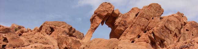
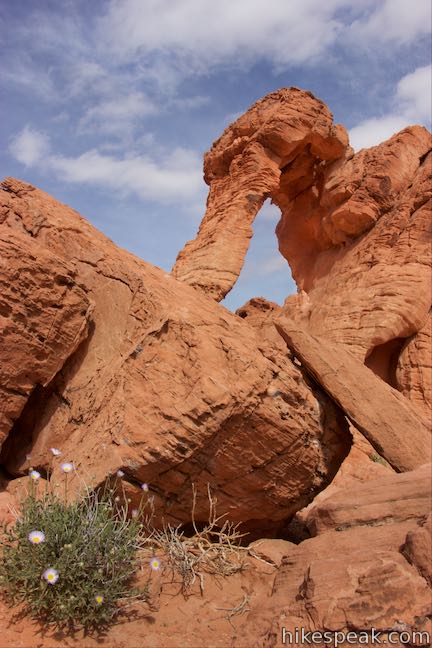
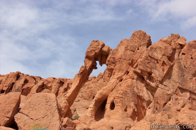
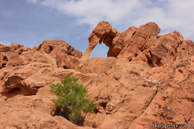
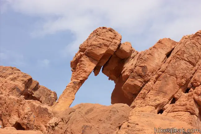
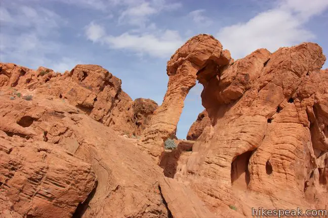
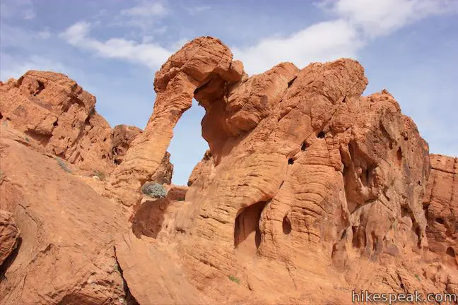
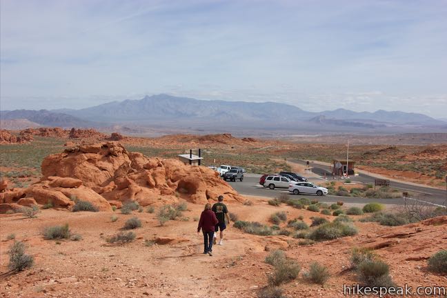
Elephant Rock is a unique rock formation just off Valley of Fire Highway, next to the east entrance of Valley of Fire State Park. This is the sort of sandstone formation that can’t be believed by people who haven’t seen it. Is Elephant Rock an oddly shaped natural arch or perhaps a stone encased mastodon trunk? Get a close look at Elephant Rock on an easy 0.3-mile hike.
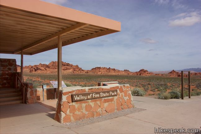
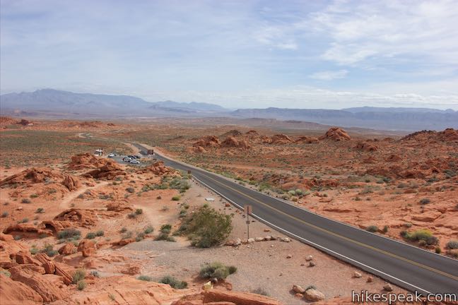
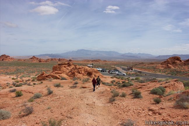
Start from a parking area just inside the parking’s east entrance. If you are entering the park from this side near Lake Mead, Elephant Rock makes an obvious first stop. When the entrance booth is closed, the parking area at Elephant Rock doubles as an entrance fee self-pay station.
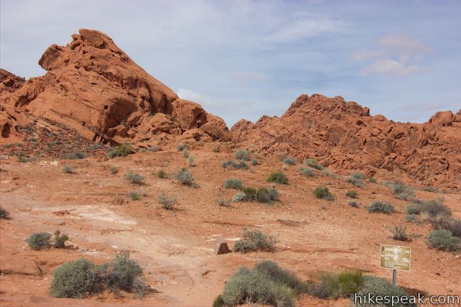
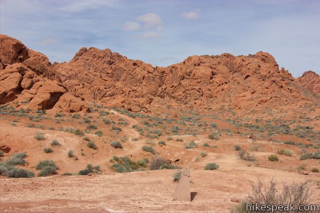
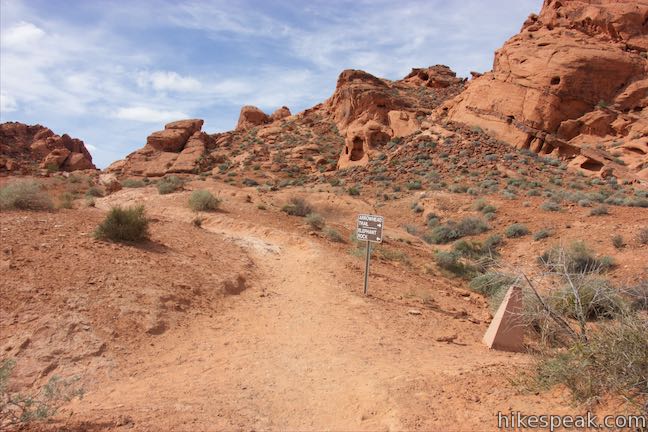
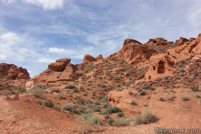
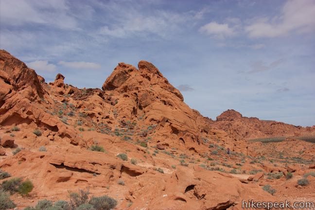
Follow the trail sign out the back of a brick structure and hike northwest into a gradual desert landscape. In less than a tenth of a mile, you will hit a junction with Arrowhead Trail (Old Arrowhead Road Historic Trail). This is a longer trail through the park that can also be used for a 1.2-mile loop in the Elephant Rock area. Turn left at this junction for the short route to Elephant Rock.
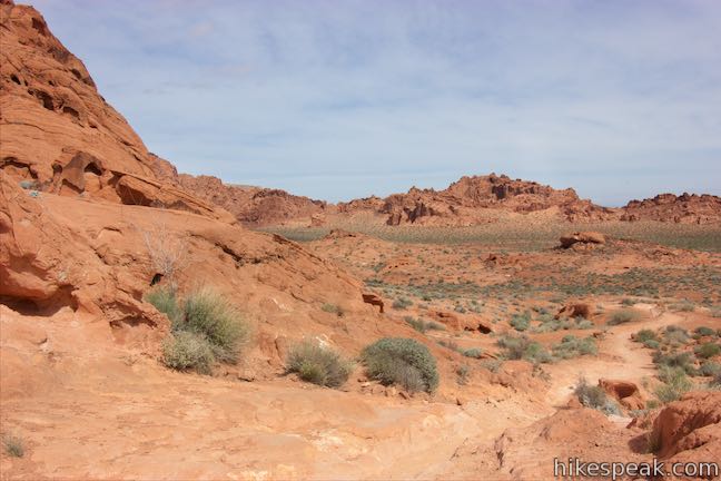
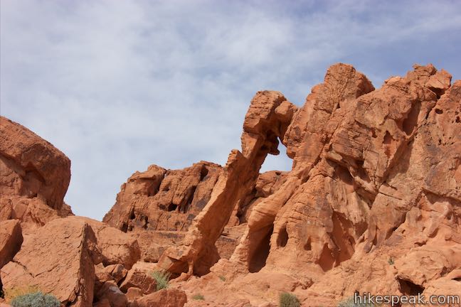
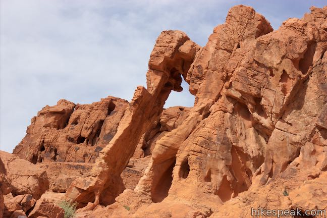
Hike a little farther up the trail, which angles southwest toward Valley of Fire Highway. When you reach the road, look up on the rocks to your right to see Elephant Rock. The elephant’s trunk – a natural arch of sandstone, really stands out, but look closer and you can visualize the elephant’s legs and body as well.
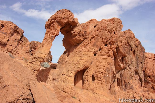
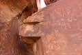
The trunk-like natural arch drops off the west side of Elephant Rock. The top of the arch is made of brick-like blocks that look different from other arches. The trunk on elephant rock is not made up of one smooth piece of bending rock as you might expect. Instead, it looks like a rock column connected by chunky pieces.
By some miracle, Elephant Rock stays upright. Obviously this fragile creation should not be harmed, so do not approach or climb on Elephant Rock. You can hoist yourself up onto the rocks alongside the trail to get a better view of Elephant Rock, exposing more of the lower parts of the animal’s legs.
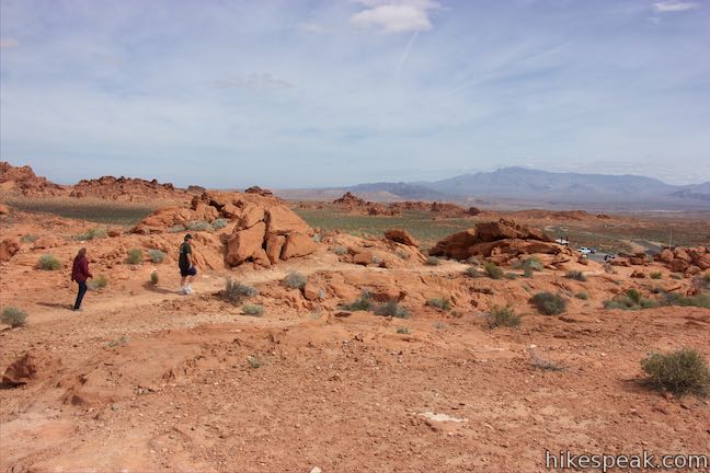
When you have taken in the glory of Elephant Rock, the option remains to continue along the road to hike the longer loop, connecting with Arrowhead Trail. Otherwise, turn around and take a tenth of a mile long trail back to the start that roughly parallels the roadway. The short hike to Elephant Rock is only 0.3 miles long with 50 feet of elevation change. Elephant Rock can be seen from Valley of Fire Highway, but roadside parking is not allowed in this area.
Valley of Fire State Park charges an entrance fee, which can be paid at the trailhead for Elephant Rock. The fee is $10 for out of state vehicles and $8 for Nevada residents (all prices as of 2016). Parking is not allowed along Valley of Fire Highway below Elephant Rock. Leashed dogs are allowed on Elephant Rock Trail. No permit is required for this short walk to Elephant Rock, so get out and enjoy!
Directions to the Trailhead
- Arriving from the east, from the intersection of Route 169 and 167 near Lake Mead, drive west on Valley of Fire Highway for two miles to the park's east entrance.
- Immediately after the gate, pull into the parking area on the right (north) side of the road.
- Coming from Las Vegas, take Interstate 15 north for about 35 miles to exit 75 (signs for Valley of Fire State Park and Lake Mead National Recreation Area).
- At the end of the offramp, proceed southeast on Valley of Fire Highway.
- Pass through the park's west entrance after 14.5 miles and drive another 6.8 miles through the park to the trailhead on the left just before the park's east entrance.
Trailhead Location
Trailhead address: Valley of Fire Highway, Valley of Fire State Park, Overton, NV 89040
Trailhead coordinates: 36.4289, -114.458175 (36° 25′ 44.03″N 114° 27′ 29.42″W)
You may also view a regional map of surrounding Nevada trails and campgrounds.


 | Petroglyph Canyon Trail to Mouse's Tank This 0.75-mile hike travels down a sandy path lined with petroglyphs to a natural basin formed in the sandstone. |
 | Balancing Rock This 0.25-mile hike, which begins next to the Valley of Fire State Park Visitor Center, approaches a rock formation that appears to stand with a bit of magic. |
 | Petrified Logs Loop This 0.3-mile hike gets close to petrified logs on the desert floor passing panels that explain how wood is petrified. |
 | Atlatl Rock Step right up to see Native American rock art on this 0.1-mile trail with stairs up a rock face to a collection of petroglyphs. |
 | Rainbow Vista This scenic hike of up to 1.5 miles explores multi-colored landscapes, crossing through sandstone formations to summit a short crest with tremendous 360-degree views and the option to continue to Fire Canyon Overlook. |
 | Fire Wave This 1.5-mile hike reaches a sensational striped creation where a slickrock depression is painted in waves of orange and beige. |
 | White Domes This 1.1-mile loop is impressive from start to finish as it explores colorful, intricate rock formations, passes and old film set, and slips through a narrow slot canyon. |
 | Hikes in Nevada Explore more trails in Nevada and the picturesque parks around Las Vegas. |
 | Atlatl Rock Campground and Arch Rock Campground Valley of Fire State Park has great places to camp surrounded by formations of red sandstone. |
- Elephant Rock in Afoot and Afield: Las Vegas and Southern Nevada by Brian Beffort (opens in a new tab)
- Elephant Rock on alltrails.com (opens in a new tab)
- Elephant Rock on roadsideamerica.com (opens in a new tab)
- Valley of Fire State Park on wikipedia.org (opens in a new tab)
- The official brochure for Valley of Fire State Park (opens in a new tab)
- A trail map for Valley of Fire State Park (opens in a new tab)
- The official website for Valley of Fire State Park (opens in a new tab)
Common Questions about Elephant Rock in Valley of Fire State Park
- Is the trail open?
- Yes. You should expect to find that Elephant Rock Trail is open. There are no recent reports of trail closures. If you discover that the trail is closed, please help your fellow hikers by reporting a closure.
- Do I need a permit for this hike?
- Yes. State Park Entrance Fee.
- How much time does this hike take?
- It takes approximately 15 minutes to hike Elephant Rock Trail. Individual hiking times vary. Add extra time for breaks and taking in the views.
- How long is this hike?
- The hike to Elephant Rock Trail is a 0.3 mile loop with 50 feet of elevation change.
- Are dogs allowed on this trail?
- Yes, dogs are allowed on Elephant Rock Trail. The trail is open to hikers, dogs.
- Is Elephant Rock Trail good for kids?
- Yes, this hike is likely suitable for children. It is relatively short (0.3 miles) with manageable elevation gain.
- Where is the trailhead located?
- The trailhead for Elephant Rock Trail is located in Overton, Nevada.
Trailhead Address:
Valley of Fire Highway
Overton, Nevada 89040
Trailhead Coordinates:
36.4289, -114.458175 - What are the driving directions to the start of the hike?
To get to the trailhead: Arriving from the east, from the intersection of Route 169 and 167 near Lake Mead, drive west on Valley of Fire Highway for two miles to the park's east entrance. Immediately after the gate, pull into the parking area on the right (north) side of the road.
Coming from Las Vegas, take Interstate 15 north for about 35 miles to exit 75 (signs for Valley of Fire State Park and Lake Mead National Recreation Area). At the end of the offramp, proceed southeast on Valley of Fire Highway. Pass through the park's west entrance after 14.5 miles and drive another 6.8 miles through the park to the trailhead on the left just before the park's east entrance.
View custom Google Maps directions from your current location.
- Are there other trails near Elephant Rock Trail?
- Yes, you can find other nearby hikes using the Hikespeak Hike Finder Map.

[…] night or two, and the temperatures are pleasable, you might not want to miss some other sights. An Elephant Rock is an arch in the shape of, of course, an elephant. The rock is right next to the road. But as […]
is there an ornament of elephant rock?
I must have stood at the viewpoint for a half hour trying to make out the elephant. I finally gave up an hike farther up the trail. when I turned around and looked back I saw the elephant clearly.