Lower Oneonta Falls in Oneonta Gorge
in Columbia River Gorge National Scenic Area
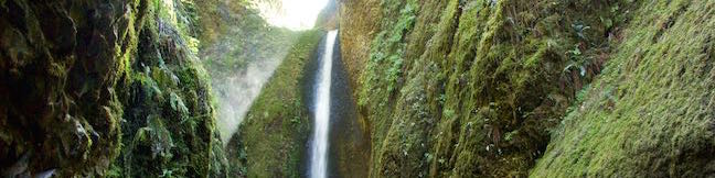
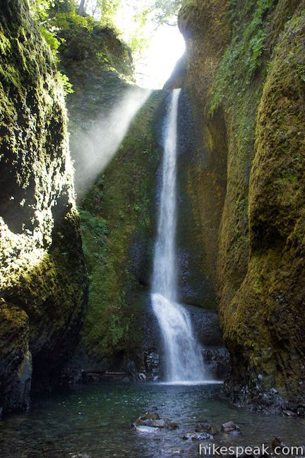
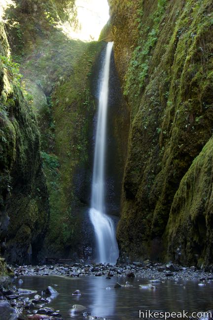
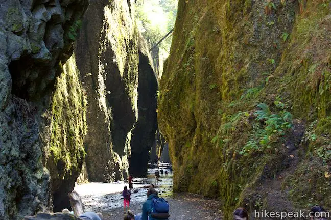
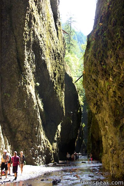
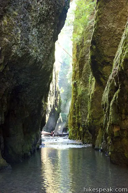
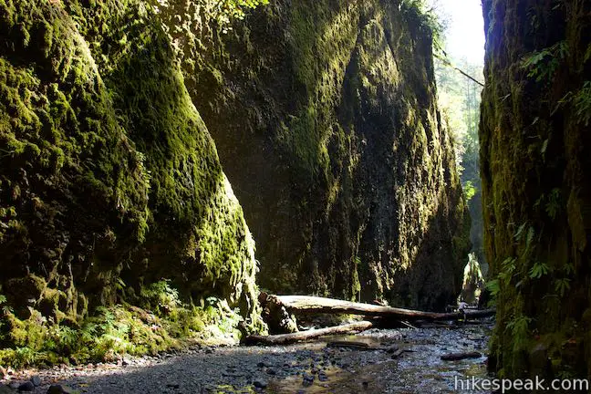
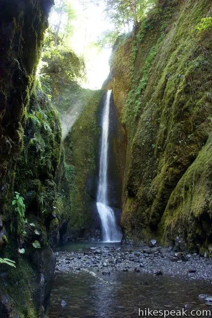
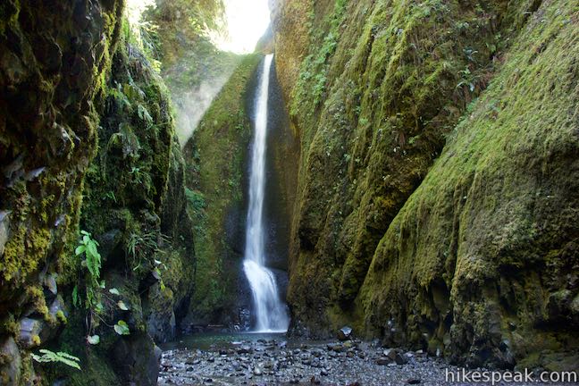
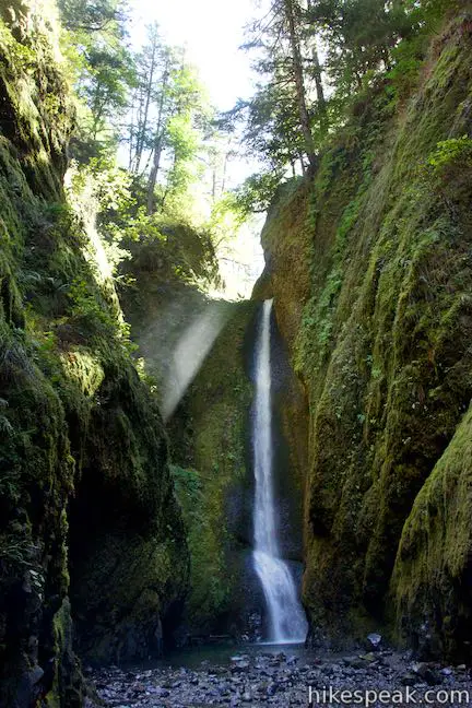
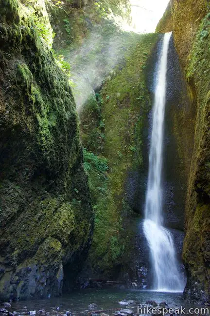
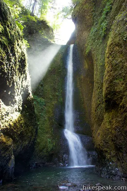
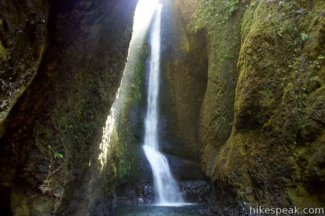
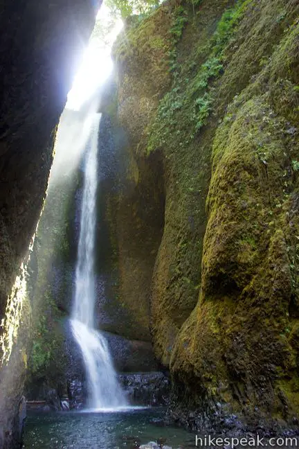
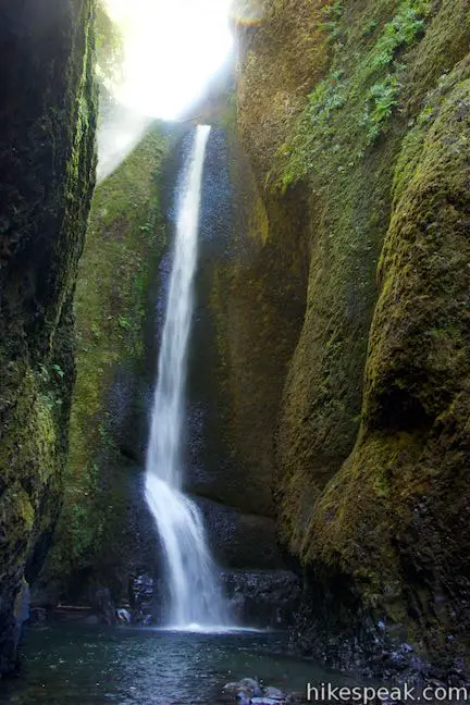
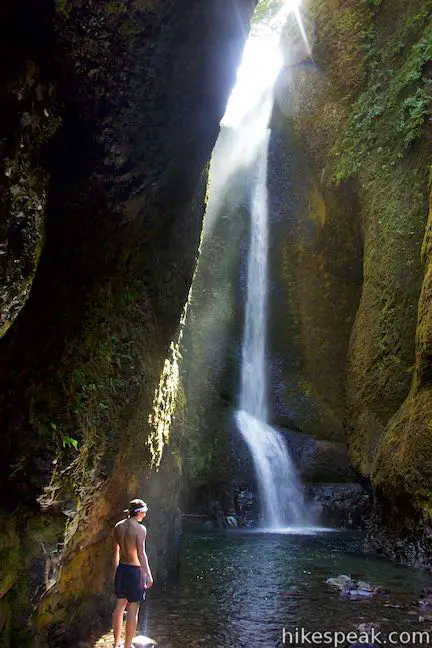
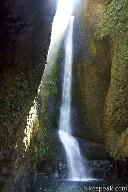
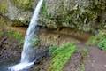
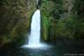
Lower Oneonta Falls is an enchantress – a 100-foot ribbon of white water plunging down a steep wall of dark volcanic rock draped in moss and ferns. Getting to this waterfall demands an off-trail adventure up Oneonta Gorge that involves wading through crystal clear stretches of Oneonta Creek as it passes between the towering walls of this narrow gorge.
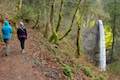
Located in Columbia River Gorge National Scenic Area (a land full of waterfalls, steep terrain, and lush vegetation), Oneonta Gorge is a truly wild gorge. The short but exciting excursion to Lower Oneonta Falls is just 0.8 miles round trip with obstacles along the way. There are downed tree trunks to climb over, rock walls to shimmy across, and up-to-your-navel water to wade through. This hike is a fun one!
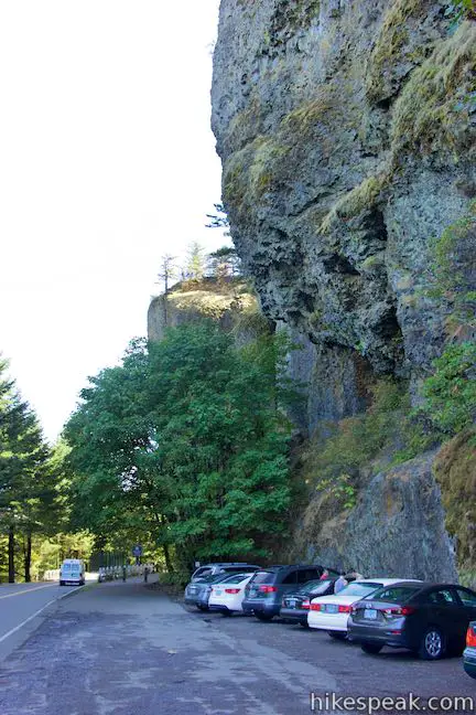
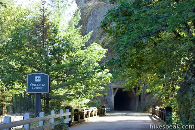
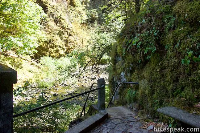
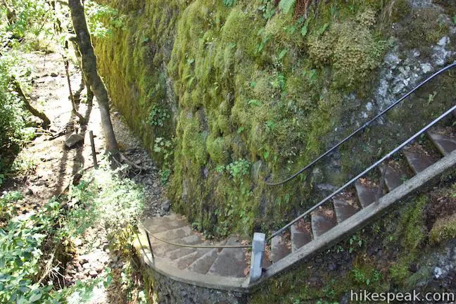
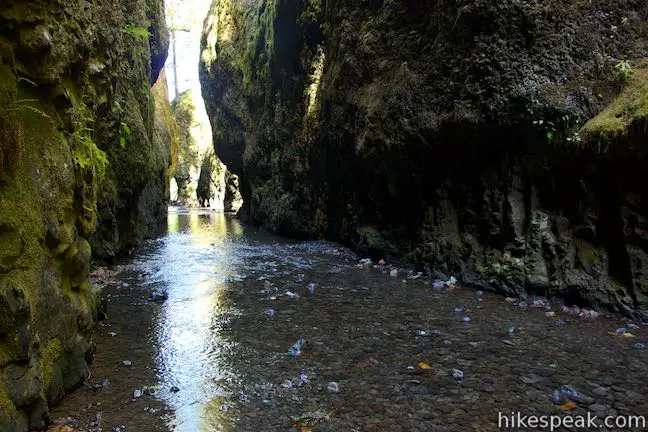
The off-trail trek to Lower Oneonta Falls begins from Historic Columbia River Highway, just west of Horsetail Falls. Look for a sign for Oneonta Gorge on the west side of a bridge over Oneonta Creek. Descend a staircase at the west end of the bridge and begin walking up the gorge. The gorge runs pretty straight south and the cliffs on each side are quite tall, so it’s impossible to get off course. Forge your way upstream and you’re bound to reach the waterfall.
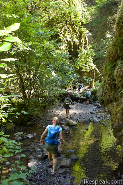
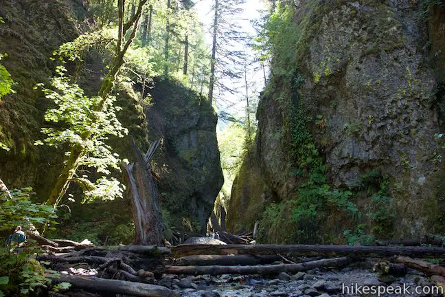
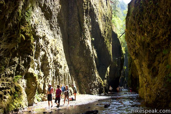
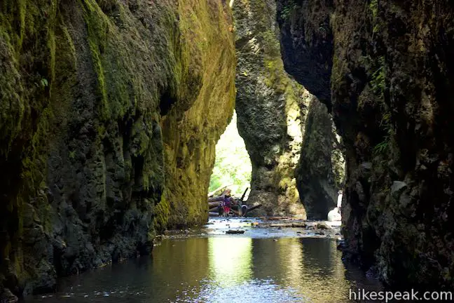
A path leads up and across the creek making use of rocks to hop across and logs to walk along. As the walls of the gorge come together and form a slot canyon-like alley, you’ll meet a cluster of tree trunks that present you’re first real obstacle. Climb over these logs and boulders, generally sticking to the left side of the gorge. When you get across the log jam, it will be harder to stay dry. Make your way out on the logs to avoid pools in the stream or just hop into the water. You’re going to have to get wet eventually, so embrace it.
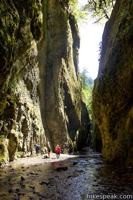
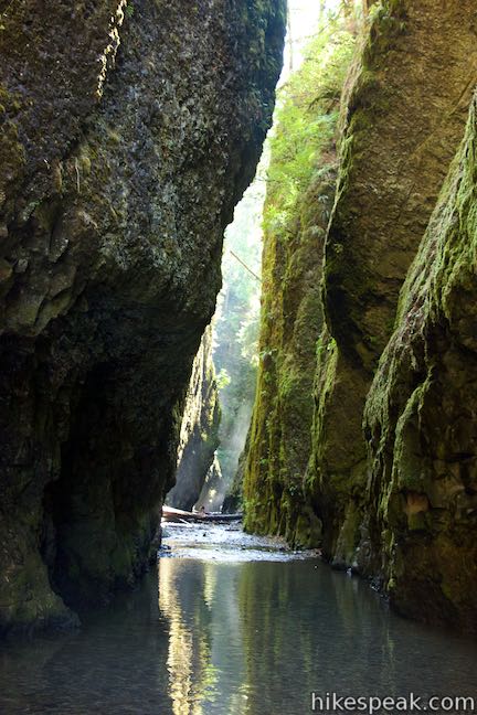
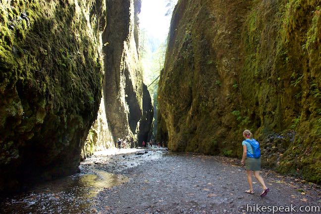
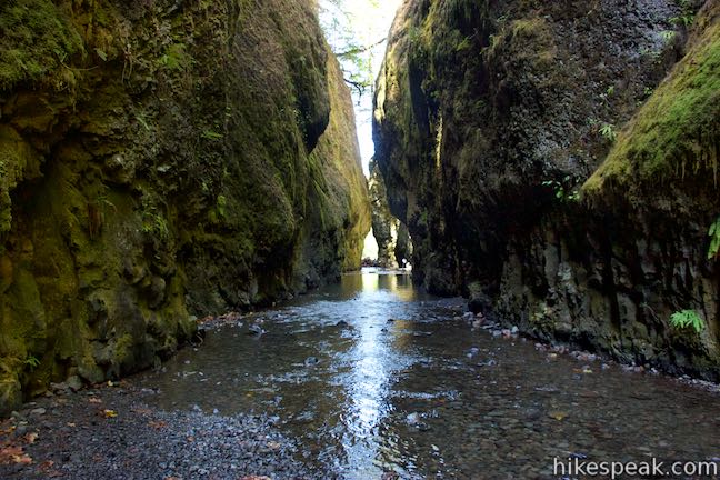
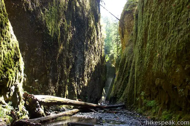
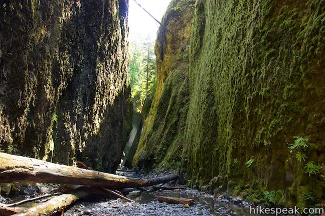
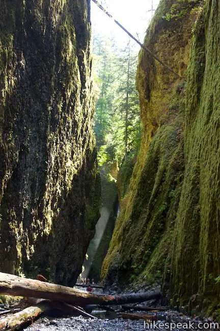
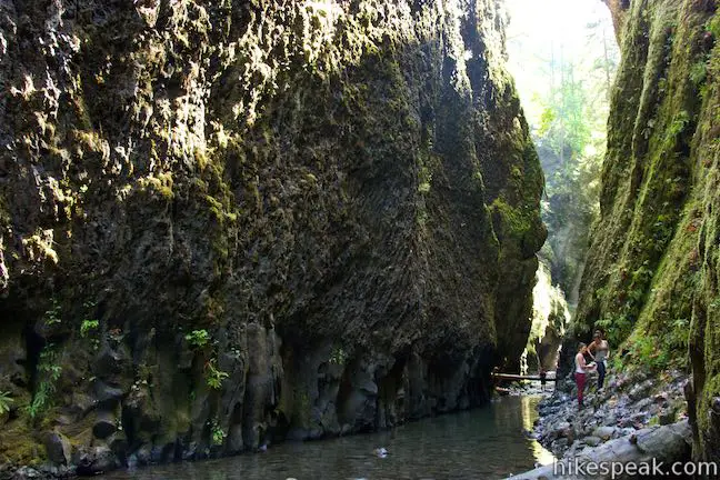
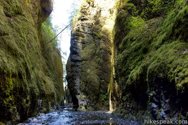
Oneonta Creek runs clear, and it is nice to look down on the colorful rocks below the water. Moss, ferns and other small green vegetation cling to the side of the gorge like tapestries covering the dark, sheer cliffs.
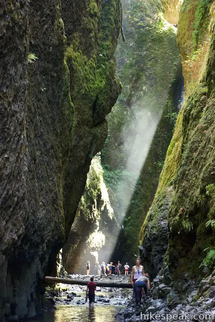
Walk up the gorge through the flowing water to gravel beds on the sides of the creek. Much of this water may be less than ankle deep. However, the walls pinch together in a couple places where the gorge is only about twenty feet across. In these spots, the creek deepens and takes up the width of the gorge, so you have to just wade through. The final deep spot in the creek is the deepest of all and you can quickly find yourself in water up to your waist. If you’re feeling spry you may be able to avoid getting in too deep by clinging to the rock wall on the right side of the gorge and hoisting your way across ledges to drier ground.
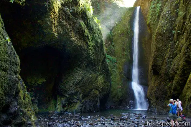
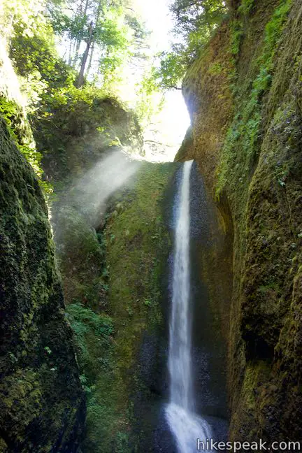
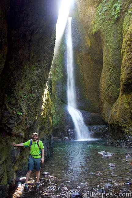
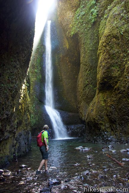
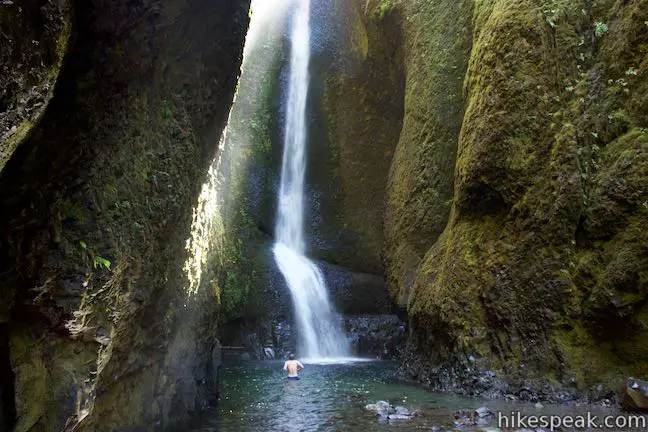
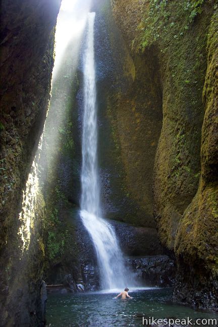
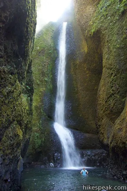
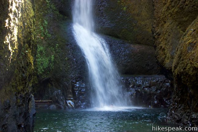
Past the second deep pool, it is just a short walk up to the base of Lower Oneonta Falls. The waterfall slides down the near-vertical cliffs at the back of the gorge, hitting rock and fanning out just above the creek. Beneath the waterfall, which is at least a hundred feet tall, a pool fills the space at the back of the gorge.
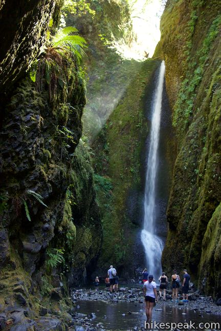
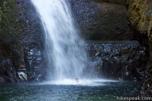
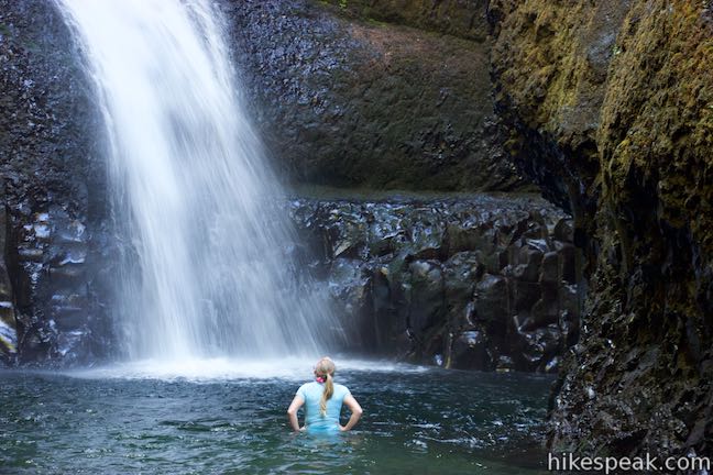
Around midday, the sun lines up above the end of the gorge and drops a shaft of light across the top of the waterfall, adding to the magic of this beautiful location. Easing closer than the obvious viewing area at the edge of the pool, the waterfall grows in volume, size, and presence. You can wade or swim forward to get right up to the waterfall and feel wrapped up by the walls of the gorge.
When you are ready to leave the stunning waterfall, there’s no other option than to turn around and head back down the gorge. The hike to Lower Oneonta Falls is 0.8 miles round trip with only about 25 feet of elevation change.
During the spring wet season, Oneonta Gorge may be impassable (and the water will be cold). Target lake summer for your hike, when water levels are generally low enough to make reaching the waterfall possible. Conditions in the gorge may change year to year. There is no maintained trail up the gorge. Be mindful of your safety. Dogs are allowed, but Oneonta Gorge is not appropriate for all dogs or all hikers. Wear footwear and clothing that can get wet. No fee or permit is required to visit Lower Oneonta Falls, so enjoy the adventure!
CLOSURE UPDATE: This hike is closed to the public because of damage from the 2017 Eagle Creek Fire. Find more information about the closure on the US Forest Service’s Columbia River Gorge National Scenic Area: Alerts and Notices webpage.
Directions to the Trailhead
- From Portland, take Interstate 84 east for 33 miles to exit 35, following a sign for Ainsworth State Park and Historic Highway.
- Bear right at the end of the offramp, heading west on a frontage road that immediately meets Historic Columbia River Highway.
- Turn left and drive 1.7 miles to a parking area at the trailhead, half a mile past the parking area for Horsetail Falls.
- A paved parking area is on the left, along with additional parking on the right.
- From The Dalles, take Interstate 84 west for 50 miles to exit 35.
- At the end of the offramp, continue west on Historic Columbia River Highway.
- Drive 1.8 miles to the trailhead parking area for Oneonta Gorge.
Trailhead Location
Trailhead address: Historic Columbia River Highway, Corbett, OR 97019
Trailhead coordinates: 45.589485, -122.07558 (45° 35′ 22.14″N 122° 04′ 32.08″W)
You may also view a regional map of surrounding Oregon trails and campgrounds.


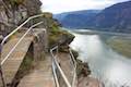
 | Horsetail Falls Trail - Oneonta Trail Loop This 2.85-mile loop explores three waterfalls by starting at Horsetail Falls, passing beneath an overhang behind Ponytail Falls, and crossing a bridge alongside Middle Oneonta Falls. The loop also passes viewpoints looking out over the Columbia River Gorge and can be extended to visit even more waterfalls. |
 | Beacon Rock Trail This 1.6-mile hike follows an impressively engineered trail packed with switchbacks that scale a monolith along the Columbia River. |
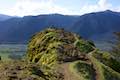 | Hamilton Mountain The beautiful 7.75-mile lollipop loop visits bombastic waterfalls and panoramic cliffs on the Washington side of the Columbia River Gorge in Beacon Rock State Park. |
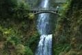 | Multnomah Falls This 0.4 to 2.6-mile hike visits Oregon's tallest (and probably most visited) waterfall, offering something to hikers of all abilities. |
 | Multnomah-Wahkeena Loop This 6.05-mile loop uses Wahkeena Trail and Larch Mountain Trail to visit six glorious waterfalls (Wahkeena Falls, Fairy Falls, Ecola Falls, Weisendanger Falls, Dutchman Falls, and Multnomah Falls) as well as many fine cascades along Wahkeena Creek and Multnomah Creek in two beautiful canyons off Columbia River Gorge. |
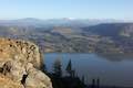 | Angel's Rest This 4.8-mile hike ascends to a panoramic landing with spectacular views across Columbia River Gorge (particularly at sunrise). |
 | Latourell Falls Trail This 2.3-mile loop explores a canyon with two beautiful waterfalls, attaining great views of both. |
 | Wahclella Falls This 2-mile hike visits a sublime waterfall in a canyon within the Columbia River Gorge. |
 | Eagle Creek Trail This 4.55-mile hike ventures up a beautiful and dramatic canyon to impressive waterfalls like Metlako Falls, Lower Punchbowl Falls, and Punchbowl Falls. |
 | Mosier Twin Tunnels This 2 to 9.5-mile hike ventures up Historic Columbia River Highway State Trail to a pair of tunnels carved into basalt cliffs on the side of Columbia River Gorge. |
 | More trails in Oregon Explore other hikes in Oregon outside the Columbia River Gorge. |
- Oneonta Gorge in Curious Gorge by Scott Cook (opens in a new tab)
- Oneonta Gorge on oregonhikers.org (opens in a new tab)
- Lower Oneonta Falls on oregonhikers.org (opens in a new tab)
- Oneonta Gorge on nwhiker.com (opens in a new tab)
- Oneonta Gorge and Lower Oneonta Falls on gorgefriends.org (opens in a new tab)
- Oneonta Gorge on wikipedia.org (opens in a new tab)
Common Questions about Lower Oneonta Falls in Oneonta Gorge in Columbia River Gorge National Scenic Area
- Is the trail open?
- Alert: Oneonta Gorge is currently marked as Closed. Please check official websites for current status.
- Is this trail free to access?
- Yes, Oneonta Gorge is free to access. No entrance fee, pass, or permit is required. If you discover that access rules have changed, please provide feedback on your experience.
- How much time does this hike take?
- It takes approximately 15 minutes to hike Oneonta Gorge. Individual hiking times vary. Add extra time for breaks and taking in the views.
- How long is this hike?
- The hike to Oneonta Gorge is a 0.8 mile out and back with 25 feet of elevation change.
- Are dogs allowed on this trail?
- Yes, dogs are allowed on Oneonta Gorge. The trail is open to hikers, dogs.
- Is Oneonta Gorge good for kids?
- Yes, this hike is likely suitable for children. It is relatively short (0.8 miles) with manageable elevation gain.
- Will I see a waterfall on this hike?
- Yes, Oneonta Gorge features a waterfall.
- What mountain range is this trail in?
- Oneonta Gorge is located in the Cascade Range.
- Where is the trailhead located?
- The trailhead for Oneonta Gorge is located in Corbett, Oregon.
Trailhead Address:
Historic Columbia River Highway
Corbett, Oregon 97019
Trailhead Coordinates:
45.589485, -122.07558 - What are the driving directions to the start of the hike?
To get to the trailhead: From Portland, take Interstate 84 east for 33 miles to exit 35, following a sign for Ainsworth State Park and Historic Highway. Bear right at the end of the offramp, heading west on a frontage road that immediately meets Historic Columbia River Highway. Turn left and drive 1.7 miles to a parking area at the trailhead, half a mile past the parking area for Horsetail Falls. A paved parking area is on the left, along with additional parking on the right.
From The Dalles, take Interstate 84 west for 50 miles to exit 35. At the end of the offramp, continue west on Historic Columbia River Highway. Drive 1.8 miles to the trailhead parking area for Oneonta Gorge.
View custom Google Maps directions from your current location.
- Are there other trails near Oneonta Gorge?
- Yes, you can find other nearby hikes using the Hikespeak Hike Finder Map.

5 Comments on Lower Oneonta Falls in Oneonta Gorge in Columbia River Gorge National Scenic Area
What hikers are saying:
✨ Generated summary of user commentsThis trail offers an adventurous water experience where visitors wade through a narrow gorge to reach the falls. While the water reaches chest height, swimming is unnecessary for adults, though children and pets will need to be carried.
Where do I find out how deep the river is right now in July? I want to go to Oneonta Falls but I don’t know how to swim.
Only goes to chest. You do not have to swim unless you are a dog. Children get carried
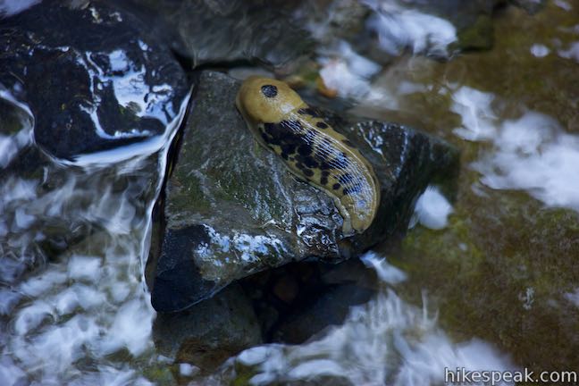
Is there a special kind of lichen on the cliff walls? Was it damaged by the fire?
We were hoping to hike Lower Oneonta Falls. This site says it was closed due to fire in 2017. Is it now 2023, is it open to the public now?
Hi, Beth
This area remains closed. More information about the closure can be found here: https://www.fs.usda.gov/Internet/FSE_DOCUMENTS/fseprd1068009.pdf