Mosier Twin Tunnels via Historic Columbia River Highway State Trail in Columbia River Gorge
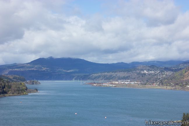
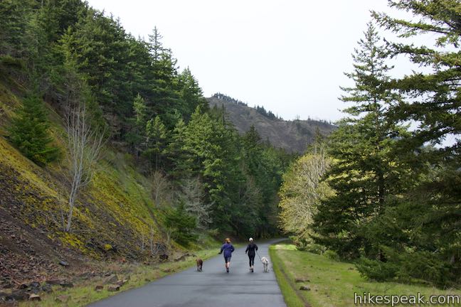
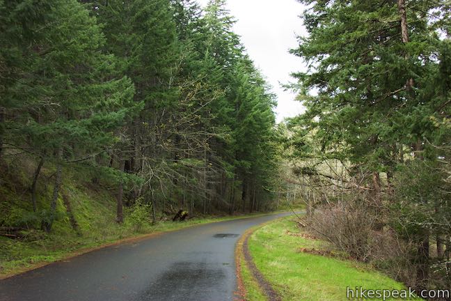
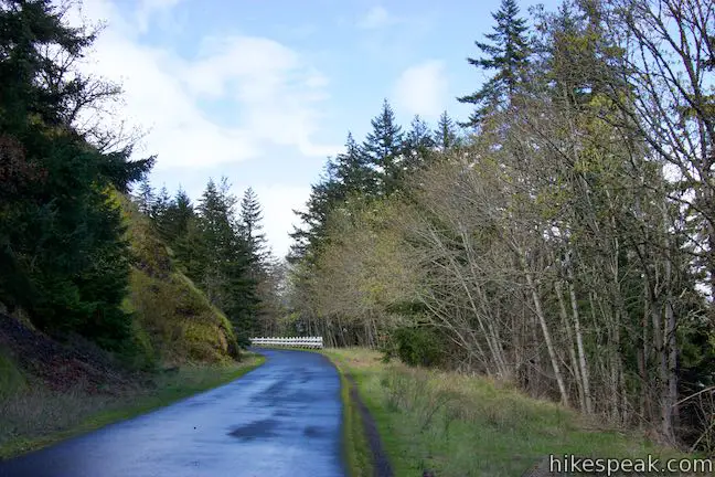
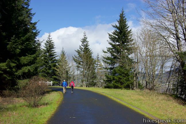
With its grand river and towering cliffs, the Columbia River Gorge is a tough place to build a roadway. See one of the engineering feats used to build a road through the gorge by moseying over to the Mosier Twin Tunnels. This picturesque pair of tunnels can be crossed on Historic Columbia River Highway State Trail, which follows the route of the century old road that crossed the gorge long before I-84. A paved 4.7-mile long section of Historic Columbia River Highway State Trail is open for hikers, joggers, and cyclists (but not vehicles) and is operated by Oregon State Parks. This trail explores an area of the Columbia River Gorge east of Hood River and presents big views across the river and surrounding landscapes. The trail is wide and paved, which is quite handy if you are looking for a mud-free gorge hike after heavy rains.
Start in the town of Mosier, from the east end of Historic Columbia River Highway State Trail, for the shortest hike to the entrance of the twin tunnels, which is 2 miles round trip.
Going farther, you can hike through the tunnels up to County Line Overlook, which offers a great vantage across the Columbia River from the high point of the trail. The hike through the tunnels and up to County Line Overlook and back is 3.9 miles round trip with 320 feet of elevation change.
The trail continues beyond that through rolling terrain with more views of the gorge. Going all the way to the west end of the trail and back is 9.5 miles round trip (or use the trailhead in Hood River for a two-vehicle shuttle and cut that distance in half).
Historic Columbia River Highway State Trail (also known as Historic Columbia River Highway Trail or HCRHT) is probably more popular with bikers than hikers as it provides a scenic car-free ride of a good length.

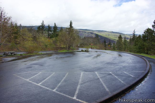
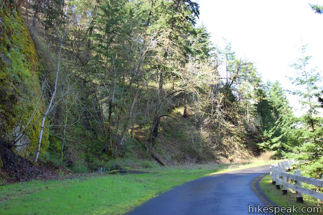
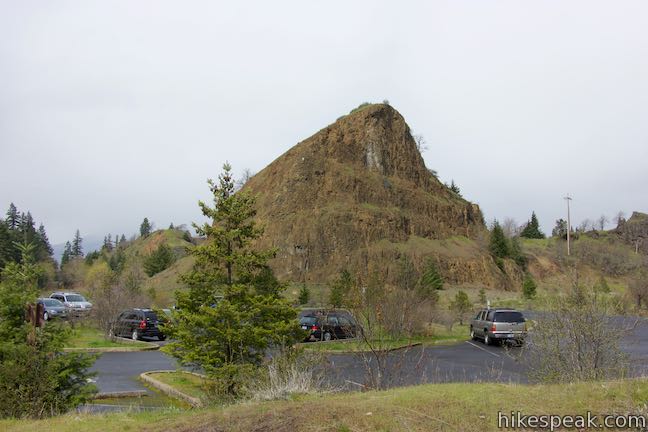
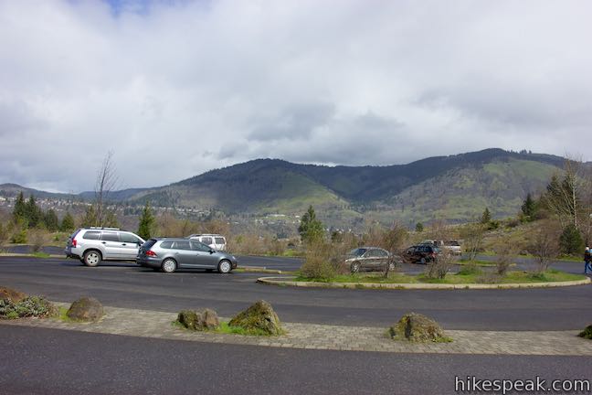
Starting in the east, the hike begins from Senator Mark O. Hatfield Trailhead on Rock Creek Road about 3/4 of a mile from Interstate 84 in Mosier. Drive up to the trailhead, you’ll actually pass the bottom of Historic Columbia River Highway State Trail on the right, but there is only room for handicapped parking at the bottom of the old road. The general public starts from a larger parking area a little farther up Rock Creek Road.
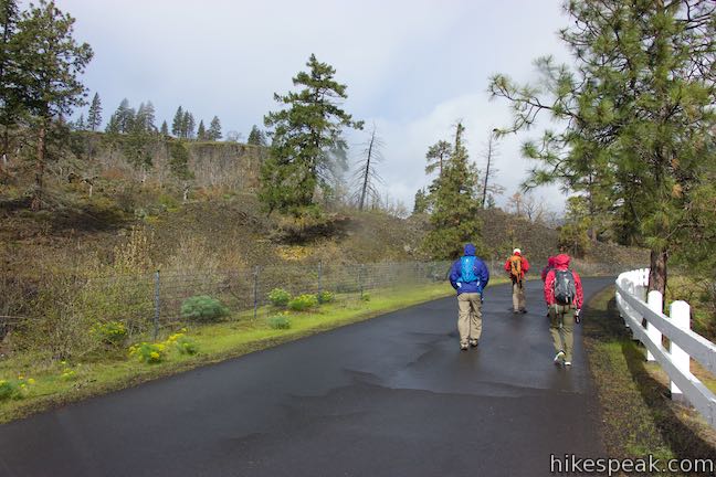
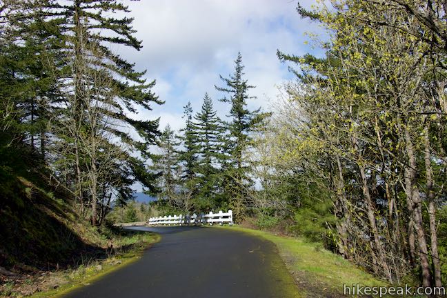
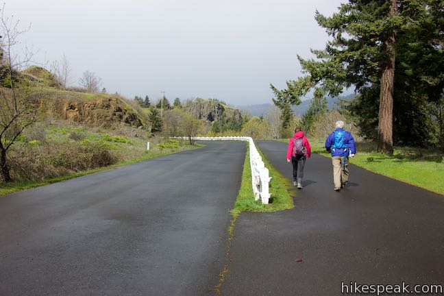
Set out from the parking lot and walk back along the road, following diamonds painted on the pavement. Use the crosswalk to switch to the left side of the road and continue downhill. Follow the walkway on a paved arm that temporarily parts from the road, rejoining it at the intersection with Historic Columbia River Highway State Trail. Turn left and begin up the wide paved trail. Pass a small handicapped parking area and come to an information panel and gate at the official start of the trail (less than a quarter mile from your actual starting point). The panel reads:
The rugged landscape of the Columbia River Gorge posed significant obstacles to the design and construction of the Historic Columbia River Highway. Here, between Hood River and Mosier, a right-of-way conflict with the railroad forced engineer John A. Elliott to locate the road away from the river and to design tunnels through steep basalt bluffs. The 17-foot-wide Mosier Twin Tunnels easily accommodated two-way traffic by Model Ts. But as automobiles became larger, accidents were common – despite widening to 20 feet. Although signals eventually regulated one-way traffic, waiting vehicles were vulnerable to falling rock from the bluffs above. With construction of a water grade thoroughfare in the 1950s, the tunnels were closed and filled. Thanks to efforts of Oregon’s Senator Mark O. Hatfield, restoration of these famous tunnels as part of a hiking and bicycling path began in 1995.
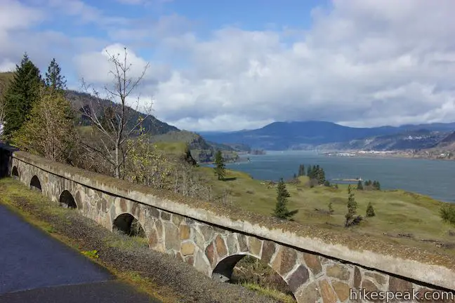
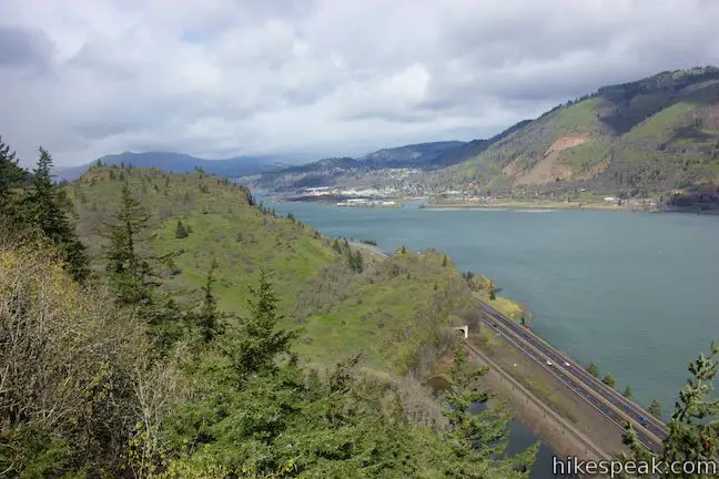
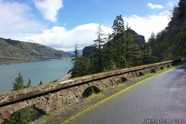
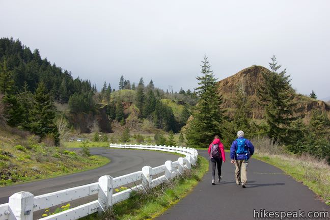
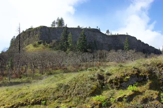
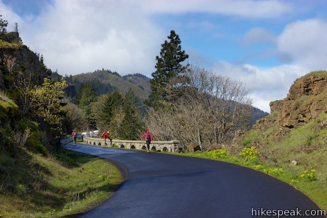
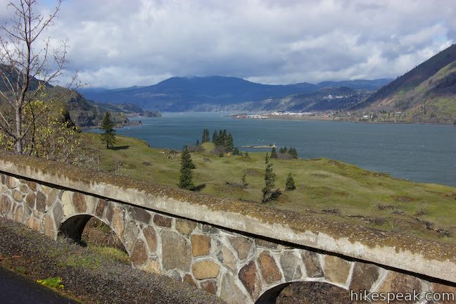
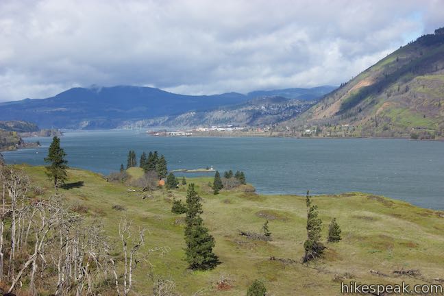
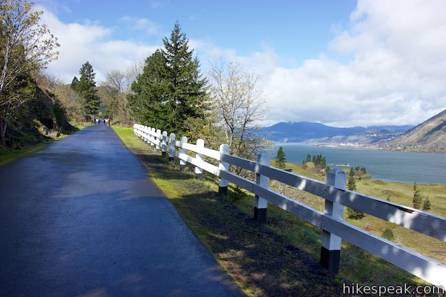
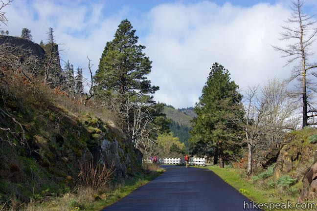
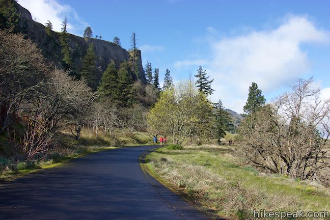
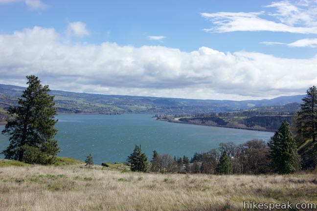
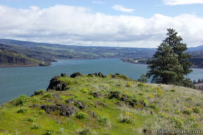
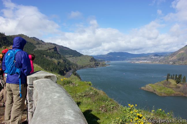
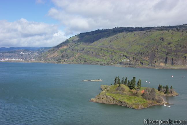
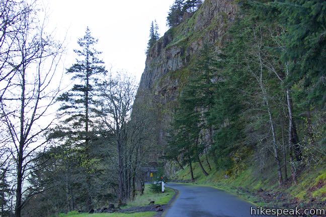
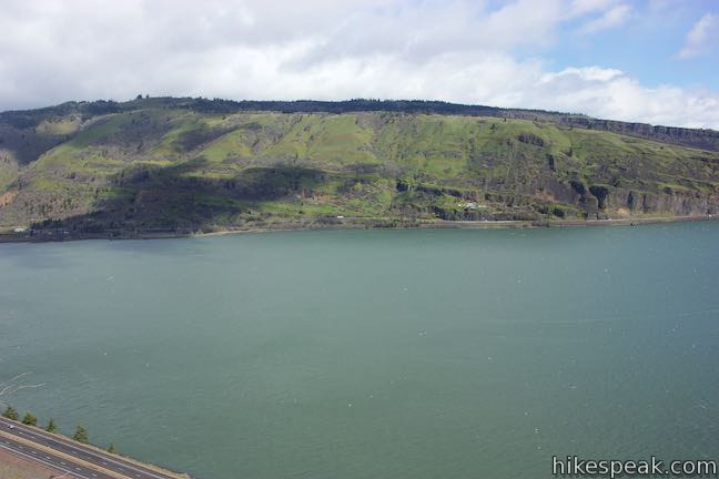
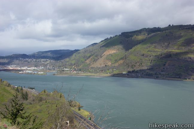
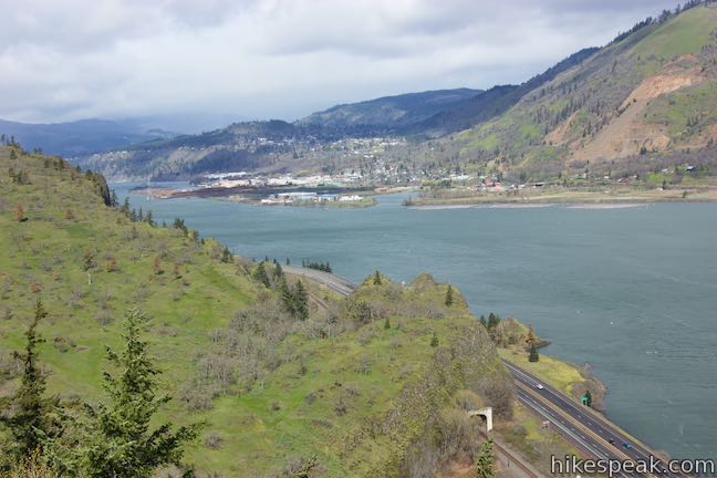
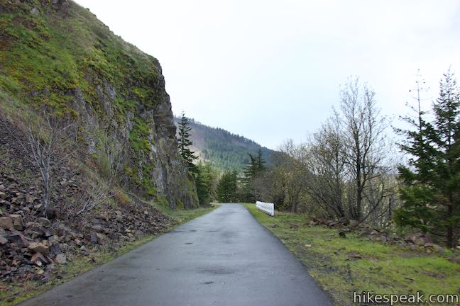
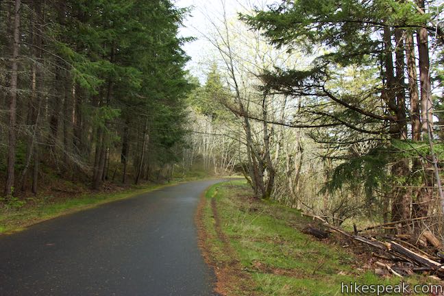
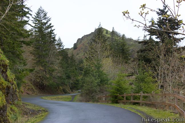
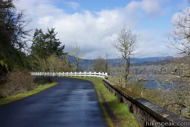
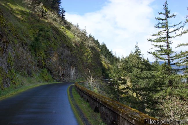
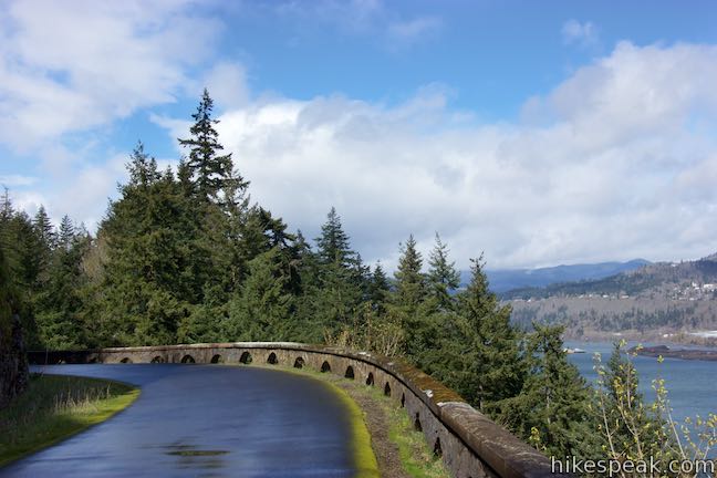
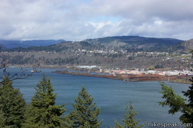
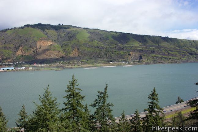
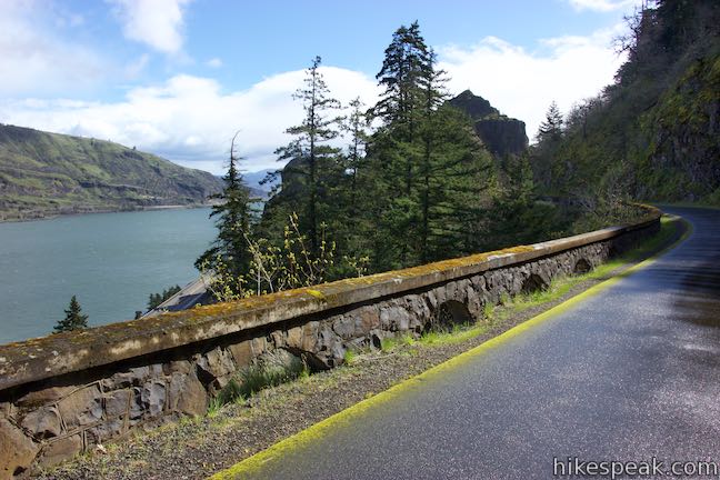
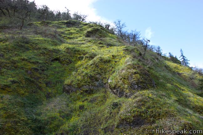
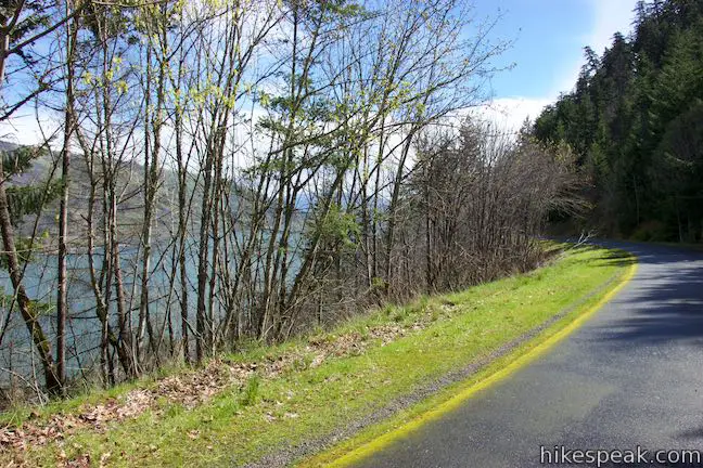
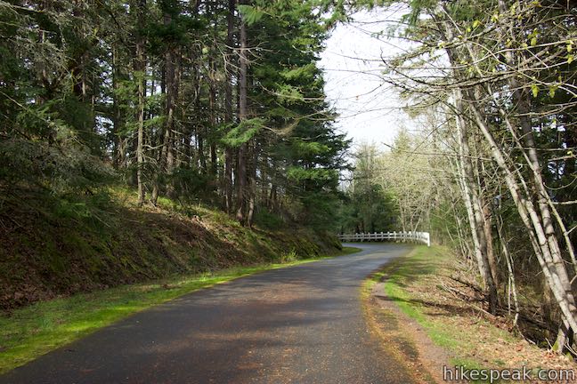
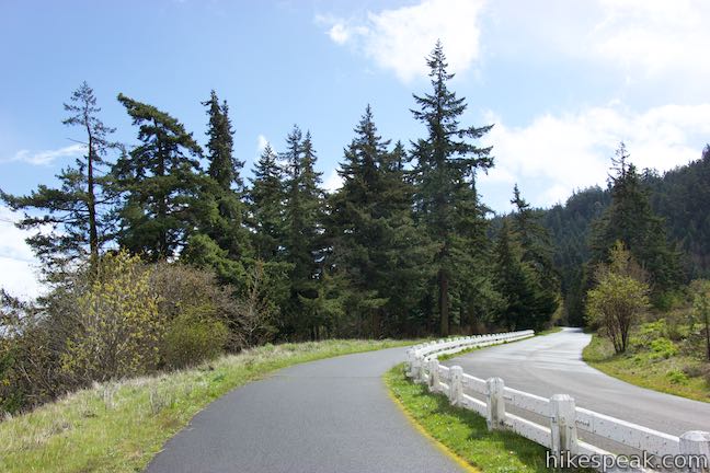
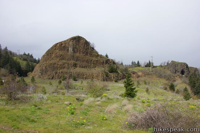
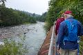
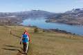
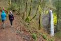
Hike up the paved trail, which is bordered by white guardrails in many places. These, and some of the arching stone walls farther up the trail, are replicas of original guardrails along the road. A lumpy landscape of hardened lava covers the hillside to the right. Spaced out trees on this hillside provide views east up a pre-gorge section of the Columbia River where the wide waterway cuts through verdant, less steep terrain.
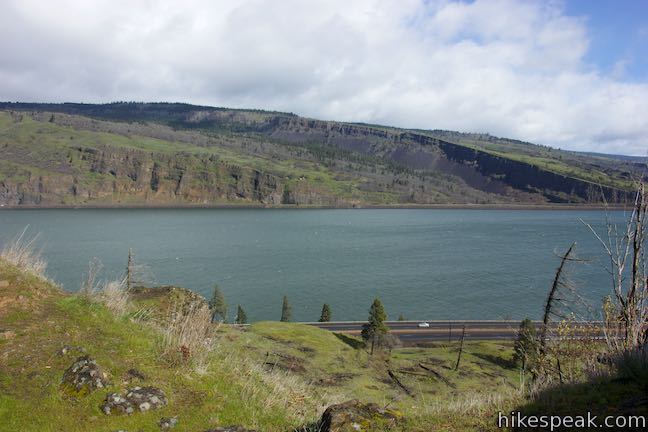
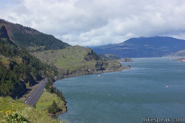
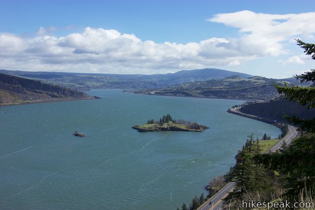
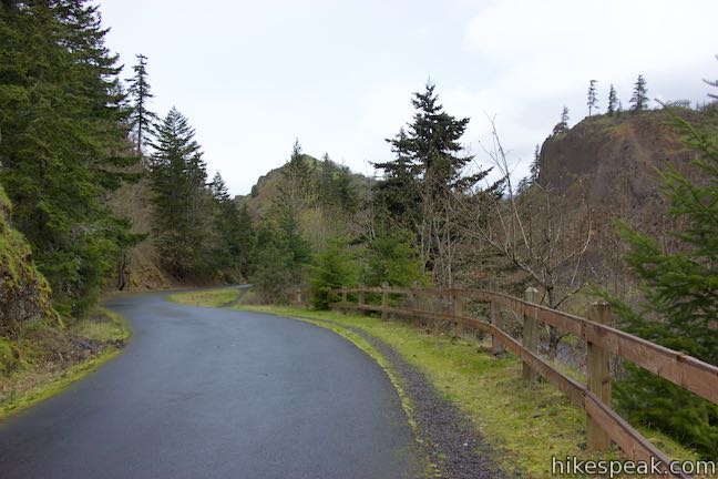
You’ll see vertical cliffs on the left as Historic Columbia River Highway Trail curves to the left to head west toward the tunnels. The trail proceeds gradually uphill. To your right, you’ll find views up and down Columbia River Gorge.
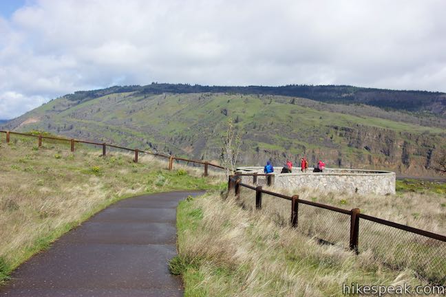
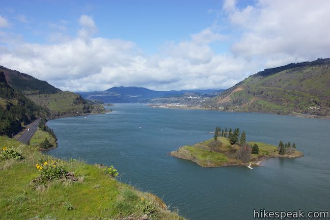
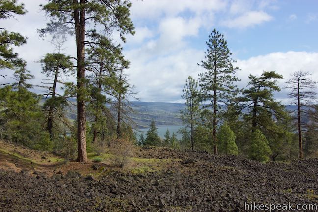
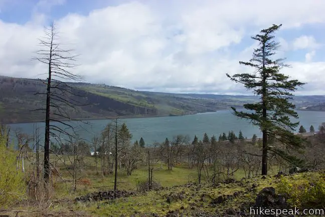
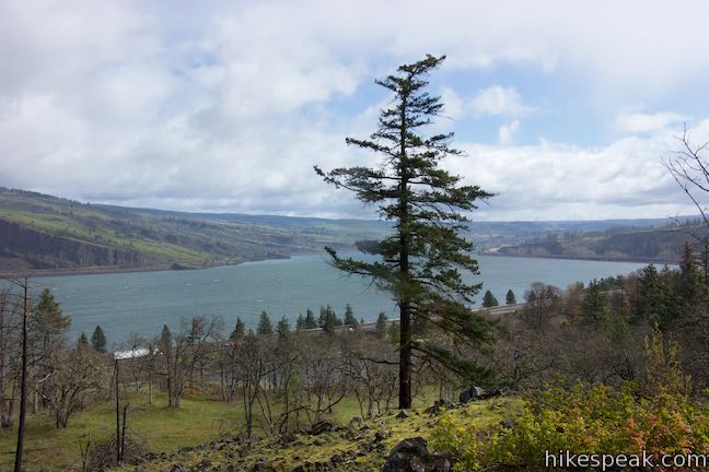
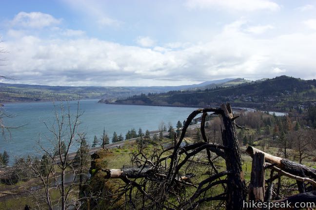
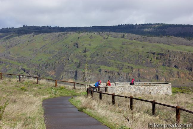
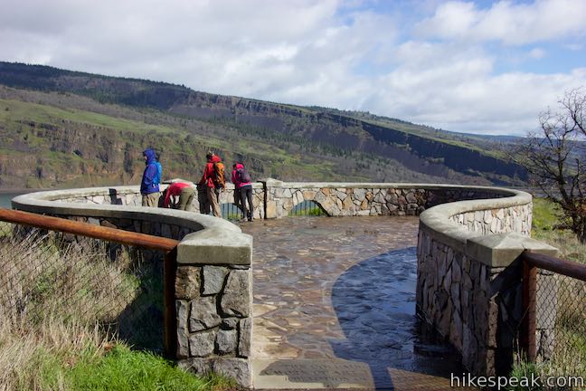
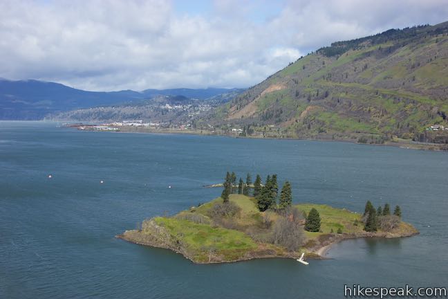
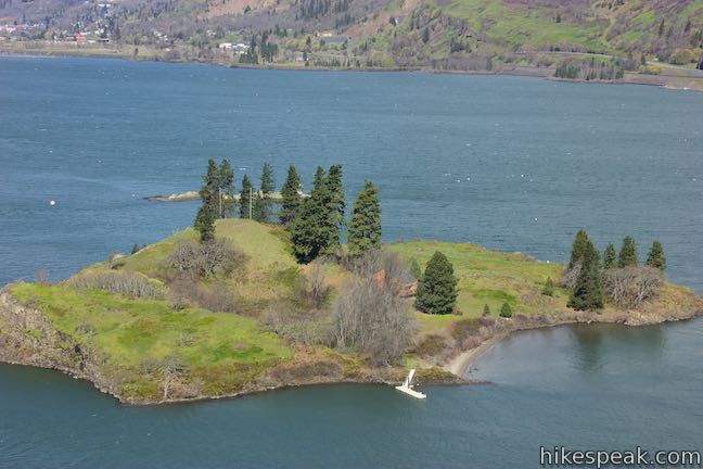
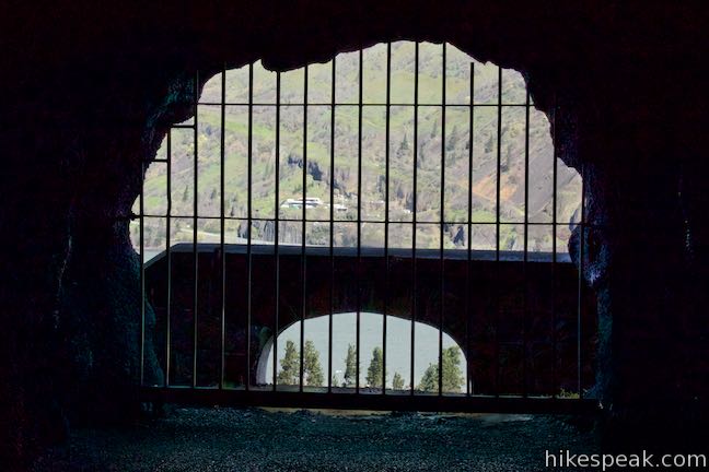
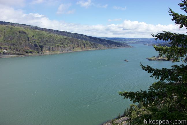
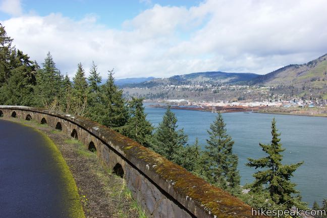
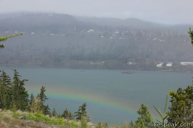
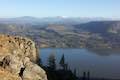
After 0.85 miles of hiking, and a tenth of a mile before the tunnels, find a spur on the right out to a stone overlook. Take it and walk a short distance to a round vista point. Explore big views from this location. Look over the cliffs toward Interstate 84, passing along the edge of the river below. Look north across the river toward Coyote Wall, also know as the Syncline, a tilted landscape of basalt cliffs in the state of Washington. Gaze down the river to the left and behold the vast beauty of Columbia River Gorge.
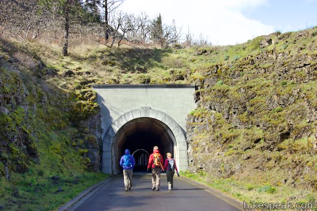
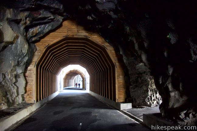
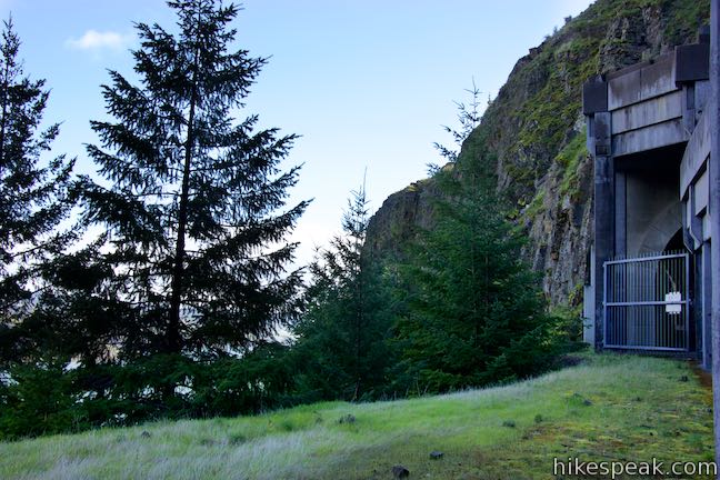
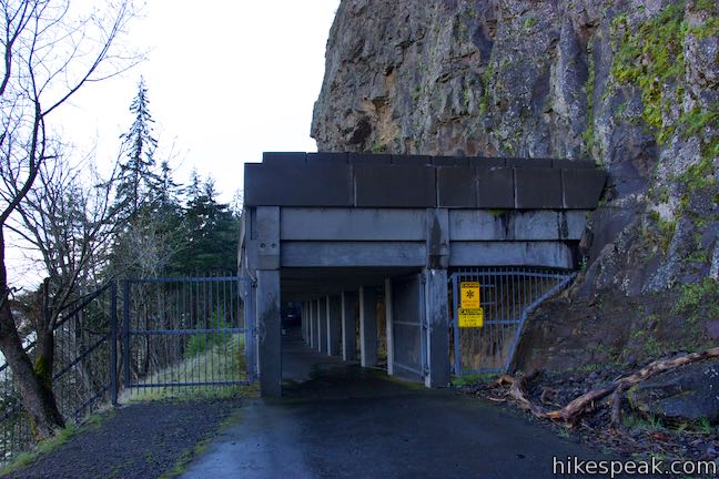
Leave the overlook and return to Historic Columbia River Highway State Trail. The spur to the overlook adds a tenth of a mile to the hike. In another tenth of a mile, you’ll reach the archway at the entrance of the Mosier Twin Tunnels.
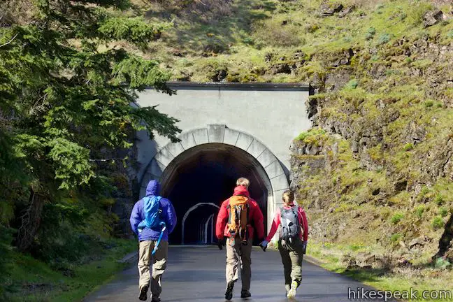
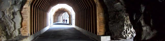
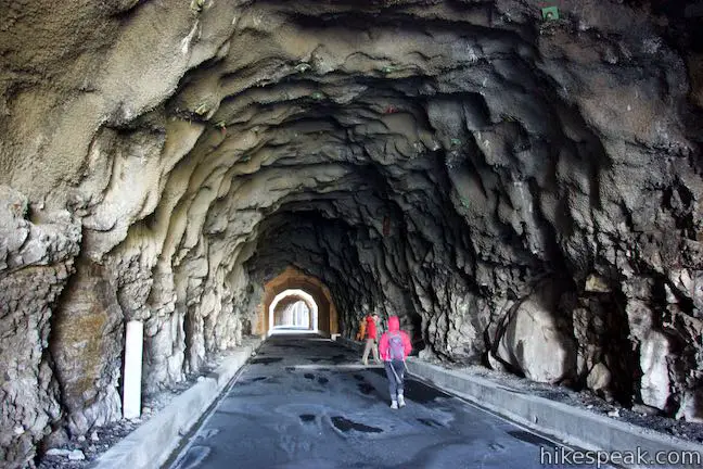
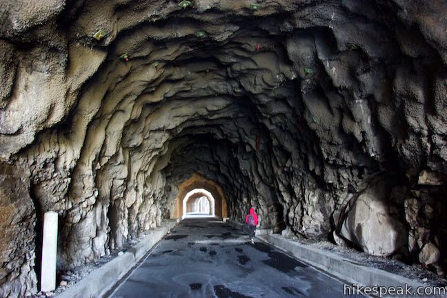
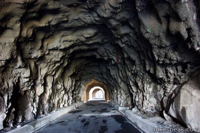
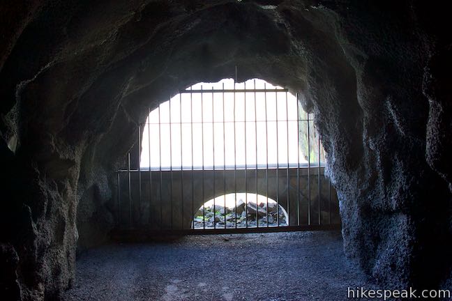
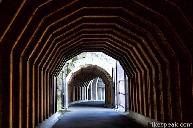
Step inside the first of two in-line tunnels carved into the basalt cliffs. The ceiling and walls of the tunnel are rough-cut rocks. Later sections are framed by wood. As you look down the tunnel, you’ll see light coming from a gap between the first and second tunnels and two windows on the right. This first tunnel is the longest, measuring 288 feet. Shortly after the first tunnel, you’ll enter a second that is 81 feet long. As you walk through the eastern tunnel, you’ll find two windows looking out across the gorge. Peer out for unique views over the river.
The Mosier Twin Tunnels were created between 1919 and 1920. Controlled explosions were used to clear four feet of basalt at a time as workers carved through the cliffs. Once open, travel through the tunnels was not without its difficulties. Even after the tunnels were widened, accidents occurred in the tunnels and dangerous rock falls came down around the tunnels.
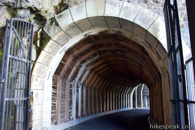
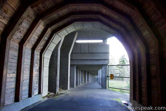
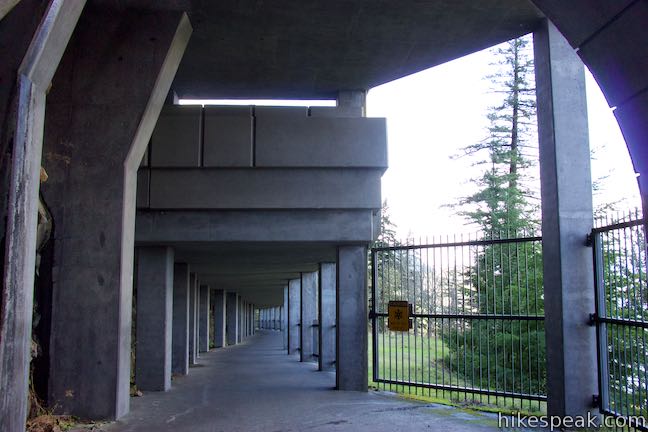
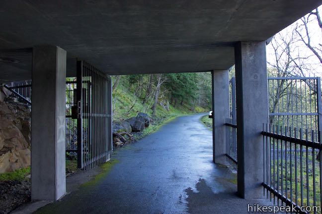
In the 1950s, a new highway was built along the river below. The Mosier Twin Tunnels, which had been a key link for travelers, became unnecessary. In 1954, the tunnels were closed to the public and filled in. Efforts to reopen the Mosier Twin Tunnels for recreational uses began in the 1980s. The rockfall hazard was eliminated with the construction of a long concrete catchment structure on the west side of the second tunnel and a shorter structure between the tunnels.
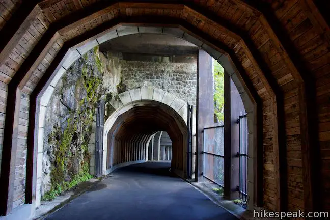
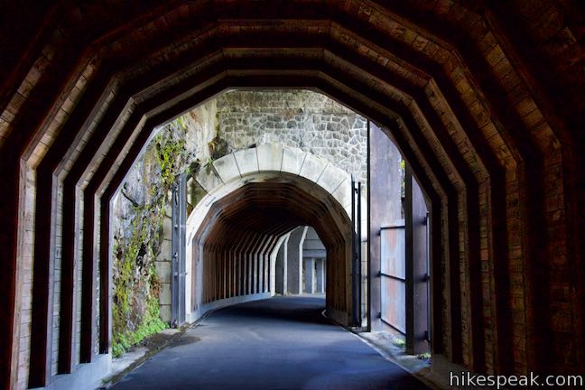
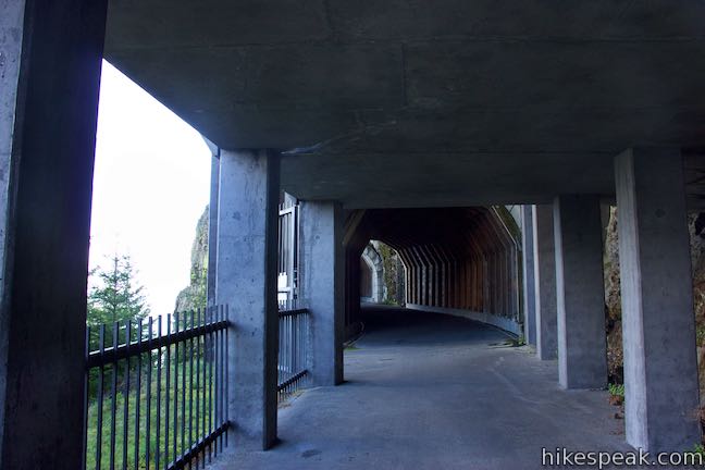
Make your way through the long eastern tunnel, pass through a small opening in between, and enter the western tunnel. Metal gates prevent you from straying out on the cliffs between the tunnels. The shorter second tunnel has wood paneling that frames the walls and ceiling. If you’re only interested in a short outing, you could turn around after the second tunnel for a hike of just over two miles round trip.
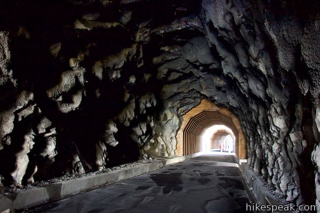
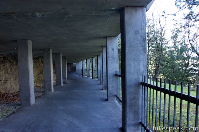
Proceeding on from Mosier Twin Tunnels, the trail remains covered by a long concrete ceiling supported by columns. The structure protects the trail from falling rocks. The trail goes downhill beneath this cover for 1/8 of a mile (longer than you are actually in the tunnels). Leave the protection of the Twin Tunnels Catchment Structure as the trail turns uphill and moves away from the cliffs.
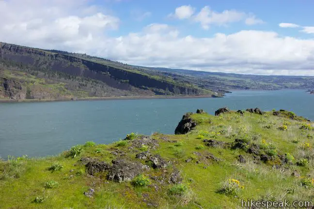
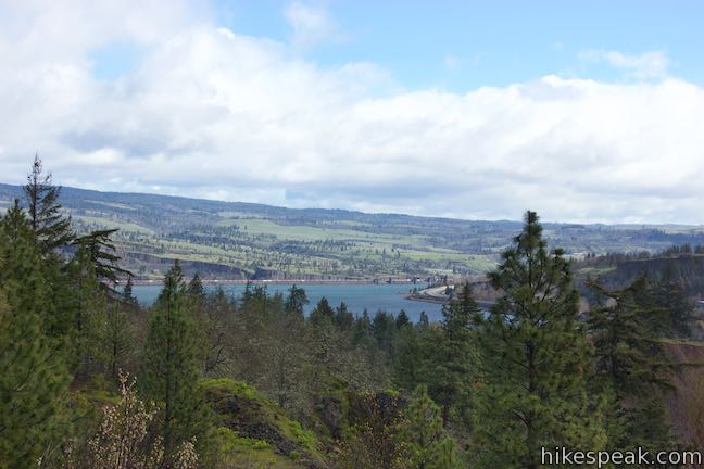
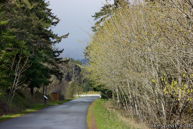
Historic Columbia River Highway State Trail gains 350 feet over the next 0.7 miles to crest the high point of the hike. Just as the trail begins to turn downhill, you’ll come to a vista point that bumps out from the right side of the trail. This is County Line Overlook. Up to this point, the hike has been in Wasco County. Hood River County is just ahead.
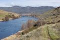
County Line Overlook presents great views over grass-topped cliffs toward the Columbia River. This viewpoint is 2 miles from the start of the hike and makes a good turnaround point for those not hiking the entire trail. Skipping the overlook east of the tunnels on the hike back trims 0.1 miles from the return distance for a 3.9-mile round trip hike with 320 feet of elevation change.
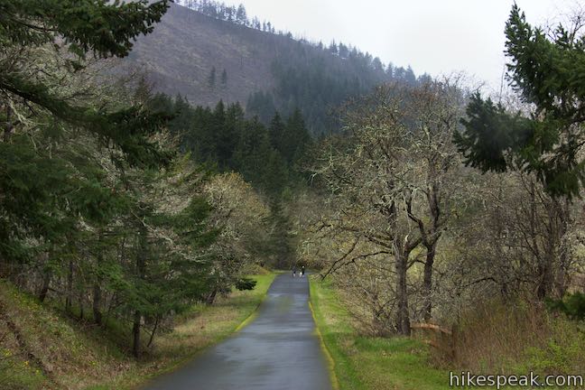
It is another 2.8 miles from County Line Overlook to the trailhead at the west end of Historic Columbia River Highway State Trail, crossing rolling terrain to ultimately descend 175 feet. The trail passes through forest for another half mile and comes to a junction with a gravel road that parts to the right and heads out to a flatter area on cliffs above the river. This road is open to hikers.
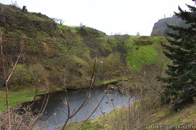
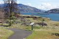
About a tenth of a mile after the junction with the gravel road, Historic Columbia River Highway State Trail passes a long, narrow pond in a trench on the right that formed within an old quarry. Several quarry sites are located along this trail, including the western trailhead.

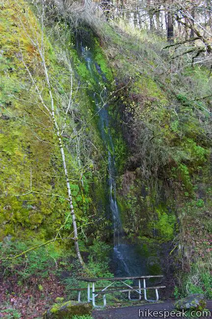
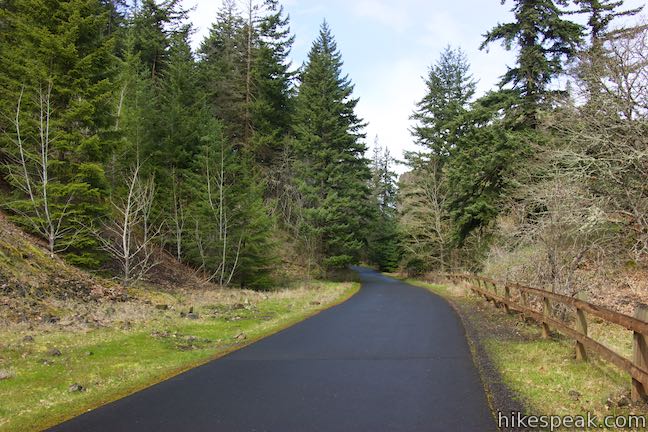
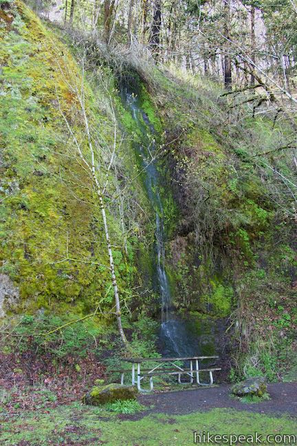
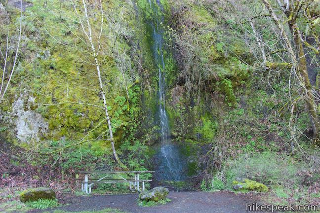
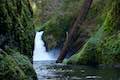
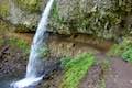
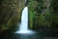
The trail makes its way gradually downhill through forest on the side of the gorge. As it starts to turn uphill again, after 3.5 miles of hiking, you’ll pass a thin waterfall dropping down the short cliffs to the right. A picnic table below this waterfall presents a nice place to take a break.
Continuing on, the trail gains another 75 feet of elevation. Don’t be alarmed when you see that the Columbia River is still well below you. The trail does not drop all the way down to river level and maintains a loftier position on the side of the gorge.
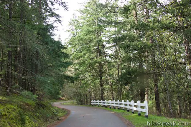
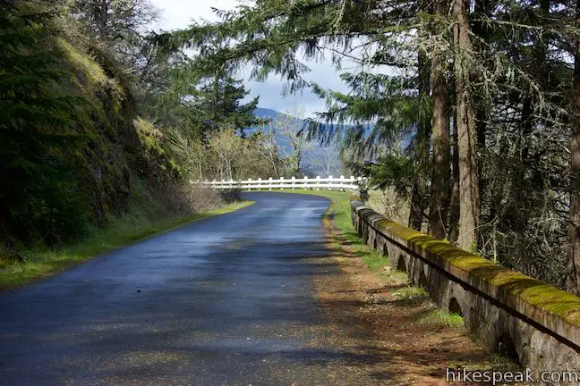
After turning downhill again, the trail passes a concrete marker labeled 69 that is a historic milepost from the old road. The last 0.6 miles are all downhill, lined by maples, firs, and intermittent views over the Columbia River. With 0.2 miles to go, you will pass a sign describing the trees and plants along the trail. A few paces past that, you’ll come to a split. The road ahead is open to vehicle traffic, so veer right on a paved sidewalk separated from the road by a white railing.
Walk down this last stretch of the trail to the trailhead parking area at the Hood River end of HCRHT. This trailhead is located below a pointed bluff and has bathrooms and a visitor center. If a vehicle is waiting for you here, you can end the hike after 4.8 miles. Otherwise, return the way you came for a 9.5-mile hike (or bike ride) with 320 feet of overall elevation change.
The trailheads are operated by Oregon State Park. A $5 day use fee is required to park at either trailhead (or a $30 annual pass). No permit is necessary to hike to Mosier Twin Tunnels. Dogs and bikes are allowed on Historic Columbia River Highway State Trail, so get out and enjoy!
Directions to the Trailhead
Eastern Trailhead (Mosier):
- Take Interstate 84 to exit 69 for Mosier.
- Drive south on Route 30 and make a left on Rock Creek Road, which circles back below Route 30.
- Drive 0.7 miles and turn left into the Senator Mark O. Hatfield Trailhead for Historic Columbia River Highway State Trail.
- Begin by hiking back down along the road.
Western Trailhead (Hood River):
- Take Interstate 84 to exit 64 for Mount Hood Highway toward White Salmon and Government Camp.
- At the end of the ramp, turn south on another end of Route 30.
- Drive 0.3 miles and turn left onto Old Columbia River Drive, following signs for Historic Columbia River Highway State Trail.
- Drive 1.2 miles up this winding road and turn left into the trailhead parking area and visitor center.
Trailhead Location
Trailhead address: Mosier Trailhead, 1758 Rock Creek Road, Mosier, OR 97040
Trailhead coordinates: 45.68, -121.409 (45° 40′ 47.99″N 121° 24′ 32.4″W)
Trailhead address: Hood River Trailhead, 2380 Old Columbia River Drive, Hood River, OR 97031
45.7034, -121.4867 (45° 42′ 12.24″N 121° 29′ 12.11″W)
View Mosier Twin Tunnels in a larger map
Or view a regional map of surrounding Oregon trails and campgrounds.


 | Pipeline Trail This easy and enticing 2.8-mile hike along Hood River crosses a catwalk atop a penstock flume pipeline. |
 | River Trail Loop This 3.1-mile loop in Deschutes River State Recreation Area borders the bottom of the Deschutes River and explores views from the water's edge and a grassy terrace. |
 | Coyote Wall This partial loop covers 5.8 miles as it ascends Coyote Wall to great views of its basalt cliffs and across Columbia River Gorge. |
 | Catherine Creek Interpretive Trail This short, paved loop explores meadows that burst with seasonal wildflowers, passing an overlook for a small waterfall and plentiful gorge views. |
 | Dog Mountain This 6.65 to 7.4 hike explores forests, wildflower-covered slopes, and grand views from a mountain along the Columbia River Gorge. |
 | Eagle Creek Trail to Punchbowl Falls This 4.55-mile hike ventures up a beautiful and dramatic canyon to impressive waterfalls like Metlako Falls, Lower Punchbowl Falls, and Punchbowl Falls. |
 | Multnomah Falls This 0.4 to 2.6-mile hike visits Oregon's tallest (and probably most visited) waterfall, offering something to hikers of all abilities. |
 | Angel's Rest This 4.8-mile hike ascends to a panoramic landing with spectacular views across Columbia River Gorge (particularly at sunrise). |
 | Latourell Falls Trail This 2.3-mile loop explores a canyon with two beautiful waterfalls, attaining great views of both. |
 | Oneonta Gorge to Lower Oneonta Falls This 0.8-mile trek follows Oneonta Creek between the tall, mossy cliffs of a wild and beautiful gorge to the base of an enchanting 100-foot waterfall. |
 | Horsetail Falls Trail - Oneonta Trail Loop This 2.85-mile loop starts at Horsetail Falls, passes beneath an overhang behind Ponytail Falls, and crosses a bridge by Middle Oneonta Falls to hit three waterfalls and viewpoints looking out over the Columbia River Gorge. |
 | Wahclella Falls This 2-mile hike visits a sublime waterfall in a canyon within the Columbia River Gorge. |
 | More trails in Oregon Explore other hikes in Oregon outside the Columbia River Gorge. |
- Mosier Twin Tunnels on oregonhikers.org (opens in a new tab)
- Mosier Twin Tunnels on wta.org (opens in a new tab)
- Mosier Twin Tunnels on pinesnvines.com (opens in a new tab)
- Mosier Twin Tunnels on thegorgeguide.com (opens in a new tab)
- Biking Hood River to Mosier on mybackyardandbeyond.com (opens in a new tab)
- Mosier Twin Tunnels on thegoodheartedwoman.com (opens in a new tab)
- Mosier Twin Tunnels on oregonhiking.com (opens in a new tab)
- Mosier Twin Tunnels on gorgefriends.org (opens in a new tab)
- Historic Columbia River Highway on wikipedia.org (opens in a new tab)
- The Oregon.gov ODOT webpage for Historic Columbia River Highway (opens in a new tab)
- The official Oregon State Parks webpage for Historic Columbia River Highway State Trail (opens in a new tab)
Common Questions about Mosier Twin Tunnels via Historic Columbia River Highway State Trail in Columbia River Gorge
- Is the trail open?
- Yes. You should expect to find that Historic Columbia River Highway State Trail is open. There are no recent reports of trail closures. If you discover that the trail is closed, please help your fellow hikers by reporting a closure.
- Do I need a permit for this hike?
- Yes. State Park Fee.
- How much time does this hike take?
- It takes approximately 2 hours 15 minutes to hike Historic Columbia River Highway State Trail. Individual hiking times vary. Add extra time for breaks and taking in the views.
- How long is this hike?
- The hike to Historic Columbia River Highway State Trail is 2 - 9.5 miles (out and back) or 4.8 miles (one way) with 320 feet of elevation change.
- Are dogs allowed on this trail?
- Yes, dogs are allowed on Historic Columbia River Highway State Trail. The trail is open to hikers, dogs, bikes.
- What mountain range is this trail in?
- Historic Columbia River Highway State Trail is located in the Cascade Range.
- Where is the trailhead located?
- The trailhead for Historic Columbia River Highway State Trail is located in Mosier, Oregon.
Trailhead Address:
1758 Rock Creek Road
Mosier, Oregon 97040
Trailhead Coordinates:
45.68, -121.409 - What are the driving directions to the start of the hike?
To get to the trailhead: Eastern Trailhead (Mosier): Take Interstate 84 to exit 69 for Mosier. Drive south on Route 30 and make a left on Rock Creek Road, which circles back below Route 30. Drive 0.7 miles and turn left into the Senator Mark O. Hatfield Trailhead for Historic Columbia River Highway State Trail. Begin by hiking back down along the road.
Western Trailhead (Hood River): Take Interstate 84 to exit 64 for Mount Hood Highway toward White Salmon and Government Camp. At the end of the ramp, turn south on another end of Route 30. Drive 0.3 miles and turn left onto Old Columbia River Drive, following signs for Historic Columbia River Highway State Trail. Drive 1.2 miles up this winding road and turn left into the trailhead parking area and visitor center.
View custom Google Maps directions from your current location.
- Are there other trails near Historic Columbia River Highway State Trail?
- Yes, you can find other nearby hikes using the Hikespeak Hike Finder Map.

[…] The two tunnels are 288 ft/88 m and 81 ft/25m in length. The entire path is paved with a very slight grade. The tunnels are on the Mosier end of the trail, but the entire distance is worthy of your time. Additional information is available here. […]