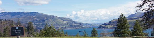
Catherine Creek Interpretive Trail
in Columbia River Gorge National Scenic Area
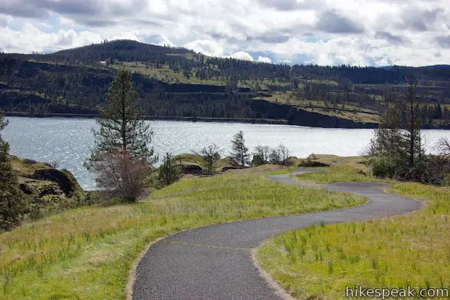
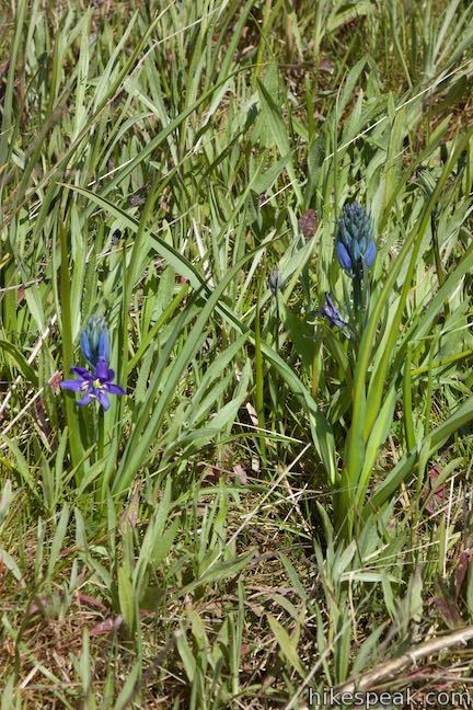
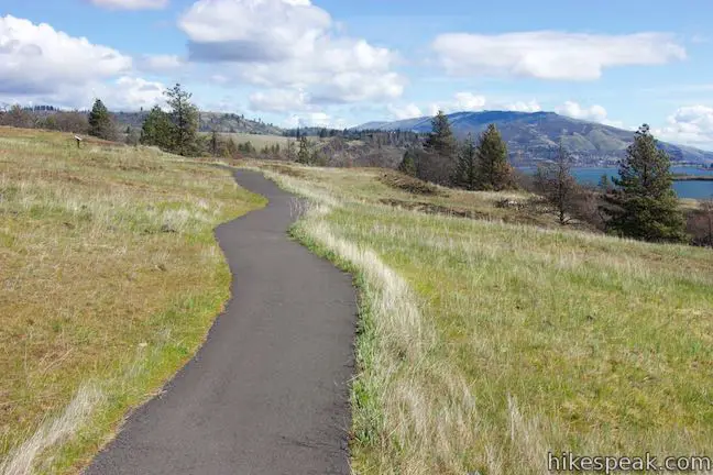
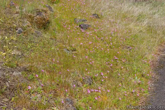
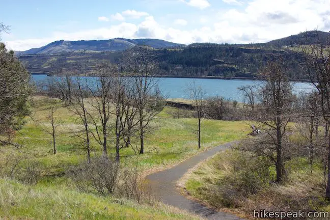
Hikers pack the slopes of Dog Mountain to see spring wildflowers, but tackling a lot of elevation is not required to see one of the best blooms in Columbia River Gorge National Scenic Area. Instead, visit Catherine Creek, where an easy, paved 0.9-mile loop (with just 100 feet of elevation change) floods with wildflowers in the spring and early summer.
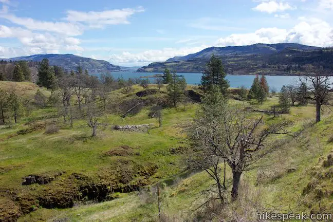
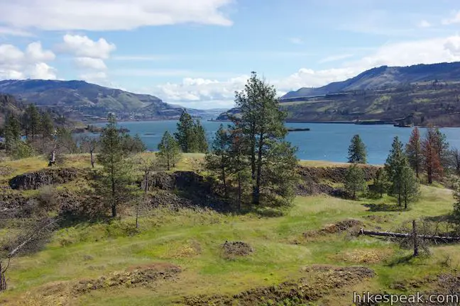
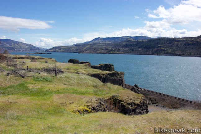
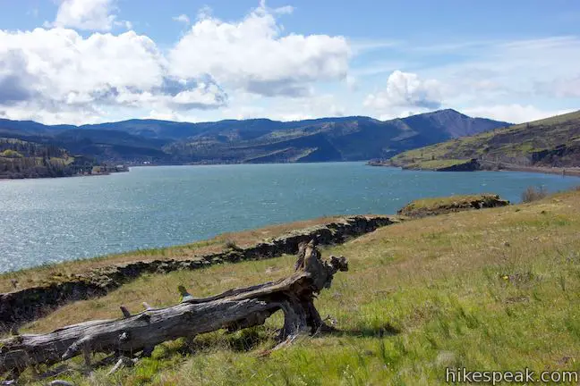
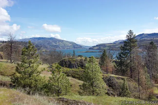
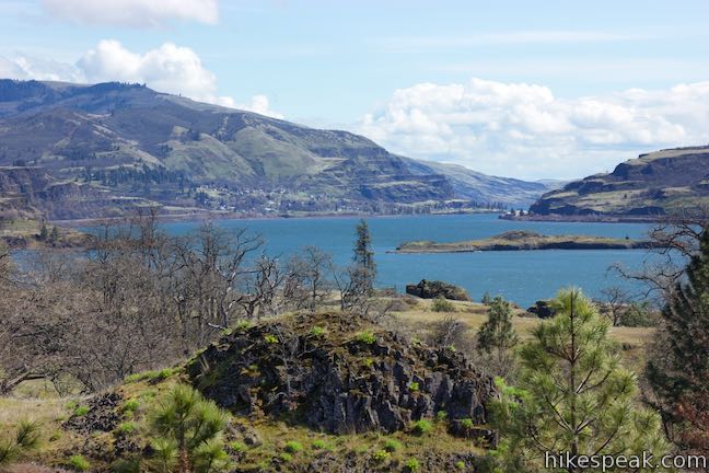
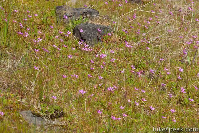
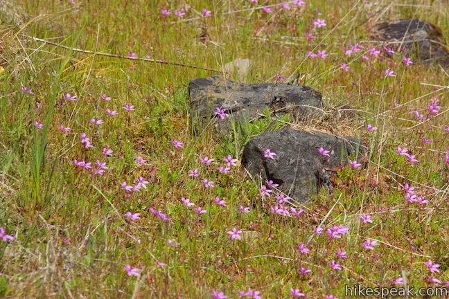
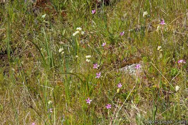
Catherine Creek Interpretive Trail crosses a grassy, south-facing, sun-exposed bluff that hosts a wide variety of flowers. The loop also offers year-round views over the Columbia River Gorge, plus a perch above a short waterfall.
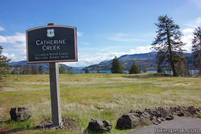
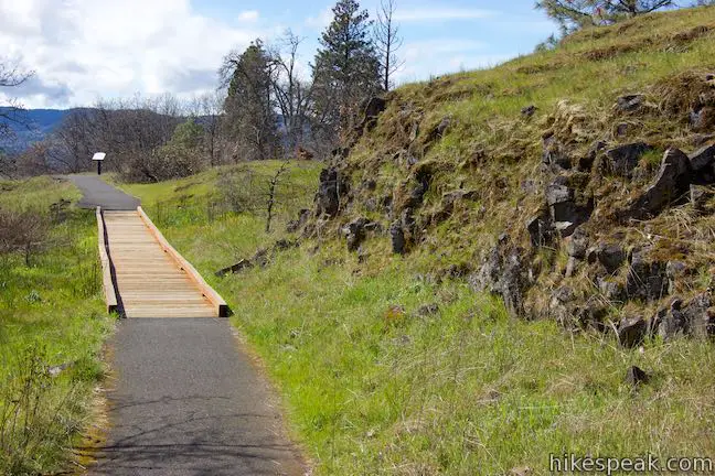
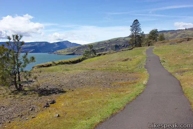
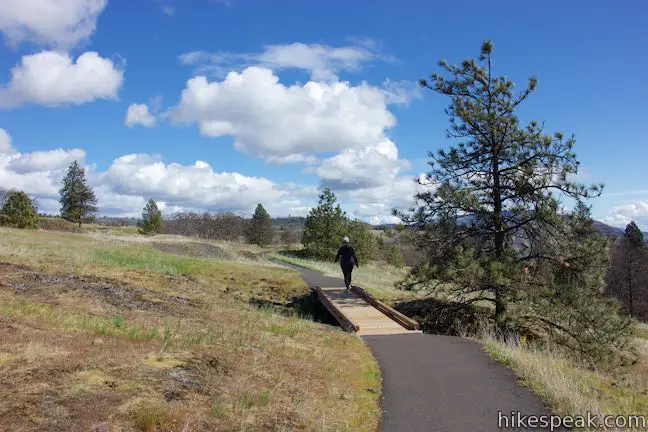
Catherine Creek Interpretive Trail starts from Old Highway 8, on the Washington side of the Columbia River Gorge, about 70 miles east of Portland. Catherine Creek Interpretive Trail is paved and wheelchair friendly (but the roadside parking is rough gravel and will be the toughest part for those in wheelchairs).
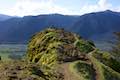
Unpaved trails venture north up the slope above the road toward Catherine Creek Arch and other destinations.
For this loop, Catherine Creek Interpretive Trail, find the start of the paved trail on the south side of the road (next to bathrooms and a Catherine creek sign).
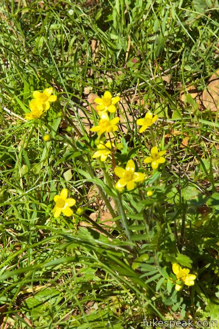
Walk down Catherine Creek Interpretive Trail for 250 feet to a junction at the beginning of the loop. Panels along the trail, describing the park’s plants and stewardship, are arranged to be read while hiking in a clockwise direction. Therefore, turn left at the junction and approach a panel with a calendar outlining the common blooming months for over two dozen flowers at Catherine Creek.
Catherince Creek Wildflower Calendar
| March | Columbia desert parsley • Grass widow • Gold stars • Yellow bells |
| April | Balsamroot • Blue-eyed Mary • Camas • Columbia Gorge lupine (Columbia Gorge Broad-leaf Lupine) • Death camas • Fiddleneck • Filaree • Pungent desert parsley (Biscuit root) • Shooting stars • White plectritis |
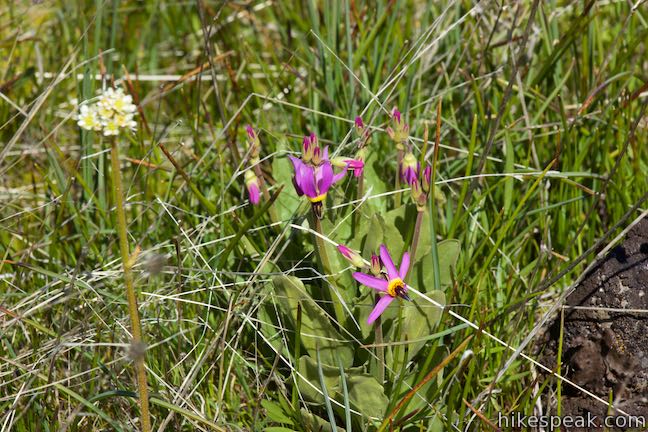
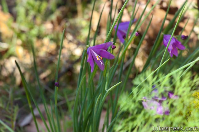
| May | Baby stars • Barrett’s penstemon • Bicolored cluster lily • Bitter root • Heart-leaf buckwheat • Indian paintbrush • Oregon sunshine (Wooly sunflower) |
| June | Bachelor’s button • Blanket flower • Common tarweed • Harvest brodiaea • Meadow larkspur • Mock orange |
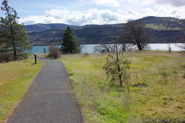
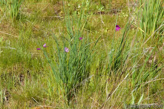
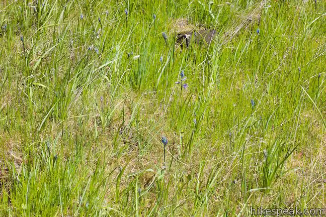
Proceed east on the trail past a wooden bench with a meadow view. What flowers do you see popping up out of the grasses? From late-February grass widows to June-blooming larkspur, you should have plenty to admire during your visit.
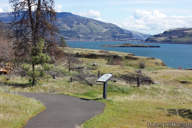
The meadow is dotted by ponderosa pines and black oaks that provide pockets of shade. Make your way past a couple more panels that explain how Catherine Creek was transformed from trash to treasure – or to be more accurate, this beautiful hillside was used as a junkyard before it was salvaged by the forest service to flower again.
In the early 1900s, the slopes above Catherine Creek were splashed with brilliant yellow and bright red blossoms of Northwest Balsamroot and Paintbrush, prompting locals to nickname this area “Sunflower Hill.” Among the warm hues stood the blue blossoms of Lupine. When the Columbia River Gorge National Scenic Area acquired this property in 1987, very few balsamroot, lupine, and paintbrush plants remained. Cattle and sheep had grazed away many species of wildflowers and trampled fragile wetland habitats, and the area had been used as a landfill. The removal of livestock, and the hard work of volunteers and Forest Service employees, are encouraging balsamroot, paintbrush, and lupine to return to Catherine Creek.
Another panel explains:
Forest Service employees and hundreds of volunteers worked to clean up the site and build this universal-access trail. In July 1998, the trail was completed. Now, visitors can explore this fragile ecosystem without trampling sensitive plants of disturbing the thin soils.
Walking the trail today, you wouldn’t think Catherine Creek had ever been anything but a beautiful natural area. The surprising land-use history is an impressive example of how nature can be restored.
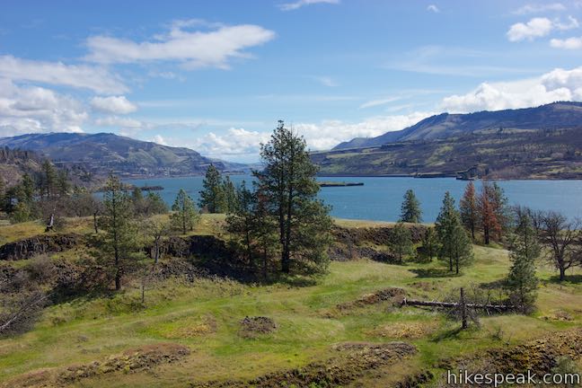
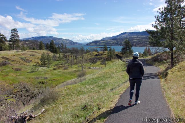
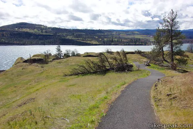
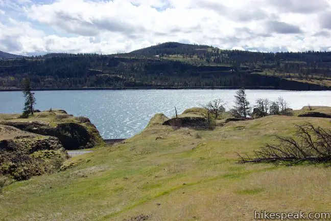
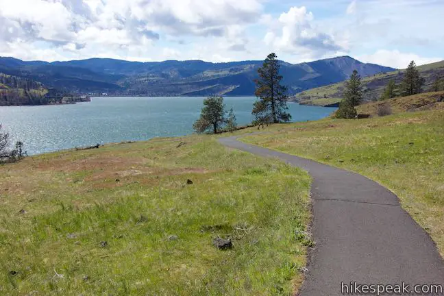
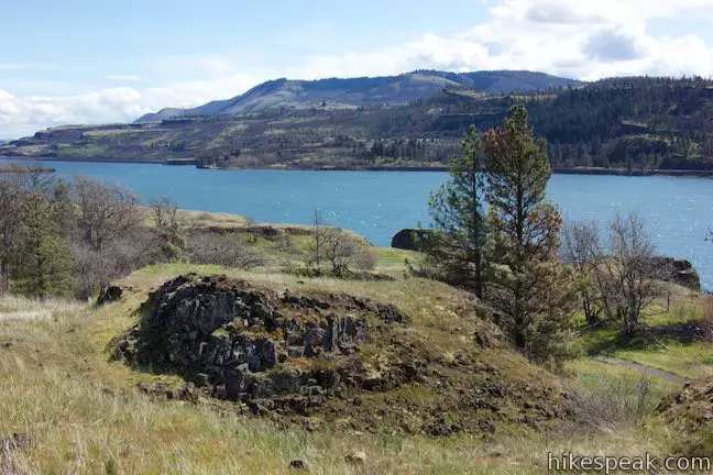
Follow the trail across grassy rolling terrain to nice views east up Columbia River Gorge. Memaloose Island sits in the middle of the wide river.
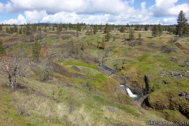
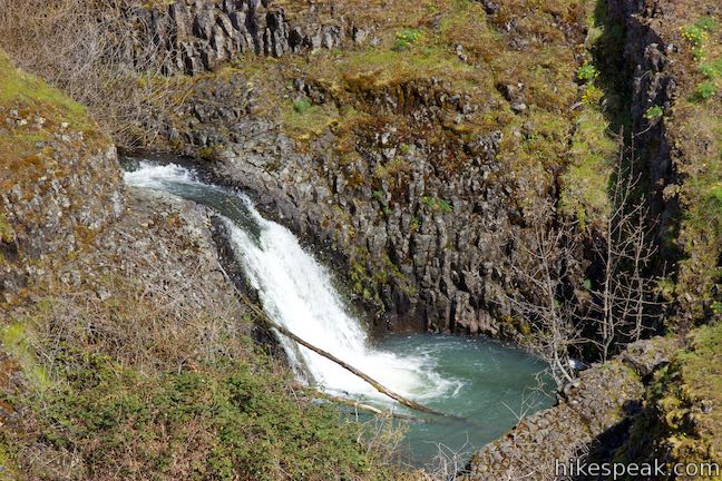
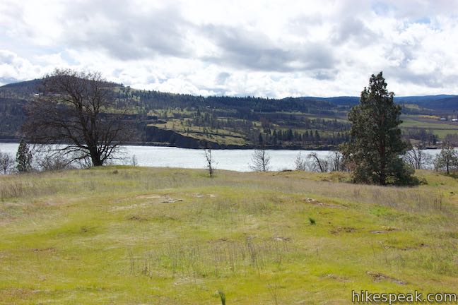
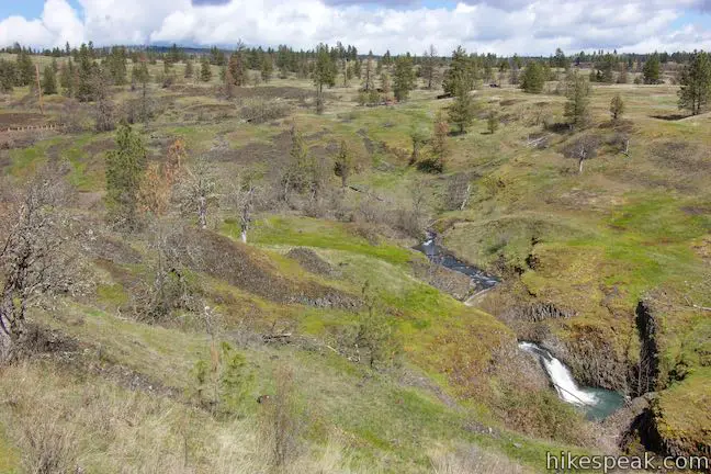
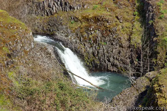
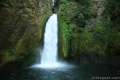
Catherine Creek Trail curves south, delivering steady river views as it leads to a viewpoint above Catherine Creek Falls, a quarter mile from the start. Below, Catherine Creek tumbles down a shallow ravine, pushing over a short twelve-foot drop into a round pool. This seasonal waterfall is a far cry from the Columbia River Gorge’s great waterfalls, but still provides a nice sight along the loop.
Continue south on the trail down the rolling bluff, passing more wildflower habitats and eventually curving back to the west. Interpretive signs explain how the dry conditions in the summer and fall turn the grasses brown. The rains that come in the winter and spring aren’t able to sink in very deep. Because most of the bluff only has a thin layer of soil covering a basalt bedrock, the rainwater forms vernal pools and ephemeral streams. Wildflowers and grasses soak up the water while it lasts.
Another panel explains that the flowers along the trail rely on different pollinators to reproduce. Bumblebees pollinate Columbia Gorge lupines, while Indian paintbrush caters to hummingbirds, and the flowers of heart-leaf buckwheat attract beetles and butterflies.
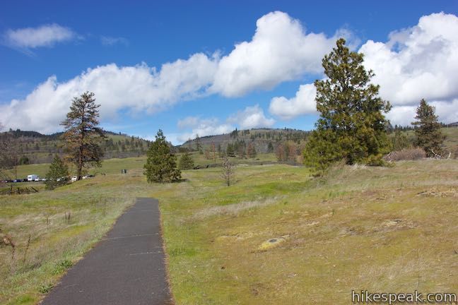
After 0.4 miles of easy hiking, come to an unmarked junction. A shortcut trail ascends to the right, trimming the trail by about a quarter mile for those short on time. For the full 0.9-mile loop, stay to the left.
Leaving the junction, the trail drops into a shaded grove. On hot days, this is a nice spot to relax. An interpretive panel explains that this cooler, darker, microclimate provides a different environment for plants, with deeper soils and milder winds than the surrounding meadows.
In this oak-pine woodland, trees and brush protect the ground from full sun and strong winds, sheltering wildflowers – such as delicate, pink-blossomed oaks toothwort – that would perish on the open slopes.
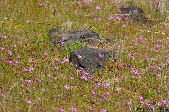
As you exit the shade, look for the opposite extreme along the trail; find wildflowers growing on outcroppings of basalt where the soil is the thinnest and the heat and wind are the most severe. Barrett’s penstemon seem to grow right out of the rocks. Blanket flower snuggle up to the outcroppings too.
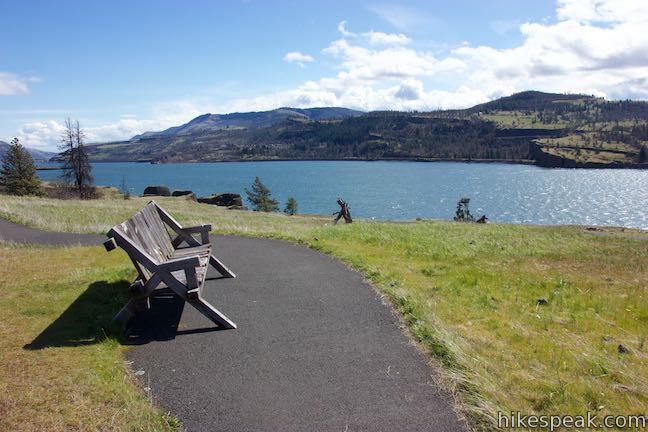
Ease out of the trees and up to refreshing views west down the Columbia River Gorge. A few benches allow you to have a seat and enjoy beautiful views.
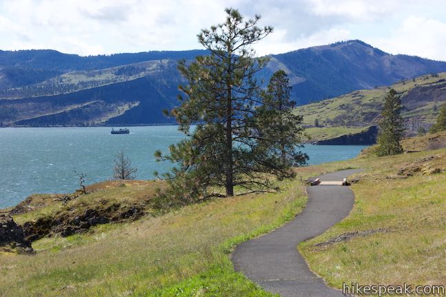
Catherine Creek Trail rises up the slope and heads back to the east, crossing through more wildflower viewing areas. Looking across the Columbia River toward Mosier, you may spot the top of Mount Hood popping up above the far side of the gorge. Highway 14 and the railroad line can be glimpsed below the bluff, along the Columbia River.
One of the last interpretive panels along the trail explores how some of the flowers that thrive here are adapted to this tough environment, with triple digit summer temperatures, harsh winds, and scarce rainfall. During the month of May, hikers can admire how the Oregon sunshine, also known as Wooly sunflower, grows hairy stems and leaves that create pockets of air around the plant to reduce evaporation.
After 0.8 miles of hiking, stay left through the junction with the top end of the shortcut trail. Angle northeast for about a hundred yards to reach the junction where the loop began. Bear left and make your back to the trailhead along Old Highway 8.
No fee or permit is required to enjoy this family-friendly hike on Catherine Creek Interpretive Trail (also known as Columbia Creek Universal Access Trail). Dogs are welcome on leashes. Bikes are not allowed. Mid April through May is probably the peak time of year to view wildflowers in the Columbia River Gorge. For a longer hike with more grassy slopes for wildflowers, check out nearby Coyote Wall.
Directions to the Trailhead
- From the intersection of Interstate 205 and Interstate 84 in Northeast Portland, take Interstate 84 east for 55.4 miles to exit 64 in Hood River, following signs for Mount Hood Highway toward White Salmon and Government Camp.
- At the end of the offramp, turn left to head north on Route 35.
- Pay a toll of a couple bucks to cross the Hood River Bridge.
- On the other side, turn right on Highway 14.
- Travel east for 5.8 miles and bear left up Old Highway 8.
- Drive 1.4 miles and park in the spaces off the left side of the road (in front of the trail to Catherine Creek Arch).
- The trailhead for Catherine Creek Interpretive Trail is on the right (south) side of Old Highway 8, 1.5 miles from Highway 14.
Trailhead Location
Trailhead address: Catherine Creek Day Use Area, Old Highway 8, Lyle, WA 98635
Trailhead coordinates: 45.71041, -121.36165 (45° 42′ 37.5″N 121° 21′ 41.9″W)
View Coyote Wall & Catherine Creek in a larger map
Or view a regional map of surrounding Washington trails and campgrounds.


 | Catherine Creek Arch This 1-mile round trip hike leads to the base of a curious natural arch in a basalt bluff. |
 | Coyote Wall This partial loop covers 5.8 miles as it ascends Coyote Wall to great views of its basalt cliffs and across Columbia River Gorge. |
 | Dog Mountain This 6.65 to 7.4 hike explores forests, wildflower-covered slopes, and grand views from a mountain along the Columbia River Gorge. |
 | Hamilton Mountain The beautiful 7.75-mile lollipop loop visits bombastic waterfalls and panoramic cliffs on the Washington side of the Columbia River Gorge in Beacon Rock State Park. |
 | Beacon Rock Trail This 1.6-mile hike follows an impressively engineered trail packed with switchbacks that scale a monolith along the Columbia River. |
 | Mosier Twin Tunnels This 2 to 9.5-mile hike ventures up Historic Columbia River Highway State Trail to a pair of tunnels carved into basalt cliffs on the side of Columbia River Gorge. |
 | Eagle Creek Trail This 4.55-mile hike ventures up a beautiful and dramatic canyon to impressive waterfalls like Metlako Falls, Lower Punchbowl Falls, and Punchbowl Falls. |
 | Wahclella Falls This 2-mile hike visits a sublime waterfall in Oregon's Columbia River Gorge. |
 | Guler Ice Cave in Gifford Pinchot National Forest This short hike goes underground to explore an old lava tube with frozen stalactites and stalagmites, plus other interesting cave features. |
 | More trails in Washington Explore other hikes in the Evergreen State, including Mount Rainier National Park and Mount Saint Helens National Volcanic Monument. |
- Catherine Creek Interpretive Trail on oregonhikers.org (opens in a new tab)
- Catherine Creek Interpretive Trail on wta.org (opens in a new tab)
- Catherine Creek Interpretive Trail on outdoorproject.com (opens in a new tab)
- The official U.S. Forest Service webpage for Catherine Creek Interpretive Trail (opens in a new tab)
Common Questions about Catherine Creek Interpretive Trail in Columbia River Gorge National Scenic Area
- Is the trail open?
- Yes. You should expect to find that Catherine Creek Interpretive Trail is open. There are no recent reports of trail closures. If you discover that the trail is closed, please help your fellow hikers by reporting a closure.
- Is this trail free to access?
- Yes, Catherine Creek Interpretive Trail is free to access. No entrance fee, pass, or permit is required. If you discover that access rules have changed, please provide feedback on your experience.
- How much time does this hike take?
- It takes approximately 30 minutes to hike Catherine Creek Interpretive Trail. Individual hiking times vary. Add extra time for breaks and taking in the views.
- How long is this hike?
- The hike to Catherine Creek Interpretive Trail is a 0.9 mile loop with 100 feet of elevation change.
- Are dogs allowed on this trail?
- Yes, dogs are allowed on Catherine Creek Interpretive Trail. The trail is open to hikers, dogs.
- Is Catherine Creek Interpretive Trail good for kids?
- Yes, this hike is likely suitable for children. It is relatively short (0.9 miles) with manageable elevation gain.
- Is this a good hike for wildflowers?
- Yes, Catherine Creek Interpretive Trail is known for its seasonal wildflower displays.
- Where is the trailhead located?
- The trailhead for Catherine Creek Interpretive Trail is located in Lyle, Washington.
Trailhead Address:
Old Highway 8
Lyle, Washington 98635
Trailhead Coordinates:
45.71041, -121.36165 - What are the driving directions to the start of the hike?
To get to the trailhead: From the intersection of Interstate 205 and Interstate 84 in Northeast Portland, take Interstate 84 east for 55.4 miles to exit 64 in Hood River, following signs for Mount Hood Highway toward White Salmon and Government Camp. At the end of the offramp, turn left to head north on Route 35. Pay a toll of a couple bucks to cross the Hood River Bridge. On the other side, turn right on Highway 14. Travel east for 5.8 miles and bear left up Old Highway 8. Drive 1.4 miles and park in the spaces off the left side of the road (in front of the trail to Catherine Creek Arch). The trailhead for Catherine Creek Interpretive Trail is on the right (south) side of Old Highway 8, 1.5 miles from Highway 14.
View custom Google Maps directions from your current location.
- Are there other trails near Catherine Creek Interpretive Trail?
- Yes, you can find other nearby hikes using the Hikespeak Hike Finder Map.

Go the extra miles...
Submit a rating of this hike to go with your comment. Contribute to the average trail rating.