Fantastic waterfalls, dramatic cliffs, charming cascades, and handsome forests entertain hikers on the first couple miles of Eagle Creek Trail. Venture up a scenic canyon on the Oregon side of the Columbia River Gorge near Cascade Locks, following the tumbling water of Eagle Creek. Trek under and across steep cliffs that place cascades in your path. A short spur off Eagle Creek Trail leads to Metlako Falls Viewpoint, which overlooks a tall beautiful waterfall. A second spur descends to Lower Punchbowl Falls and an upstream walk toward Punchbowl Falls, which dives into a ferny gorge. Eagle Creek Trail presents a top-down view of Punchbowl Falls before continuing deeper into Columbia River Gorge National Scenic Area. Turn around at Punchbowl Falls for a spectacular 4.55-mile round trip hike with 400 feet of elevation change.
Eagle Creek Lane goes up a canyon off Columbia River Gorge that is a couple miles west of the Bridge of the Gods in Cascade Locks. Eagle Creek Trailhead is at the end of the road, half a mile from Interstate 84. Because of the trailhead’s limited parking or because of nearby offerings, you may choose to start at the bottom of Eagle Creek Lane by the Cascade Fish Hatchery or from picnic sites in Eagle Creek Recreational Area. Leaving from a large parking area by the hatchery extends the hike by a mile round trip and starting from the picnic area increases the round trip distance by 0.7 miles.
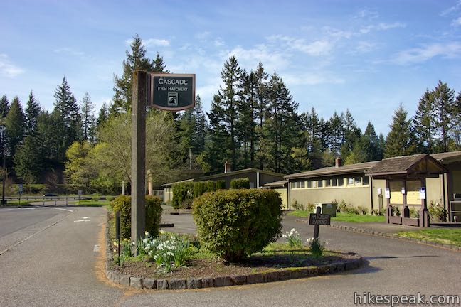
Cascade Fish Hatchery & Eagle Creek Recreational Area
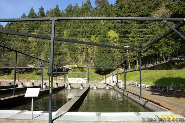
The first thing you’ll come to as you drive up Eagle Creek Lane is a salmon hatchery. The hatchery was built in 1957 and is operated by the Oregon Department of Fish and Wildlife on U.S. Forest Service land. Visitors are welcome to walk around the hatchery and look at all the small fish in the rearing ponds. Panels around the hatchery describe the important role of fishing in Oregon. One panel explains how the hatchery works:
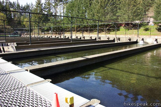
After 1 or 2 years at sea, coho salmon return up the fish ladder to the Collection & Spawning Facility from mid-September through November. Eggs from ripe adult females and milt (sperm) from males are mixed together in a bucket and put into a tray. The trays are kept in the Incubation Building in a steady flow of fresh water from Eagle Creek. There the eggs develop and hatch in about 12 weeks. Baby fish, or “fry” are moved to 6 starter ponds where they begin feeding. As they grow, the fish must be spread out into the other 24 ponds to prevent over-crowding and disease. Each of the 30 Rearing Ponds has a capacity of 75,000 smolts (a young salmon ready to migrate to the ocean) for a total of approximately 2.25 million fish. The coho salmon are held in these rearing ponds for approximately 1 year. The following spring when they are ready to migrate to the ocean, they are approximately 6 inches long.
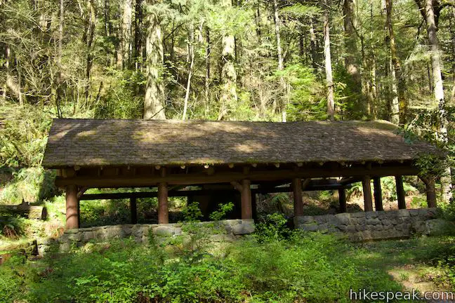
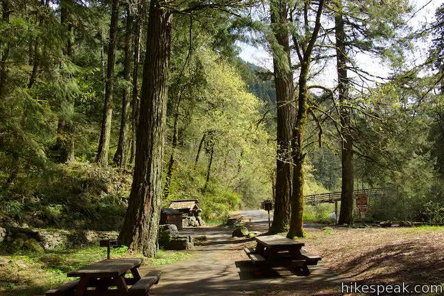
Across from the fish ladder in Eagle Creek, you’ll find a large parking area that’s a good starting point for those wishing to visit the hatchery and the trail. Walk to the side of the parking area away from the hatchery to a trail that starts next to park bathrooms. Take this trail for a short distance through forest and down stone steps to Eagle Creek Lane. Turn left and walk along the road into an area with several nice picnic sites and a large pavilion. A campground is farther to the east behind the picnic area. Pass through a small parking area and keep walking up Eagle Creek Lane, which narrows as it passes a sign for Eagle Creek Trail No. 440.
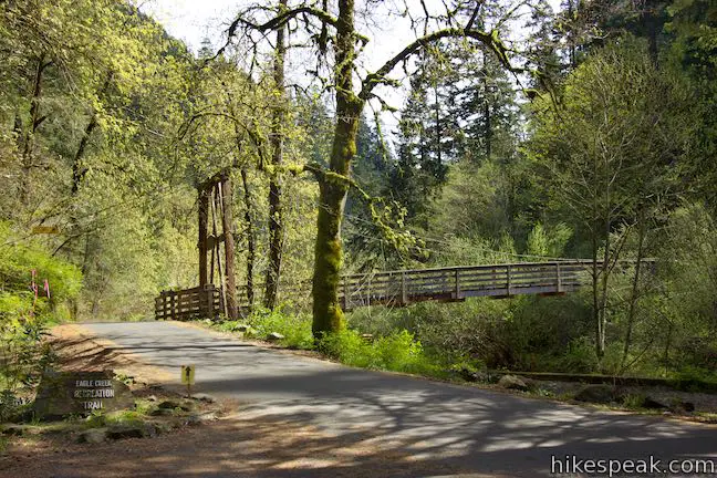
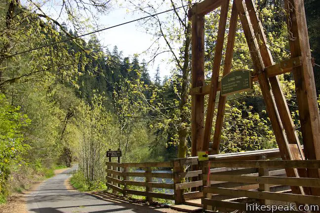
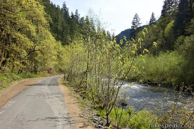
Just after the picnic area, you’ll pass a suspension bridge crossing Eagle Creek. A sign on the bridge’s wooden framing identifies this as Gorge Trail. If you crossed this bridge, you could hike 3 miles west to Tanner Creek. Back in the picnic area, you can find another part of Gorge Trail that goes east and links up with the Pacific Crest Trail after 2.5 miles near Bridge of the Gods. Proceed straight up Eagle Creek Lane and walk another third of a mile along Eagle Creek to the trailhead.
Eagle Creek Trail
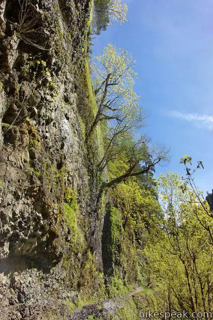
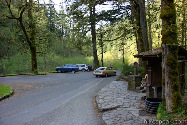
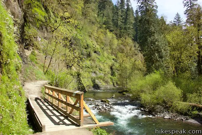
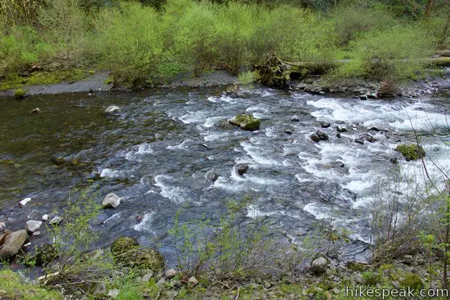
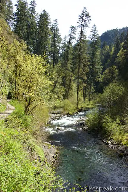
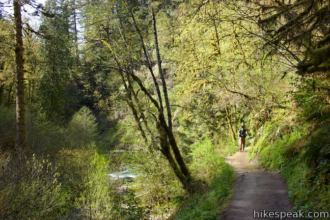
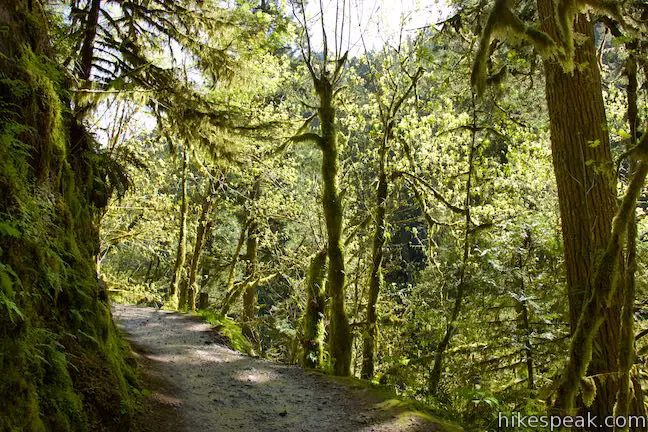
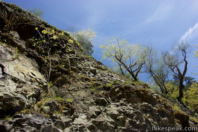
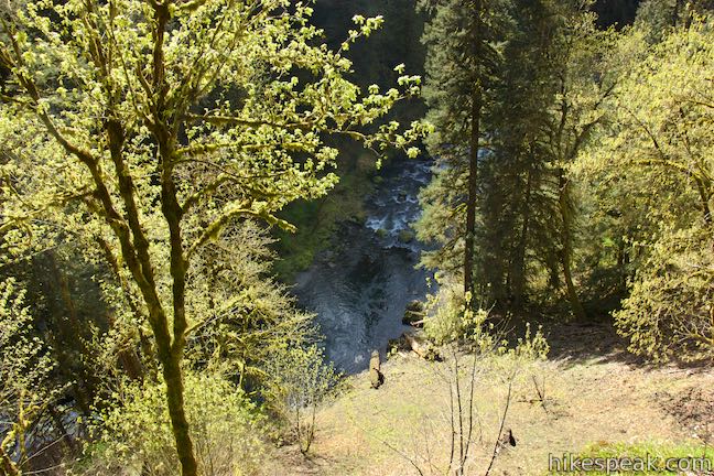
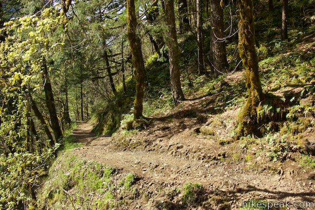
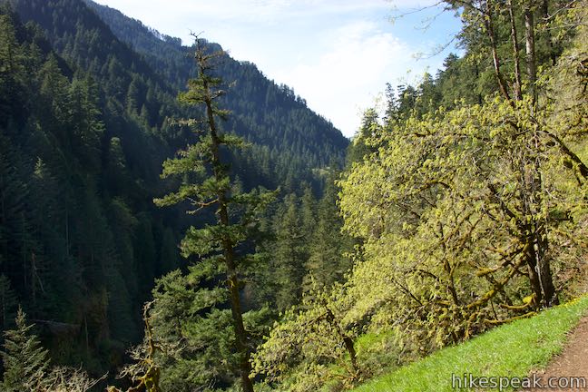
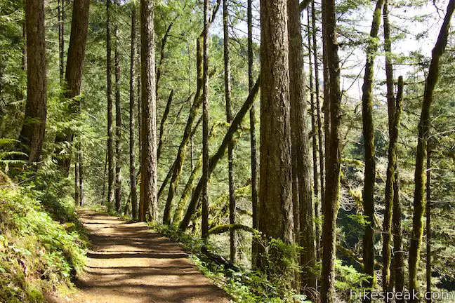
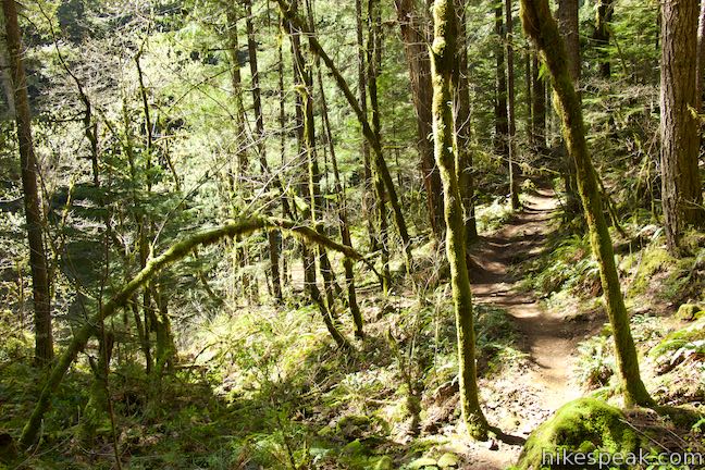
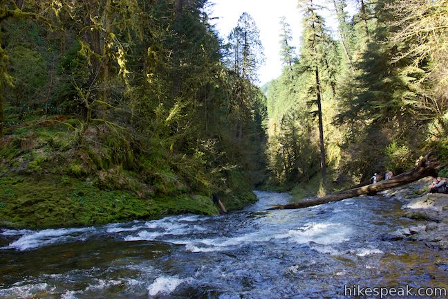
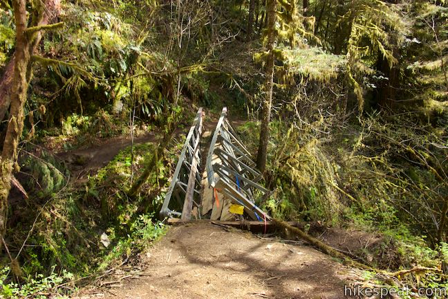
Eagle Creek Trail begins from the end of Eagle Creek Lane by a trail kiosk and some parking. Hike up the dirt trail, which quickly rounds a bend with views up Eagle Creek, framed by bluffs and forests. Walk across an early bridge as the trail makes its way up the east side of the canyon. The trails starts near the water level, but rises above Eagle Creek as you go. The cliffs on the left side grow taller too. Pass a few cascades and several spots where water trickles down the cliffs. After heavy rain, the water pouring down the side of the canyon must be enchanting.
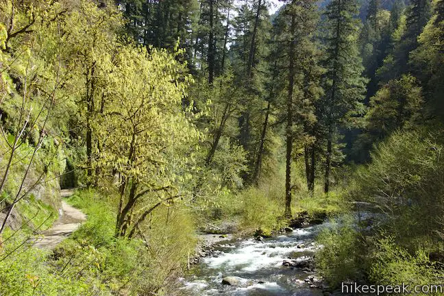
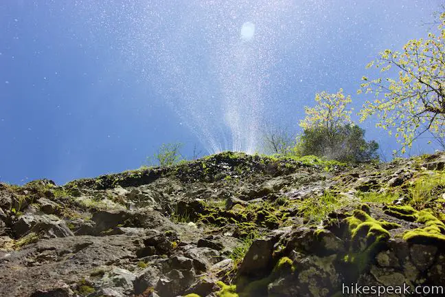
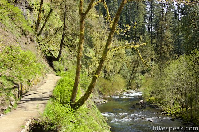
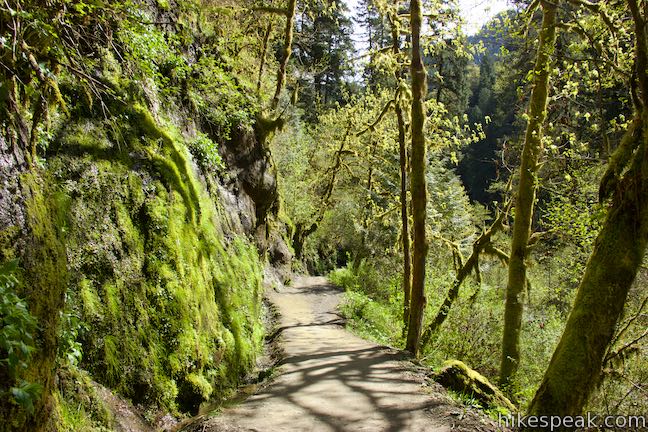
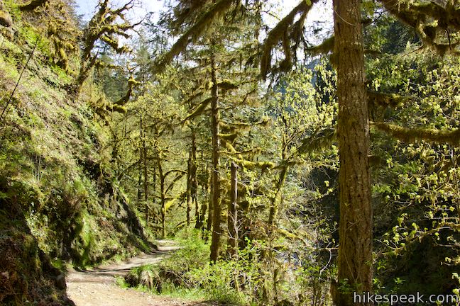
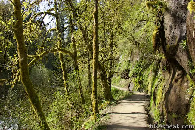
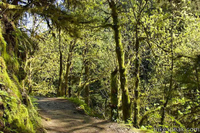
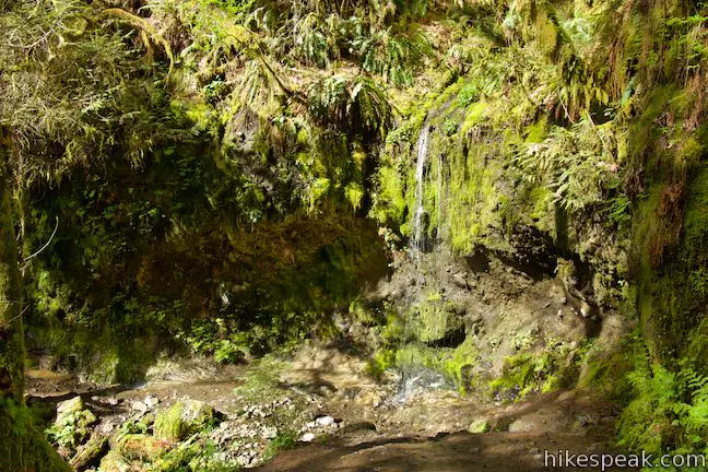
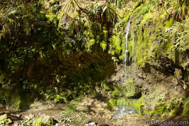
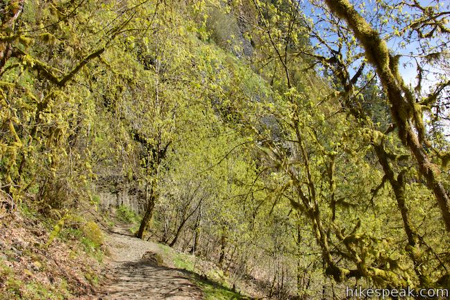
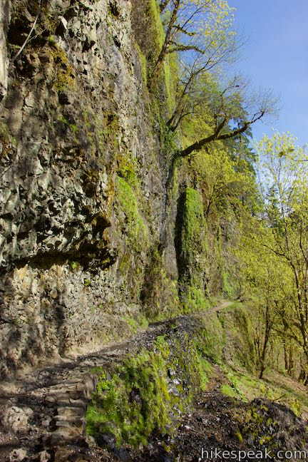
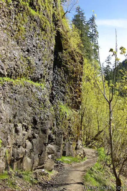
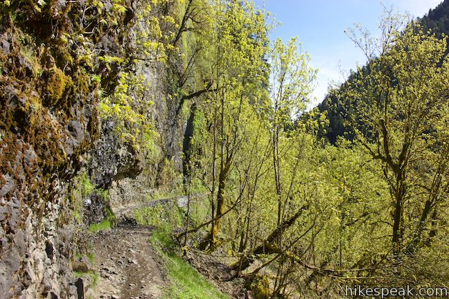
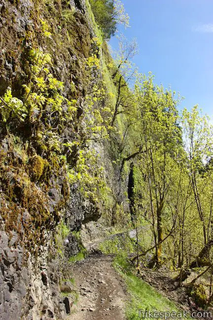
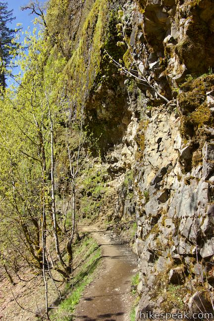
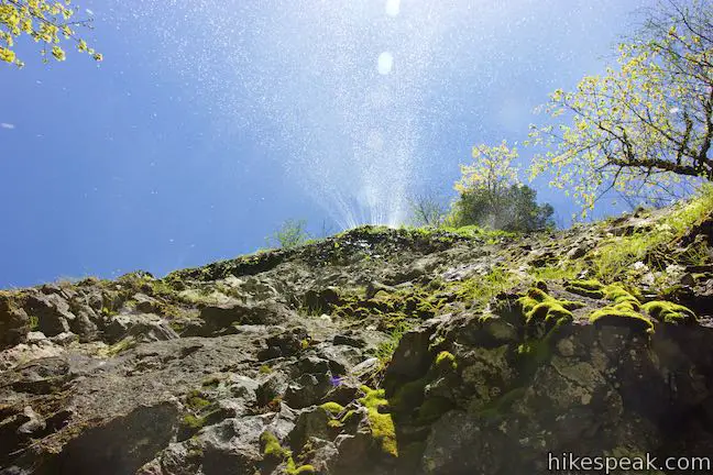
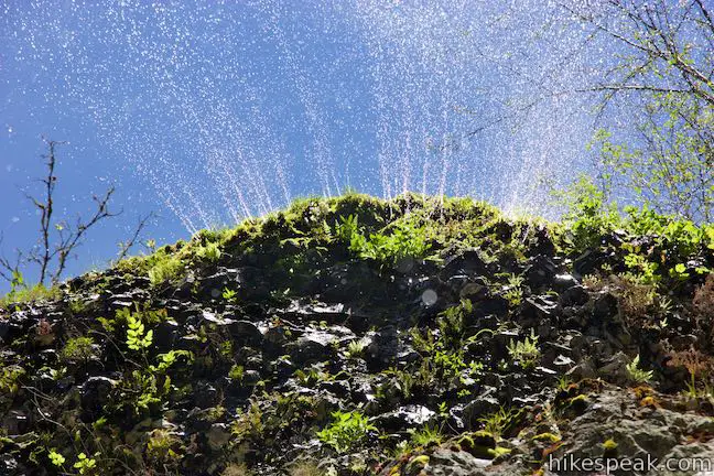
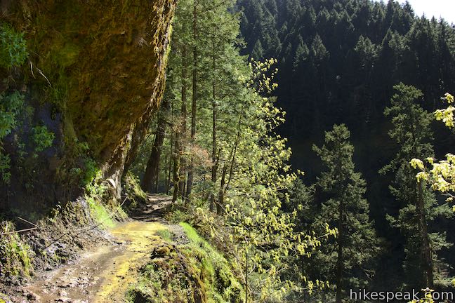
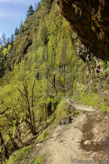
The trail rises above the creek over the first half mile and dips into an old growth forest where lichen clings to oaks, firs, cedars, and hemlocks. Maidenhair ferns and mossy-boulders cover the floor of the trail’s temperate rainforests. Pass a shower-like cascade next to the trail, where a stream drops about eight feet. Ahead, the trail exits the forest and enters one of the most impressive stretches of the hike. Tall cliffs rise above the trail at the 3/4-mile mark. Stare up a wall of basalt as you follow the trail across the base of the cliffs.
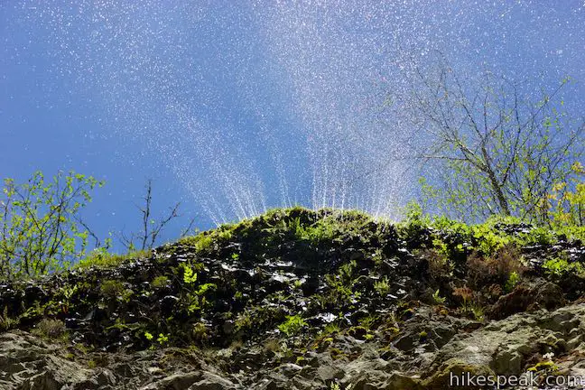
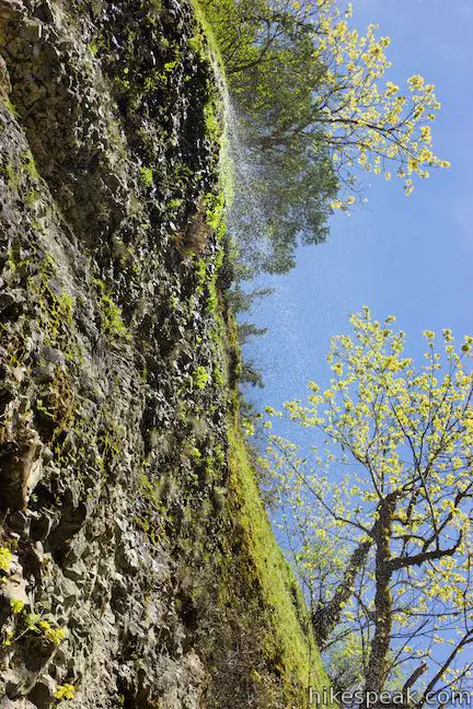
Do you feel like you’re getting rained on? Look up the cliffs to see a scattered waterfall spewing from the top of the cliffs. The amount of water coming down the cliffs will vary depending on the time of your visit. Even a small amount of water can be impressive. From underneath, the waterfall sprays out like lines on a sprinkler.
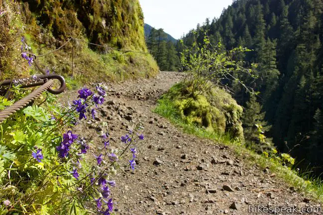
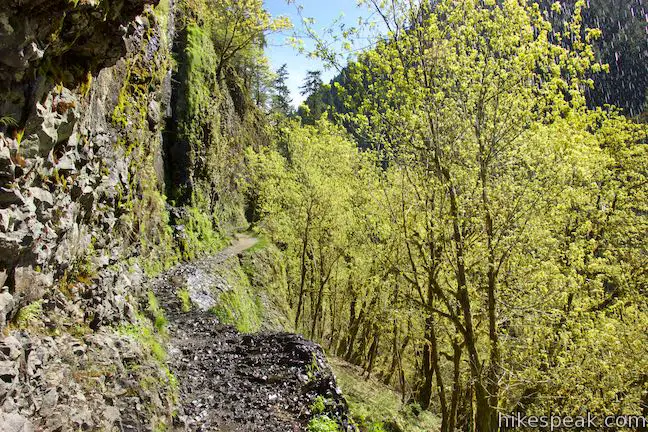
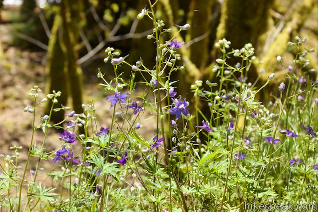
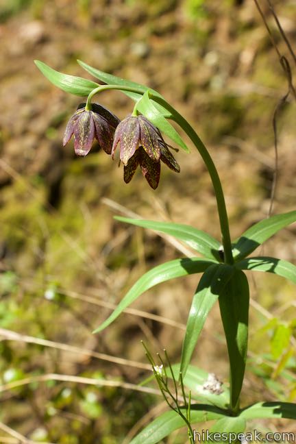
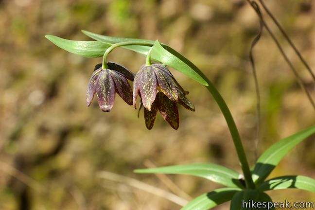
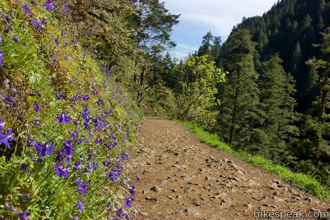
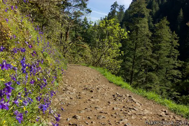
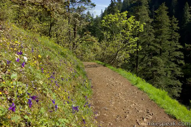
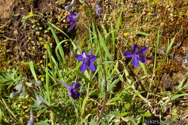
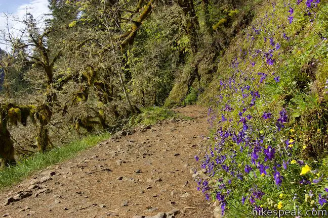
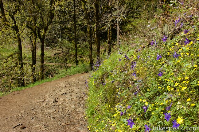
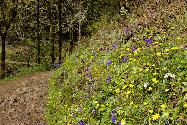
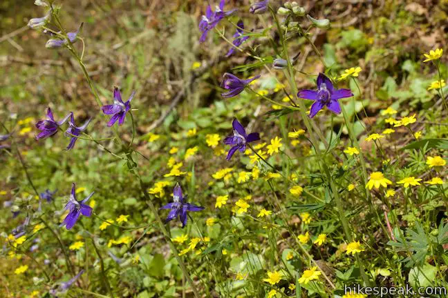
As you proceed up the trail across the base of the cliffs, you can look down a steep slope toward Eagle Creek. In the spring, flowers like chocolate lilies, shooting star, and larkspur appear along the trail, soaking up afternoon sunlight.
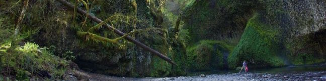
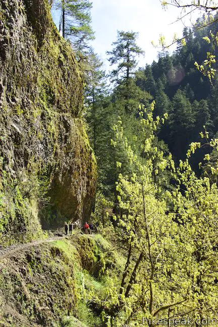
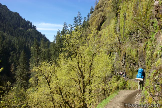
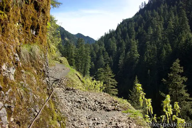
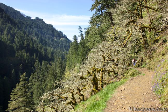
Hike into a wooded area where the cliffs seem to taper out. When the trail exits the trees, things get even more dramatic. Steep out on a landing about 100 feet above Eagle Creek with nothing but a sheer drop between you and the water. Look up the canyon framing Eagle Creek, which is shouldered by conifer-covered ridges. If you’re afraid of heights, you won’t like this spot or the section of trail that follows. Eagle Creek Trail cuts a course across the steep side of the canyon. The trail is relatively narrow and bordered by precipitous drop-offs. A cable has been fixed into the cliff wall on the left side of the trail to offer something to hold on to during this precarious crossing.
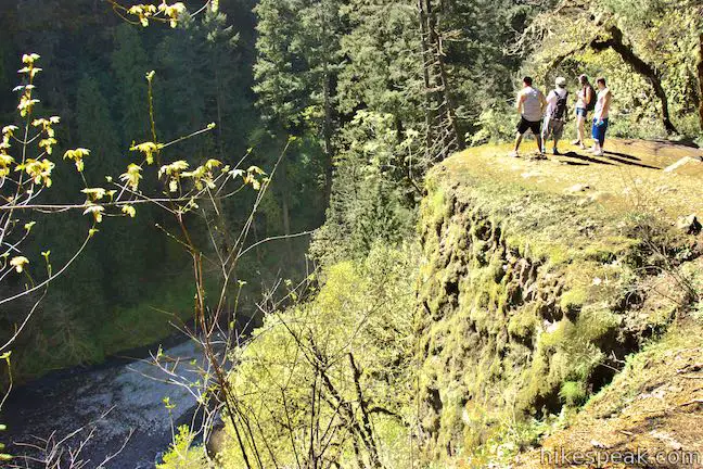
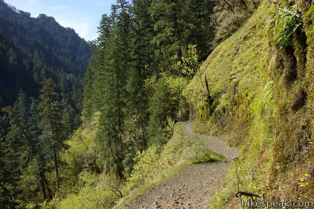
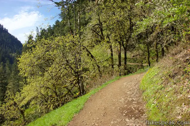
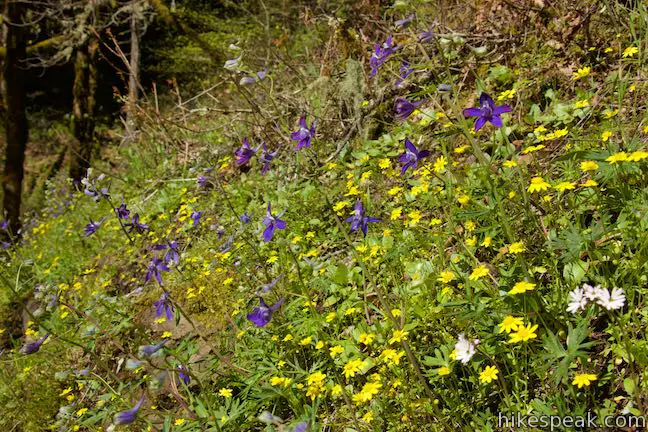
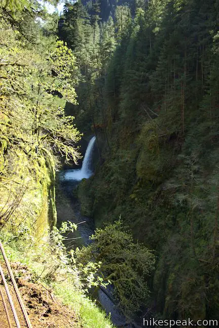
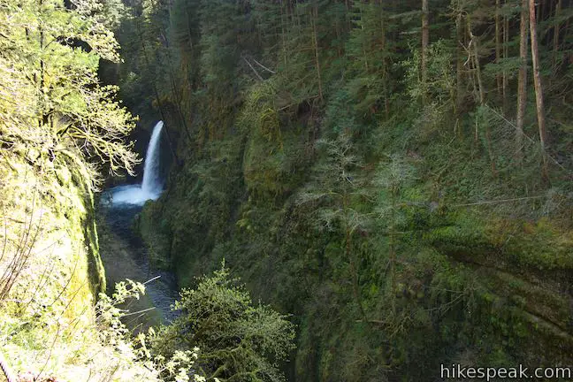
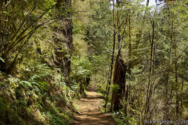
At the end of the cable, the trail continues across sun-exposed cliffs above Eagle Creek where colorful spring windflowers are abundant. The trail plots a scenic course along the side of the canyon. Eventually, you’ll dive back into an old growth forest dominated by tall hemlocks. Within this forest, and 1.45 miles from the trailhead, Eagle Creek Trail comes to the first of two junctions with paths to Metlako Falls Viewpoint. The Y-shaped offshoot to the waterfall overlook is only a tenth of a mile long, replacing a 0.05-mile long section of Eagle Creek Trail. The waterfall is awesome and the additional is minimal, but many hikers breeze right past the viewpoint (Columbia River Gorge really spoils hikers with all of its waterfalls).
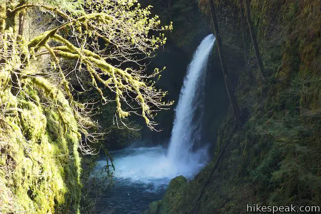
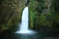
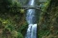
Bear right down the trail to Metlako Falls Viewpoint to check out the waterfall before continuing on Eagle Creek Trail. After about 100 feet, you’ll come to another junction. The trail to the left heads back up to Eagle Creek Trail and is the path to take once you’re ready to continue. Turn right to walk out to an overlook on the edge of the cliffs. Peer out from the railing and look to your left up a U-shaped gorge with steep walls. At the top of this canyon, Metlako Falls spills from the right, leaping from the top of the cliffs and free falling to the canyon floor. A sign at the trailhead measures the waterfall at 150 feet tall (other sources describe it as 100 feet tall). The name Metlako comes from an Indian goddess for Salmon. There’s no doubt that salmon swimming up Eagle Creek would be halted by Metlako Falls. Though the waterfall is a decent distance away from the viewpoint, it is truly a beautiful sight.
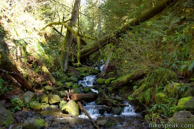
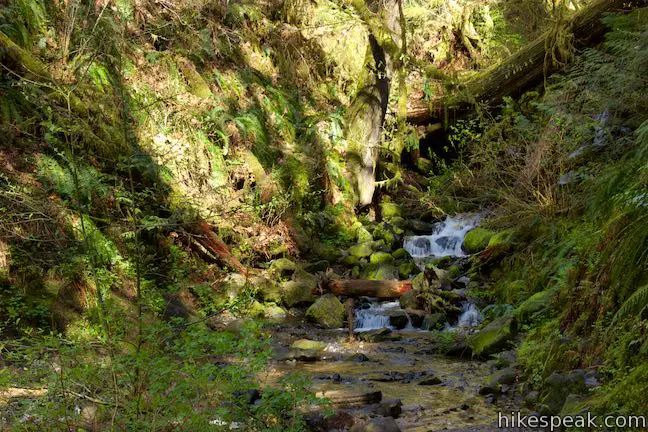
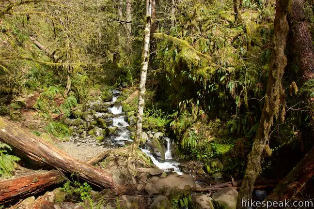
Leave Metlako Falls Viewpoint and make two quick right turns to return to Eagle Creek Trail, proceeding south. Pass through forest and come to a crossing of Sorenson Creek below a lovely cascade. Tumbling tiers of water are surrounded by mossy boulders and framed by fern-covered slopes.
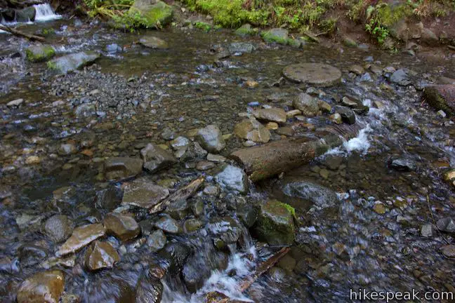
Rock hop across Sorenson Creek and hike another 0.05 miles to another marked junction that is 1.75 from Eagle Creek Trailhead if you hike directly (or 1.8 miles into the hike if you include Metlako Falls Viewpoint). A sign reading “Lower Punch Bowl” marks a trail to the right that descends to Eagle Creek beside Lower Punchbowl Falls.
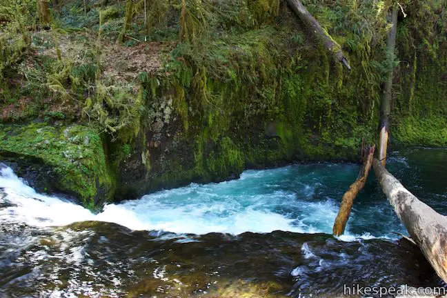
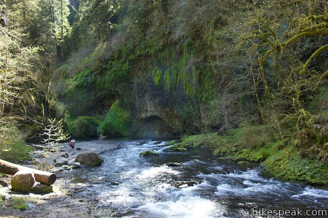
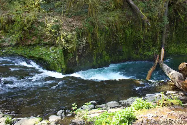
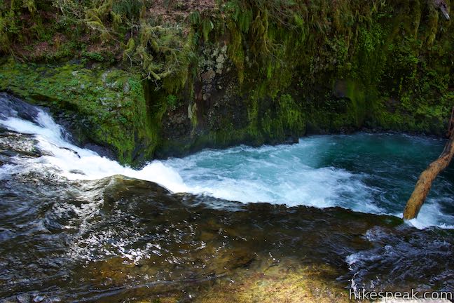
Turn right down the trail to Lower Punch Bowl and descend 150 feet over 0.2 miles. At the bottom of the trail, concrete steps lead to the rocky bank of Eagle Creek. To your right is a horseshoe-shaped drop in the creek called Lower Punchbowl Falls. The waterfall is about 12 feet tall and twenty to thirty feet across.
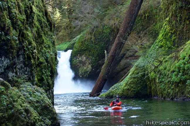
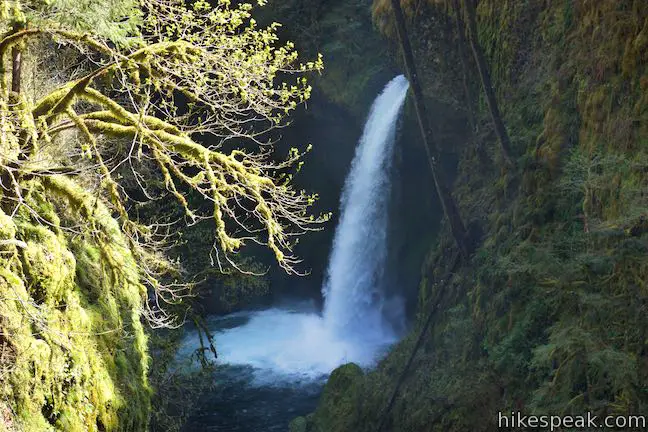
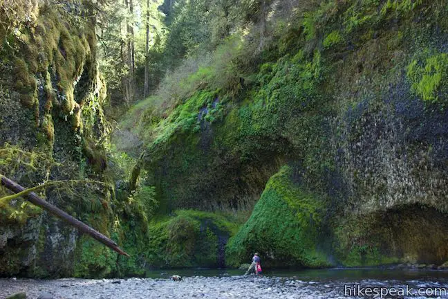
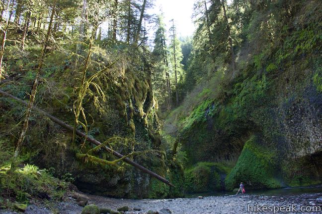
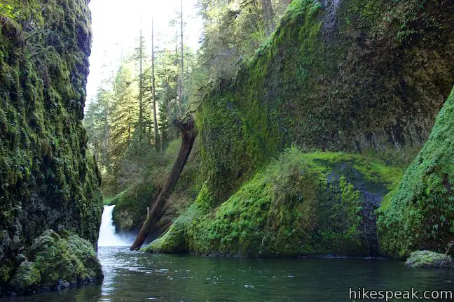
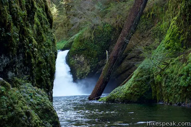
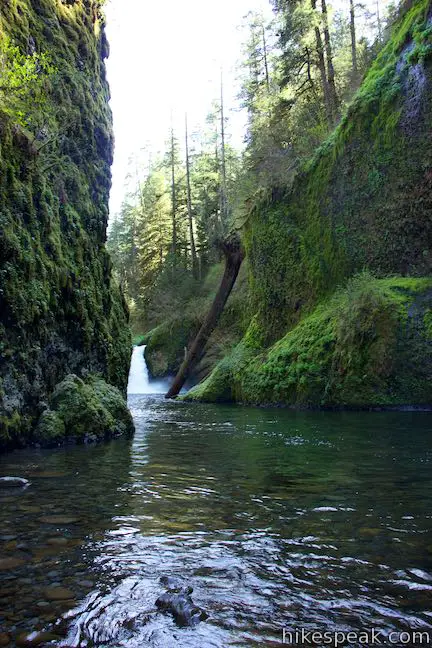
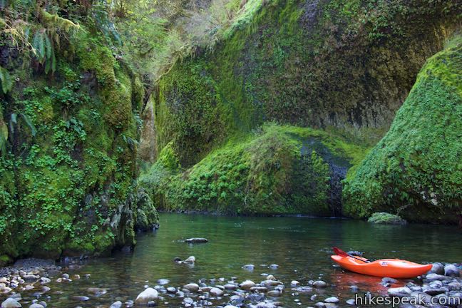
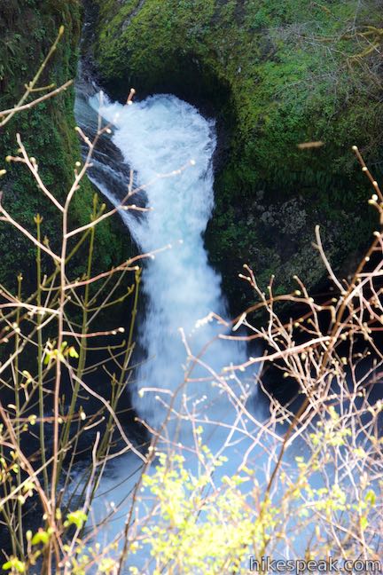
Walk up the bank along Eagle Creek toward tall dark rock walls covered in green moss and maidenhair ferns. Depending on the water level (or your willingness for wet feet) you can walk up to the mouth of the gorge for an awesome perspective of Punchbowl Falls, which drops into the rock amphitheater just upstream.
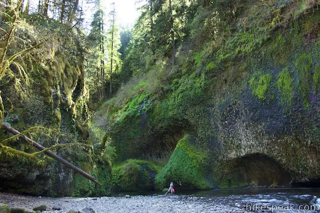
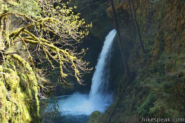
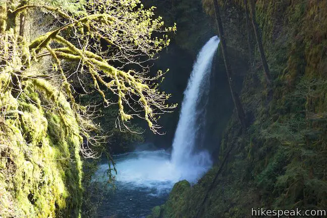
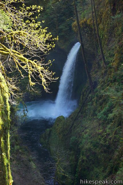
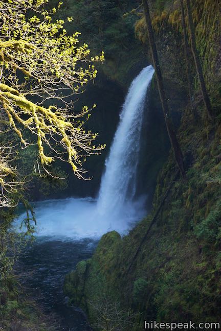
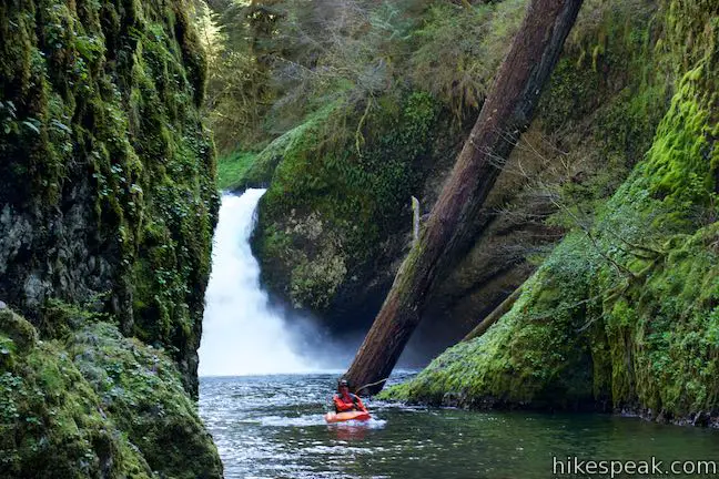
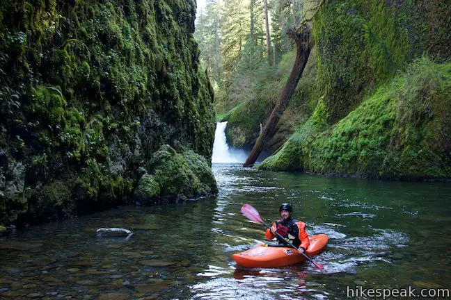
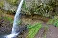
A gravel point extending into the creek (which may not be available when the flow is high) offers a good look at the waterfall. Punchbowl Falls (or Punch Bowl Falls) is taller and narrower than its downstream sibling. The waterfall plunges into a ferny gorge, dropping over 30 feet to a broad pool (the punch bowl). Rock walls pinch the top of the waterfall into a narrow channel. Thrill-seeking kayakers actually go down Punchbowl Falls when water levels are favorable.
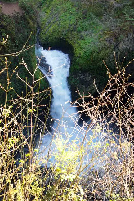
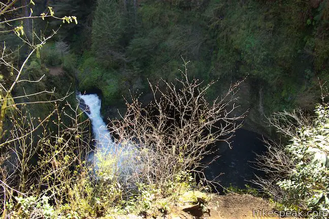
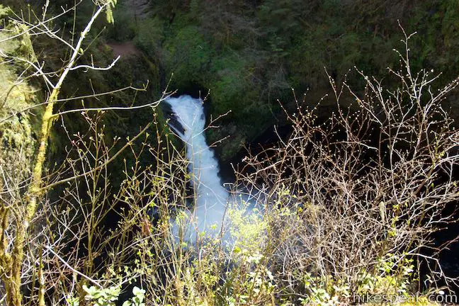
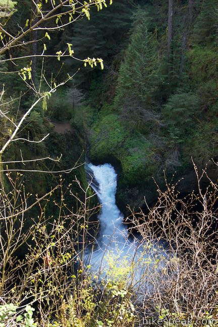
After scoping out Punchbowl Falls from the bottom up, return to Eagle Creek Trail for a top-down view. Walk back to the trail down to Eagle Creek and hike back up to the junction. Turn right and hike another quarter mile to a viewpoint on the bluff overlooking Punchbowl Falls. Although brush can partially block the view, you will find spots to gaze down at the picturesque falls. This vantage offers a nice look at the top of the waterfall, where Eagle Creek rushes through a chasm before crashing down into the pool.
The banks below the viewpoint are steep, so be cautions where you stand to avoid dangerous falls. This viewpoint above Punchbowl Falls is a good place for day hikers to turn about. The direct hike back to the trailhead is two miles long. If you visit Metlako Falls Viewpoint and Lower Punchbowl Falls on the hike out, you will put in about 2.55 miles of hiking, resulting in a round trip hike that is 4.55 miles long with 400 feet of elevation change.
Ahead, Eagle Creek Trail continues toward High Bridge and Tunnel Falls, which are 1.3 and 4 miles farther up the trail. Less then a tenth of a mile past Punchbowl Falls Viewpoint, Eagle Creek Trail comes to Tish Creek Bridge. The bridge was severely damaged by a falling tree during a winter storm. However, the bridge was replaced in February of 2017, so hiking above the bridge is now possible. For more information about Eagle Creek Trail, call the U.S. Forest Service at 541-308-1700.
Eagle Creek Trail is a lovely and popular place to hike. Dogs are permitted on leashes, but bikes are not allowed. A $5 day use fee must be paid to park at the trailheads in Eagle Creek Recreational Area. An annual Northwest Forest Pass or America the Beautiful pass can be used instead of paying the fee (price as of 2016). Supervise children through the steep drop-offs on Eagle Creek Trail. No permit is required to hike to Punchbowl Falls, so get out and enjoy!
CLOSURE UPDATE: This hike has REOPENED to the public following damage from the 2017 Eagle Creek Fire.
Directions to the Trailhead
- From Portland, drive about 32 miles east on Interstate 84 to exit 41, marked with signs for the fish hatchery and Eagle Creek Recreational Area.
- The offramp becomes a road that crosses Eagle Creek and comes to a stop sign.
- The onramps for I-84 are to the left.
- Turn right and drive up Eagle Creek Lane toward the trailhead, which is at the end of this half-mile long road.
- You may also park near the hatchery or picnic area.
- From Hood River, drive west on Interstate 84 for 23 miles.
- Take exit 40 for Booneville Dam.
- Turn left onto Booneville Way, drive under the interstate, and turn left onto US 30 east to get back on I-84 in the other direction.
- Get off at exit 41 for Eagle Creek.
- Drive off the interstate to Eagle Creek Lane, turn right and drive half a mile up the road to the trailhead.
Trailhead Location
Trailhead address: Eagle Creek Trailhead, Eagle Creek Lane, Cascade Locks, OR 97014
Trailhead coordinates: 45.6368, -121.9196 (45° 38′ 12.48″N 121° 55′ 10.56″W)
View Eagle Creek Trail in a larger map
Or view a regional map of surrounding Oregon trails and campgrounds.


 | Wahclella Falls This 2-mile hike visits a sublime waterfall in a canyon within the Columbia River Gorge. |
 | Oneonta Gorge to Lower Oneonta Falls This 0.8-mile trek follows Oneonta Creek between the tall, mossy cliffs of a wild and beautiful gorge to the base of an enchanting 100-foot waterfall. |
 | Horsetail Falls Trail - Oneonta Trail Loop This 2.85-mile loop starts at Horsetail Falls, passes beneath an overhang behind Ponytail Falls, and crosses a bridge by Middle Oneonta Falls to hit three waterfalls and viewpoints looking out over the Columbia River Gorge. |
 | Beacon Rock Trail This 1.6-mile hike follows an impressively engineered trail packed with switchbacks that scale a monolith along the Columbia River. |
 | Hamilton Mountain The beautiful 7.75-mile lollipop loop visits bombastic waterfalls and panoramic cliffs on the Washington side of the Columbia River Gorge in Beacon Rock State Park. |
 | Multnomah Falls This 0.4 to 2.6-mile hike visits Oregon's tallest (and probably most visited) waterfall, offering something to hikers of all abilities. |
 | Multnomah-Wahkeena Loop This 6.05-mile loop uses Wahkeena Trail and Larch Mountain Trail to visit six glorious waterfalls (Wahkeena Falls, Fairy Falls, Ecola Falls, Weisendanger Falls, Dutchman Falls, and Multnomah Falls) as well as many fine cascades along Wahkeena Creek and Multnomah Creek in two beautiful canyons off Columbia River Gorge. |
 | Angel's Rest This 4.8-mile hike ascends to a panoramic landing with spectacular views across Columbia River Gorge (particularly at sunrise). |
 | Latourell Falls Trail This 2.3-mile loop explores a canyon with two beautiful waterfalls, attaining great views of both. |
 | Mosier Twin Tunnels This 2 to 9.5-mile hike ventures up Historic Columbia River Highway State Trail to a pair of tunnels carved into basalt cliffs on the side of Columbia River Gorge. |
 | More trails in Oregon Explore other hikes in Oregon outside the Columbia River Gorge. |
- Eagle Creek Trail on oregonhikers.org (opens in a new tab)
- Eagle Creek Trail on oregon.com (not the official state website) (opens in a new tab)
- Eagle Creek Waterfalls on wikipedia.org (opens in a new tab)
- Eagle Creek Trail on alltrails.com (opens in a new tab)
- Eagle Creek Trail on hikingguy.com (opens in a new tab)
- Eagle Creek Trail on nwhiker.com (opens in a new tab)
- Eagle Creek Trail on theoutbound.com (opens in a new tab)
- An article about the damage to Tish Creek Bridge on oregonlive.com (opens in a new tab)
- The official forest service webpage for Punchbowl Falls (opens in a new tab)
- A Forest Service trail discription and map handout (pdf) for Eagle Creek Trail (opens in a new tab)
- The official Forest Service webpage for Eagle Creek Trail (opens in a new tab)
Common Questions about Eagle Creek Trail to Punchbowl Falls in Columbia River Gorge
- Is the trail open?
- Yes. You should expect to find that Eagle Creek Trail to Punchbowl Falls is open. There are no recent reports of trail closures. If you discover that the trail is closed, please help your fellow hikers by reporting a closure.
- Do I need a permit for this hike?
- Yes. National Forest Fee.
- How much time does this hike take?
- It takes approximately 2 hours 15 minutes to hike Eagle Creek Trail to Punchbowl Falls. Individual hiking times vary. Add extra time for breaks and taking in the views.
- How long is this hike?
- The hike to Eagle Creek Trail to Punchbowl Falls is a 4.55 mile out and back with 400 feet of elevation change.
- Are dogs allowed on this trail?
- Yes, dogs are allowed on Eagle Creek Trail to Punchbowl Falls. The trail is open to hikers, dogs.
- Will I see a waterfall on this hike?
- Yes, Eagle Creek Trail to Punchbowl Falls features a waterfall.
- What mountain range is this trail in?
- Eagle Creek Trail to Punchbowl Falls is located in the Cascade Range.
- Where is the trailhead located?
- The trailhead for Eagle Creek Trail to Punchbowl Falls is located in Cascade Locks, Oregon.
Trailhead Address:
Eagle Creek Lane
Cascade Locks, Oregon 97014
Trailhead Coordinates:
45.6368, -121.9196 - What are the driving directions to the start of the hike?
To get to the trailhead: From Portland, drive about 32 miles east on Interstate 84 to exit 41, marked with signs for the fish hatchery and Eagle Creek Recreational Area. The offramp becomes a road that crosses Eagle Creek and comes to a stop sign. The onramps for I-84 are to the left. Turn right and drive up Eagle Creek Lane toward the trailhead, which is at the end of this half-mile long road. You may also park near the hatchery or picnic area.
From Hood River, drive west on Interstate 84 for 23 miles. Take exit 40 for Booneville Dam. Turn left onto Booneville Way, drive under the interstate, and turn left onto US 30 east to get back on I-84 in the other direction. Get off at exit 41 for Eagle Creek. Drive off the interstate to Eagle Creek Lane, turn right and drive half a mile up the road to the trailhead.
View custom Google Maps directions from your current location.
- Are there other trails near Eagle Creek Trail to Punchbowl Falls?
- Yes, you can find other nearby hikes using the Hikespeak Hike Finder Map.

Go the extra miles...
Submit a rating of this hike to go with your comment. Contribute to the average trail rating.