Beacon Rock Trail
in Beacon Rock State Park
![]()
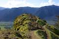
Beacon Rock rises like a stone tower with sheer cliffs dropping to the Columbia River. Beacon Rock Trail could be the Columbia River Gorge relative of Moro Rock Trail in Sequoia National Park. The trail is built right up the side of the basalt monolith, using over fifty switchbacks and at least a dozen cliff-straddling bridges to reach a pointed summit. The hike up Beacon Rock Trail is 1.6 miles round trip with 600 feet of elevation change. Great views of the Columbia River Gorge are around every turn (and the trail has a lot of turns).
Beacon Rock is a prominent landmark on the Washington shore of the Columbia River, protected by Beacon Rock State Park. Route 14 crosses through the park, and Beacon Rock Trail begins directly from this main road along the north side of the gorge. The start of the trail goes south into a forest at the base of Beacon Rock. A panel at the trailhead explains how Beacon Rock got its name:
While scouting a passage through the “Great Shoote,” treacherous rapids that once existed a few miles upstream from here, William Clark and Joseph Field of the Lewis and Clark Expedition observed a “remarkable high detached rock… we call the Beaten Rock.” In October 1805, Clark recorded the name “Beaten Rock” several times in his journals and on his carefully drawn map of this area. Then, during the spring of 1806 return trip, Clark began using the name “Beacon Rock.” No one knows why Clark used two names for the rock. Perhaps the term “Beaten” related to its weathered appearance. He may have used the name “Beacon” because of the rock’s prominence as a landmark in the Columbia River Gorge (particularly visible from the downstream direction).
Don’t let yourself by beaten by the trail up Beacon Rock, just plot a steady pace to the top. Native Americans had another name for Beacon Rock, “che-che-op-tin,” which might translate to “navel of the earth.” Native Americans used Beacon Rock as a landmark for the edge of the tidal influence of the Pacific Ocean by the river’s westernmost rapids.
Take Beacon Rock Trail into the forest below the great rock and stare up, wondering to yourself, how is a trail going to get up that monolith?
Cross a land bridge over a depression in the terrain on the west side of Beacon Rock. Come to a turn to the right where the trail becomes concrete. Pass a falling rocks sign and begin hiking up around the side of Beacon Rock.
Walk through a gate, about 0.2 miles from the start. A sign above the gate indicates that it is locked at dusk and that Beacon Rock is closed from dusk to 8 a.m. Plan your outing accordingly.
Continue up the trail across Beacon Rock, which drops away steeply below you to the Columbia River. Now on the south side of Beacon Rock, the switchbacks get serious. Grip the railings and maneuver up Beacon Rock. The switchbacks are so close together that you’ll actually pass two points along the trail where inclined bridges curl the trail back over itself. As you mount the impressive string of twists and turns, you might wonder how this trail came to be. A panel explains that Henry Biddle carried out the trail’s creation:
Biddle bought the rock for a dollar in 1915 and spent the next three years building the steep trail, handrails, and bridges. At one time it was suggested that the rock be blown up to make a jetty at the mouth of the Columbia. Biddle’s family donated it to Washington State Parks in 1935.
“My purpose in acquiring the property was simply and wholly that I might build a trail to the summit.” – Henry Biddle
It is fairly amazingly that they found a trail route up this steep rock and had the determination to build it.
Ascend Beacon Rock Trail, gazing west down Columbia River Gorge toward Angel’s Rest and Crown Point Vista House in the distance. Munra Point and Nesmith Point rise up in the mountains across the river on the Oregon side of the gorge. The trail also leads to views east up the river toward Booneville Dam.
Climb away from an early cluster of switchbacks to a larger more compressed section of switchbacks in the middle of the ascent. The trail folds back over itself again and again. In this area, it is possible to look down over at least a dozen different layers of the trail!
After so many switchbacks that you lose track, the trail comes to a perch with a nice view across Columbia River Gorge. Leave the cliffs to enter a wooded area above. Beacon Rock Trail tapers out and angles north toward the summit. The trail has several more switchbacks, but nothing like what you’ve been through already.
Nearing the top of Beacon Rock, find excellent views west up the verdant forest along the Columbia River toward Bonneville Dam.
Approach the crown of the monolith where the trail makes a sharp right turn and becomes a steep flight of stone steps. Surprisingly, these are the first steps of the ascent. Push up to the summit for grand views over the Columbia River. The cliffs on Hamilton Mountain are also in view to the north. Conifers on the mountaintop obscure views to the west, but the summit is still a triumph.
A sign at the summit marks the achievement:
Congratulations on reaching the top of Beacon Rock! You are now about 850 feet above sea level. If you were standing here during the Ice Age floods, you would see icebergs floating in a churning mass of muddy water a mere 150 feet below you. During the floods, water shot through the Columbia River Gorge with incredible force again and again. Their great erosive power scoured the sheer cliffs of the gorge. After exiting the narrow passageway near Troutdale, Oregon, the water spread out and slowed, dumping huge amounts of sand and silt. Parts of Portland and Vancouver sit on a series of floodbars deposited by Ice Age floods.
Geologists theorize that these same Ice Age floods expose Beacon Rock by eroding away softer rock that surrounded the basalt core of a volcano.
After enjoying the views, hike back down Beacon Rock Trail the way you came. Going down is fast and east. The round trip distance is 1.6 miles with 600 feet of elevation change.
Beacon Rock can be quite windy, so carry warm layers. Sneakers should be fine for this hike as the trail surface is mostly concrete with wooden bridges and loads of switchbacks.
Dogs are welcome on Beacon Rock Trail. Bikes, sensibly, are not allowed. A Washington State Parks Discover Pass should be displayed in any vehicle parking at the trailhead. The cost for the pass is $10 per day or $30 per year (unless you visit on one of the park’s free days). Day passes can be purchased at the trailhead. No other permit is needed to summit Beacon Rock. Enjoy the hike!
Directions to the Trailhead
- From Portland, follow Interstate 205 north into the state of Washington.
- Take exit 27 toward Camas, merge onto Route 14, and travel east for 28 miles to the trailhead (which is 34.5 miles up Route 14 from Interstate 5 in Vancouver).
- Beacon Rock comes into view as you head up a hill toward the trailhead.
- Pass the park headquarters for Beacon Rock State Park on the left across from one section of parking for Beacon Rock Trail.
- After that, find the start of Beacon Rock Trail on the right across from a road that rises toward Hamilton Mountain Trailhead and the park's Main Campground.
- A larger parking area comes just east of the trailhead, and has a bathroom and picnic tables.
Trailhead Location
Trailhead address: Washington 14 & Beacon Rock Trail, Stevenson, WA 98648
Trailhead coordinates: 45.62854, -122.02222 (45° 37′ 42.7″N 122° 01′ 20″W)
View Beacon Rock State Park in a larger map
Or view a regional map of surrounding Washington trails and campgrounds.
![]()
![]()
![]()
![]()
![]()
![]()
![]()
![]()
![]()
![]()
![]()
![]()
![]()
![]()
![]()
![]()
![]()
![]()
![]()
![]()
![]()
![]()
![]()
![]()
![]()
![]()
![]()
![]()
![]()
![]()
![]()
![]()
![]()
![]()
![]()
![]()
![]()
![]()
![]()
![]()
![]()
![]()
![]()
![]()
![]()
![]()
![]()
![]()
![]()
![]()
![]()
![]()
![]()
![]()
![]()
![]()
![]()
![]()
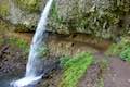
 | Hamilton Mountain The beautiful 7.75-mile lollipop loop visits bombastic waterfalls and panoramic cliffs on the Washington side of the Columbia River Gorge in Beacon Rock State Park. |
 | Coyote Wall This partial loop covers 5.8 miles as it ascends Coyote Wall to great views of its basalt cliffs and across Columbia River Gorge. |
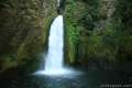 | Wahclella Falls This 2-mile hike visits a sublime waterfall in Oregon's Columbia River Gorge. |
 | Eagle Creek Trail This 4.55-mile hike ventures up a beautiful and dramatic canyon to impressive waterfalls like Metlako Falls, Lower Punchbowl Falls, and Punchbowl Falls. |
 | Horsetail Falls Trail - Oneonta Trail Loop This 2.85-mile loop starts at Horsetail Falls, passes beneath an overhang behind Ponytail Falls, and crosses a bridge by Middle Oneonta Falls to hit three waterfalls and viewpoints looking out over the Columbia River Gorge. |
 | Lower Oneonta Falls in Oneonta Gorge This 0.8-mile trek follows Oneonta Creek between the tall, mossy cliffs of a wild and beautiful gorge to the base of an enchanting 100-foot waterfall. |
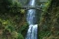 | Multnomah Falls This 0.4 to 2.6-mile hike in Columbia River Gorge visits Oregon's tallest (and probably most visited) waterfall, offering something to hikers of all abilities. |
 | Multnomah-Wahkeena Loop This 6.05-mile loop uses Wahkeena Trail and Larch Mountain Trail to visit six glorious waterfalls (Wahkeena Falls, Fairy Falls, Ecola Falls, Weisendanger Falls, Dutchman Falls, and Multnomah Falls) as well as many fine cascades along Wahkeena Creek and Multnomah Creek in two beautiful canyons off Columbia River Gorge. |
 | Guler Ice Cave in Gifford Pinchot National Forest This short hike goes underground to explore an old lava tube with frozen stalactites and stalagmites, plus other interesting cave features. |
 | June Lake This 2.6-mile hike visits a small lake and a waterfall on the southern slopes of Mount Saint Helens. |
 | Lava Canyon Trail This 1.25-mile loop explores a colorful canyon re-carved by the 1980 eruption of Mount Saint Helens. |
 | Ape Cave This adventurous underground hike in Mount Saint Helens National Volcanic Monument travels through one of the longest lava tubes in the world. |
 | Trail of Two Forests This short nature trail in Mount Saint Helens National Volcanic Monument tours a landscaped that was transformed by a molten lava flow. For extra fun, crawl through a 50-foot long lava tube beneath the trail. |
 | More trails in Washington Explore other hikes in the Evergreen State, including Mount Rainier National Park and Mount Saint Helens National Volcanic Monument. |
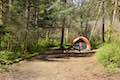 | Camping in Beacon Rock State Park The main campground in Beacon Rock State Park has 26 first-come first-serve campsites in a forest setting. |
- Beacon Rock Trail on oregonhikers.org (opens in a new tab)
- Beacon Rock Trail on wta.org (opens in a new tab)
- Beacon Rock Trail on pnwanderers.com (opens in a new tab)
- Beacon Rock Trail on outdoorproject.com (opens in a new tab)
- Beacon Rock Trail on hikingproject.com (opens in a new tab)
- Beacon Rock Trail on alltrails.com (opens in a new tab)
- Beacon Rock Trail on gorgefriends.org (opens in a new tab)
- Beacon Rock Trail on nwhiker.com (opens in a new tab)
- Beacon Rock on wikipedia.org (opens in a new tab)
- The official trail map for Beacon Rock State Park (opens in a new tab)
- The official brochure for Beacon Rock Trail (opens in a new tab)
- The official webpage for Beacon Rock State Park (opens in a new tab)
Common Questions about Beacon Rock Trail in Beacon Rock State Park
- Is the trail open?
- Yes. You should expect to find that Beacon Rock Trail is open. There are no recent reports of trail closures. If you discover that the trail is closed, please help your fellow hikers by reporting a closure.
- Do I need a permit for this hike?
- Yes. Washington State Parks Discover Pass.
- How much time does this hike take?
- It takes approximately 1 hour to hike Beacon Rock Trail. Individual hiking times vary. Add extra time for breaks and taking in the views.
- How long is this hike?
- The hike to Beacon Rock Trail is a 1.6 mile out and back with 600 feet of elevation change.
- Are dogs allowed on this trail?
- No, dogs are likely not allowed on Beacon Rock Trail. The trail is primarily open to hikers.
- Does this trail go to a summit?
- Yes, Beacon Rock Trail reaches a summit with panoramic views.
- What mountain range is this trail in?
- Beacon Rock Trail is located in the Cascade Range.
- Where is the trailhead located?
- The trailhead for Beacon Rock Trail is located in Stevenson, Washington.
Trailhead Address:
Washington 14
Stevenson, Washington 98648
Trailhead Coordinates:
45.62854, -122.02222 - What are the driving directions to the start of the hike?
To get to the trailhead: From Portland, follow Interstate 205 north into the state of Washington. Take exit 27 toward Camas, merge onto Route 14, and travel east for 28 miles to the trailhead (which is 34.5 miles up Route 14 from Interstate 5 in Vancouver). Beacon Rock comes into view as you head up a hill toward the trailhead. Pass the park headquarters for Beacon Rock State Park on the left across from one section of parking for Beacon Rock Trail. After that, find the start of Beacon Rock Trail on the right across from a road that rises toward Hamilton Mountain Trailhead and the park's Main Campground. A larger parking area comes just east of the trailhead, and has a bathroom and picnic tables.
View custom Google Maps directions from your current location.
- Are there other trails near Beacon Rock Trail?
- Yes, you can find other nearby hikes using the Hikespeak Hike Finder Map.

Go the extra miles...
Submit a rating of this hike to go with your comment. Contribute to the average trail rating.