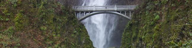
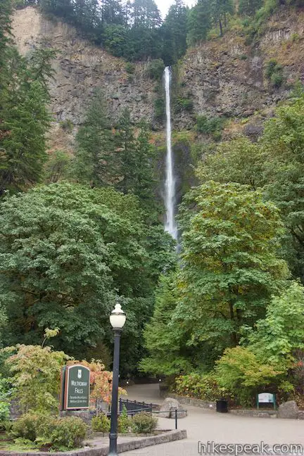
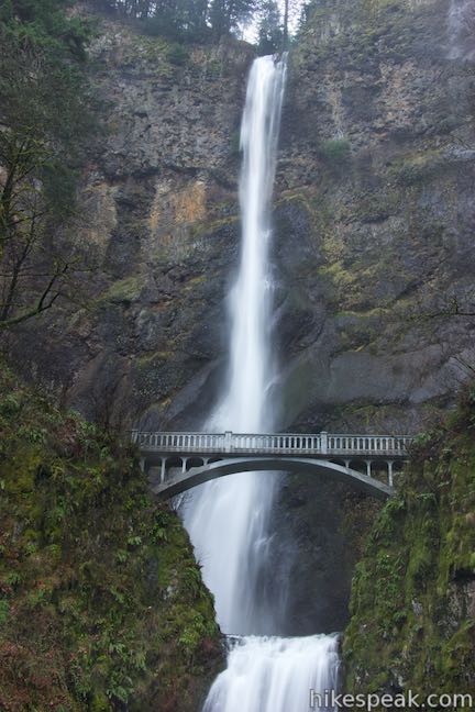
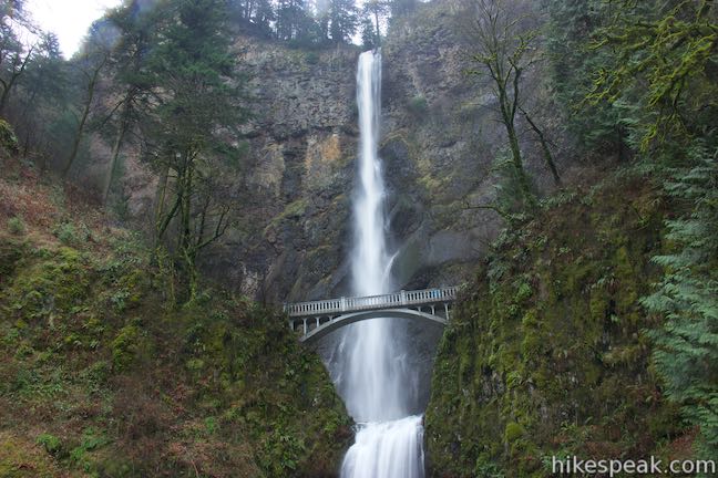
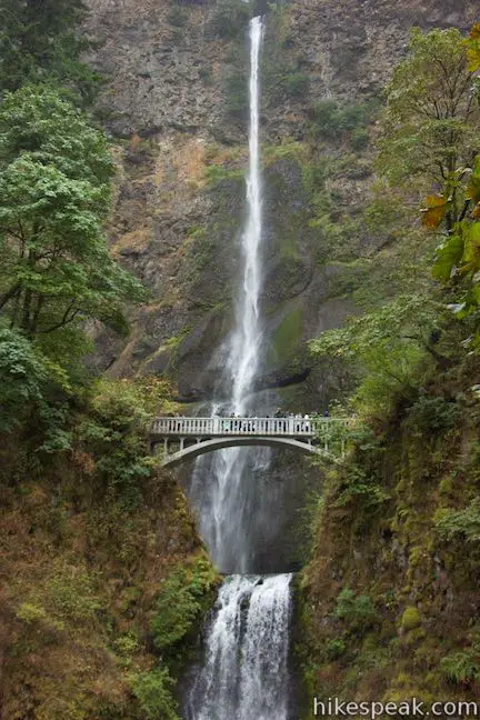
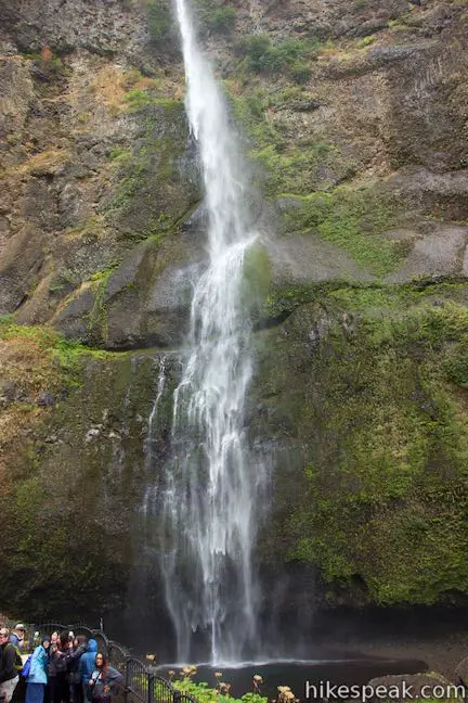
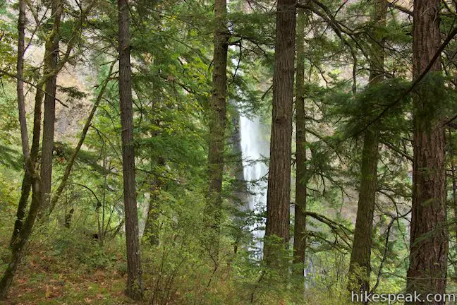
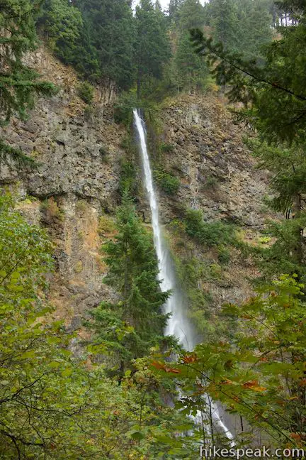
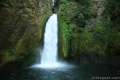
Multnomah Falls is the tallest waterfall in Oregon and one of the tallest year-round waterfalls in the United States. The 620-foot waterfall is grand, beautiful, and easy to reach, making it one of the most popular outdoor attractions in the Pacific Northwest.
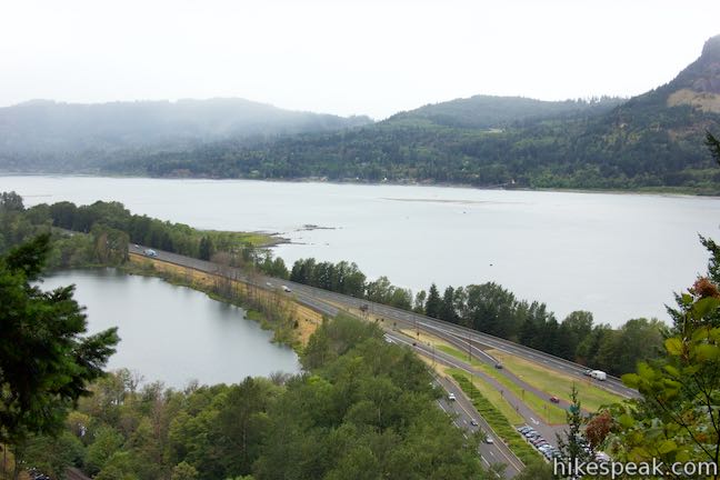
Located in the Columbia River Gorge on the Washington – Oregon border, 30 miles east of Portland, Multnomah Falls offers something for hikers of all abilities. Whether you walk to the base of the falls, hike 0.2 miles to a scenic footbridge, 1.2 miles to the top of the falls, or explore more waterfalls in the area on Multnomah-Wahkeena Loop, your visit will be memorable.
Walking to the base of Multnomah Falls
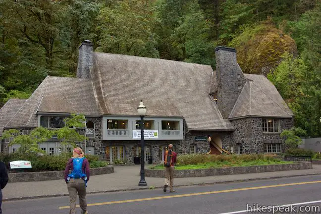
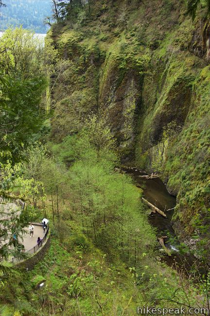
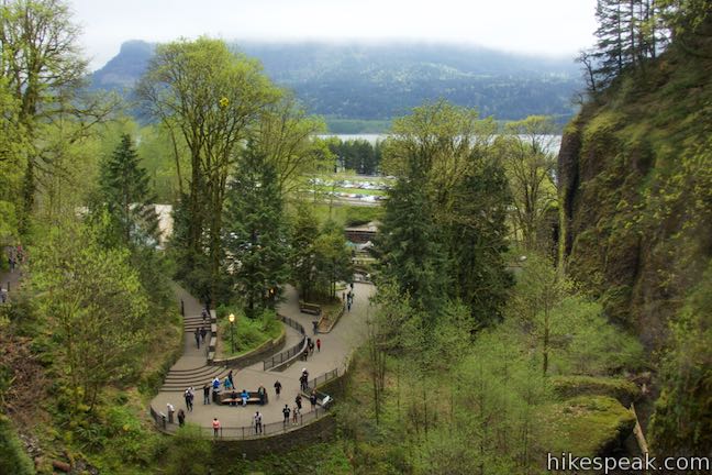
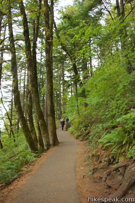
Begin from a parking area just off Interstate 84 and follow a walkway alongside a calm stretch of Multnomah Creek to Multnomah Lodge, a historic stone building with a restaurant, cafe, gift shop, and visitor center – all the things you would expect in a heavily touristed area.
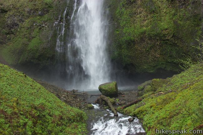
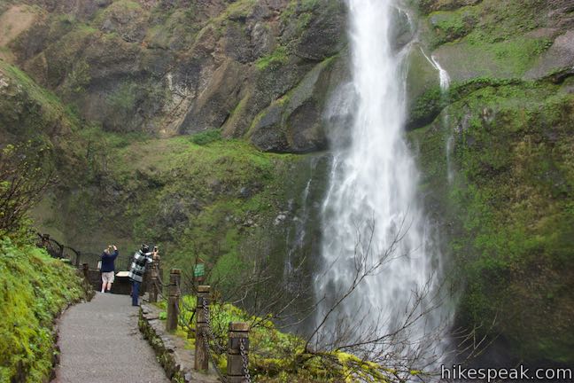
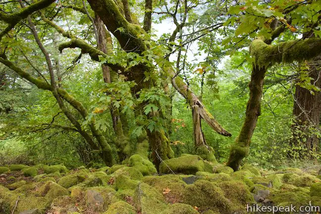
Continue up the walkway to the left of the lodge toward the waterfall itself, which resides in a lush canyon shaded by firs, cedars, maples, and alders.
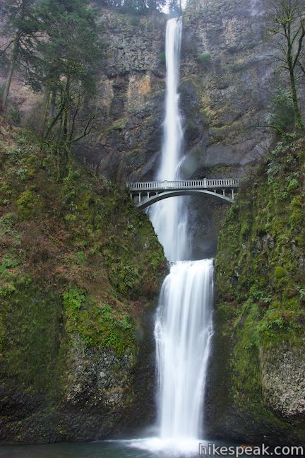
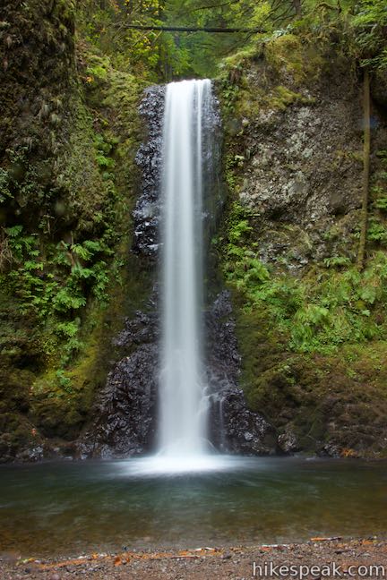
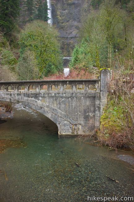
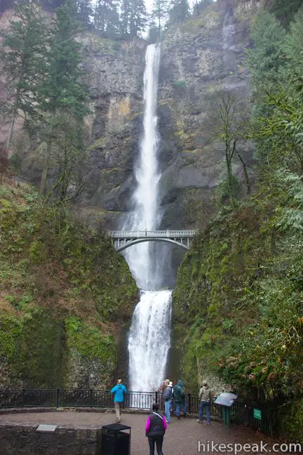
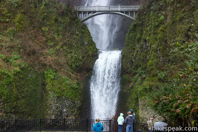
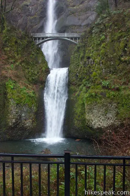
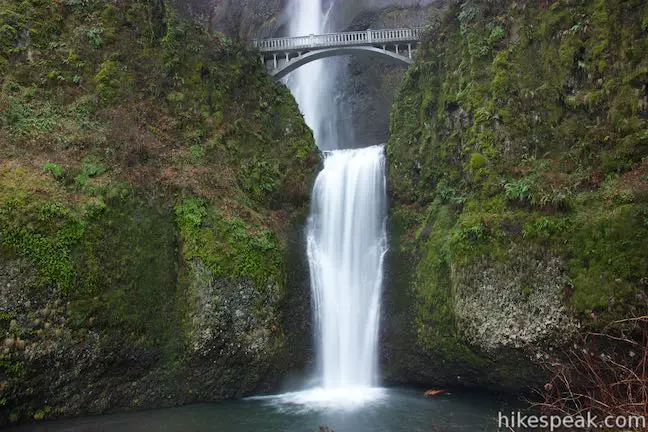
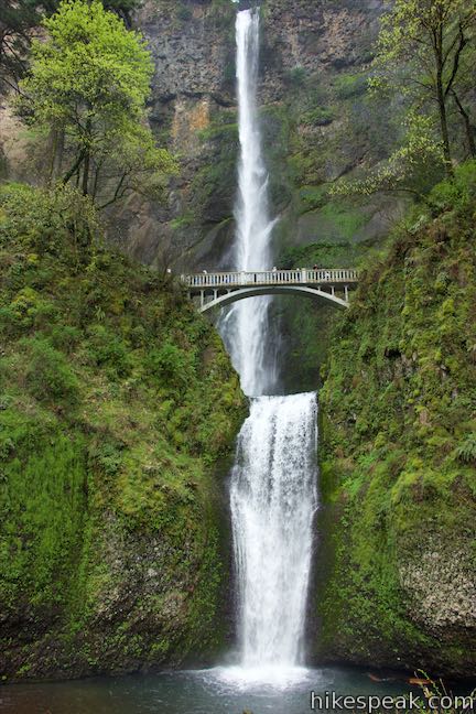
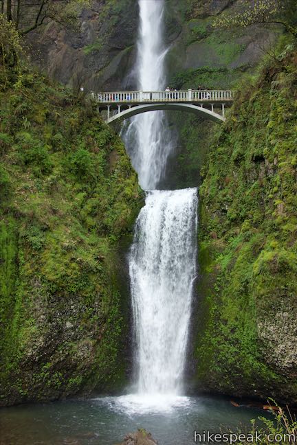
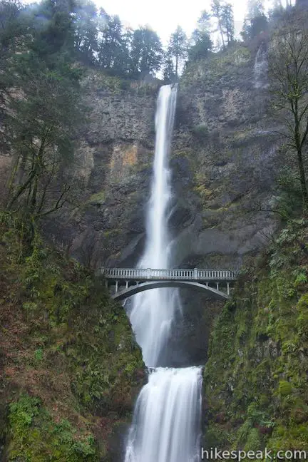
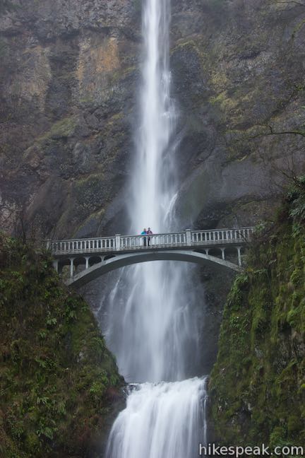
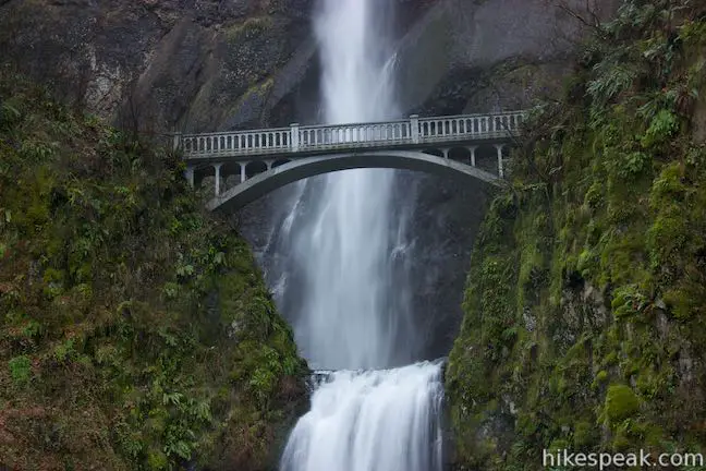
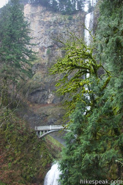
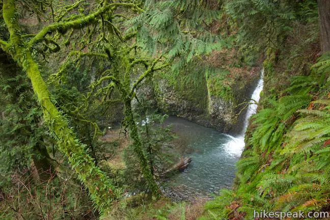
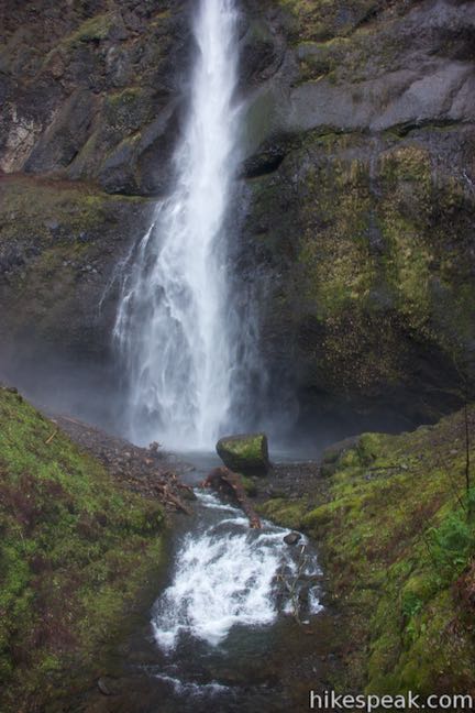
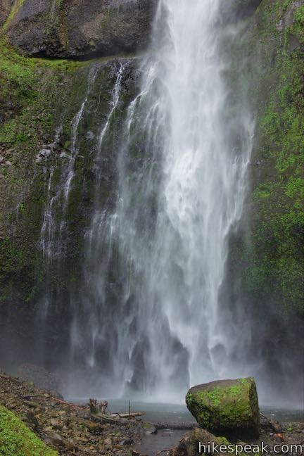
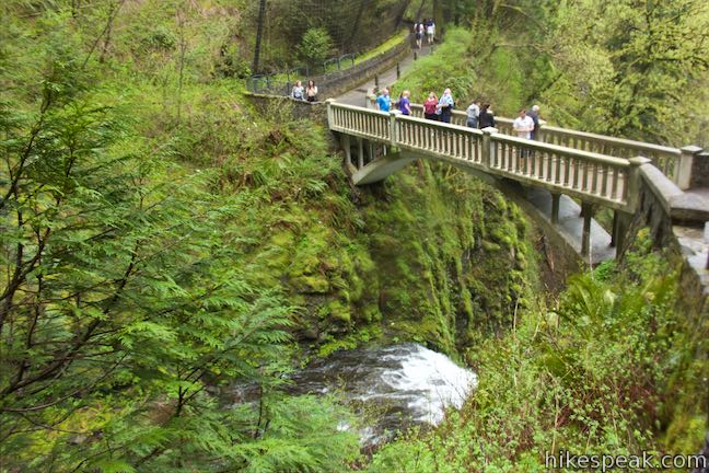
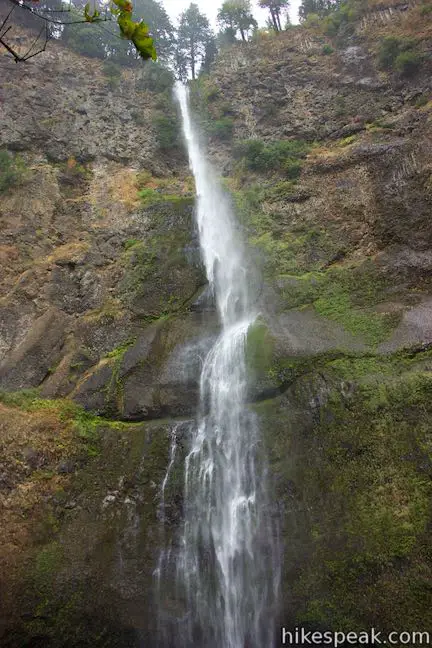
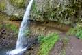
Multnomah Falls is split in two tiers. The upper tier is 542 feet tall, while the lower tier drops another 69 feet. The lower tier makes a swift plunge into a pool in front of the viewpoint. A picturesque footbridge straddles the two tiers, providing an intimate experience amidst the waterfall. The bridge is designed elegantly enough not to detract from the waterfall’s beauty. Behind the bridge, the upper tier makes a long, long drop down a sheer rock wall with many interesting layers.
Hiking to Benson Bridge
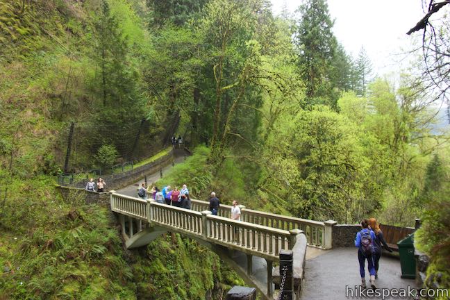
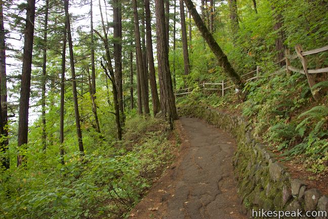
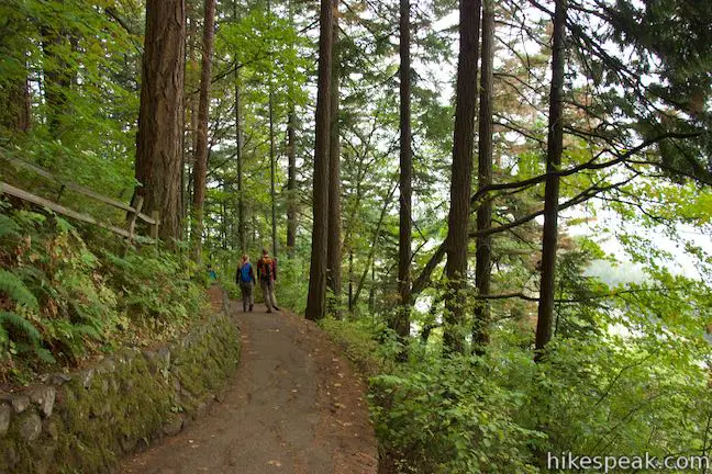
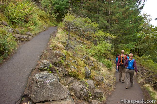
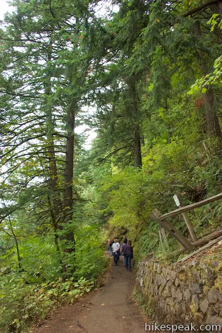
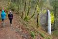
Next to the viewing area below Multnomah Falls, Larch Mountain Trail begins with a short staircase. To reach Benson Bridge, continue up this paved trail through a few switchbacks. Views of the waterfall become obscured by the forest, but you’ll catch some nice profiles of the lower falls.
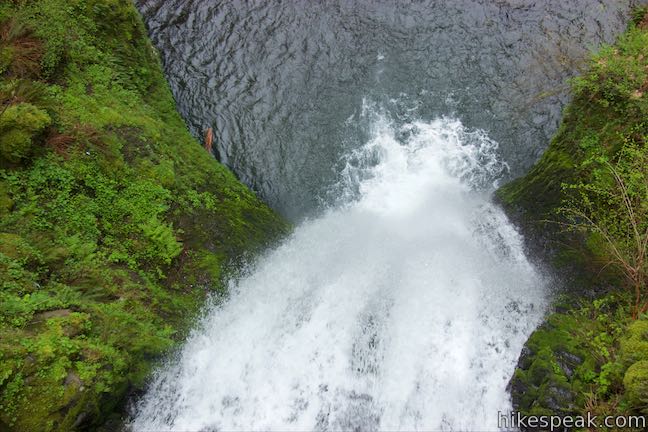
In less than 0.2 miles, arrive at the short but memorable bridge spanning a gap in the canyon on top of the lower tier. Look over the railing for a dizzying perspective straight down the lower falls. Below that, you’ll see people looking up from the lower viewpoint where you just stood.
Looking in the other direction, the bridge boasts a better perspective of the upper tier of Multnomah Falls than you had below. A widening cord of white water falls down an enormous cliff. Tilt your head up to see the top of the waterfall, where the creek pours out of the forest above. Moss and ferns line the vertical rock wall, adding Oregon charm to this must-see waterfall in the Columbia River Gorge.
About Benson Bridge: The bridge is named after Simon Benson, a lumberman and philanthropist who donated land along the Columbia River Gorge for preservation, including the land around Multnomah Falls.
If you intend to turn around at Benson Bridge, don’t do so before crossing the bridge and hiking a short way farther up to a viewpoint at a sharp bend in the trail. This spot is even closer to the waterfall, hitting hikers with spray when gusts come toward the trail. Watch as water is swept away from the rock at the bottom of this enormous drop. If you hike higher than this bend, recognize that the best views of Multnomah Falls are behind you.
Hiking to the top of Multnomah Falls
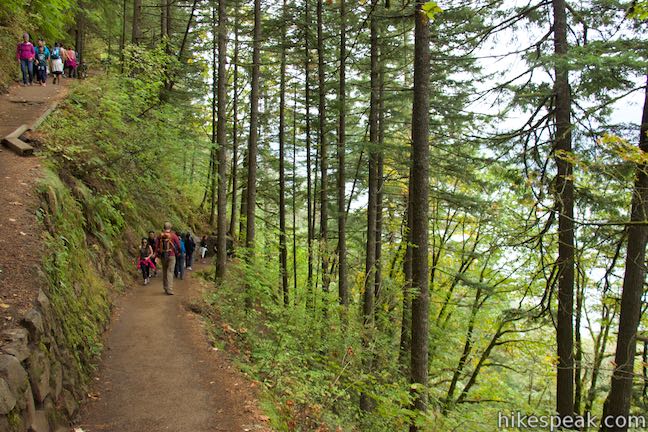
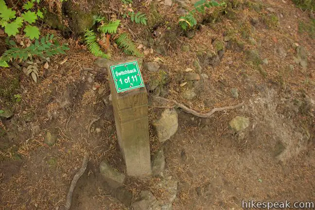
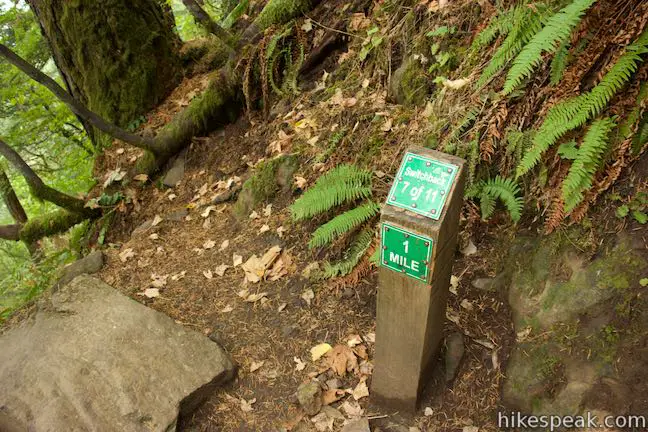
Larch Mountain Trail continues beyond the bend above Benson Bridge and becomes more serious, with eleven numbered switchbacks on the trail up to an overlook at the brink of Multnomah Falls. After all that effort, the view from the top of the falls won’t wow quite as much as the ones below, so there’s no shame it turning around at Benson Bridge or just above it.
Larch Mountain Trail remains paved as it ascends the side of Columbia River Gorge toward Multnoma Falls. At 0.2 miles above Benson Bridge, pass through a junction with Gorge Trail, which heads east toward Oneonta Gorge. At the next switchback (#3) you’ll find a viewing area with between-the-trees views of Multnomah Falls. Break here or continue up the trail. Spot the waterfall again after switchback five before Multnoma Falls goes into hikding.
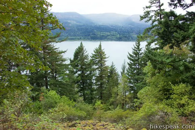
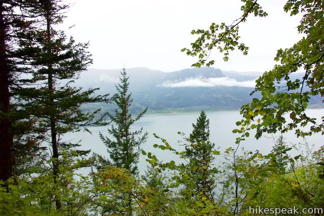
Look out over the Columbia River through gaps in the forest as the trail continues to ascend. Pass through switchback after switchback as the numbers keep going up. Finally, at switchback number nine, reach a crest in the trail. Ascended 700 feet from the bottom of the trail in under a mile takes effort, so catch your breath as the trail now heads downhill.
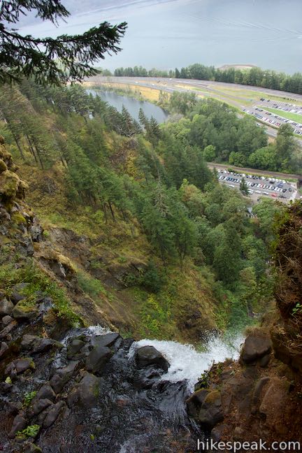
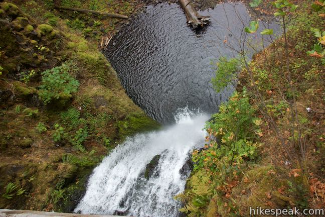
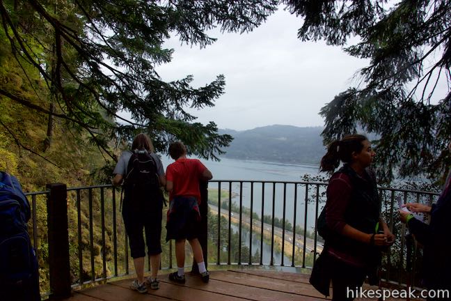
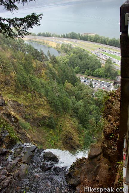
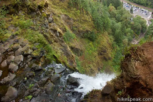
Come to a junction with a trail to Multnomah Falls Overlook. Turn right to hike down the 0.2-mile long spur out to the brink of Multnomah Falls. Switchbacks bring you down alongside Multnomah Creek, where the tentative water seems to have no idea what’s in store. A narrow staircase between stone walls leads to a small round viewing area (with a highly necessary safety railing) that is right alongside the top of Multnomah Falls.
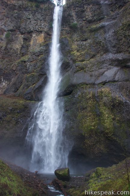
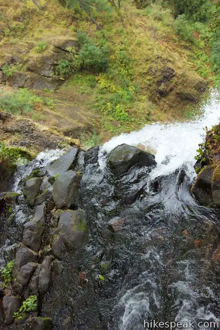
Look over the lip of the waterfall, where the the creek takes a massive 542-foot leap down the upper tier of Multnomah Falls. It’s a long way down. At the bottom of the waterfall, you’ll see the viewing area near Multnomah Lodge. You can also look out past Interstate 84 across the Columbia River Gorge. The overlook allows you to safely stand where it would otherwise be perilous. The viewpoint is well integrated into the landscape so that it is not noticeable when looking up at the waterfall from below.
After bagging this top-down view, return to Larch Mountain Trail. You ca turn left to hike right back down the trail the way you came and complete a 2.4-mile round trip hike.
Hiking beyond the brink pf Multnomah Falls
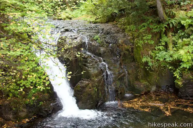
Those eager to see more will find plenty more to see. Turn right up Larch Mountain Trail. The pavement ends as the trail leads to a canyon filled with a few more waterfall, like Weisendanger Falls, which is 0.35 miles up the trail. You put in a lot of effort to get to the top of Multnomah Falls, so why not enjoy some of the lovely canyon above?
If you’re hiking far above Multnomah Falls, consider hiking Multnomah-Wahkeena Loop, a tremendous waterfall-filled hike that incorporates Larch Mountain Trail. This loop comes down Larch Mountain Trail’s steep paved switchbacks at the end of the loop, after a more moderate ascent.
No fee or permit is required to visit Multnomah Falls. Dogs are allowed on leashes. From the viewing area below Multnomah Falls, it is 0.4 miles round trip to Benson Bridge, 2.4 miles round trip to the top of the falls (with 750 feet of elevation change), and 13.6 miles round trip to the top of Larch Mountain. Even if you do not wish to hike a great distance, do not miss Multnomah Falls. It is a magnificent sight.
Want a great view over Columbia Rive Gorge?
- Drive to the Vista House
- Hike to Angel’s Rest
- Or explore other trails in Columbia River Gorge
CLOSURE UPDATE: This hike has reopened to the public following damage from the 2017 Eagle Creek Fire. Find more information about the wildfire closure on the US Forest Service’s Columbia River Gorge National Scenic Area: Alerts and Notices webpage.
Directions to the Trailhead
- Take Interstate 84 to exit 31 (30 miles east of Portland and 50 miles west of The Dalles).
- The exit is well marked for Multnomah Falls and leads right to a large parking area.
- Walk south toward Multnomah Falls, passing below the freeway.
- Alternatively, a smaller parking area is located along Historic Columbia River Highway near Multnomah Lodge.
- From Portland, take Interstate 84 to exit 28 for Bridal Veil.
- Go east on Bridal Veil Road for a quarter mile to Historic Columbia River Highway.
- Continue east for 2.9 miles to Multnomah Lodge, where parking is on the left.
Trailhead Location
Trailhead address: 53000 Historic Columbia River Highway, Corbett, OR 97019
Trailhead coordinates: 45.5777, -122.1173 (45° 34′ 39.72″N 122° 07′ 02.28″W)
You may also view a regional map of surrounding Oregon trails and campgrounds.
Larch Mountain Trail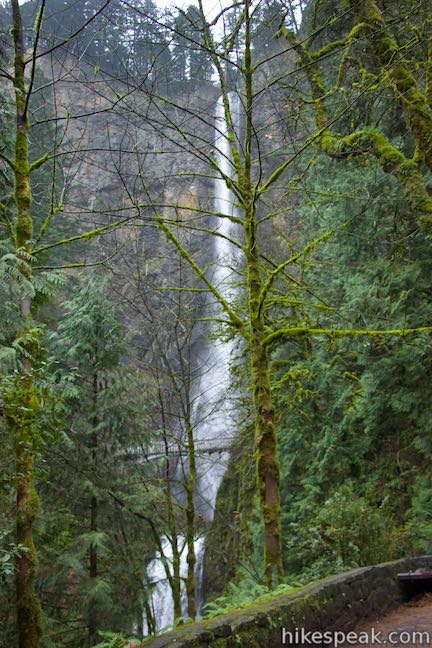


 | Multnomah-Wahkeena Loop This 6.05-mile loop uses Wahkeena Trail and Larch Mountain Trail to visit six glorious waterfalls (Wahkeena Falls, Fairy Falls, Ecola Falls, Weisendanger Falls, Dutchman Falls, and Multnomah Falls) as well as many fine cascades along Wahkeena Creek and Multnomah Creek in two beautiful canyons off Columbia River Gorge. |
 | Angel's Rest This 4.8-mile hike ascends to a panoramic landing with spectacular views across Columbia River Gorge (particularly at sunrise). |
 | Latourell Falls Trail This 2.3-mile loop explores a canyon with two beautiful waterfalls, attaining great views of both. |
 | Oneonta Gorge to Lower Oneonta Falls This 0.8-mile trek follows Oneonta Creek between the tall, mossy cliffs of a wild and beautiful gorge to the base of an enchanting 100-foot waterfall. |
 | Horsetail Falls Trail - Oneonta Trail Loop This 2.85-mile loop starts at Horsetail Falls, passes beneath an overhang behind Ponytail Falls, and crosses a bridge by Middle Oneonta Falls to hit three waterfalls and viewpoints looking out over the Columbia River Gorge. |
 | Wahclella Falls This 2-mile hike visits a sublime waterfall in a canyon within the Columbia River Gorge. |
 | Eagle Creek Trail This 4.55-mile hike ventures up a beautiful and dramatic canyon to impressive waterfalls like Metlako Falls, Lower Punchbowl Falls, and Punchbowl Falls. |
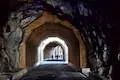 | Mosier Twin Tunnels This 2 to 9.5-mile hike ventures up Historic Columbia River Highway State Trail to a pair of tunnels carved into basalt cliffs on the side of Columbia River Gorge. |
 | More trails in Oregon Explore other hikes in Oregon outside the Columbia River Gorge. |
Common Questions about Multnomah Falls in Columbia River Gorge National Scenic Area
- Is the trail open?
- Yes. You should expect to find that Multnomah Falls: Bottom to the Brink is open. There are no recent reports of trail closures. If you discover that the trail is closed, please help your fellow hikers by reporting a closure.
- Is this trail free to access?
- Yes, Multnomah Falls: Bottom to the Brink is free to access. No entrance fee, pass, or permit is required. If you discover that access rules have changed, please provide feedback on your experience.
- How much time does this hike take?
- It takes approximately 15 minutes to hike Multnomah Falls: Bottom to the Brink. Individual hiking times vary. Add extra time for breaks and taking in the views.
- How long is this hike?
- The hike to Multnomah Falls: Bottom to the Brink is 0.4 to 13.6 miles (out and back) with 25 feet of elevation change.
- Are dogs allowed on this trail?
- Yes, dogs are allowed on Multnomah Falls: Bottom to the Brink. The trail is open to hikers, dogs.
- Is Multnomah Falls: Bottom to the Brink good for kids?
- Yes, this hike is likely suitable for children. It is relatively short (0.4 miles) with manageable elevation gain.
- Will I see a waterfall on this hike?
- Yes, Multnomah Falls: Bottom to the Brink features a waterfall.
- What mountain range is this trail in?
- Multnomah Falls: Bottom to the Brink is located in the Cascade Range.
- Where is the trailhead located?
- The trailhead for Multnomah Falls: Bottom to the Brink is located in Corbett, Oregon.
Trailhead Address:
53000 Historic Columbia River Highway
Corbett, Oregon 97019
Trailhead Coordinates:
45.5777, -122.1173 - What are the driving directions to the start of the hike?
To get to the trailhead: Take Interstate 84 to exit 31 (30 miles east of Portland and 50 miles west of The Dalles). The exit is well marked for Multnomah Falls and leads right to a large parking area. Walk south toward Multnomah Falls, passing below the freeway.
Alternatively, a smaller parking area is located along Historic Columbia River Highway near Multnomah Lodge. From Portland, take Interstate 84 to exit 28 for Bridal Veil. Go east on Bridal Veil Road for a quarter mile to Historic Columbia River Highway. Continue east for 2.9 miles to Multnomah Lodge, where parking is on the left.
View custom Google Maps directions from your current location.
- Are there other trails near Multnomah Falls: Bottom to the Brink?
- Yes, you can find other nearby hikes using the Hikespeak Hike Finder Map.

15 Comments on Multnomah Falls in Columbia River Gorge National Scenic Area
What hikers are saying:
✨ Generated summary of user commentsHikers find the steep ascent rewarding for the scenic views of the river. Finding parking is a significant challenge during busy periods, making it necessary to arrive early in the day. Jake warns that winter visits bring dangerous conditions near the bridge where frozen water creates slick surfaces.
How long is the actual hike? Like hour wise.
If you set aside an hour, you will have plenty of time to hike up to the bride above the lower tier of the waterfall. You will need more time to go further. Finding parking can take as long as walking to the waterfall on busy days…
I overheard someone saying that the bridge is not open right now. Is this true?
This is a steep hike, but about an hour long. When we went, the falls were closed at the top, so we didn’t get to see the view down into the pool; however, the hike was still worth it to see the river along the top. Our 5 year old made the trail with less effort than we did.
I’m thinking of going to Multnomah falls during New Years week. The thing that concerns me is the weather. Does anyone know what weather is like during this time of year?
Hi, around New Years the falls are usually partially frozen. The weather will obviously be cold and the area around the bridge and a little after might be actually quite dangerous because of the frozen water on the ground.
Is the place more crowded during July 4th weekend?
I would expect Multnomah Falls to be very busy any holiday weekend. Arrive early in the day if you can.
Will I be able to park a truck with a fifth wheel near the trail head?
TYIA ?
So long as the parking lot isn’t full, you should be able to park. Arrive early.
Are these trails wheelchair (scooters) accessible? Thanks!!
How early can you go to the falls? I want to go before sunrise would that be a problem
Are dogs allowed on all trails?
Planning to visit two weekends from now. Any feedback is much appreciated. 1. Do I need to buy a pass? 2. What is a good time to arrive to find parking.
How steep is the trail from the Lodge to the bridge? Asthmatic walking!