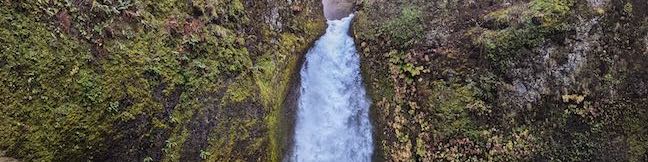
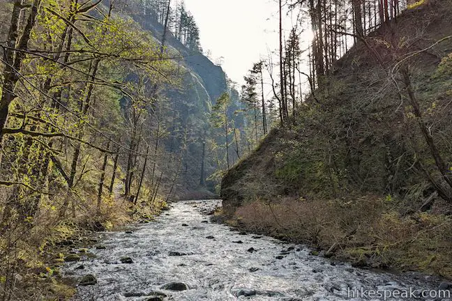
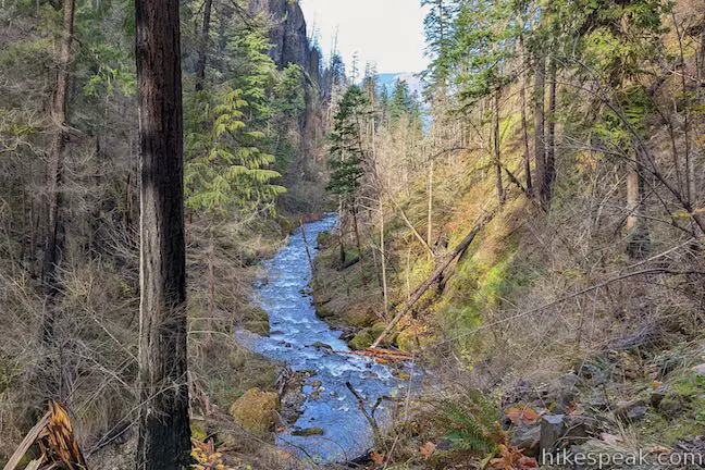
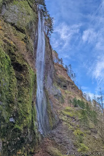
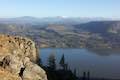
If you were designing a landscape just for waterfalls, you would end up with something not unlike the Columbia River Gorge. Dozens of waterfalls spill from the basalt cliffs in this region. The abundance of water creates mossy natural retreats that could barely be matched even if you were designing a landscape from scratch. Multnomah Falls is the tallest waterfall in the area, and while Wahclella Falls is not as grand (its two tiers total 130 feet), it is quite charming and the trail to the waterfall is a lot less crowded. Wahclella Falls gets its share of visitors, but it is possible for a hiker to have the waterfall all to his or herself. The lollipop loop trail to Wahclella Falls is two miles round trip with 250 feet of elevation gain – a beautiful one-hour trek.
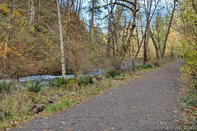
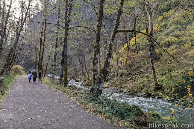
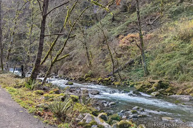
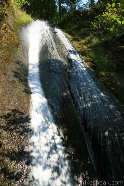
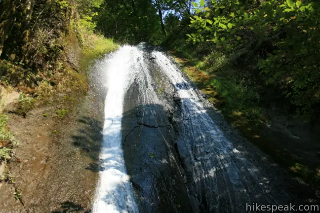
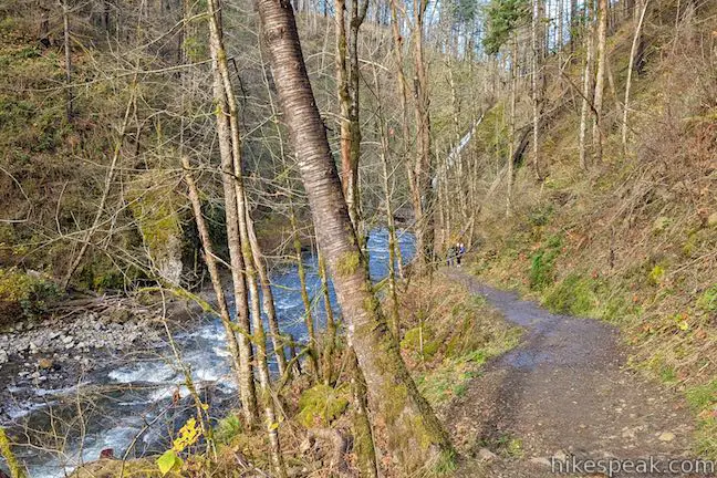
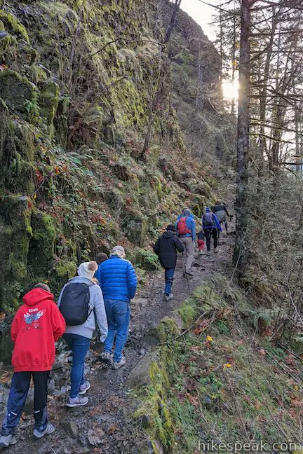
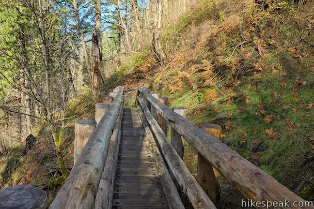
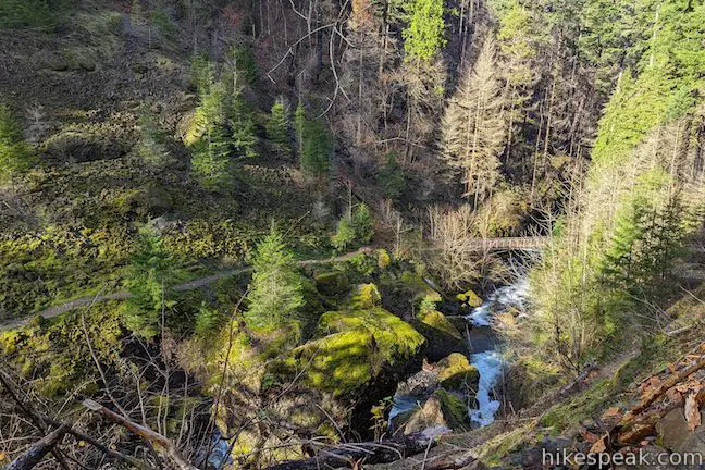
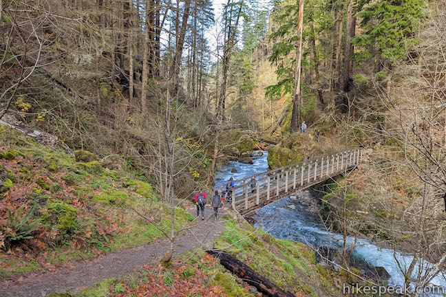
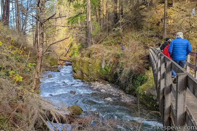
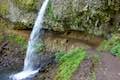
Warm up with a level stroll down a wide trail bordering Tanner Creek. After 0.3 miles, the trail makes a sharp turn to the left. Here hikers cross a short wooden bridge in the mist of 35-foot Munra Falls. This unadvertised waterfall courses down a rock wall to join Tanner Creek, and is so close you can practically touch it.
In Southern California this waterfall could serve as a hike’s main attraction, but this being Oregon, Munra Falls is just an appetizer for the waterfall ahead.
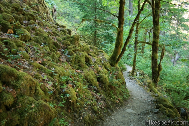
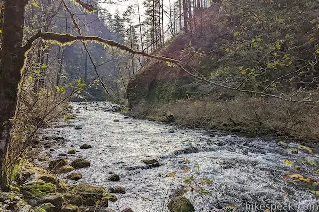
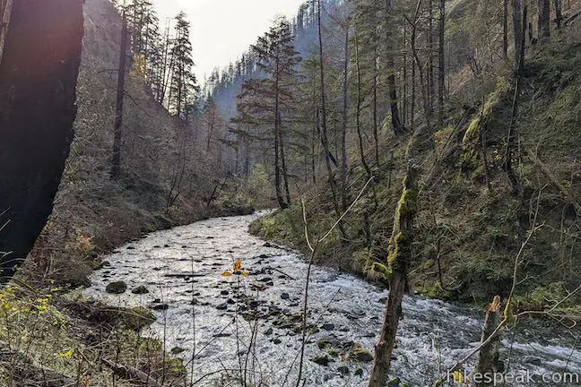
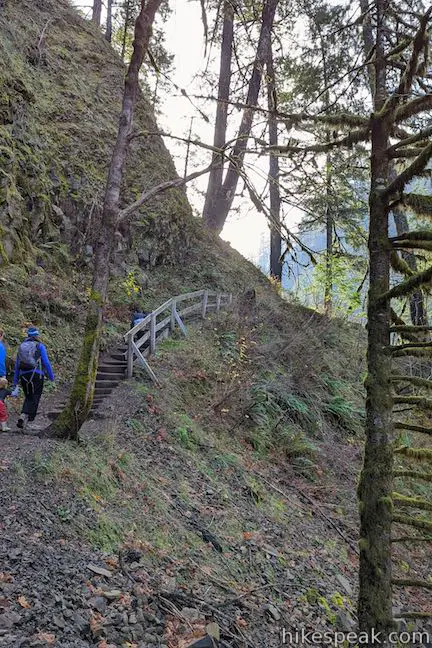
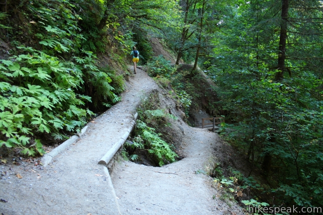
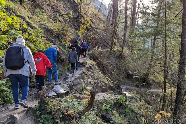
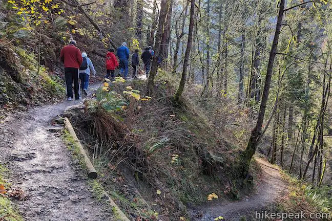
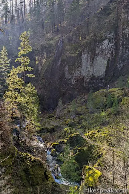
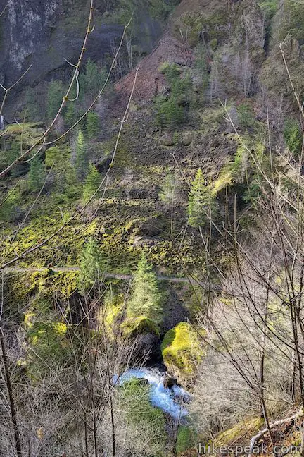
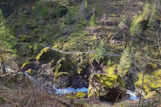
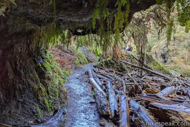
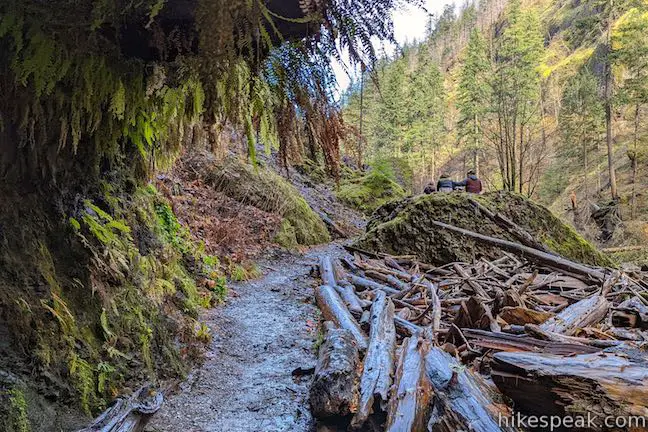
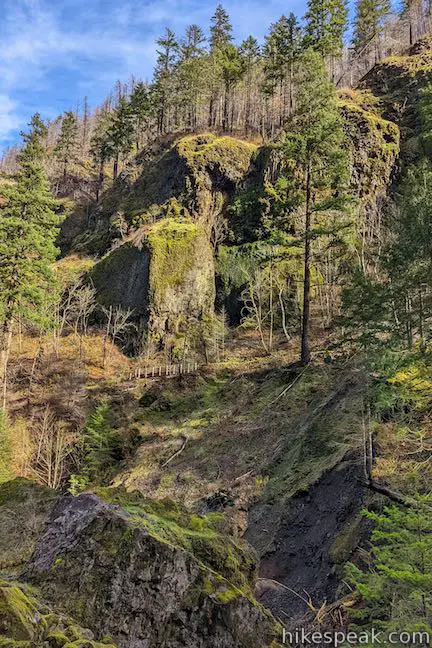
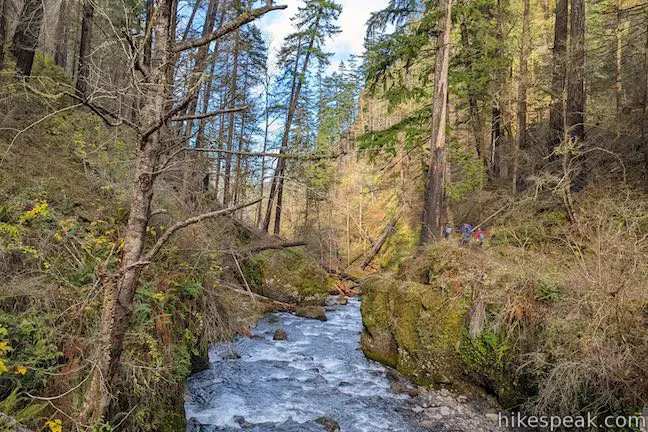
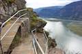
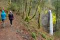
Beyond the bridge, the trail narrows to a single track and begins a gradual climb along the side of the canyon carved by Tanner Creek. A section of wooden steps, half a mile from the start, represent the steepest climb. You won’t mind the effort as you pass through a charming woodland with a forest floor of moss and ferns.
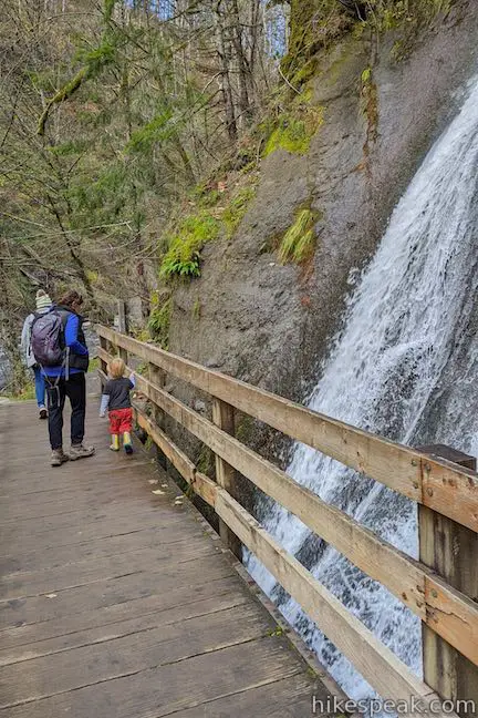
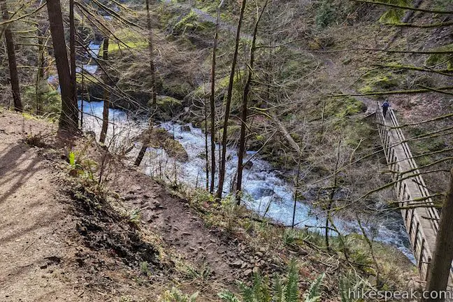
At 0.7 miles you will come to a split in the trail. To the left, the trail continues up through the forest to the waterfall. To the right, the trail drops to a bridge, crosses, and proceeded upstream to the falls. An upper bridge just below the waterfall allows for the loop. Which way you should go depends on how you want to be introduced to the falls. If you would like your first impression of the waterfall to be up close and in full glory, select the upper trail to the left. If, on the other hand, you prefer to begin with a distant view of Wahclella Falls and track in for a close up, select the lower trail. Both routes to the waterfall are approximately 0.3 miles in length.
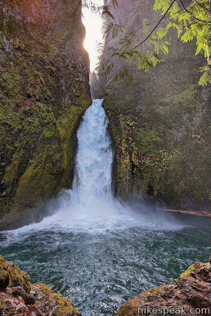
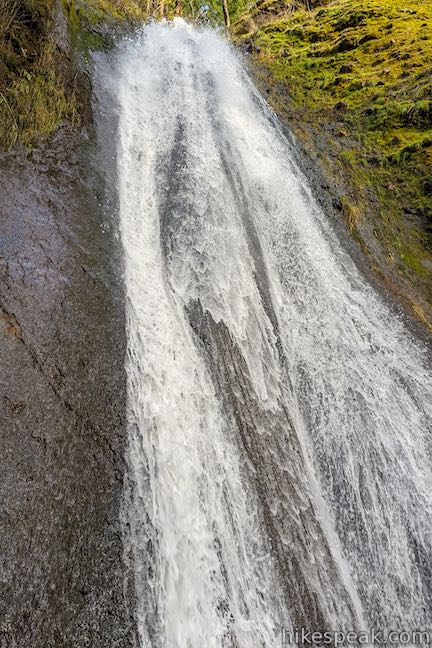
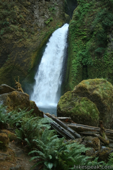
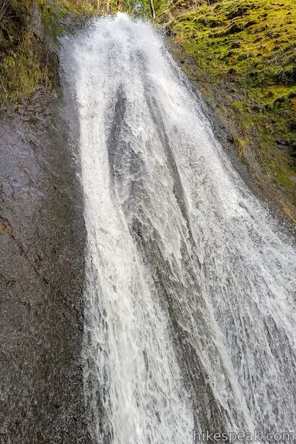
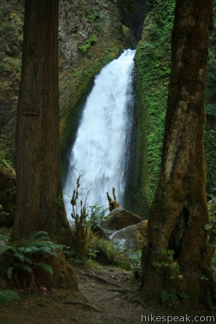
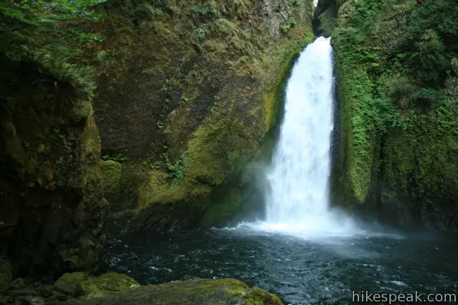
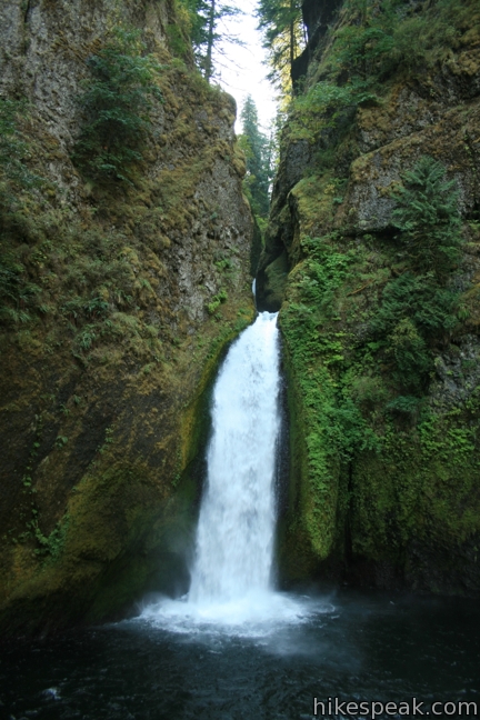
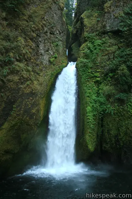
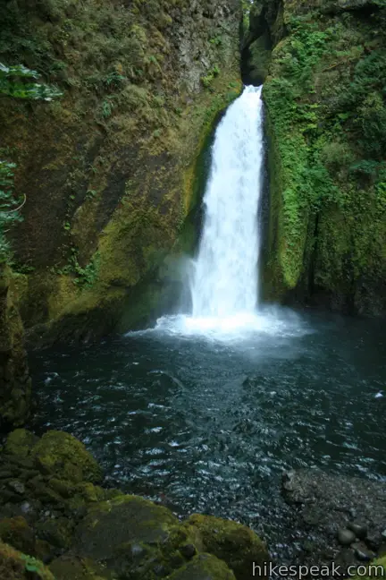
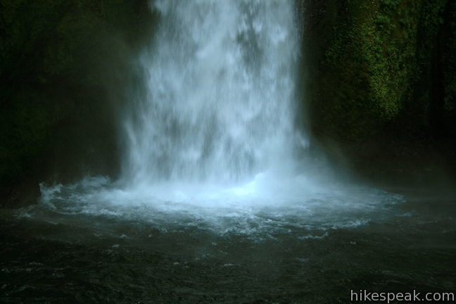
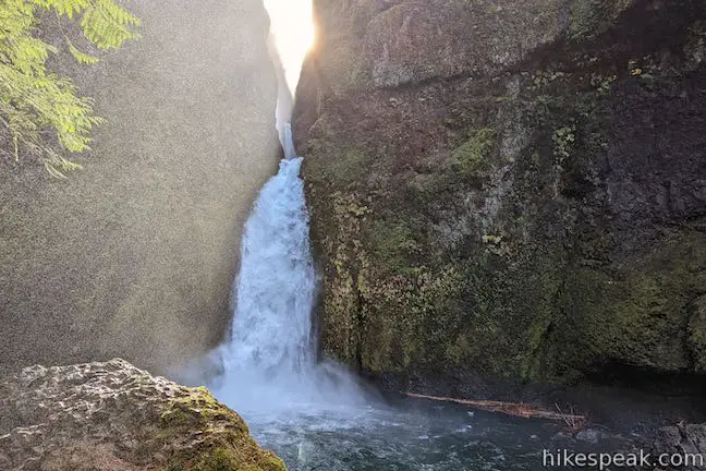
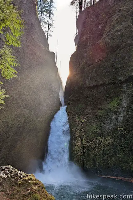
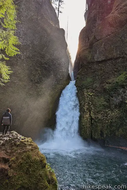
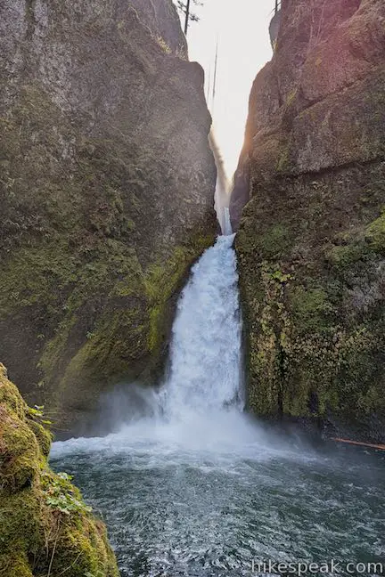
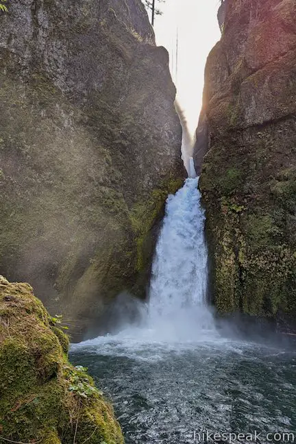
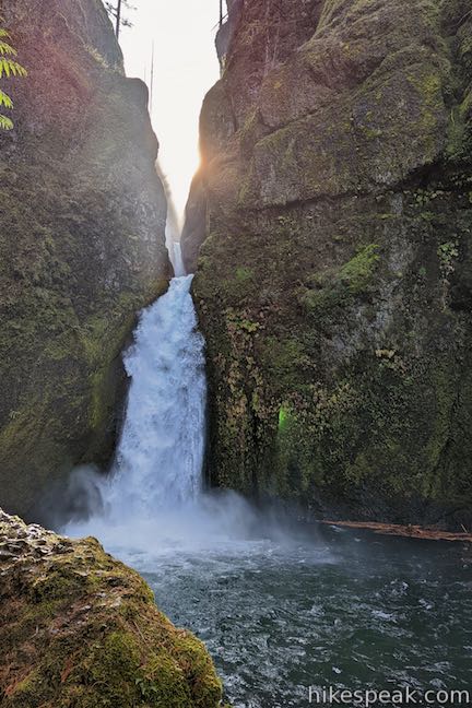
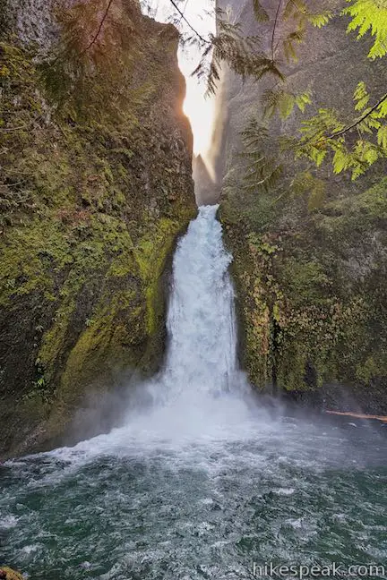
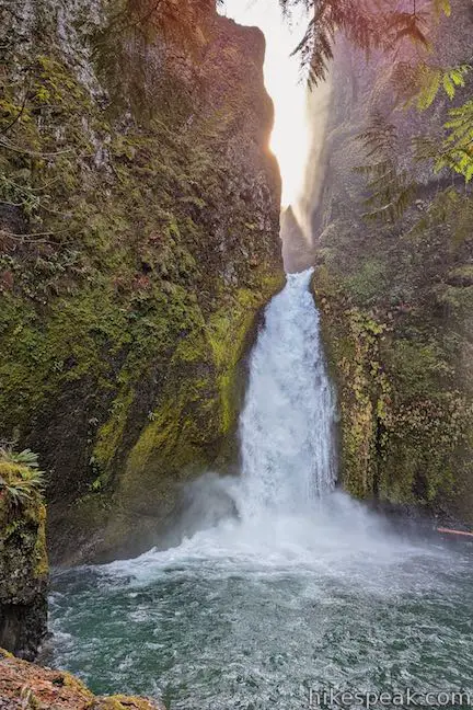
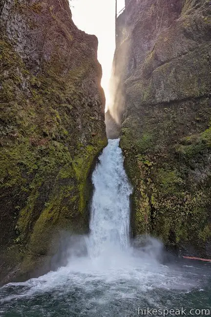
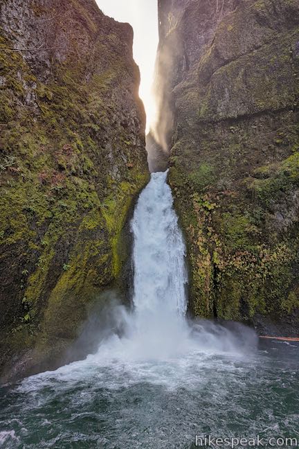
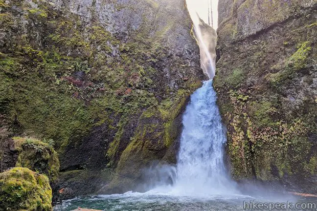
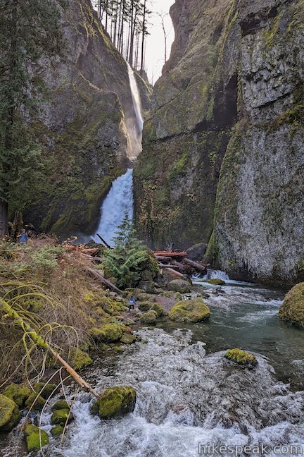
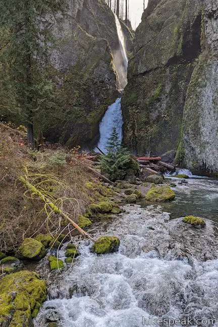
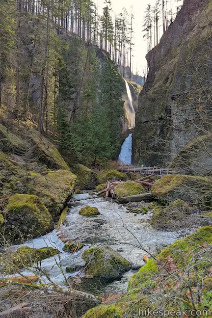
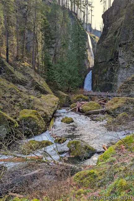
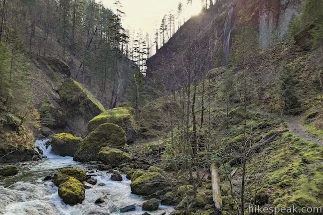
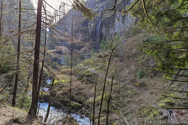
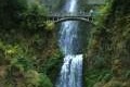
The sight of Wahclella Falls is an impressive one. The lower tier of the falls plunges 80 feet into a dark pool surrounded by a rock amphitheater laden with moss and ferns. Stand at the rock lectern and absorb the waterfall-filled arena.
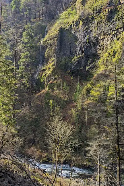
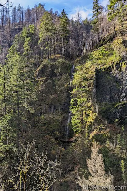
Above the cataract, an upper tier of the waterfall can be seen dropping an additional fifty feet. Between the two, as through afraid of missing the party, another seasonal falls can be seen. Silky threads from East Fork Falls shower into the creek from a hidden source in the rock above the creek. The more you look at Wahclella Falls, the more there is to see. Spend time taking it in from a few angles. This serene location would be worthy of a much longer hike.
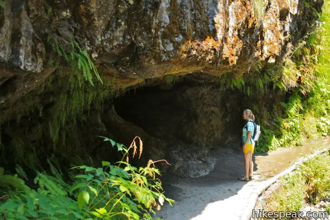
On the west side of the bridge below the falls is a rock overhang with a small cave. Poke your head in before returning down the trail. Dogs are allowed on leash. Children should love the hike, but keep ahold of them as there are steep drops along the trail. A $5 day use fee is required to park at the trailhead in Columbia River Gorge National Scenic Area (price as of 2019). A Northwest Forest Pass or America the Beautiful public lands pass can be used in place of the day use fee.
TRAIL STATUS: Open! This hike closed to the public due to damage from the 2017 Eagle Creek Fire, but reopened in August 2019. Find more information about trail closures on the US Forest Service’s Columbia River Gorge National Scenic Area: Alerts and Notices webpage.
Directions to the Trailhead
- Take Interstate 84 to exit 40, Booneville Dam (40 miles east of Portland). turn south and drive a short distance to the parking area for Wahclella Falls Trail.
Trailhead Location
Trailhead address: Northeast Bonneville Way & Interstate 84, Cascade Locks, OR 97014
Trailhead coordinates: 45.63152, -121.95368 (45° 37′ 53.4″N 121° 57′ 13.25″W)
You may also view a regional map of surrounding Oregon trails and campgrounds.


 | Mosier Twin Tunnels This 2 to 9.5-mile hike ventures up Historic Columbia River Highway State Trail to a pair of tunnels carved into basalt cliffs on the side of Columbia River Gorge. |
 | Eagle Creek Trail This 4.55-mile hike ventures up a beautiful and dramatic canyon to impressive waterfalls like Metlako Falls, Lower Punchbowl Falls, and Punchbowl Falls. |
 | Horsetail Falls Trail - Oneonta Trail Loop This 2.85-mile loop starts at Horsetail Falls, passes beneath an overhang behind Ponytail Falls, and crosses a bridge by Middle Oneonta Falls to hit three waterfalls and viewpoints looking out over the Columbia River Gorge. |
 | Oneonta Gorge to Lower Oneonta Falls This 0.8-mile trek follows Oneonta Creek between the tall, mossy cliffs of a wild and beautiful gorge to the base of an enchanting 100-foot waterfall. |
 | Beacon Rock Trail This 1.6-mile hike follows an impressively engineered trail packed with switchbacks that scale a monolith along the Columbia River. |
 | Hamilton Mountain The beautiful 7.75-mile lollipop loop visits bombastic waterfalls and panoramic cliffs on the Washington side of the Columbia River Gorge in Beacon Rock State Park. |
 | Multnomah Falls This 0.4 to 2.6-mile hike visits Oregon's tallest (and probably most visited) waterfall, offering something to hikers of all abilities. |
 | Multnomah-Wahkeena Loop This 6.05-mile loop uses Wahkeena Trail and Larch Mountain Trail to visit six glorious waterfalls (Wahkeena Falls, Fairy Falls, Ecola Falls, Weisendanger Falls, Dutchman Falls, and Multnomah Falls) as well as many fine cascades along Wahkeena Creek and Multnomah Creek in two beautiful canyons off Columbia River Gorge. |
 | Angel's Rest This 4.8-mile hike ascends to a panoramic landing with spectacular views across Columbia River Gorge (particularly at sunrise). |
 | Latourell Falls Trail This 2.3-mile loop explores a canyon with two beautiful waterfalls, attaining great views of both. |
 | More trails in Oregon Explore other hikes in Oregon outside the Columbia River Gorge. |
- Wahclella Falls on oregonhikers.org (opens in a new tab)
- Wahclella Falls on wikipedia.org (opens in a new tab)
- Wahclella Falls on waterfallswest.com (opens in a new tab)
- Wahclella Falls on world-of-waterfalls.com (opens in a new tab)
- The National Forest webpage for Wahclella Falls Trail (opens in a new tab)
Common Questions about Wahclella Falls in Columbia River Gorge National Scenic Area
- Is the trail open?
- Yes. You should expect to find that Wahclella Falls Trail is open. There are no recent reports of trail closures. If you discover that the trail is closed, please help your fellow hikers by reporting a closure.
- Do I need a permit for this hike?
- Yes. Northwest Forest Pass Required.
- How much time does this hike take?
- It takes approximately 1 hour to hike Wahclella Falls Trail. Individual hiking times vary. Add extra time for breaks and taking in the views.
- How long is this hike?
- The hike to Wahclella Falls Trail is a 2 mile out and back with 250 feet of elevation change.
- Are dogs allowed on this trail?
- Yes, dogs are allowed on Wahclella Falls Trail. The trail is open to hikers, dogs.
- Is Wahclella Falls Trail good for kids?
- Yes, this hike is likely suitable for children. It is relatively short (2 miles) with manageable elevation gain.
- Will I see a waterfall on this hike?
- Yes, Wahclella Falls Trail features a waterfall.
- What mountain range is this trail in?
- Wahclella Falls Trail is located in the Cascade Range.
- Where is the trailhead located?
- The trailhead for Wahclella Falls Trail is located in Cascade Locks, Oregon.
Trailhead Address:
Northeast Bonneville Way & Interstate 84
Cascade Locks, Oregon 97014
Trailhead Coordinates:
45.63152, -121.95368 - What are the driving directions to the start of the hike?
To get to the trailhead: Take Interstate 84 to exit 40, Booneville Dam (40 miles east of Portland). turn south and drive a short distance to the parking area for Wahclella Falls Trail.
View custom Google Maps directions from your current location.
- Are there other trails near Wahclella Falls Trail?
- Yes, you can find other nearby hikes using the Hikespeak Hike Finder Map.

7 Comments on Wahclella Falls in Columbia River Gorge National Scenic Area
What hikers are saying:
✨ Generated summary of user commentsThis trail provides a rewarding family experience with manageable sections for children. Hikers should stay to the right at the fork for an easier path and prepare for a short, slippery climb during rainy weather.
“Overall definitely worth it in the end.” Jump to comment ↓
This is a great family trail. Easy if you stay to the right at the fork. There is a short stretch that is a bit of a climb where you’ll want to hold smaller kids’ hands, especially if it’s been raining lately, but other than that, not too strenuous to get up and over.
[…] the most famous. But on the recommendation of locals, we spent the last day of our trip hiking to Wahclella Falls, a trail that’s an easy one mile each way — but one that offers plenty of moss-, lichen-, fern- […]
[…] N and I drove into the Columbia Gorge to Wahclella Falls – our next hike. We have been fortunate to have fairly nice weather recently as winter hiking can […]
I actually used map my run to map the distance. 2 miles each way. Overall definitely worth it in the end.
[…] Wahclella Falls is about a mile from the trailhead. It’s an up and down trail but not too much elevation gain and it’s a nice little area. The trail splits at about .7 miles. Go either direction, it loops back on itself. More on the hike here. […]
A $5 recreation fee or Northwest Forest Pass is now required.
Lost a wallet in the parking lot on 1/7/20. I’d is included inside wallet with the name Hadley Hegg. If found please reach out. Will reward. Email at: hadley.hegg@gmail.com