Multnomah-Wahkeena Loop
in Columbia River Gorge
Multnomah Falls is the tallest waterfall in Oregon and not the sort of waterfall that leaves you asking for more. Still, the Columbia River Gorge has so many waterfalls to offer that you can pair scoping out Multnomah Falls from top to bottom with admiring a quintet of other waterfalls on an immensely beautiful hike. This loop combines Wahkeena Trail with Larch Mountain Trail and is 6.05 miles long with 1,525 feet of elevation between its high and low points.
Called the Multnomah-Wahkeena Loop, it’s actually common to start on Wahkeena Trail, taking that to Wahkeena Falls and Fairy Falls and over to Larch Mountain Trail where you hike along Multnomah Creek past Ecola Falls, Weisendanger Falls, Dutchman Falls, and lots of unnamed cascades to get down to Multnomah Falls, which has viewpoints at the brink, middle, and bottom. The loop concludes with a paved trail down from the top of Multnomah Falls. While this last part of the loop can get pretty crowded, the other four and a half miles deliver solitude in a verdant forest full of basalt cliffs, waterfalls, and cascades.
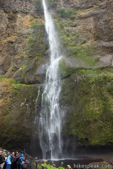
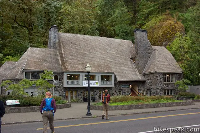
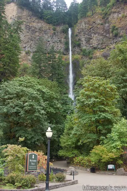
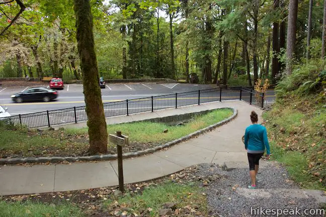
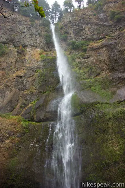
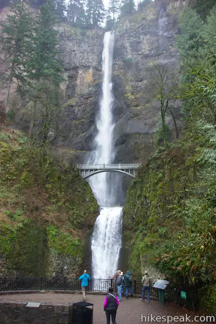
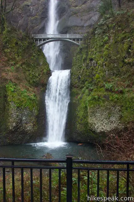
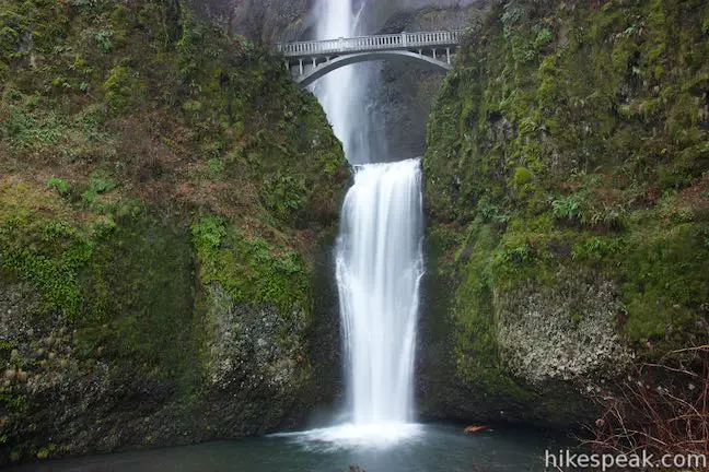
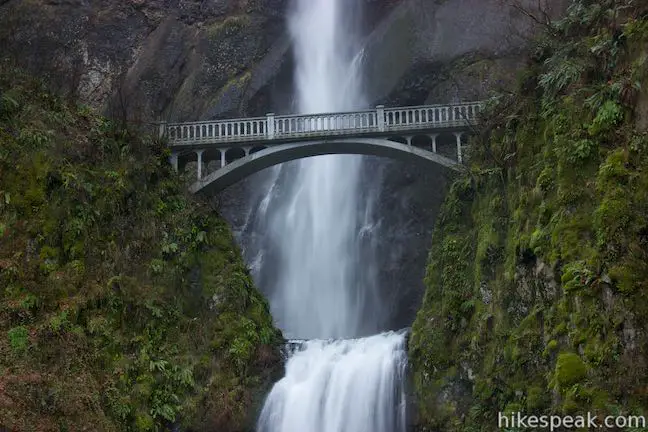
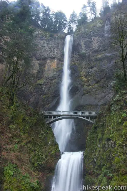
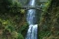
Start from parking areas near Multnomah Lodge below Multnomah Falls. Before setting out, you’ll get an eyeful of this impressive waterfall dropping 620 feet over two gorgeous tiers. Spot Benson Bridge between the tiers of the waterfall, a span that you will cross on this hike. You could start this loop by visiting Multnomah Falls first, but that requires taking Larch Mountain Trail up a string of steep switchbacks that climb some 725 feet in a mile. Why not descend all those switchbacks at the end of the hike and save Multnomah Falls for last? This seems to be the preferred route, so the directions here tackle the loop in a counter-clockwise direction.
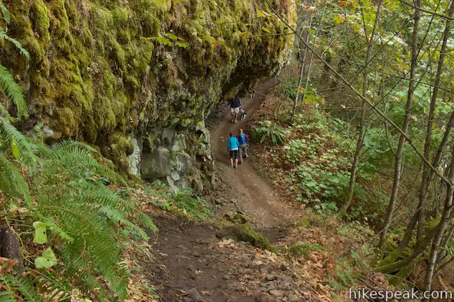
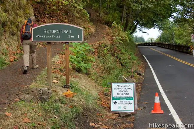
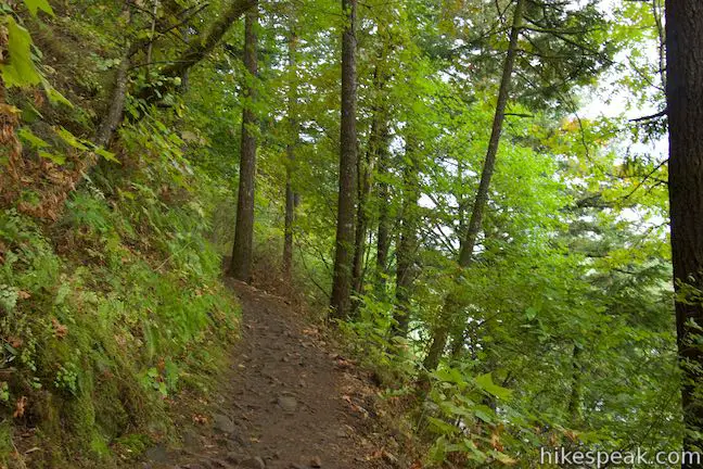
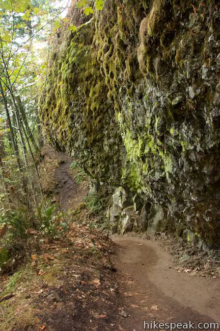
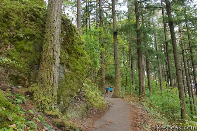
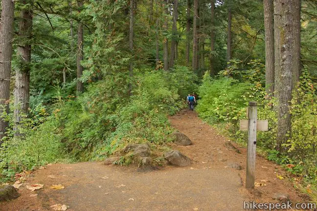
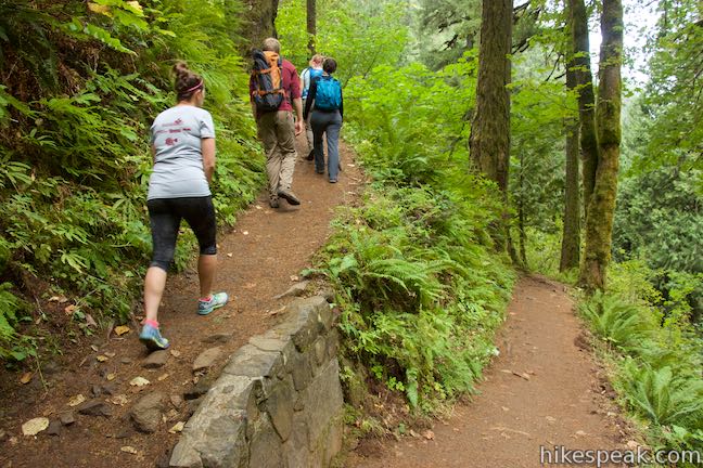
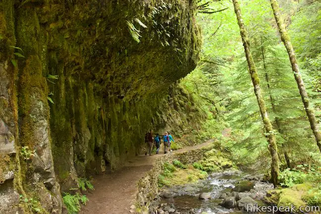
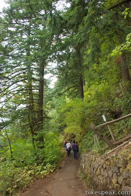
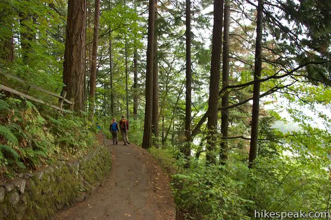
Walk west from Multnomah Lodge along Historic Columbia River Highway. In just a tenth of a mile, you’ll reach the start of Return Trail, which ascends to the left. Return Trail is a dirt single track that follows the side of the gorge above the road. Dip below a fun overhang in the basalt cliffs and then pass a spot where water may be pouring down the rock wall that rises above the left side of the trail. The water drips off lines of vegetation and flows over moss and ferns that cling to the vertical surface. Return Trail cuts through the forest and eventually drops back down to Historic Columbia River Highway.
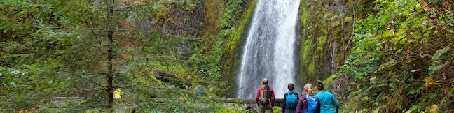
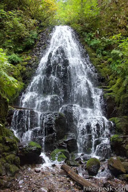
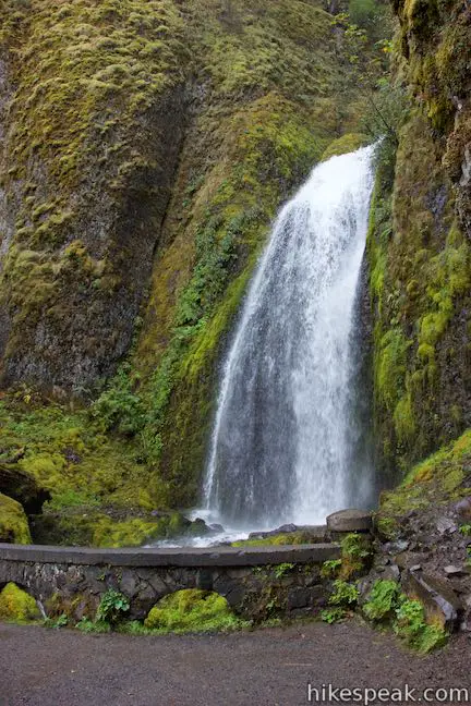
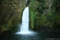
Return Trail ends after 0.6 miles. Turn left along a sidewalk toward a viewing area below Wahkeena Falls. From this vantage, alongside the stream below the waterfall, you can look up through the forest toward a 242-foot gusher. Motorists who park along Historic Columbia River Highway get to share this perspective. Keep hiking and you’ll get quite a bit closer to this waterfall.
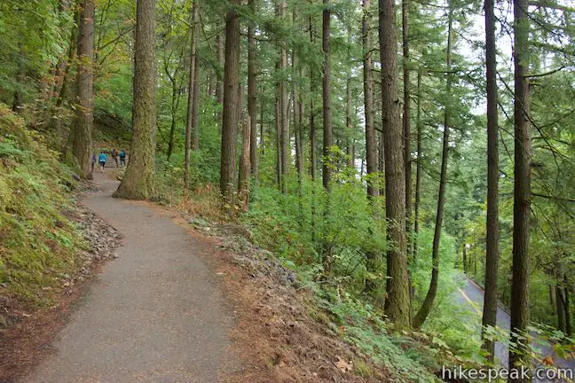
Cross Wahkeena Creek to the start of Wahkeena Trail, which is paved for the next 0.7 miles. Hike east up the trail until a sharp turn to the left points you back toward Wahkeena Falls. Cross a stone bridge just below the base of the waterfall. Only the bottom tier is in view at first, fanning out down a cliff of moss-covered volcanic rock. Walk across the bridge to get a peek at the upper tiers of the waterfall. Linger too long and you’ll get hit with spray from the waterfall, which collides with a rock landing next to the trail.
A bench by the waterfall allows hikers to pause and absorb the view. At just 0.85 miles into the hike, it’s probably too early for a break, so continue east up the trail. Come to a junction at the 1-mile mark with Perdition Trail, which parts to the left and is closed. Bear right to keep ascending Wahkeena Trail.
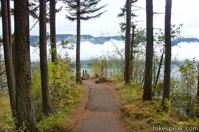
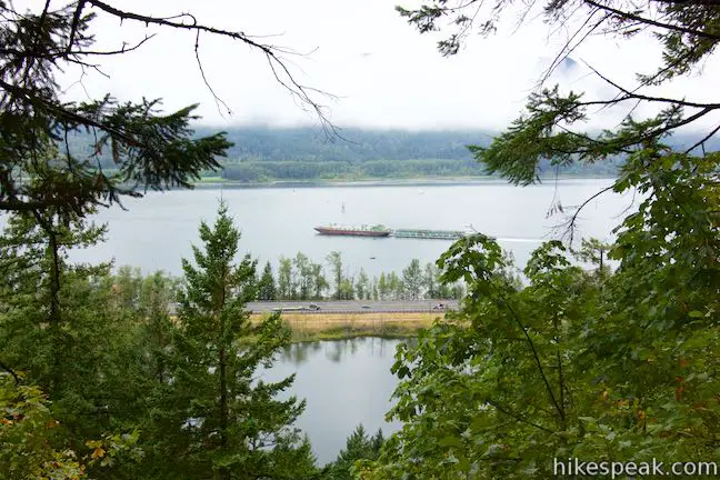
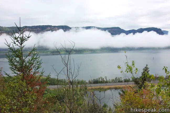
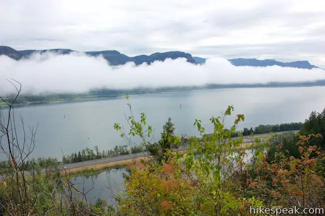
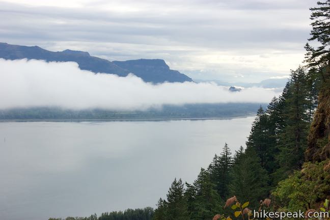
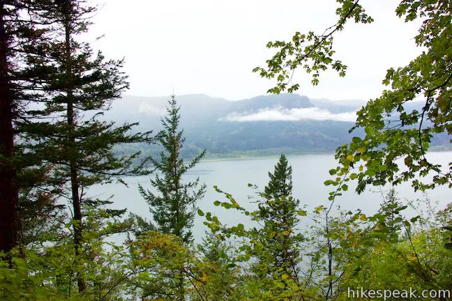
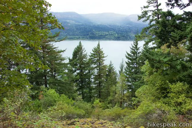
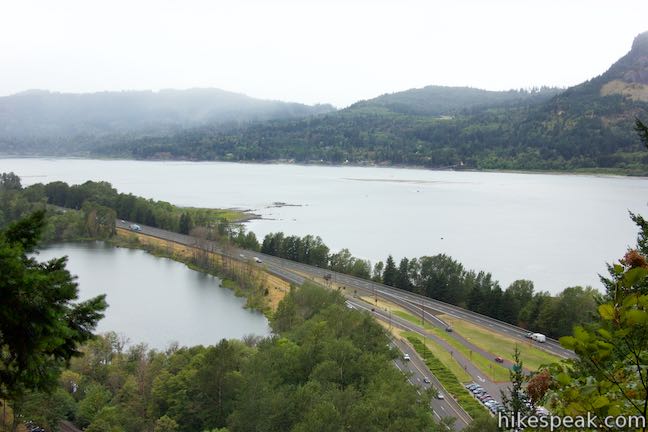
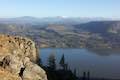
Switchbacks take you higher up the side of the gorge and soon you’ll get the reward for your effort. When the pavement ends, bear right on a short spur to Lemmons Viewpoint. Named after a firefighter who died battling a wildfire, the viewpoint has a grand perspective looking out across the Columbia River Gorge. Across the river, there are pine-covered ridges in the state of Washington.
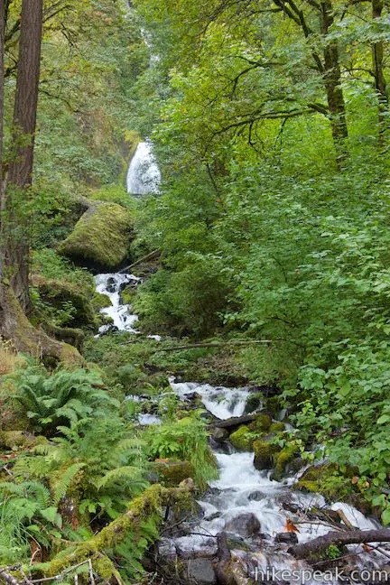
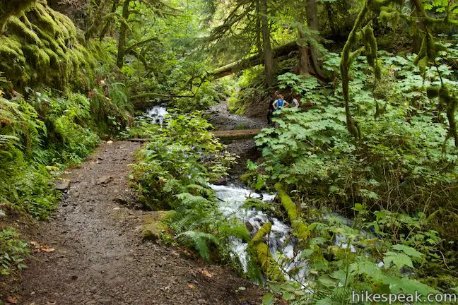
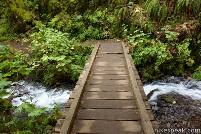
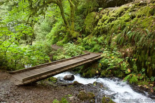
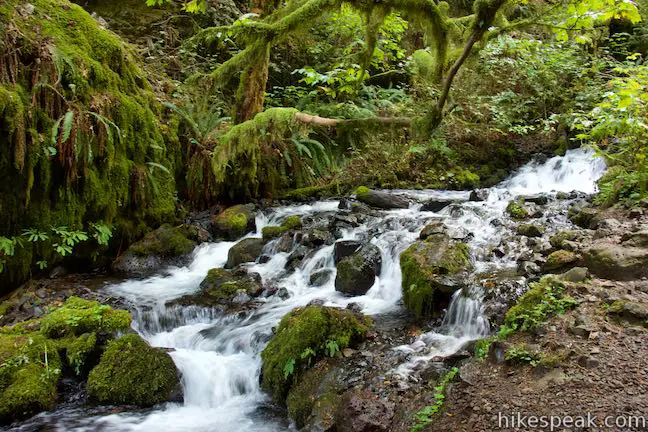
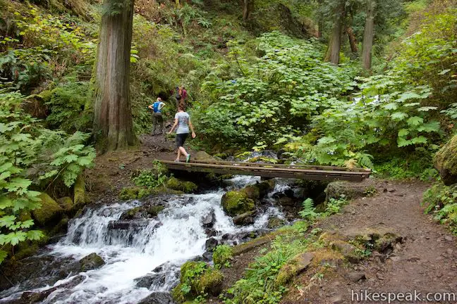
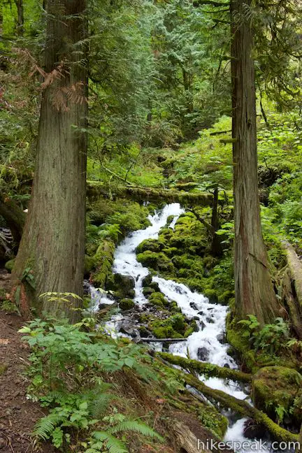
Now unpaved and not as steep, Wahkeena Trail heads south and up into a canyon to Wahkeena Creek. Approach some lovely tumbling cascades where a wooden footbridge leads to the west side of the creek. Moss and ferns cling to trees and rocks on the sides of the canyon, wrapping the creek in green. Cascades are plentiful over the next mile of Wahkeena Trail.
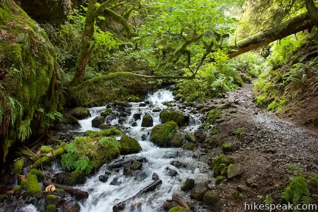
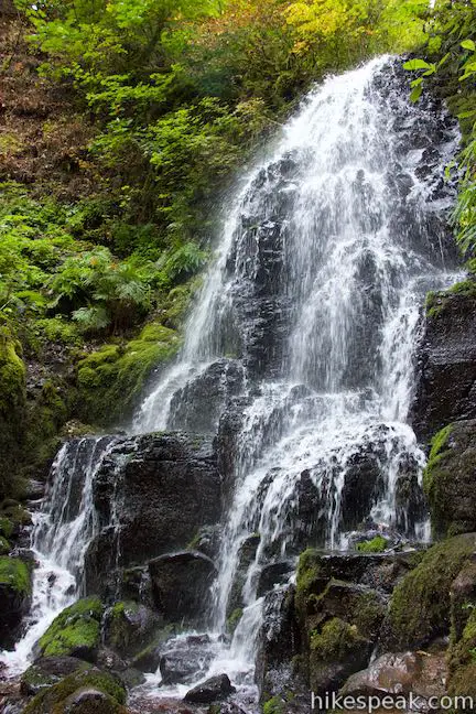
Hike up along the west side of the creek, quickly reaching a footbridge that takes you back to the east side. From here, a string of short switchbacks go up the side of the canyon to Fairy Falls, which tumbles down a rock wall just above the trail. Fairy Falls is about twenty feet tall and widens out in the shape of a fan as it pours down a pitch of black rock with several staircase-like terraces on its descent.
Cross the creek below Fairy Falls and follow Wahkeena Trail through switchbacks that approach beautiful cascades on Wahkeena Creek. Frothy white water tumbles down slopes bordered by moss-covered rocks. Come up to a junction with Vista Point Trail, which parts to the left. Vista Point Trail can be used as an alternate route because it reconnects with Wahkeena Trail, 0.85 miles farther up. To stick with Wahkeena Trail, make a hard right turn and continue up the trail.
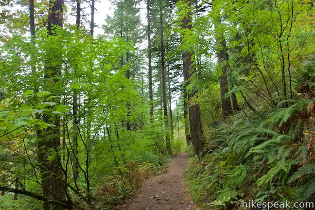
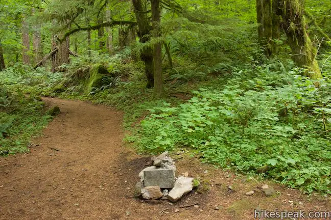
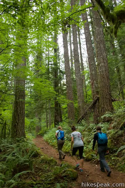
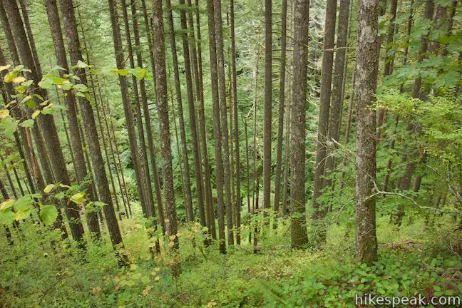
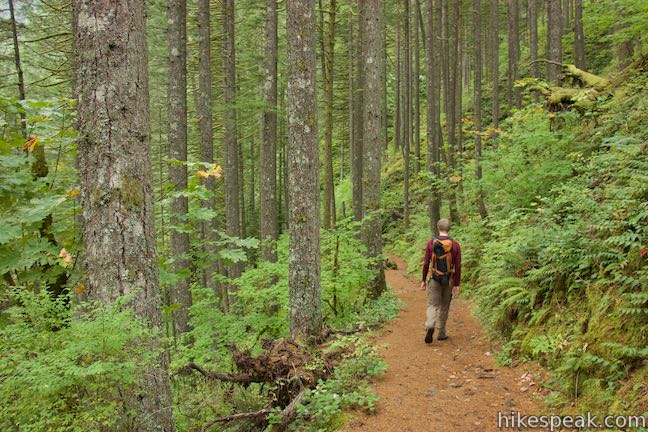
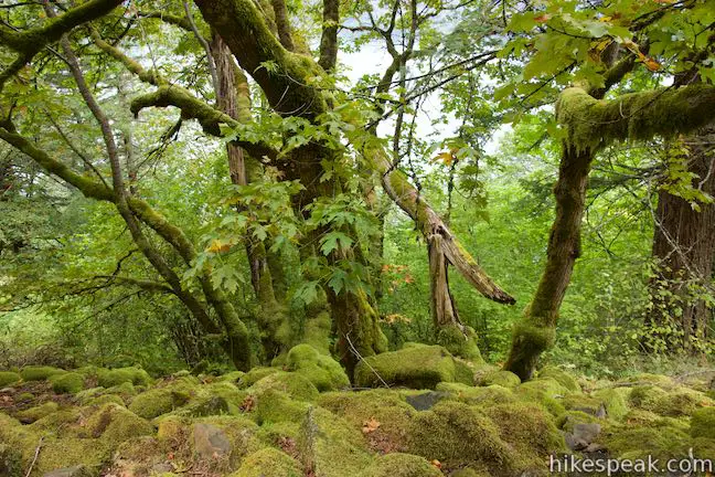
You’ve left Wahkeena Creek now, but the forest is still lovely, full of maples, other deciduous trees, and conifers like Douglas firs. Ferns are everywhere and this temperate rainforest has an abundance of green.
Less than half a mile from the previous junction, and 2.3 miles from the start of the hike, come to a split with Angels Rest Trail, which parts to the right. If you took this trail, you could hike a short distance to Wahkeena Spring, the source of the creek, or venture higher into the mountains. To stick with the loop, stay to the left up Wahkeena Trail.
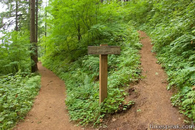
The trail goes east and gradually ascends the mountainside before curving to the left to aim northeast toward the next canyon on the loop. At around 2.7 miles from the start of the hike, cross over the high point of the loop where there are two junctions. Stick with Wahkeena Trail by proceeding to the right past the top of Vista Point Trail (unless you came up by that route). Then pass the bottom of Devils Rest Trail, which ascends to the right going about 1.6 miles up to a scenic overlook higher in the mountains.
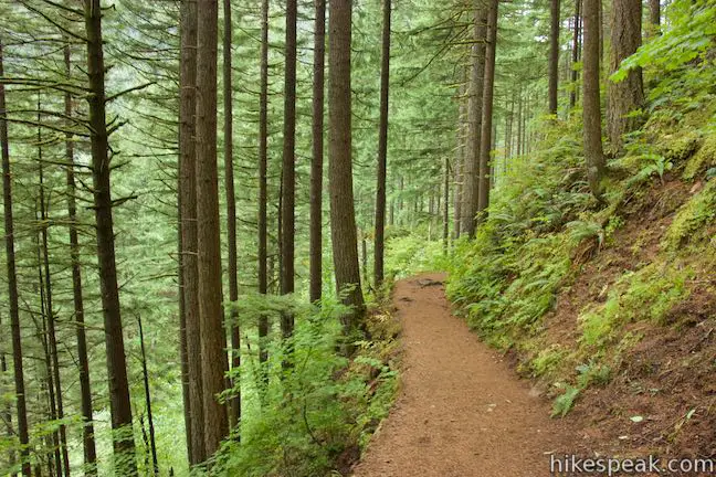
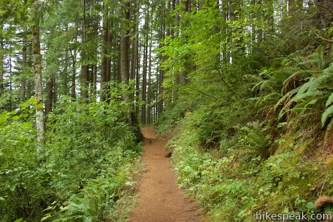
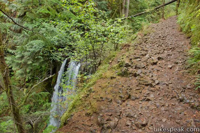
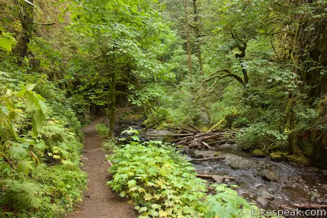
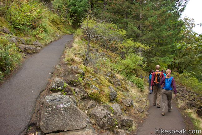
Over the next mile, Wahkeena Trail descends gradually toward Larch Mountain Trail. The dirt track weaves along a mountainside that drops away to the left. Sometimes, there are pretty steep dropoffs on that side of the trail. Follow the brown trail through a sea of green, passing a couple small streams.
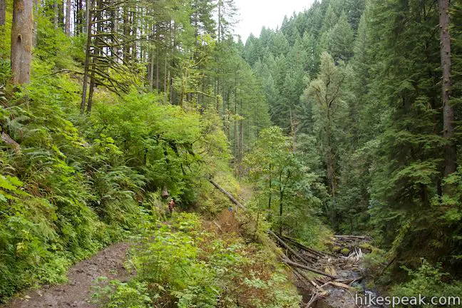
Eventually, the trail rounds its way down into the canyon containing Multnomah Creek, which you’ll spot running along the far side of Larch Mountain Trail. Come to a junction with Larch Mountain Trail, 3.7 miles from the start of the hike. Turn left to continue with the loop by hiking down the canyon (or turn right to ascend to Larch Mountain).
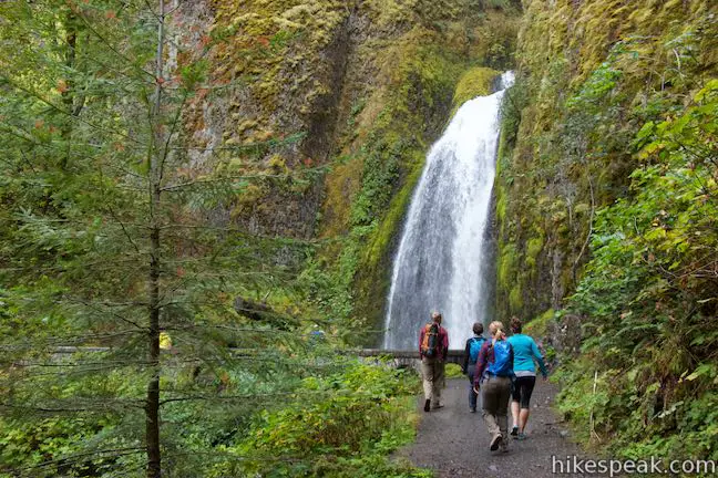
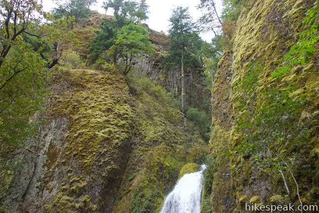
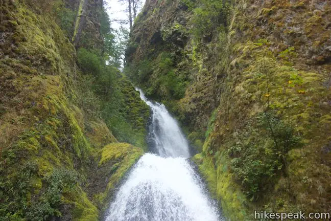
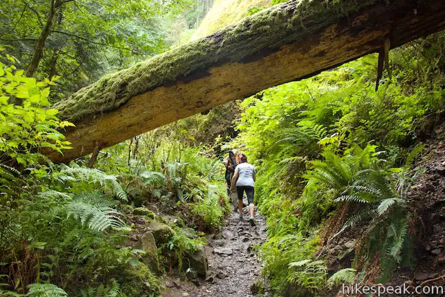
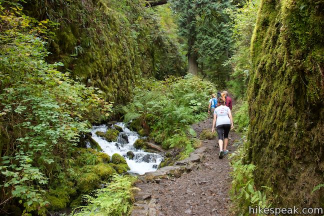
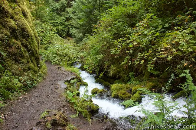
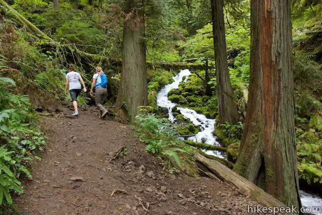
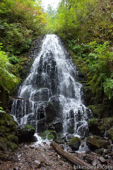
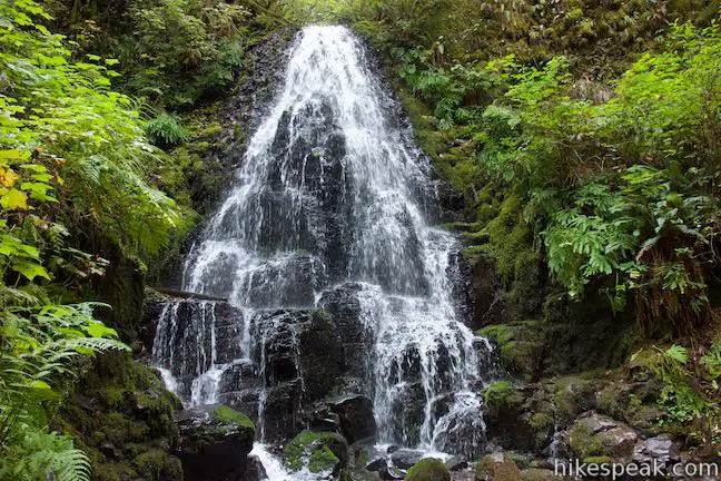
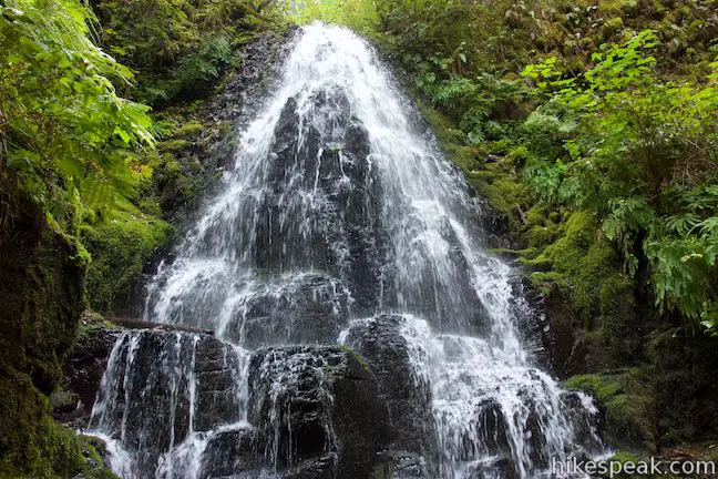
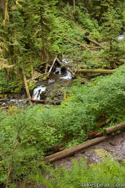
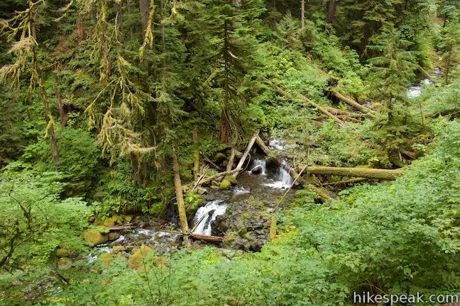
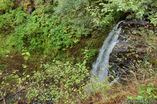
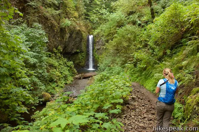
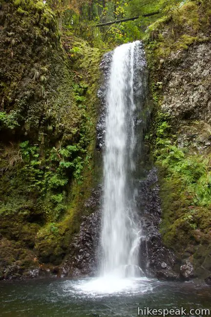
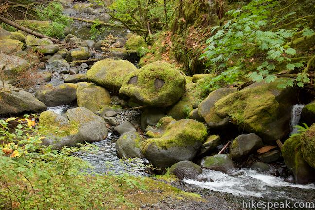
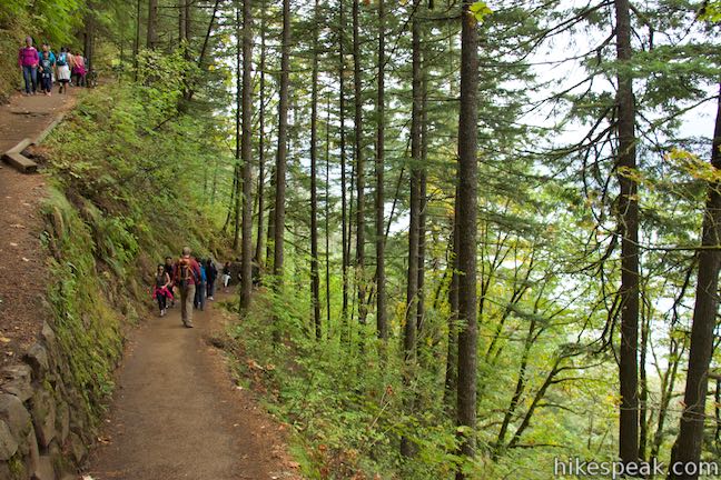
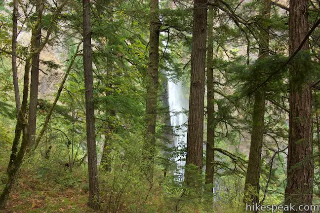
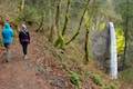
Hike downhill on Larch Mountain Trail through a very scenic area of Columbia River Gorge National Scenic Area. To your right, Multnomah Creek displays a string of cascades. These short jumps in the creek’s path down the canyon are lovely to walk along, but the creek packs even more punch – several waterfalls upstream from the big kahuna, Multnomah Falls. Ecola Falls is the first to come. Pass the brink of this 55-foot waterfall, 0.3 miles down from the junction with Wahkeena Trail. The trail goes across a ledge adjacent to the waterfall, offering only partial views of the falls through brush. It’s hard to fully take in Ecola Falls, unlike the next waterfall.
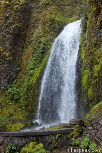
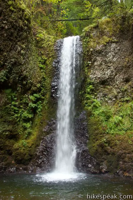
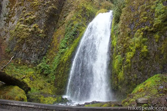
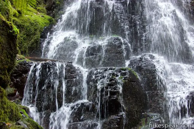
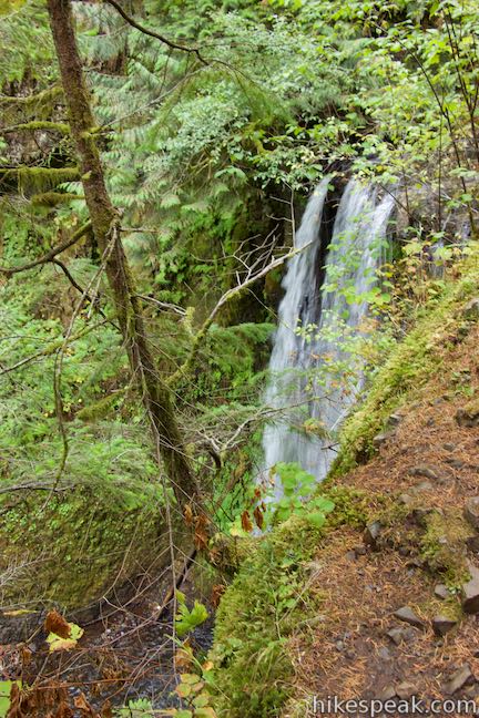
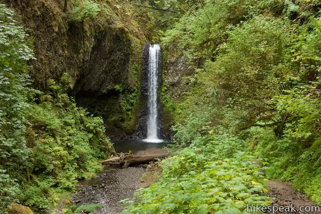
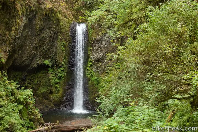
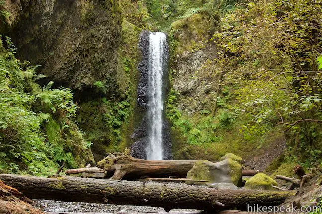
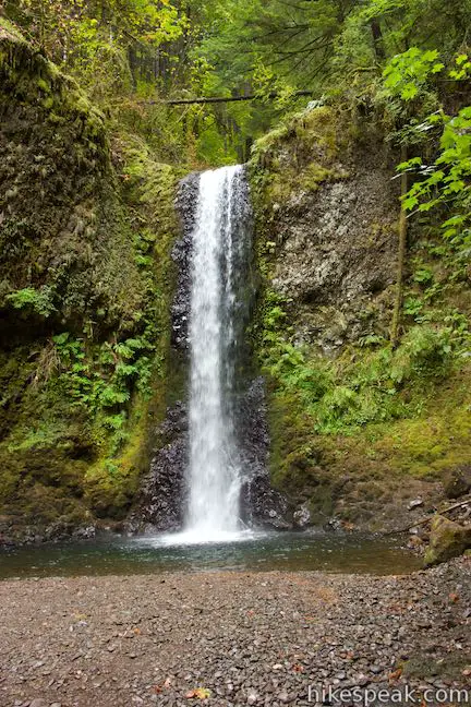
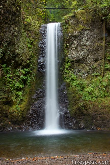
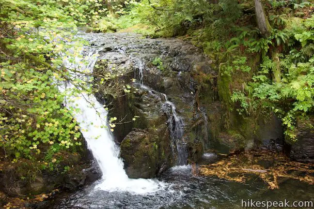
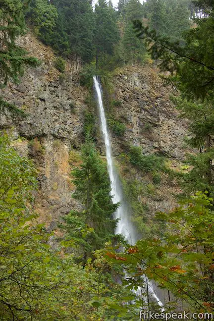
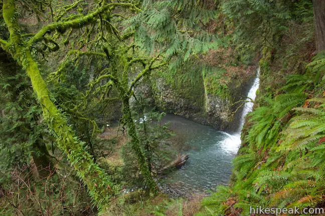
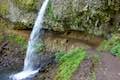
Larch Mountain Trail goes down the canyon past Weisendanger Falls and you’ll catch sight of the top of the waterfall through brush along the trail. Hike down a switchback to come face-to-face with the waterfall. Weisendanger drops fifty-five feet in a single plunge, landing in a pool that’s just upstream of the trail. If you like, hop off the trail and make your way up along the creek to the base of the waterfall. Weisendanger Falls is a definite beauty.
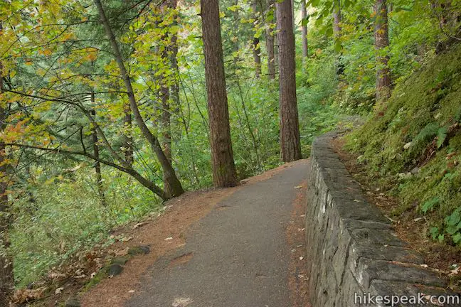
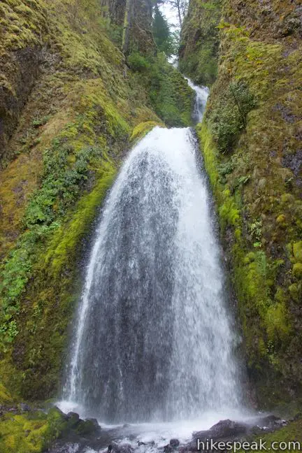
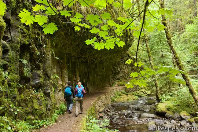
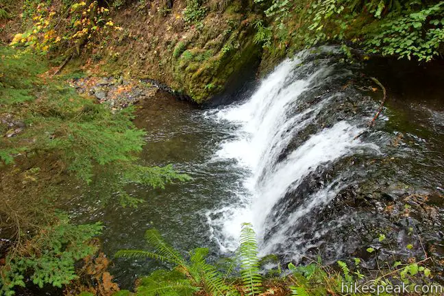
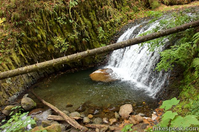
Proceed down Larch Mountain Trail, which borders the creek again, passing below an impressive overhang in the basalt cliffs that frame the canyon. Next the trail passes Dutchman Falls, which is split into short tiers. The final piece of the waterfall slides into a nice pool.
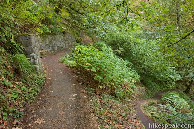
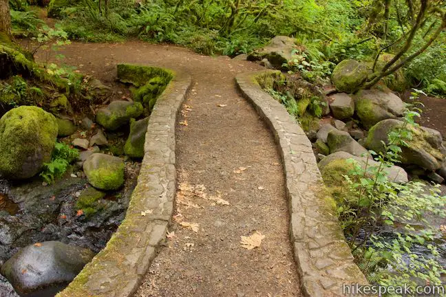
Continue down the trail past the cascading creek, which reveals something lovely around every bend. Eventually, you’ll come to a small stone bridge. Just over this bridge, you’ll find pavement and the crowds come next.
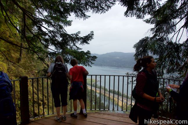
The trail turns uphill, passing a rough trail on the left that goes to Multnomah Falls Overlook. Come to a second, more-established trail to the overlook at a junction 4.55 miles from the start of the loop. Turn left to hike the 0.2-mile long spur out to an overlook at the brink of Multnomah Falls.
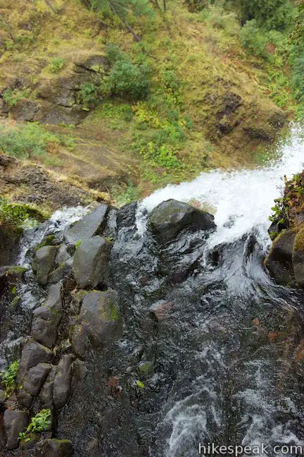
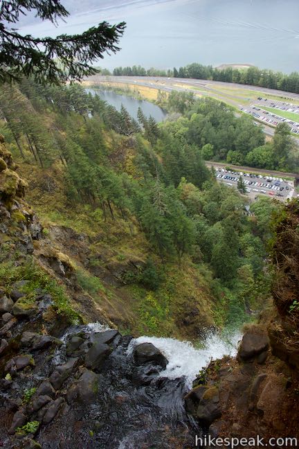
Switchbacks lead down to Multnomah Creek where a narrow staircase between stone walls accesses a small round viewing area (with highly necessary safety railing) that is right alongside the top of Multnomah Falls. Look over the lip of the waterfall, where the the creek takes a massive 542-foot leap down the upper tier of Multnomah Falls. It’s a long way down. At the bottom of the waterfall, you’ll see the viewing area near Multnomah Lodge. You can also look out past Interstate 84 across the Columbia River Gorge. The overlook allows you to safely stand where it would otherwise be perilous and the viewpoint is well integrated into the landscape so that it is not noticeable when looking at the waterfall from below.
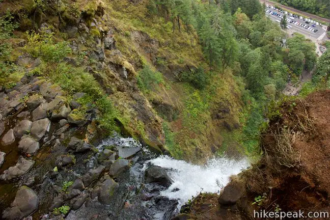
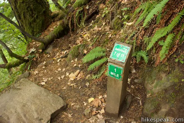
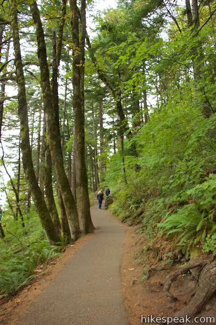
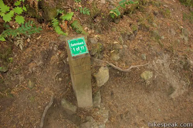
Leave the overlook and walk back up to Larch Mountain Trail. Turn left to head toward the bottom of the waterfall, which actually demands a short ascent before turning downhill. Go up over a crest that’s marked with a sign reading switchback 9 of 11. You’ve already passed bends ten and eleven and have switchbacks eight through one to turn through on the way down to Benson Bridge. It’s a just over a mile from here to Multnomah Lodge, descending 725 feet.
The numbers don’t lie. Hike down the paved trail through switchback after switchback, each with a small, green sign that chronicles your progress. Coming down the trail, Multnomah Falls is rarely visible. You’ll probably pass a lot of visitors trudging their way up to the overlook – isn’t it easier coming down this trail? As you hit switchback five, look for Multnomah Falls through the trees. Turn away from the waterfall and then come back at switchback three, where a viewing area with better between-the-trees views of the waterfall offers a spot to stop for a break.
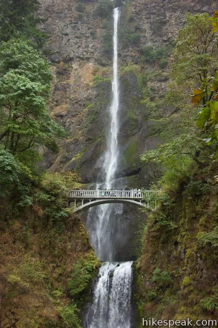
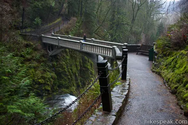
The trail proceeds downhill toward the Columbia River, which is occasionally visible through gaps in the forest. At the next sharp turn, Larch Mountain Trail meets Gorge Trail, which heads east toward Oneonta Gorge. Bear right to keep heading down Larch Mountain Trail, hiking another 0.2 miles to Benson Bridge. The countdown of the numbered switchbacks come to an end, followed by a blastoff view at an unnumbered twist in the trail where it is closest to the upper tier of Multnomah Falls. This is an awesome place to stand and look at the falls, tilting your head all the way up to see the top of the waterfall where you just stood. Mist from the waterfall blows across this part of the trail, officially starting the cool down.
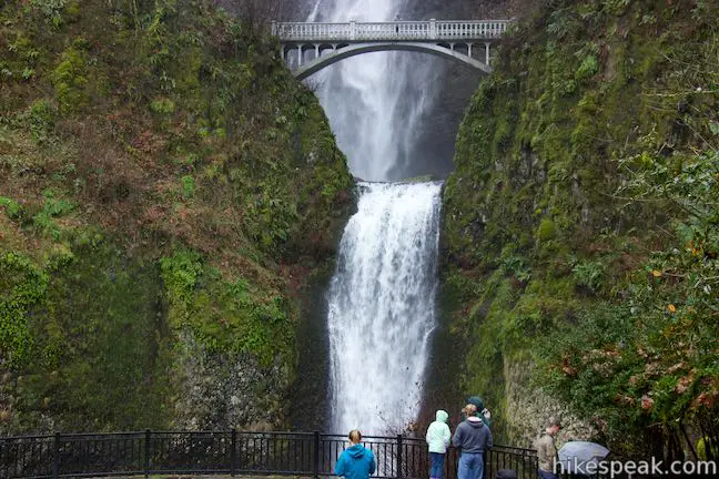
Next, cross Benson Bridge, which spans the gap between the tiers of Multnomah Falls. On the right side of the bridge, you get a dizzying view looking straight down the lower falls. Below that, you’ll see people looking up from the lower viewpoint. Wave hello; you’re probably in someone’s photo. On the other side of the bridge, look upstream toward the taller tier, where water is swept away from the rock at the bottom of this enormous drop.
Simon Benson was a lumberman and philanthropist who lived from 1851 to 1942. He pioneered using large ocean-going log rafts to get lumber from the Columbia River down to Southern California. Benson donated land along the Columbia River Gorge for preservation, including both Multnomah and Wahkeena Falls – something you’ll be quite thankful for by this point.
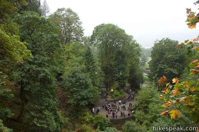
Hike down the final stretch of Larch Mountain Trail, which has a couple obligatory switchbacks before a staircase takes you down to the bottom of the trail at the viewing area facing Multnomah Falls. The lower tier makes a swift 69-foot plunge into a pool below the viewpoint. Admire the bridge crossing the span above the lower falls, which is designed elegantly enough not to detract from the waterfall’s beauty. Behind the bridge, the upper tier makes its long, long drop down a sheer rock wall with many interesting layers.
Leave the viewing area and walk north down to Multnomah Lodge, where this loop began. If you parked off Historic Columbia River Highway, your vehicle will be just across from the lodge. If you parked off Interstate 84, take the walkway back to the parking lot.
The basic directions for Wahkeena Trail – Larch Mountain Trail Loop are:
- Walk west from Multnomah Lodge along Historic Columbia River Highway (0 miles)
- Turn left up Return Trail (0.1 miles)
- Turn left on the sldewalk by the Wahkeena Falls Viewing Area (0.6 miles)
- Begin up Wahkeena Trail (0.65 miles)
- Cross a bridge below Wahkeena Falls (0.85 miles)
- Turn right at a junction with Perdition Trail, which is closed (1 mile)
- The pavement ends as you reach a spur to Lemmons Viewpoint, which is on the right (1.35 miles)
- After a couple footbridges, pass Fairy Falls (1.65 miles)
- Turn right past the bottom of Vista Point Trail (1.85 miles)
- Turn left past Angels Rest Trail to stay on Wahkeena Trail (2.3 miles)
- Stay to the right pass the top of Vista Point Trail (2.7 miles)
- Stay to the left past the bottom of Devils Rest Trail (2.7 miles)
- Turn left down Larch Mountain Trail at the end of Wahkeena Trail (4.7 miles)
- Pass Ecola Falls (4 miles)
- Pass below the base of Weisendanger Falls (4.2 miles)
- Cross a stone bridge where the pavement resumes (4.5 miles)
- Turn left down the trail to Multnomah Falls Overlook (4.55 miles)
- Look out from the brink of Multnomah Falls (4.75 miles)
- Return to Larch Mountain Trail and turn left (4.95 miles)
- Stay left through a switchback and a junction with Gorge Trail (5.55 miles)
- Cross Benson Bridge (5.75 miles)
- Pass Multnomah Falls Viewing Area (5.95 miles)
- Walk down to Multnomah Lodge and the parking areas (6.05 miles)
Expect Larch Mountain Trail to be crowded below Multnomah Falls Overlook. Luckily, you’ll be hiking downhill so that you can speed past the other visitors. No fee or permit is required to hike the Multnomah-Wahkeena Loop, which incorporates Return Trail, Wahkeena Trail, Larch Mountain Trail, and Multnomah Falls Overlook Trail. Dogs are permitted on these trails, but bikes are not. Multnomah Falls is a world-class waterfall and while Wahkeena Falls, Fairy Falls, Ecola Falls, Weisendanger Falls, and Dutchman Falls might be less impressive, they are definitely worth check out. This hike has great scenery, so get out and enjoy!
CLOSURE UPDATE: This hike has reopened to the public following damage from the 2017 Eagle Creek Fire. Find more information about the wildfire closure on the US Forest Service’s Columbia River Gorge National Scenic Area: Alerts and Notices webpage.
Directions to the Trailhead
- Take Interstate 84 to exit 31 (30 miles east of Portland and 50 miles west of The Dalles).
- The exit is well marked for Multnomah Falls and leads right to a large parking area.
- Walk south from there toward Multnomah Falls, passing below the freeway.
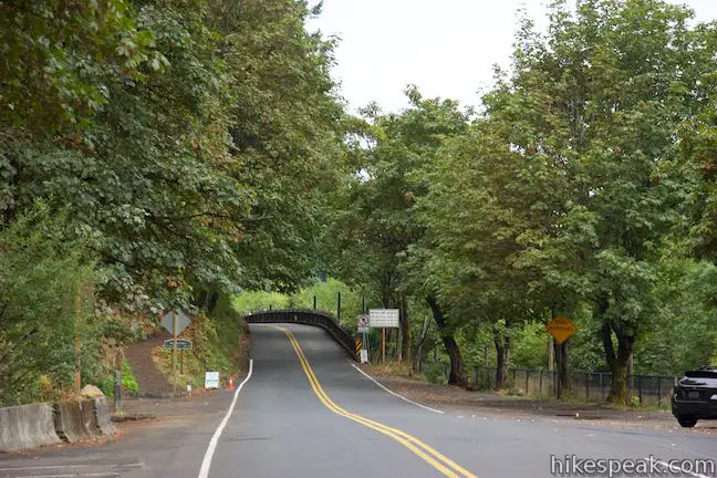
- Alternatively, there is parking along Historic Columbia River Highway near Multnomah Lodge and Wahkeena Falls.
- From Portland, take Interstate 84 to exit 28 for Bridal Veil.
- Go east on Bridal Veil Road for a quarter mile to Historic Columbia River Highway.
- Continue east for 2.9 miles to Multnomah Lodge, where there is parking on the left (passing the Wahkeena Falls Viewing Area along the way).
Trailhead Location
Trailhead address: 53000 Historic Columbia River Highway, Corbett, OR 97019
Trailhead coordinates: 45.5777, -122.1173 (45° 34′ 39.72″N 122° 07′ 02.28″W)
View Columbia River Gorge in a larger map
Or view a regional map of surrounding Oregon trails and campgrounds.


 | Multnomah Falls This 0.4 to 2.6-mile hike visits Oregon's tallest (and probably most visited) waterfall, offering something to hikers of all abilities. |
 | Angel's Rest This 4.8-mile hike ascends to a panoramic landing with spectacular views across Columbia River Gorge (particularly at sunrise). |
 | Latourell Falls Trail This 2.3-mile loop explores a canyon with two beautiful waterfalls, attaining great views of both. |
 | Oneonta Gorge to Lower Oneonta Falls This 0.8-mile trek follows Oneonta Creek between the tall, mossy cliffs of a wild and beautiful gorge to the base of an enchanting 100-foot waterfall. |
 | Horsetail Falls Trail - Oneonta Trail Loop This 2.85-mile loop starts at Horsetail Falls, passes beneath an overhang behind Ponytail Falls, and crosses a bridge by Middle Oneonta Falls to hit three waterfalls and viewpoints looking out over the Columbia River Gorge. |
 | Wahclella Falls This 2-mile hike visits a sublime waterfall in a canyon within the Columbia River Gorge. |
 | Eagle Creek Trail This 4.55-mile hike ventures up a beautiful and dramatic canyon to impressive waterfalls like Metlako Falls, Lower Punchbowl Falls, and Punchbowl Falls. |
 | Mosier Twin Tunnels This 2 to 9.5-mile hike ventures up Historic Columbia River Highway State Trail to a pair of tunnels carved into basalt cliffs on the side of Columbia River Gorge. |
 | More trails in Oregon Explore other hikes in Oregon outside the Columbia River Gorge. |
- Multnomah-Wahkeena Loop in Curious Gorge by Scott Cook (opens in a new tab)
- Multnomah-Wahkeena Loop in Afoot and Afield: Portland/Vancouver by Douglas Lorain (opens in a new tab)
- Multnomah-Wahkeena Loop on oregonhikers.org (opens in a new tab)
- Multnomah-Wahkeena Loop on gorgefriends.org (opens in a new tab)
- Multnomah-Wahkeena Loop on oregonhiking.com (opens in a new tab)
- The official National Forest webpage for Larch Mountain Trail (opens in a new tab)
- The official National Forest webpage for Wahkeena Trail (opens in a new tab)
- Multnomah Falls on Oregon.com (not the official state website) (opens in a new tab)
- Multnomah Falls on wikipedia.org (opens in a new tab)
- Wahkeena Falls on wikipedia.org (opens in a new tab)
- Multnomah Falls on waterfallswest.com (opens in a new tab)
- The national forest webpage for Multnomah Falls (opens in a new tab)
Common Questions about Multnomah-Wahkeena Loop in Columbia River Gorge
- Is the trail open?
- Yes. You should expect to find that Multnomah-Wahkeena Loop is open. There are no recent reports of trail closures. If you discover that the trail is closed, please help your fellow hikers by reporting a closure.
- Is this trail free to access?
- Yes, Multnomah-Wahkeena Loop is free to access. No entrance fee, pass, or permit is required. If you discover that access rules have changed, please provide feedback on your experience.
- How much time does this hike take?
- It takes approximately 3 hours 30 minutes to hike Multnomah-Wahkeena Loop. Individual hiking times vary. Add extra time for breaks and taking in the views.
- How long is this hike?
- The hike to Multnomah-Wahkeena Loop is a 6.05 mile loop with 1525 feet of elevation change.
- Are dogs allowed on this trail?
- Yes, dogs are allowed on Multnomah-Wahkeena Loop. The trail is open to hikers, dogs.
- Will I see a waterfall on this hike?
- Yes, Multnomah-Wahkeena Loop features a waterfall.
- What mountain range is this trail in?
- Multnomah-Wahkeena Loop is located in the Cascade Range.
- Where is the trailhead located?
- The trailhead for Multnomah-Wahkeena Loop is located in Corbett, Oregon.
Trailhead Address:
53000 Historic Columbia River Highway
Corbett, Oregon 97019
Trailhead Coordinates:
45.5739, -122.1181 - What are the driving directions to the start of the hike?
To get to the trailhead: Take Interstate 84 to exit 31 (30 miles east of Portland and 50 miles west of The Dalles). The exit is well marked for Multnomah Falls and leads right to a large parking area. Walk south from there toward Multnomah Falls, passing below the freeway.
Alternatively, there is parking along Historic Columbia River Highway near Multnomah Lodge and Wahkeena Falls. From Portland, take Interstate 84 to exit 28 for Bridal Veil. Go east on Bridal Veil Road for a quarter mile to Historic Columbia River Highway. Continue east for 2.9 miles to Multnomah Lodge, where there is parking on the left (passing the Wahkeena Falls Viewing Area along the way).
View custom Google Maps directions from your current location.
- Are there other trails near Multnomah-Wahkeena Loop?
- Yes, you can find other nearby hikes using the Hikespeak Hike Finder Map.

What experience of hikers would you recommend this for? Beginners (easy), moderate (good physical shape)… etc. Etc?
Best to be in reasonable shape. Otherwise its going to be a very long day