Hamilton Mountain Loop
in Beacon Rock State Park
![]()
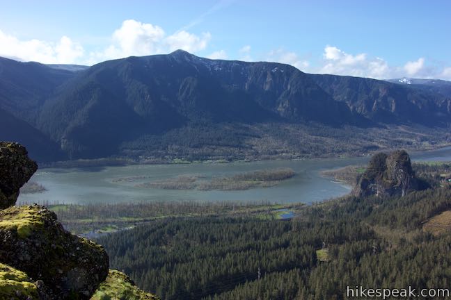
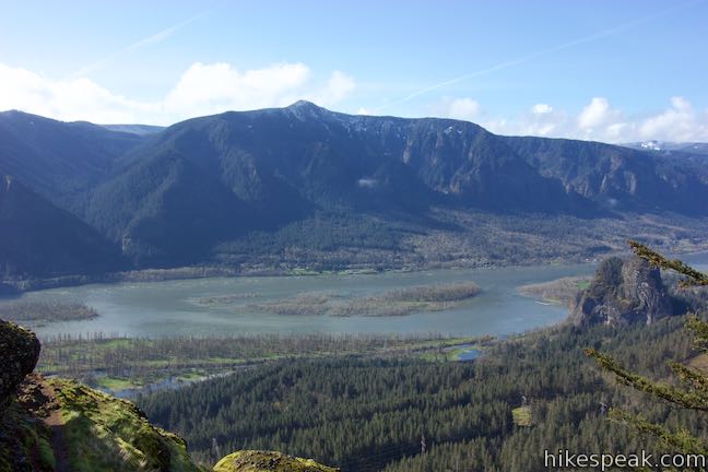
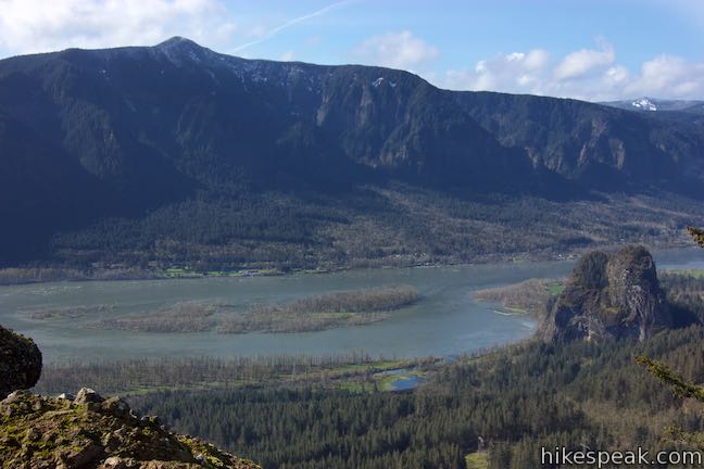
Only hike Hamilton Mountain Trail if you like charming forests, bold waterfalls, and awesome cliff-top views. Hamilton Mountain Trail passes a viewpoint for the Pool of the Winds, where Rodney Falls plunges into a rock-wrapped punchbowl. The trail rises to a summit along the Columbia River Gorge, ascending 2,025 feet on a 7.75-mile lollipop loop.
Some of Hamilton Mountain’s best views come from a perch below the summit and a saddle after the summit. Although you could hike 6 miles up and back to the mountaintop, it is a more rewarding experience to hike the full 7.75-mile loop. Turning around at Rodney Falls is also an option, for a family-friendly 2.3-mile effort. As an intermediate outing, turn around at a gorge-facing perch below the summit of Hamilton Mountain for a 3.8-mile up-and-back hike that still delivers a complete experience.
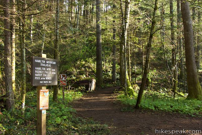
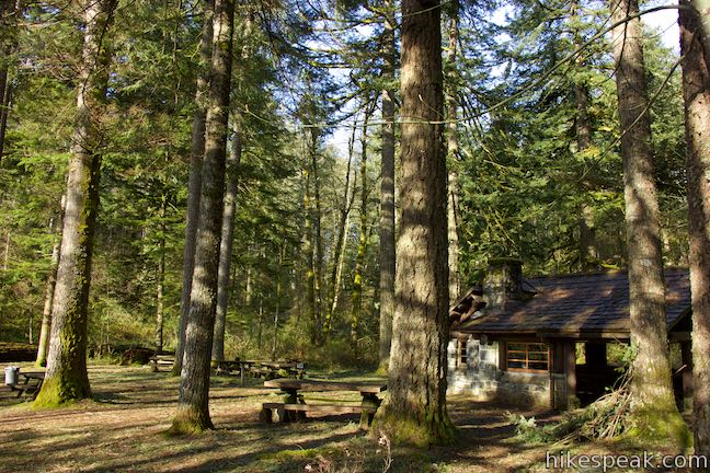
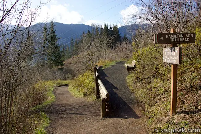
Hamilton Mountain Trail is part of Beacon Rock State Park and the trailhead is just up a road from Beacon Rock itself. Find the start of Hamilton Mountain Trail off the right side of the road to the park’s Main Campground.
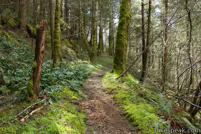
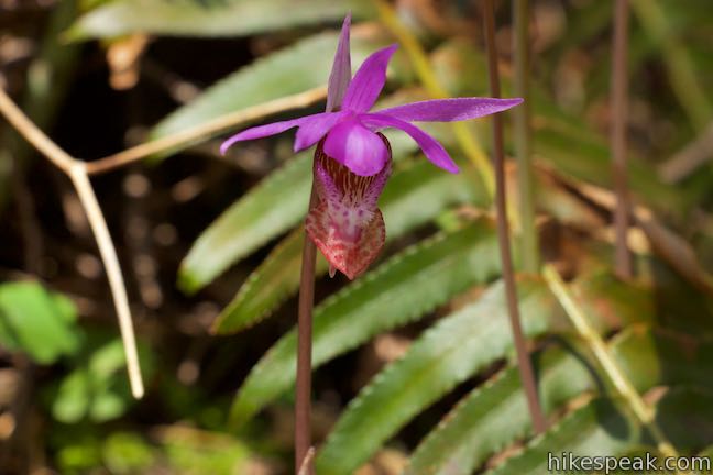
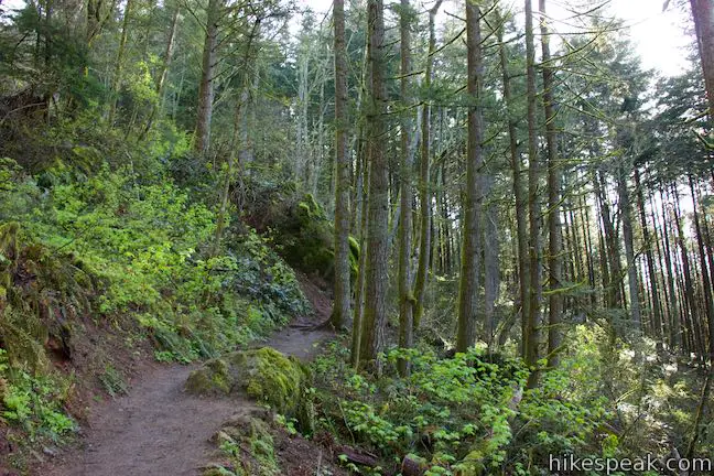
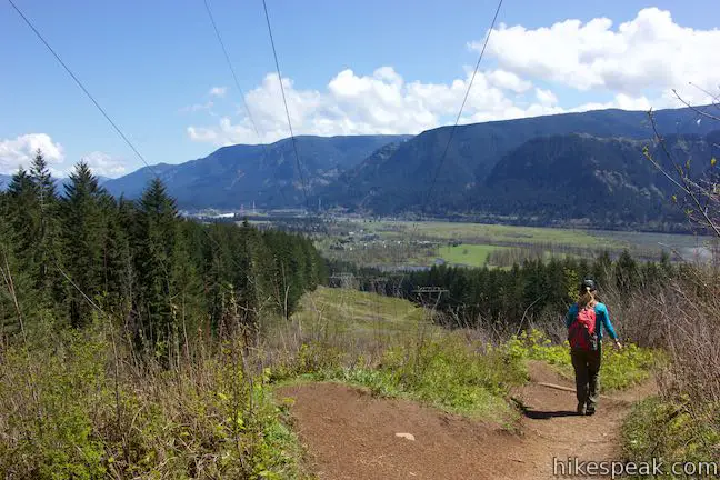
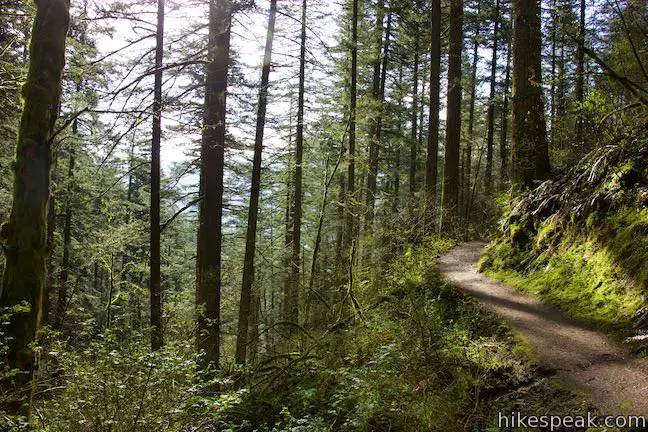
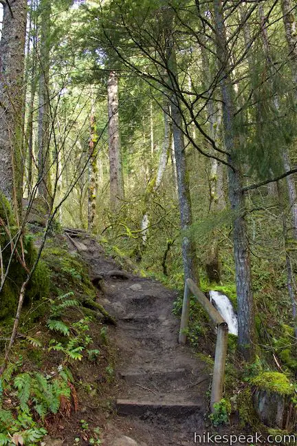
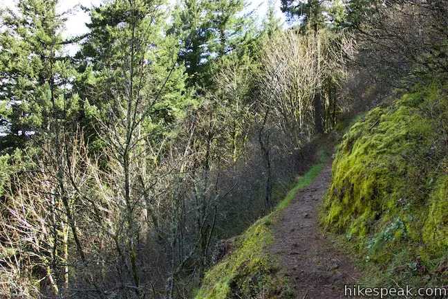
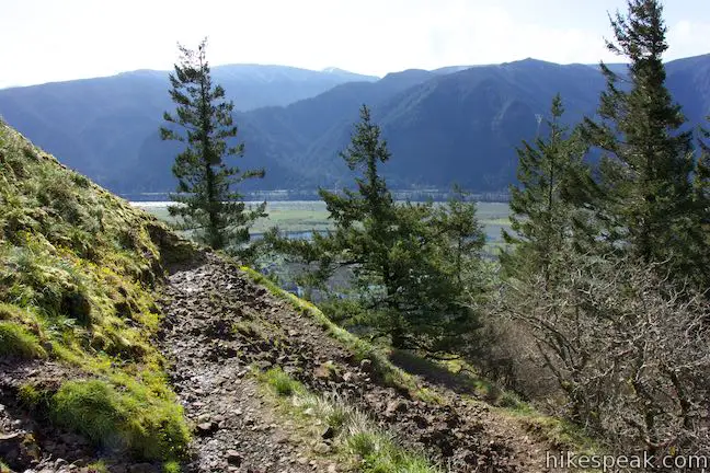
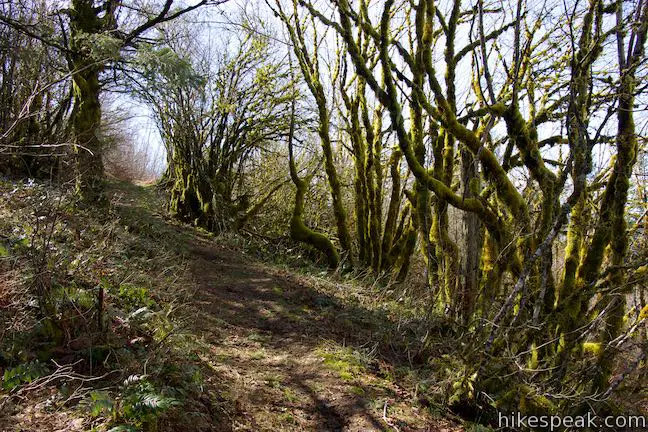
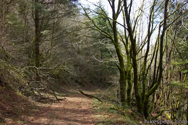
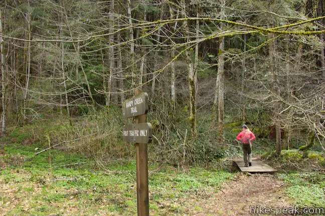
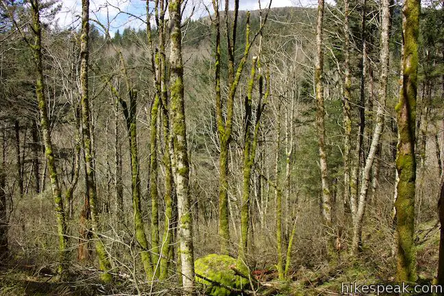
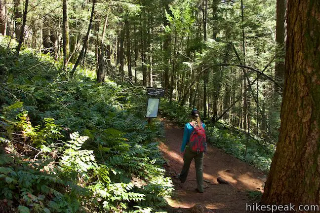
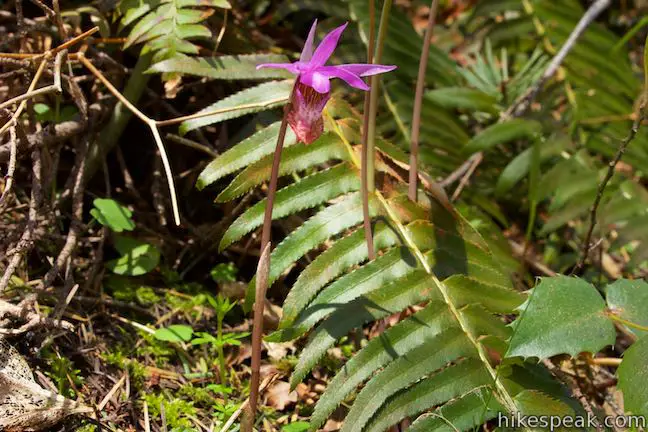
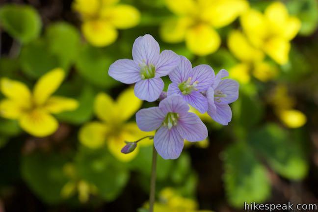
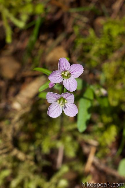
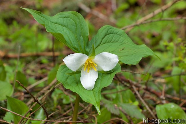
Walk past bathrooms toward a picnic area and bear right up Hamilton Mountain Trail. The moderate ascent across a wooded hillside is more colorful in the spring, thanks to yellow violets, fairy slipper orchids, bleeding hearts, oaks toothwort bloom, red thimbleberries, and trillium that bloom amongst the greenery. After a third of a mile, the trail exits the forest into an area cut away for high power lines that run up from Booneville Dam, which is visible below up the Columbia River. The trail crosses beneath the power lines to a junction with Hardley Trail, which goes to the left toward the campground. A bench here provides an early place to take a break. Bear right to continue up Hamilton Mountain Trail.
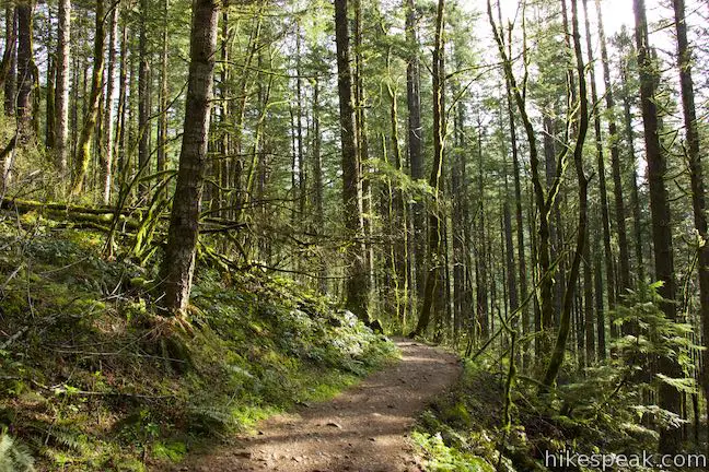
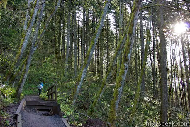
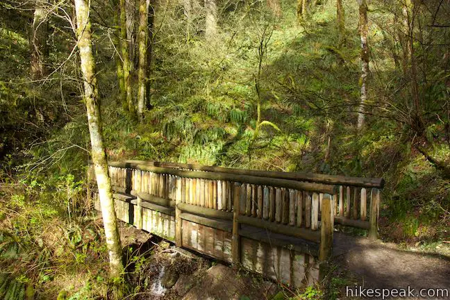
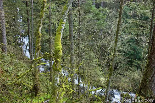
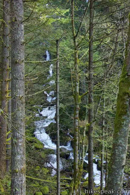
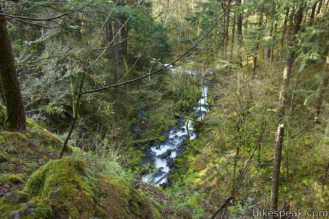
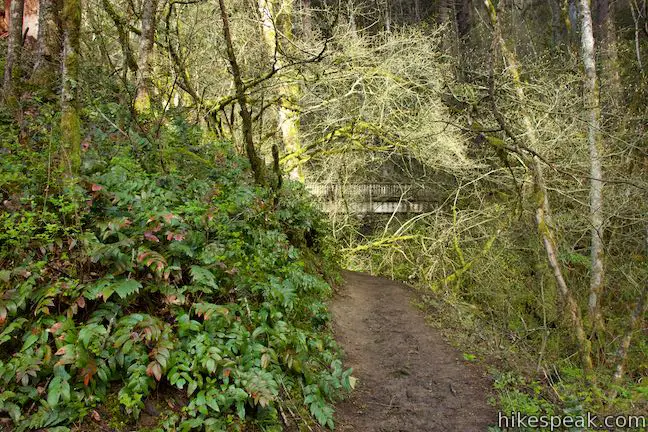
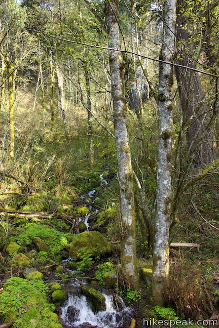
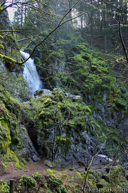
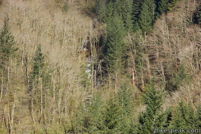
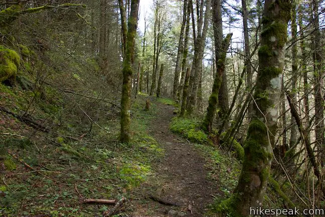
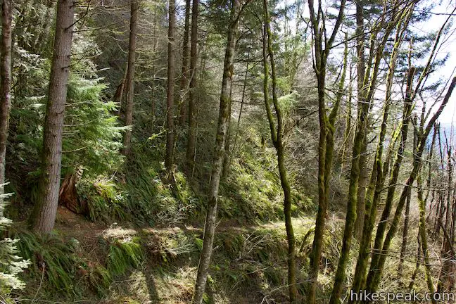
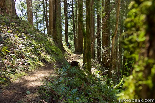
Past the junction, Hamilton Mountain Trail returns to the forest and continues a moderate ascent through lush greenery. Douglas firs dominate the second growth forest. Bracken ferns and state-line-ignoring Oregon grapes hug the shoulders of the trail. Hike around a draw in the mountainside where a footbridge crosses a small stream. Enjoy a nice perspective through the forest as you approach even more impressive water.
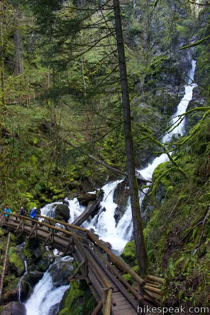
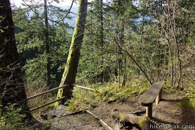
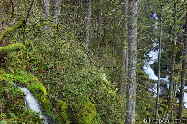
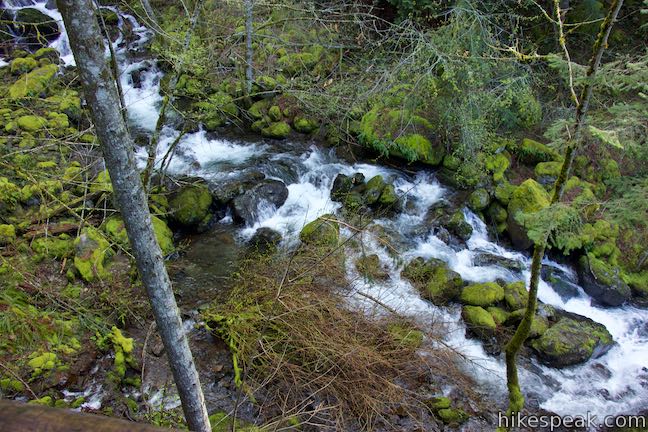
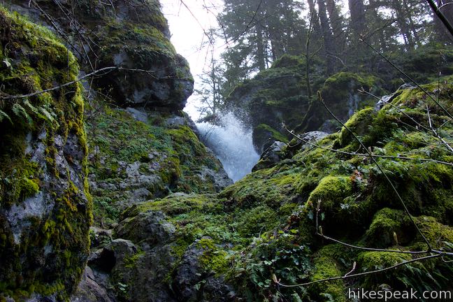
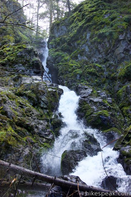
A tenth of a mile after one bridge and 0.95 miles from the trailhead, come to a junction just in front of another bridge. Two paths to the right lead down to Hardy Falls Viewpoint. Bear right on the first path, which goes out to a bench and a railing on the side of the canyon facing Hardy Falls. Brush can obscure the waterfall, requiring you to step up on the railing to get a clear look at the falling water.
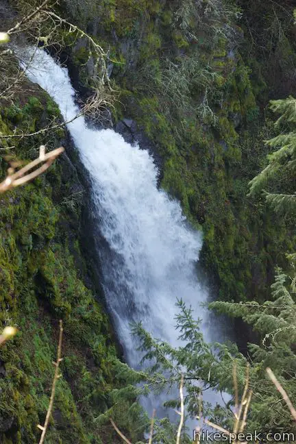
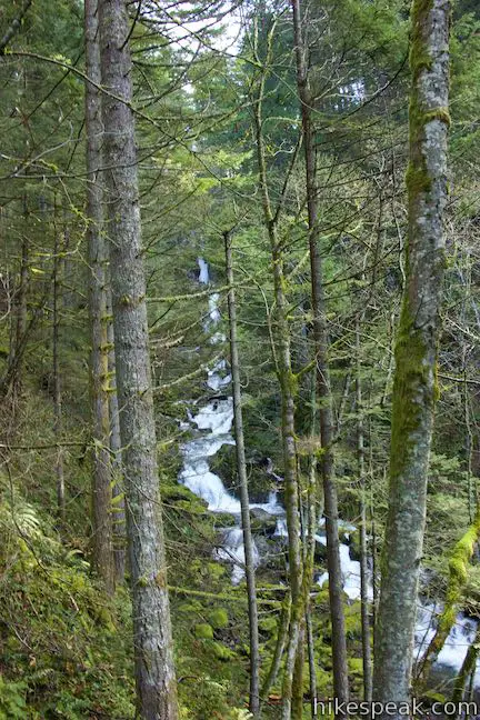
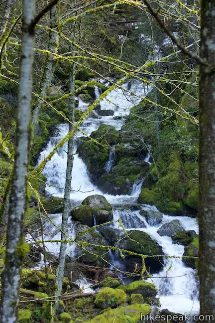
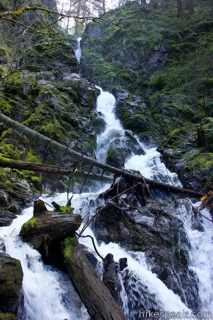
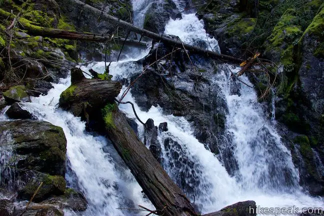
To see the lower lookout, take the path to the left of the railing, following wooden steps down to a merger with the other path from Hamilton Mountain Trail. Proceed down the path to a wooden viewing platform on a landing along Hardy Creek just above the brink of the falls. While you can hear the waterfall below the viewpoint, the falling water is actually hard to see. Look up the creek from the viewing platform for a nice perspective of Rodney Falls and the cascades in between. Admire the surroundings and hike back up to Hamilton Mountain Trail. Turn right, cross the footbridge, and continue along the trail.
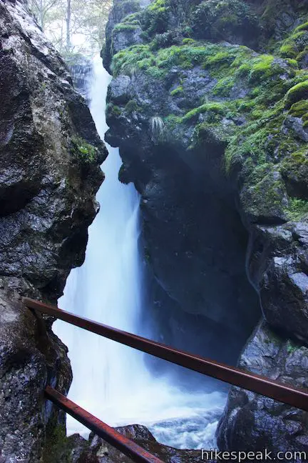
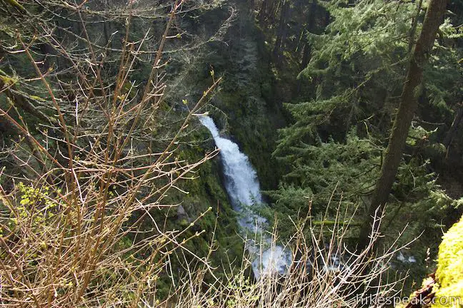
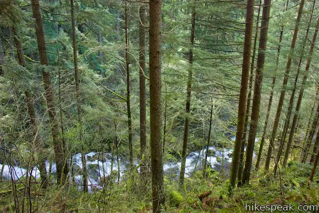
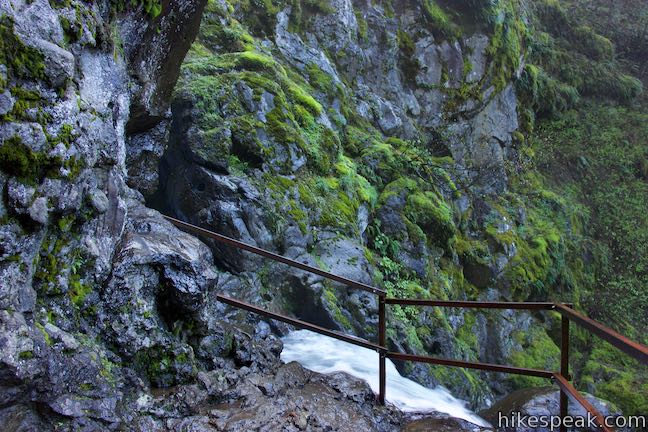
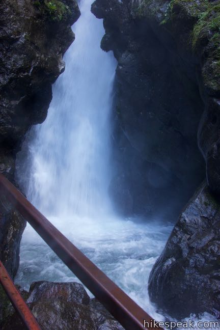
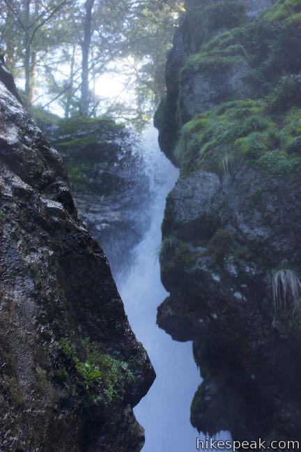
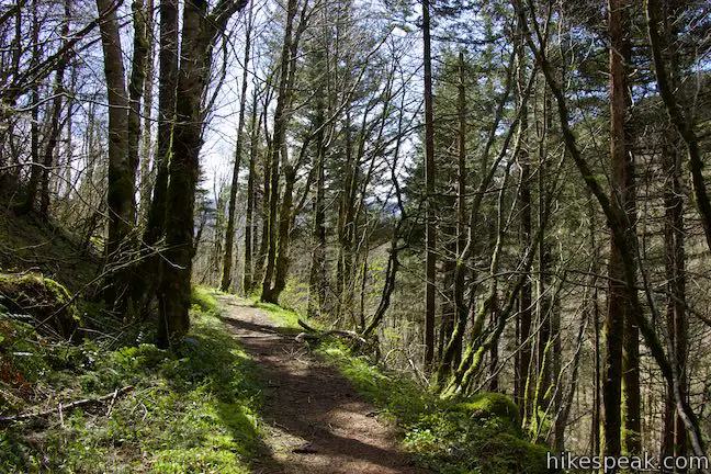
Hamilton Mountain Trail crosses the side of the canyon above tumbling Hardy Creek. Before you know it, you’ll come to another trail split. To the right, Hamilton Mountain Trail drops to a bridge spanning Hardy Creek in front of Rodney Falls. The awesome attraction known as the Pool of the Winds (or Pool of Winds) is up a short spur to the left.
Follow the fork to the left toward the Pool of the Winds, easing across the steep side of the canyon up to a big drop at the top of the waterfall.

Find a railing at the end of the trail where you can step up and watch the creek drop through the cliffs into an alcove that is nearly completely enclosed in rock to create a raucous punchbowl. Look inside the Pool of the Winds‘ rock-wrapped plunge to see water and wind mix and whip up gusts of mist. After a snowy winter, the water coming through the Pool of the Winds will spray you from this vantage, which is quite invigorating!
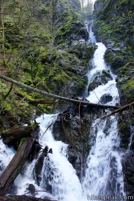
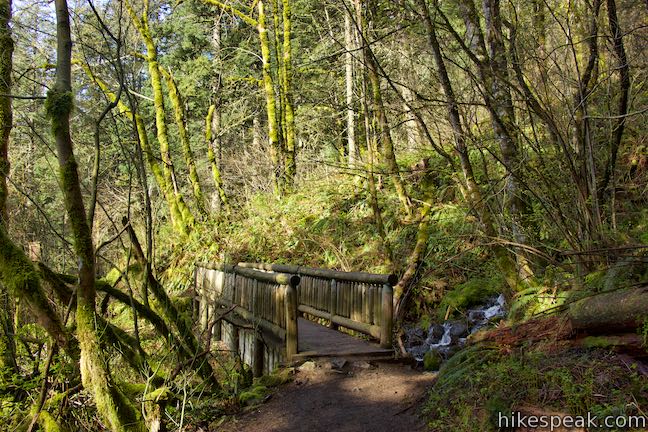
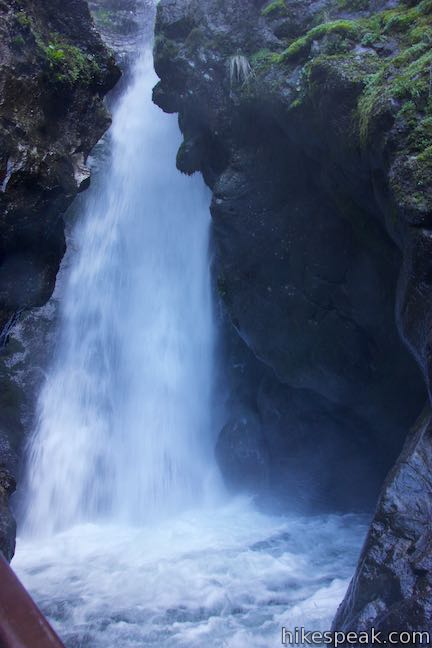
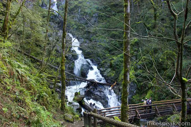
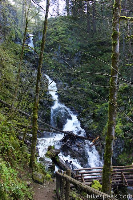
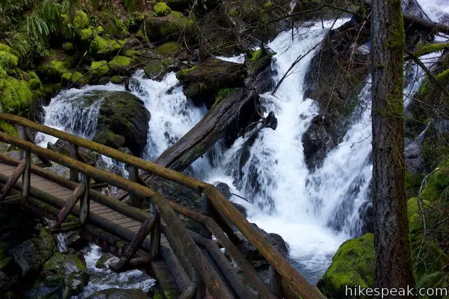
Make your way back down to Hamilton Mountain Trail. Having hiked 1.2 miles, you could turn right and walk a mile back to the trailhead for an easier 2.2-mile outing with 450 feet of elevation change. If you’re forging ahead, bear left on Hamilton Mountain Trail and descend a switchback to a big wooden bridge across the creek in front of Rodney Falls. Look up this waterfall toward the Pool of the Winds. The water rushing down to the mountainside in front of the bridge is quite lovely.
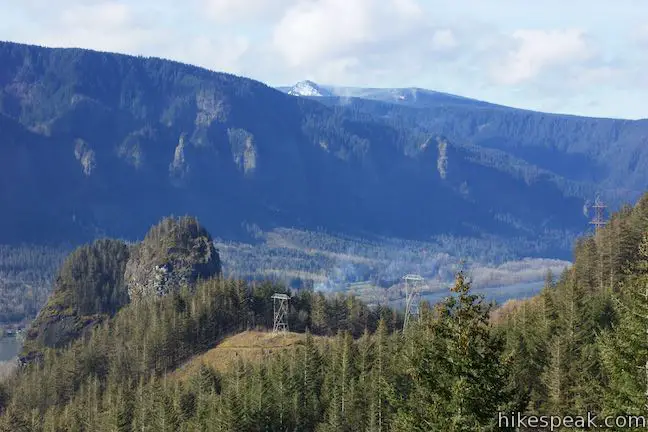
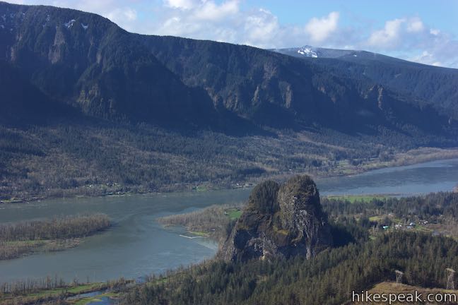
Across the bridge, the trail rises through switchbacks, going over a crest and around a bend that offers a window out from the forest and across Columbia River Gorge. While the gorge views get better as you climb, this framing of Beacon Rock is quite nice.
Rise through the trees for another tenth of a mile to a junction with Hardy Creek Trail, 1.5 miles into the hike. This junction marks the start of the loop on Hamilton Mountain. Bear right to stay on Hamilton Mountain Trail.
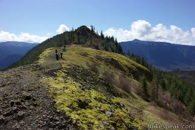
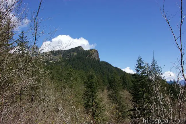
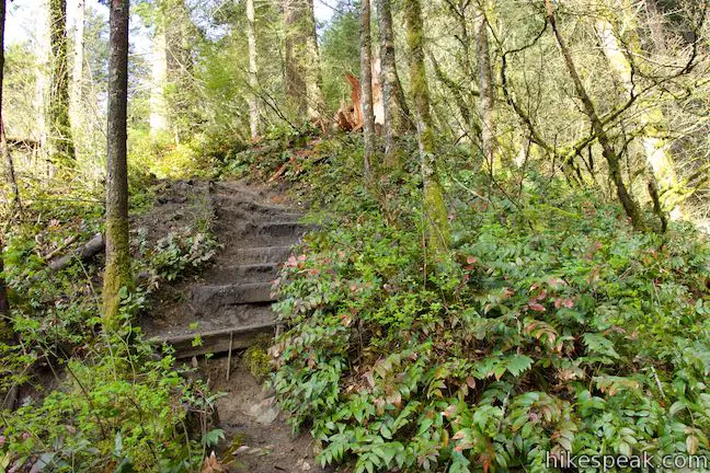
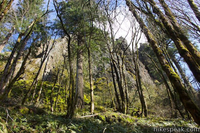
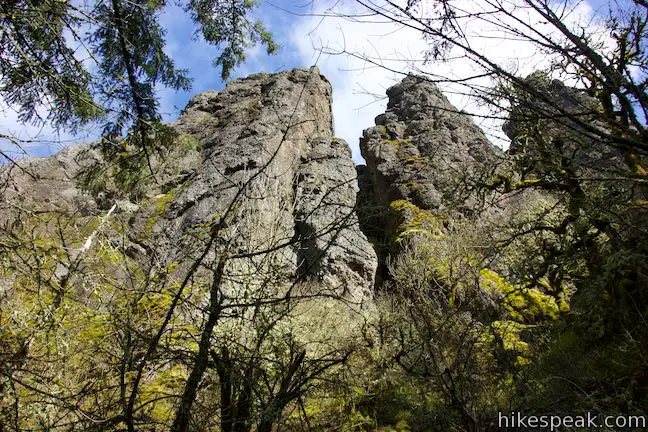
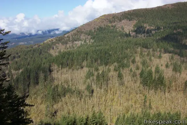
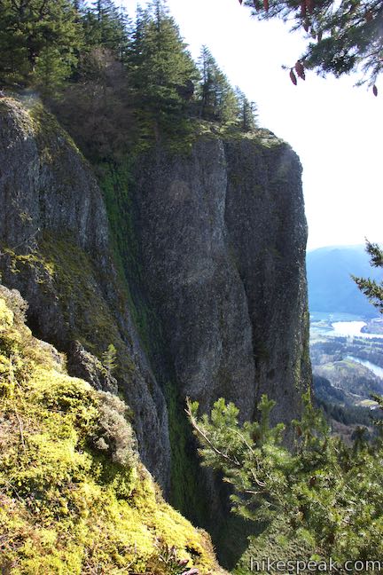
Ascend toward tall cliffs that lord over the mountainside. A switchback brings you across the base of this sheer basalt ridge on the southwest side of Hamilton Mountain. While this might appear like an impasse, Hamilton Mountain Trail finds a route up alongside the steep cliffs. Switchbacks lead up a sheep slope behind the even steeper cliffs.
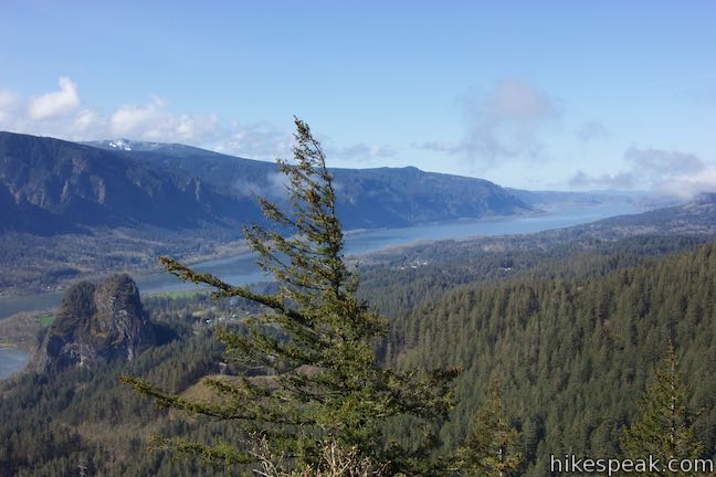
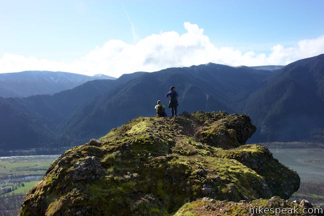
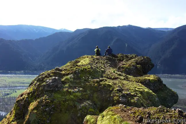
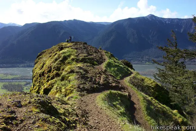
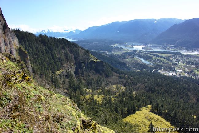
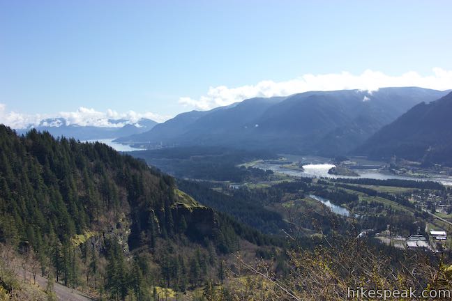
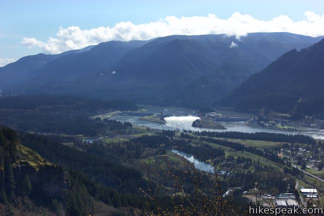
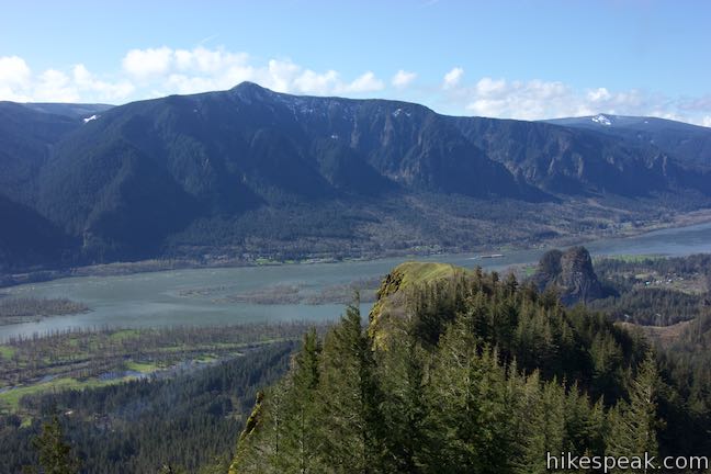
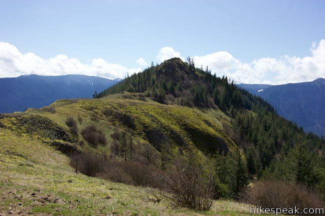
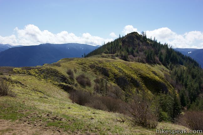
As you approach the top of these lovely cliffs, be prepared to put as pause on the ascent. At 2 miles from the start of the hike, Hamilton Mountain Trail makes a horseshoe bend to the left in front of an exposed outcropping on cliffs extending into the gorge. This natural overlook begs for some off-trail exploration.
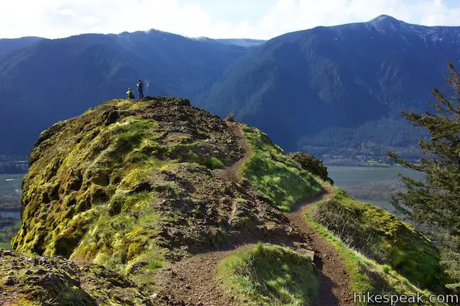
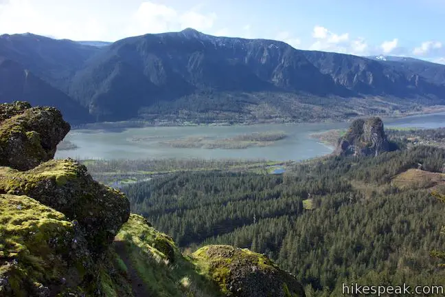
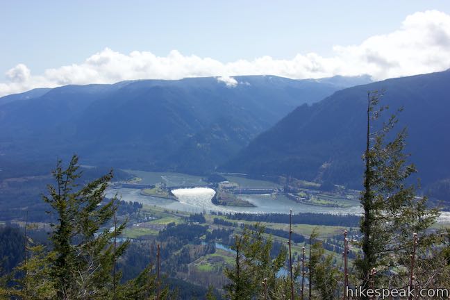
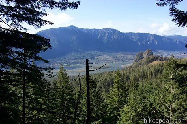
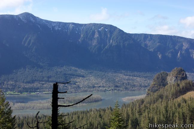
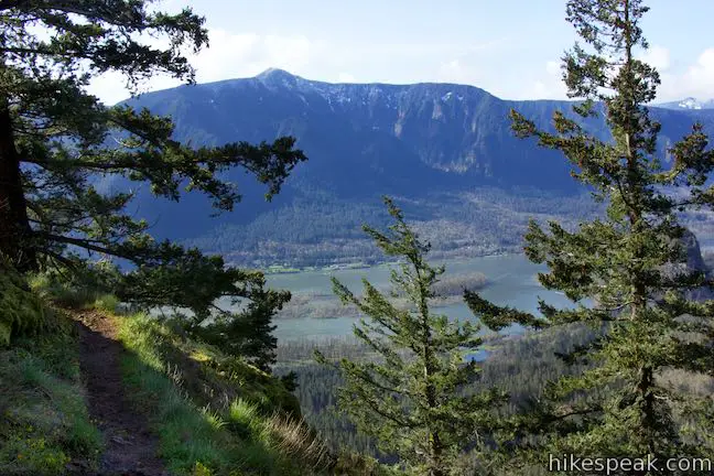
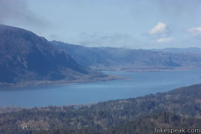
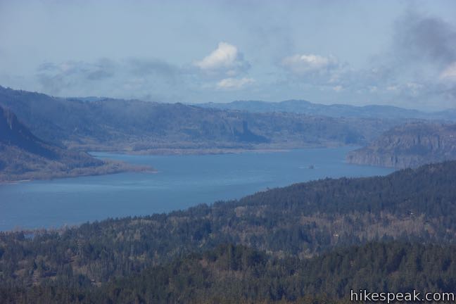
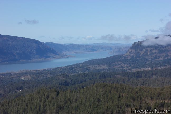
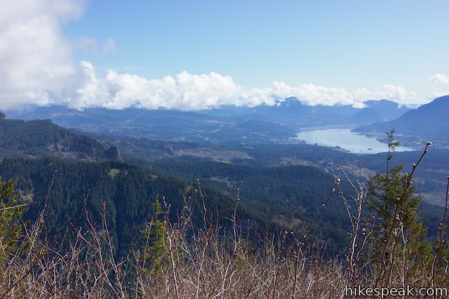
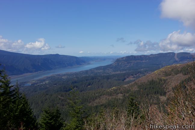
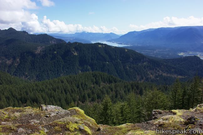
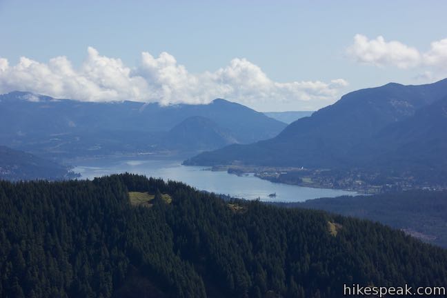
Take paths out on the point just off the trail and admire the outstanding views. Look west toward Beacon Rock and down the Columbia River Gorge where Angel’s Rest and the Vista House can be seen in the distance on the Oregon side of the river.
The Columbia River Gorge view from the perch off Hamilton Mountain Trail is broad and beautiful. If you don’t intend to hike the loop on Hamilton Mountain, you could certainly turn around here without being too shortchanged by the views at the summit. Skipping the two side trails on the hike down results in a 3.8-mile round trip hike with 1,150 feet of elevation change.
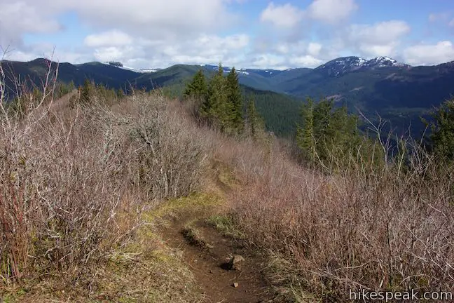
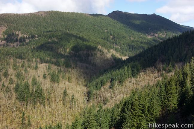
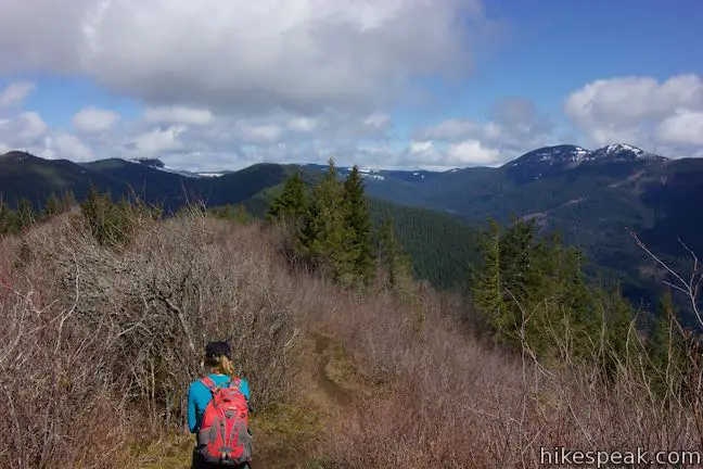
Above the overlook, Hamilton Mountain Trail heads inland (avoid the footpath going straight up the ridge). Hike along the backside of the ridge, trading in views across the gorge to gaze up the wooded valley framing Hardy Creek. You’ll be able to hear and occasionally glimpse the water below.
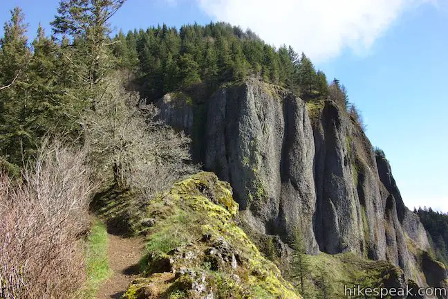
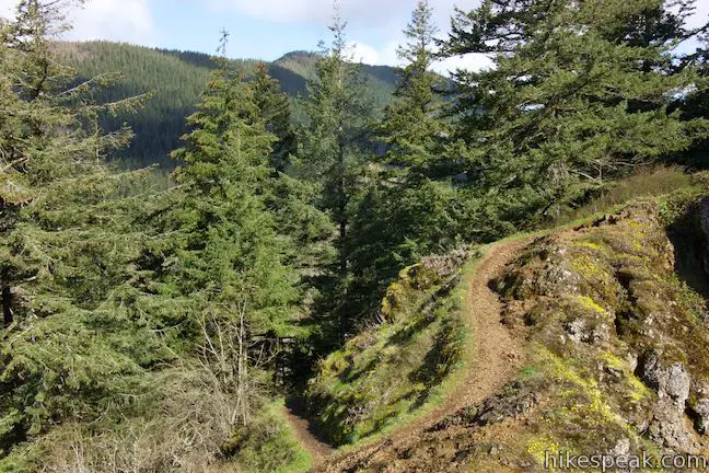
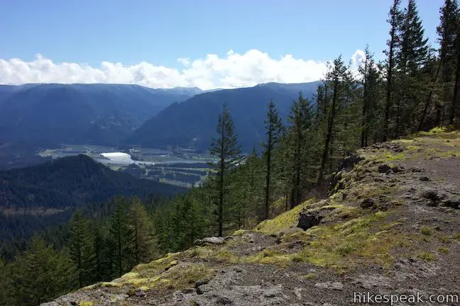
As it ascends toward the summit, Hamilton Mountain Trail returns to the ridge spine. Steep cliffs in front of the trail are decorated with yellow-green lichens. Grab a few glimpses across the gorge before the trail passes behind the cliffs and launches into a string of tight switchbacks. The short and steep twists and turns ascend exposed slopes with over-the-shoulder views down the Columbia River Gorge. As you get higher up the mountain, the switchbacks stretch out and slip into a forest above the cliffs.
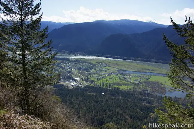
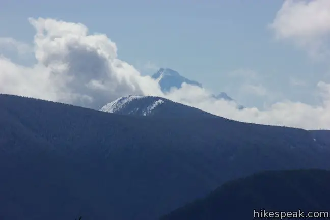
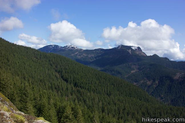
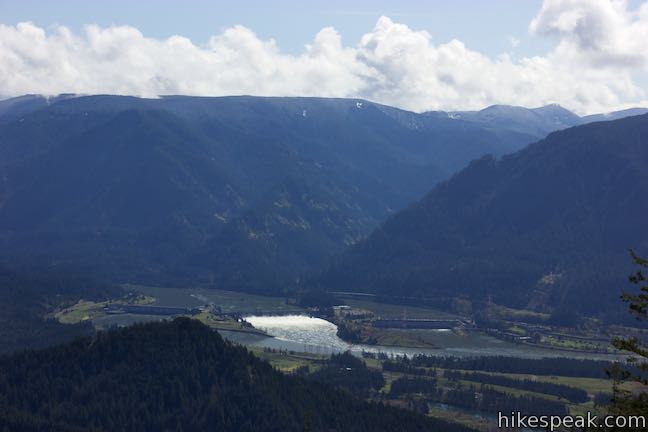
Eventually, Hamilton Mountain Trail stops climbing and comes to a T-junction. Turn right and walk 100 feet to the summit of Hamilton Mountain. Forest prevents the 2,420-foot mountaintop from having 360-degree views, but you will find a clear perspective east up the Columbia River toward Bonneville Dam. Table Mountain rises to the northeast, looking quite imposing. Ridges on Mount Hood pop up over the south side of the gorge.
Having struck the summit after around 3.1 miles of hiking, you could turn around and get back to the trailhead in just 2.9 miles. However, Hamilton Mountain Trail offers more to see. You owe it to yourself to hike farther. An exposed saddle on the north side of Hamilton Mountain has bi-directional gorge views as well as a daunting perspective of Table Mountain. Hike over to Hamilton Mountain Saddle!
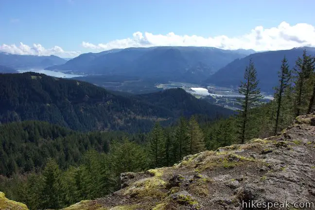
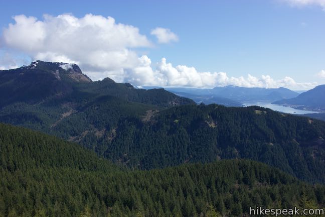
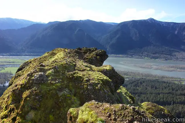
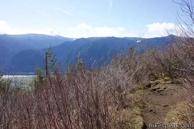
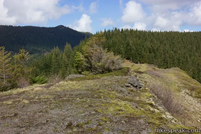
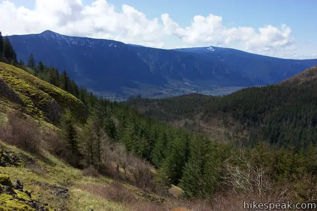
To reach “The Saddle” Viewpoint, take the only other trail leaving the summit and hike north along the ridge, which is mostly wooded with some rock outcroppings. The trail drops 375 feet in 0.8 miles to come to a treeless area atop a runway of basalt. The basalt drops off sharply on both sides of the ridge for open views to the east and west. The eastward views best those from the summit, looking up the gorge and across a pine valley toward Table Mountain, which rises like a rock throne to the northeast.
Proceed across the saddle to a multi-point trail junction, 4.05 miles from the trailhead. Follow the sign with the arrow pointing toward “Campground & Picnic Trailhead via Hardy Creek Trail” and turn left down Equestrian Trail. This road-width trail leads down to Hardy Creek Trail, which reconnects with Hamilton Mountain Trail to form the loop.
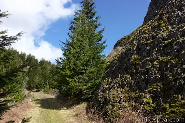
Gaze back across Hamilton Mountain Saddle before the Equestrian Trail eases into the forest. Pass Don’s Cutoff, a single-track parting to the right, as Equestrian Trail curves to the left. (For a 0.4-mile longer variation on this loop, hikers can take Don’s Cutoff over to Upper Hardy Creek Trail.) Around the curve, Equestrian Trail descends along the base of the basalt cliffs on the west side of the saddle, passing interesting cubist steps covered in lichens.
Proceed down the trail into forest along the east side of Hamilton Mountain. The views on Equestrian Trail become limited to the forest right around you. Descend south for about half a mile to a pronounced bend to the right. Continue descending toward a sharp bend to the left and a junction with Upper Hardy Creek Trail, 5 miles from the start of the hike. Bear left to hike down along Hardy Creek.
After a short distance, notice a picnic table and a bridge over Hardy Creek to the right. Leave the wide trail here and turn left onto Hardy Creek Trail, a single-track through lovely forest above the creek.
You will be on Hardy Creek Trail for 1.3 miles. Enjoy the creek views at the start. As you proceed, Hardy Creek gradually slips farther and farther down into the canyon below the trail. Cross a couple footbridges as Hardy Creek Trail wraps around creases in the mountainside. Eventually this hike through the forest leads you back to Hamilton Mountain Trail.
After 6.45 miles of hiking, return to the junction that you passed at the 1.5-mile mark. Assuming you skip the spurs to Hardy Falls View and the Pool of the Winds on the descent, you can get back to the trailhead in 1.3 miles to complete the 7.75-mile hike. Bear right down Hamilton Mountain Trail and follow it all the way back to the trailhead. The waterfalls and cascades will be a welcome déjà vu on the hike down.
The basic directions for this loop are:
- Begin up Hamilton Mountain Trail (0 miles)
- Stay to the right past Hardley Trail (0.45 miles)
- Reach a spur to Hardy Falls Viewpoint and turn right (0.95 miles)
- Admire waterfalls and cascades from a viewing platform below the trail (1 mile)
- Return to Hamilton Mountain Trail and turn right to proceed across a footbridge (1.05 miles)
- Turn left up a spur to the Pool of the Winds on Rodney Falls (1.1 miles)
- Stand in front of the Pool of the Winds (1.15 miles)
- Return to Hamilton Mountain Trail and proceed down toward a bridge over Hardy Creek (1.2 miles)
- Stay to the right through a junction with Hardy Creek Trail where the loop begins (1.5 miles)
- Pass a cliff-top perch with dramatic views of Columbia River Gorge (2 miles)
- Come to a T-junction on the top of Hamilton Mountain and stroll to the right on a short spur with views up Columbia River Gorge before proceeding on the trail to the left to Hamilton Mountain Saddle (3.1 miles)
- Cross an exposed basalt saddle with views dominated by Table Mountain (3.9 miles)
- Reach the end of Hamilton Mountain Trail and turn left down Equestrian Trail (4.05 miles)
- Stay to the left past Don’s Cutoff(4.1 miles)
- Make a sharp left to descend past Upper Hardy Creek Trail (5 miles)
- Turn left onto Hardy Creek Trail (5.15 miles)
- Come back to Hamilton Mountain Trail, closing the loop, and turn right (6.45 miles)
- Return to the trailhead, bypassing the two spurs on the descent (7.75 miles)
Major junctions are marked with signs and trail maps. Dogs are welcome on leashes for this hike, but bikes are not allowed. A Washington State Parks Discover Pass should be displayed in any vehicle parking at the trailhead. The cost for the pass is $10 per day or $30 per year (unless you visit on one of the park’s free days). No other permit is needed to hike to Rodney Falls and Hamilton Mountain, so get out and enjoy!
Directions to the Trailhead
- From Portland, follow Interstate 205 north into the state of Washington.
- Take exit 27 toward Camas, merge onto Route 14, and travel east for 28 miles (34.5 miles up Route 14 from Interstate 5 in Vancouver).
- After Beacon Rock comes into view, drive up a hill past the park headquarters for Beacon Rock State Park on the left.
- Roadside parking for Beacon Rock Trail begins on the right.
- Make the next left up a road toward Hamilton Mountain Trailhead and the state park's Main Campground.
- Drive 0.3 miles up this road and bear right into the trailhead parking area (a gate at the bottom of this road is closed in the winter).
- A bathroom is located at the far end of the parking area near the start of Hamilton Trail.
- A picnic area is set just within the forest.
Trailhead Location
Trailhead address: Washington 14, Stevenson, WA 98648
Trailhead coordinates: 45.6326, -122.0198 (45° 37′ 57.4″N 122° 01′ 11.3″W)
View Beacon Rock State Park in a larger map
Or view a regional map of surrounding Washington trails and campgrounds.


Wildflowers along Hamilton Mountain Trail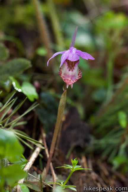


 | Coyote Wall This partial loop covers 5.8 miles as it ascends Coyote Wall to great views of its basalt cliffs and across Columbia River Gorge. |
 | Beacon Rock Trail This 1.6-mile hike follows an impressively engineered trail packed with switchbacks that scale a monolith along the Columbia River. |
 | Wahclella Falls This 2-mile hike visits a sublime waterfall in Oregon's Columbia River Gorge. |
 | Eagle Creek Trail This 4.55-mile hike ventures up a beautiful and dramatic canyon to impressive waterfalls like Metlako Falls, Lower Punchbowl Falls, and Punchbowl Falls. |
 | Horsetail Falls Trail - Oneonta Trail Loop This 2.85-mile loop starts at Horsetail Falls, passes beneath an overhang behind Ponytail Falls, and crosses a bridge by Middle Oneonta Falls to hit three waterfalls and viewpoints looking out over the Columbia River Gorge. |
 | Lower Oneonta Falls in Oneonta Gorge This 0.8-mile trek follows Oneonta Creek between the tall, mossy cliffs of a wild and beautiful gorge to the base of an enchanting 100-foot waterfall. |
 | Multnomah Falls This 0.4 to 2.6-mile hike in Columbia River Gorge visits Oregon's tallest (and probably most visited) waterfall, offering something to hikers of all abilities. |
 | Multnomah-Wahkeena Loop This 6.05-mile loop uses Wahkeena Trail and Larch Mountain Trail to visit six glorious waterfalls (Wahkeena Falls, Fairy Falls, Ecola Falls, Weisendanger Falls, Dutchman Falls, and Multnomah Falls) as well as many fine cascades along Wahkeena Creek and Multnomah Creek in two beautiful canyons off Columbia River Gorge. |
 | Guler Ice Cave in Gifford Pinchot National Forest This short hike goes underground to explore an old lava tube with frozen stalactites and stalagmites, plus other interesting cave features. |
 | June Lake This 2.6-mile hike visits a small lake and a waterfall on the southern slopes of Mount Saint Helens. |
 | Lava Canyon Trail This 1.25-mile loop explores a colorful canyon re-carved by the 1980 eruption of Mount Saint Helens. |
 | Ape Cave This adventurous underground hike in Mount Saint Helens National Volcanic Monument travels through one of the longest lava tubes in the world. |
 | Trail of Two Forests This short nature trail in Mount Saint Helens National Volcanic Monument tours a landscaped that was transformed by a molten lava flow. For extra fun, crawl through a 50-foot long lava tube beneath the trail. |
 | More trails in Washington Explore other hikes in the Evergreen State, including Mount Rainier National Park and Mount Saint Helens National Volcanic Monument. |
 | Camping in Beacon Rock State Park The main campground in Beacon Rock State Park has 26 first-come first-serve campsites in a forest setting. |
- Hamilton Mountain on oregonhikers.org (opens in a new tab)
- Hamilton Mountain on wta.org (opens in a new tab)
- Hamilton Mountain on summitpost.org (opens in a new tab)
- Hamilton Mountain on outdoorproject.com (opens in a new tab)
- Hamilton Mountain on hikingproject.com (opens in a new tab)
- Hamilton Mountain on gorgefriends.org (opens in a new tab)
- Hamilton Mountain on nwhiker.com (opens in a new tab)
- Hamilton Mountain Loop on traildaddy.guide (opens in a new tab)
- Beacon Rock State Park on wikipedia.org (opens in a new tab)
- The official trail map for Beacon Rock State Park (opens in a new tab)
- The official brochure for Hamilton Mountain Trailhead (opens in a new tab)
- The official webpage for Beacon Rock State Park (opens in a new tab)
Common Questions about Hamilton Mountain Loop in Beacon Rock State Park
- Is the trail open?
- Yes. You should expect to find that Hamilton Mountain Loop is open. There are no recent reports of trail closures. If you discover that the trail is closed, please help your fellow hikers by reporting a closure.
- Do I need a permit for this hike?
- Yes. Washington State Parks Discover Pass.
- How much time does this hike take?
- It takes approximately 4 hours 30 minutes to hike Hamilton Mountain Loop. Individual hiking times vary. Add extra time for breaks and taking in the views.
- How long is this hike?
- The hike to Hamilton Mountain Loop is a 7.75 mile lollipop loop with 2025 feet of elevation change.
- Are dogs allowed on this trail?
- Yes, dogs are allowed on Hamilton Mountain Loop. The trail is open to hikers, dogs.
- Is Hamilton Mountain Loop a difficult hike?
- This hike should be considered strenuous. Hikers should be prepared for a workout covering 7.75 miles and 2025 feet of climbing.
- Will I see a waterfall on this hike?
- Yes, Hamilton Mountain Loop features a waterfall.
- Does this trail go to a summit?
- Yes, Hamilton Mountain Loop reaches a summit with panoramic views.
- What mountain range is this trail in?
- Hamilton Mountain Loop is located in the Cascade Range.
- Where is the trailhead located?
- The trailhead for Hamilton Mountain Loop is located in Stevenson, Washington.
Trailhead Address:
Washington 14
Stevenson, Washington 98648
Trailhead Coordinates:
45.6326, -122.0198 - What are the driving directions to the start of the hike?
To get to the trailhead: From Portland, follow Interstate 205 north into the state of Washington. Take exit 27 toward Camas, merge onto Route 14, and travel east for 28 miles (34.5 miles up Route 14 from Interstate 5 in Vancouver). After Beacon Rock comes into view, drive up a hill past the park headquarters for Beacon Rock State Park on the left. Roadside parking for Beacon Rock Trail begins on the right. Make the next left up a road toward Hamilton Mountain Trailhead and the state park's Main Campground. Drive 0.3 miles up this road and bear right into the trailhead parking area (a gate at the bottom of this road is closed in the winter). A bathroom is located at the far end of the parking area near the start of Hamilton Trail. A picnic area is set just within the forest.
View custom Google Maps directions from your current location.
- Are there other trails near Hamilton Mountain Loop?
- Yes, you can find other nearby hikes using the Hikespeak Hike Finder Map.

Go the extra miles...
Submit a rating of this hike to go with your comment. Contribute to the average trail rating.