Griffith Observatory West Observatory Trail Griffith Park Western Canyon hike to Griffith Observatory Los Angeles California
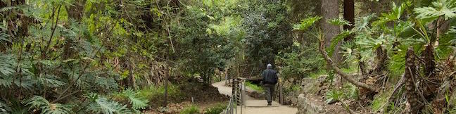
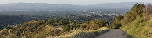
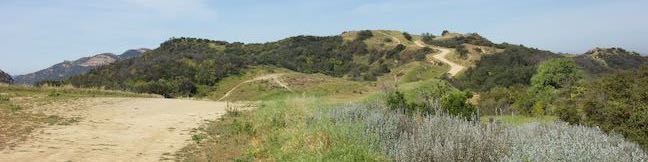
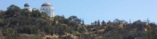
Perched on the slopes of Mount Hollywood in Griffith Park, Griffith Observatory is a true Los Angeles landmark. Roads lead up to the impressive structure and so do trails. East Observatory Trail offers an approach from the Vermont Canyon side. For a 2.1-mile round trip hike to Griffith Observatory from Western Canyon, venture up West Observatory Trail from Fern Dell Drive. West Observatory... Read more.
By: Published: Last updated: May 13, 2025
Ferndell Trail Griffith Park hike Ferndell Nature Museum Western Canyon Los Angeles California
The short trail through Ferndell in Griffith Park is an out-of-the-ordinary walking path for Los Angeles, bordering a stream that nourishes tropical plants under the shade of sycamores. Even when other parts of Griffith Park dry out and turn brown, Ferndell stays lush and green, thanks to the recycled water it receives from Griffith Observatory. The relaxing quarter-mile long trail glides... Read more.
By: Published: Last updated: December 7, 2018
High Line Trail in New York City Manhattan Aerial Greenway The High Line Walk
On the lower west side of Manhattan, an old raised rail line that was headed for demolition has been transformed into an attractive asset, a surprising park that hovers above city streets. The High Line has become a New York City landmark, offering a one-of-a-kind walk with a refreshing perspective of NYC. Like the rest of New York City, the High Line Trail has something for everyone,... Read more.
By: Published: Last updated: May 13, 2025
Blue Lake Track Lake Tikitapu Circuit Rotorua Bay of Plenty New Zealand Blue Lake Circuit Blue Lake Walk
Blue Lake, also know as Lake Tikitapu, is a lovely mountain lake just southeast of Rotorua in the Bay of Plenty region of New Zealand. Blue Lake Track offers a circuit around the lake, passing through native bush to pleasant beaches and scenic viewpoints. The loop is 5.9 kilometers long and extends nicely to 6.15 kilometer (3.8 miles) round trip by grabbing a couple extra views. There is... Read more.
By: Published: Last updated: May 6, 2017
Okere Falls Track Walk Okere Falls Scenic Reserve Hiking Trail Rotorua Kaituna River Okere River Tutea Falls Tutea's Cave New Zealand
Okere Falls Track presents a 3-kilometer round trip walk (1.9-mile hike) in Okere Falls Scenic Reserve near Rotorua, New Zealand loaded with views of waterfalls, cascades, and emerald-colored pools on the Okere River, all encircled by dense native brush. The river can be explored on an exciting whitewater rafting trip, but you'll get a great overview of its finer features and stay dry on... Read more.
By: Published: Last updated: January 24, 2018
M Trail Cerro San Luis Madonna Mountain Hike to the M Cerro San Luis Obispo California
From downtown San Luis Obispo, it's easy to spot the large white “M” on the side of nearest mountain, Cerro San Luis. If you've looked up at the “M,” you may have wondered what it's like to look down from that big white letter, find out! The “M” is interesting to see up close and its perch provides a panoramic view over San Luis Obispo. Hikers have a... Read more.
By: Published: Last updated: May 13, 2025
Hi Mountain Trail Hike San Luis Obispo County Hi Mountain Road Arroyo Grande
Hi Mountain Trail is located in the Santa Lucia Mountains east of Lopez Lake. The San Luis Obispo County-run trail is quite different from the area's coastal hikes and covers a variety of environments in a short distance. Start with a nice-and-easy stream-side trail through a dense woodland. Bust up a ridge and suddenly you're in a grassy landscape with panoramic views. Then drop to... Read more.
By: Published: Last updated: April 25, 2017
Fiscalini Ranch Preserve Bluff Trail Cambria Marine Terrace Trail East West Ranch San Luis Obispo County California central coast hike
Fiscalini Ranch Preserve (previously called East West Ranch) is a 434-acre park right in the middle of Cambria, a coastal town at the north end of San Luis Obispo County. Bordered by neighborhoods to the north and south, the preserve provides public access to a mile of beautiful coastline spared from development except for trails with boardwalks, bridges, and whimsical benches made out of... Read more.
By: Published: Last updated: April 7, 2017
Temescal Ridge Trail Hub Junction Temescal Peak Reseda Boulevard Hike Santa Monica Mountains Topanga State Park Dirt Mulholland Marvin Braude Mulholland Gateway Park
Reseda Boulevard gives hikers in the San Fernando Valley easy access to Topanga State Park and other areas of the Santa Monica Mountains. From the top of Reseda Boulevard, it is just 0.2 miles up to an unpaved stretch of Mulholland Drive (called Dirt Mulholland) that runs east and west across the range, connecting to lots of other trails, including nearby Temescal Ridge Trail. Enjoy nice... Read more.
By: Published: Last updated: May 13, 2025
Summit to Summit Motorway Trail Topanga Canyon California Santa Monica Mountains
Summit to Summit Motorway is a 3.2-mile road along a ridgeline between the high points of Old Topanga Canyon Road and Topanga Canyon Boulevard (hence the name Summit to Summit). Less than half a mile of the road is paved and the rest is packed dirt perfect for hiking, biking, or jogging. At the northeast end, Summit to Summit Motorway finishes across from Top of Topanga Overlook, a park with... Read more.
By: Published: Last updated: December 7, 2018